My most current blog entry:
Entries in Forest (19)
Road Trip USA: Lake Tahoe, California: Hiking the Rubicon Trail
Two days of hiking the Rubicon Trail along the mountains of Lake Tahoe, California, USA.
Day One: Around the Lighthouse Trail, along Emerald Point, to Calawee Cove Beach . . . . and back on the ridge trail.
 Day one began at my friend's house . . . with this beautiful view out over a wetlands reserve.
 The wetlands and the hills nearby . . . amazing colors . . . first day of Autumn.
 Our hike would begin along Emerald Bay.
 Rocky forested mountains and clear blue sky and emerald waters . . . what more could a hiker ask for?
 Stunning trees in clear, bright light. Our trail was easy to follow, and indeed, we saw many other hikers.
 Views I will remember forever.
 This is my favorite topography: large pines, preferably Ponderosa pine, large boulders, dry forest floor, grand views.
 Such a lovely trail.
 As always, I find beauty in old weathered tree stumps and snags.
 It seemed like around every bend n the trail we would turn back to Lake Tahoe and another panoramic view.
 There was a stretch of trail that ran along a narrow ledge high above the lake.
 But mostly the trail was wide and not too steep.
 Nature's own arrangement.
 Our hike only lasted a couple of hours . . . I cold have stayed all day . . . and decided to come back the next day to 'finish the trail.'
 Evidence of a recent burn, perhaps two or more years ago.
 Remarkable light, pattern, and texture . . .
 The forest floor was strewn with debris in many places . . . no burn passed this way.
 We reached our destination at Calawee Cove, where we saw a casino cabin cruiser servicing the 'high rollers.'
 Calawee Cove Beach is a public park (see map at end of this entry). We turned around and took a different, steeper trail back to our car.
 Wonderful boulders.
 My favorite view of the day.
 Our trail.
 Our trail back to the parking lot. A great day with many great views.
 A fine 'hoodoo' rock formation framed by Lake Tahoe.
 Our trail map.
-----------------------
Day Two: Walking the South portion of the Rubicon Trail past the Vikingsholm and along the shore of Lake Tahoe.
 The Rubicon Trail follows the ridges and contours of beautiful Emerald Bay of Lake Tahoe.
 The towering rocky cliffs of the Sierra Nevada mountains tower over the bay.
 A dry, rock strewn, late summer forest floor lined the trail throughout. Over two days I walked the length of the Rubicon trail.
 The popular Rubicon Trail is not a difficult trail to follow.
 Access to parts of the Rubicon Trail are on old service roads. The south part of the trail starts at the parking lot.
 The service road leads you to the lake shore where there is a dock (swimming not recommended because of the extremely cold water).
 There are also kayaks for rent.
 I had been told that there was an old Scandinavian homestead at the end of Emerald Bay, but I did not expect something so charming as the Vikingsholm!
 Is this 19th century Norway? No . . . . it's Lake Tahoe, California, USA in 2018!
 A fascinating sight: a sod-roofed shed.
 The Vikingsholm was laid out in typical Scandinavian farmhouse style with a central courtyard.
 A magnificent structure . . . from any period.
 Excellent folkcraft details.
 I marvelled at this old pump . . . gasoline?
 Vikingsholm was surrounded by beautiful natural grounds and small ponds.
 The Rubicon Trail ranger cabin (and gift shop . . . I bought the t-shirt!).
 The trail to the Lower Eagle Falls began behind the Ranger cabin.
 It has been a long, mostly dry summer, with a less-than-average snow pack in the Sierras, so the Lower Eagle Falls were not so spectacular . . . although the geology was interesting.
 The Lower Eagle Falls trail had some beautiful giant old cedars.
 The Rubicon Trail to the south shore of Emerald Bay began across this Eagle Creek bridge. I had a long conversation here with an Indian Motorcycle dealer from Phoenix, Arizona about the future of motorcycles. He agreed with me that there needs to be hybrid motorcycles that can be run on batteries for in-town commuting . . . and have a 'scrambler' frame and 650 gas engine for long out-of-town road trips with tent and gear.
 So many beautiful and dramatic geological features to see along the trail.
 Many natural wonders to look at.
 Lovely dry forest.
 A weathered old trunk.
 Quiet hiking . . . .
 I saw only four other hikers in three hours.
 There were a wide variety of trees.
 The trail came close to the bay at several points.
 I can understand why this place is called Emerald Bay!!!
With a tourist boat in the background, some friendly ducks came to sit on a rock.
 I sat here to take a rest.
 Near the point I headed back on the same trail.
 Back along the lake shore . . . .
 . . . and back along the Vikingsholm . . . .
 . . . and back along the beach . . .
 . . . and back along the crystal clear water of Emerald Bay . . .
 . . . and up the steep trail to the car park . . . overlooking the beautiful Fannette Island . . .
 . . . and the view from my camper in the parking lot. A perfect day.
 Two days of hiking the most beautiful mountain trails with a constant view of incredible Lake Tahoe. My map.
Update on Thursday, September 27, 2018 at 7:07AM by
 Dr. Jeff Harper
Dr. Jeff Harper
Yes, we saw wildlife in Lake Tahoe . . . but it was all around the house!
 The hummingbirds enjoyed the feeder. They will leave soon on a migration ahead of the coming snows.
 A busy little fellow.
 A challenge to the feeder perch.
 A visiting white egret.
 This one was hunting fish . . . and eventually caught one that was too big to swallow whole!
 My host told me there were black bears living in the neighborhood, but this did not prepare me for the excitement of actually seeing one standing in the front yard! This is a real 450-500 pound bear! I had the wrong lend for the low light situation, and was so excited that I didn't check my settings! Oh no! I choked!
Road Trip USA: Billy Frank Jr. Nisqually National Wildlife Refuge
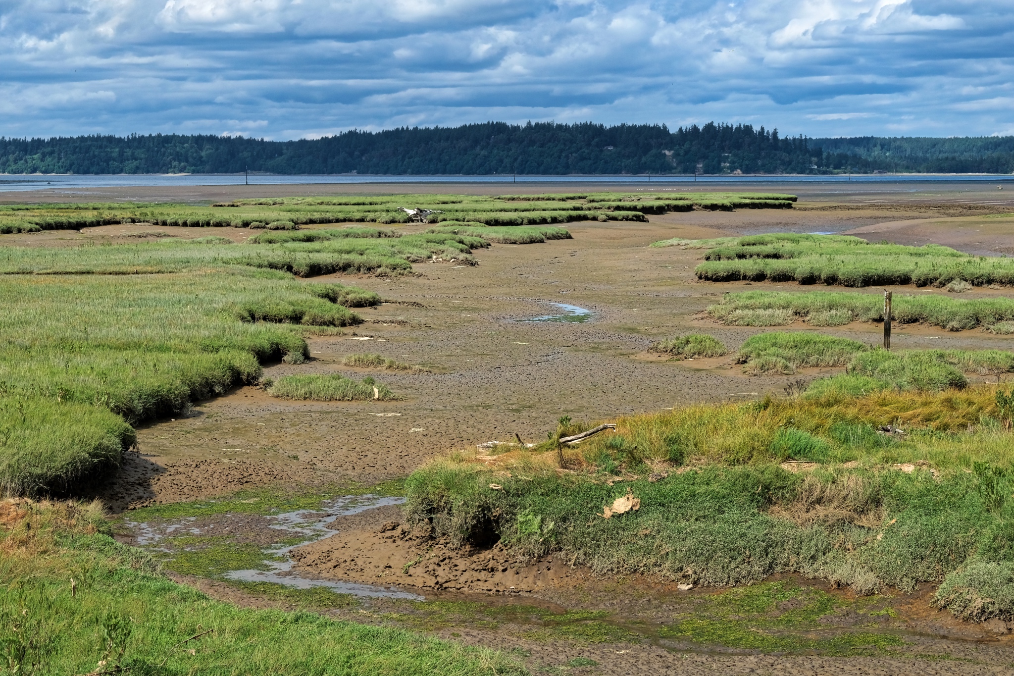
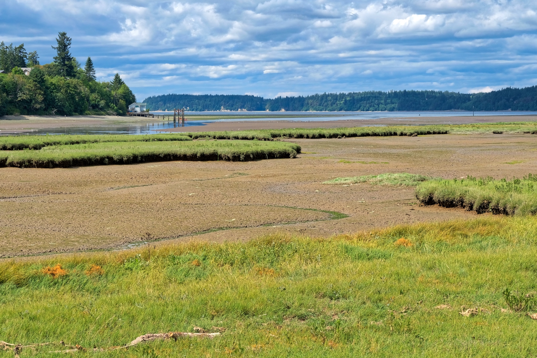 I spent a fine afternoon in the forest, fields, mud flats, and estuary of the Billy Frank Jr. Nisqually National Wildlife Reserve, near Olympia, Washington.
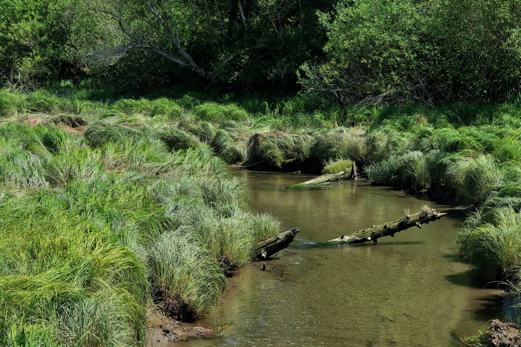 I have wanted to go to the Nisqually Wildlife Reserve since I arrived in Washington a few months ago . . . and today was my chance: perfect weather. I passed Woodland Creek, an estuarial creek, several times before and stopped this time . . . it was on the way.
 The wetlands grasses were in full mid-summer lushness.
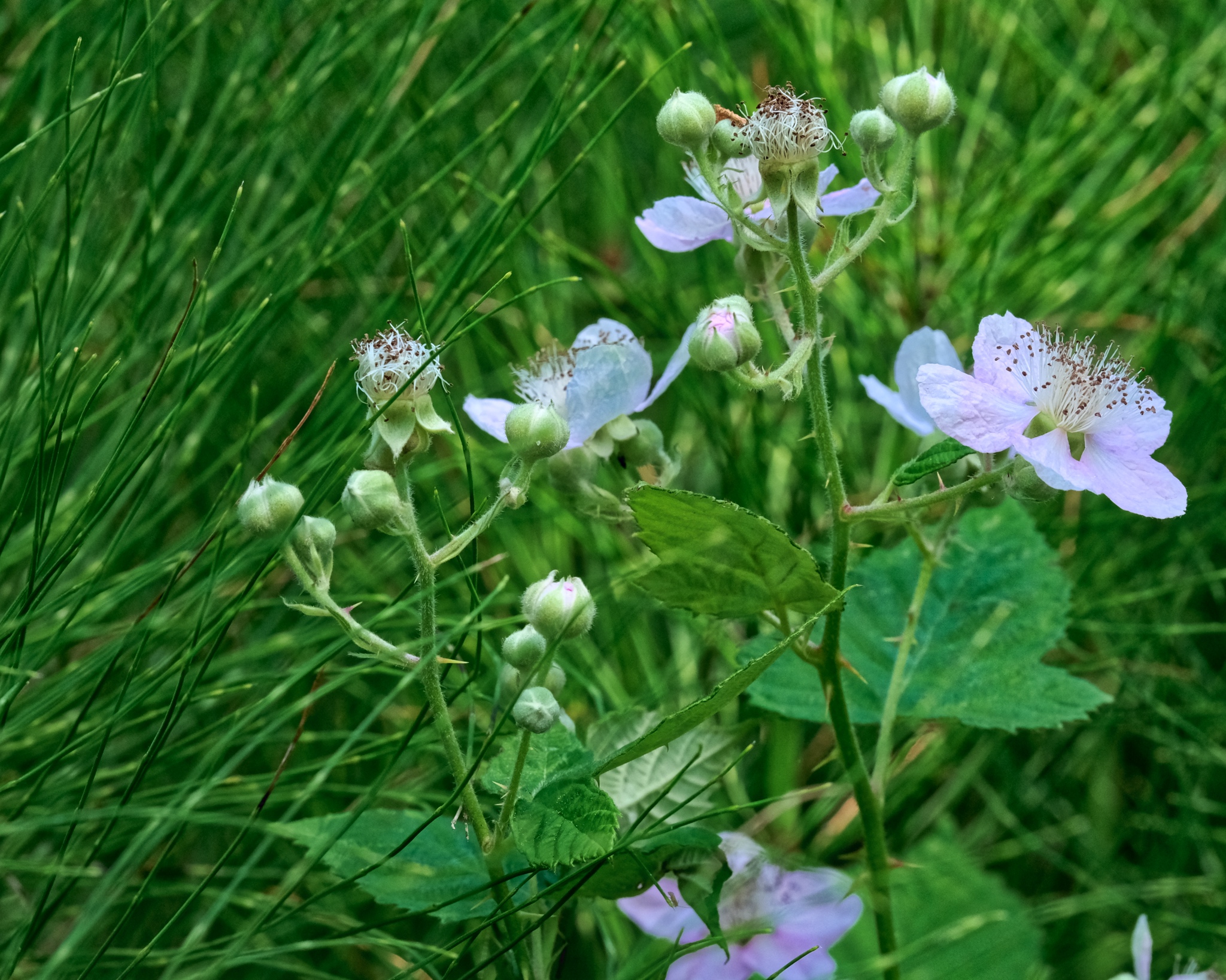 The blackberry vines grew among the horsetail ferns everywhere.
 Someone hung a large birdhouse along the path.
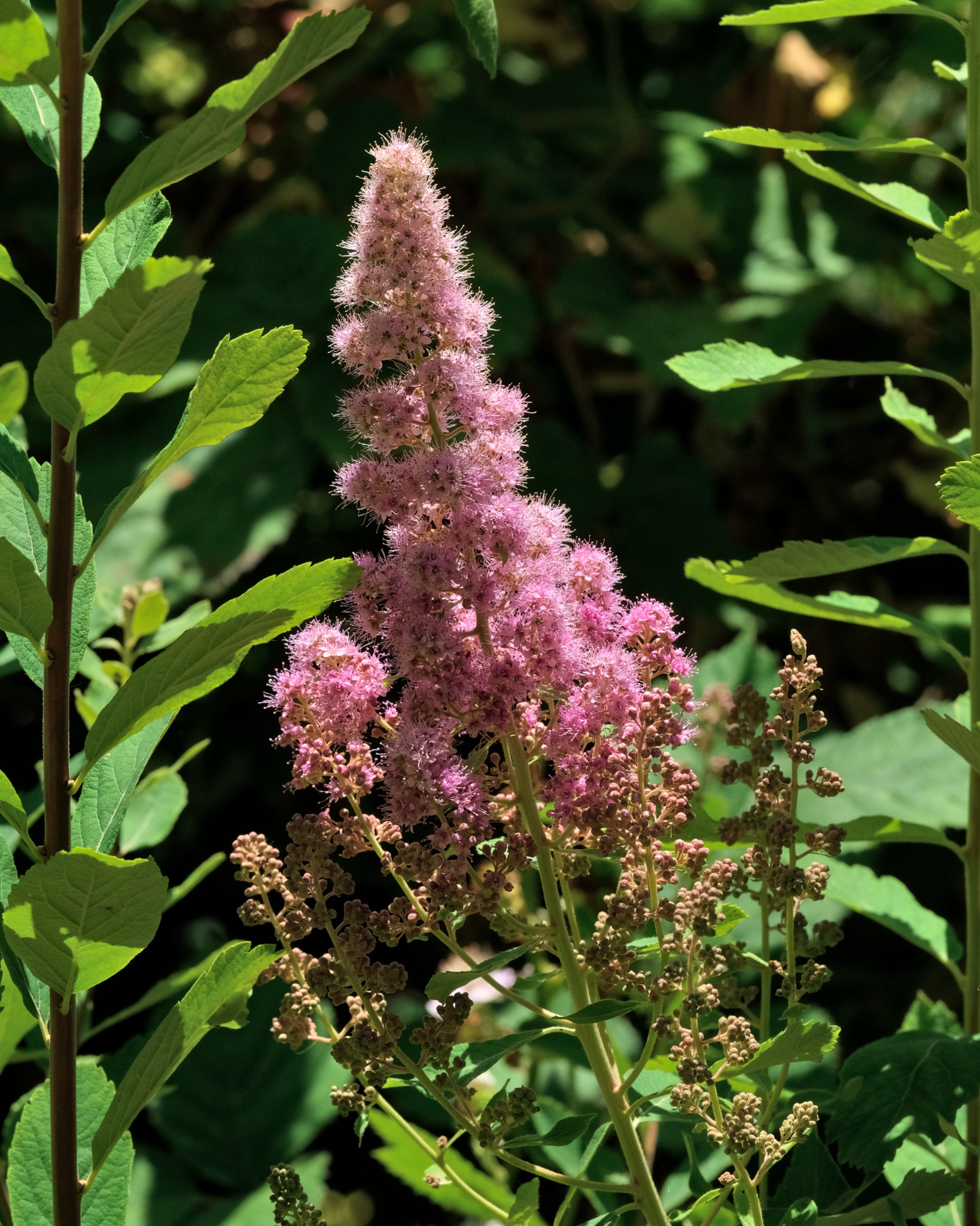 Beautiful summer wildflowers . . . and then a moving distraction along the creek . . .
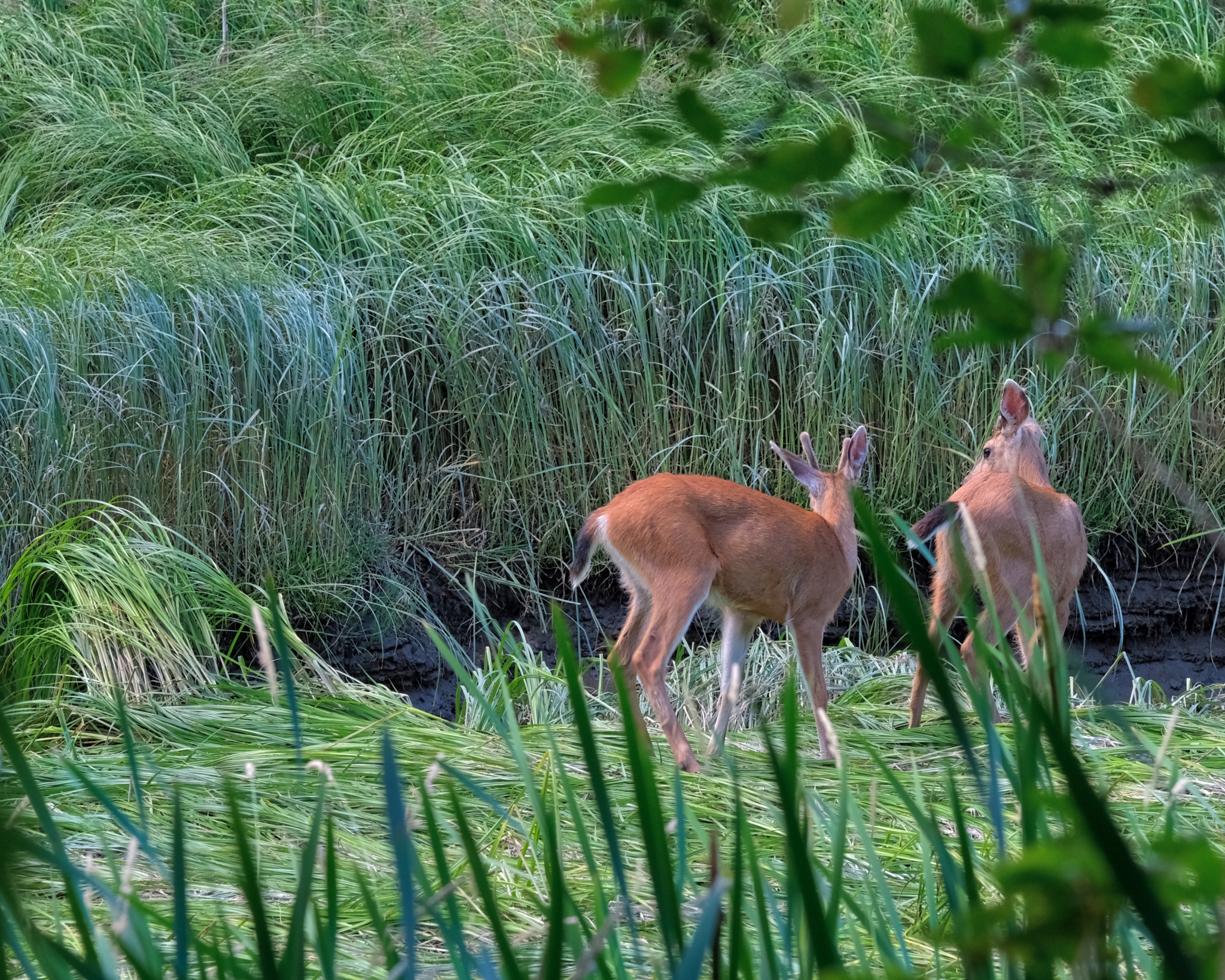 A wonderful surprise . . . . I sat very quietly, not 20 yards away.
 I watched, and photographed, for over a half hour . . .
 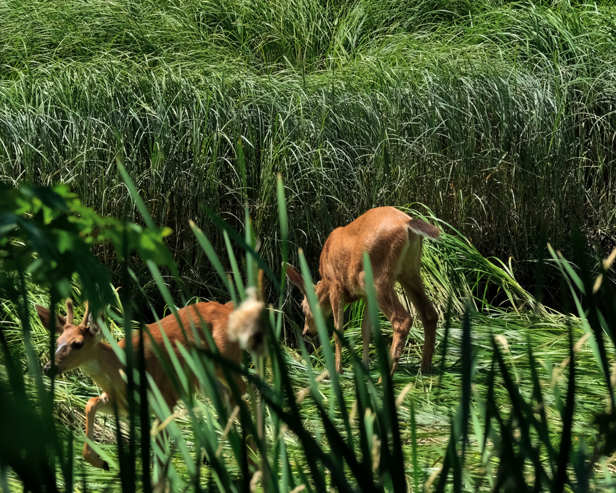 They finally moved on along, walking in the Woodland Creek streambed. I followed, but lost sight of them in the dense forest.
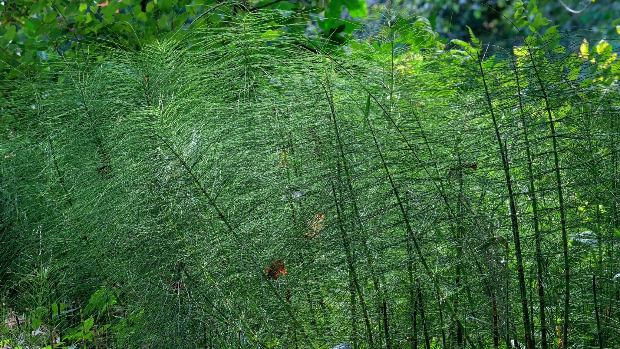 I wandered back to my camper along a horsetail fern-lined trail, and drove out to the Nisqually estuary.
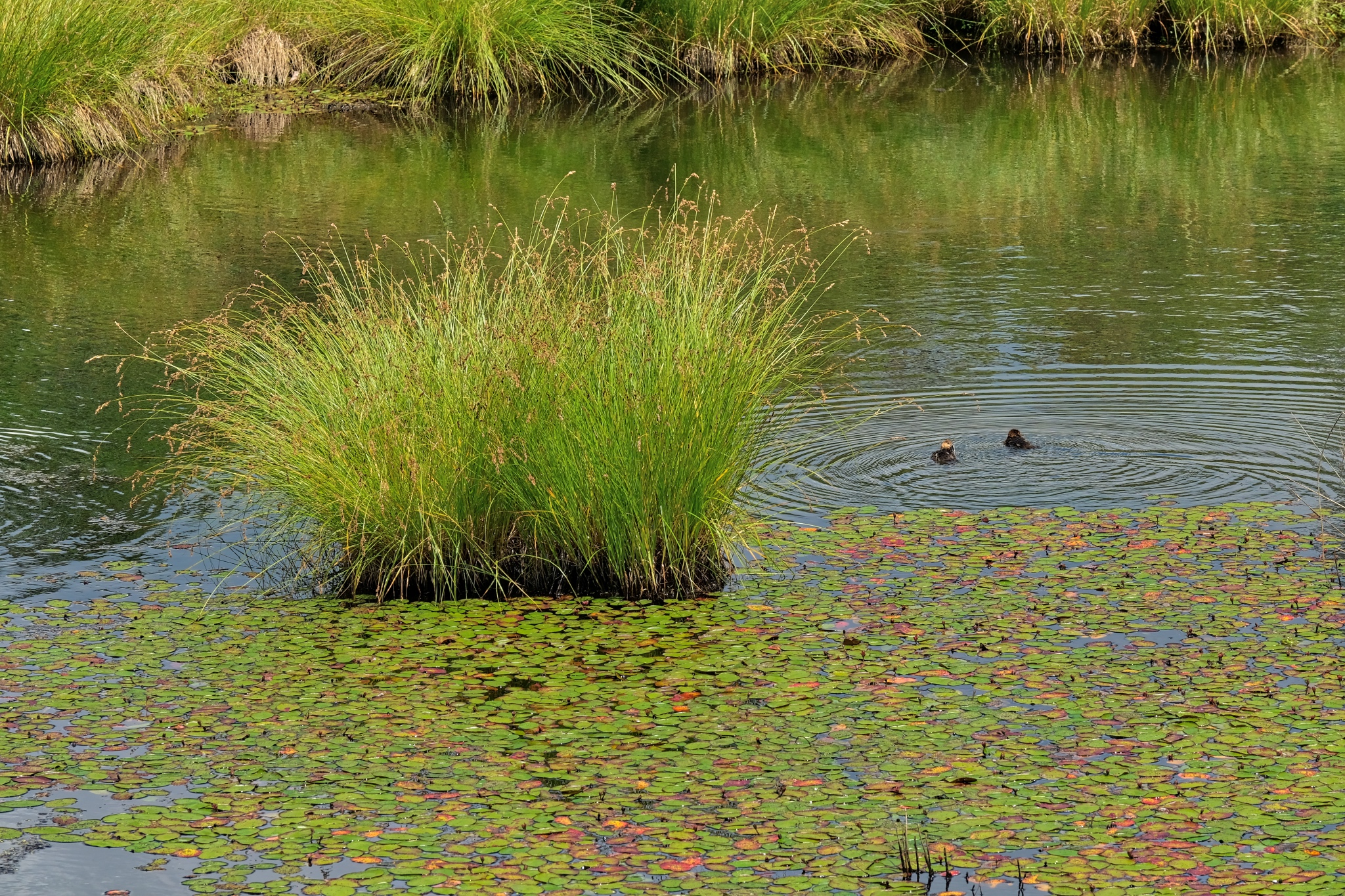 The Nisqually National Wildlife Reserve is comprised of four distinct natural ecological settings: freshwater ponds, wet forests, former farm fields, and estuarial mud flats (I visited during extreme low tide). All areas were fantastic! Here, diving ducks in a freshwater pond.
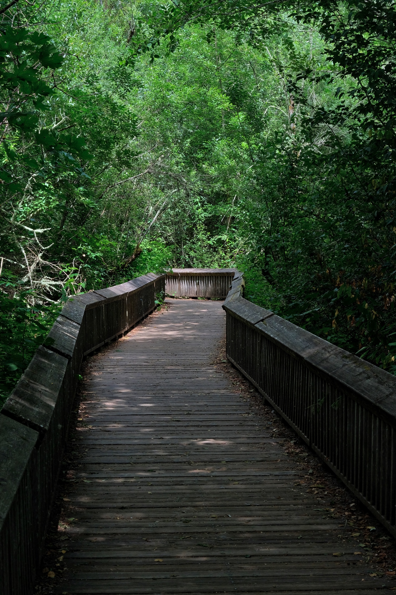 Elevated wooden walkways took visitors out into, and above the delicate ecology of the wet forest.
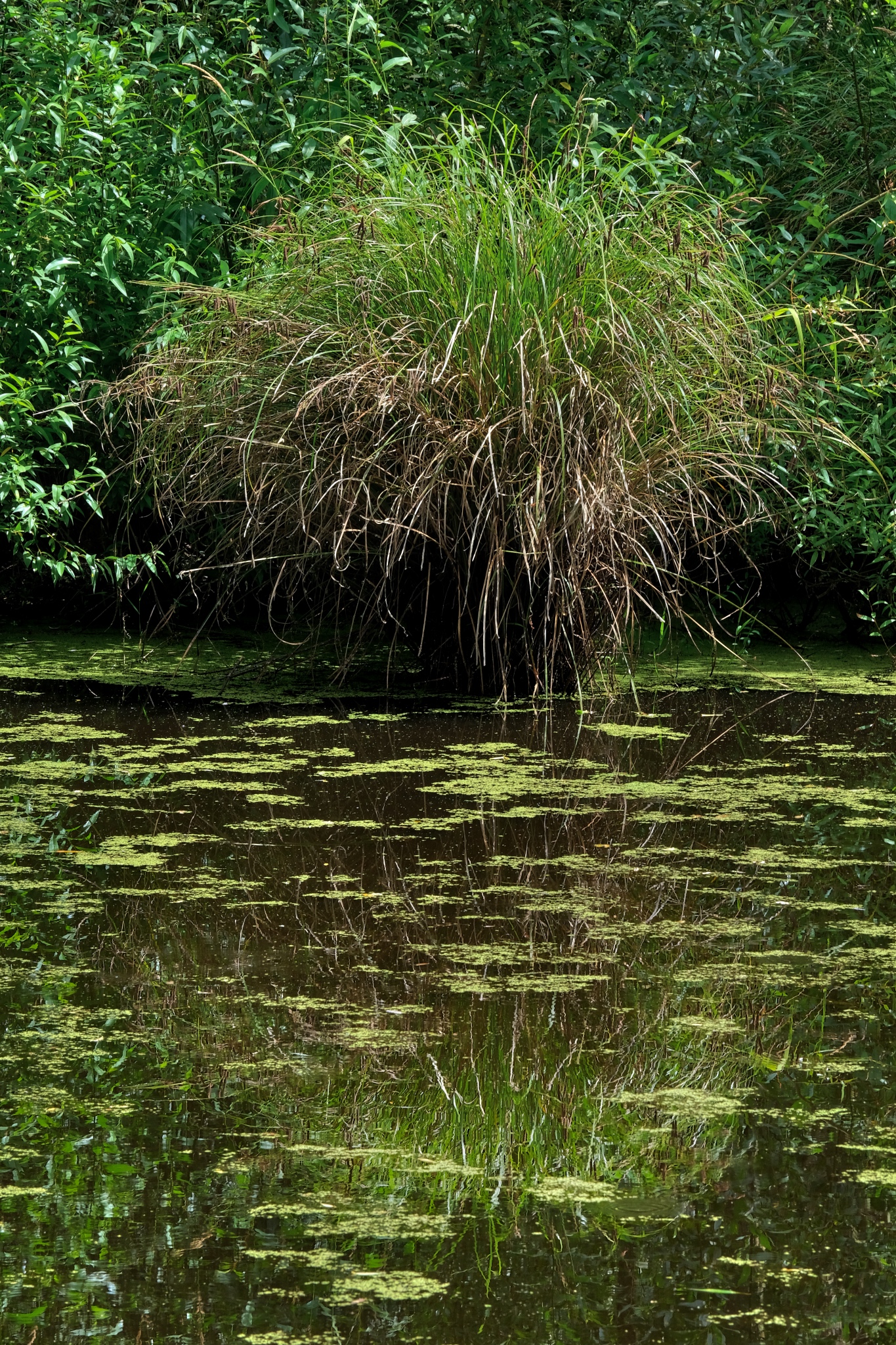 The elevated walkways afforded wonderful views of the freshwater wetlands.
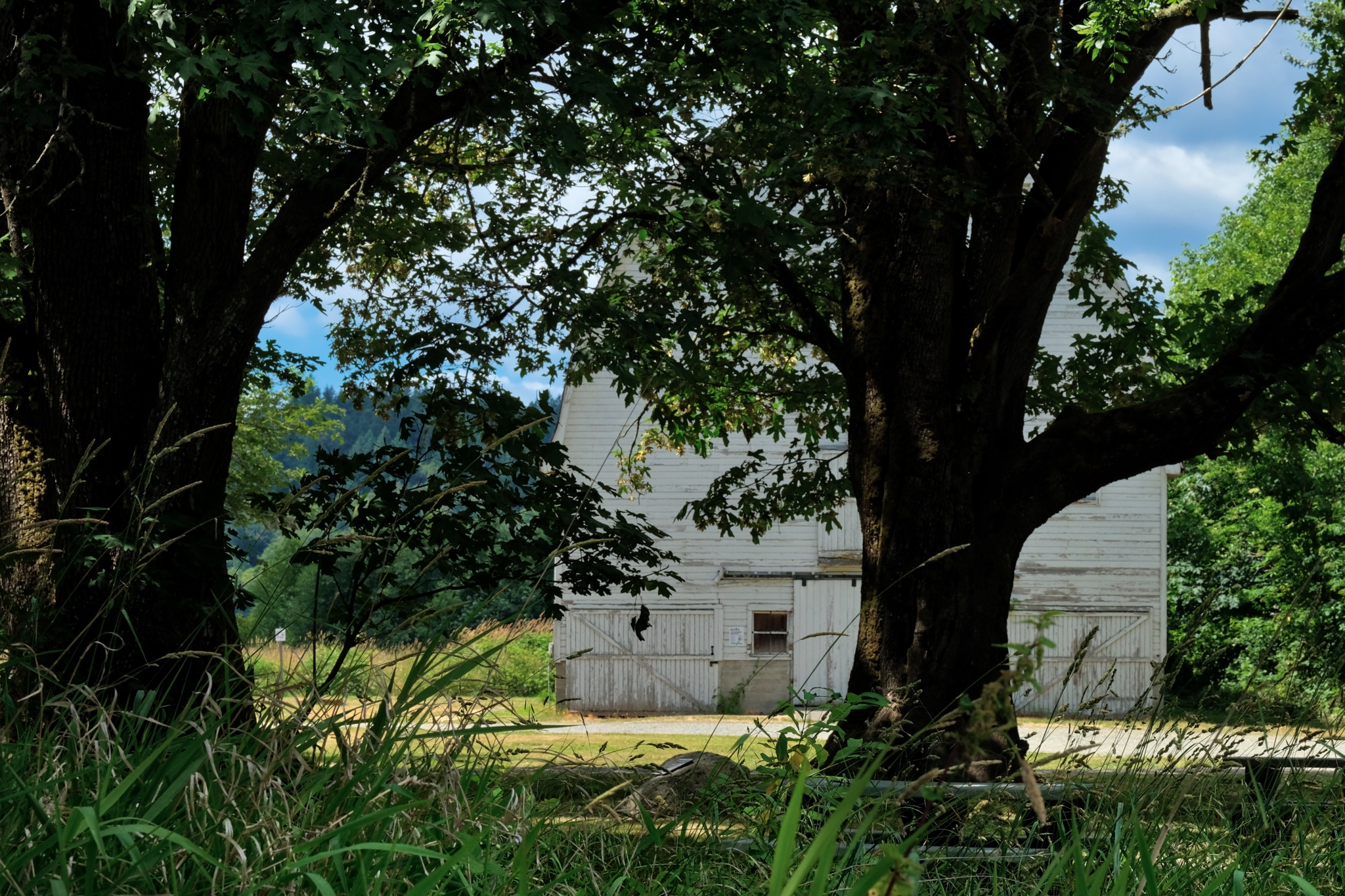 At the edge of the forest were the barns of an old settlement farm.
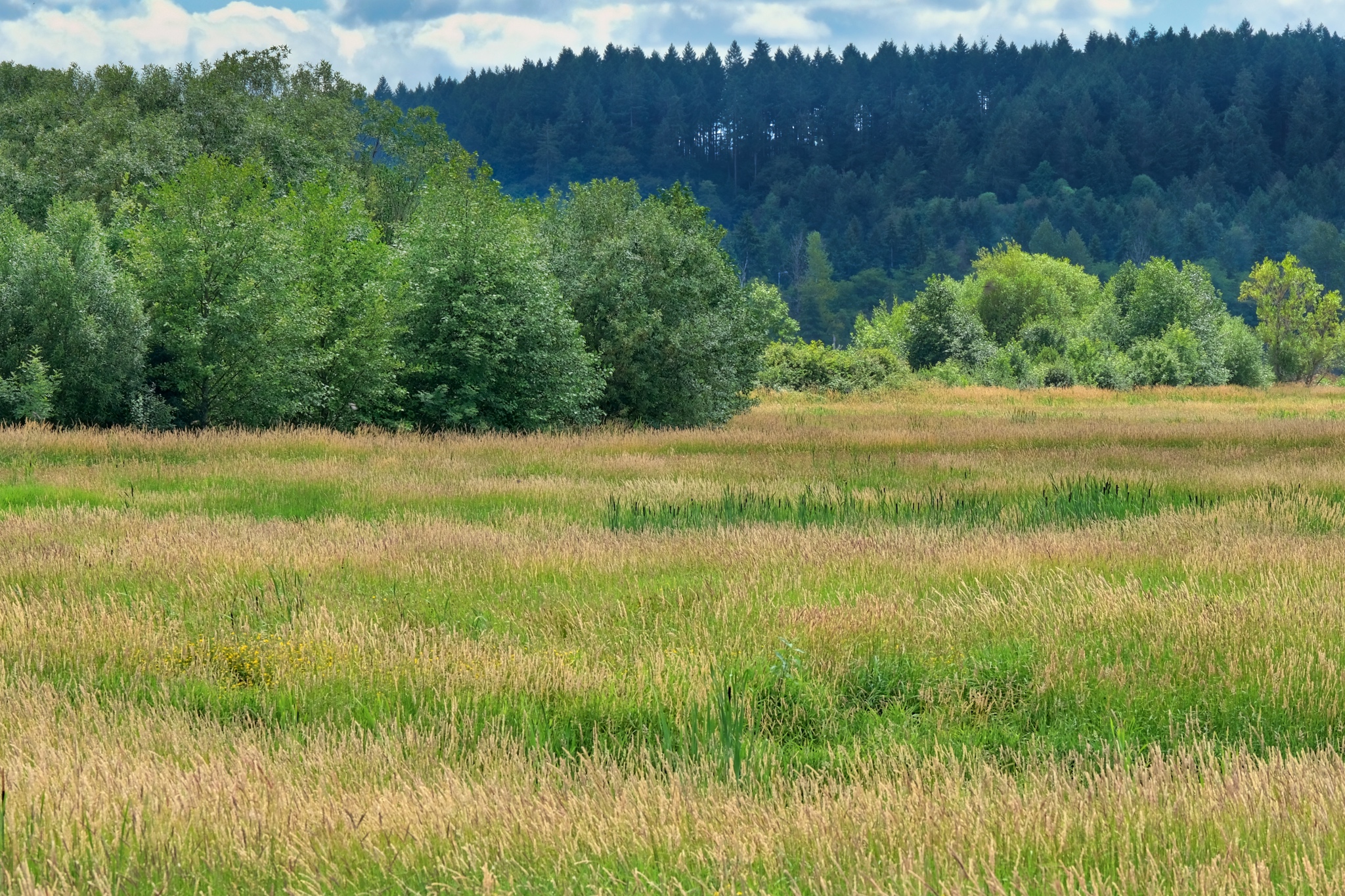 Early settlers expended a huge amount of labor and resources building a system of dykes to drain some of the Nisqually Estuary for farmland. The land now stands uncultivated . . . for the benefit of wildlife habitat.
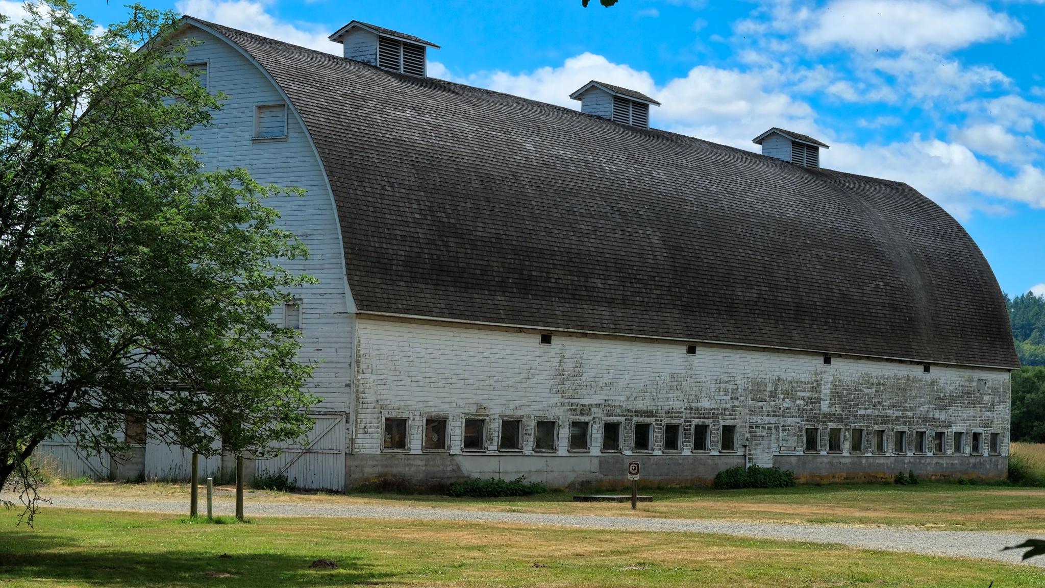 The huge barn, now a part of the National Wildlife Reserve.
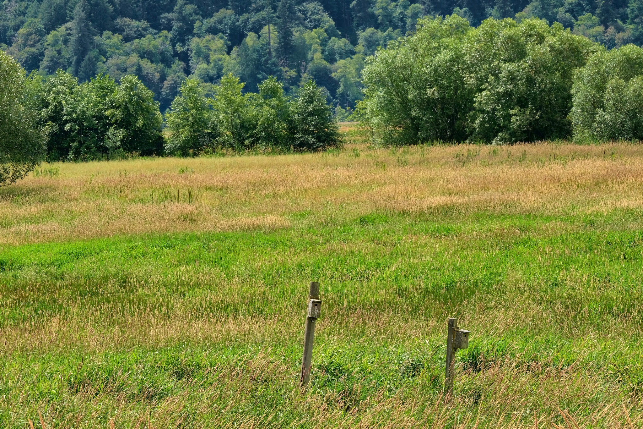 The colors of the fields and surrounding hills were breathtaking!
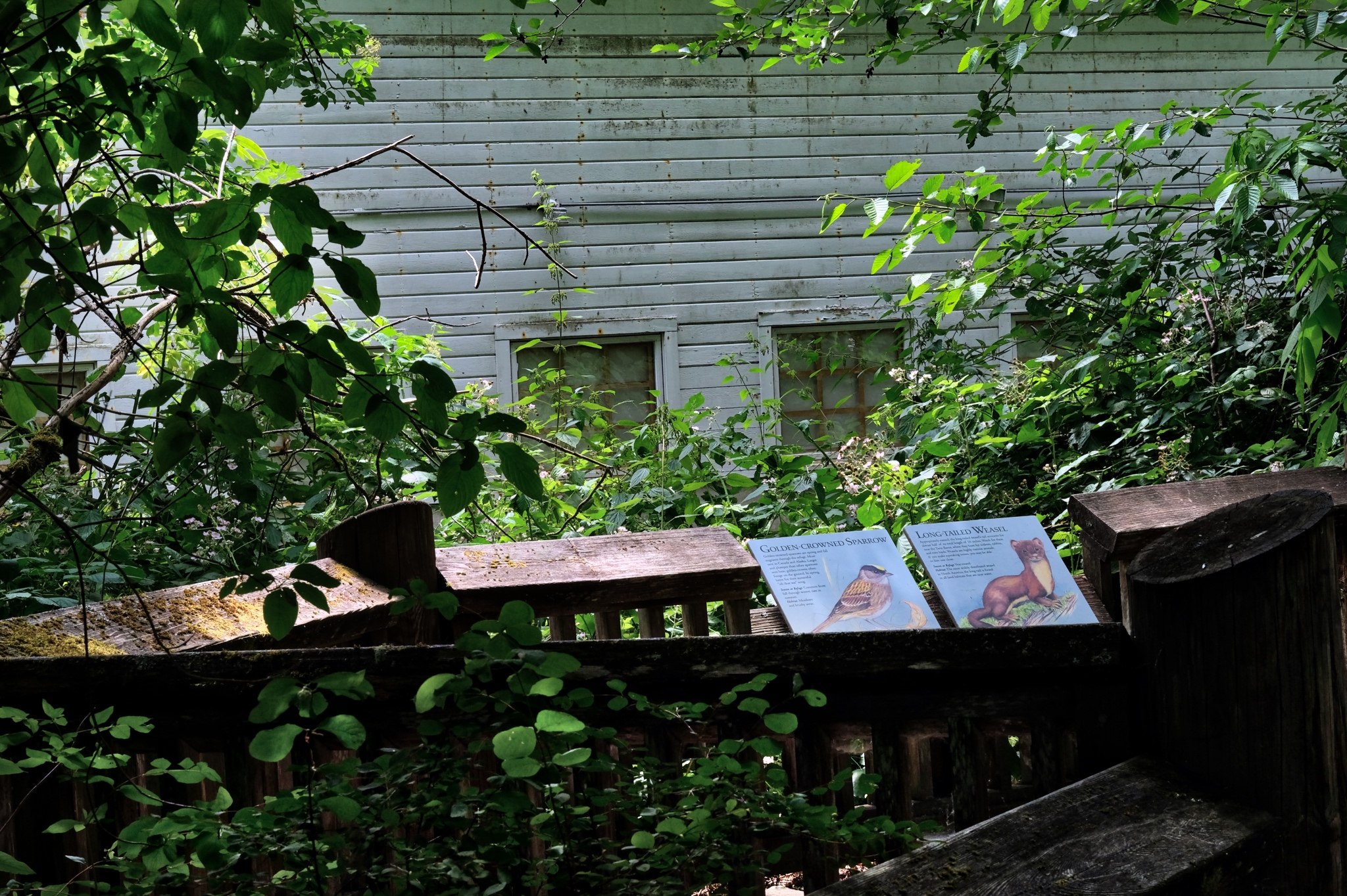 All the paths were well marked with informational signage about the indigenous flora, fauna, and local geology.
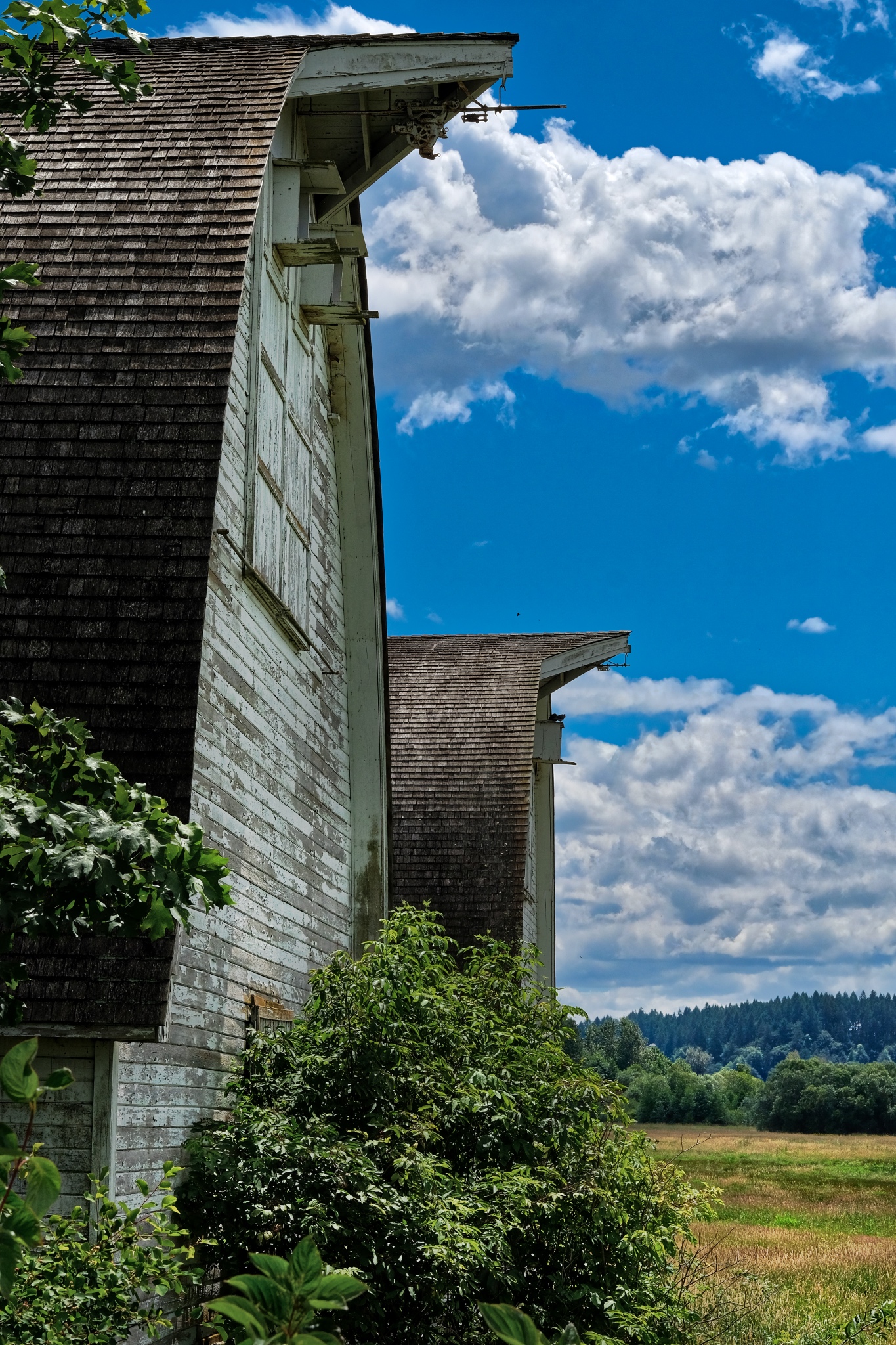 A wonderful angle from which to view the mammoth barns!
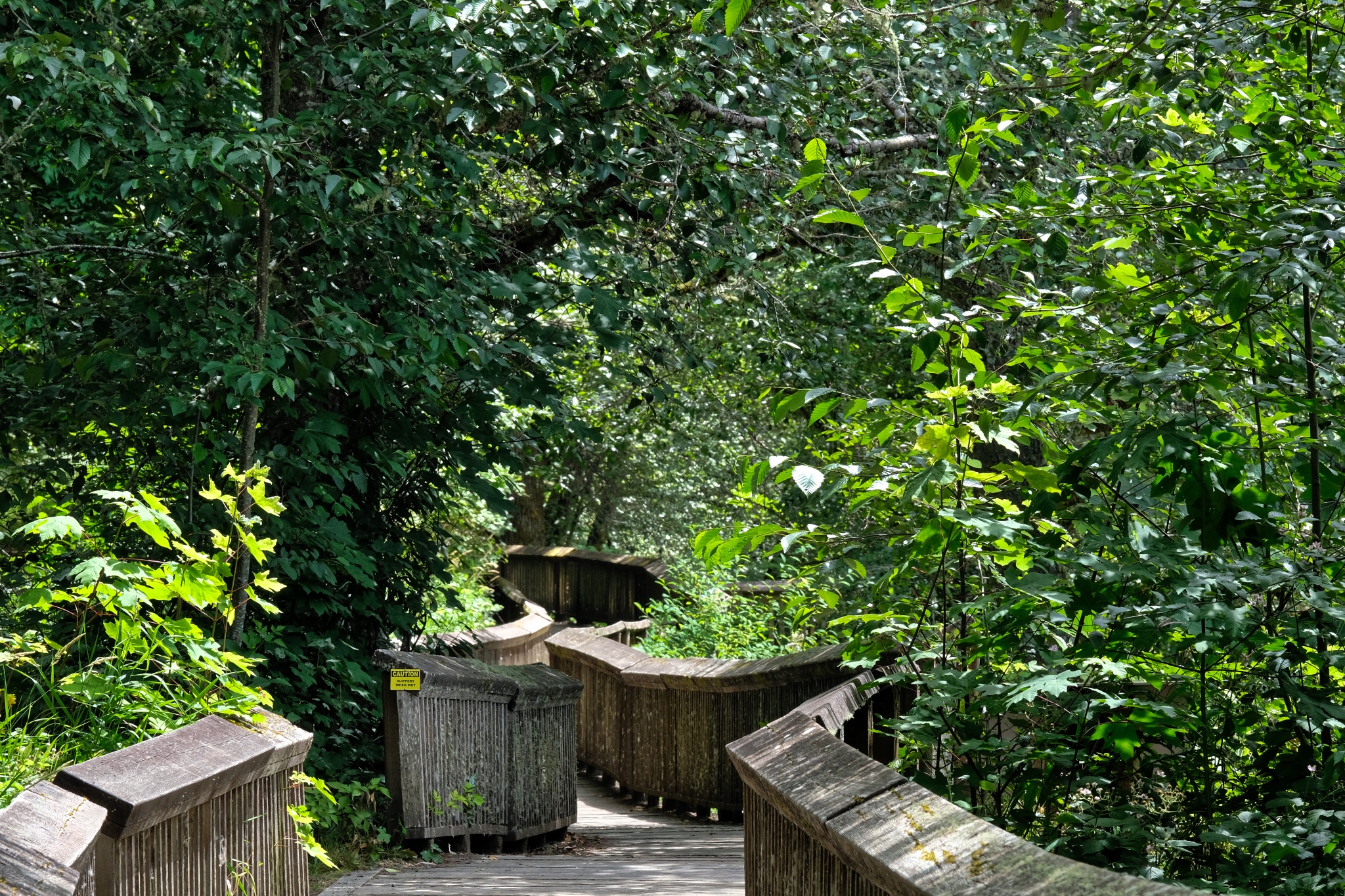 I wandered around some more on the elevated walkways, stopping here and there to take flower photos.
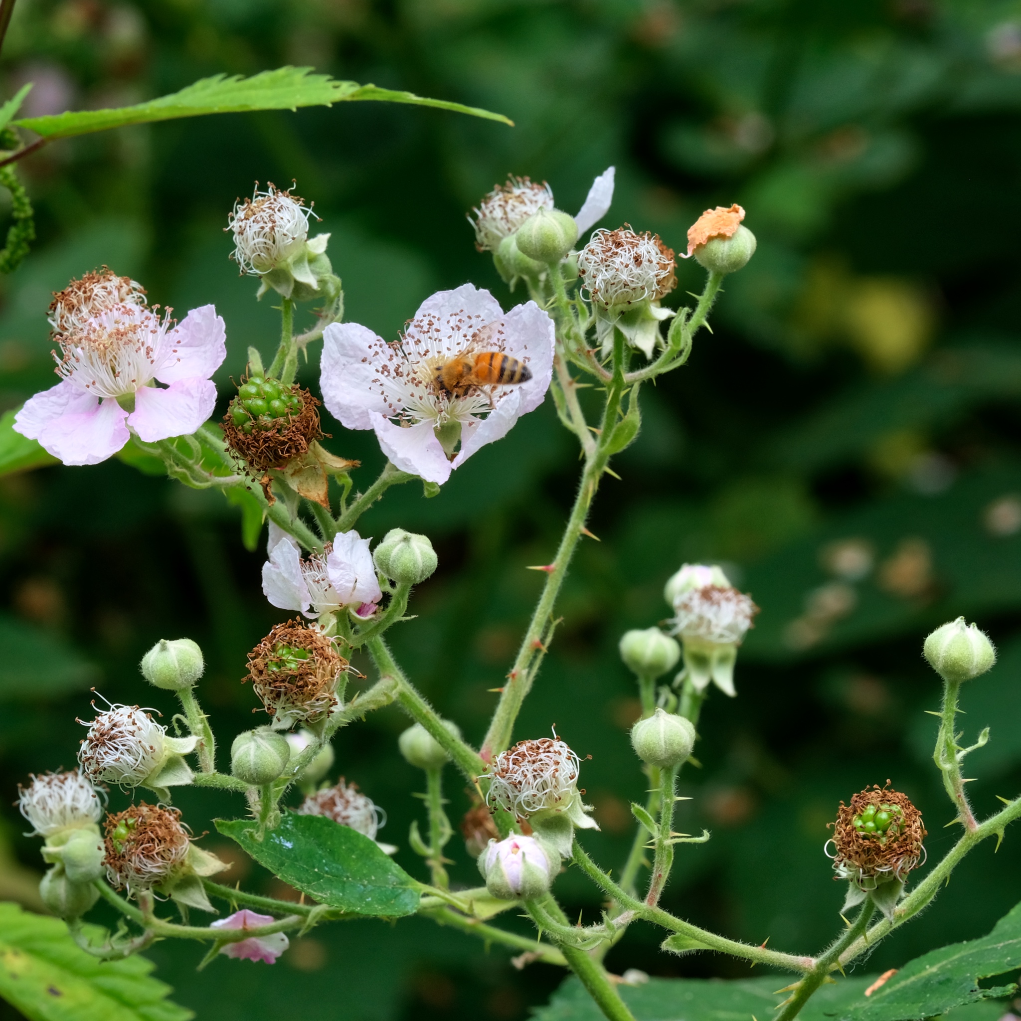 Busy bees . . . and . . .
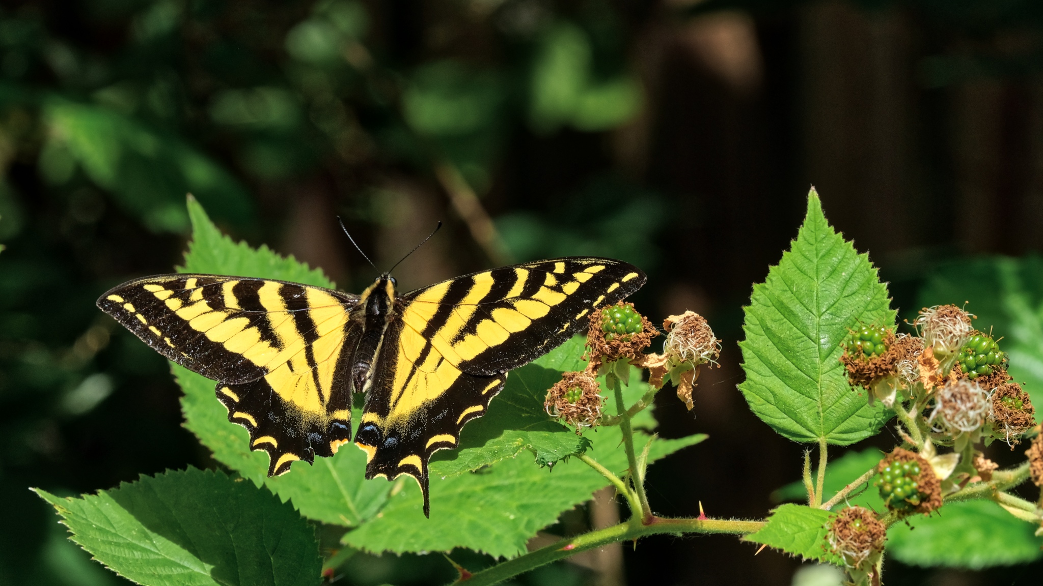 Busy butterflies too!
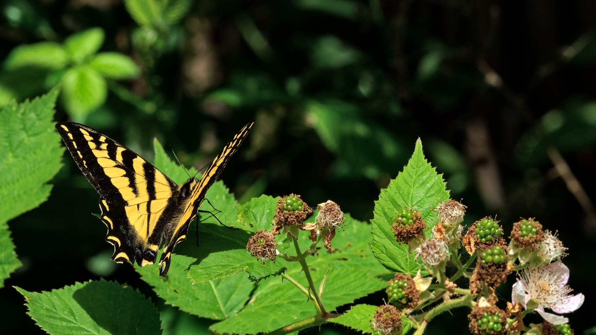 This one seemed to stay around just so I could photograph it!
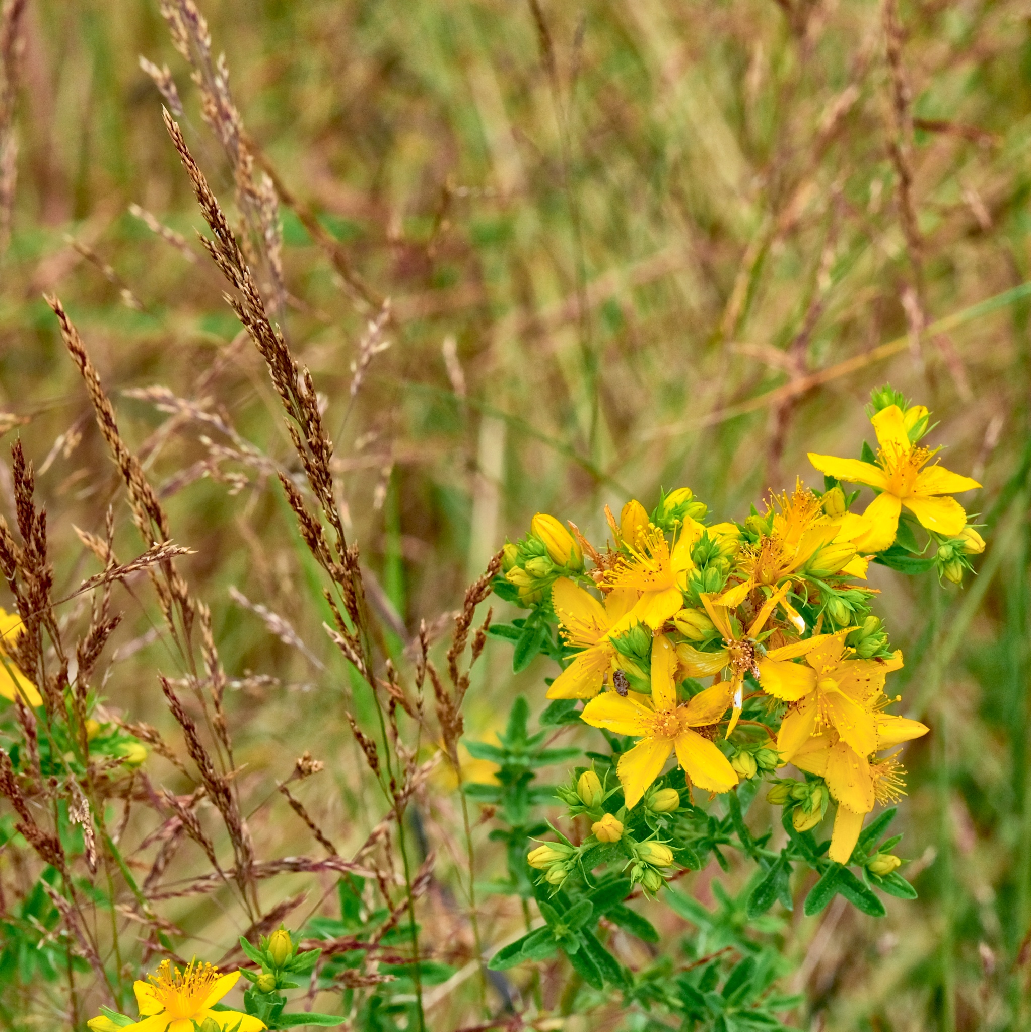 I left the cool shade of the forest for the dry gravel path through the fields and onward toward the estuary . . .
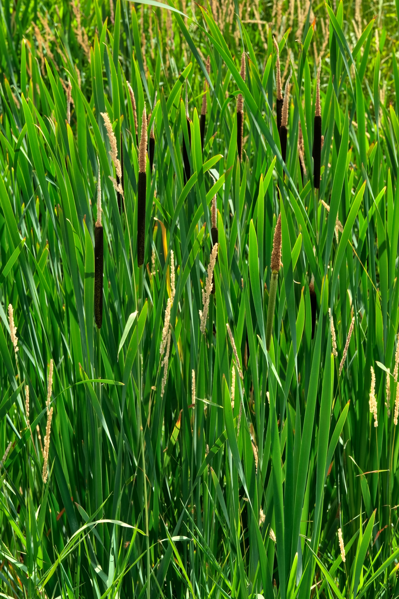 The old field drainage canals astride the dyke was full of thick bull rushes.
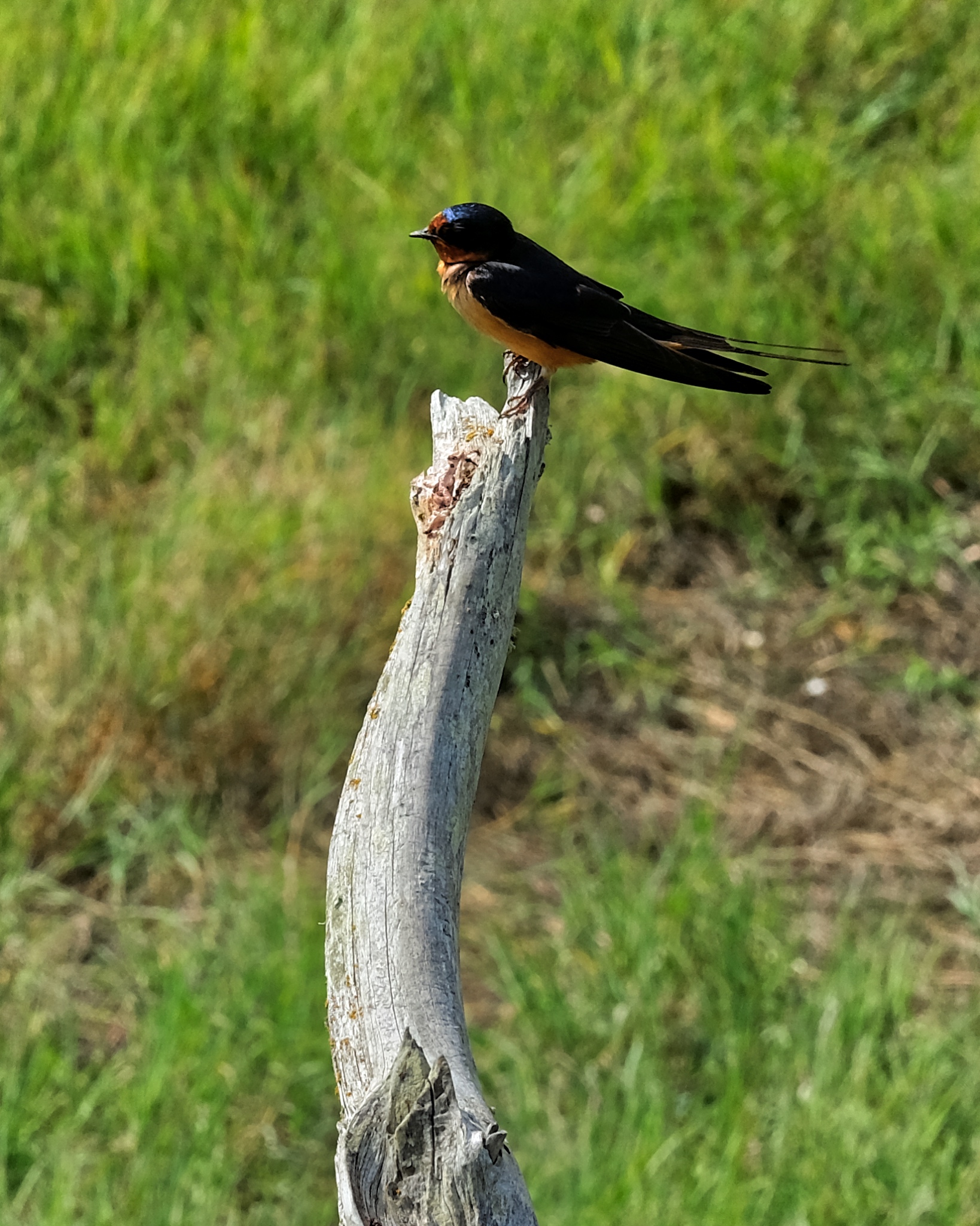 Many birds on the forest edge.
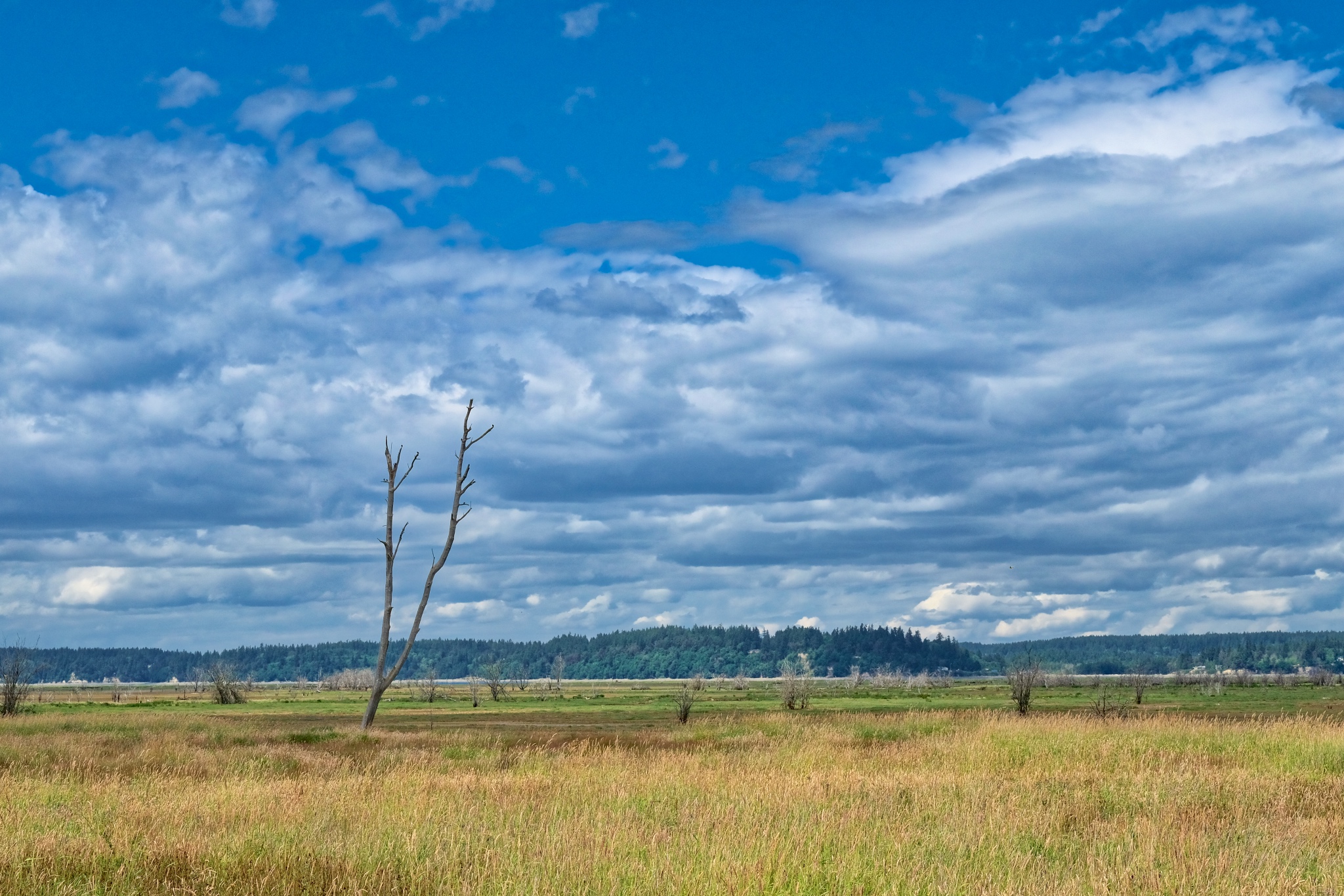 The grassy fields gradually gave way to estuarial flats.
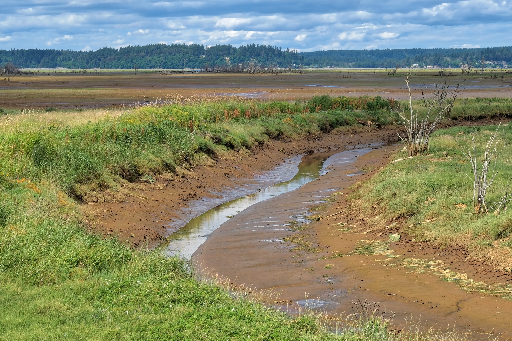 I knew the tide was going to be out when I saw these small bay arterial channels.
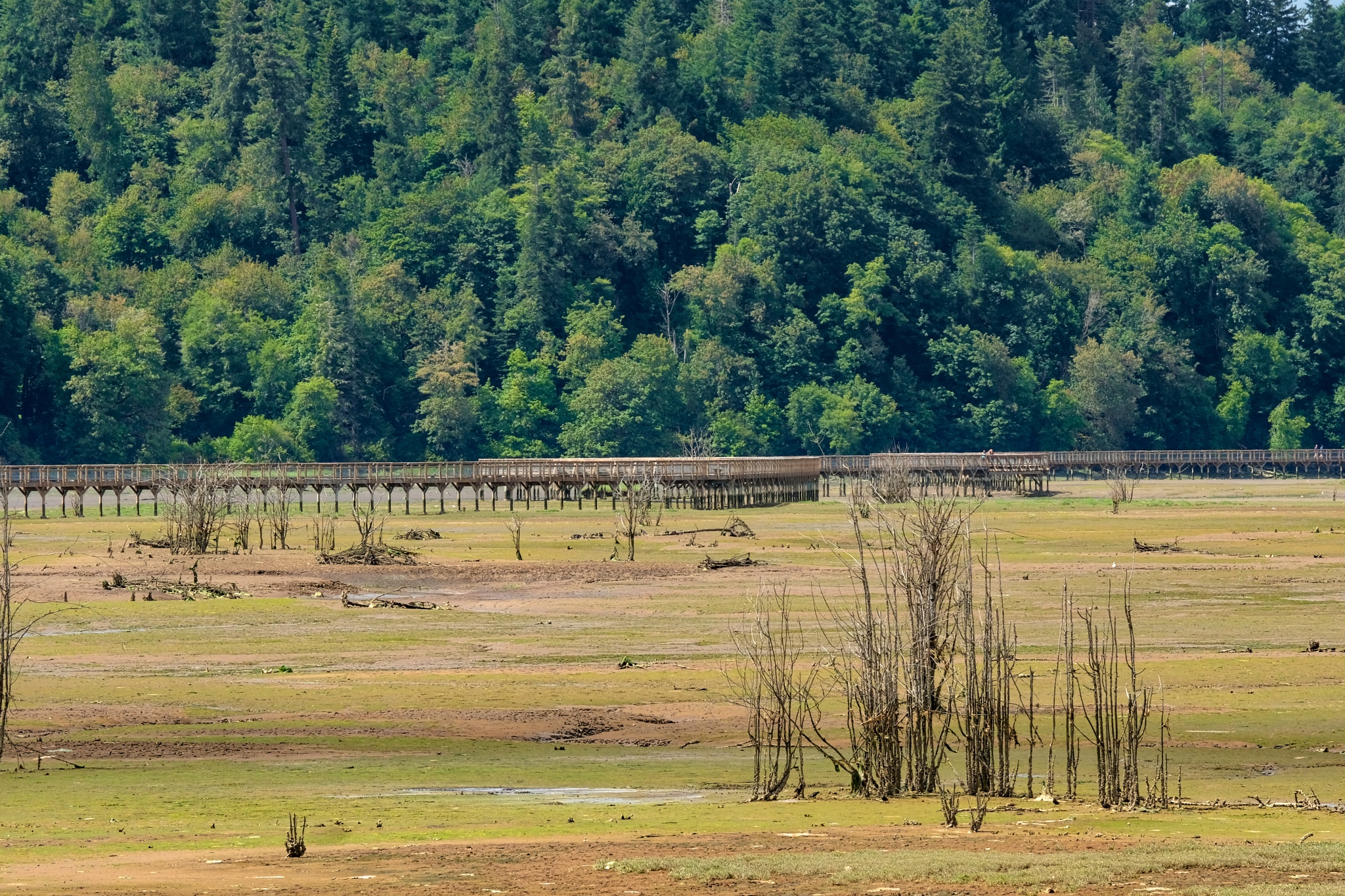 My first view across the wetlands toward the elevated observation walkway.
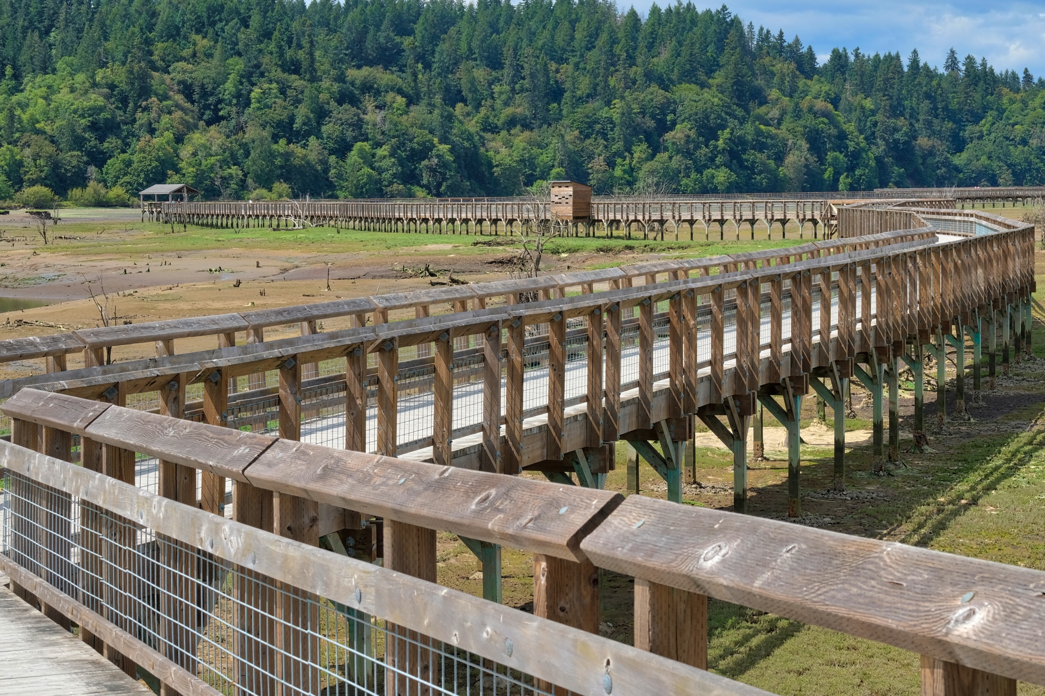 I climbed the ramp up onto the observation walkway . . . an incredible piece wooden construction in its own right.
 The view back up the Nisqually River across dry sand bars.
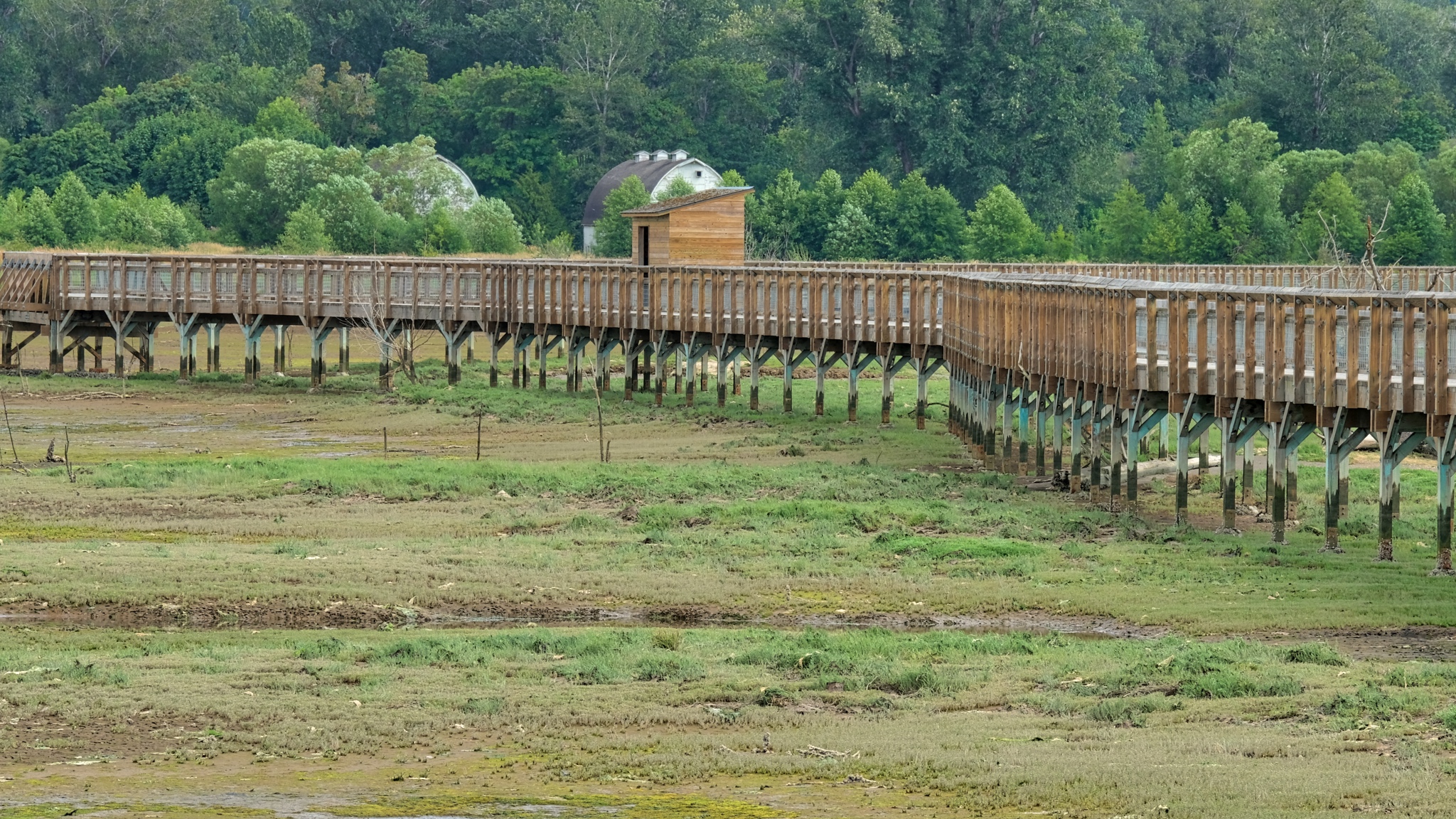 Looking back toward the tree line and the old ban from the walkway.
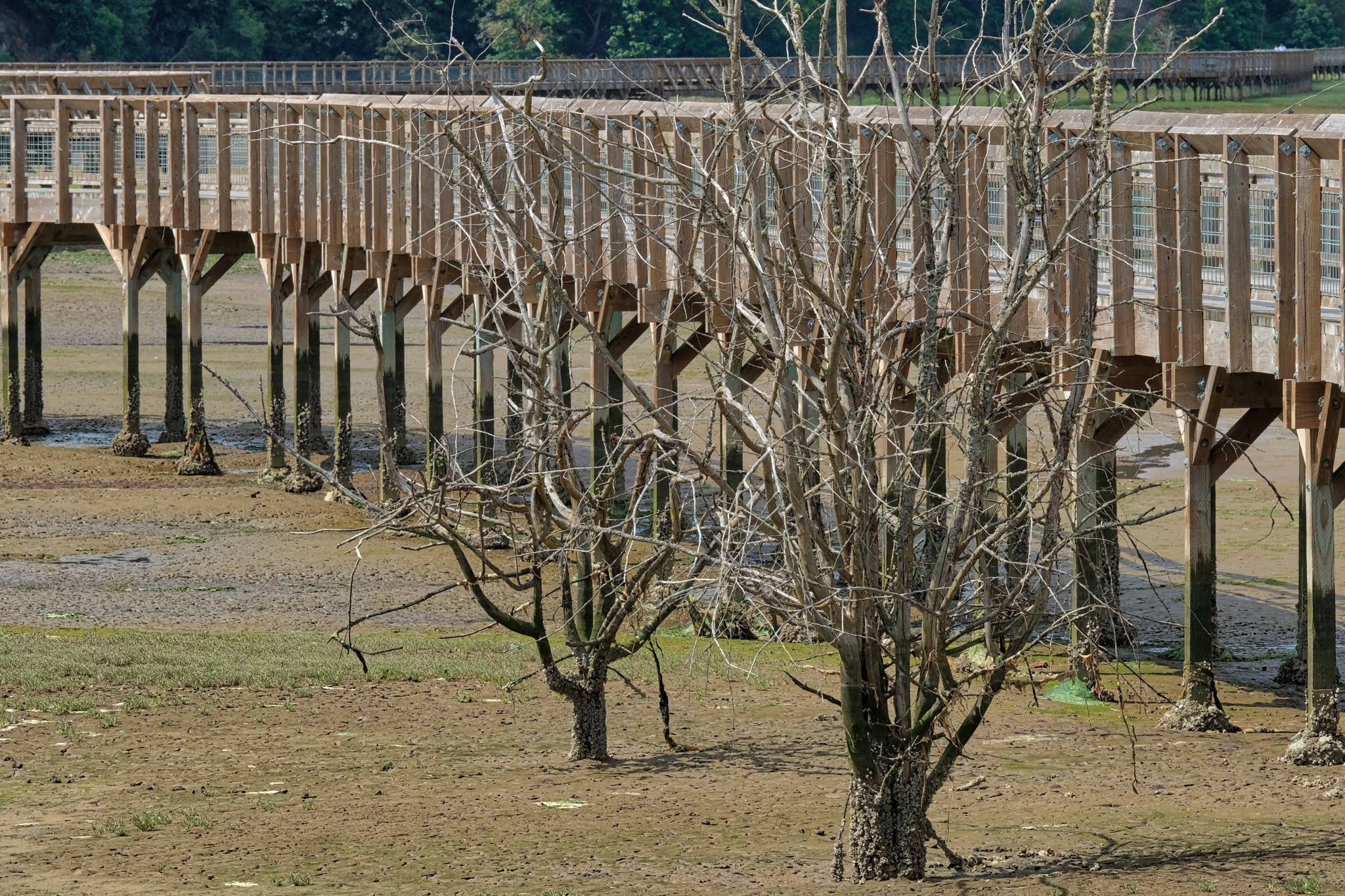 The sights from the walkway were both strange and captivating. You cannot visit these low tide estuarial landscapes any other way.
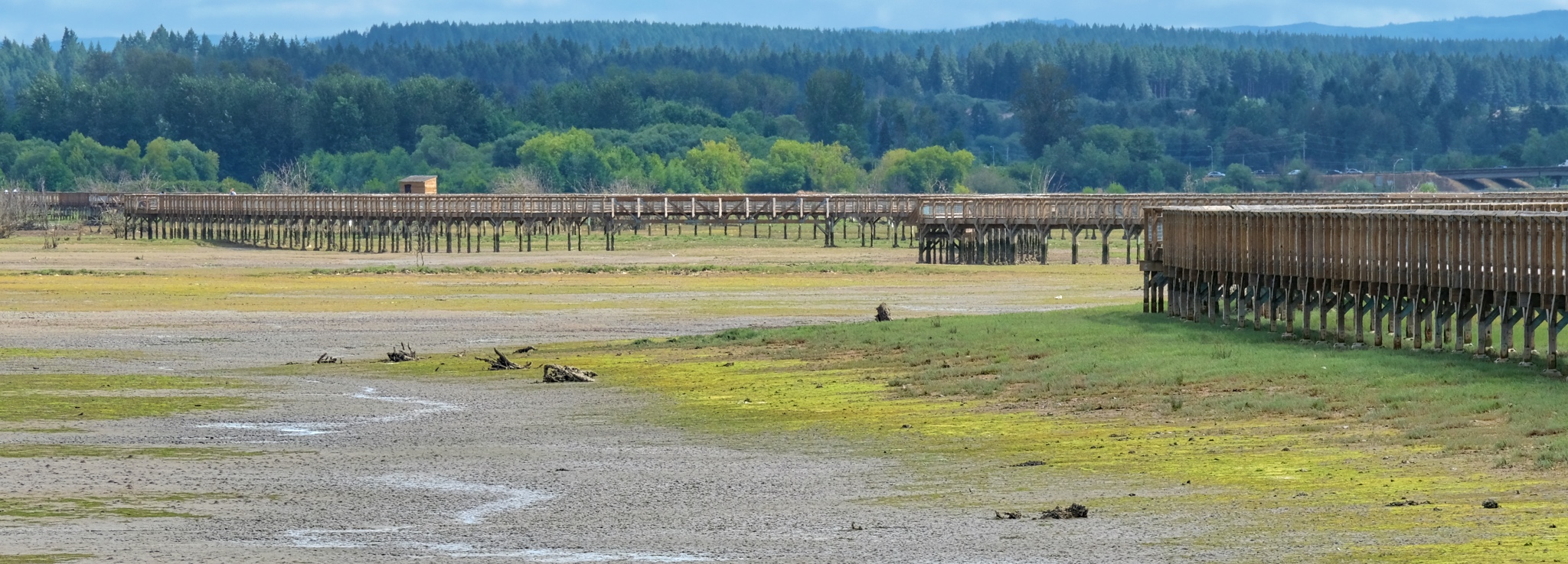 A mega-walkway!
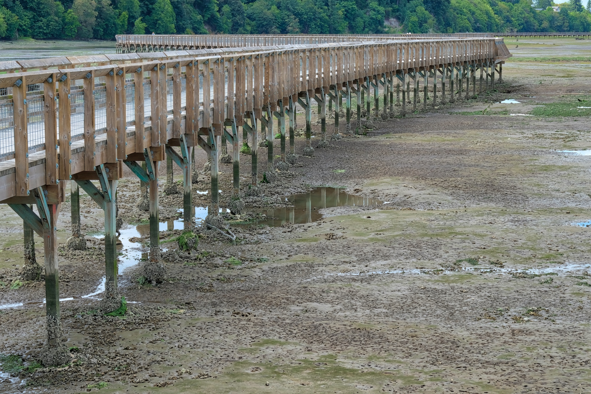 The further out I went the more it became an exposed bay floor.
 On one side of the walkway was the Nisqually River . . . with evidence of the pilings of old commercial structures.
 Some commercial project lost to time.
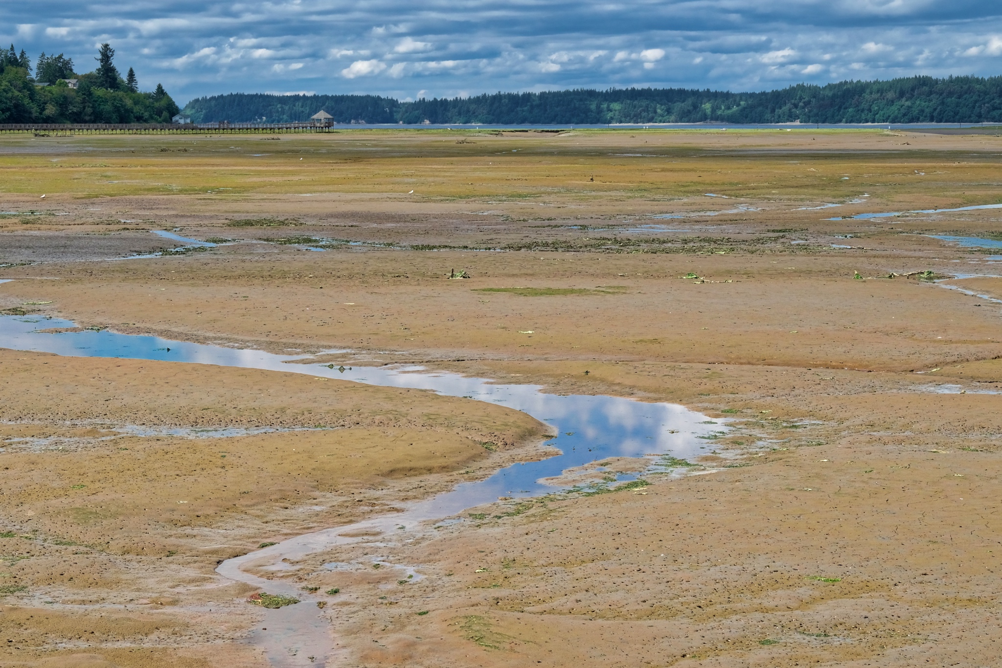 On the other side of the walkway was a vista across vast mud flats . . . loaded with very interesting objects!
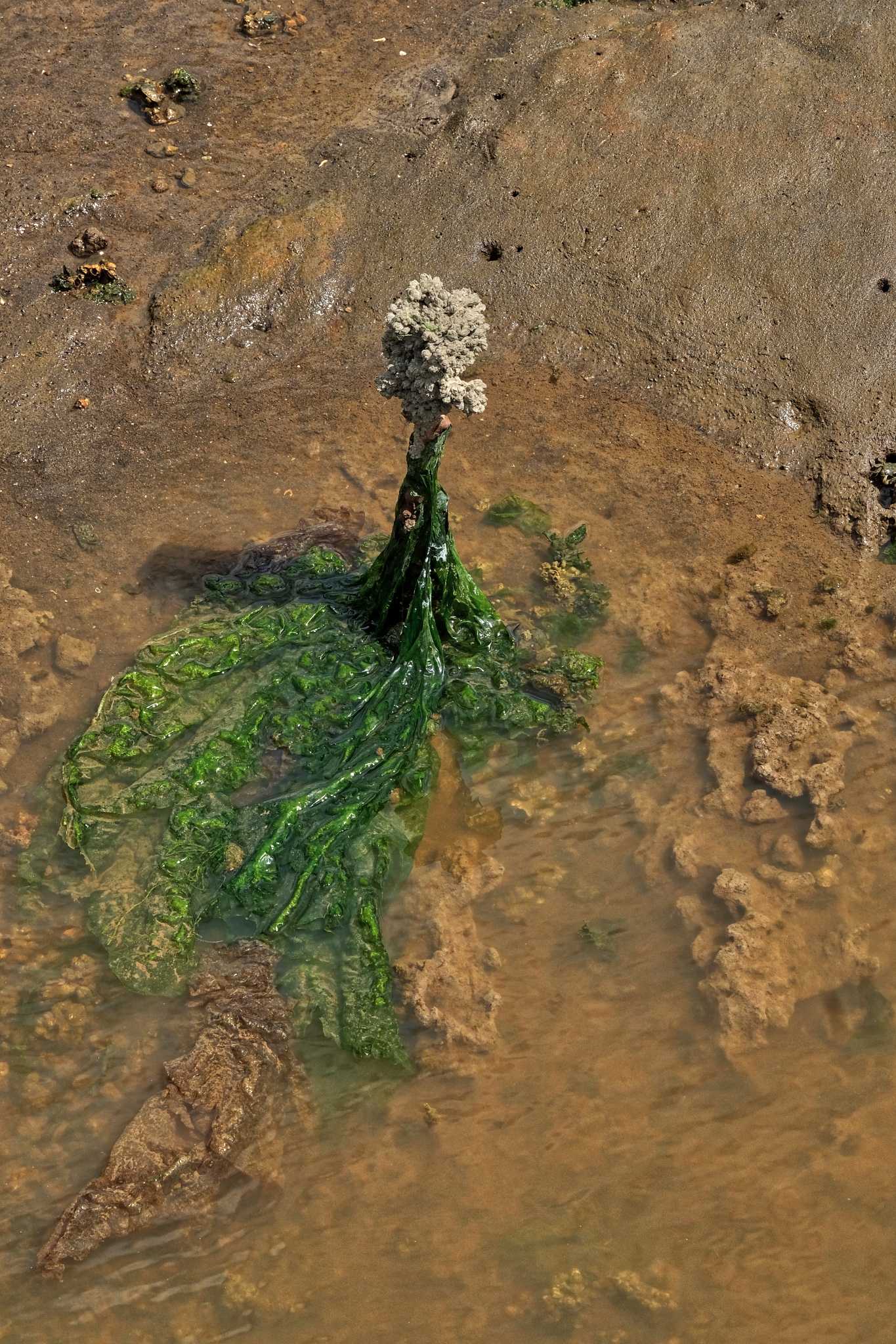 Strange things . . . . and, unfortunately all too many plastic bags!
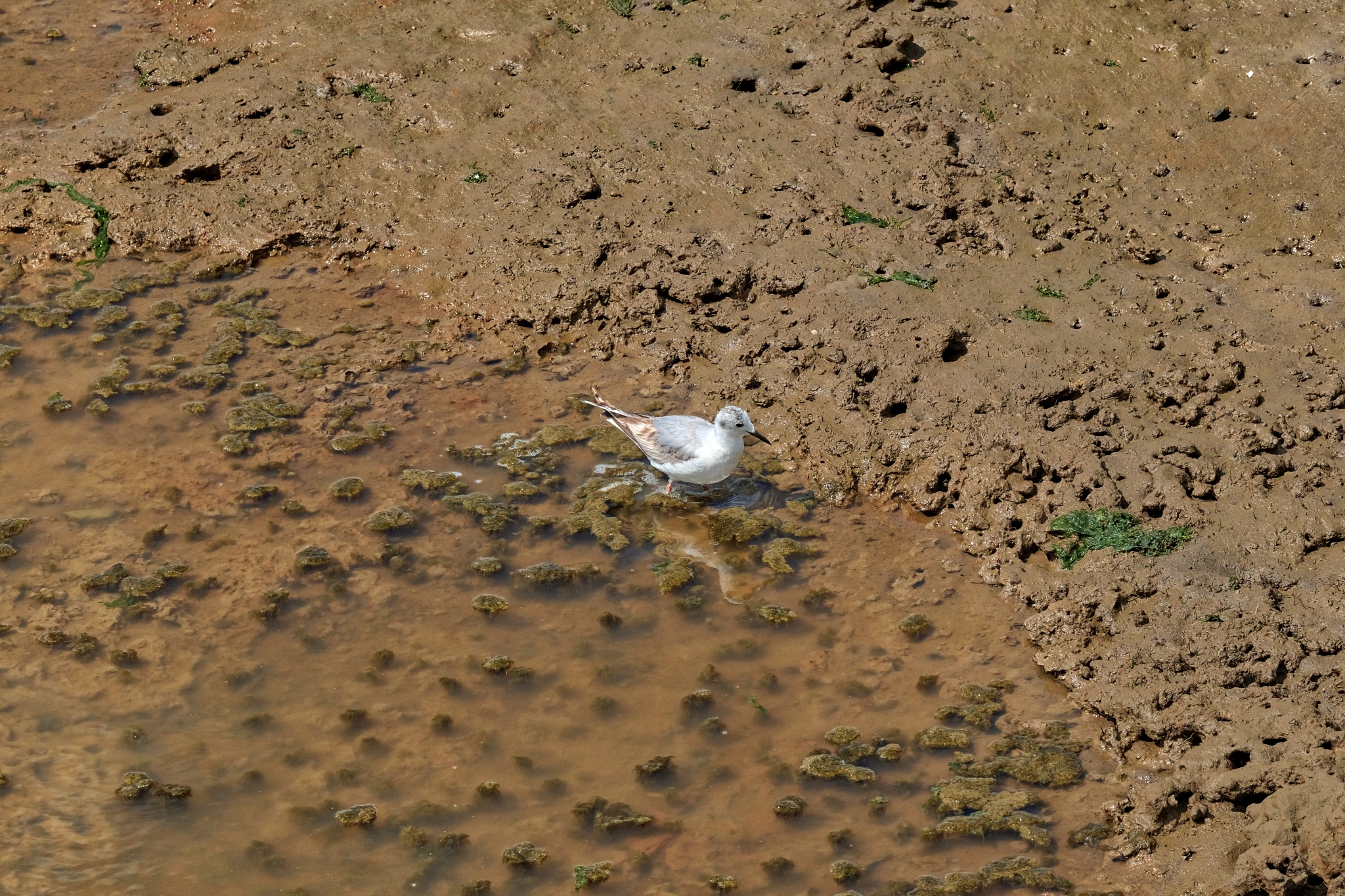 There were not as many birds as I somehow had expected . . . but there were birds.
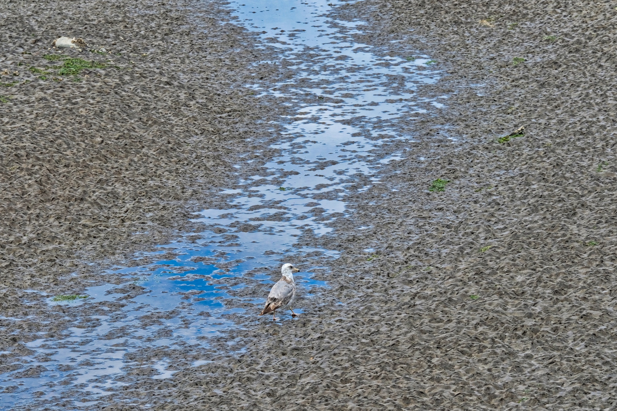 A gull loitering in the muddy estuary . . .
 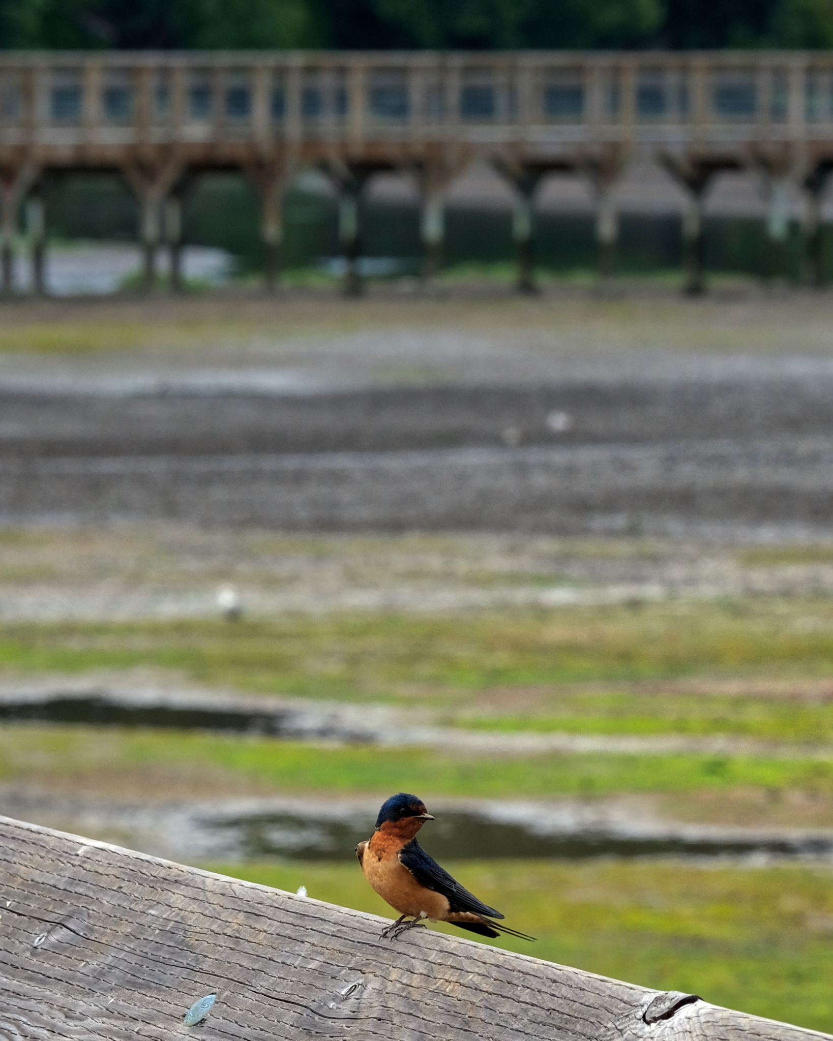 A friendly little fellow!
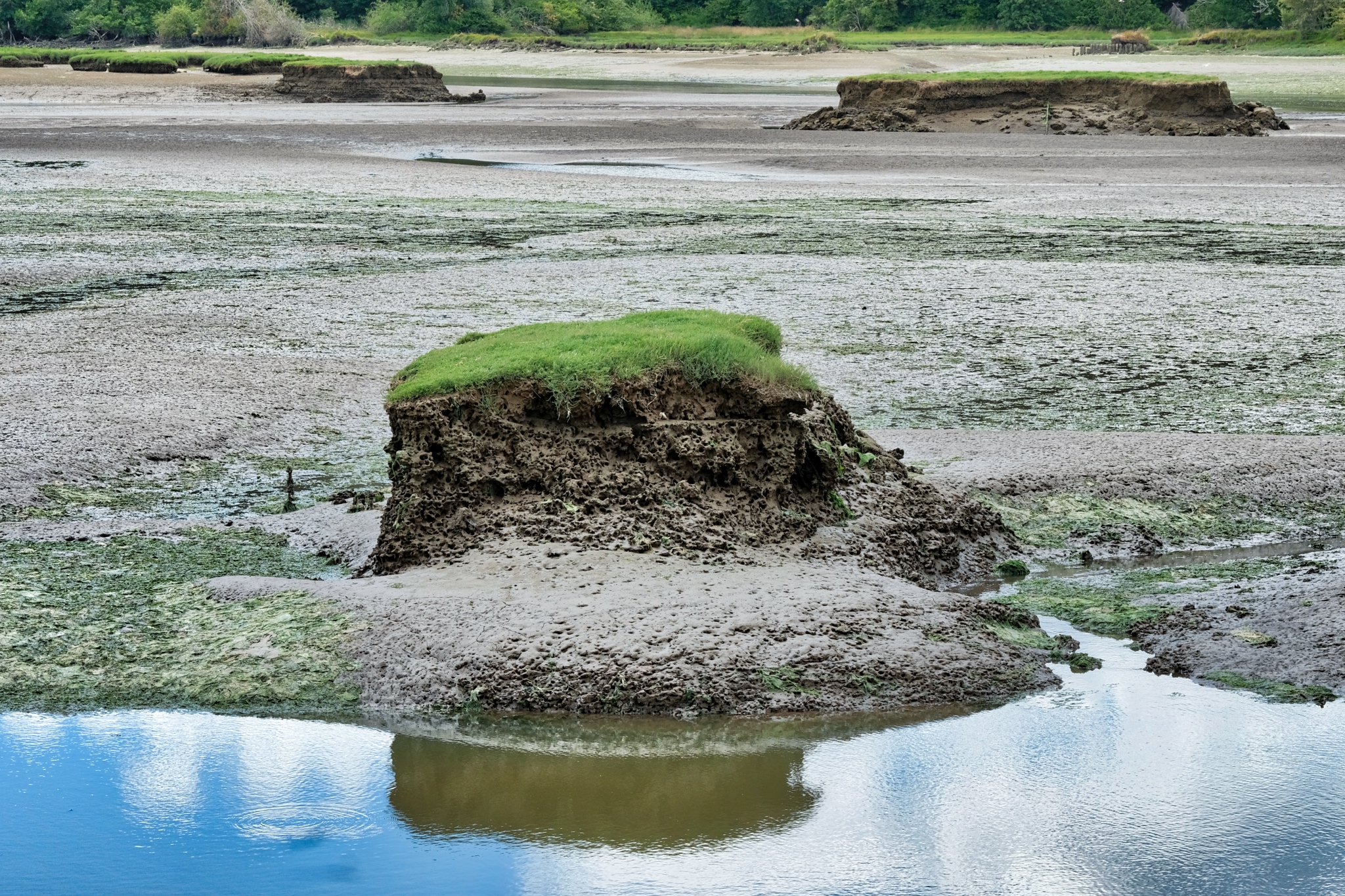 Evidence of sea level rise: the old level of the fields and 'dry' flats are eroding away with only a few small 'islands' of the old land level left. Only a few inches of sea level rise can cause this kind of erosion of wetlands.
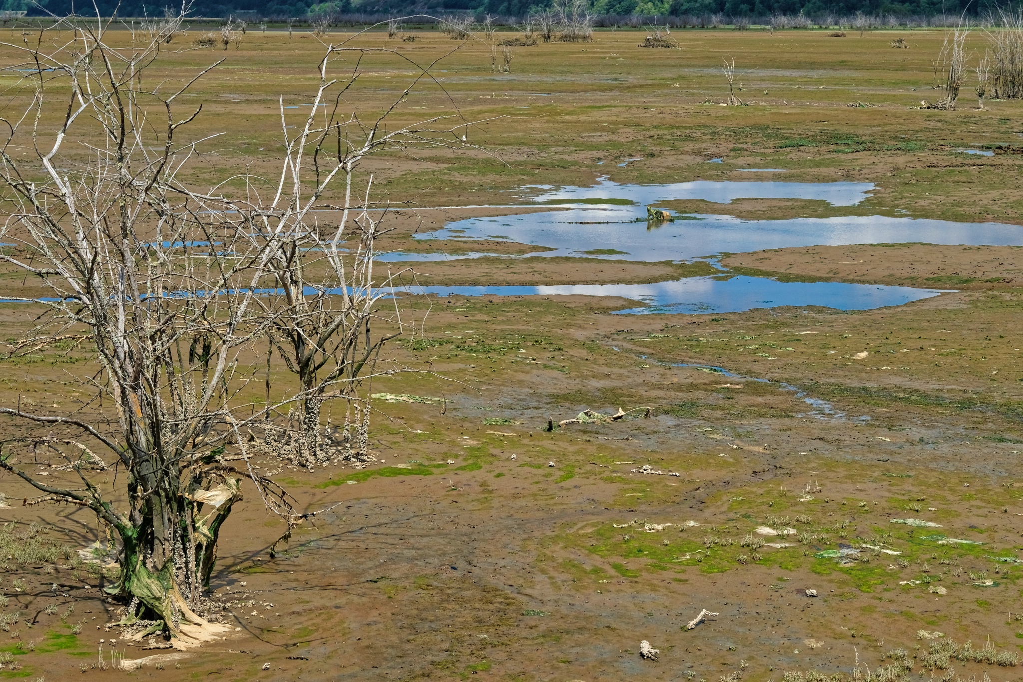 Sea water inundation into previously 'dry' areas.
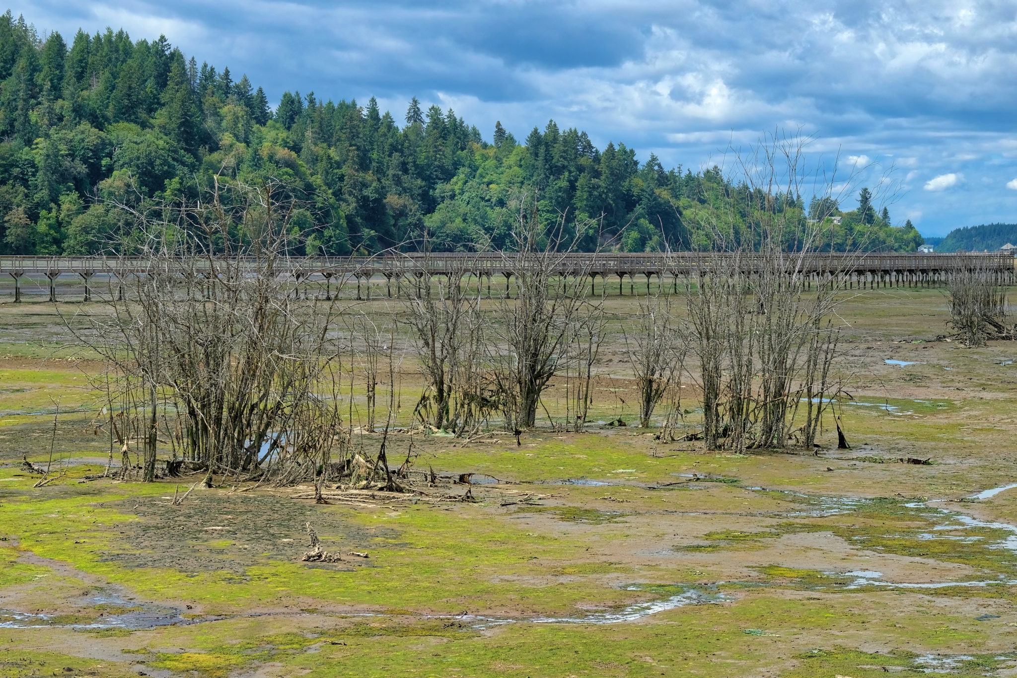 A new ecology is beginning to develop.
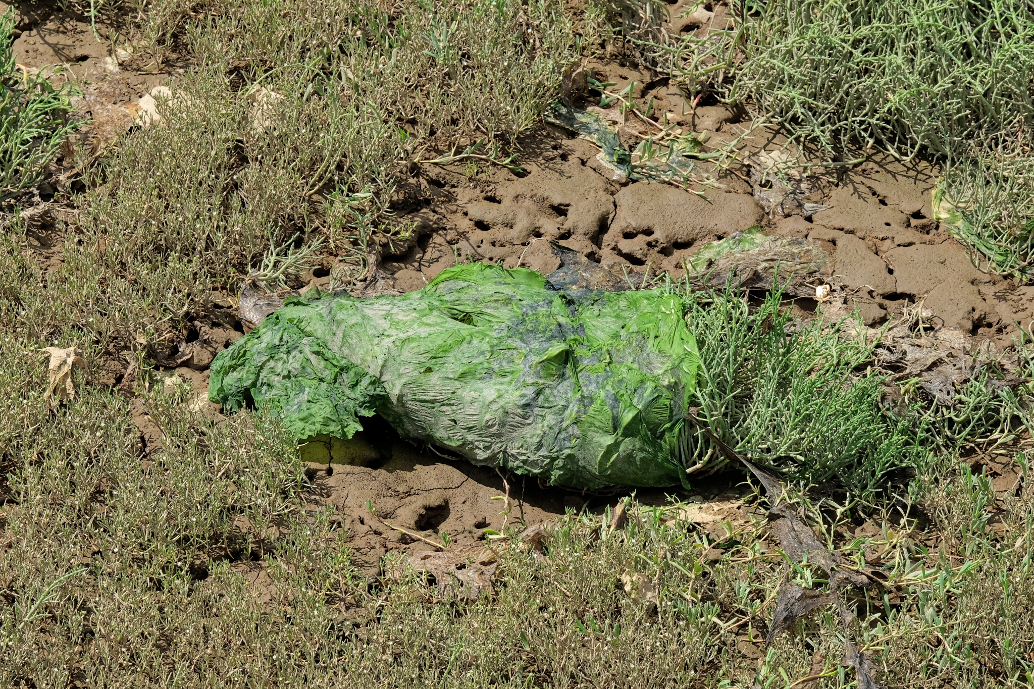 Altogether too much plastic. The Human Being!!!
 Here and there were sand bag earthworks to direct the drainage flow under the walkway to the Nisqually River.
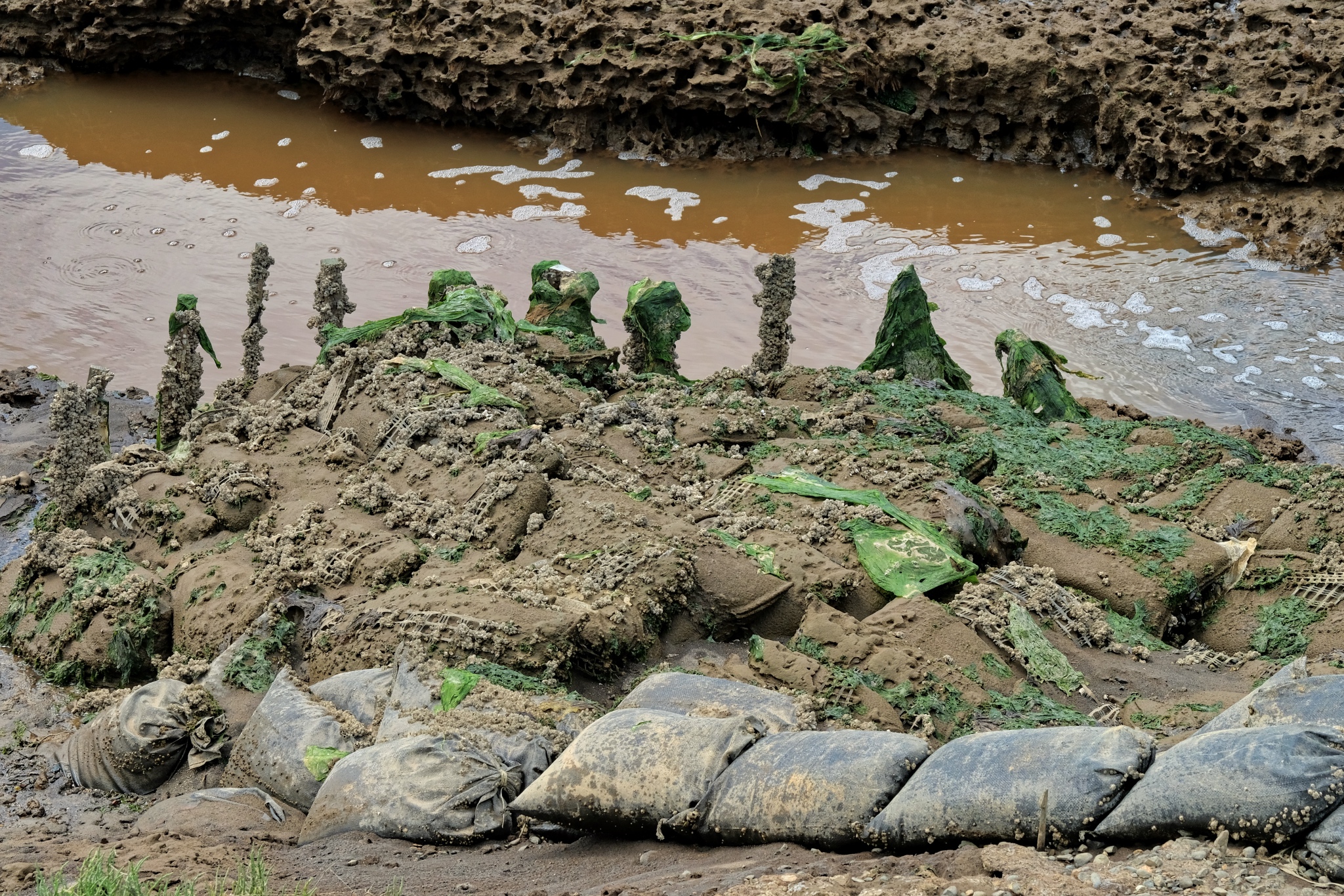 I imagine this water redirection effort to save the walkway is a never-ending chore.
 Stumps washed down the river when it raged in winter.
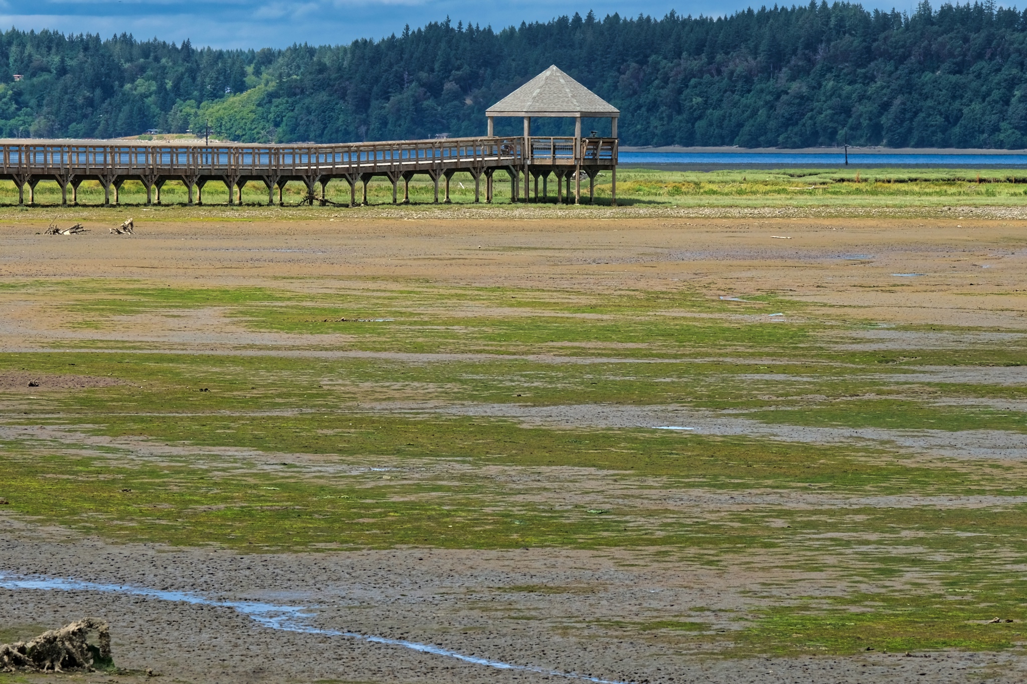 My ultimate goal, and the terminus of the walkway, was several miles from dry land!
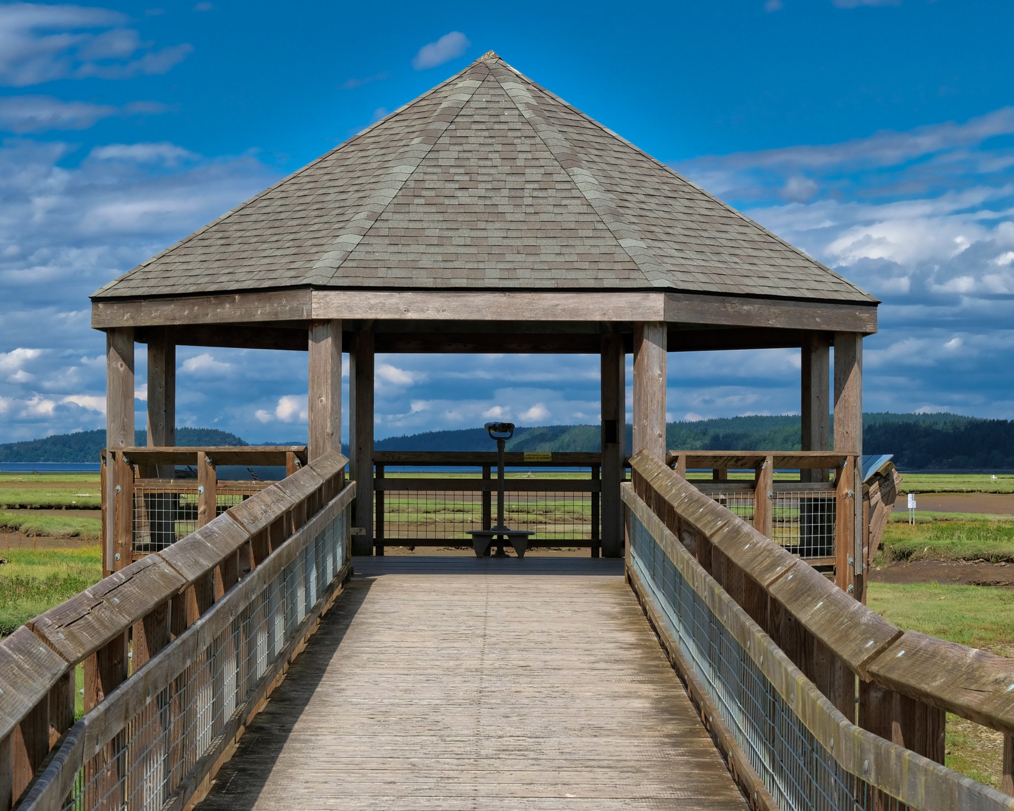 The final observation pavilion was not too far from the actual Puget Sound.
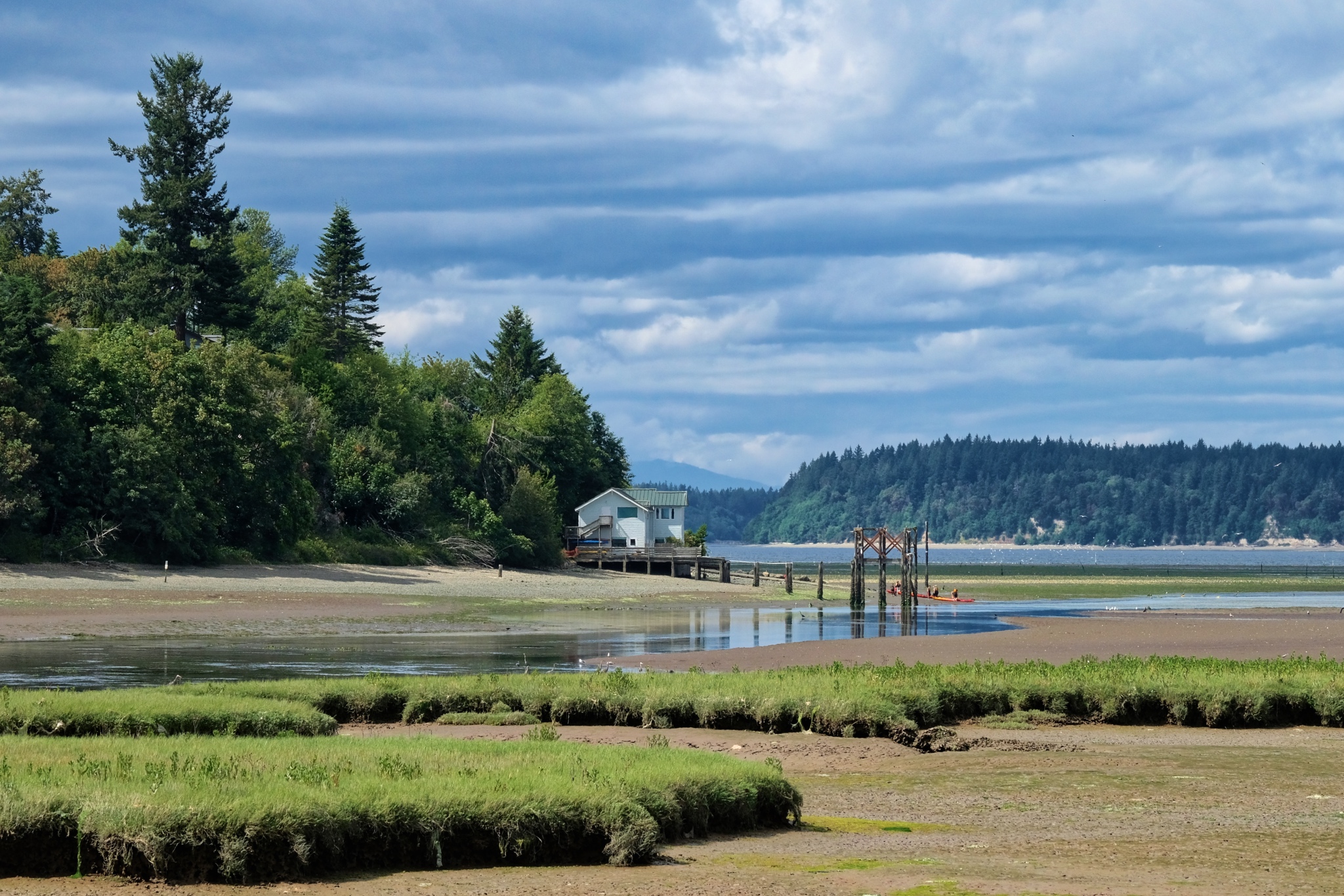
The view from the last observation pavilion.
 Puget Sound in the background.
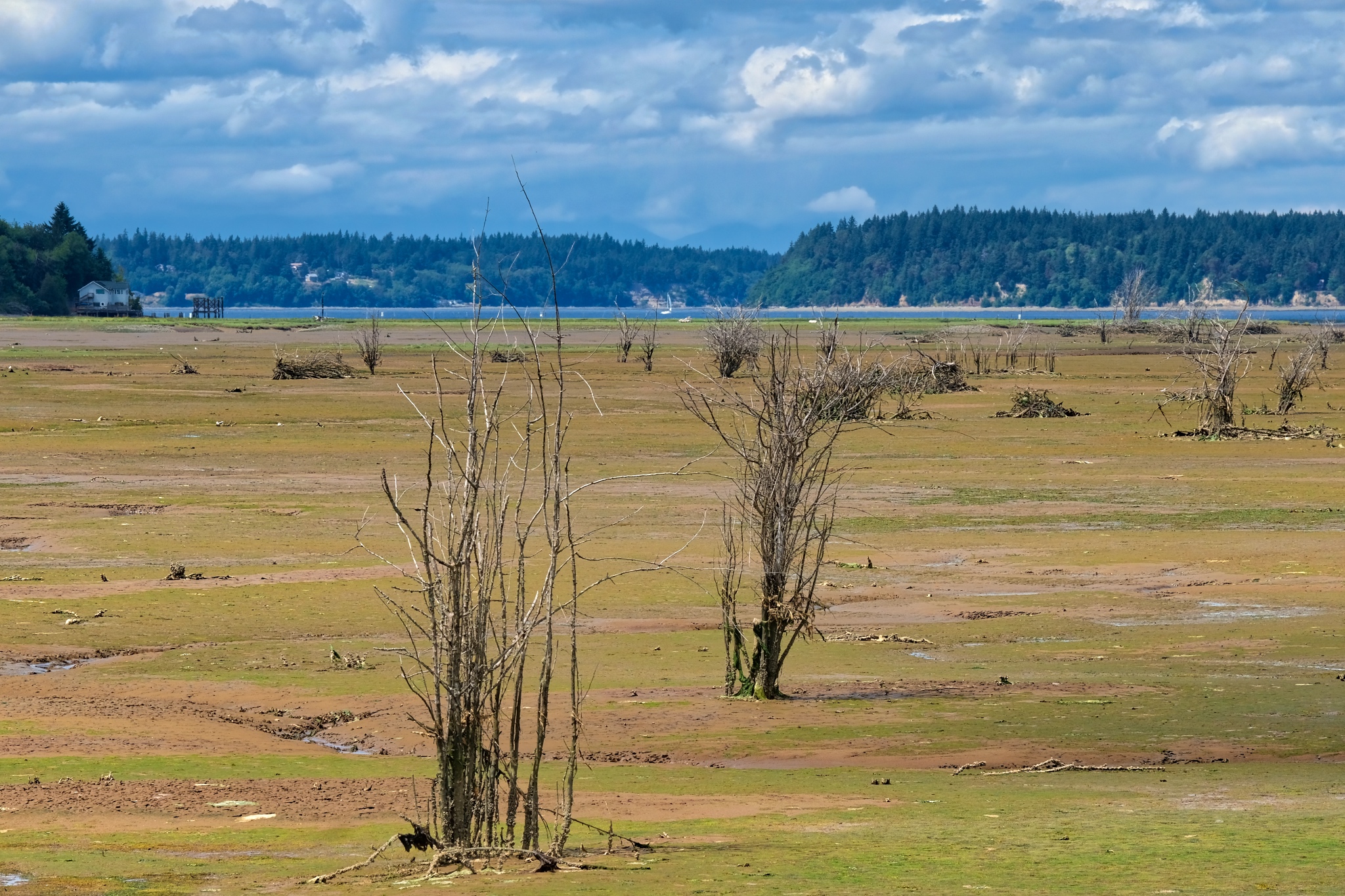 It was a beautiful day to be out in the world . . . making the most of the supramundane.
Road Trip USA: Oregon Camping - Silver Creek Falls
 Magnificent South Falls at Oregon's Silver Falls State Park.
 Out and about on the back roads and state parks of Oregon in my little camping rig. Life is great.
 Only 40 miles from where I have been staying near Keizer, Oregon is Silver Falls State Park.
 The western slopes of the Cascades Mountains are extremely damp and lush.
 It rains so much here there is moss hanging from the trees.
 I arrived on a cool, but dry, afternoon in early June. After setting up camp I went out on my bicycle to explore the well maintained trails.
 I have been all over the world . . . and this part of Oregon is by far the GREENEST! Ireland and Scotland are not even close.
 There are many miles of bike paths throughout the park, which I rode on day two of my stay. This is the Ridge Trial. I love the look of the orange pine needles covering the trail.
  The Ridge Trail passed through some marvelous old growth forest.
 A steep climb brought many views of this old forest.
 In many places the forest floor was a carpet of ferns!
 A new wonderment at every turn of the bike path.
 Trees felled by storms lay about here and there . . . and will decompose to supply nutrients to the next generations of tall trees.
 I found myself stopping often just to take in all the beauty. What a bike trail!
 A damp stand . . . .
 Layers and layers of greenery . . .
 SOUTH FALLS
 After a long bike ride in the forest, the overcast sky began to clear, so I packed up my camp site and drove to the South Falls trailhead. Here, the view of the South Falls from above. I met a nice family from Thailand here. It's a small world.
 The path down and behind South Falls offers many fine spots for photography.
 A very beautiful waterfall.
 The trail goes behind the cascading falls . . . a very impressive sight.
 There were a fair number of tourists on this day . . . and we all stood kin silence under the falls listening to the powerful 'song' of the water falling from above.
 The bright sun suddenly appeared along the path to the Lower South Falls. . . making the already green environment explode with luminosity. Incredible green!
 The picture post card view.
 Silver Creek.
 A nice bridge view . . . there were many other photographers, most with big tripods, wanting to use the bridge as a vantage point . . . but they were all complaining that people walking on it caused it to shake.
 The two-mile path to Lower South Falls followed Silver Creek most of the way.
This is a very busy trail with lots of curious children.
 A magical place.
 The path rose for quite while before a view of the creek was visible again.
 A steep zig-zag of stairs down to the fall's base.
 After the winding and steep stairs down, I was rewarded with my first view of Lower South Falls.
 The Lower South Falls through the trees.
 A beautiful view.
 Oregon!
 The path here also continued behind the falls.
 The roar of the falls became very loud as you neared it.
 Another fabulous forest waterfall view.
 I got a little wet behind the falls.
 Through the mists . . .
 Directly behind the falls.
 My last glimpse of the Lower South Falls as the sun began to shine again.
 Up the steep steps and onto the ridge for a view of the creek in bright sunlight.
 I walked back up the path to my camper and left the park. I spent a wonderful three days in a beautiful place. The camping sites and facilities were first rate.
Oregon Countryside and Gallon House Bridge
 Hops for your beer: Oregon is a major world producer of hops . . . a very labour-intensive crop.
 Oregon fields of grain.
 This cooperative farmer stopped so I could take this photograph. Thank you.
 A small road sign indicated 'Gallon House Bridge' . . . it must be very special, I thought.
 And very special it was too. Gallon House Bridge is the oldest continuously used covered bridge in Oregon.
 A perfect country road 'find.'
 A very well-maintained old bridge.
 To walk an Oregon country road in June . . . .
 Oregon . . . good people, beautiful countryside.
Biking The Chehalis Western Trail In Early Spring: Heaven!

Mile Zero - The Chehalis Western Trail, just outside of Olympia, Washington.

With my new (used) bike under me on a cold and damp late March day, I headed up the trail to see wht I could see . . . . and take a few photos. Mile Zero is only a few hundred yards from where I am staying.

The brown vestiges of last Autumn still strewn about on the wet trail . . .

. . . but here and there the first signs and sprouts of Spring were appearing.

I rode this trail in sections . . . up and back for 5-7 miles each way at a time, in different weather and in an ever exploding Springtime.

Before all the foliage returned, there were still many views out across the Thurston County rural landscaped.

The Chehalis Western Trail is a converted logging company rail line cut through beautiful forested Pacific Northwest countryside.

The trail is very well maintained and the horse riders, walkers, and bike riders share the pavement . . . and follow the rules.

As the weeks went by, and the weather warmed, the bare branches started to show tiny daubs of green.

The deep, old growth forests remain lush throughout the winter.

There are a number of ponds and small lakes along the 18 miles of the trail I have ridden so far.

I have taken my bike rides at various times of the day . . . an evening scene at one of the many lovely lakes.

Riding through these tree-lined canyons and green tunnels is a visual delight.

My new (used) large-size hybrid bike. Perfect for this kind of riding. It has a sprung front end and a sprung and damped seat. Very comfortable. I have since added more kit - lights, a dinger, a water bottle, and a couple of sacks for my phone and camera.

Such different scenes along the way . . . from open and sunny to dark and closed in.

I stopped often to take photos and have a sip of water.

A beautiful pond where I would sit and rest each time to just enjoy Nature.

As Spring progressed, the trail became greener and greener.

Very occasionally I would see another cyclist or walker.

New growth everywhere . . . . in late Spring.

There was more and more green in the tree tops the later in Spring I rode.

Sometimes I would load my bike into my truck and drive up to where I last turned around. My last leg (so far) was from mile 11 to mile 18. This leg of the trail brought me up into the foothills of the Cascades Muntains . . . and a very different topography.

The Deschutes River.

The Chehalis Western Trail runs along side the Deschutes River for several miles.

Up in the hills there were beaver dams with duck pairs paddling about.

The trail crossed several pleasant streams.

A Llama (or Alpaca?) ranch along side the trail. Cute.

I felt right at home on the trail . . . there were many 'Old Timers' like me out for exercise and inspiration.

My now 'kitted out' bike on a water stop . . . up near Mile 18.

I returned often to my favorite pond for quiet meditation.

Mmmmm!

It has been raining about 50% of the time I have been here . . . and many areas of the forest are supersaturated . . . making for some wonderful reflections.

Beautiful daubs of green and yellow adorn the trees all along the route.

A small sign directed me to this pretty lakeside rest area.

An idyllic Pacific Northwest scene . . . on the more-or-less rare clear day in late April.

The same stretches of trail I rode only one month earlier are now lush with new leaves and flowers.

Trees sprouting puffs of Spring.

Beautiful wild flowers along the trail.

Blossoms and blooms.

These fruit tree blossoms . . . smelled so sweetly.

Deep in the undergrowth . . .

Such a bold yellow!

Such lovely scenes all along . . .

Greener and greener as the weeks go bye.

April 27, and the refoliation is nerly complete.
Update on Tuesday, May 8, 2018 at 3:20AM by
Dr. Jeff Harper
Dr. Jeff Harper

Two weeks later and I am out with the intention of riding the last 13 miles . . . . beginning at mile 15 of the trail.

It was a beautiful day . . . clearing all day, and warm. Wonderfully bucolic scenes of western Washington.

The cows were enjoying the good weather . . . and fresh tender grass.

The Chehalis Western Trail climbs up into the foothills of the Cascade mountain range, and as it does, the trees become larger.

The trail up in this part is an almost continuous tunnel between the trees.

Such a lovely and inspirational place for an all-day bike ride.

There were some wildlife to spot . . .

It must have been a very bad winter here . . . the deer were very thin. :-)

The cows, on the other hand, seemed to have done well over the winter.

The bike path became sunnier as the day wore on.

On and on down into a tunnel of foliage . . .

A rail line crossed over the path, which was itself a rail line before being paved.

It must be very wet here throughout the winter . . . these trees were completely moss and lichen covered . . . and only just beginning to bud out.

Beautiful . . .

Sometimes the trail would come out of the trees into bright sunshine.

There were many kinds of wild flowers. I had a lot of miles to cover, so I did not stop as often as would have liked.

Sweet yellow wild flowers.

As the trail neared its end near the town of Yelm, there was more farmland.

What an idyllic scene.

A dry shed for the kids to wait for the school bus . . . it rains a lot here.

The rural school bus waiting shed was decorated nicely . . .

The complexity of these budding trees in the bright clear sunshine was captivating.

I eventually rode to the end of the trail . . . 13 miles one-way . . . and then back for a total of 26 miles (40K) in one day! Overall I rode the 34 miles of the trail in three sections . . . both directions, for a total of 68 miles along the fantastically beautiful Chehalis Western Trail while Spring was exploding all around me.
