My most current blog entry:
Entries in Nevada (4)
USA Road Trip: Black Rock Desert Camping - Nevada
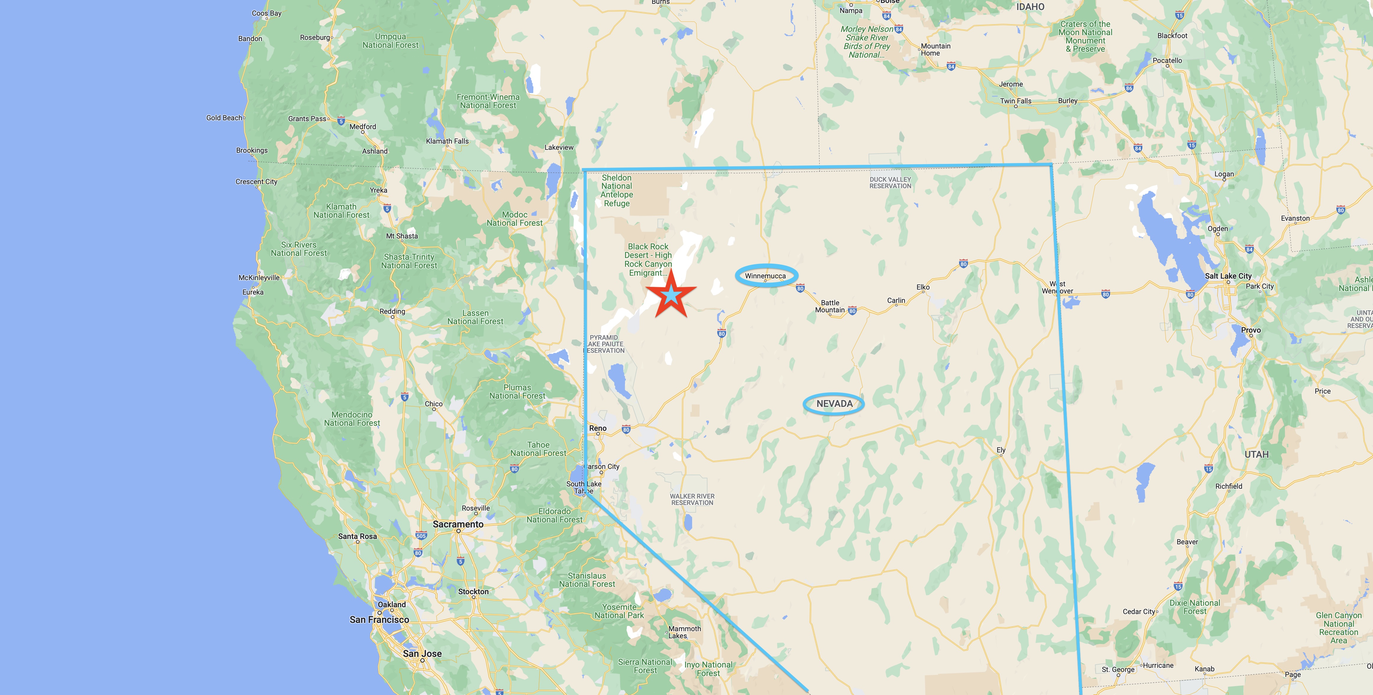 My big USA road trip took me on the small roads from Oregon south across the Nevada border and into the town of Winnemucca, where I washed clothes, showered, and cleaned out my camper at an RV park next to a casino.
 Heading out on gravel and sand Nevada Highway 49 out of Winnemucca across dried lake beds and desolate desert landscapes. My kind of place.
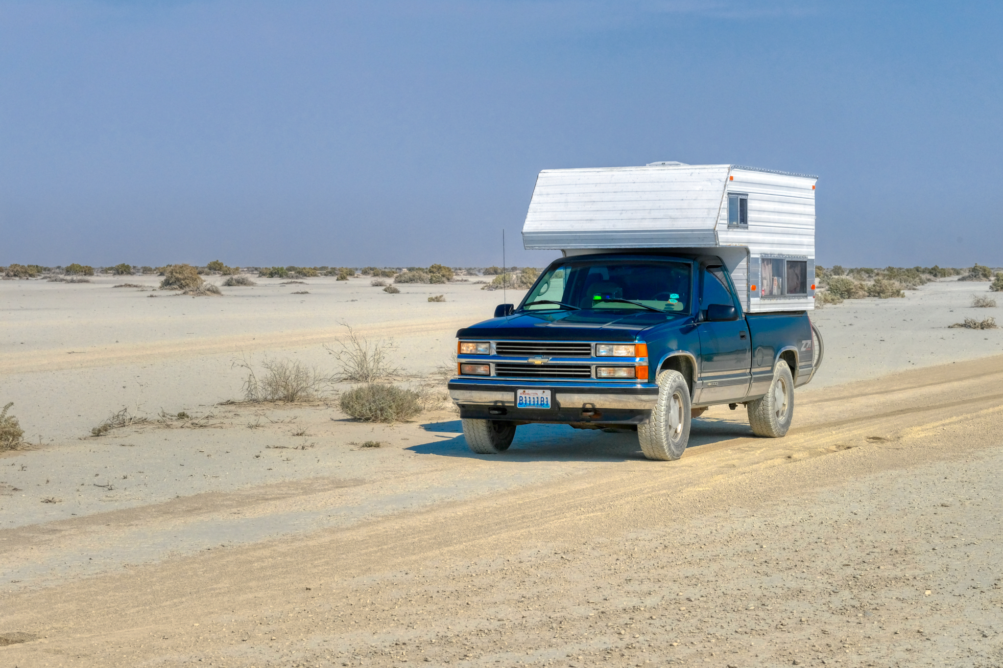
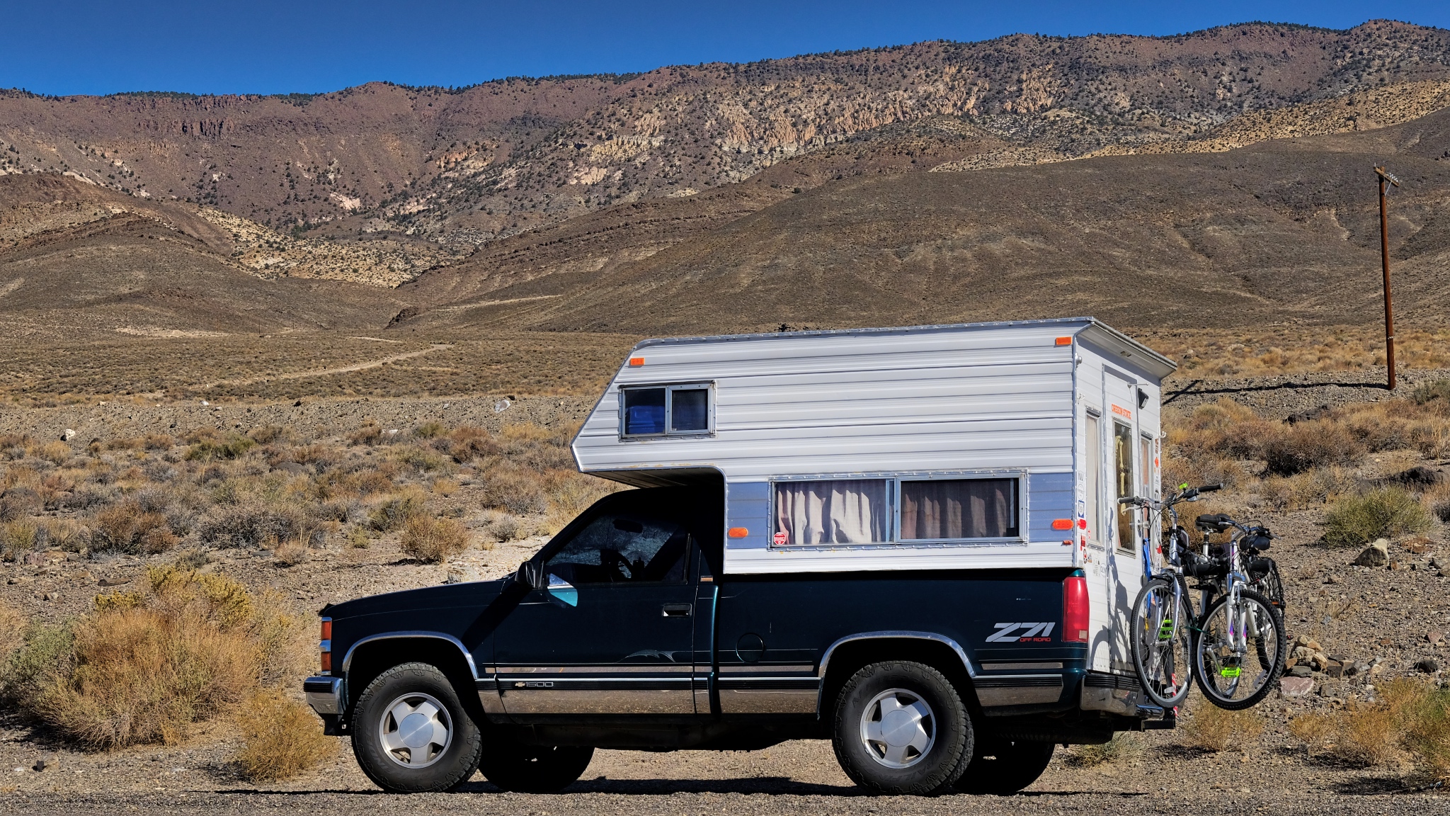
 Ready for anything that comes my way in my brother's trusty 4X4 Chevy camper (now sold).
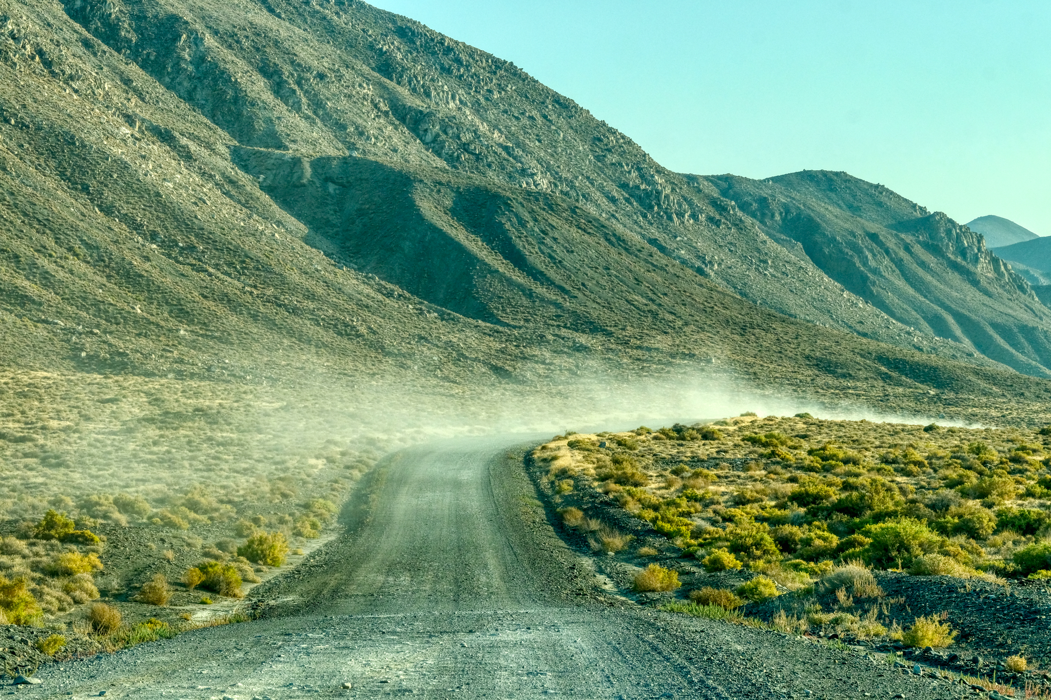
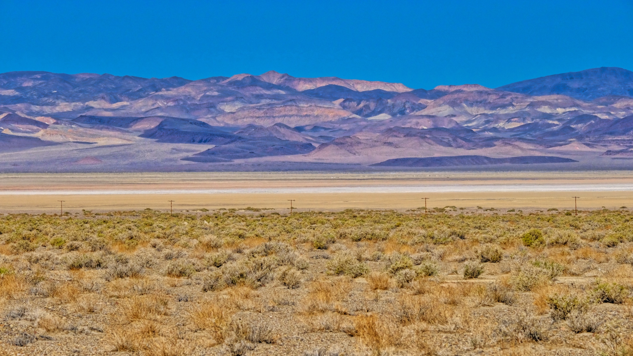
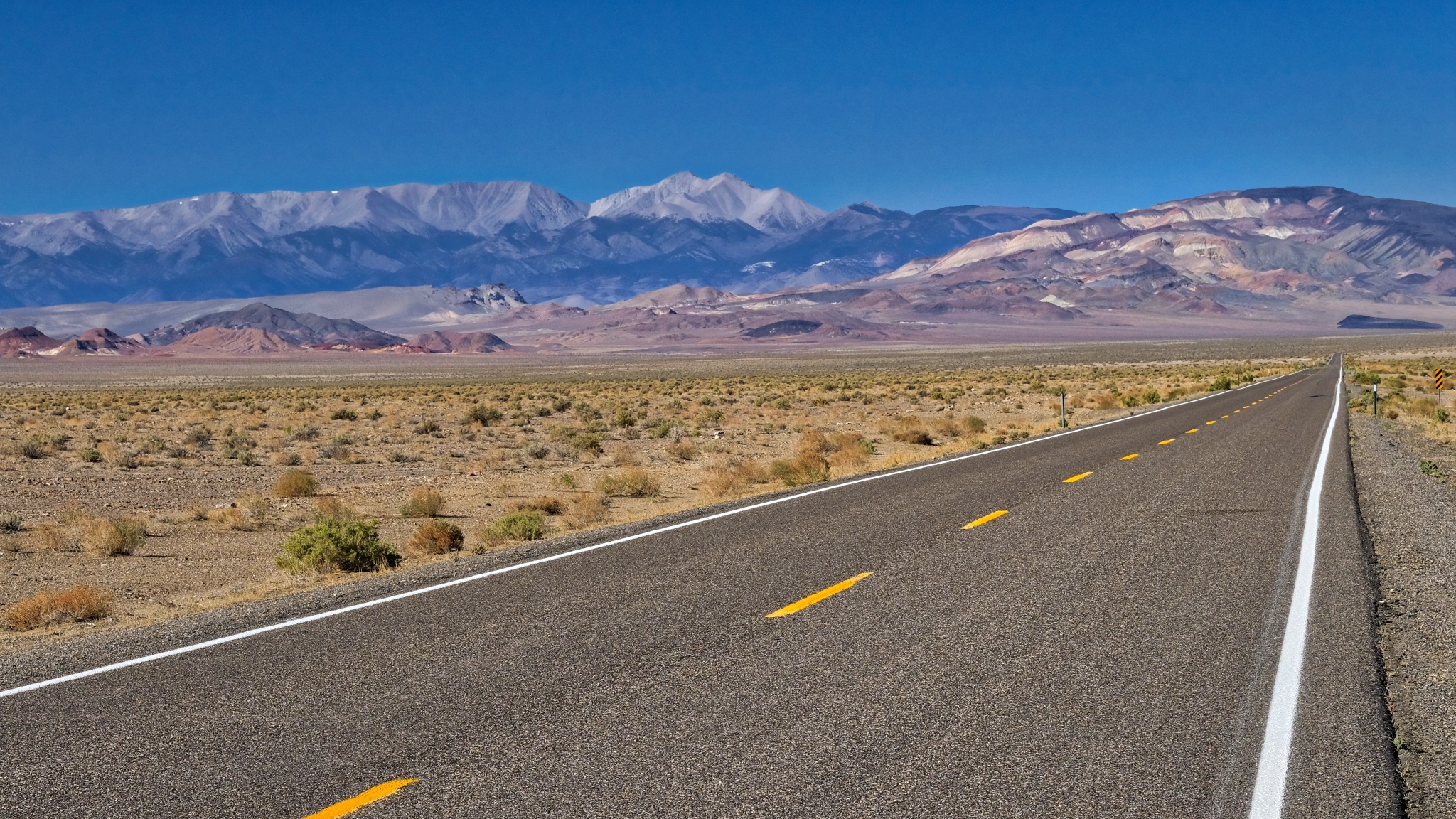
 Nevada Highway 49 swerves across several alkaloid flats on the way out to the Black Rock Desert.
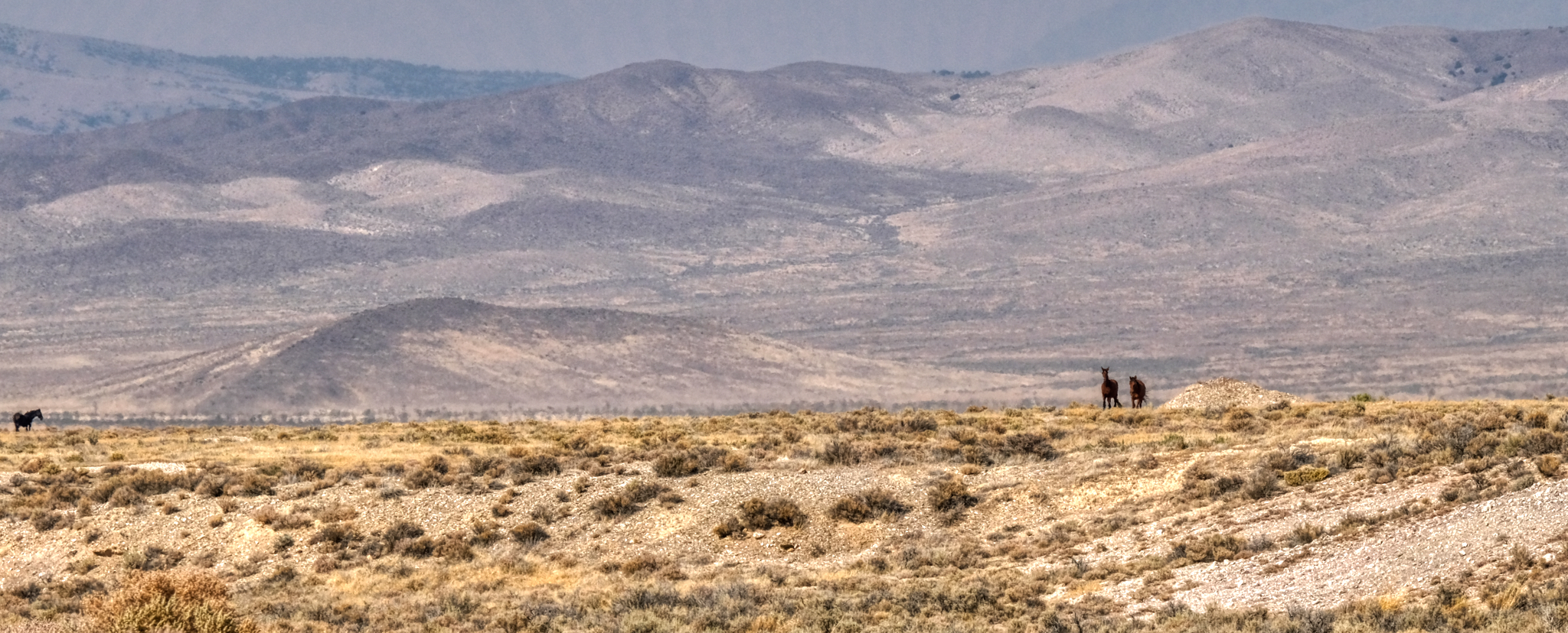 Wild country . . . with wild horses still running free.
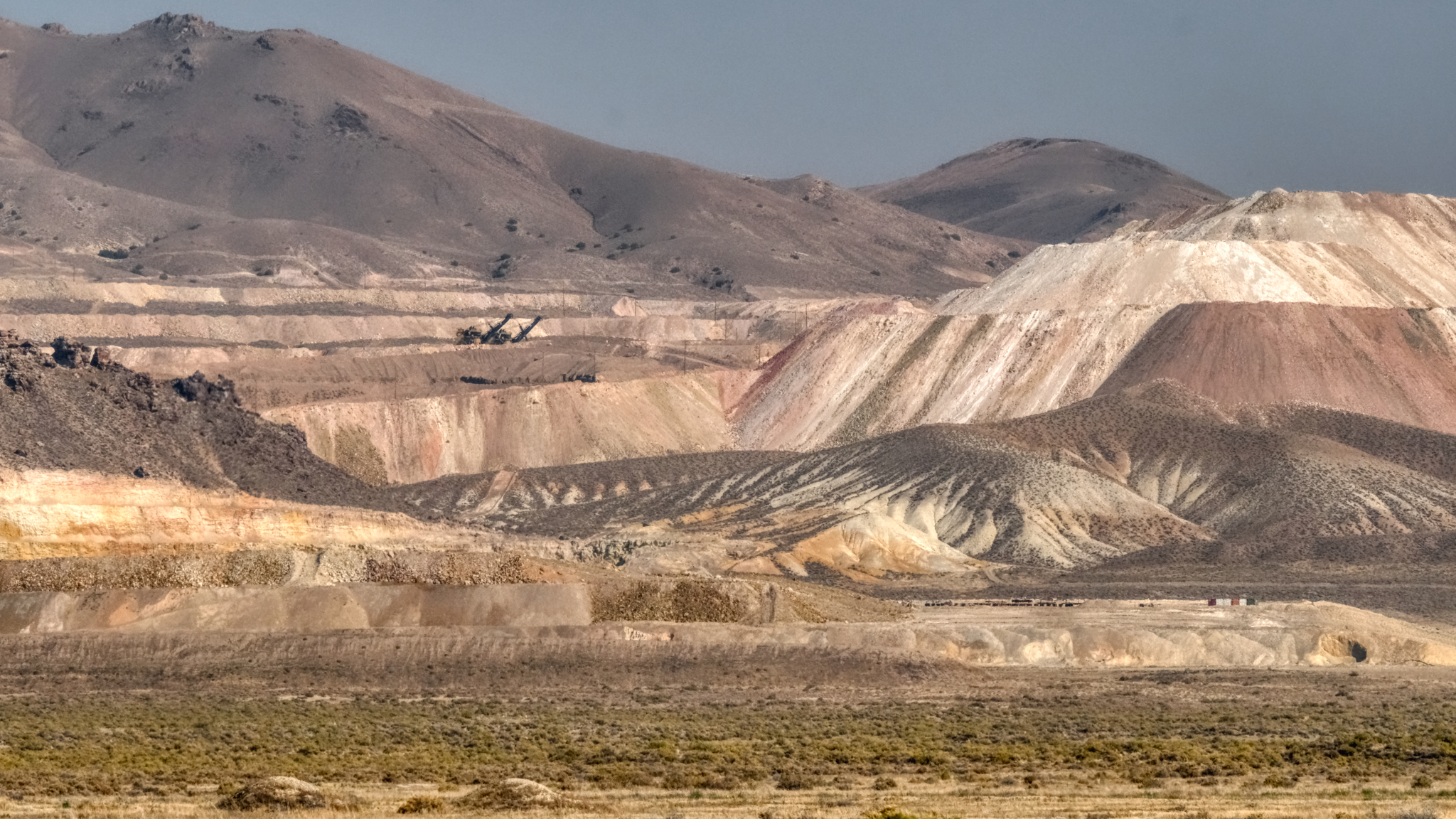 The Allied Nevada Hycroft Gold Mine is along Nevada Highway 49 . . . a very large mining operation.
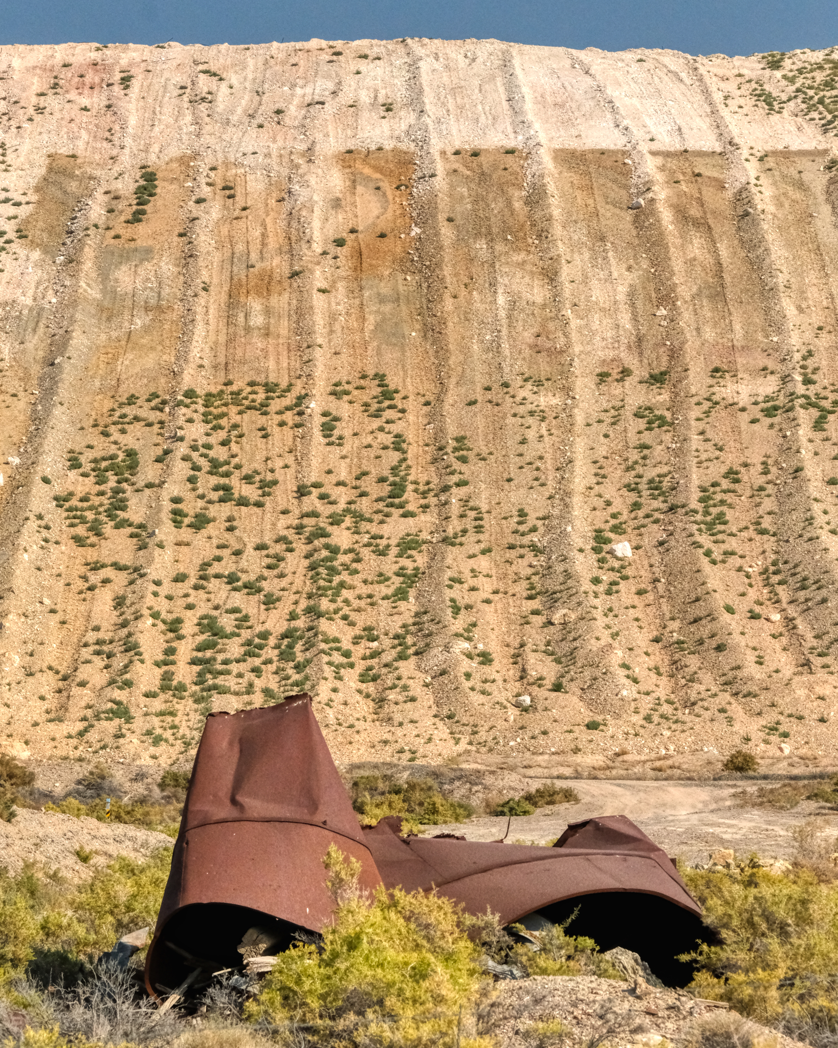 The gold mine moved a lot of dirt around . . . they stripped the face off of quite a few hills to be able to see the color of the rock and sand beneath. Huge scars.
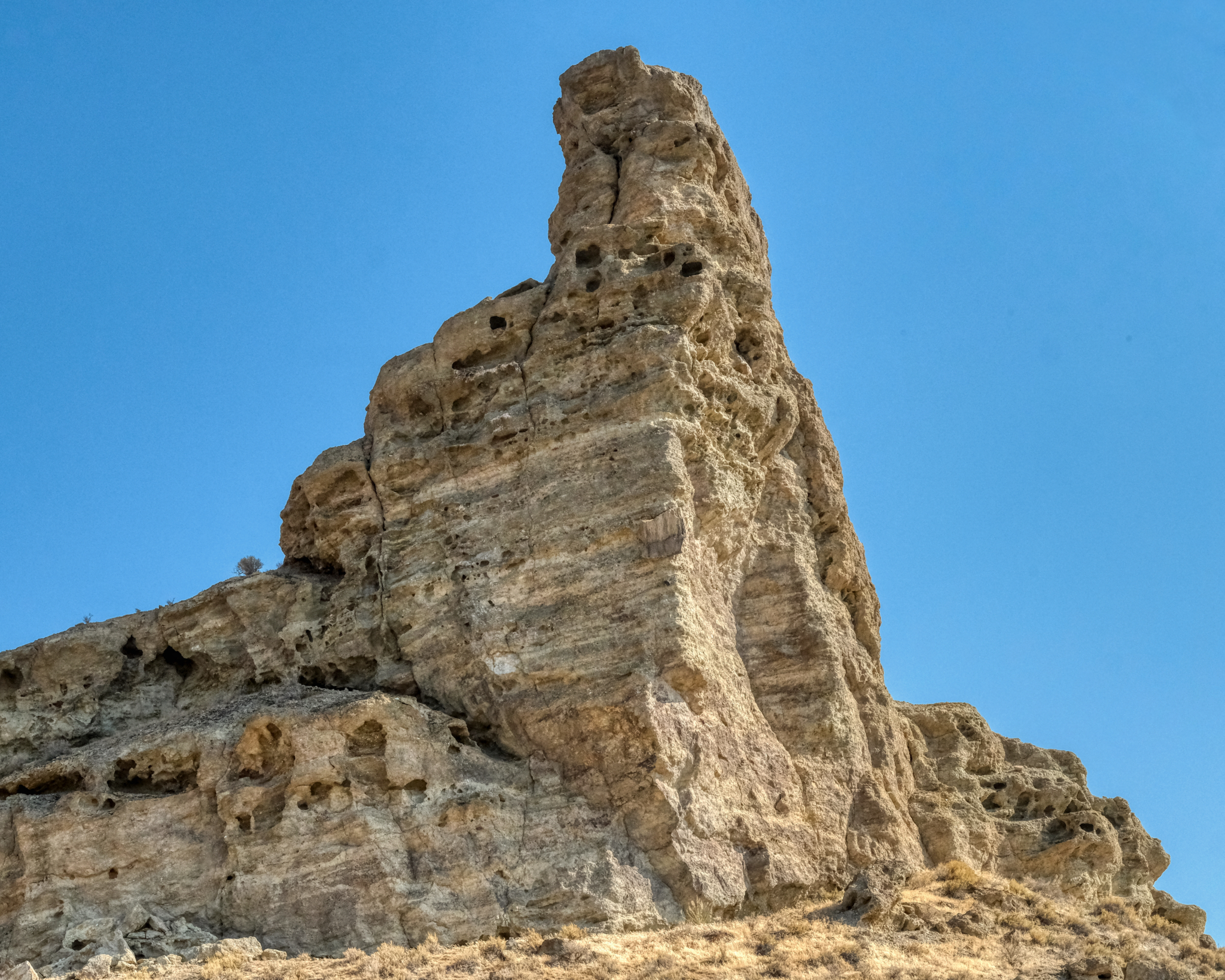
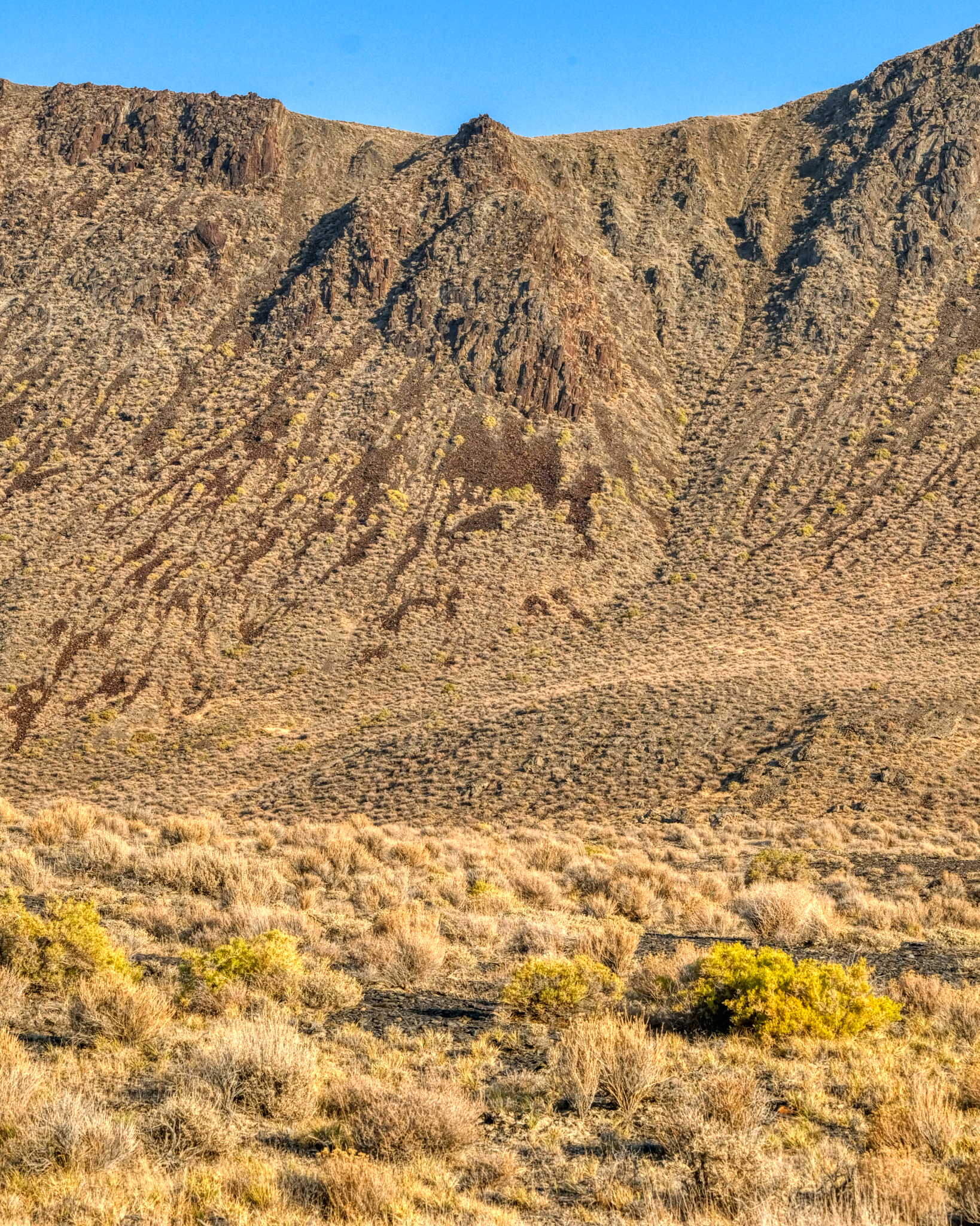
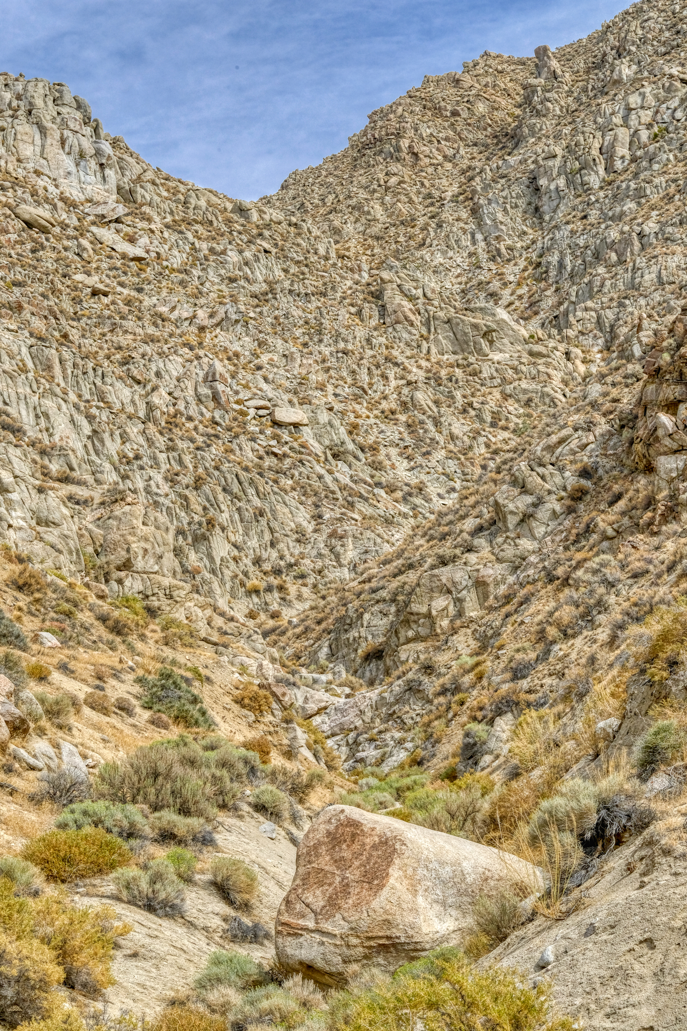
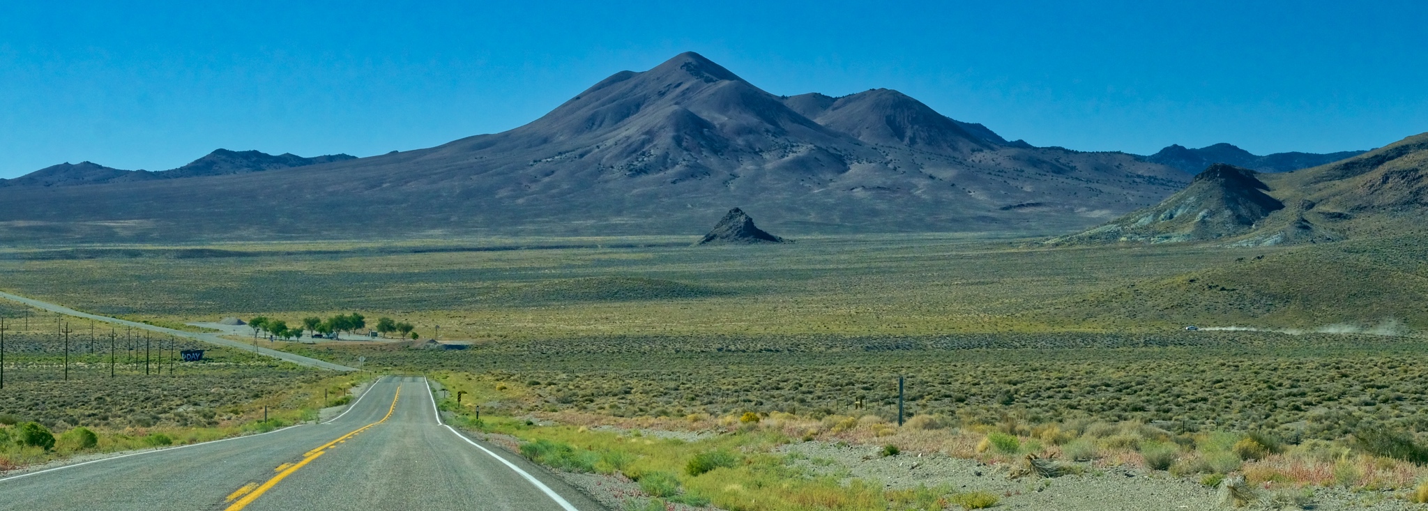
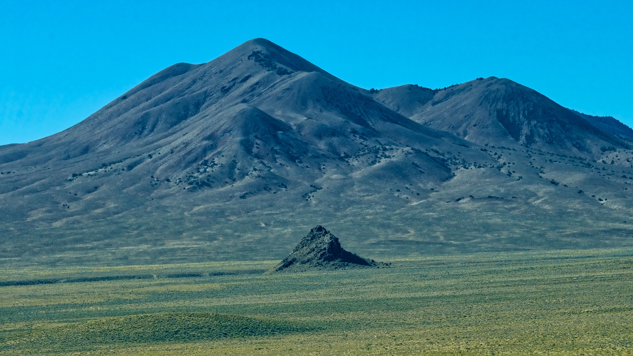
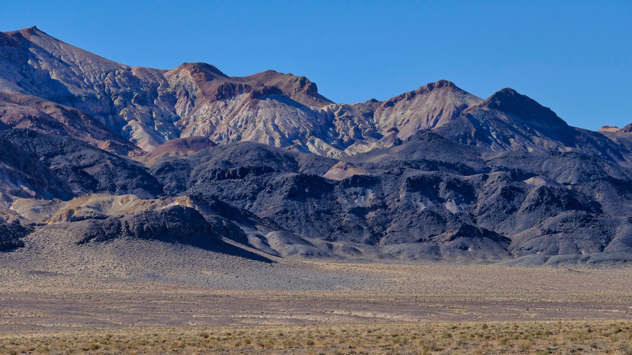
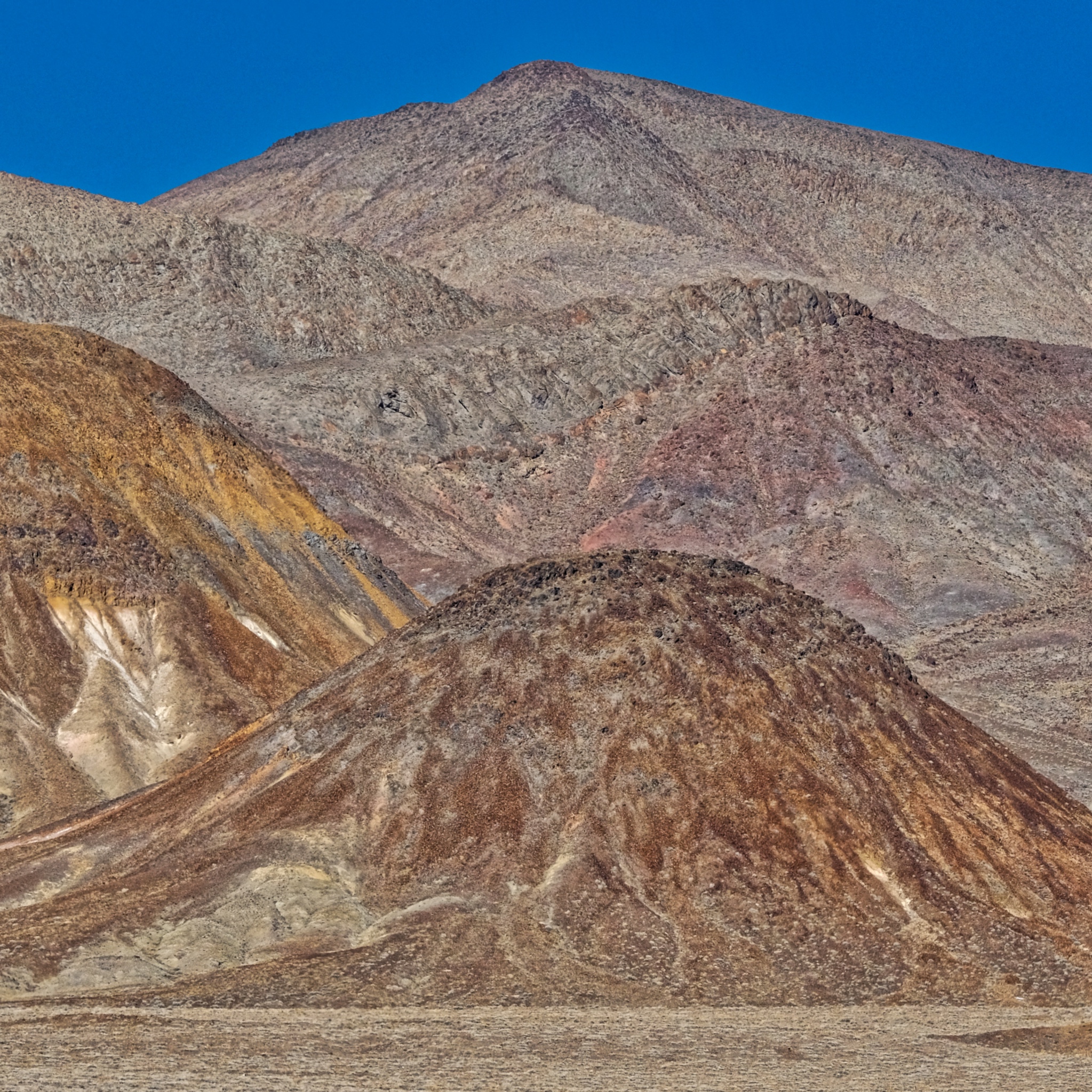
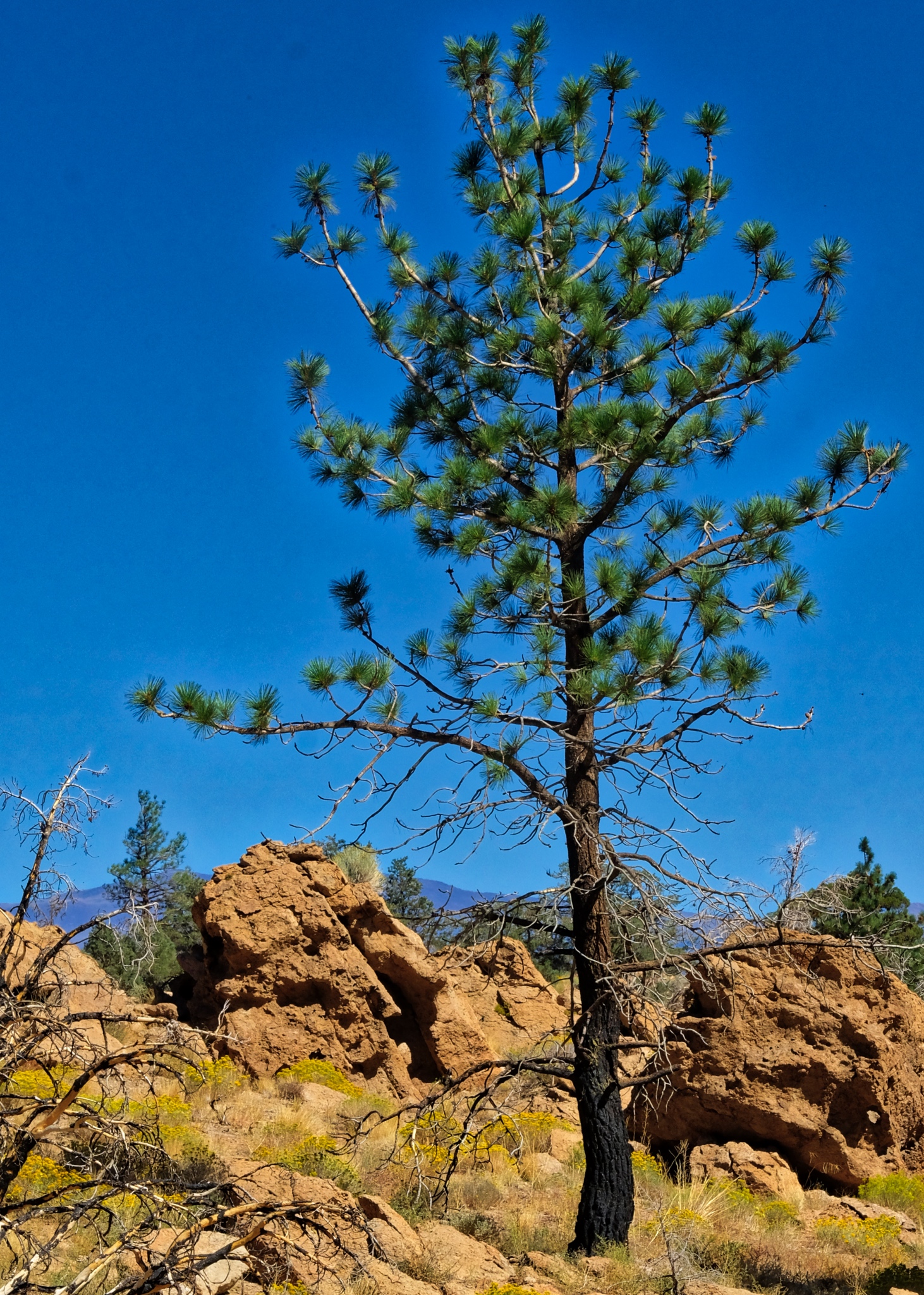
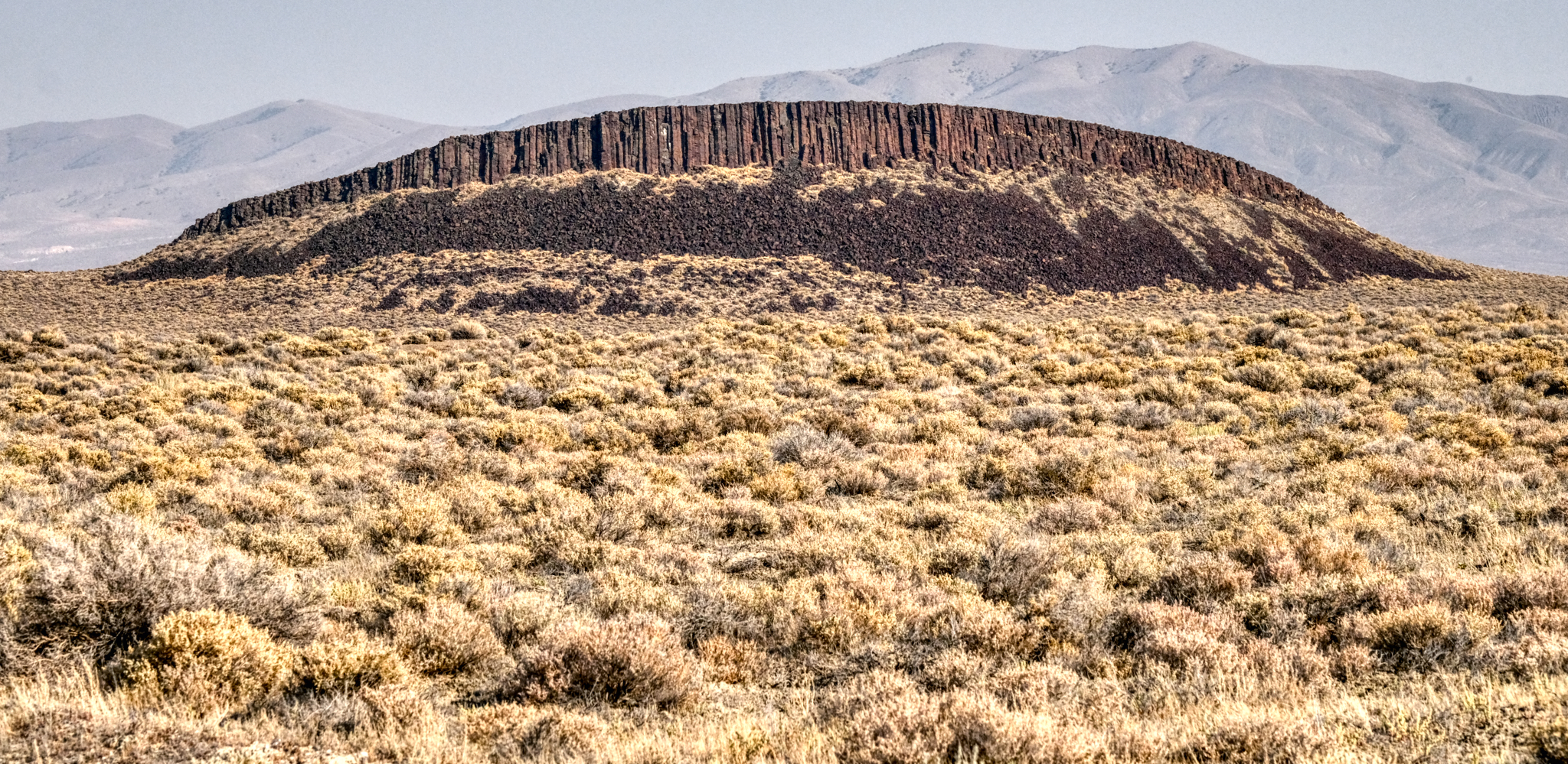 Highway 49 passes through some truly amazing desert. This volcanic spine was marvelous . . .
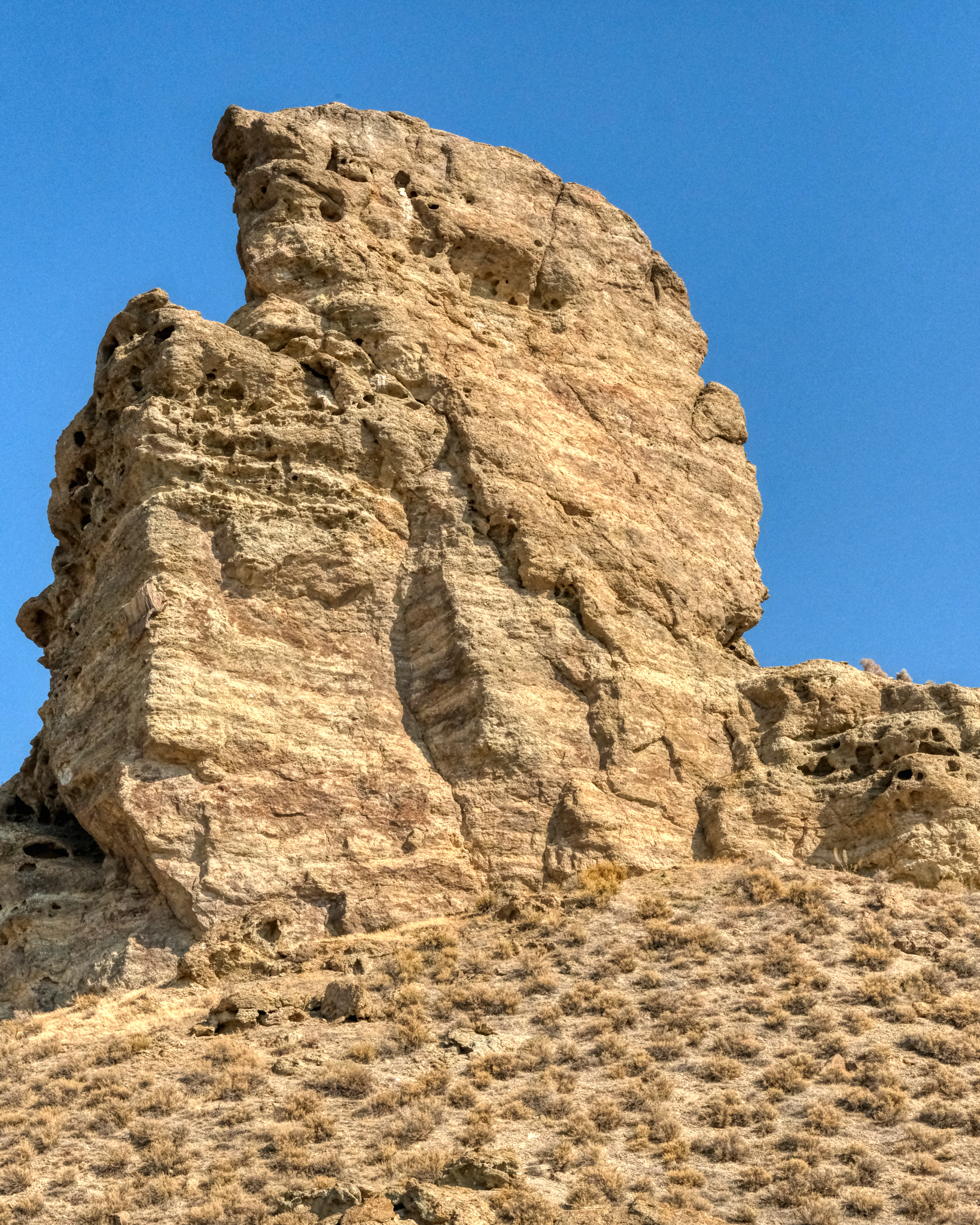
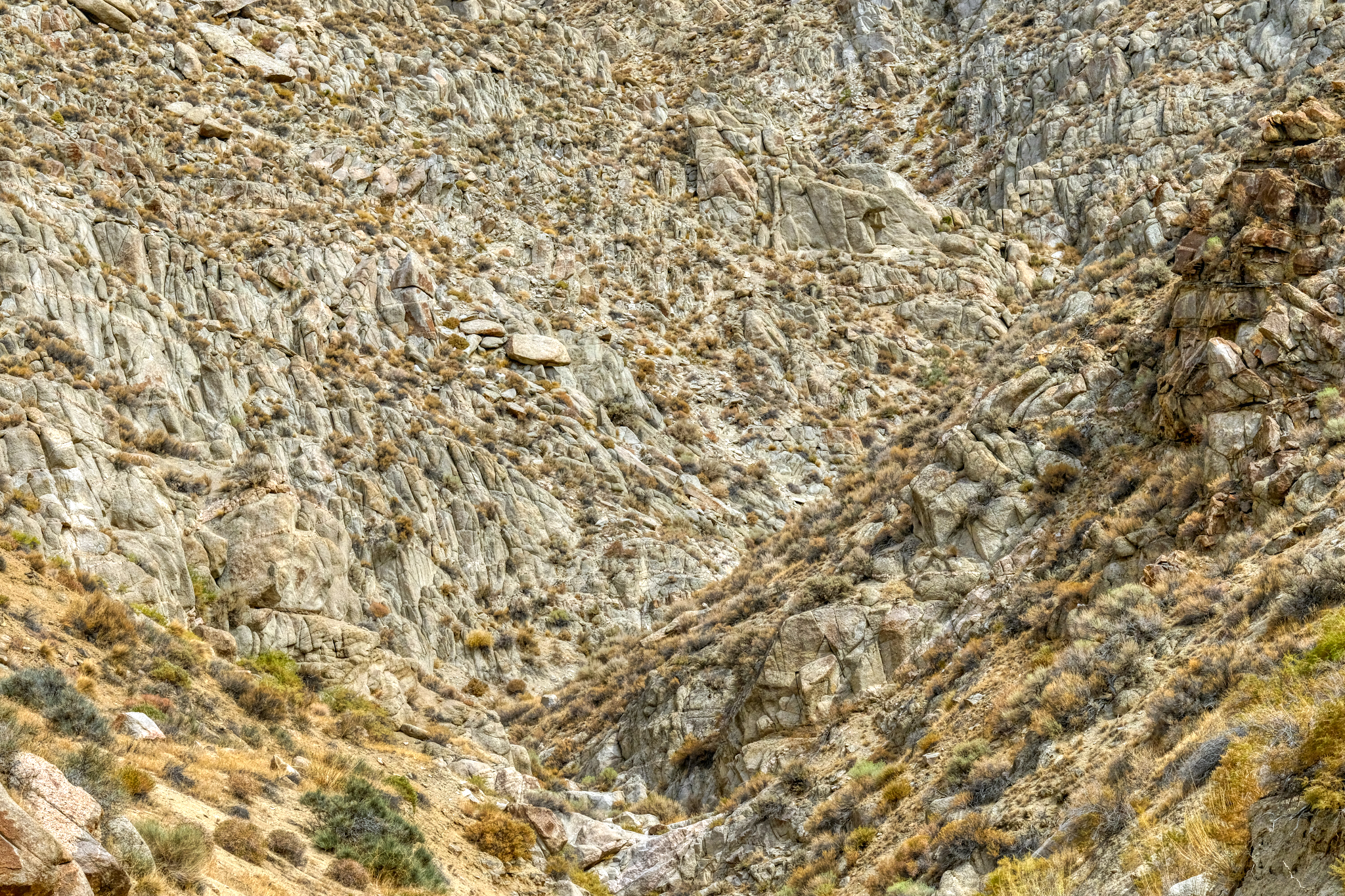
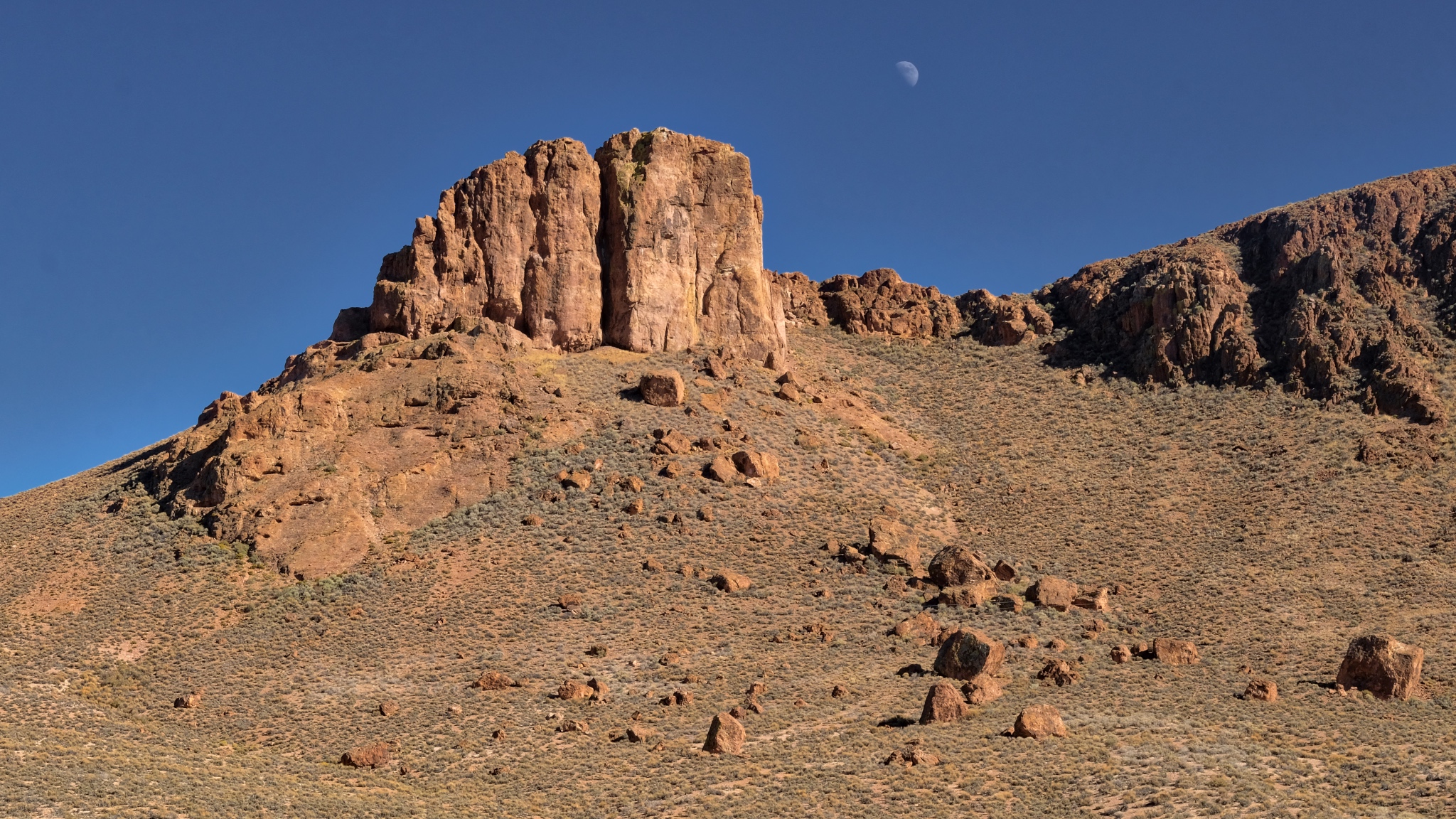
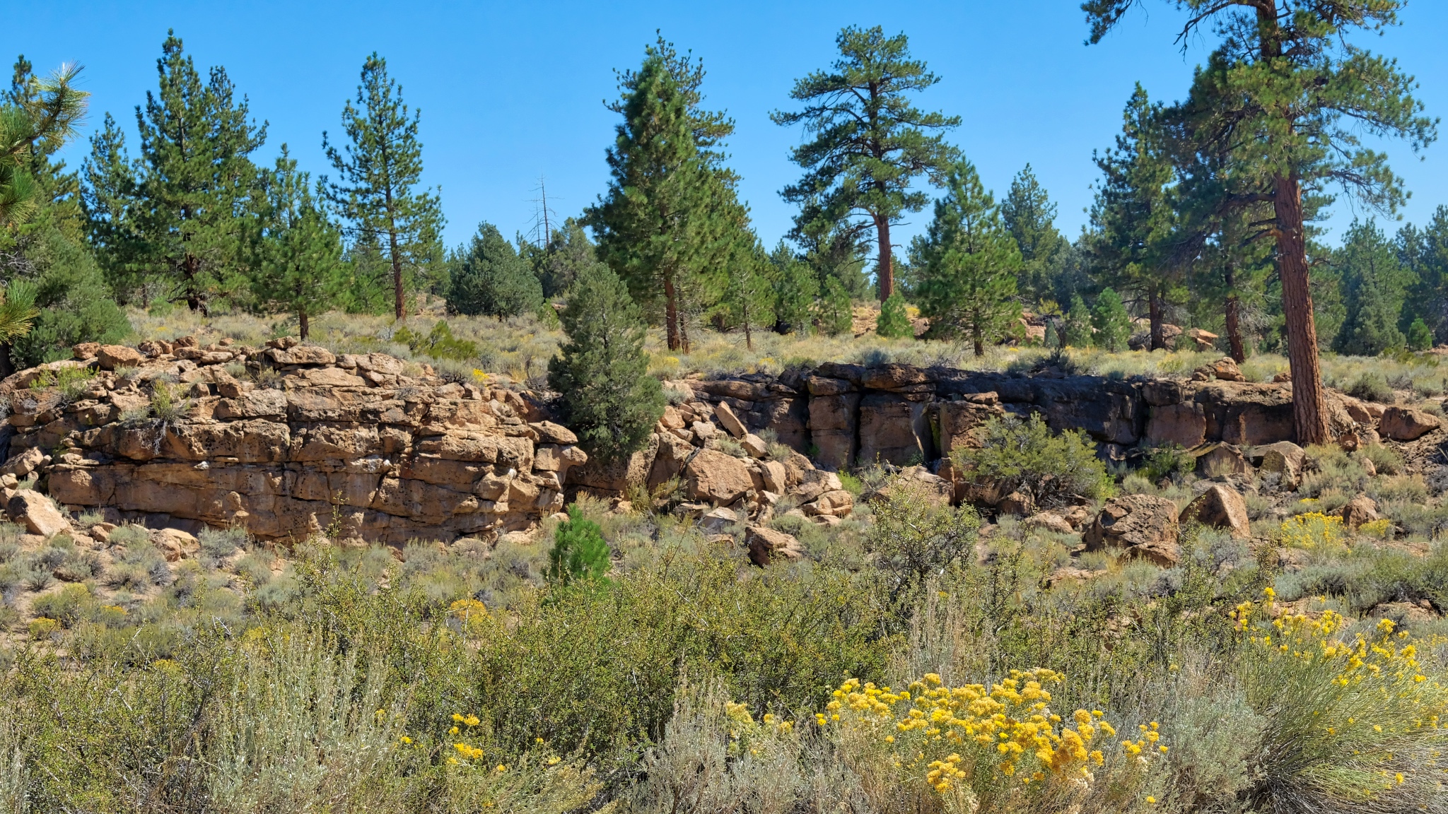
 Here and there along the road were rock outcroppings in fantastic shapes. Unfortunately, the sky was still full of smoke from the many wildfires out West that summer . . . making photography very difficult.
 The desert.
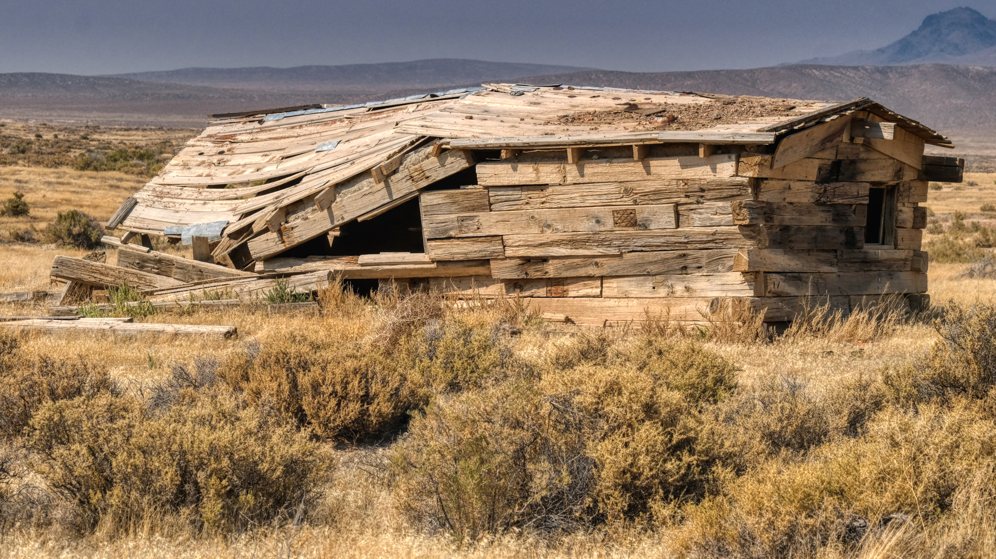
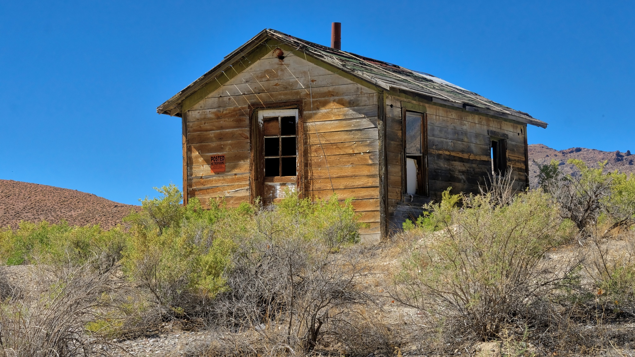
 Driving on these sand and gravel desert roads means you are always on the lookout for bumps and ditches . . . and occasionally scanning the horizon for something interesting . . . like an abandoned homestead. I spotted this one off in the distance and drove out to in on a two track trail. I always respect "Private Property" and "Keep Out" signs . . . but this place had no such signage. I went in.
 What was life like living out in this remote place?
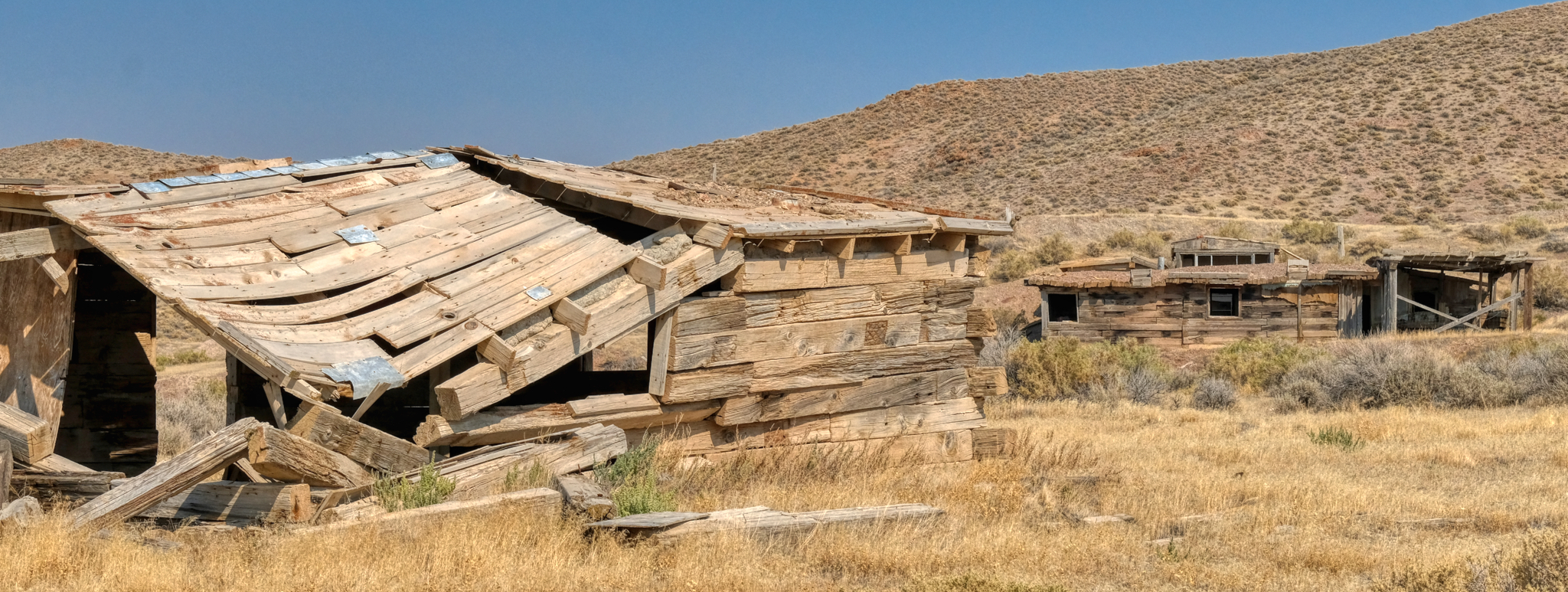 These old abandoned desert homesteads offer great photo opportunities.
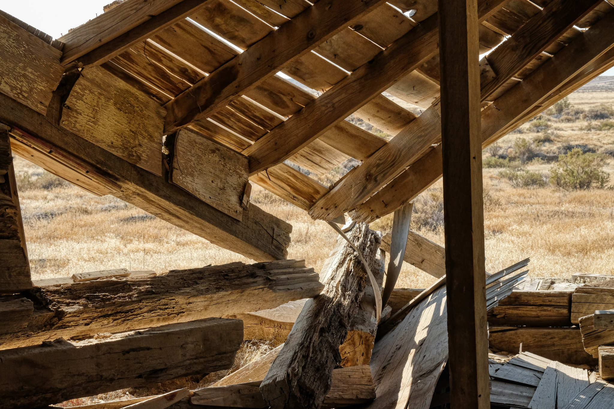
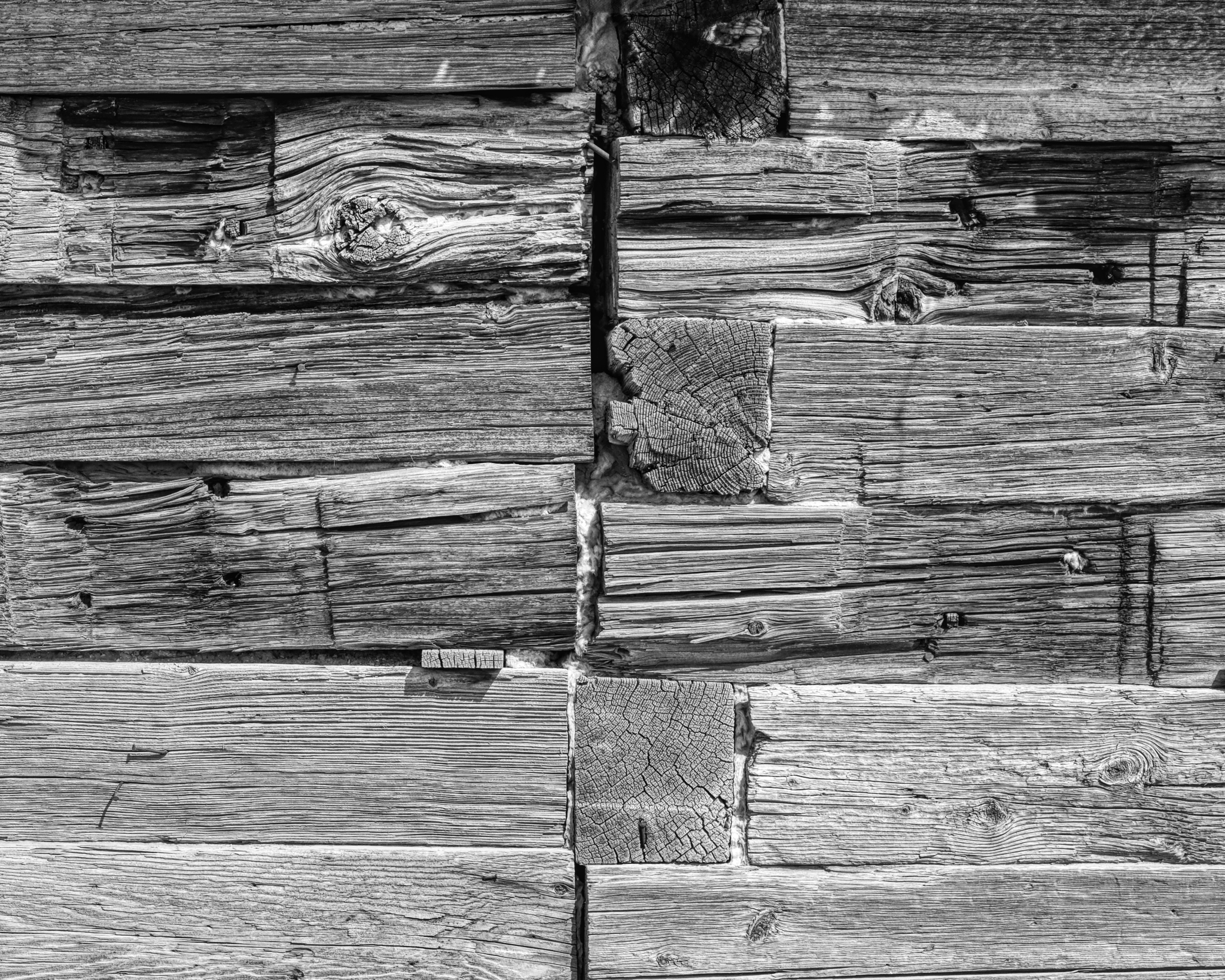
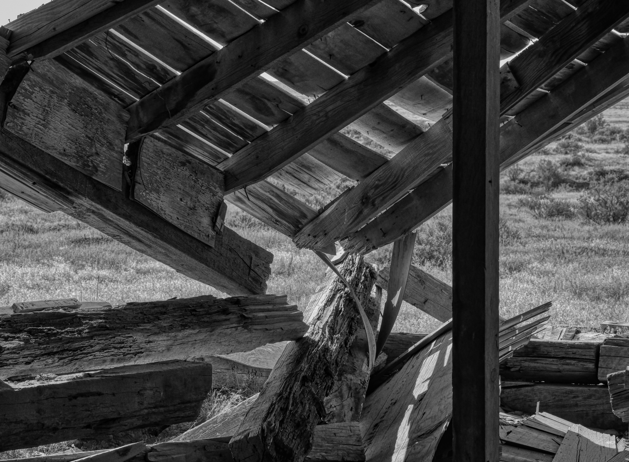
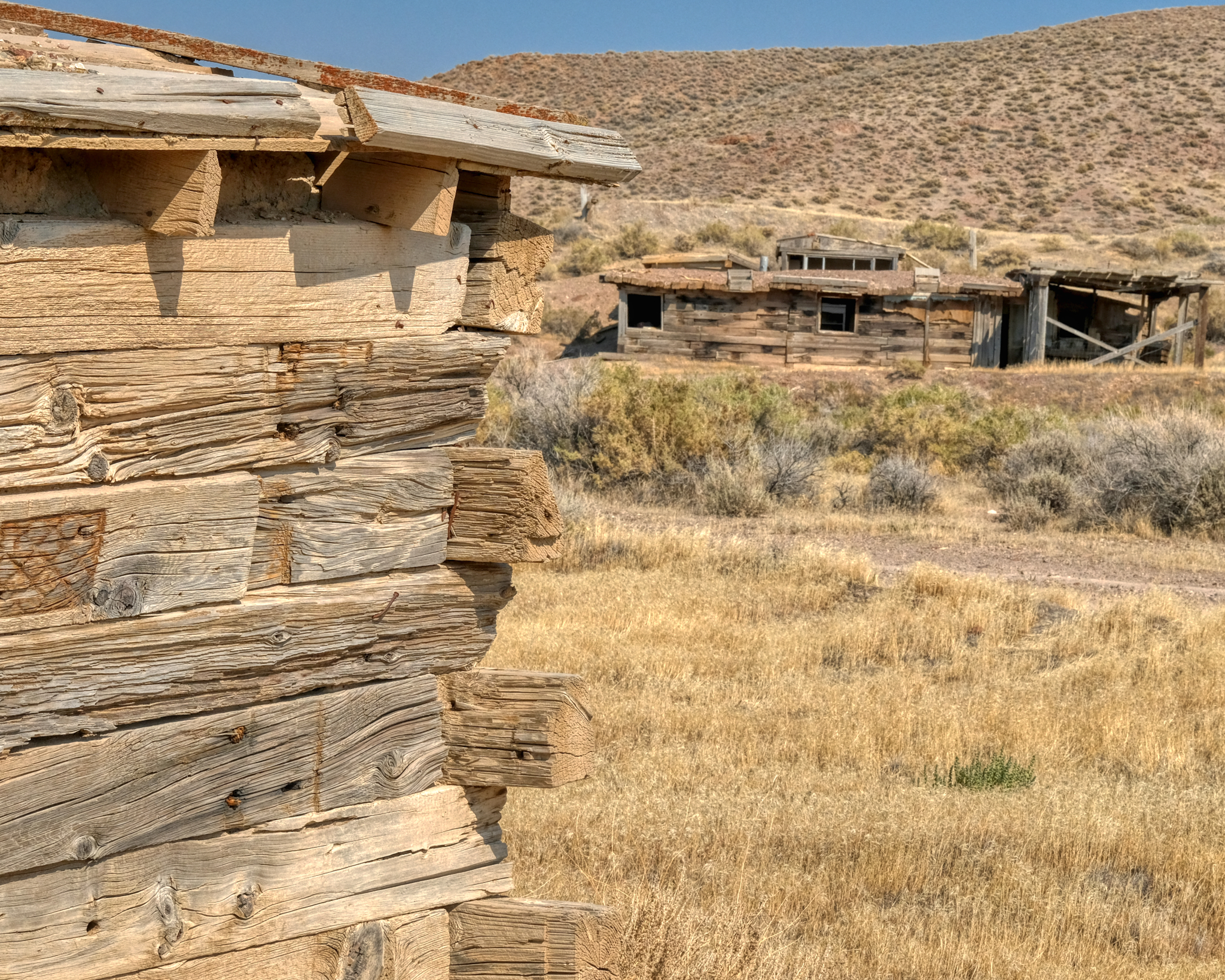 They used some very large wooden beams to construct these buildings. Looks like something salvaged out of old mines.
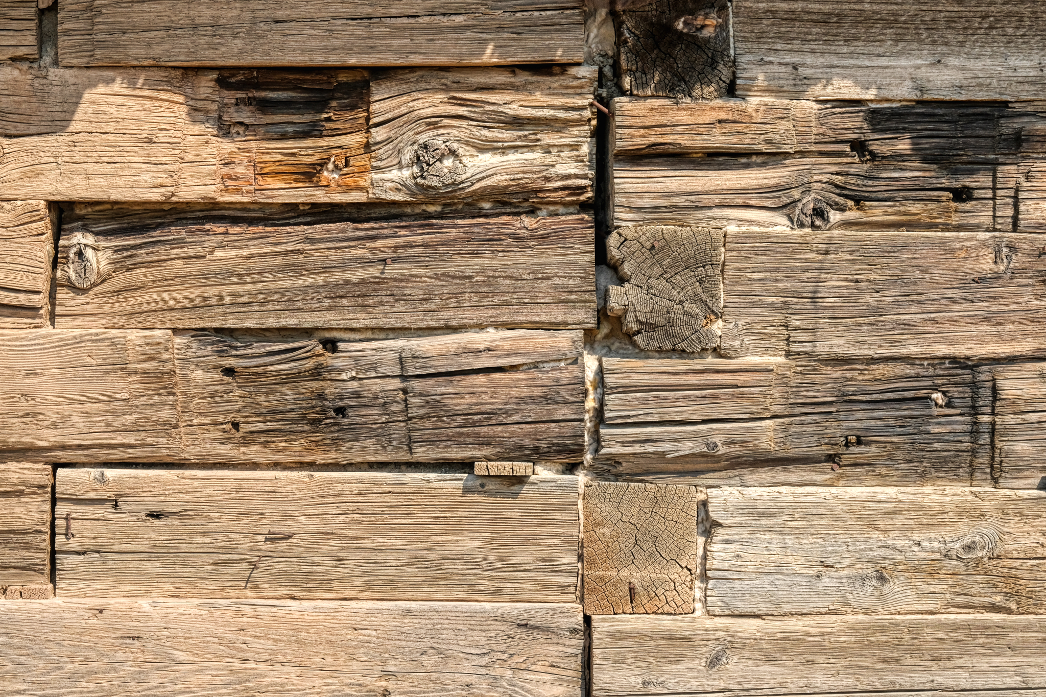
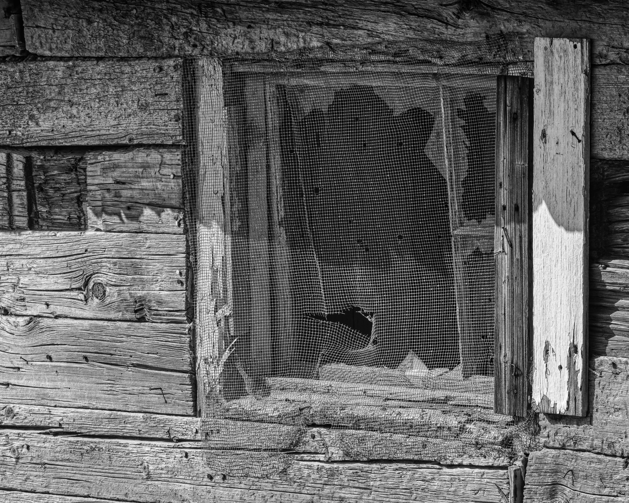
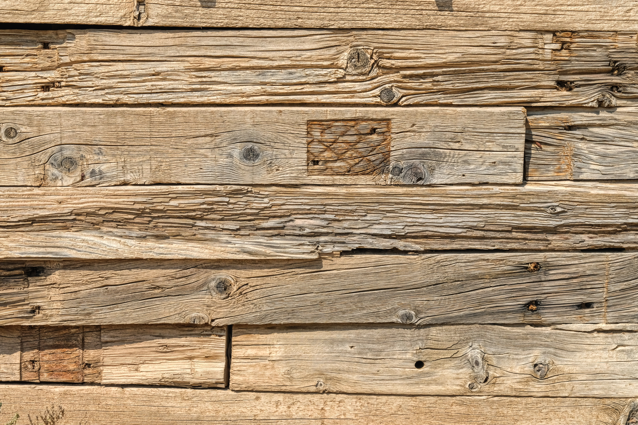 The textures! WOW! One of my favorite photographic subjects: weathered wood.
 I spent quite a long time exploring this visually interesting place.
 Stunning arrangements everywhere . . . just waiting for printing and framing.
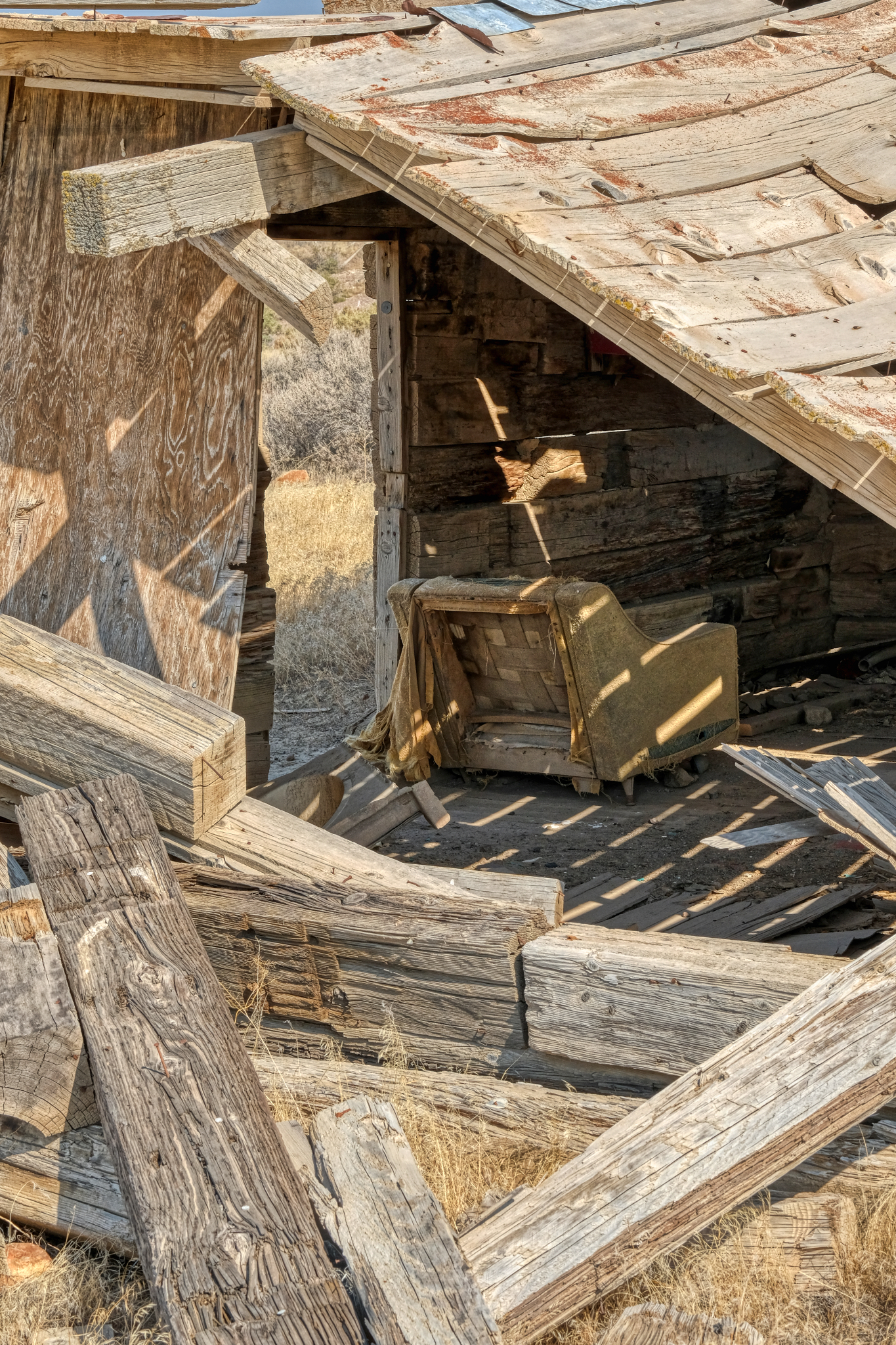
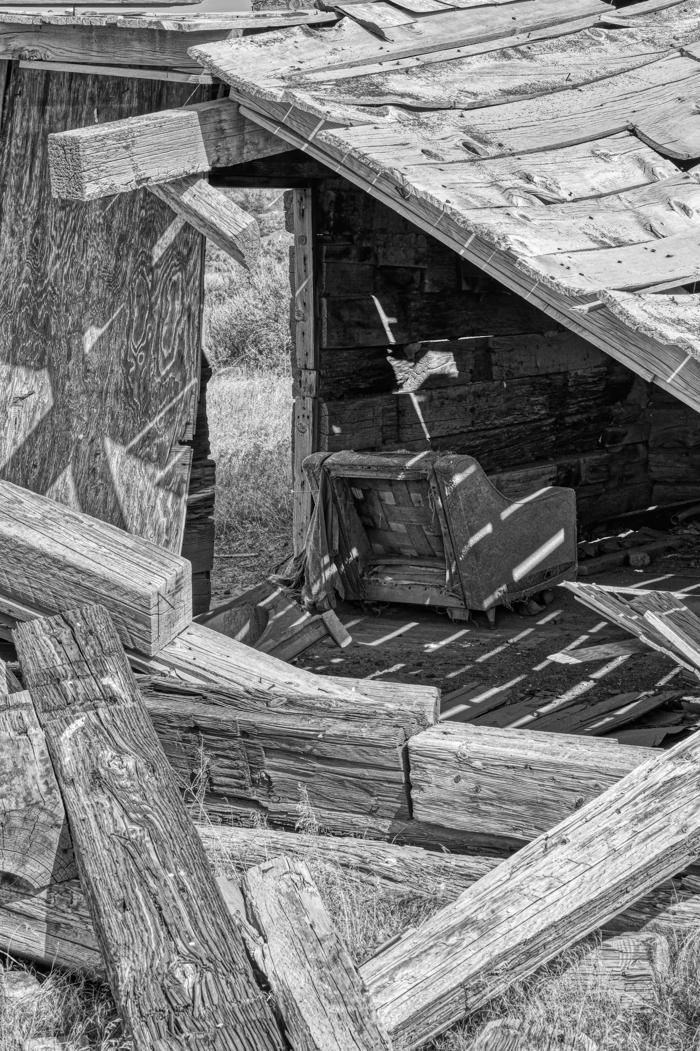
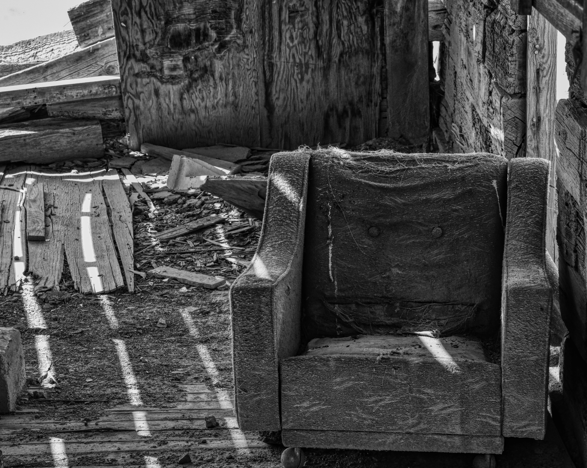
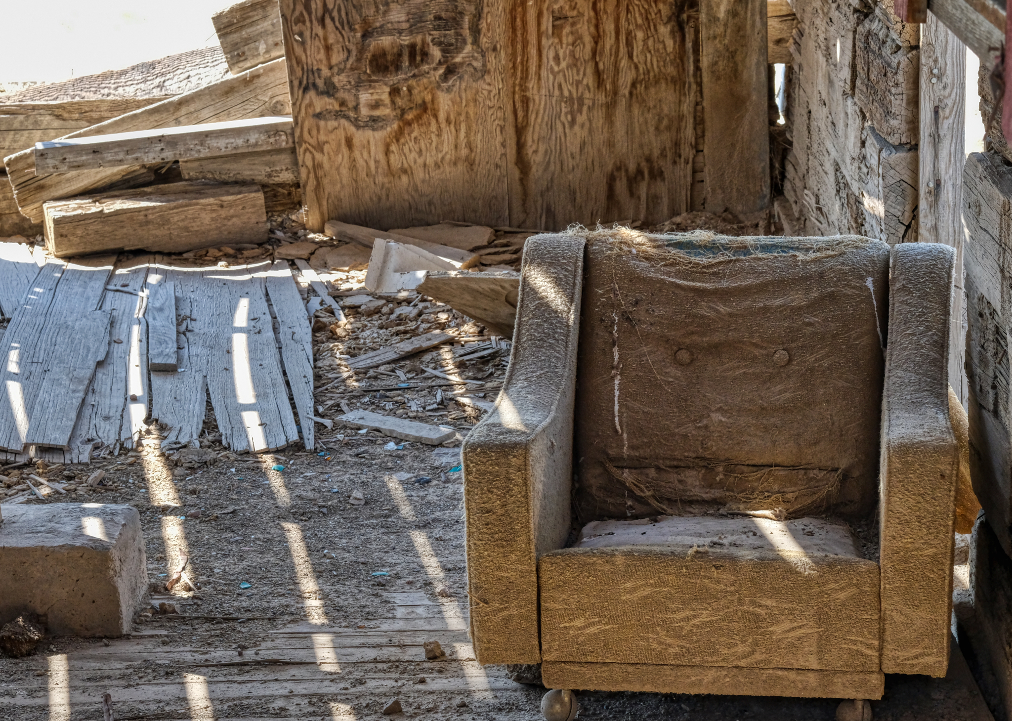 I guess they decided NOT to bring the good chair along with them when they left.
 Lovely light, shadow, and shape.
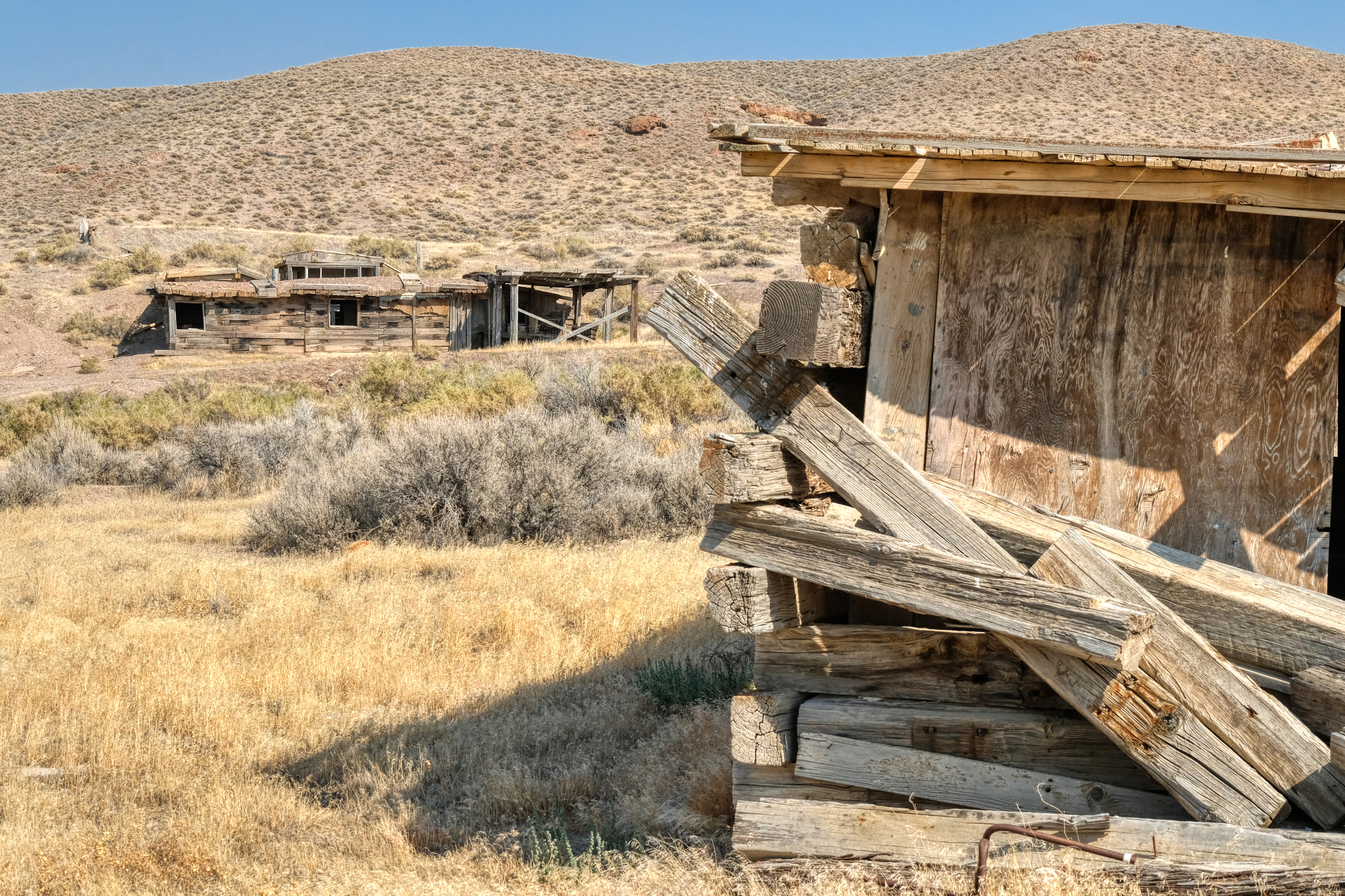 There were several houses on this site. I imagined that there must have been a place name . . . a "town" name at one time, but I could find no mention of this site on any online maps I could find.
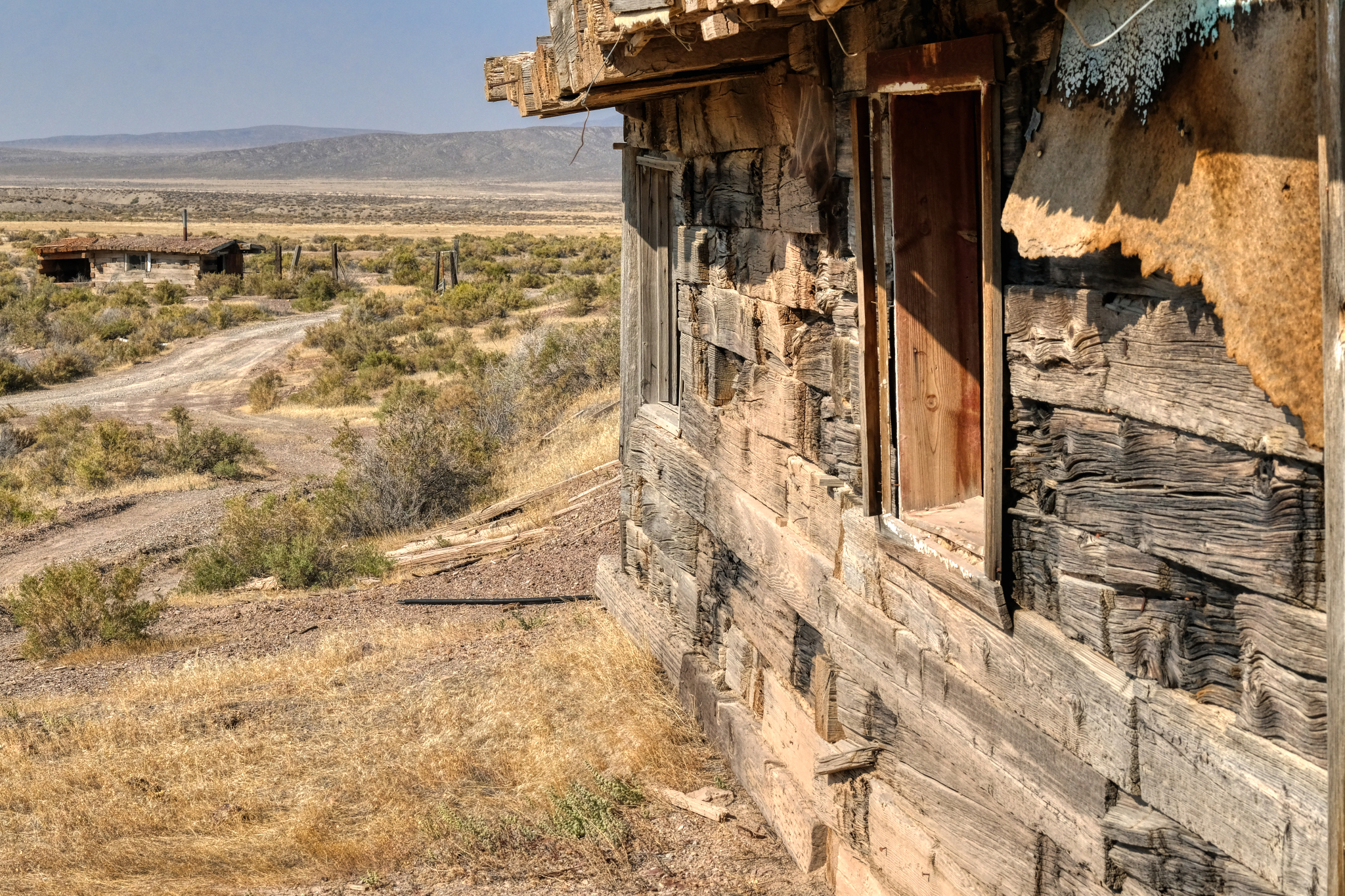
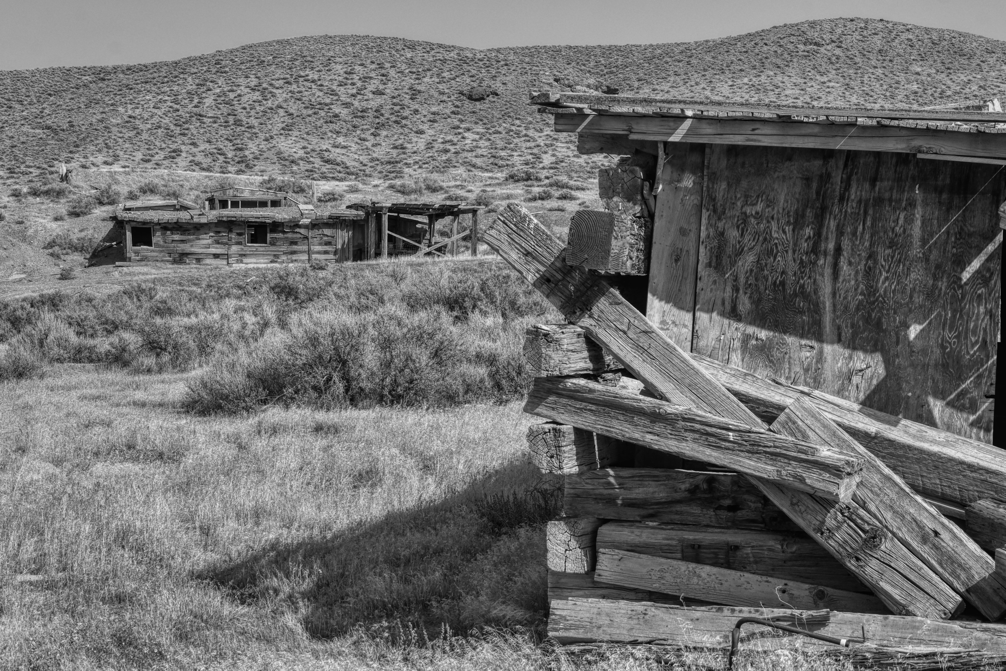
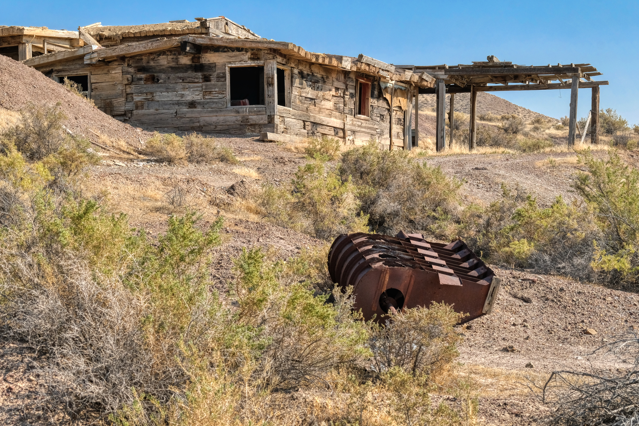 This house was larger than the rest of the cabins. There was a mine opening on the hill above.
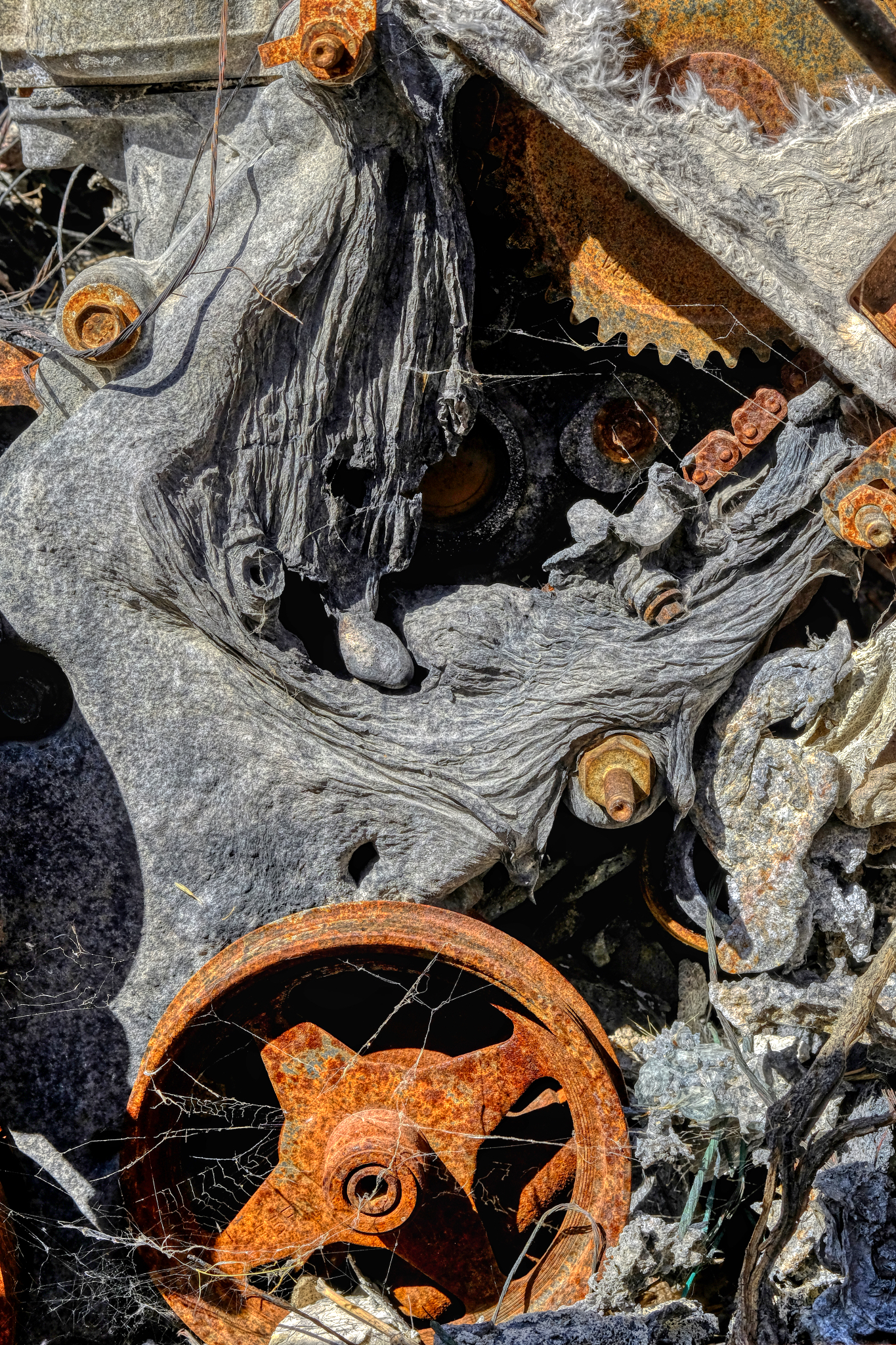
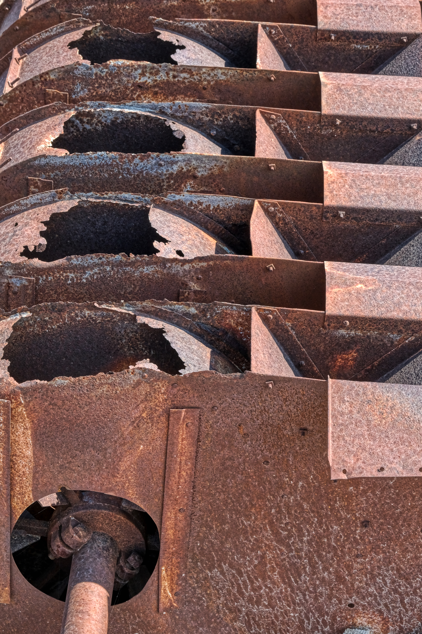 A piece of rusting mining machinery. I do not know what this could have been used for . . . sorting and separating something, I suppose.
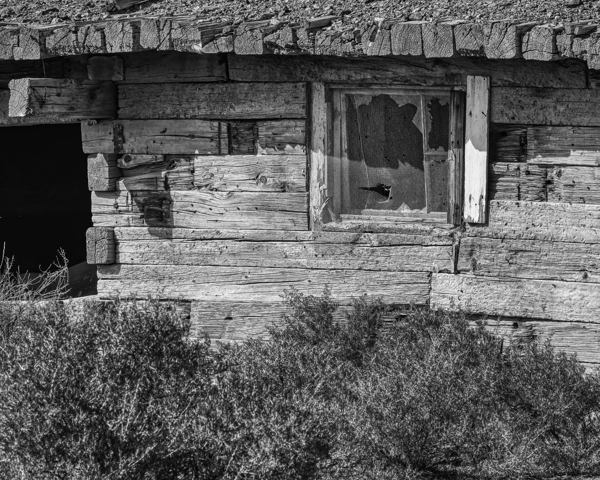
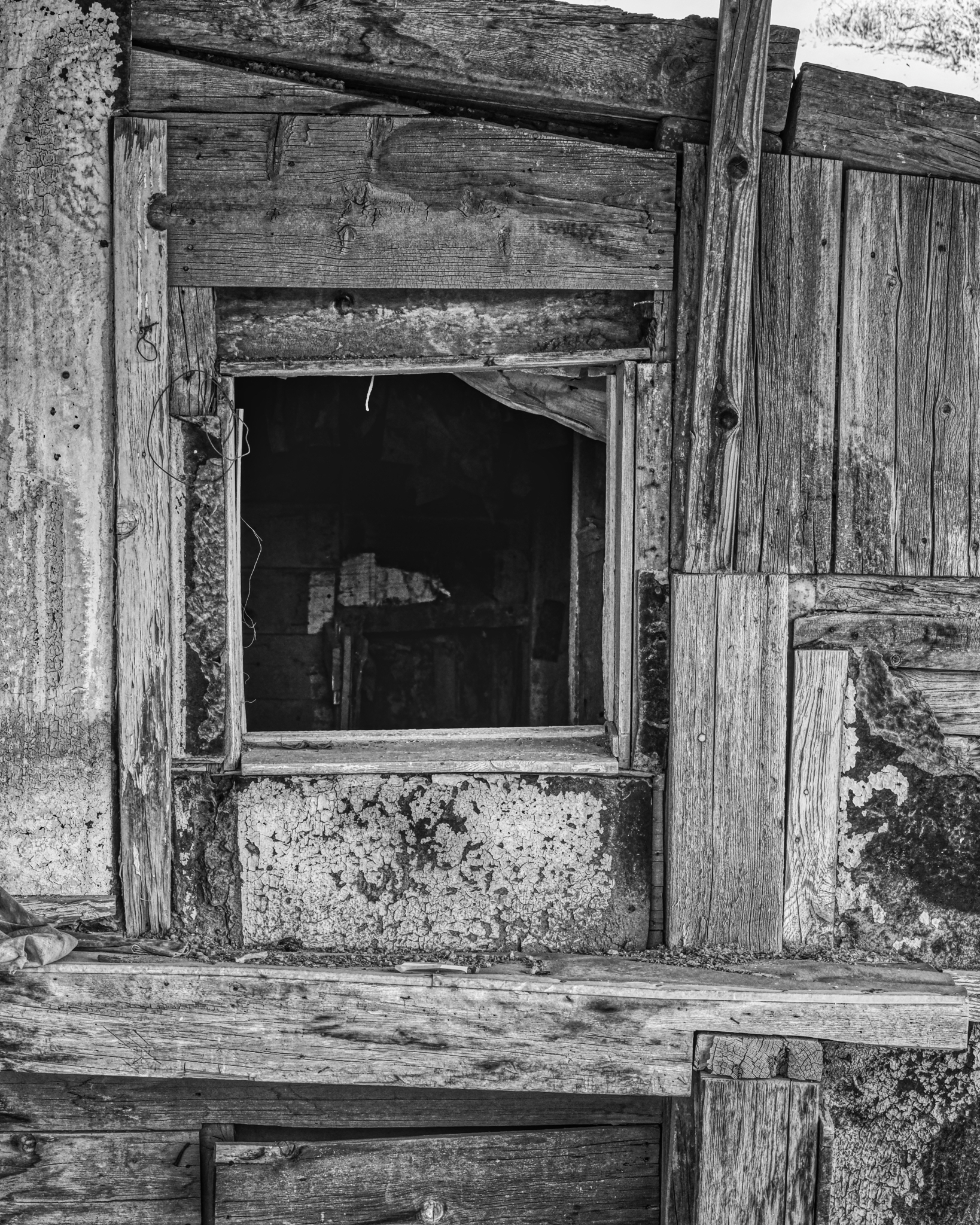
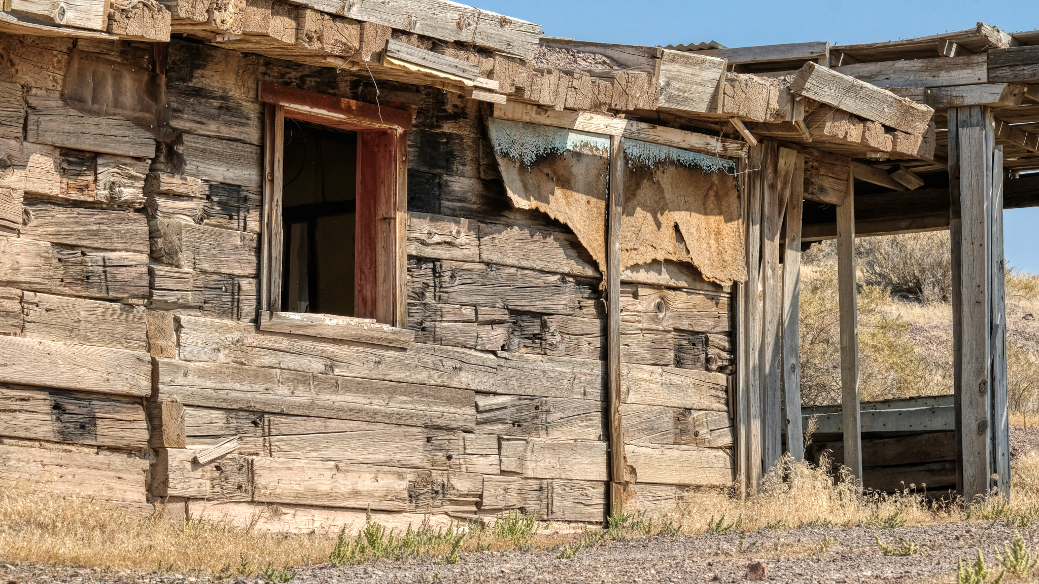 The 'Big House' . . . looks like it had fibreboard and tarpaper covering at one time.
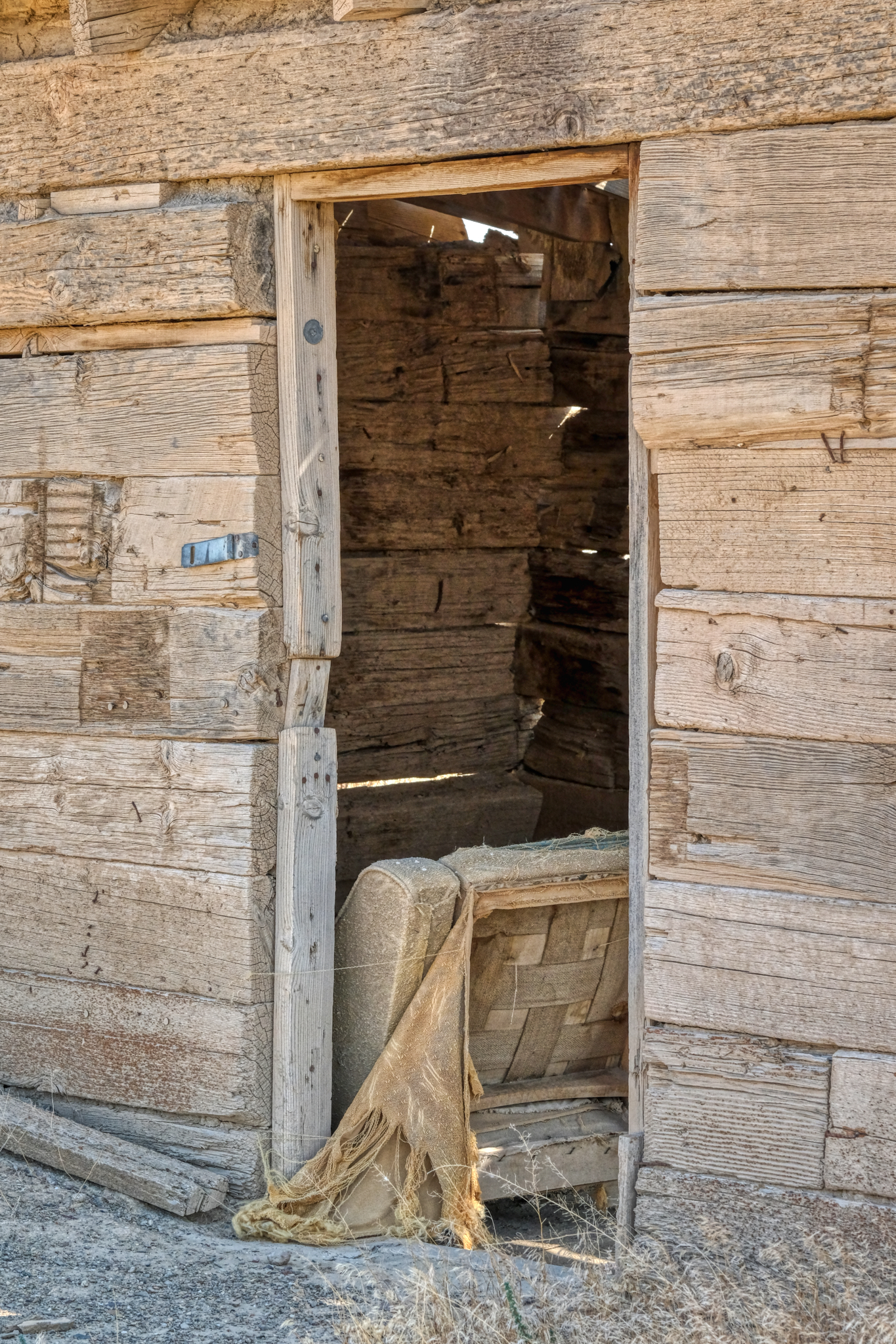
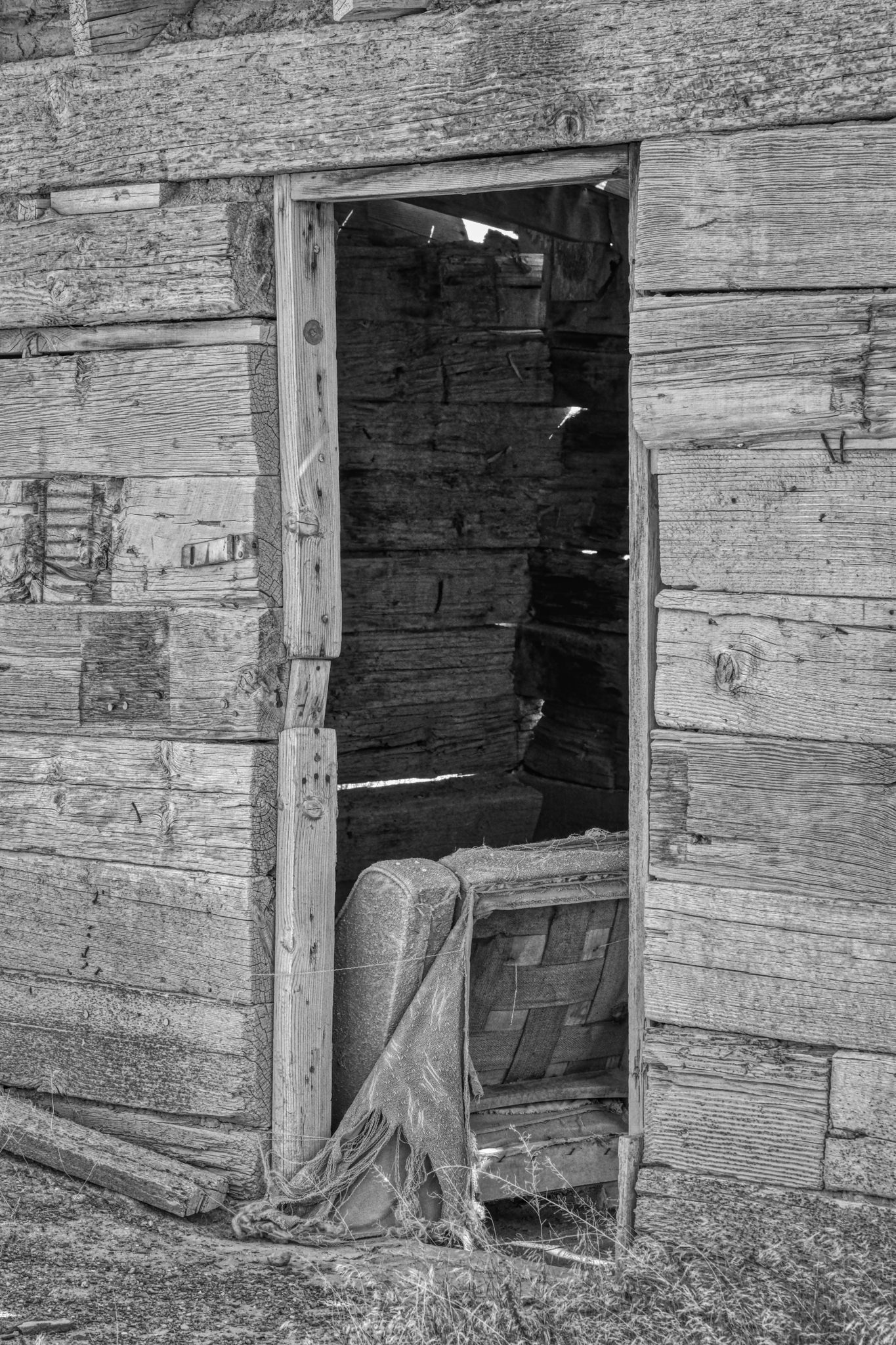
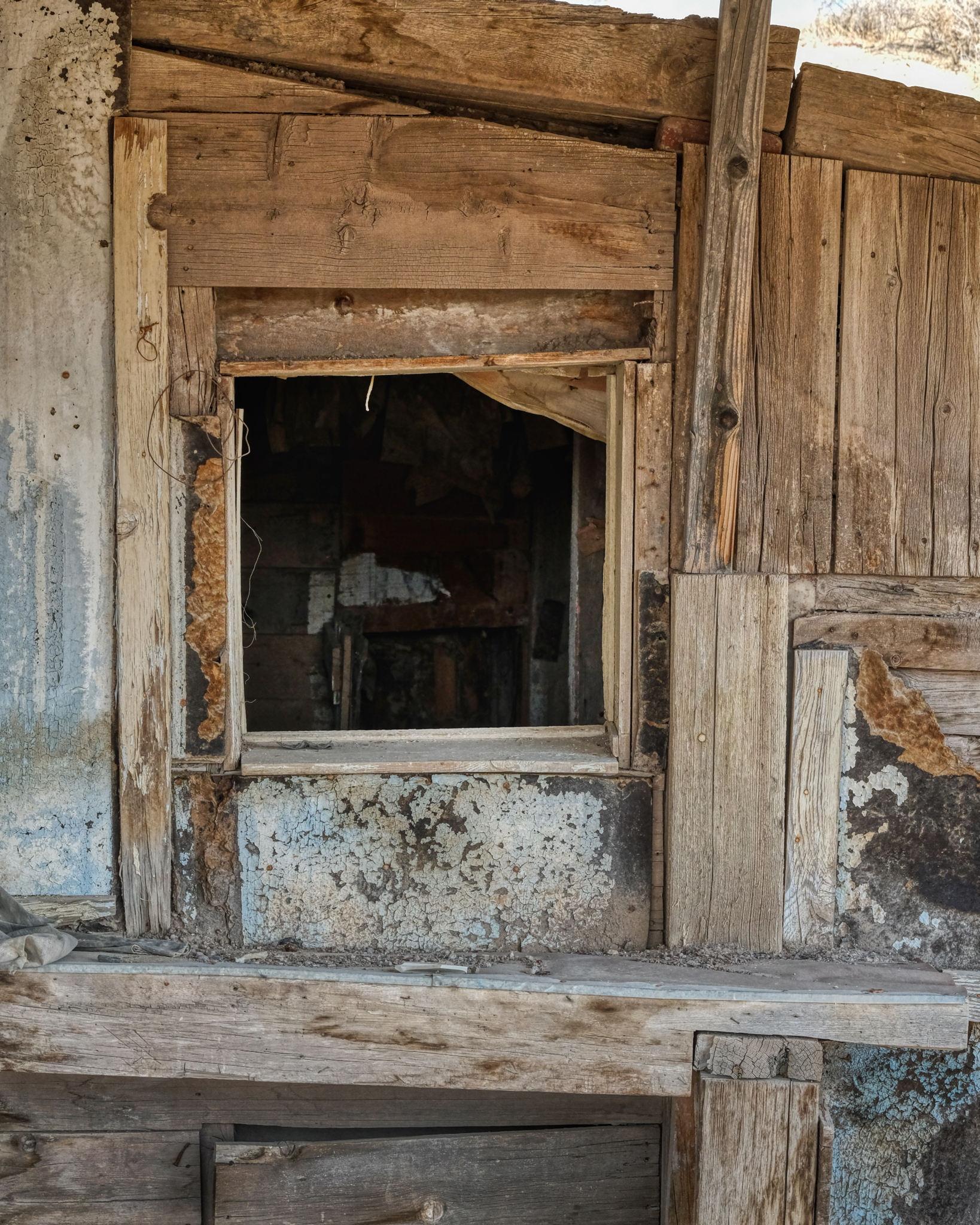 I poked my nose into the Big House . . . .
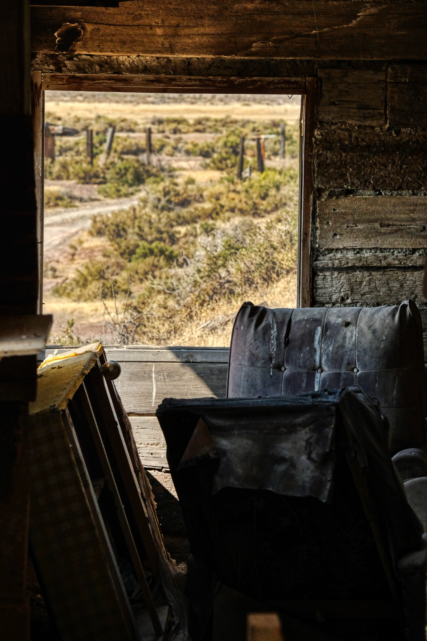 . . . and the view from the inside of the 'main house'. It was a mess . . . perhaps whoever had lived here left in a hurry . . . .
 I walked down the hill to another abandoned old wood cabin.
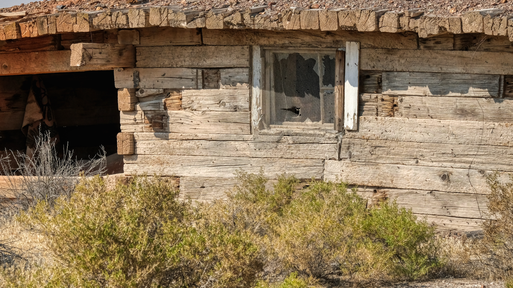
 Another house made of these very large wooden timber beams.
 Fantastic old, dry timbers . . . the textures and patterns!
 A picture tells a story . . .
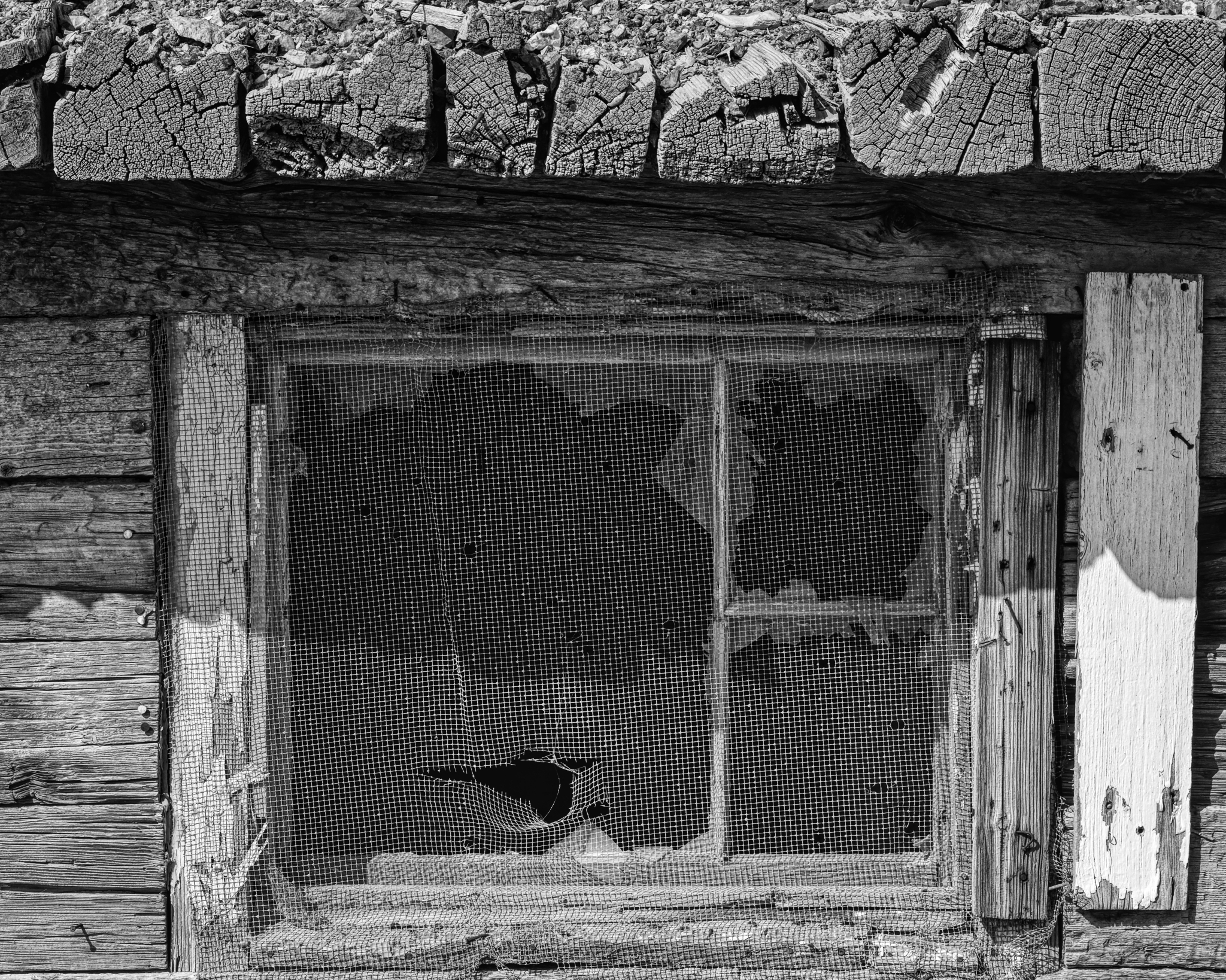
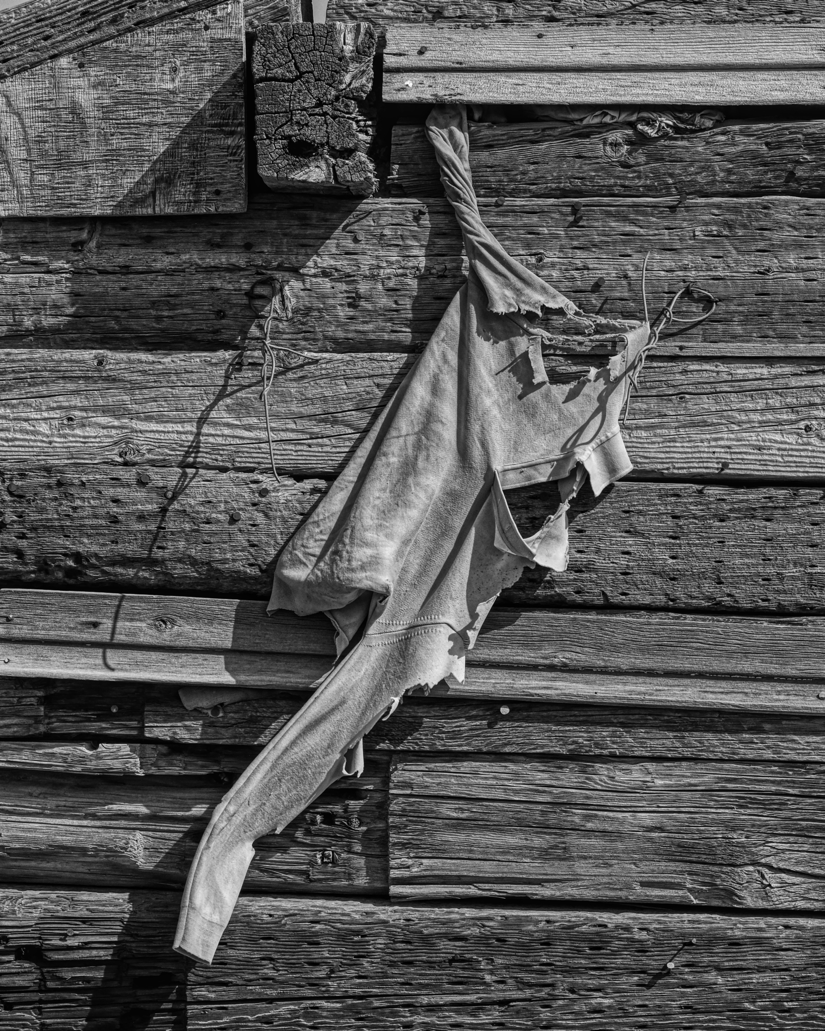
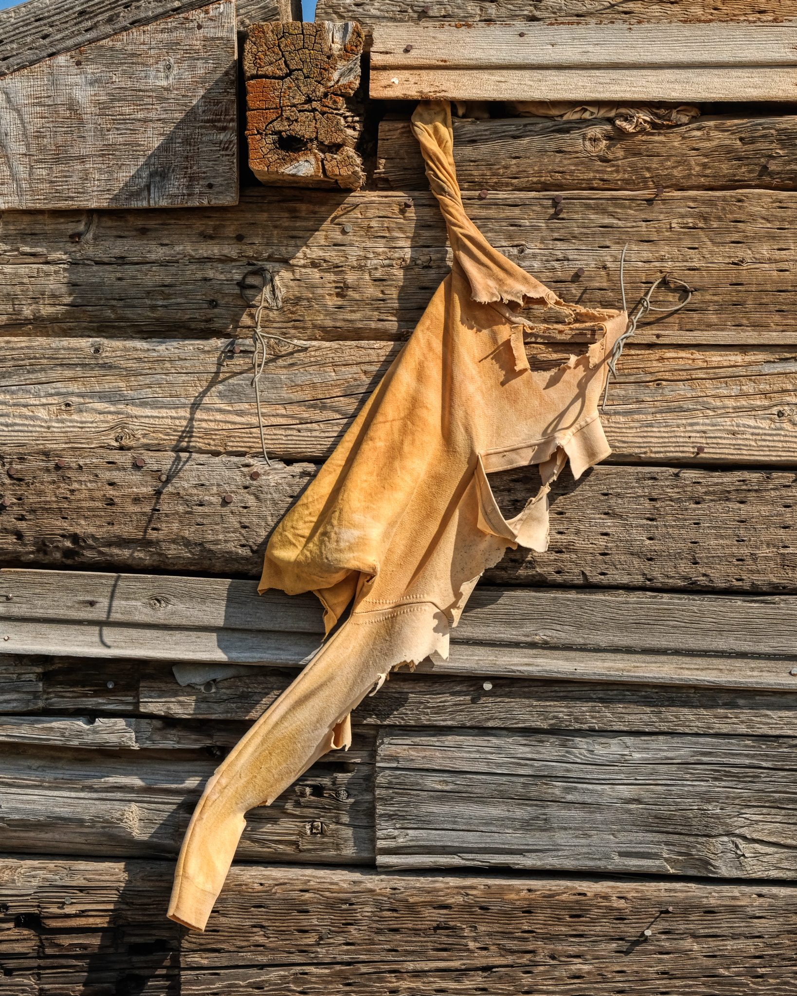 I had apparently stumbled upon the site of the National Sweatshirt Testing Facility (NSTF).
 A perfect 'screen saver' photo . . .
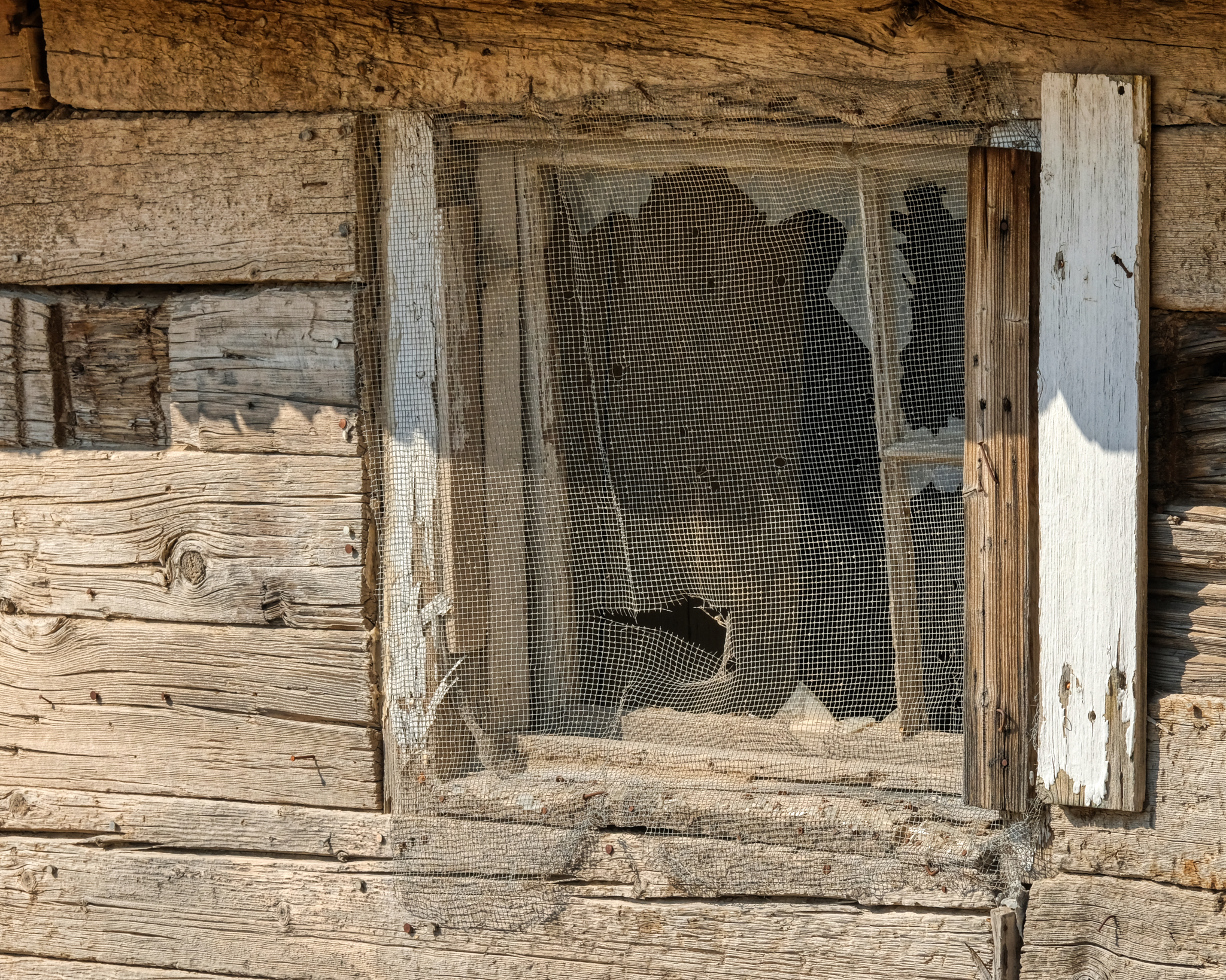
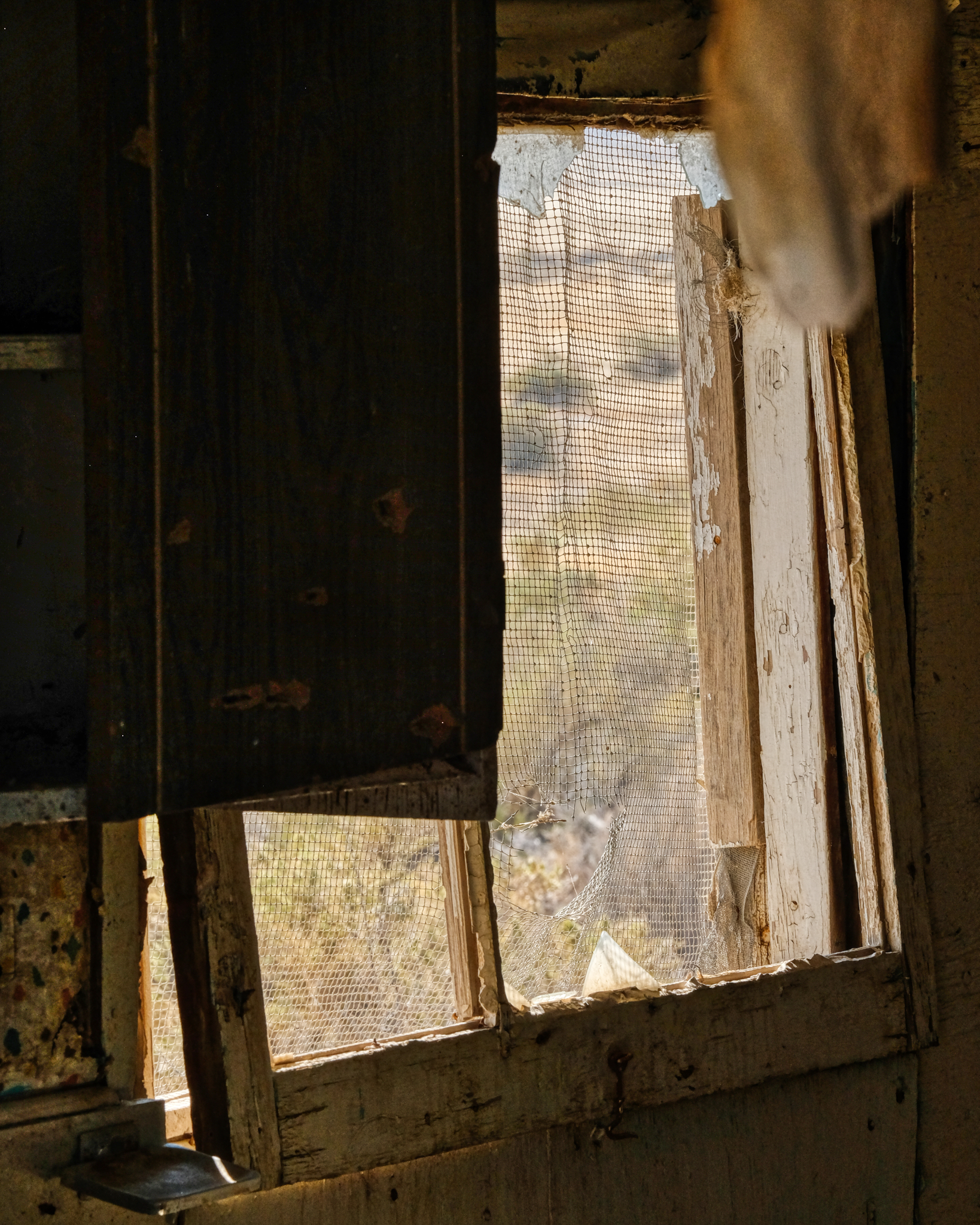 All I could think was that the flying insects around here must have been pretty big.
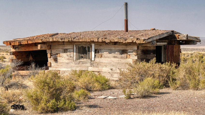
 Yet another abandoned miners house from a bygone era . . . not all that long ago . . . .
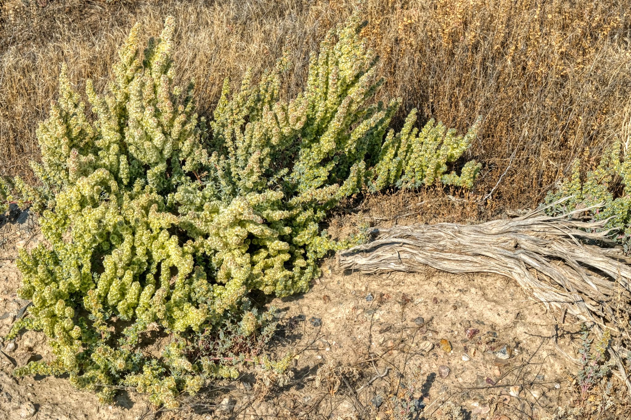 It was early September when I was in northwest Nevada . . . and there is always some fauna that thrives at every time of the year on the desert.
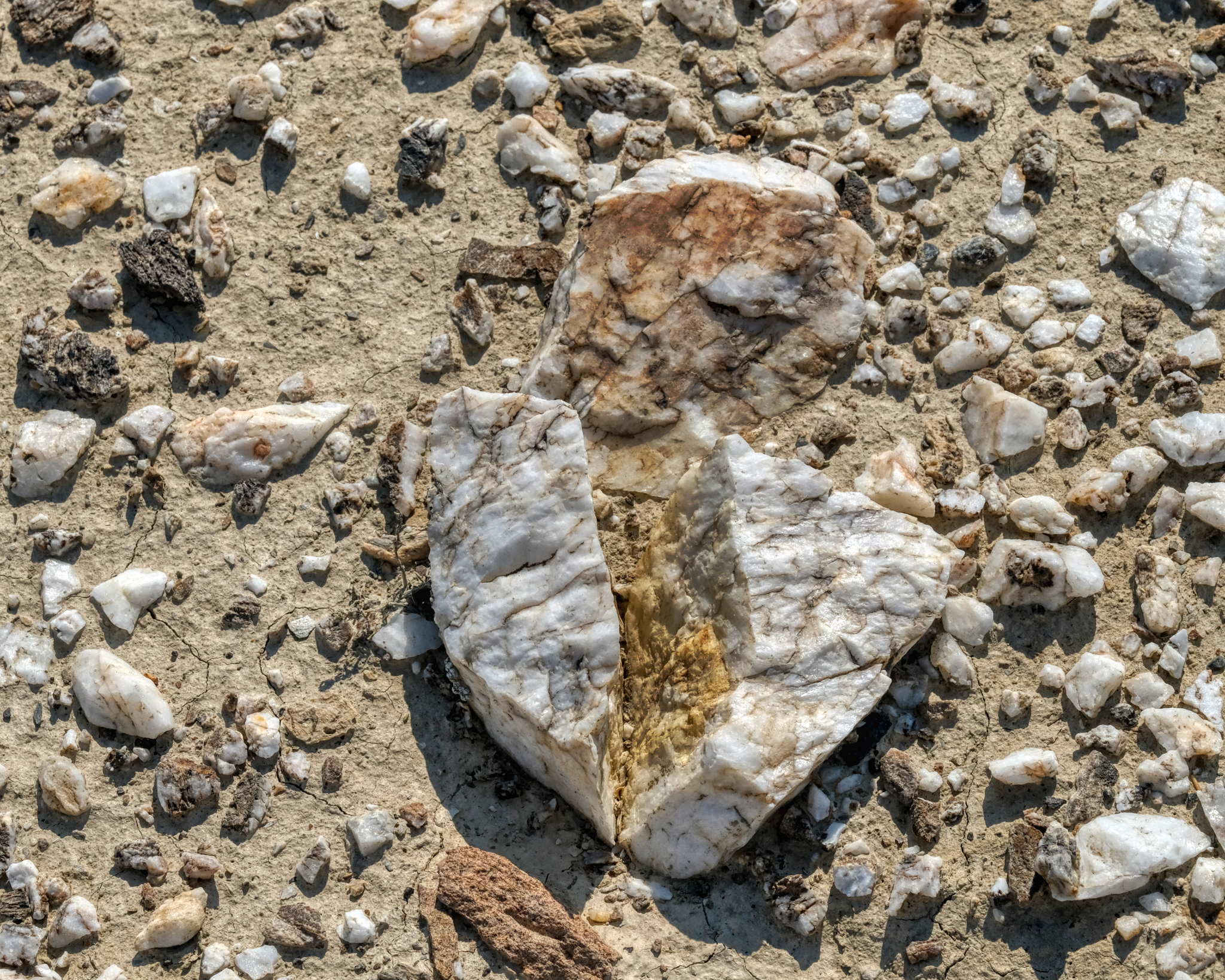 The desert floor around the old mining community was littered with this white quartz . . . I wonder what they were mining for here? I left the abandoned miner houses and drove back out on Highway 49 . . . to look for a place to set up camp.
 This is what I was looking for: a track that led up and away from the road and into the wild desert. I drove about a mile up this track before I decided that this isn't what I wanted . . . and I do not know why. But I was tempted.
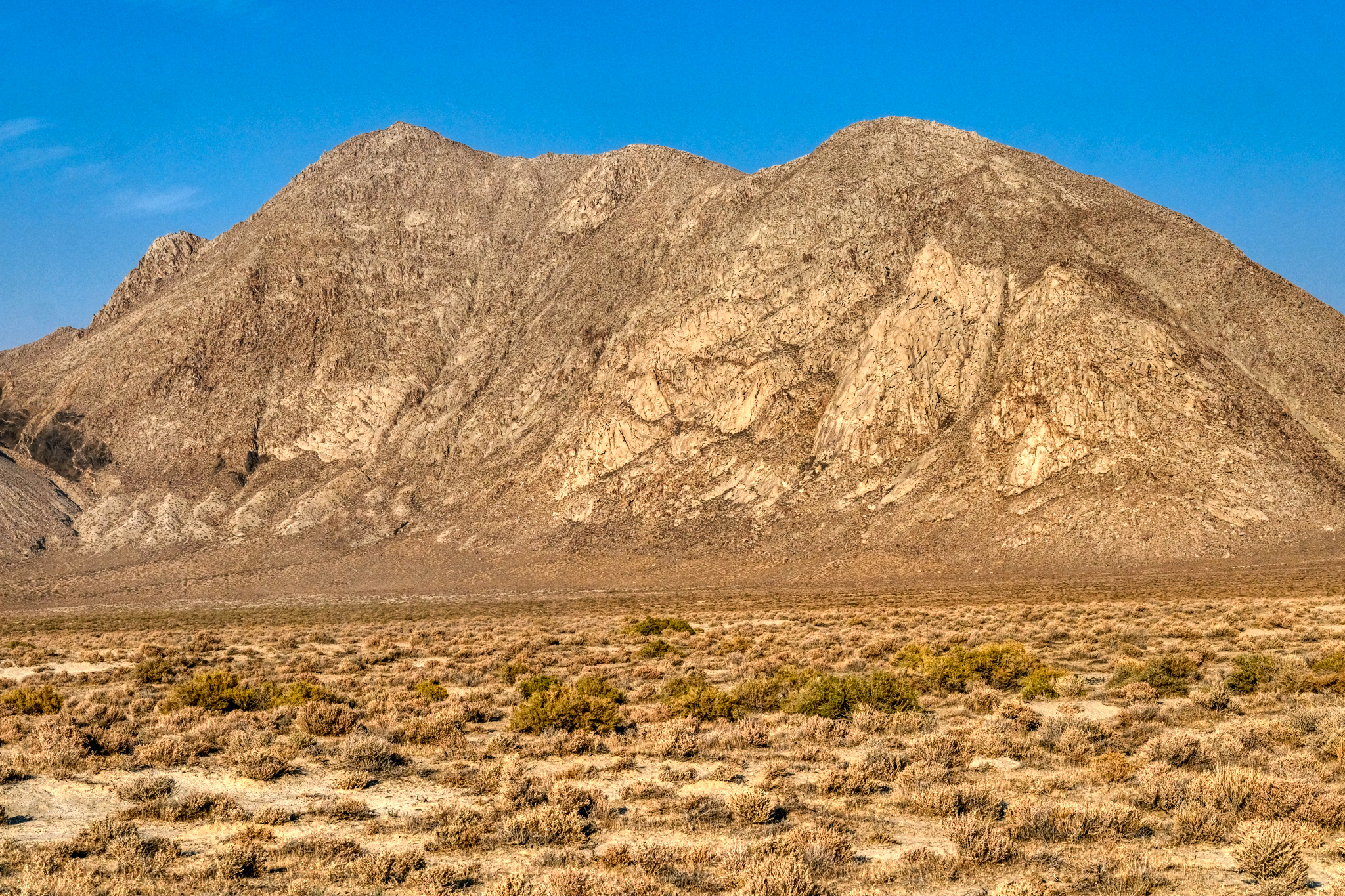
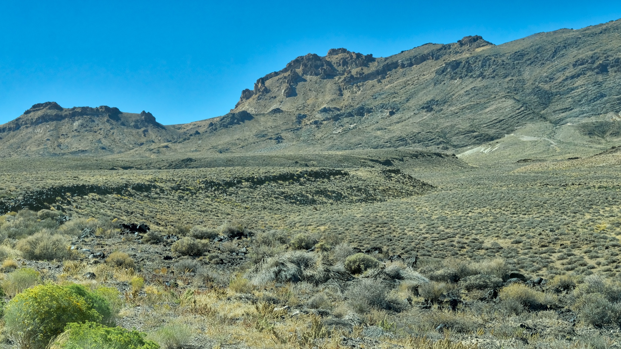
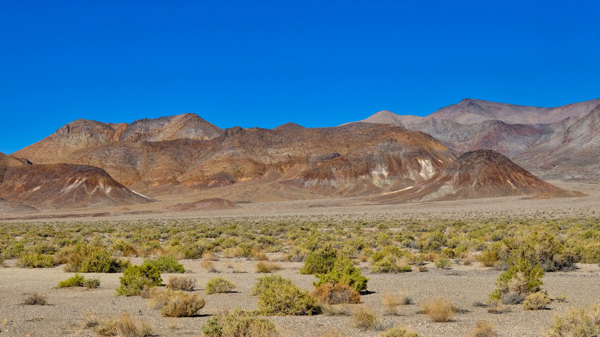
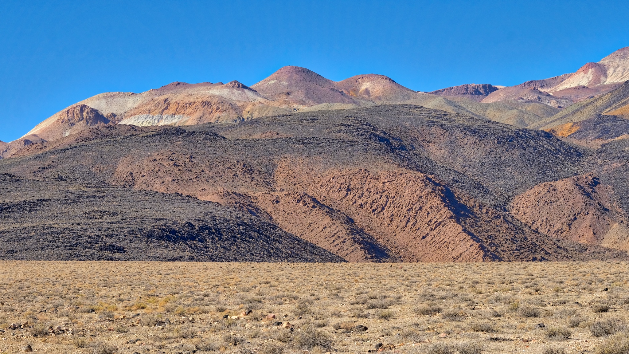
 The view to my left as I drove toward the Black Rock Desert was always a sharp escarpment, with ever-changing geology and brush covering.
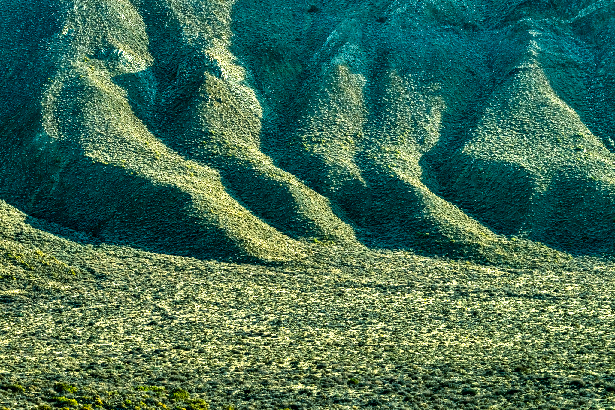
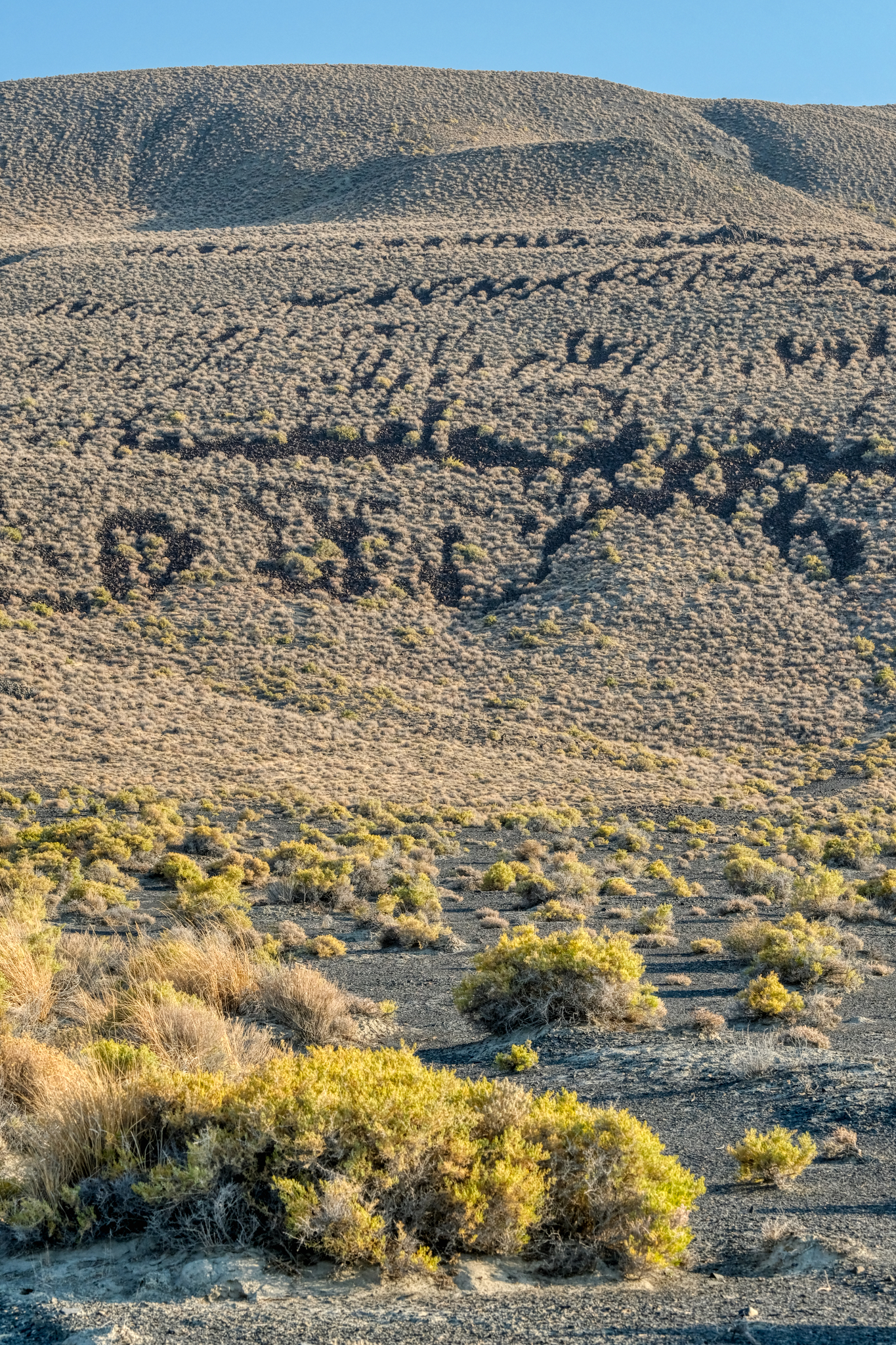 I stopped here in wonderment! There seemed to be giant petroglyphs on this volcanic hillside. What language was this? Of course, I knew it was just bald spots on an old lava flow . . .
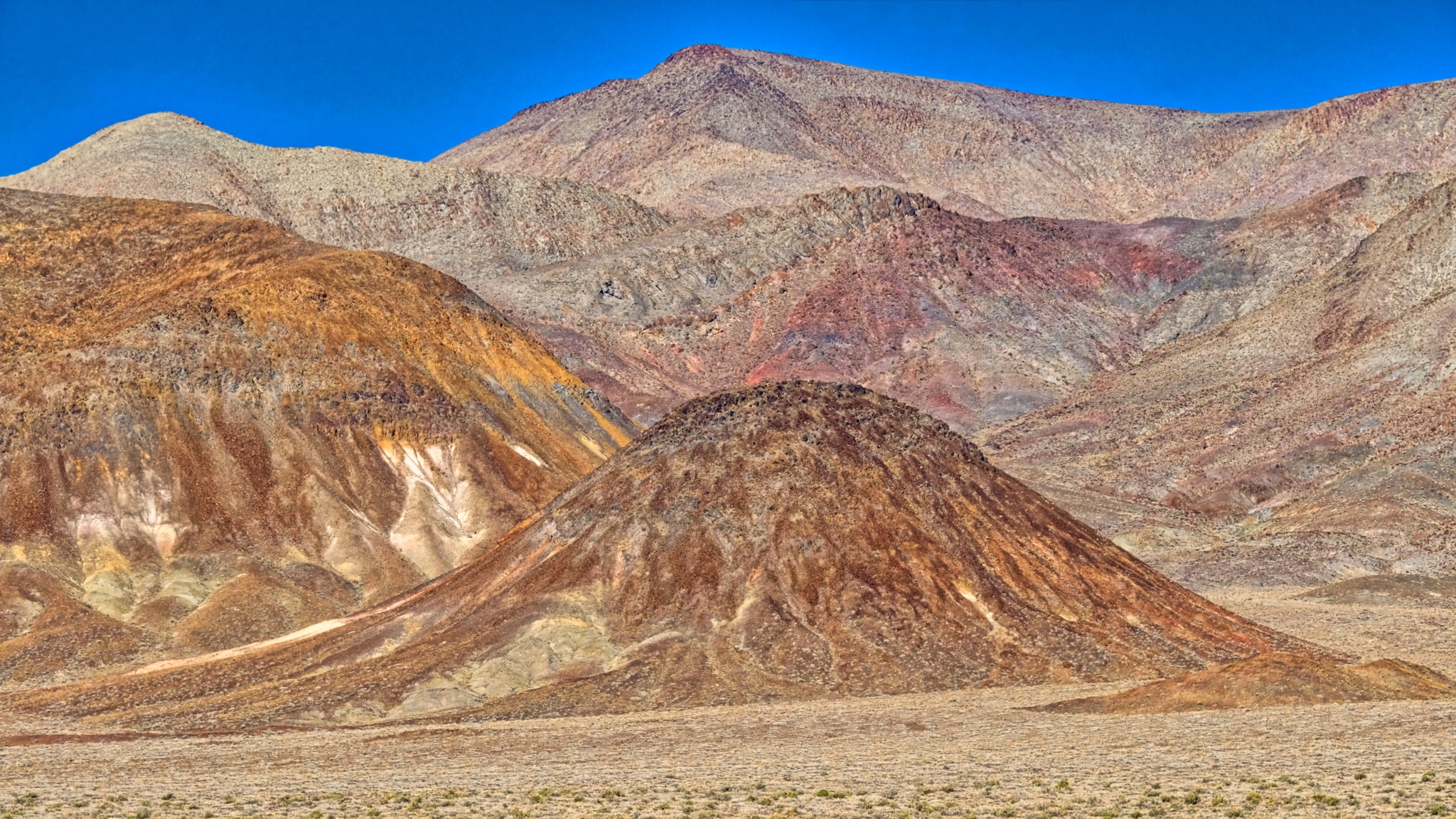
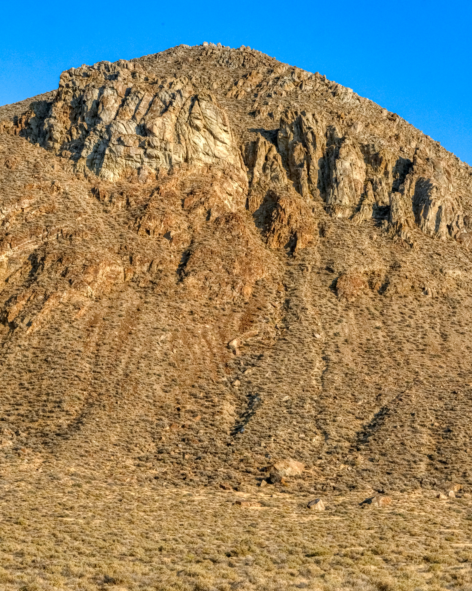 Such an amazing desert mountain landscape . . . but look closely . . .
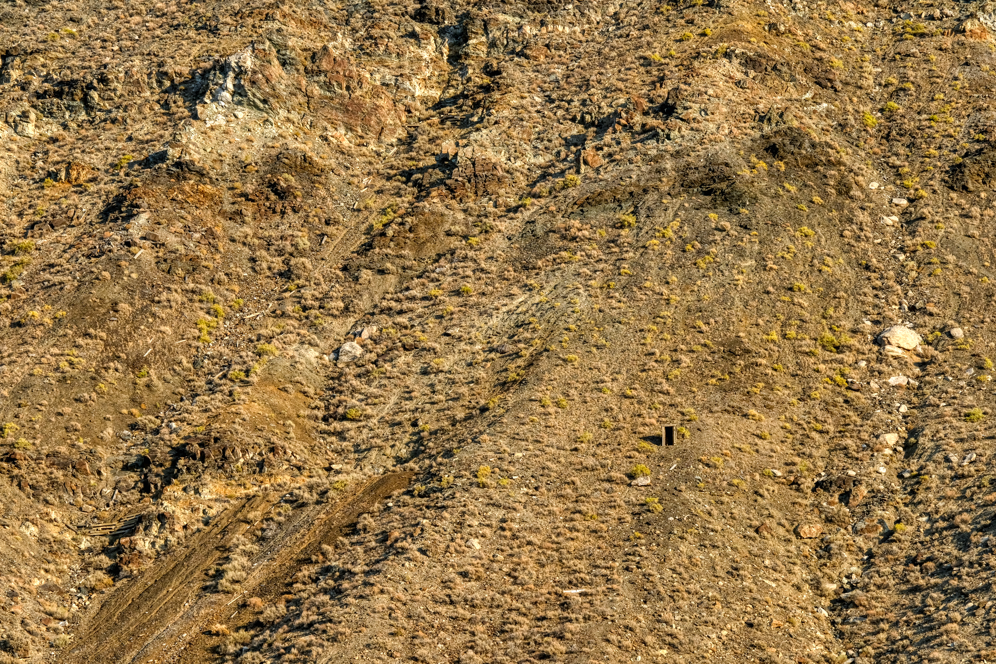 . . . but look closer . . . and you see the remnants of an old mine entrance way up on the mountainside. Astounding!
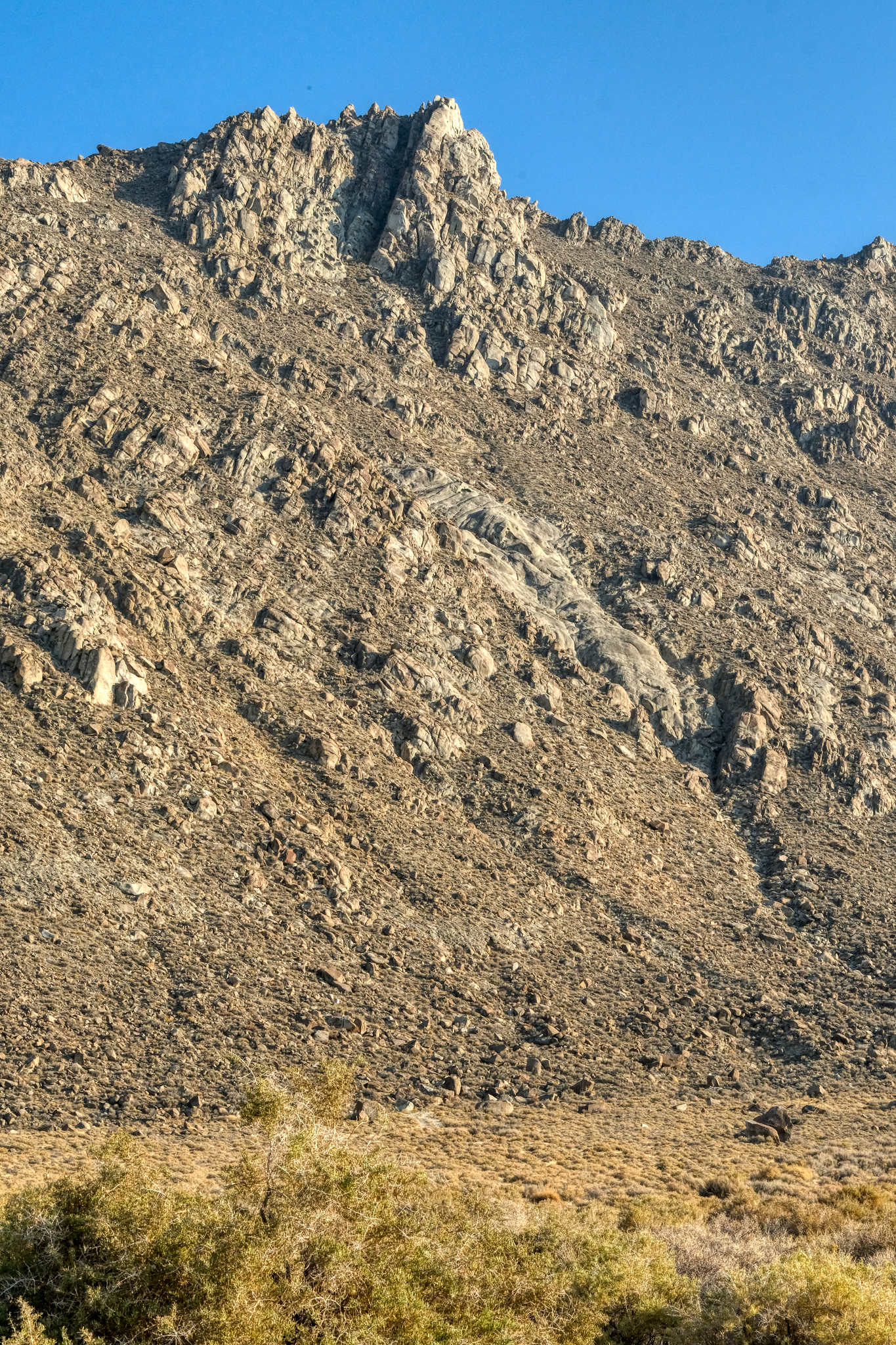
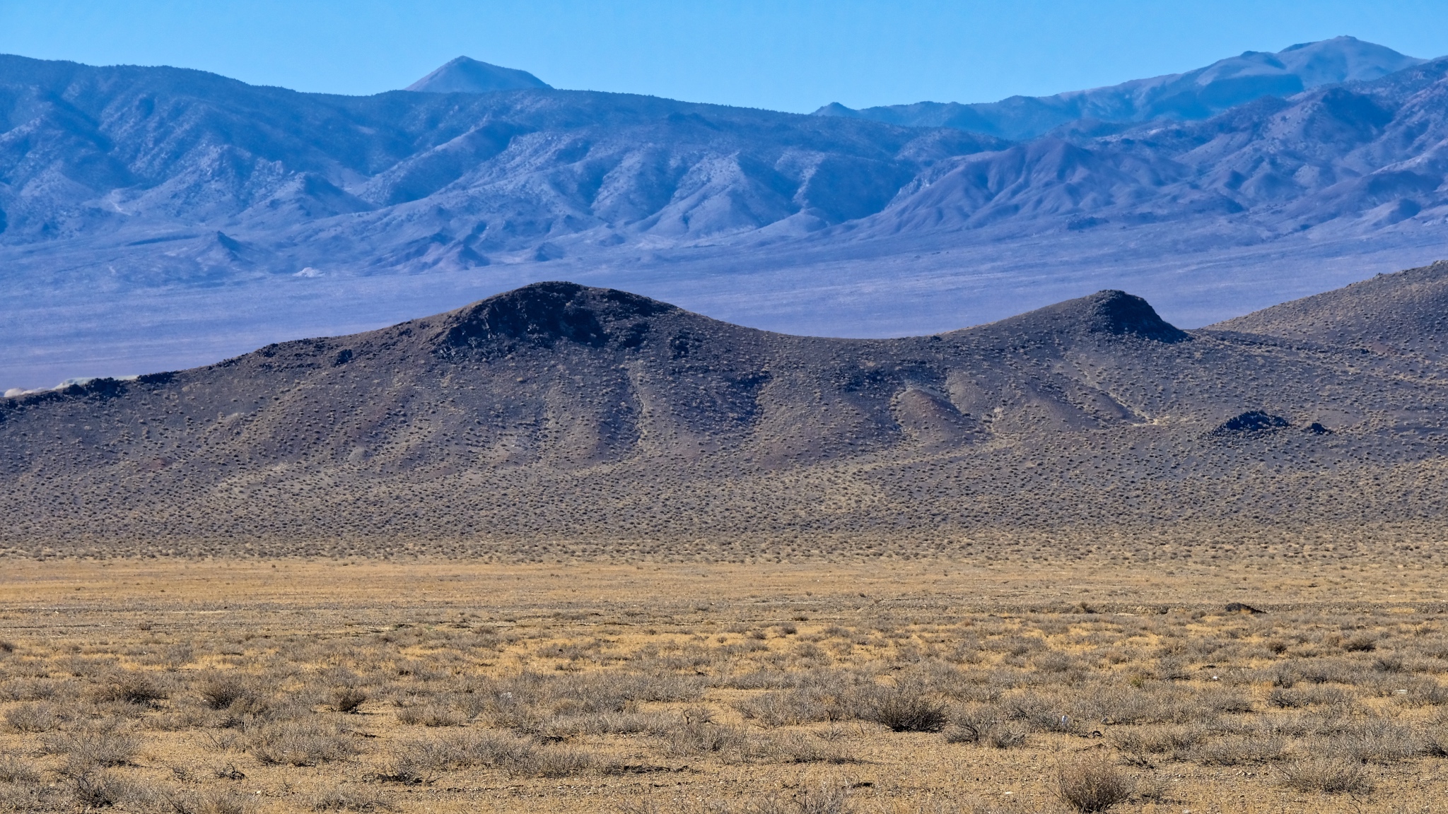
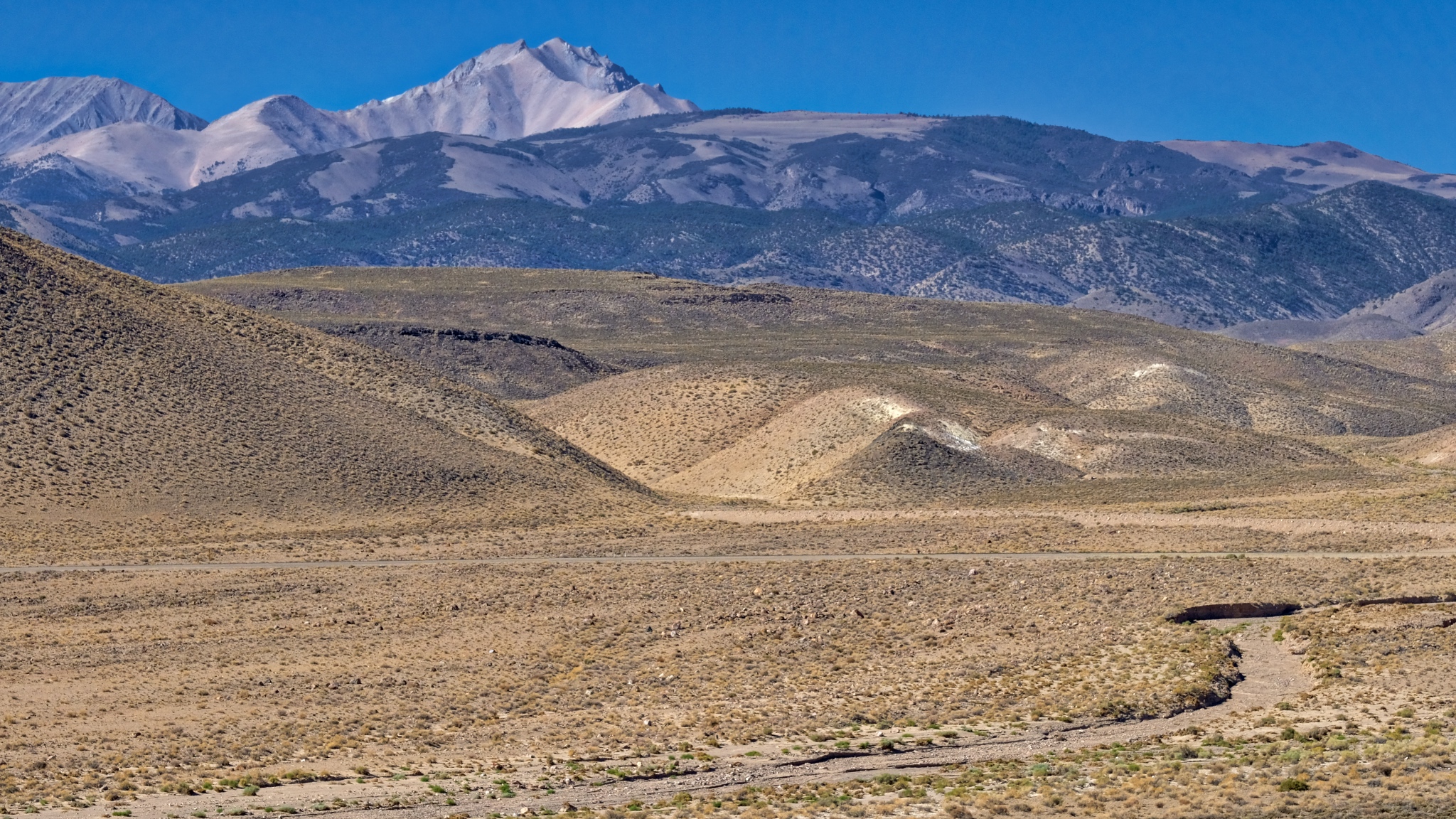
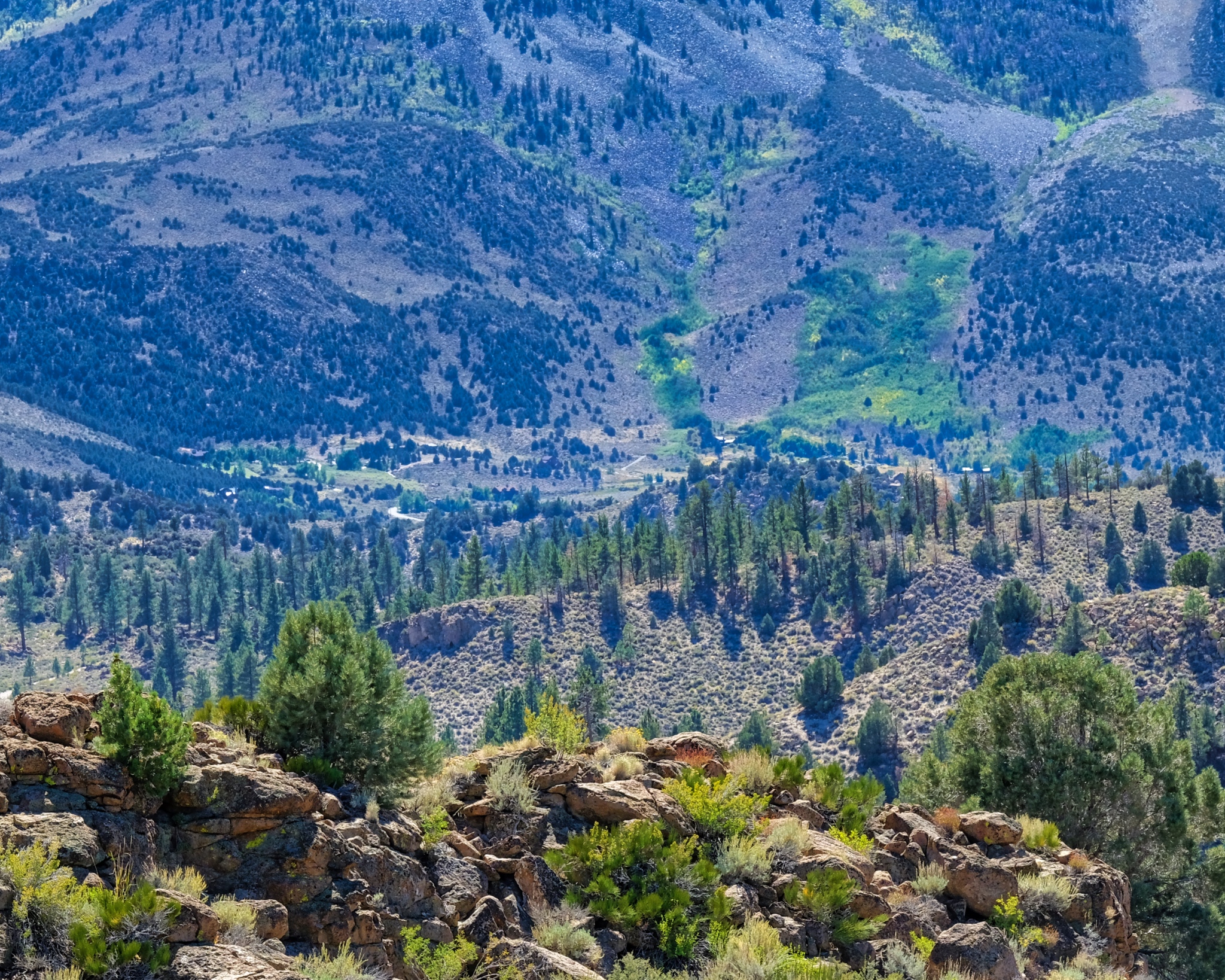
 I drove for an hour alongside this rocky ridge . . . always scanning for something interesting . . .
 I stopped and contemplated climbing up to this "dry waterfall ' . . . but it was much further away and much taller than I thought.
 The shadows were getting longer and I felt the need to find my camping spot . . .
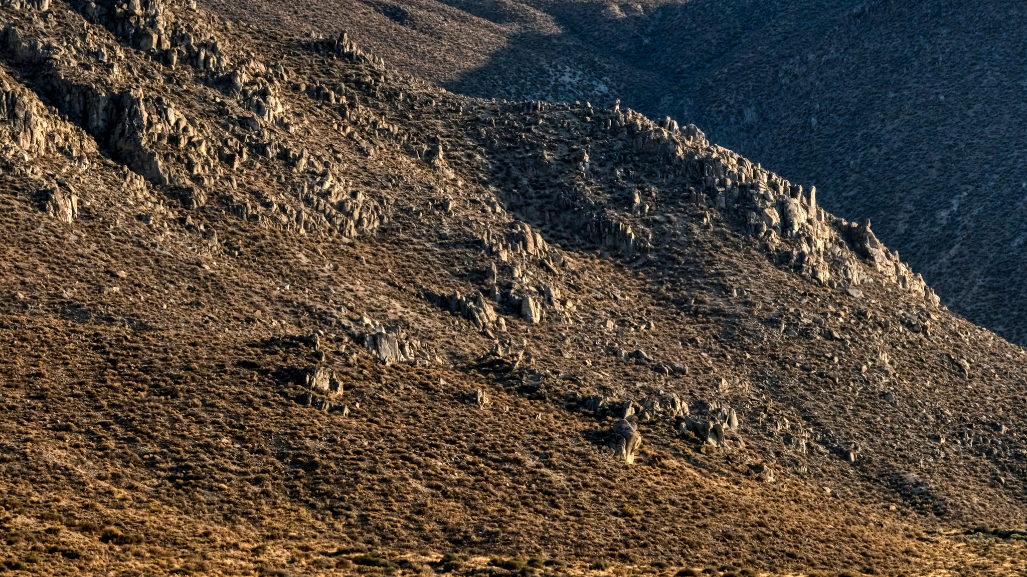
 Long shadows on the desert hills.
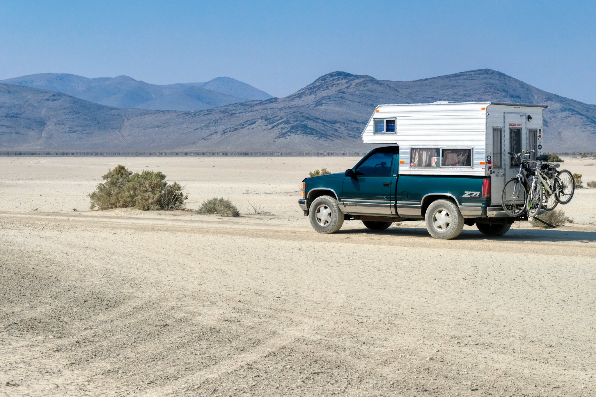
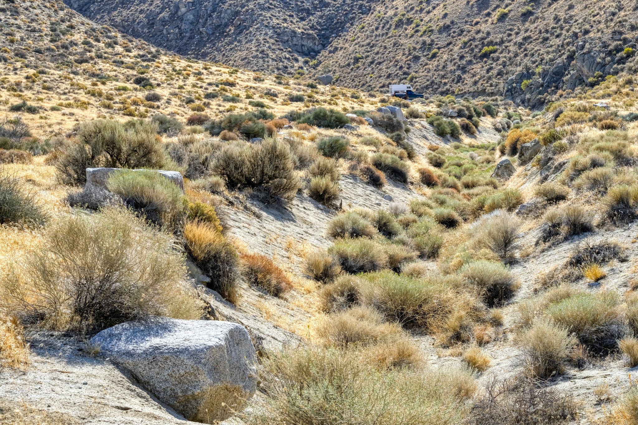
 In the five days I spent out of Winnemucca on the desert roads, I saw only two other cars . . . I caught up with this truck . . . but turned off before I got too close.
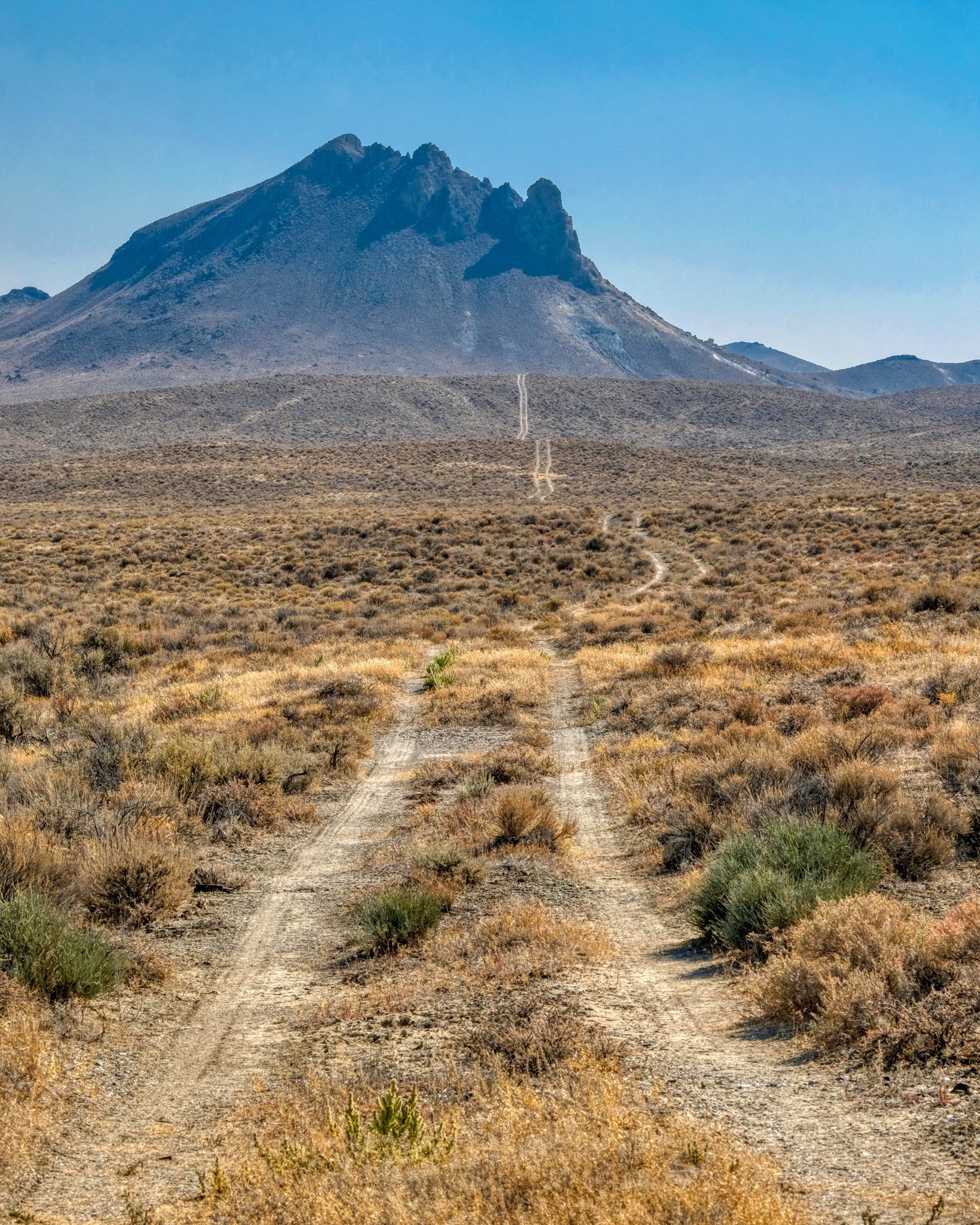
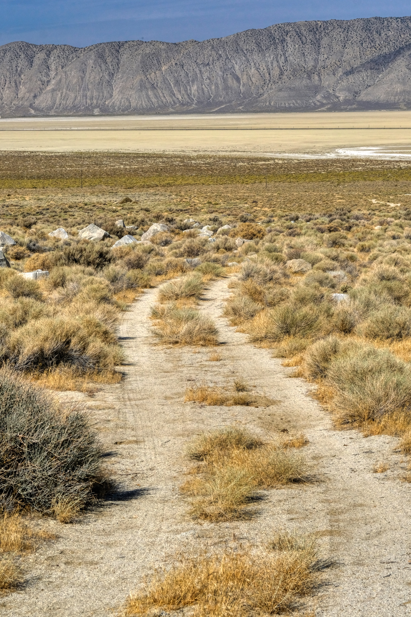
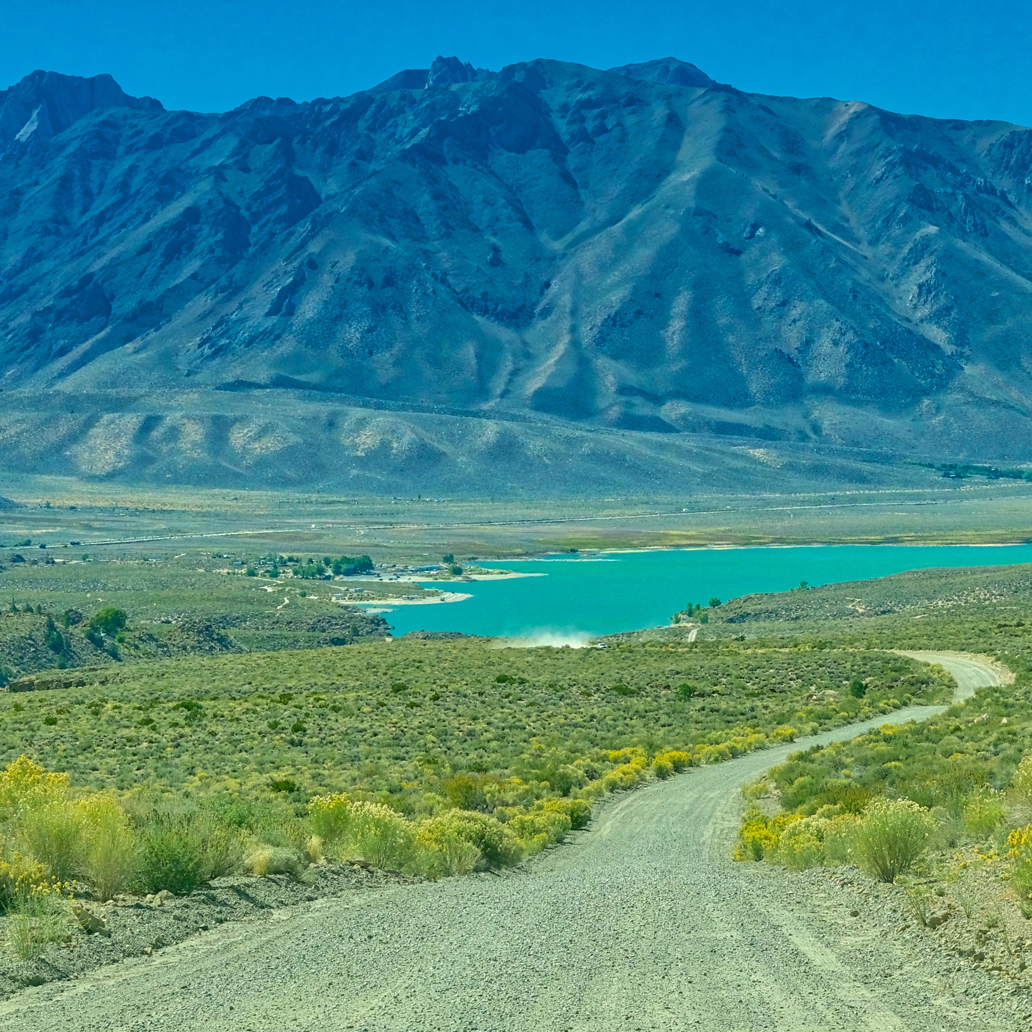
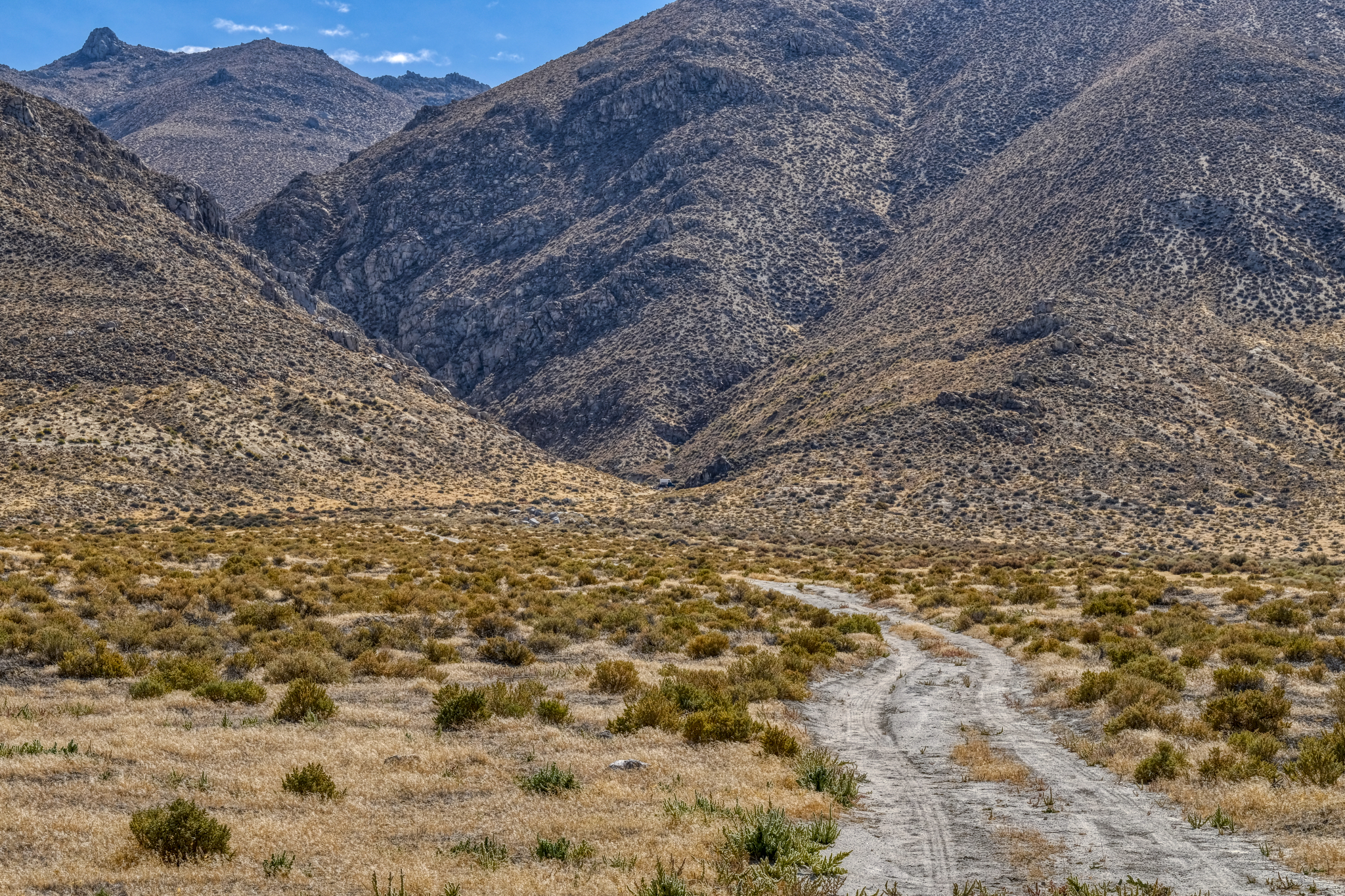 I eventually spotted this little track heading up into a gap in the rocky hills and thought it might be an interesting place to park my camper . . .
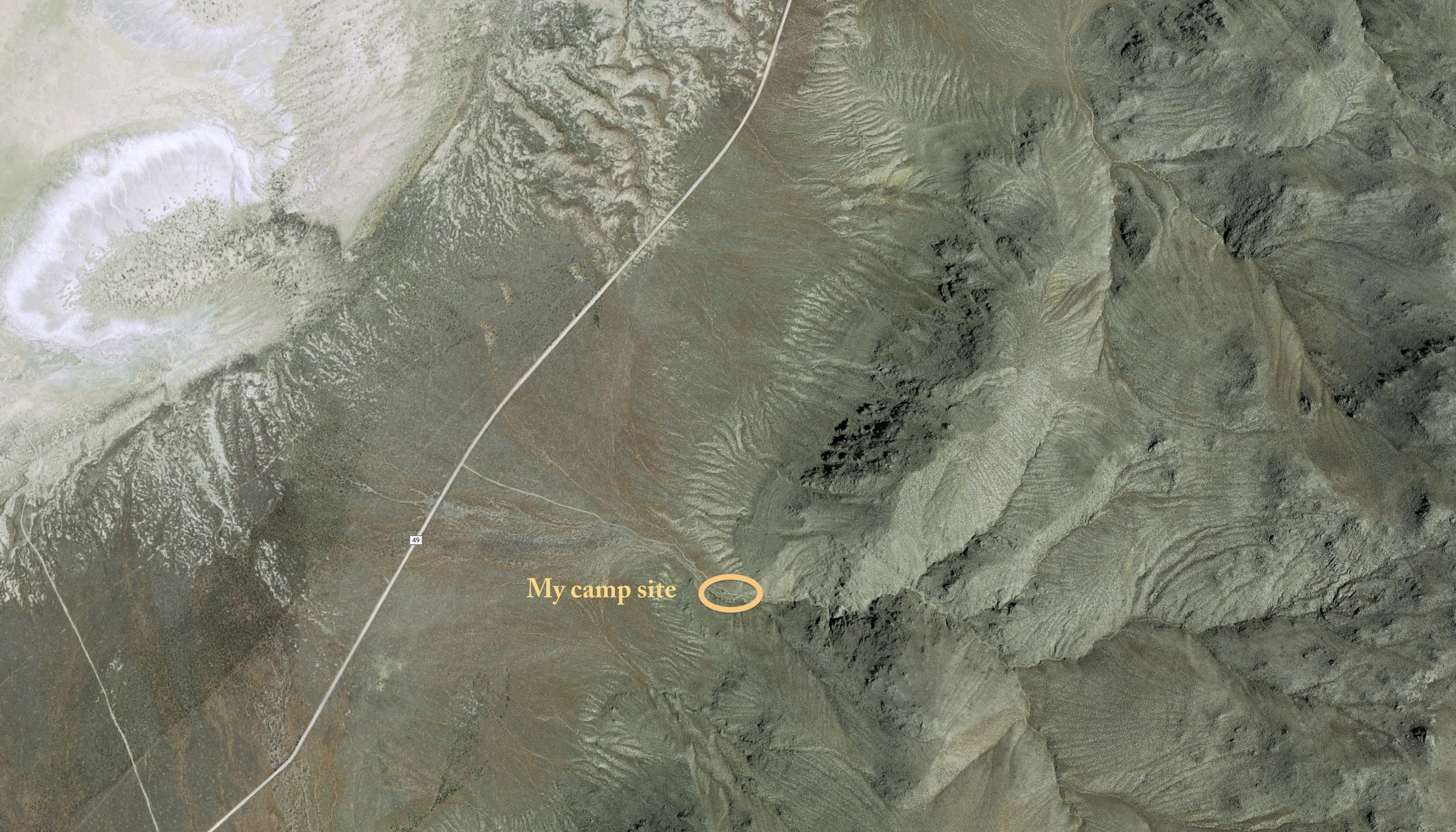 GoogleMaps photo of my campsite . . . . a dream location for me!
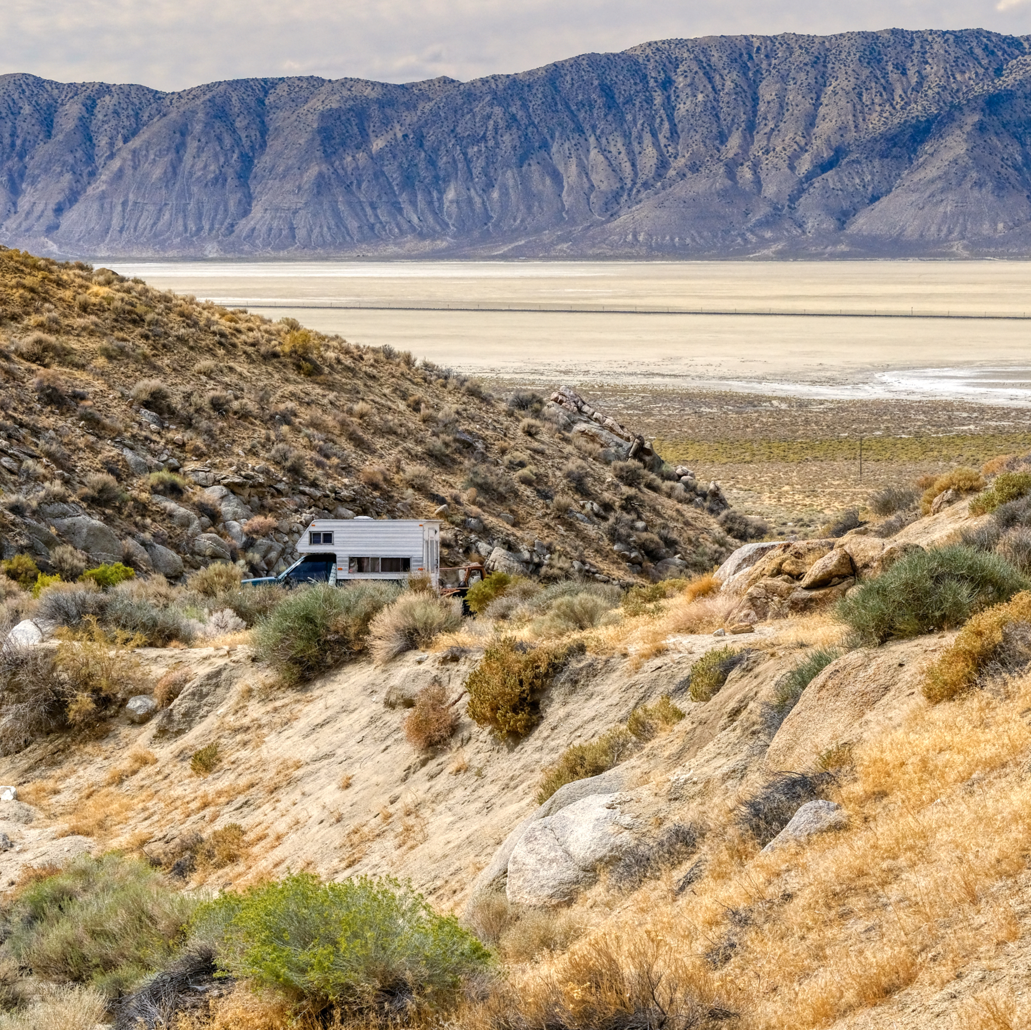 I drove up the sandy track and found a flat place to park . . . . the next morning I took this photo of the fine place I found . . . with a grand view of the Black Rock Desert.
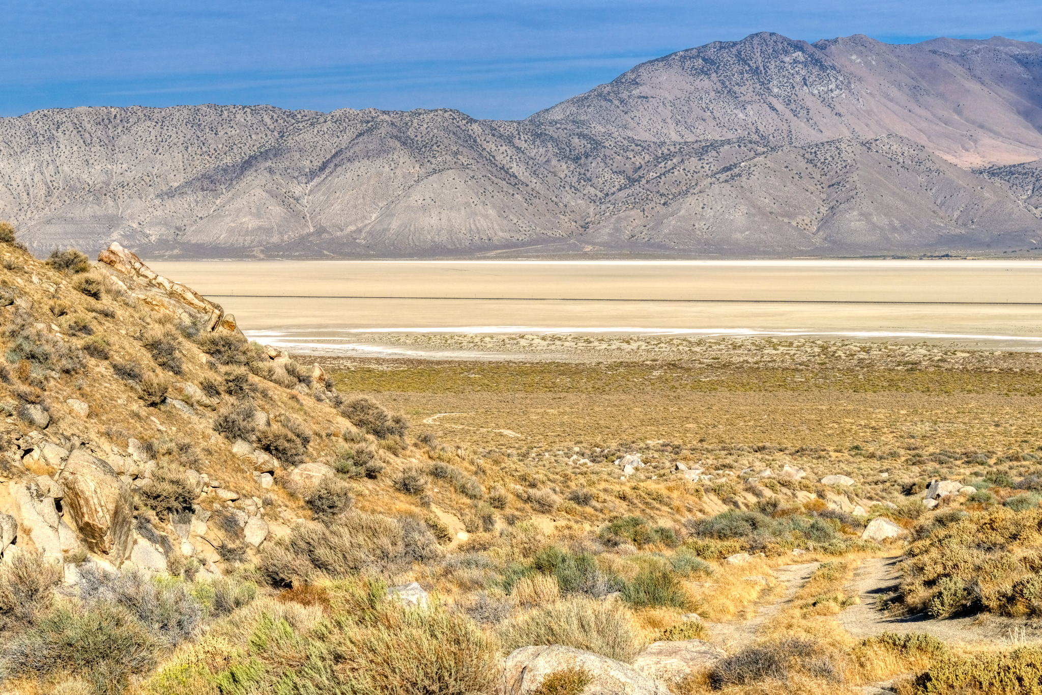
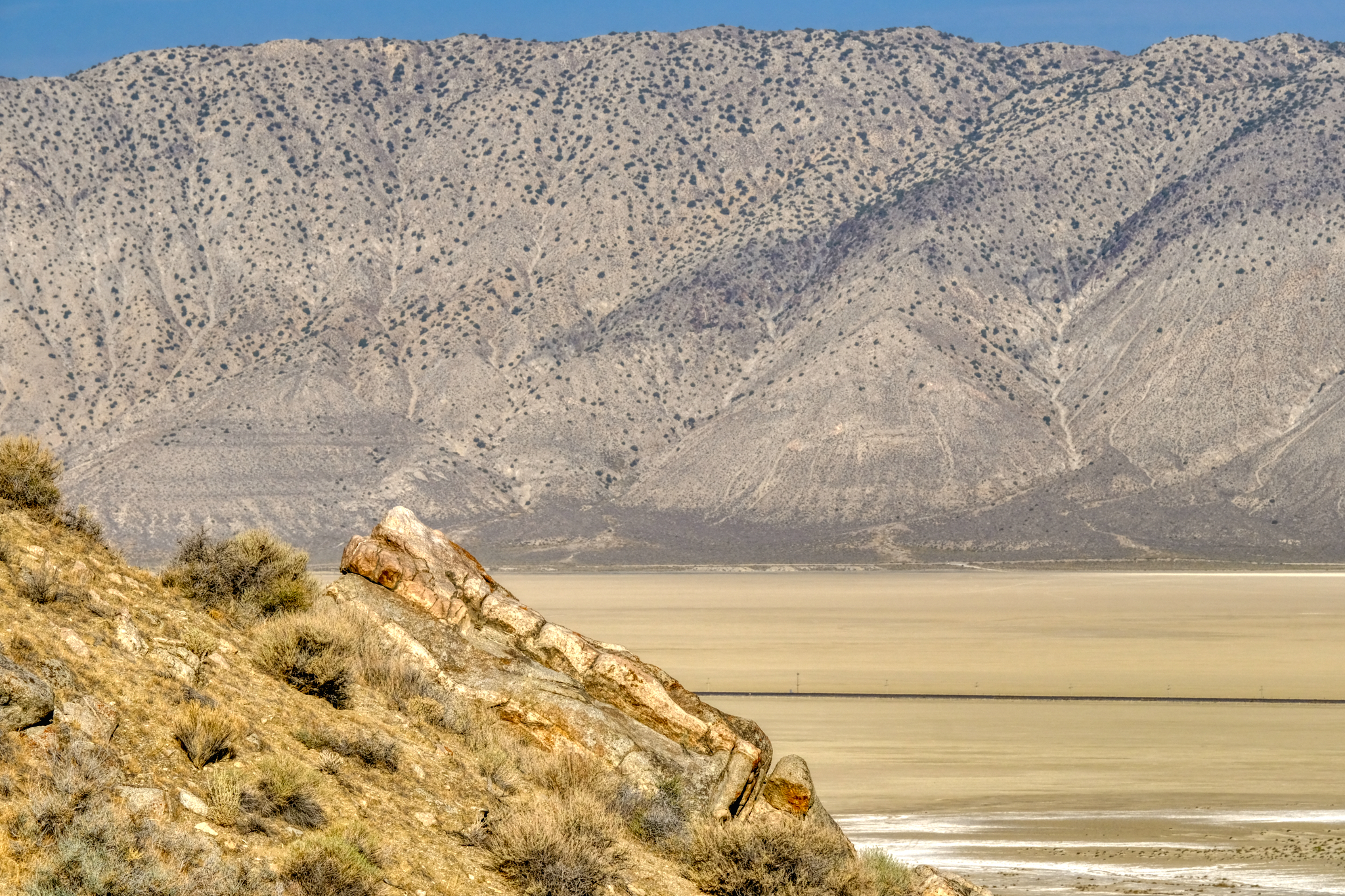
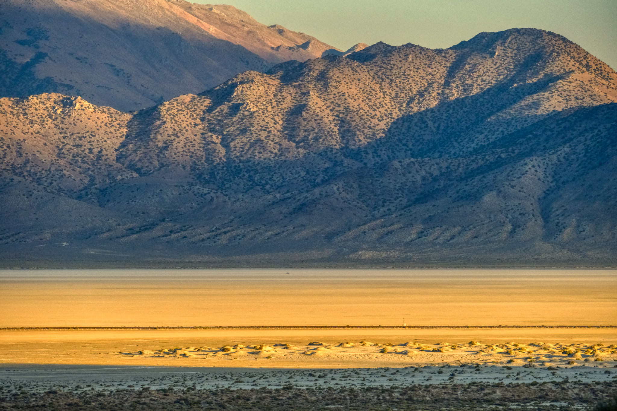
Looking away from the Black Rock Desert I had this view . . .
 My incredible desert canyon view . . . I wasn't sure which way to point my chair . . . the dry lake or the rocky canyon!!!
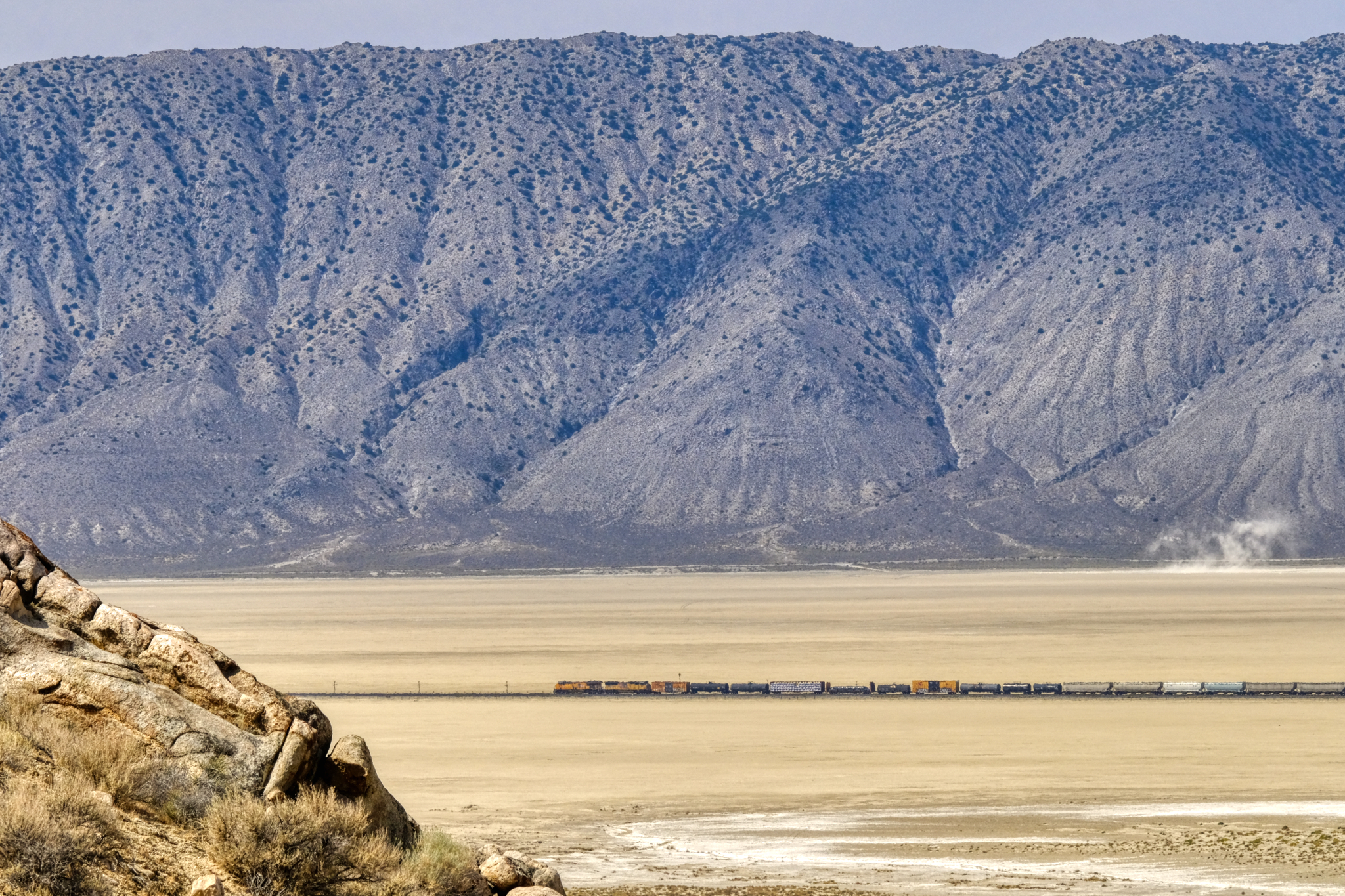 My view of the dry lake included an active train line . . . a couple times a day long freight trains would slowly pass below.
 My morning Grand View . . . I think I will go for a walk.
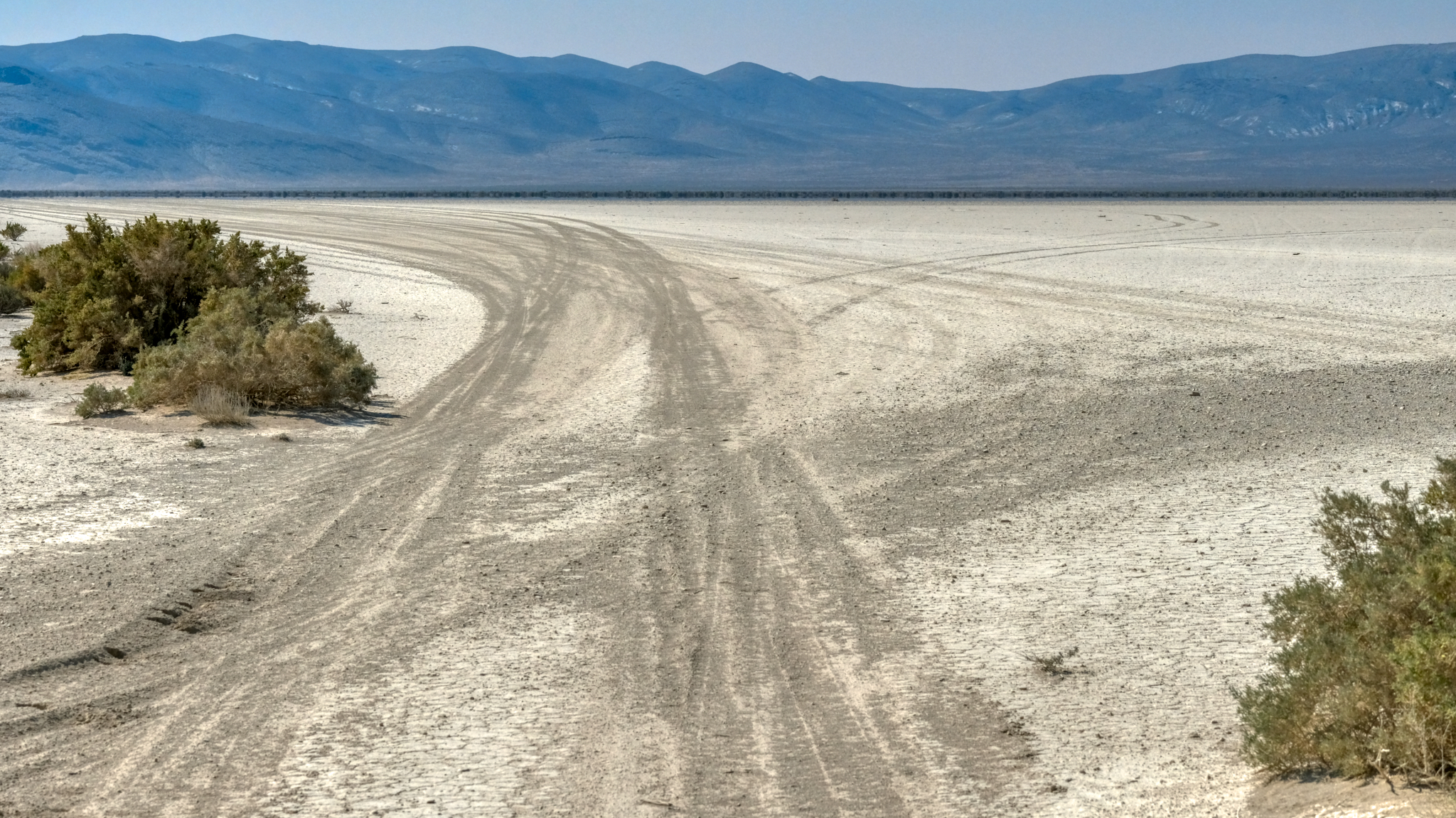
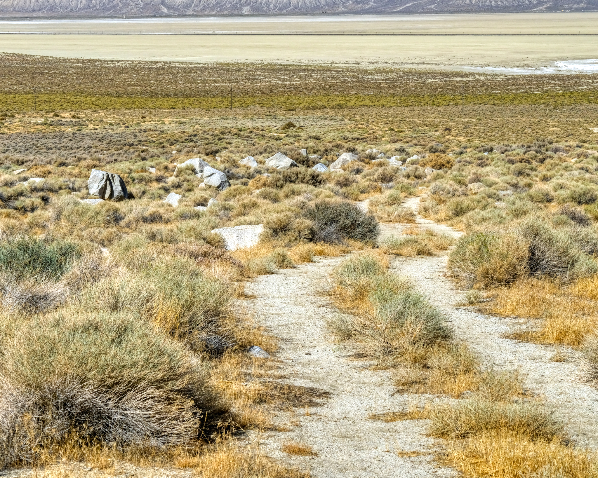
 One morning I decided to walk down the sandy track and out onto the dry lake bed . . . for exercise . . . and curiosity.
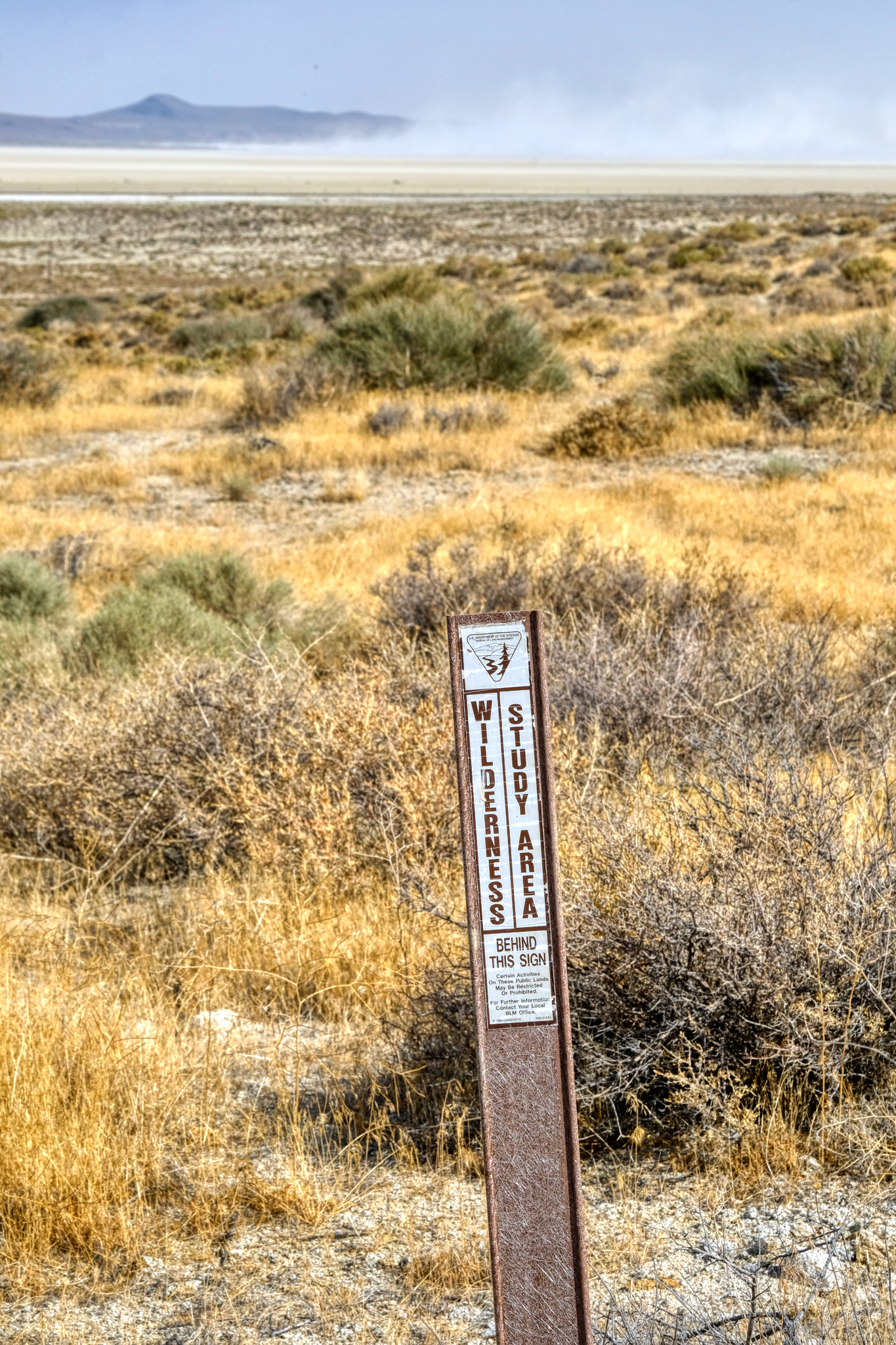 I was happy to see this sign . . . glad the area was being protected.
 At some point after I set up my camp, probably while I was staring at the mountainside, somebody rode a horse across my tire tracks on the sandy track. An interesting walk indeed!
 The marvelous morning light made for great photography of the desert flora.
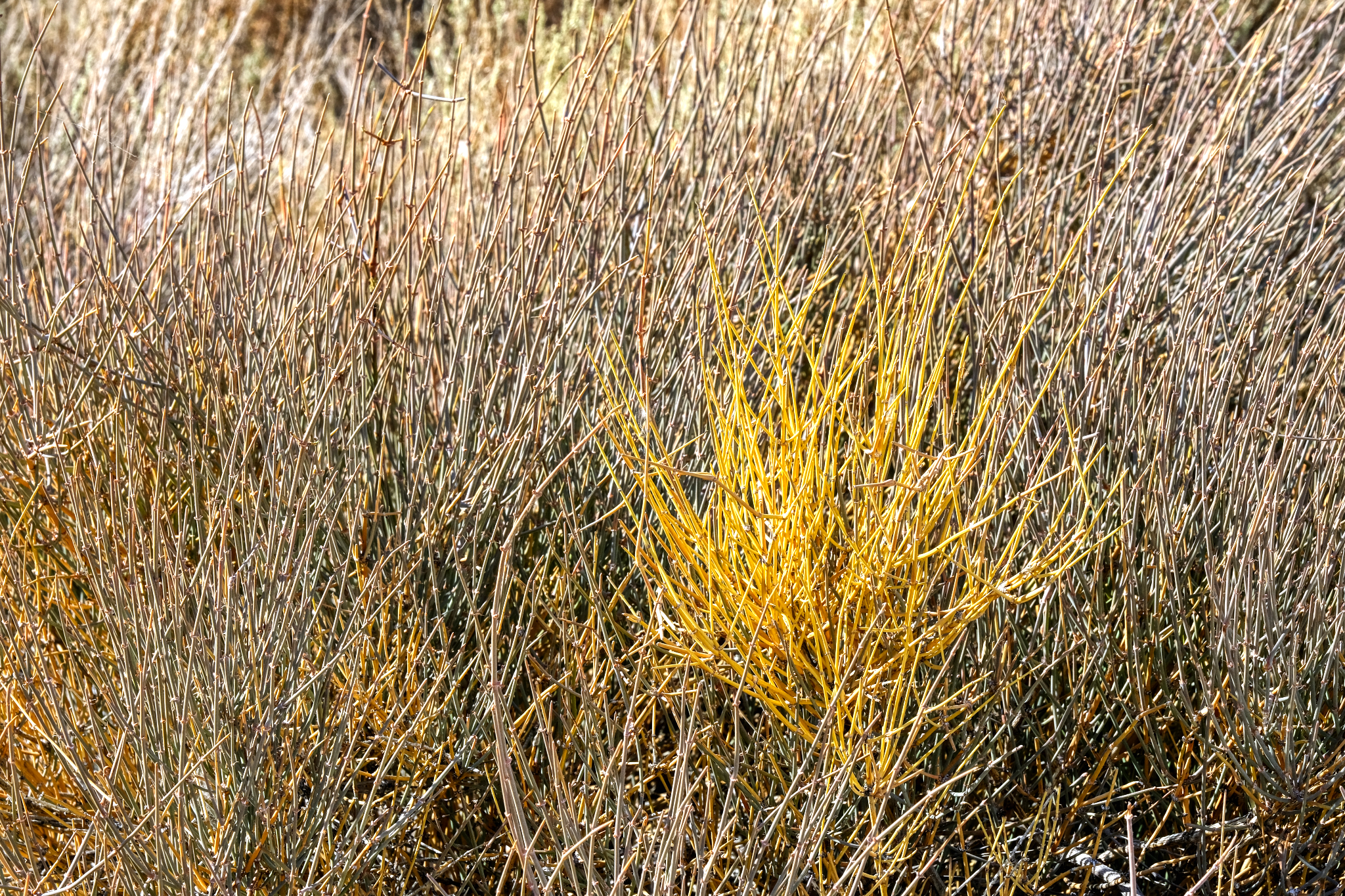 These "desert reeds" was a complexity of beauty.
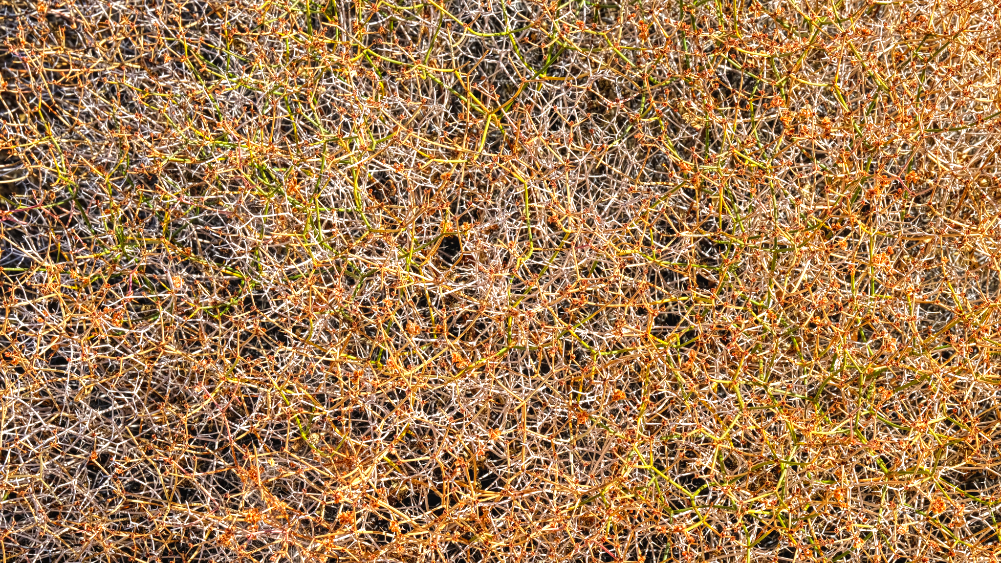 Wonderful complex patterns out here in "the middle of nowhere" . . .
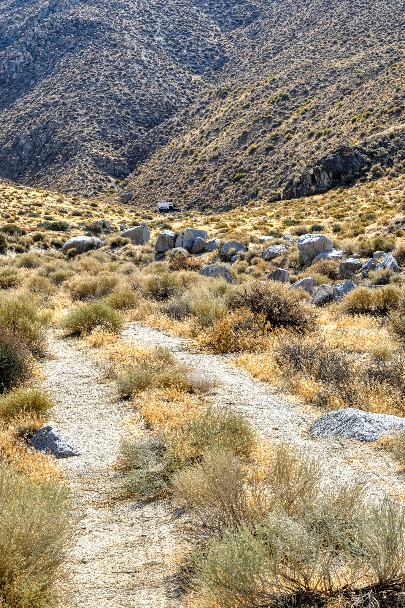 Looking back up the track to my camper in the canyon.
 Walking further, I crossed Nevada State Highway 49 as I approached the wide dry lake bed.
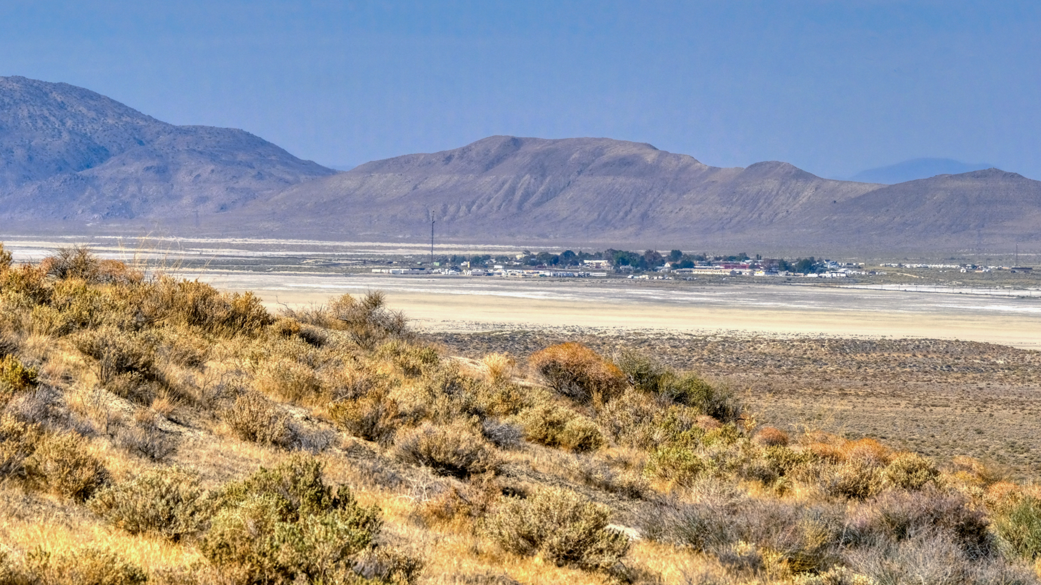
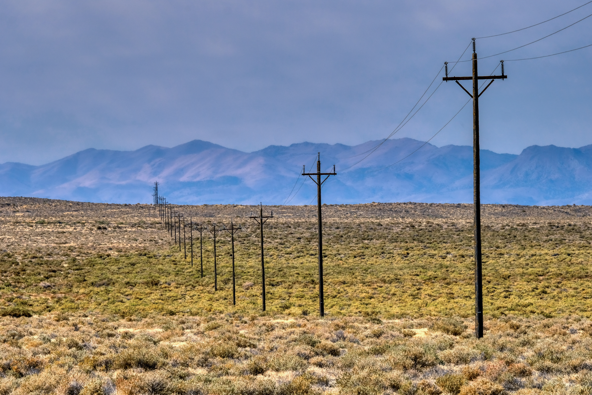 A short stretch of scrub brush with phone poles leading to the little town of Gerlach, Nevada (pop. 107).
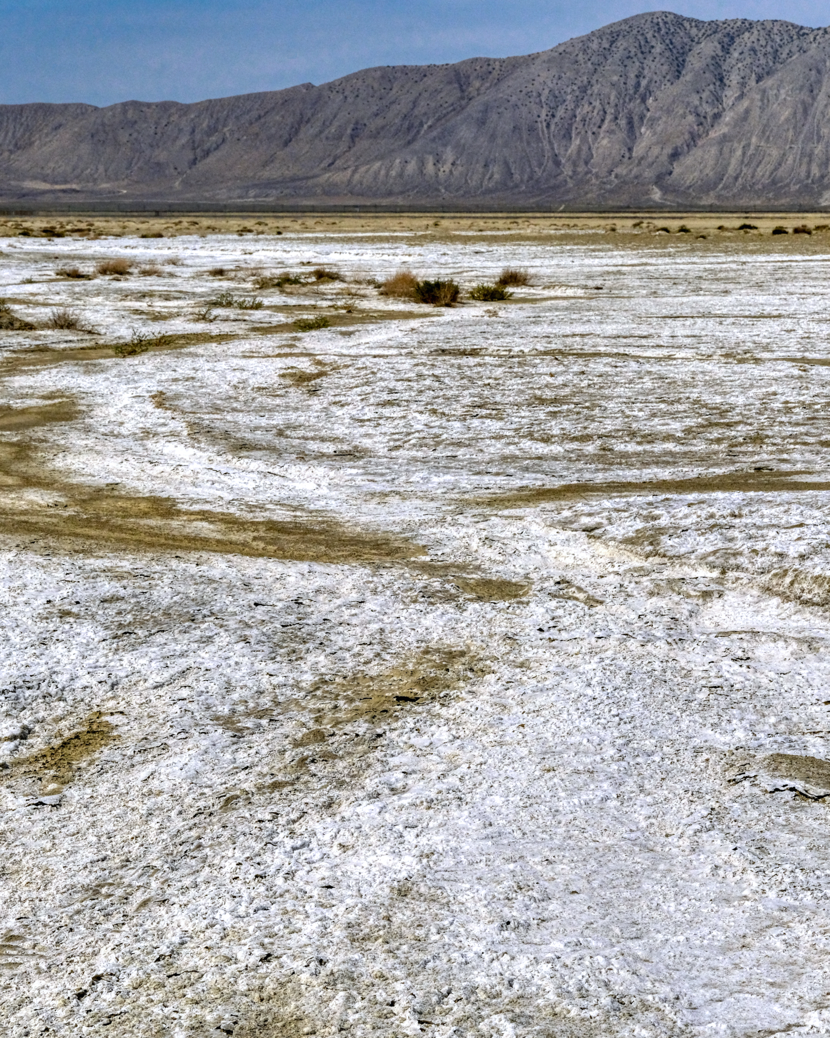 . . . and at last I stepped out onto the amazing surface of the Black Rock Desert.
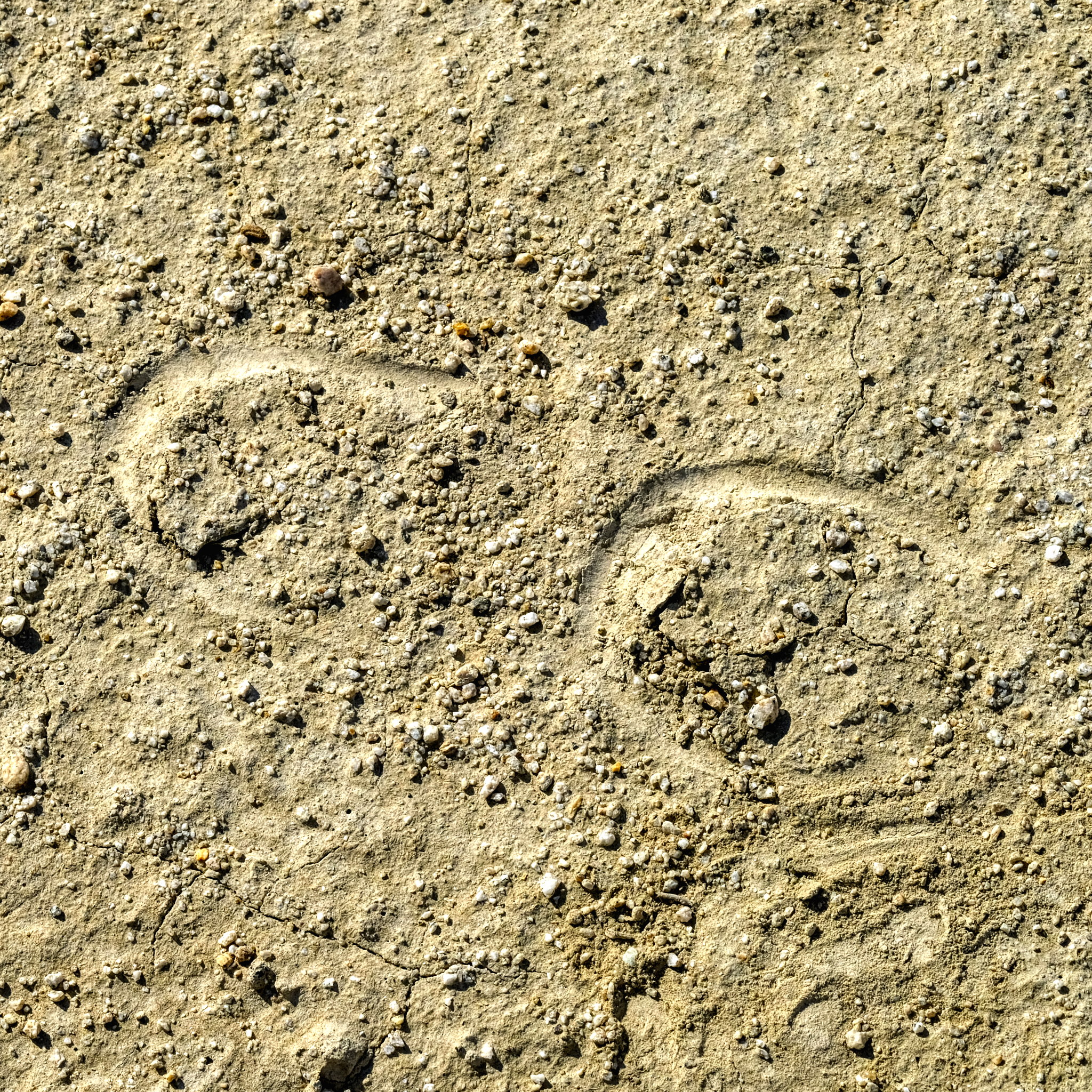
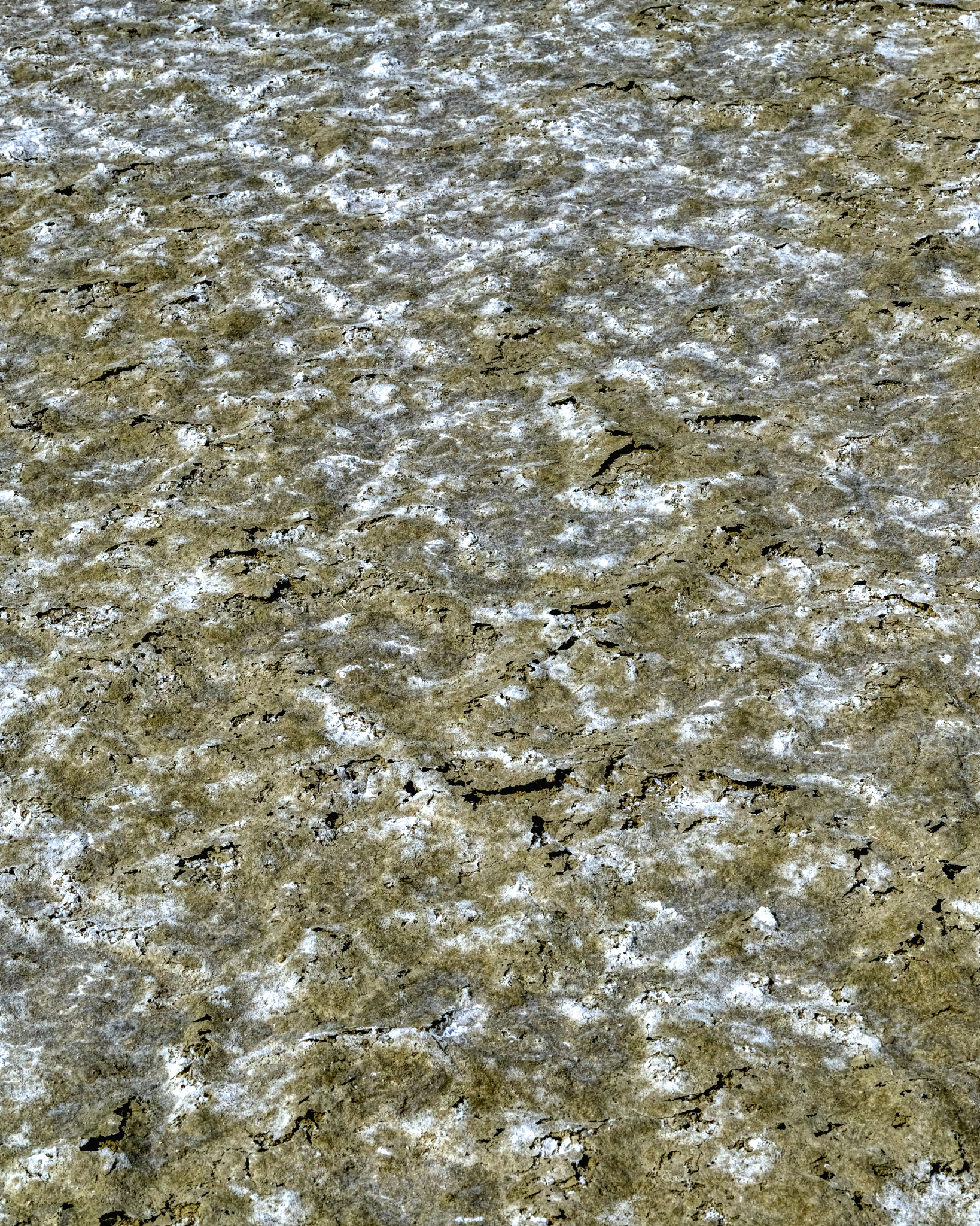
 I love these desert/dry lake bed textures as photographic subjects. I was not disappointed here!
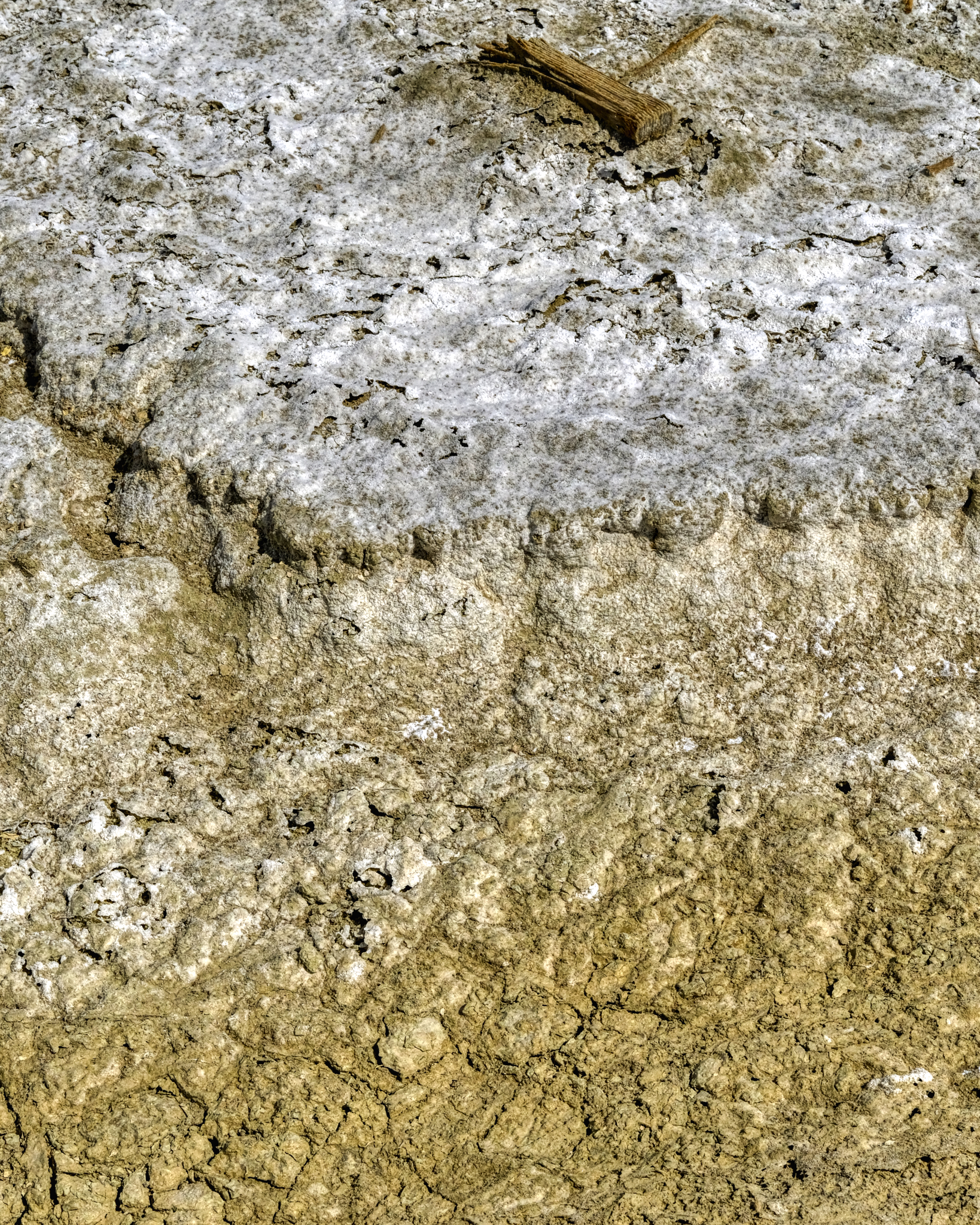
 Such delicately thin wafers of minerals spread out underfoot . . . I tried to avoid stepping on them.
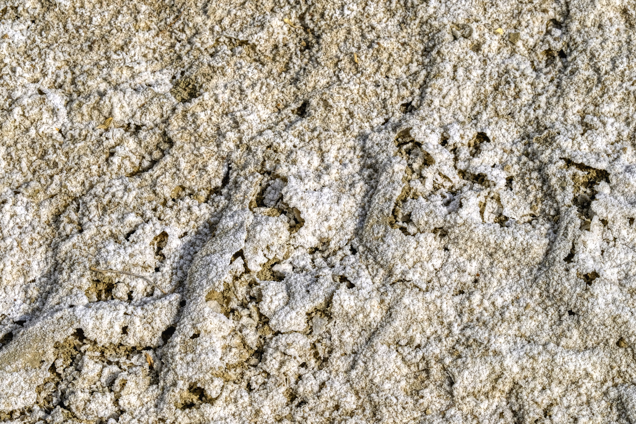 Salt or alkaline crusting . . . I do not know . . . I did not taste it.
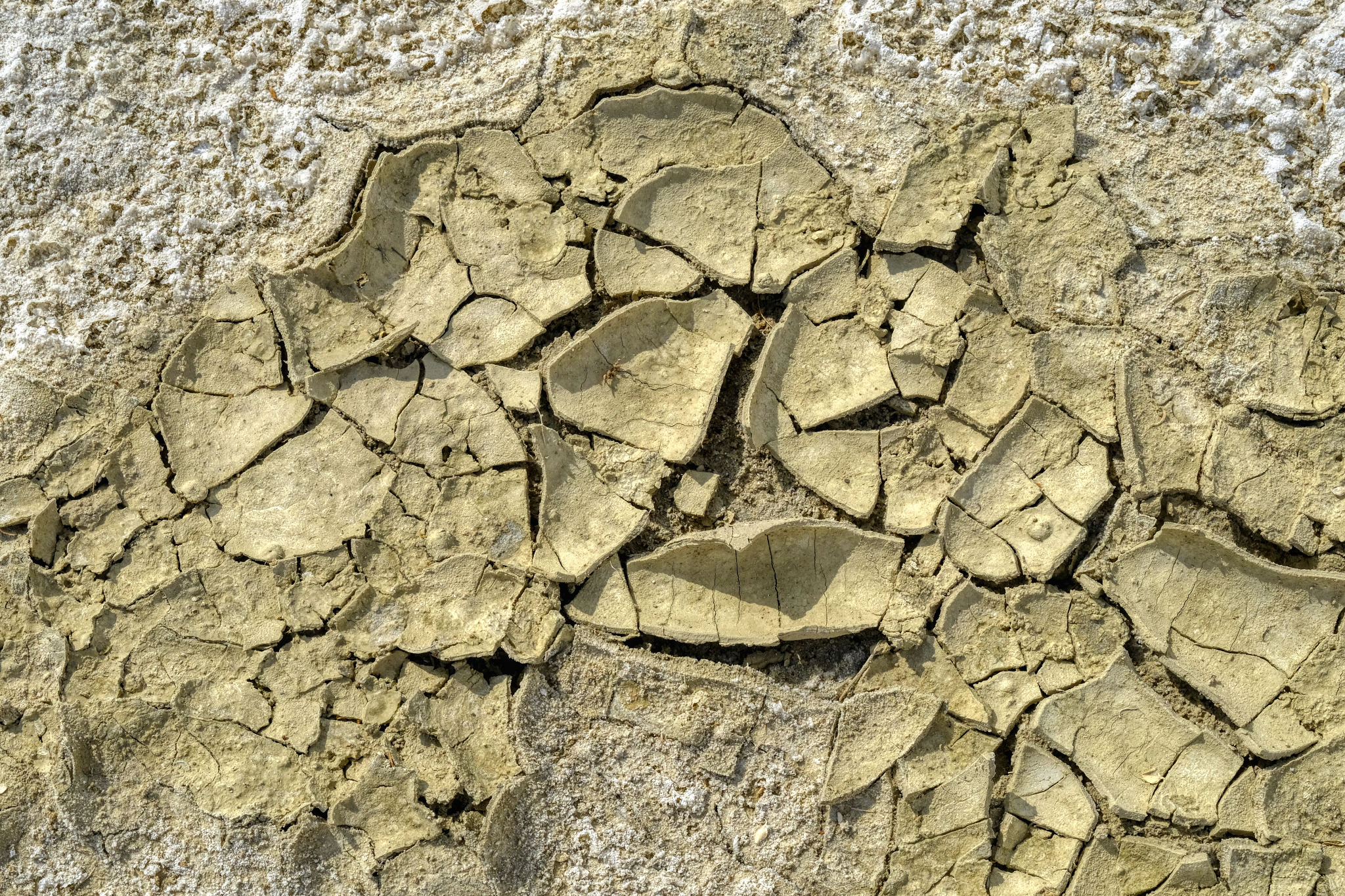 Water had pooled here in the not too distant past.
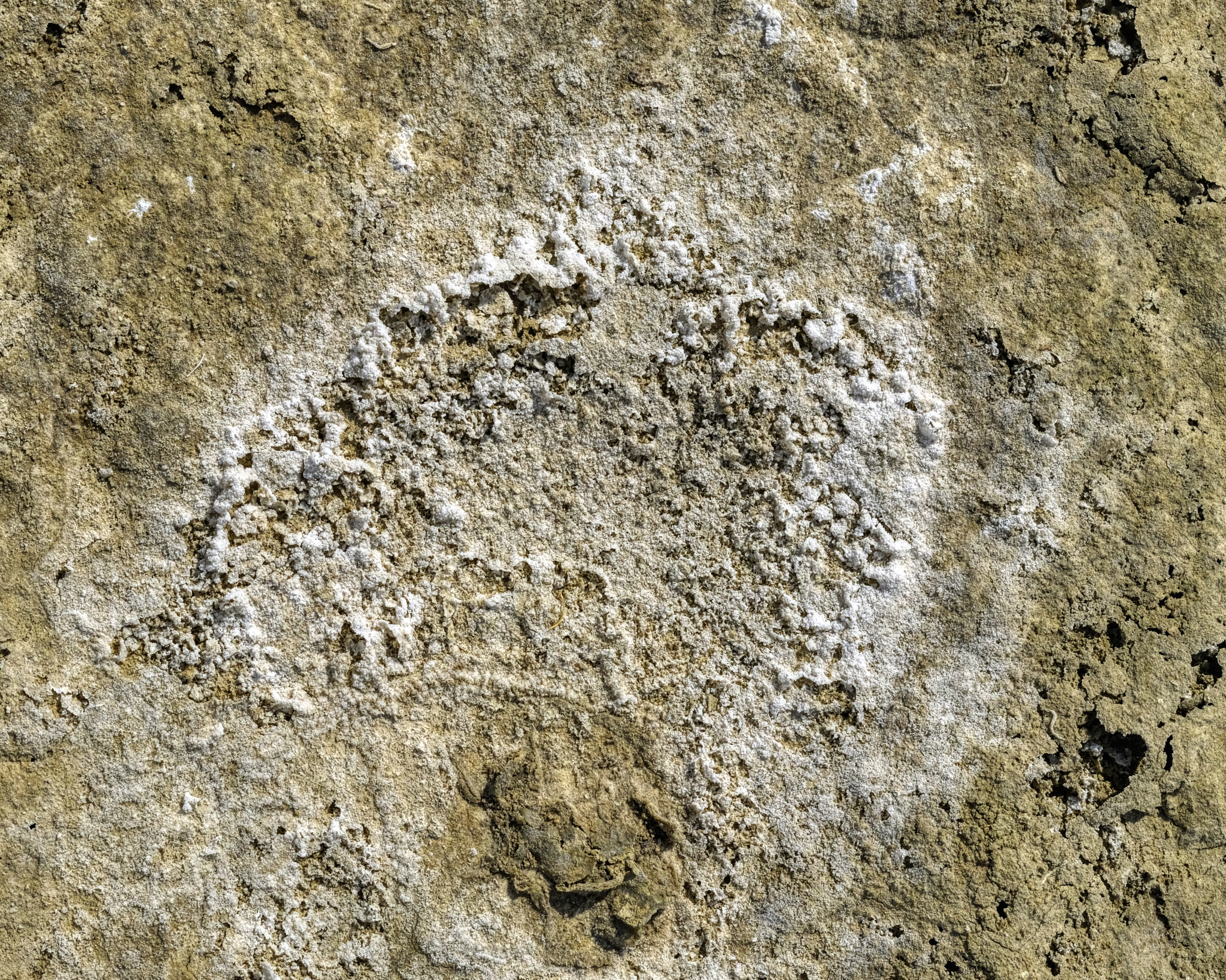
 Much of this vast surface had this texture . . astonishing beauty!
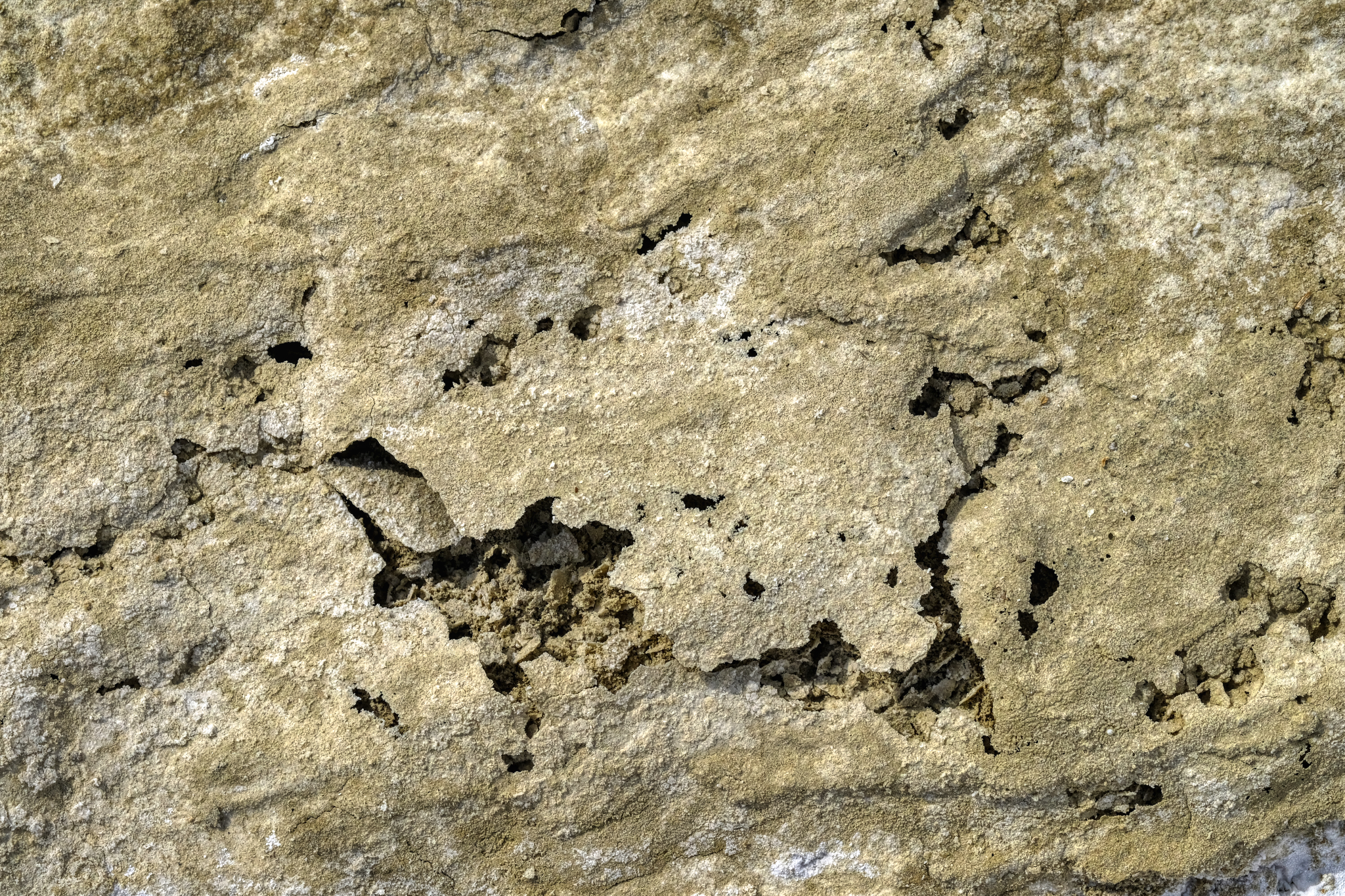 Thin mineral wafers . . .
 I crunched around on these amazing surfaces for quite awhile before turning back to my camper.
 I walked back to my camper by way of this little canyon . . .
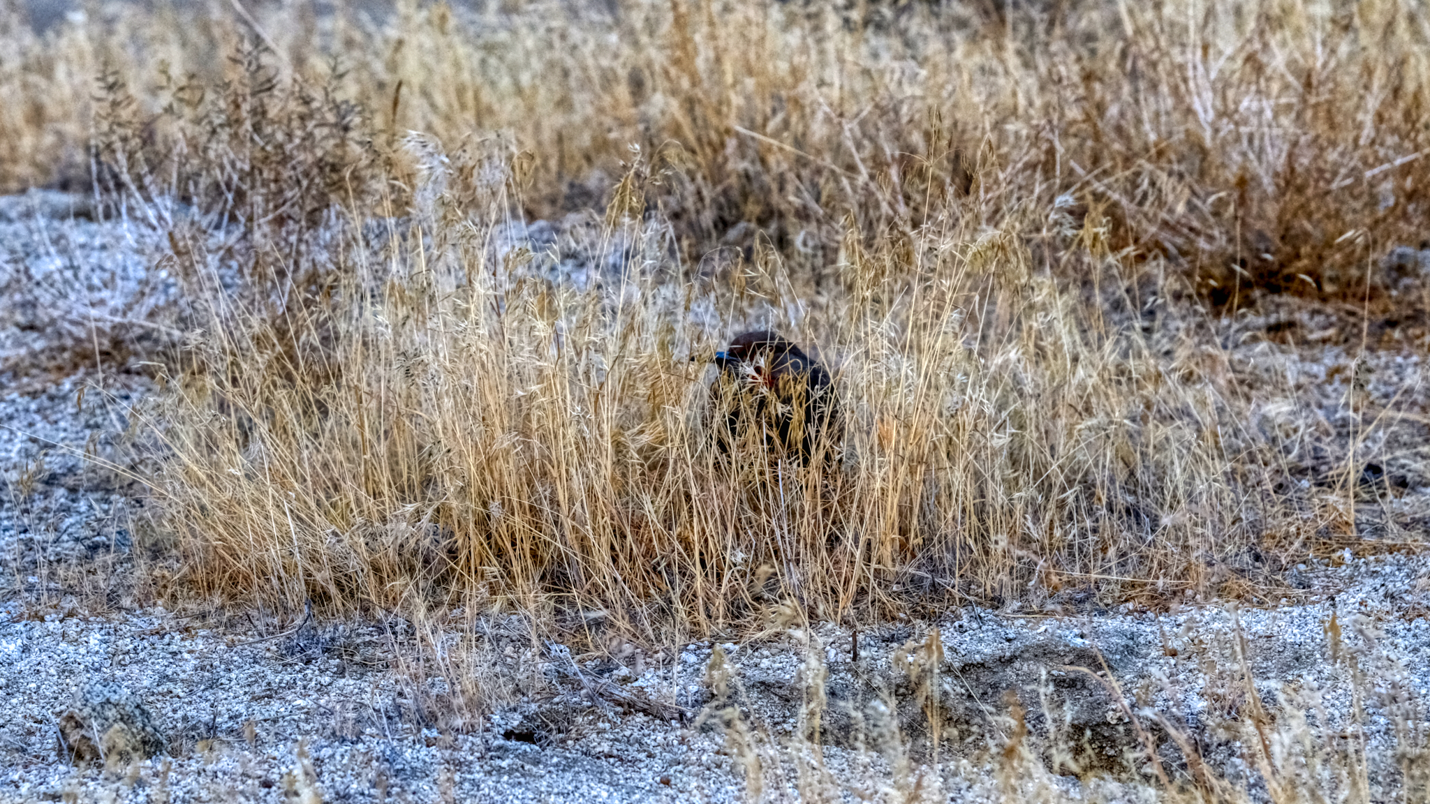 . . . the only wildlife I saw during my five days in the Black Rock Desert . . . one lone bird. There weren't even any insects.
 What I did have in the place of wildlife was geology . . . lots of fascinating geology.
 Back at my campsite, settled into my camp chair, I sat enjoying the rest of the day . . . reading, snacking, drinking lots of water . . . and, yes, checking my iPhone for messages . . . as there was very good (4 bars) Internet way out there!
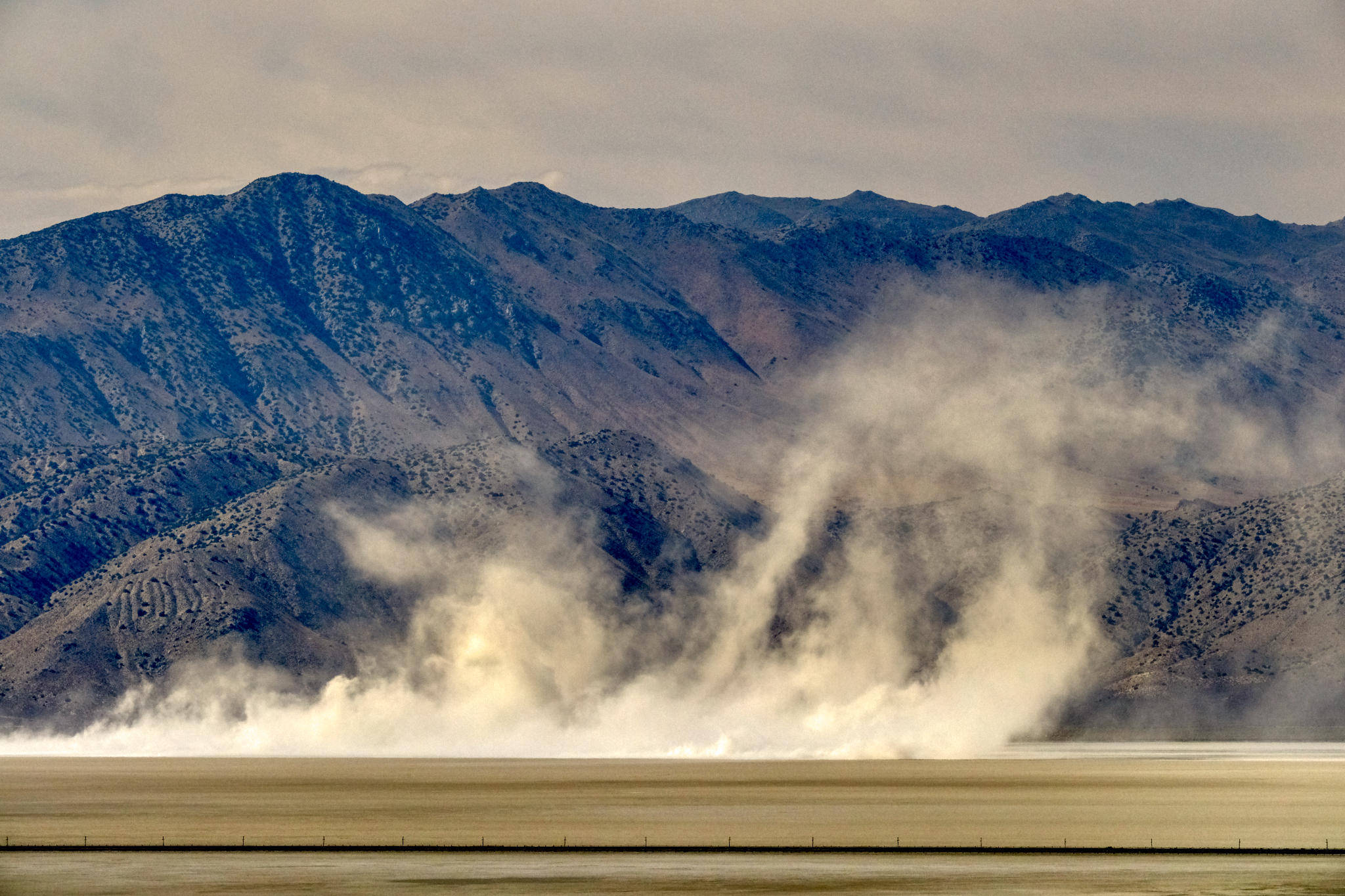 A nice dust storm blew up mid afternoon . . .
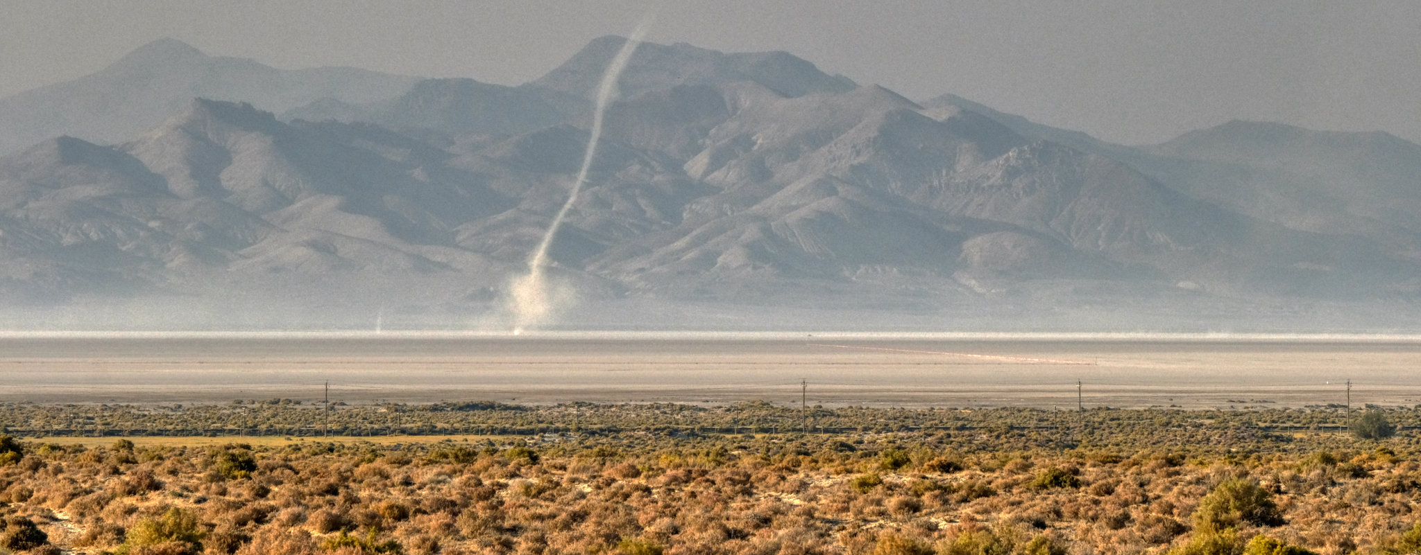 . . . and then a wonderful 'dust devil' blew across the dry lake bed. (Excuse the quality of this photo - a lot of dust in the air at this time).
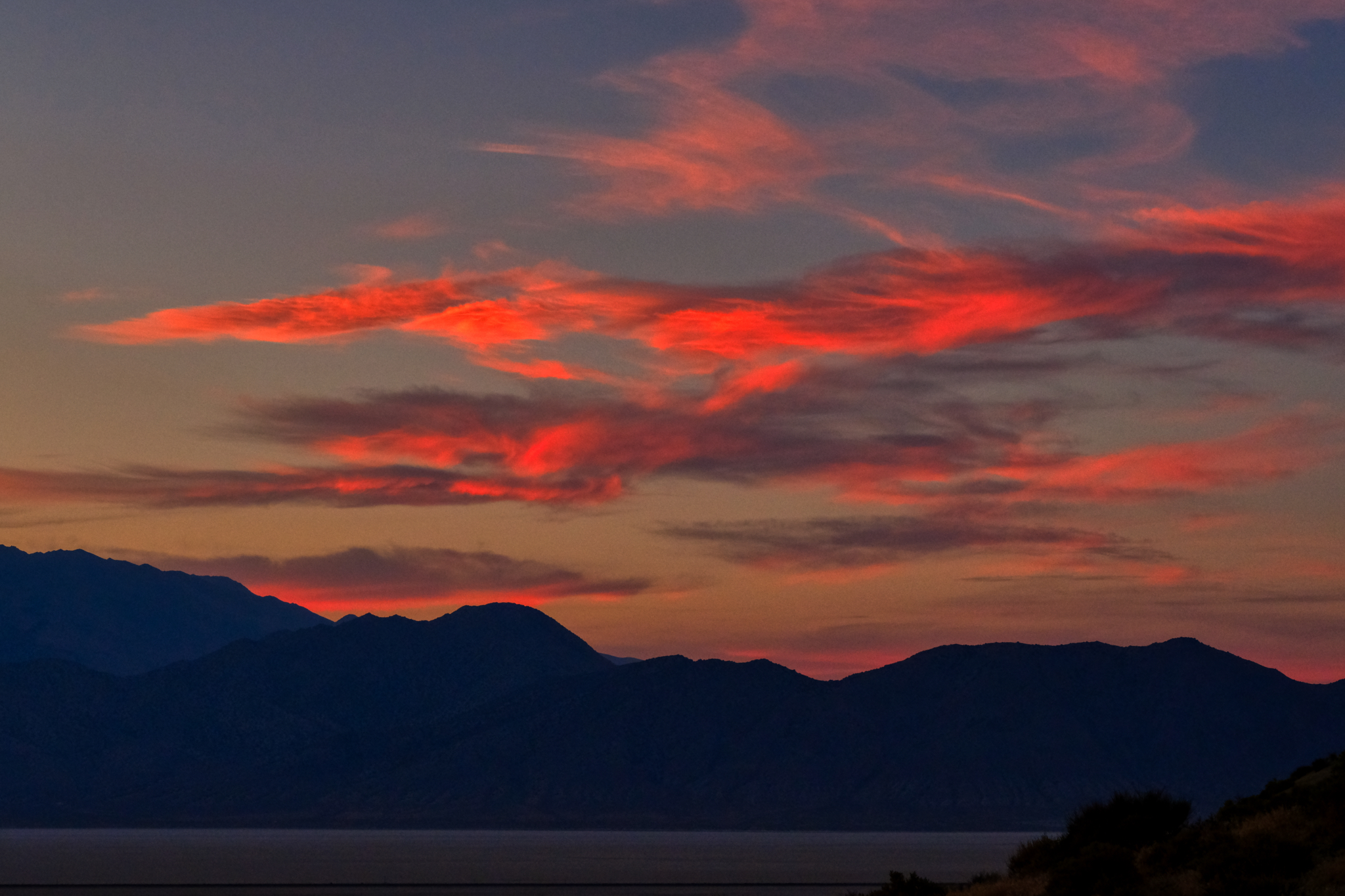
 The sunsets were magnificent!
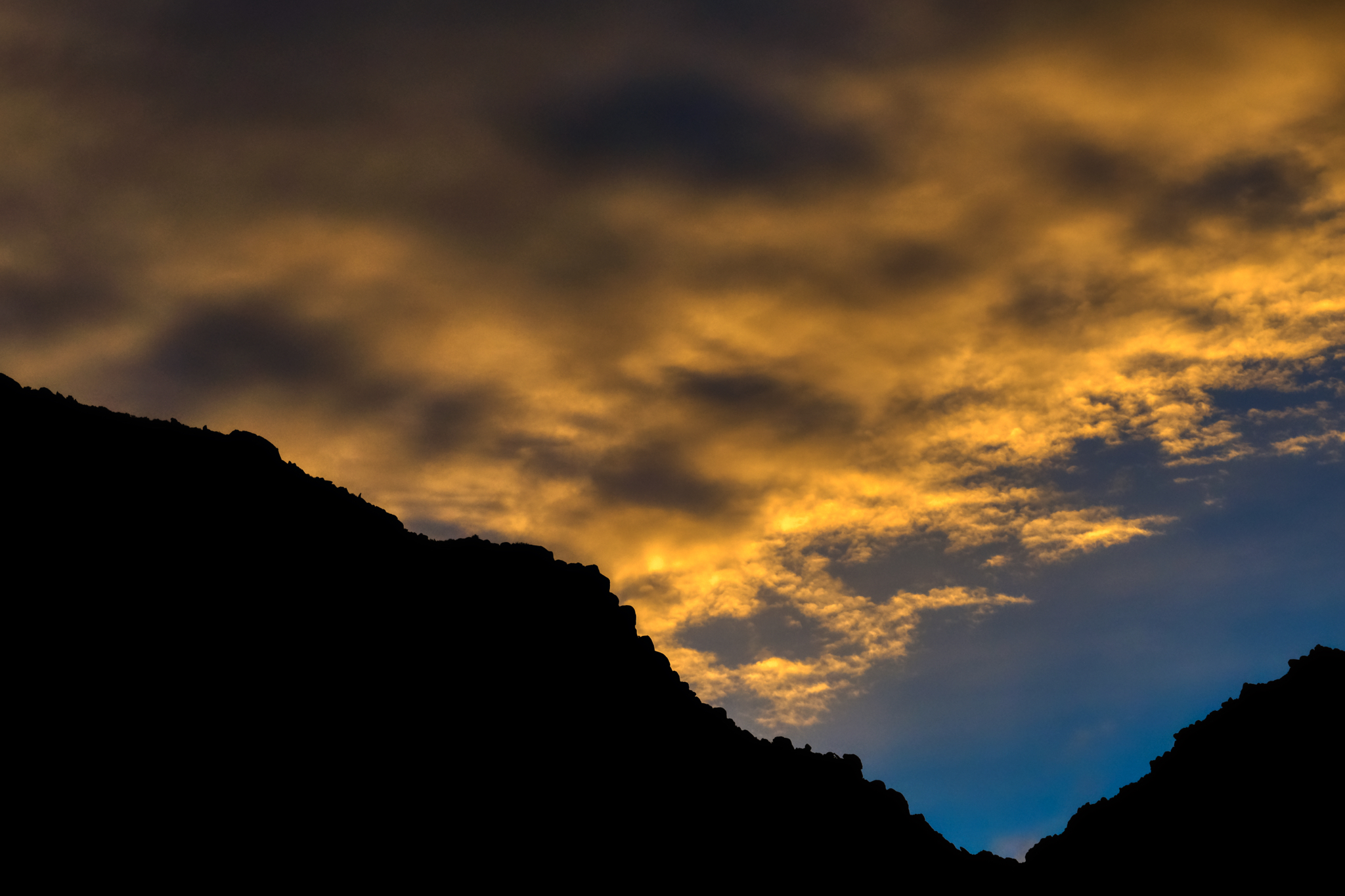 The colors!!!
 "You are in the forest, but you are on the desert."
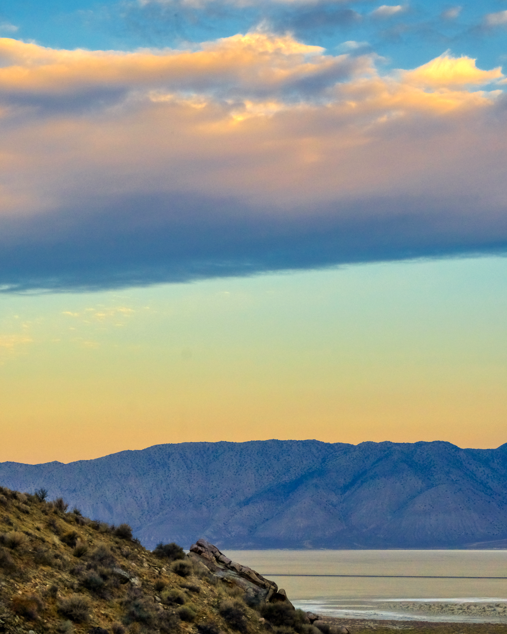
 A morning view out over the dry lake bed of the Black Rock Desert.
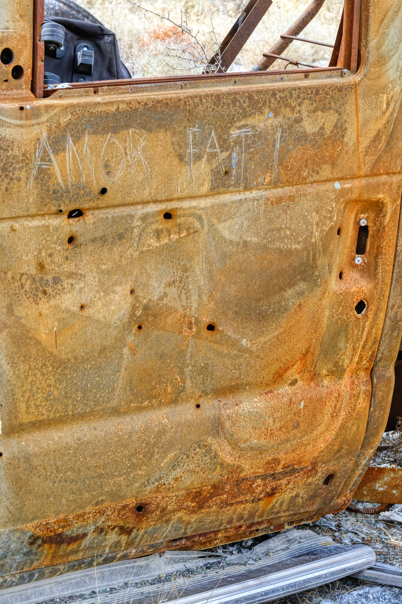 As I discovered, my 'lucky' campsite had not been so lucky for a former visitor to the spot. There was the charred remains of a burned out motorhome not far away. I left this message for future visitors, "Amor Fati."
 I diagnosed the motorhome's problem as an 'overheating problem in the engine.'
 After five days my camper batteries had gone down, so I folded up my sun shade and loaded the table, chairs, porta-potty, and BBQ back into the camper and headed back down the hill. I had had a wonderful and relaxed time just sitting, reading, thinking, wandering around the desert, and enjoying the view. Perfect.
 And then back out on Nevada Highway 49 into Gerlach (pop. 107) . . . and civilization! I stopped in at the only cafe and had a 'real' breakfast and good coffee. I also stopped in at the Burning Man Main Office to find a harried woman dealing with major complaints of some of the attendees . . . the Burning Man event was just two weeks before . . . I intervened and counseled peace and understanding. People calmed down. My work was done. I stopped at the little store and bought a large bag of Cheetos and a couple of Coke Zeros for the drive back to Winnemucca.
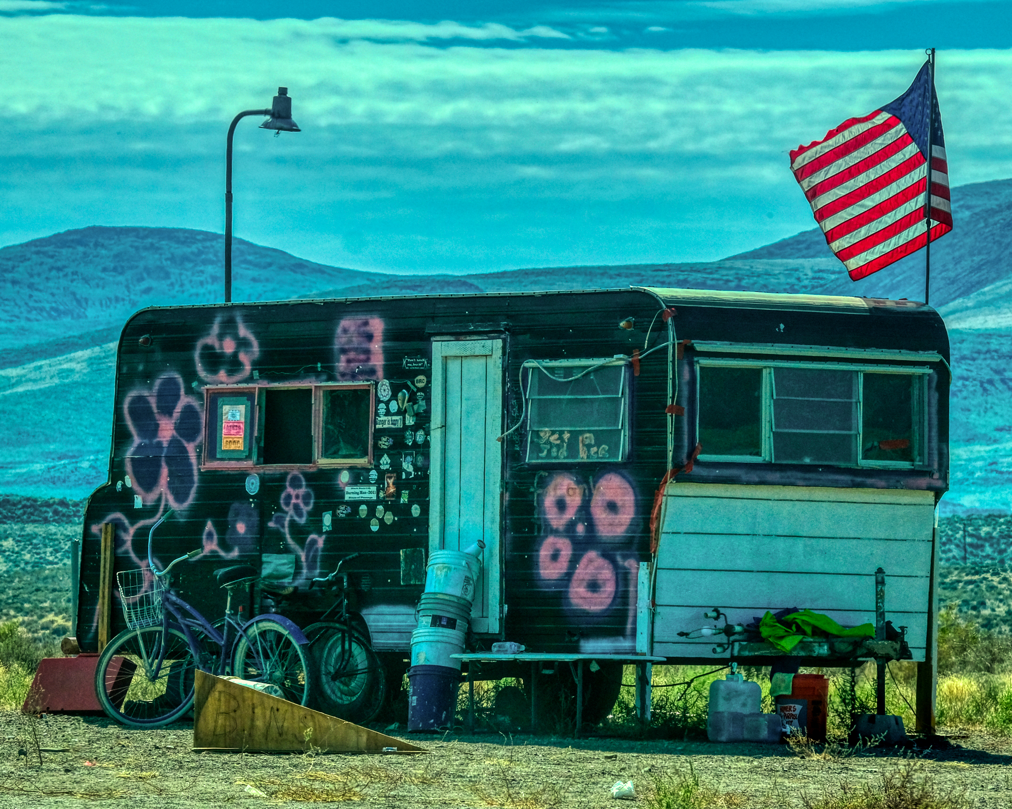 From Gerlach I headed south on Nevada Highway 447 toward Interstate 80 and then back to Winnemucca. But I could not resist stopping and getting this photo of REAL AMERICAN FREEDOM! "Turn on, tune in, and drop out" anyone?
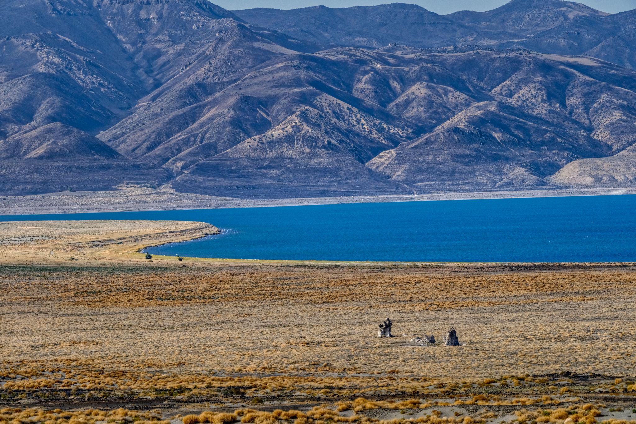 Ancient Pyramid Lake and the town of Nixon was my last stop before I entered I-80. A shower, washing machine, and NFL games in the casino lounge were waiting for me.
 A great trip!
 Dr. Jeff Harper
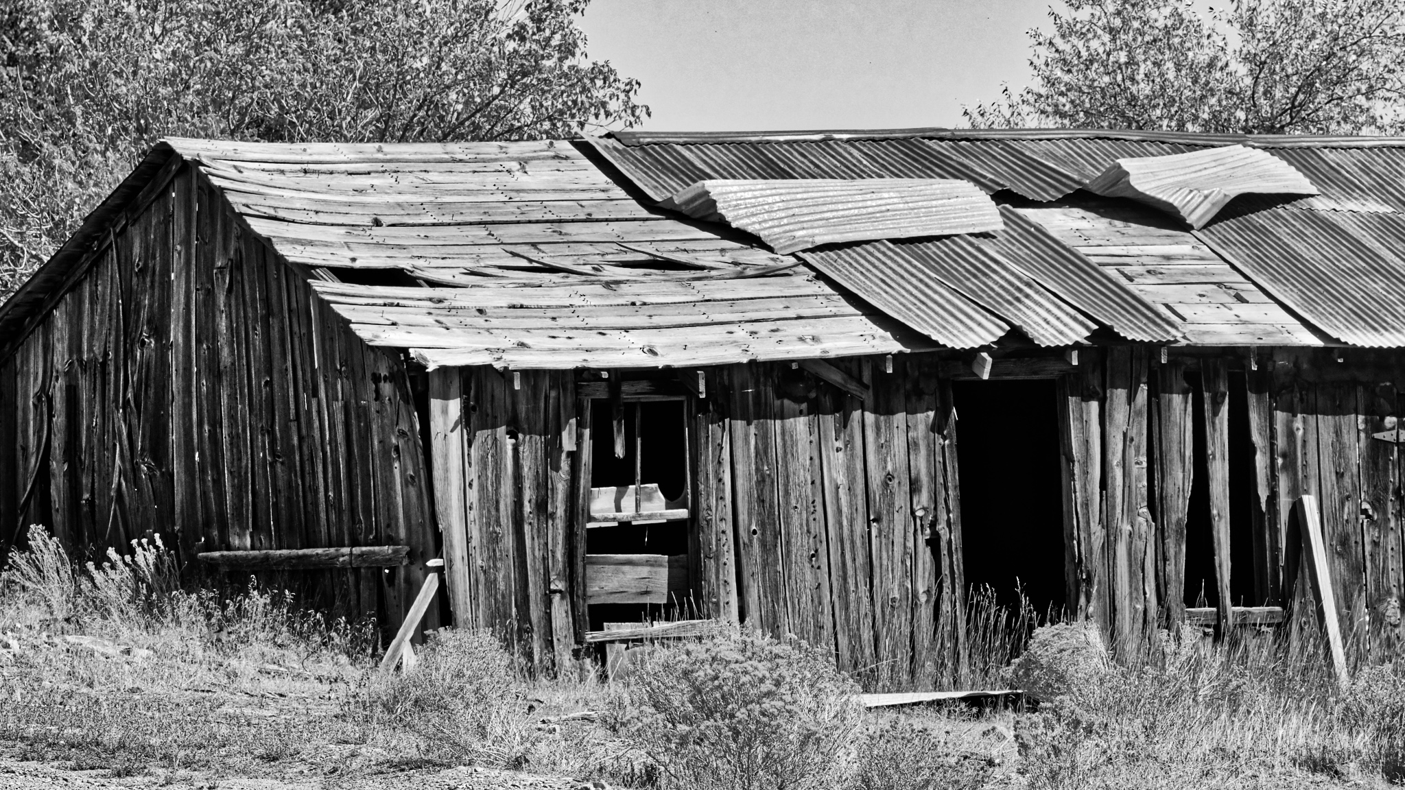
Some of the photos of the abandoned miners' 'town' demanded black and white post-processing . . . here they are without comment:
Road Trip USA: Bonneville, Utah to Swall Meadows, California
In early September 2018, after camping/spectating at the World of Speed land speed event on the Bonneville Salt Flats, I drove at a 45 degree angle across the state Nevada to get to Swall Meadows, California in the Eastern Sierras.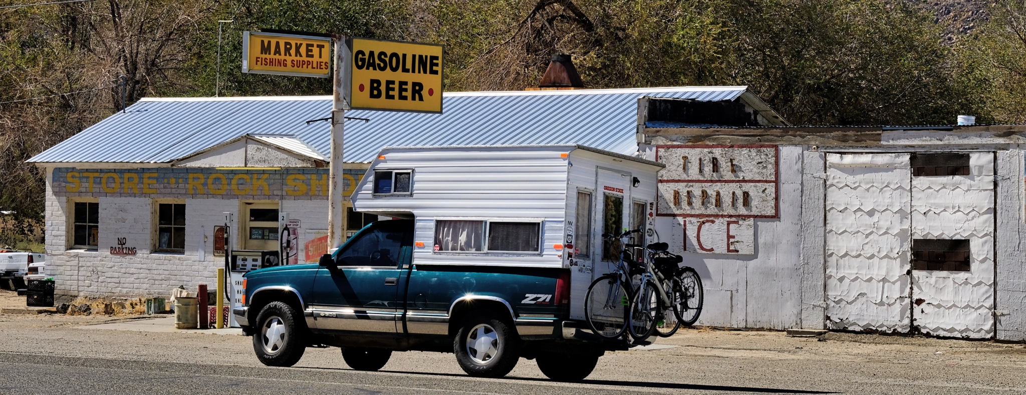
On the road again!!!
 The road out of Utah went through some very deserted landscape. There were miles and miles between any sign of human activity.
 A little human activity after the first hundred miles . . . a roadside stop up ahead on the right.
 I suppose these geological features exist all over the world, but they would be obscured by forests and towns, and farms. Out here, in this high scrubland, every little remnant of a cinder cone still stands out.
 I absolutely love this type of landscape . . . and I don't know why . . . maybe the expression "high lonesome" explains it. I feel pulled to just wander around these hills . . . for years.
 An endless expanse of an endless variety of shapes and colorful vistas.
 Here and there can be seen traces of former mining operations in the scars on the mountains.
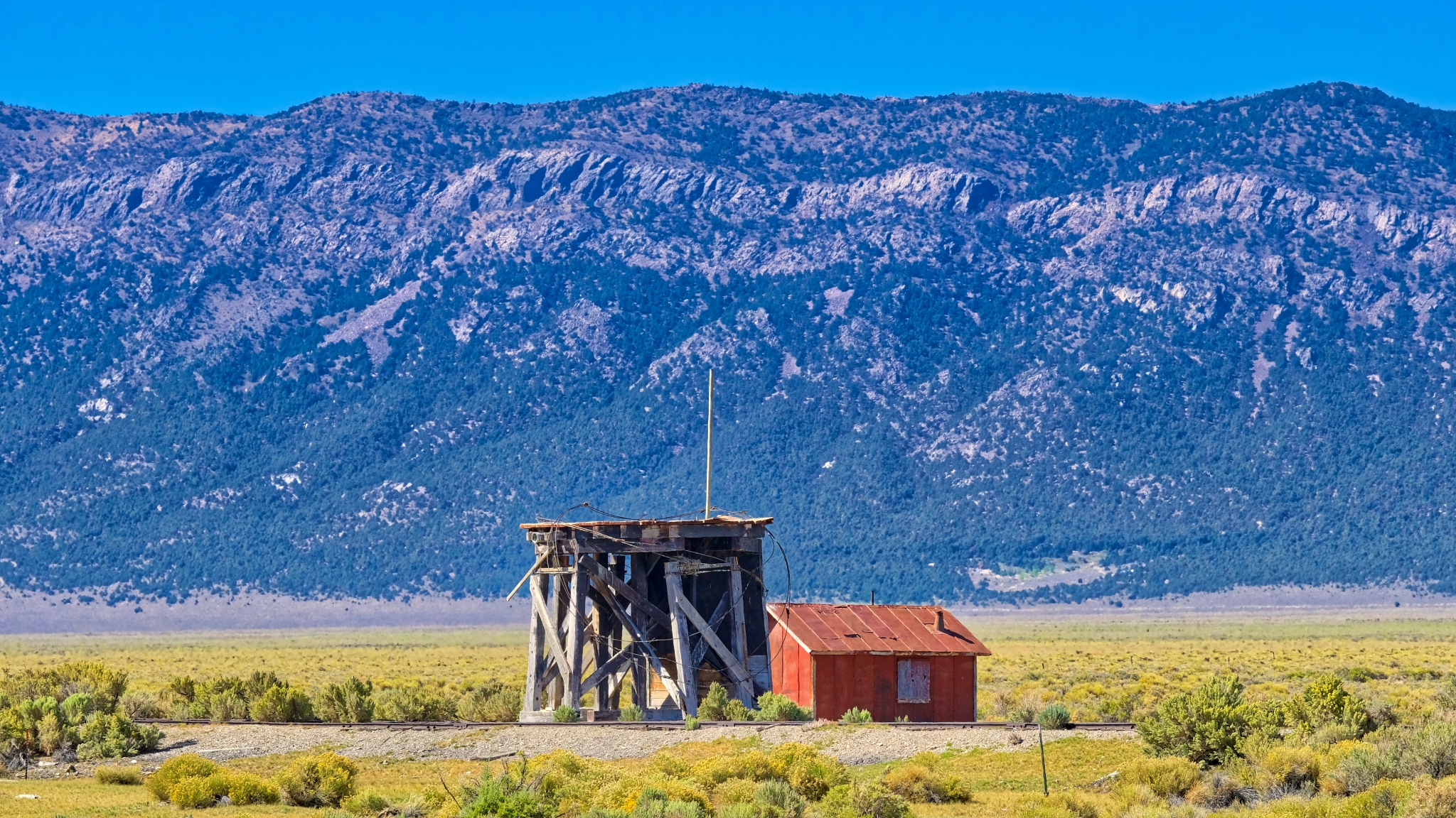 An abandoned water tower servicing an abandoned rail spur near Cherry Creek, Nevada.
 I passed by many roads I didn't have time to explore.
 A story for each abandoned shack out here . . . a story never to be told.
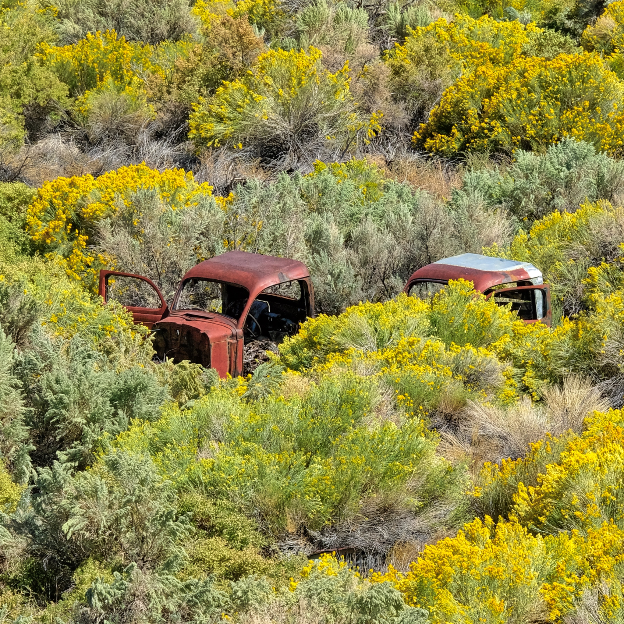 Used and left behind. I'm surprised the hot rodders and rat rodders haven't scavenged these old truck cabs.
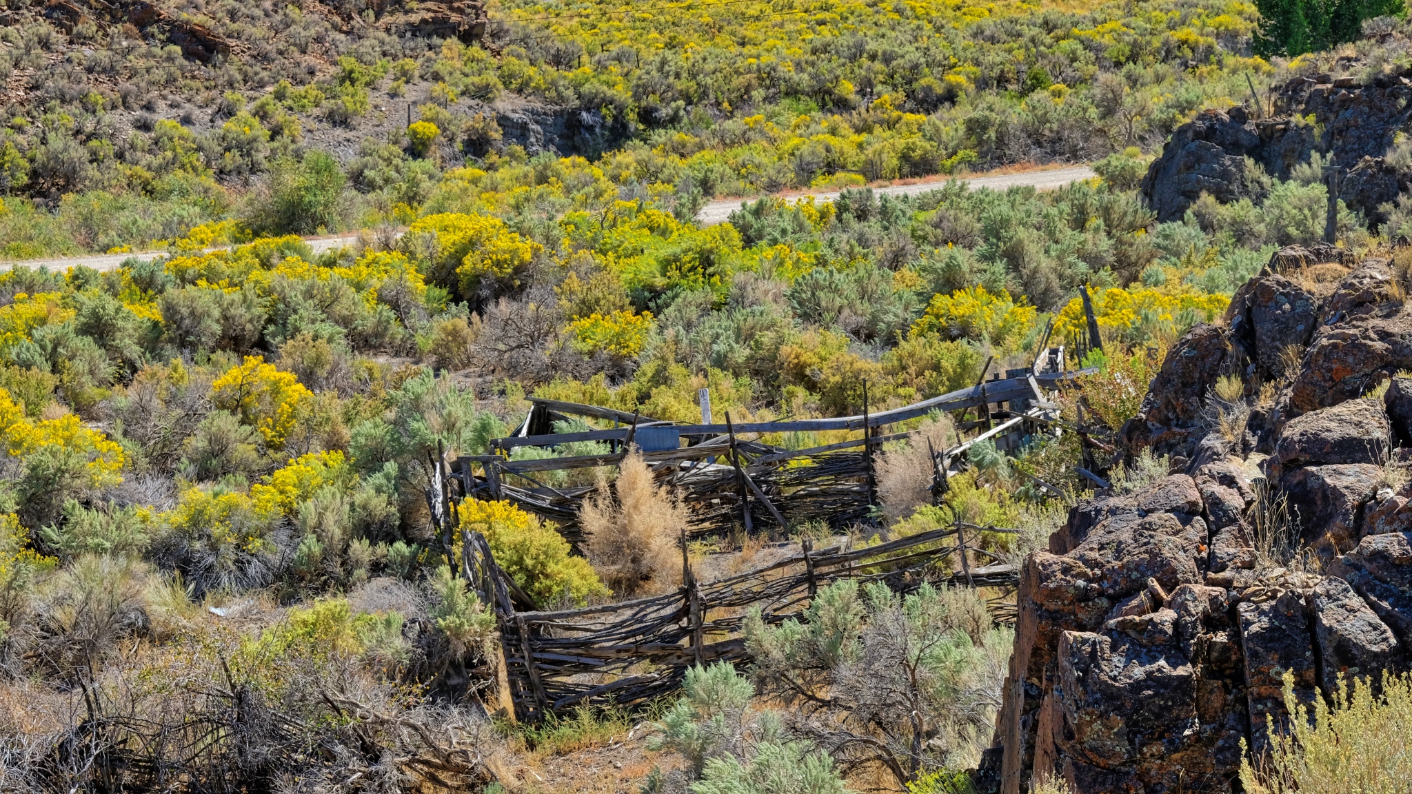 Hopes of ranching left behind with the decaying split beams.
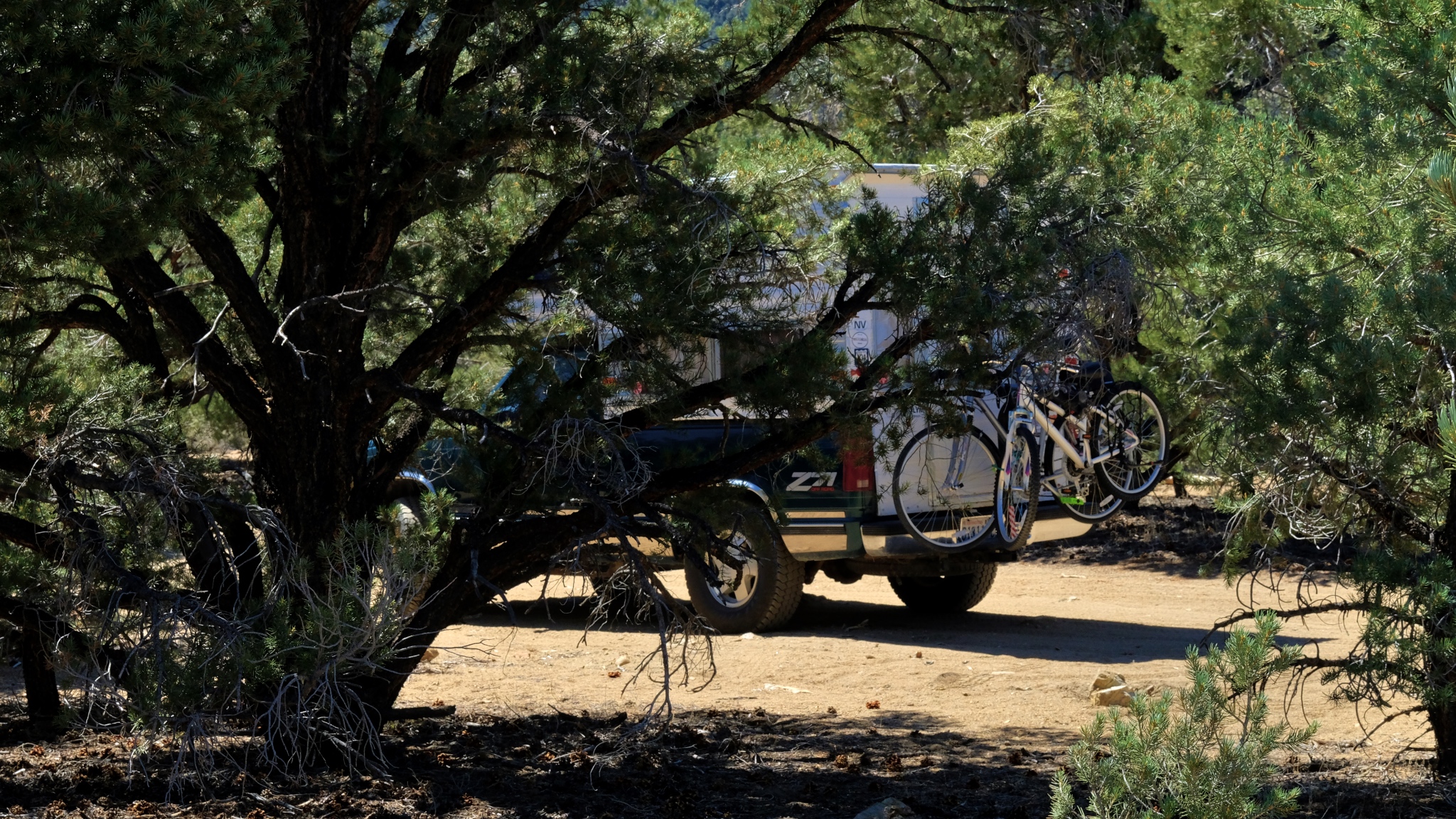 It is good to have four wheel drive when nature calls.
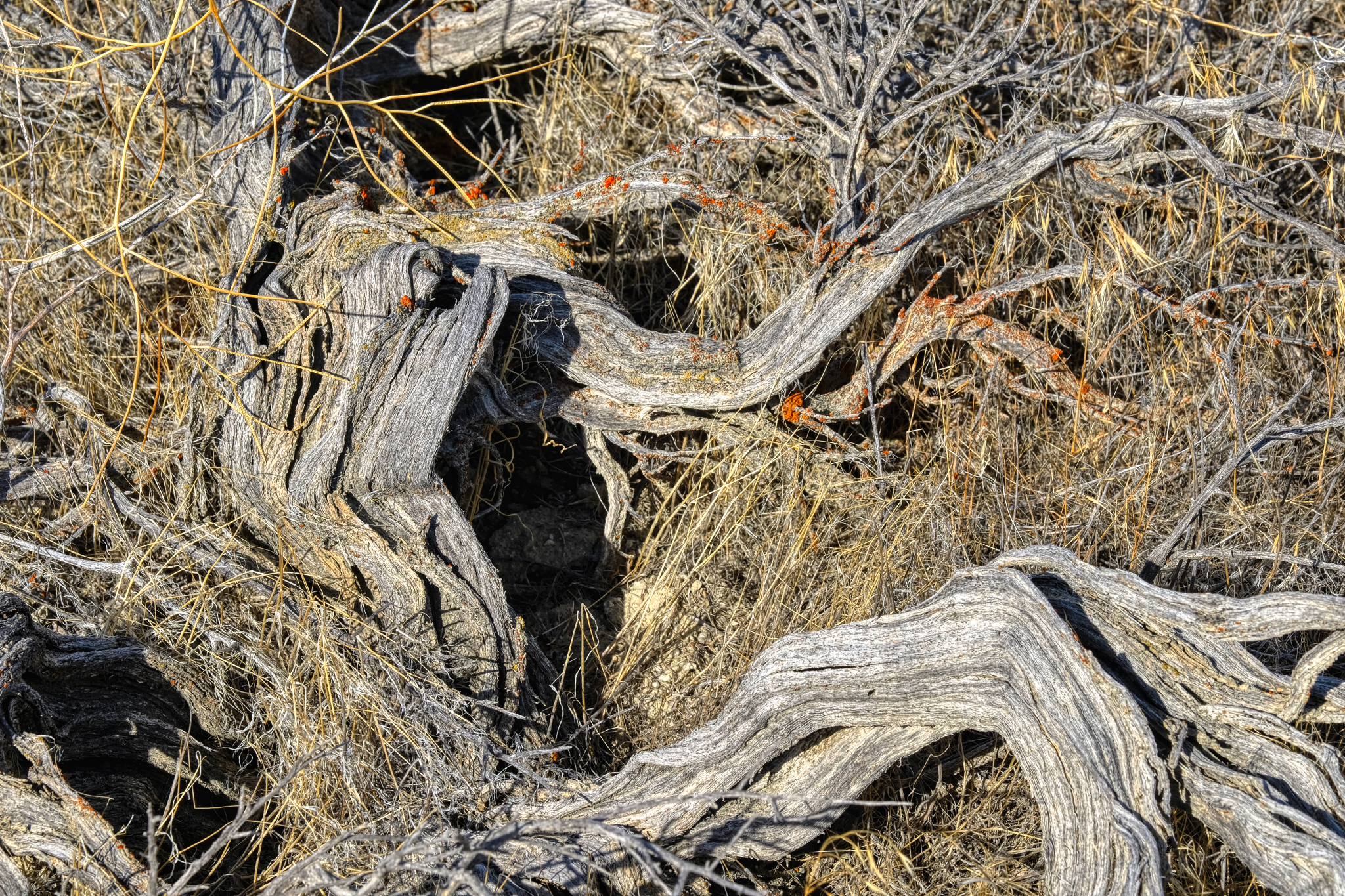
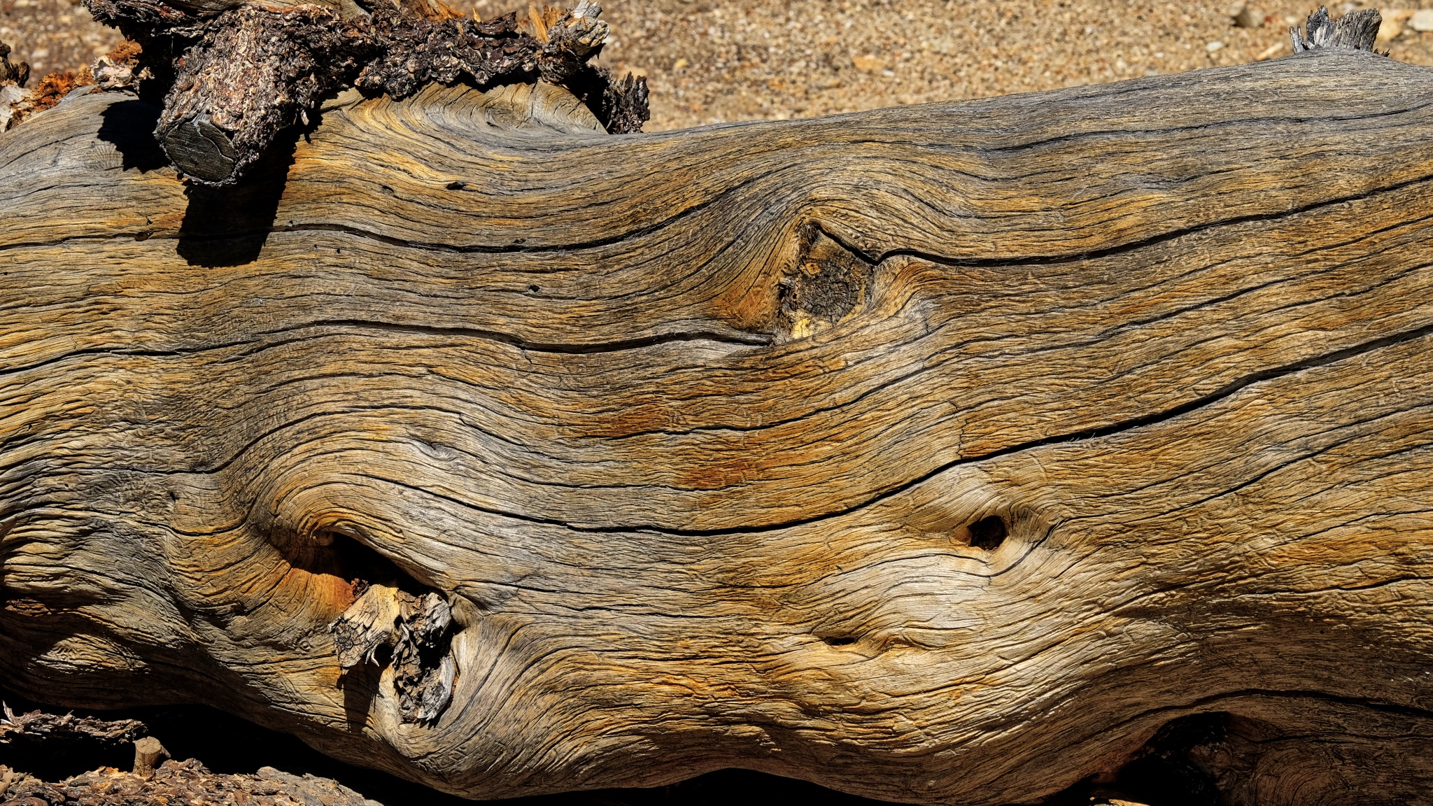 An ancient bristle cone pine trunk.
 A left behind moon on a clear Nevada morning.
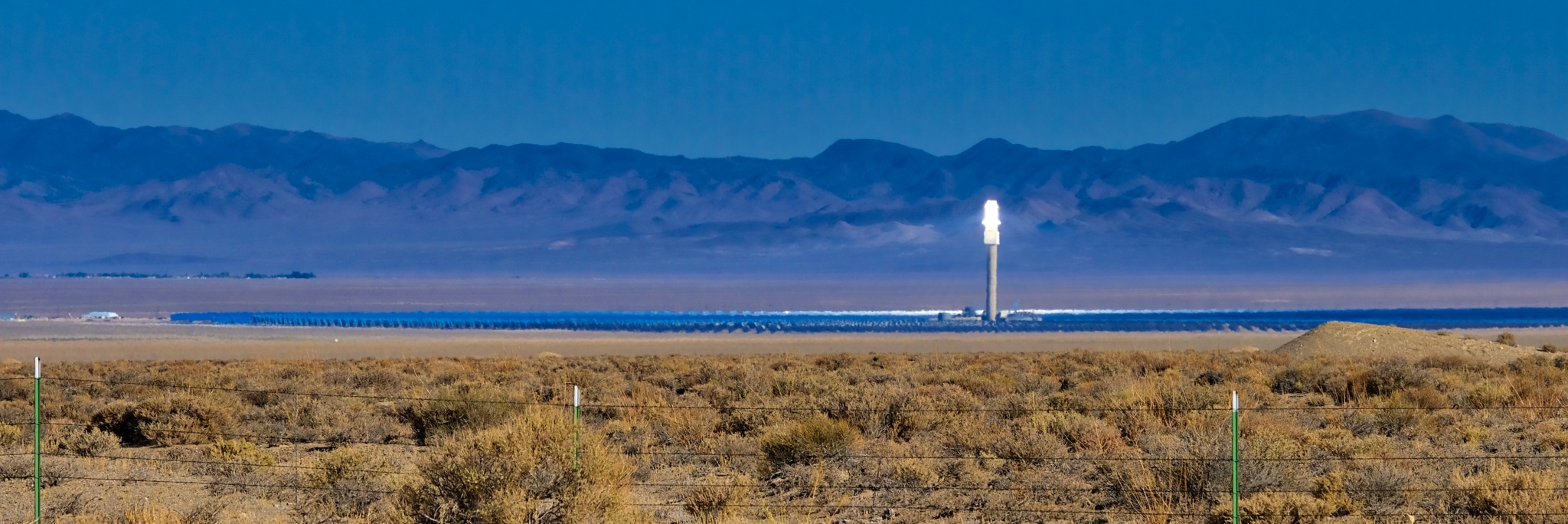 A solar reflector energy farm way out in the desert. Amazing technology . . . you could almost smell the fried birds from the road!
 Loving my life on the road!
 A long road to an other abandoned mountainside mine.
 Scrub brush, dry lake, and mineral rich mountains.
 With so few structures around, I stopped at each one . . .
 Mineral rich hills . . . another abandoned mining operation.
 Strange hills left behind to weather after mining. This looks like a tungsten vein.
 The colors, shapes, and textures of these mined hills were simply fantastic.
 Geology everywhere (of course).
 Along the highway a gypsum deposit.
 An active gypsum mine.
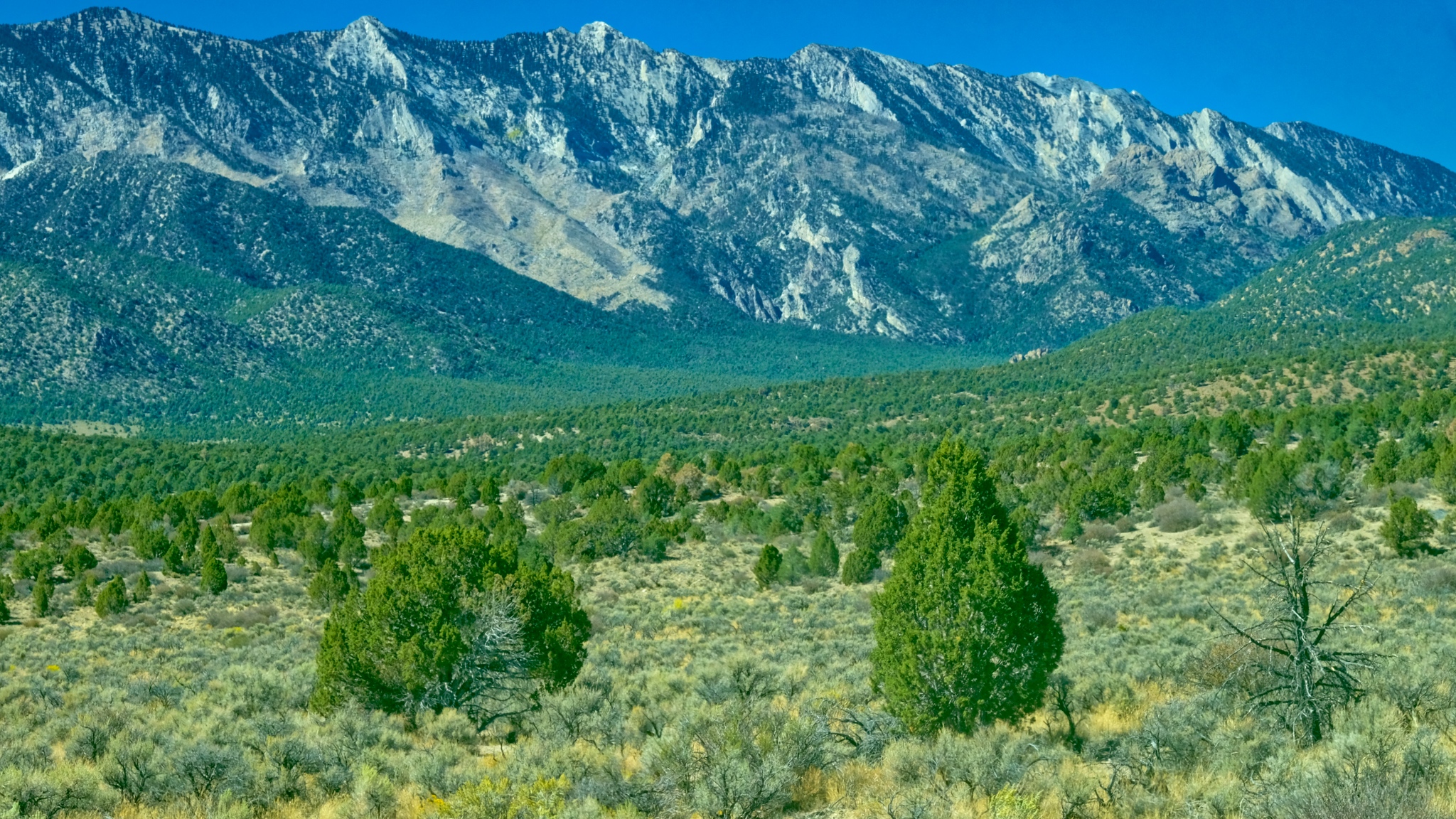
 Coming up on the Boundary Range, which separates Nevada from California.
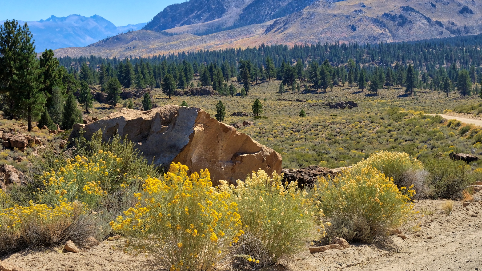
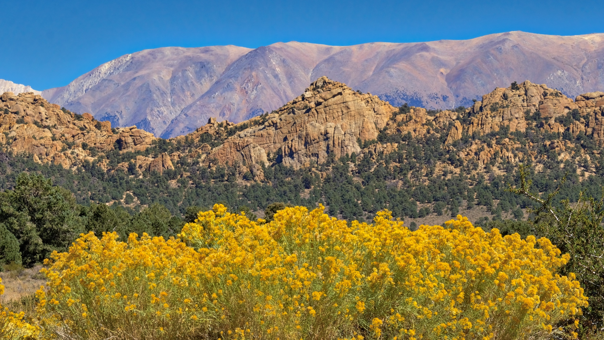 Some stunning flowering scenes as I began to gain in elevation into the Boundary Range.
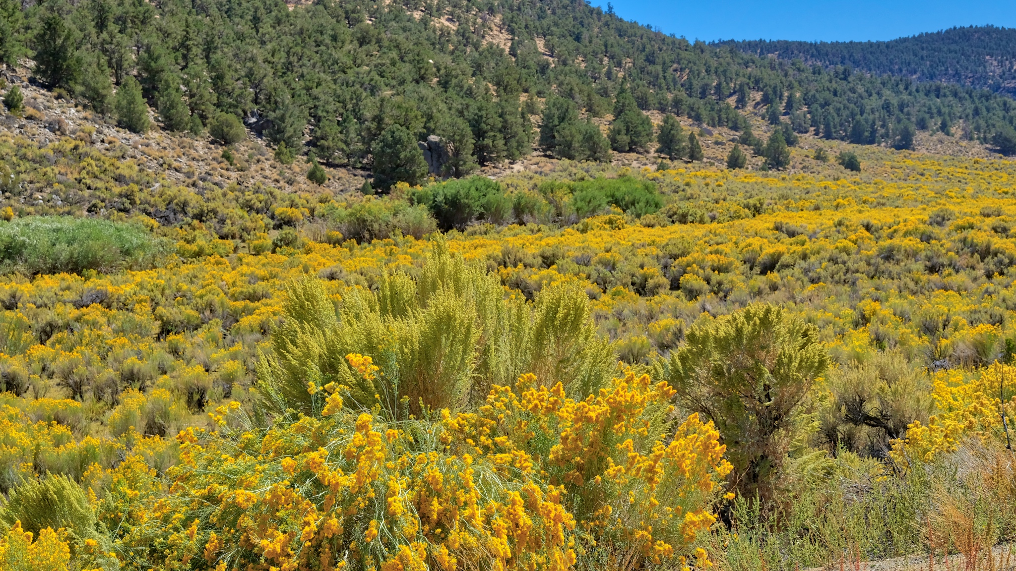 Up and over a mountain pass through a sea of yellow!
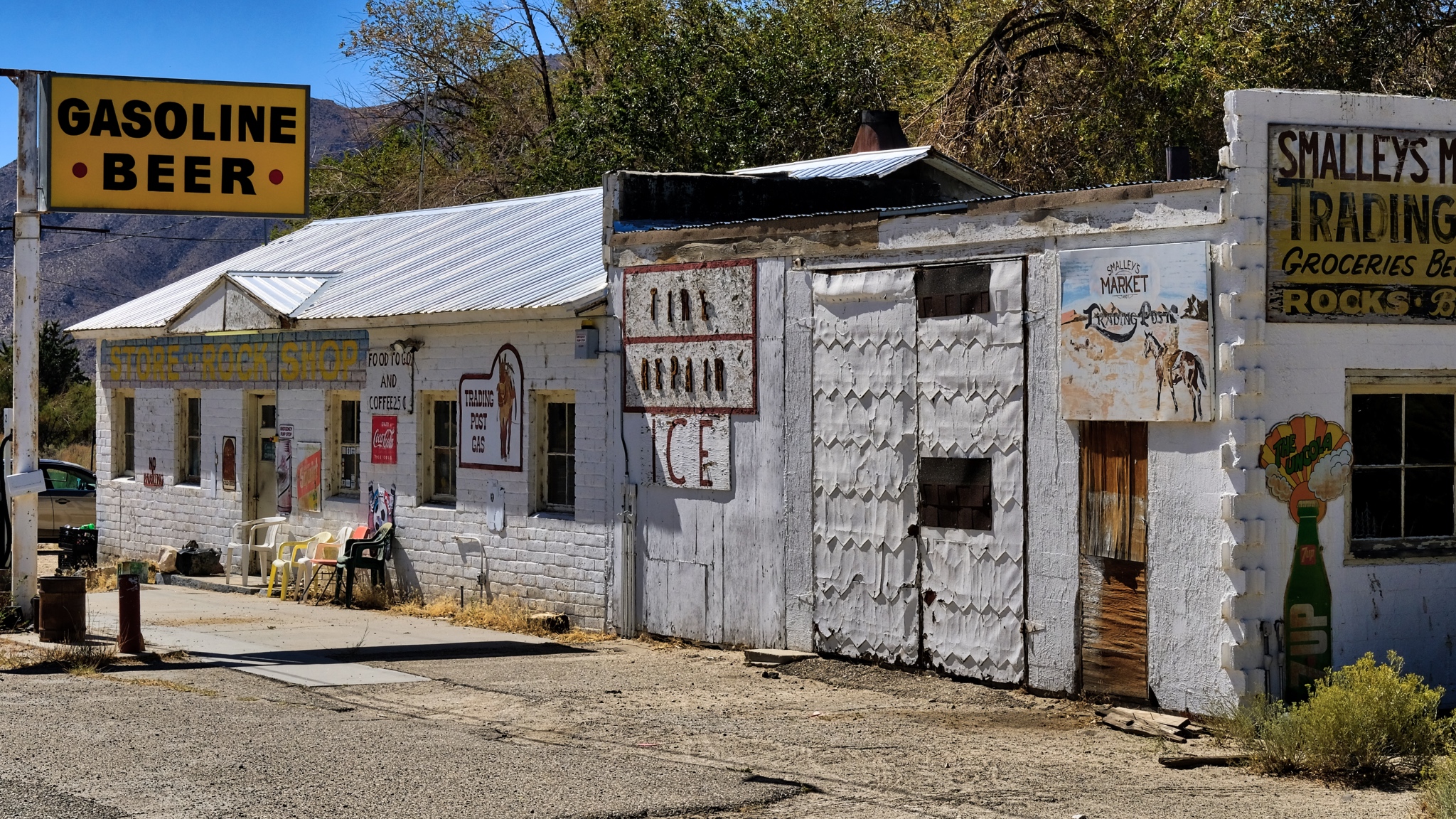 There were a few wide spots in the road along the way . . . here in Benton, California.
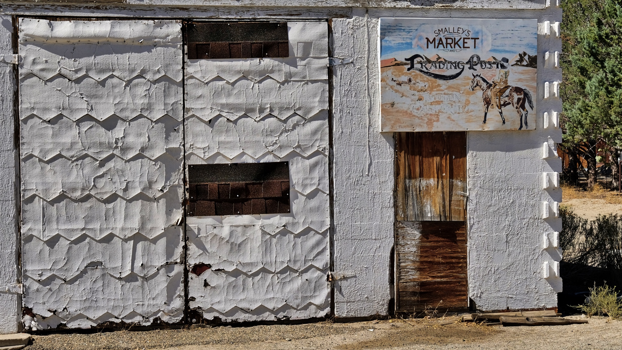 Fabulous textures of age.
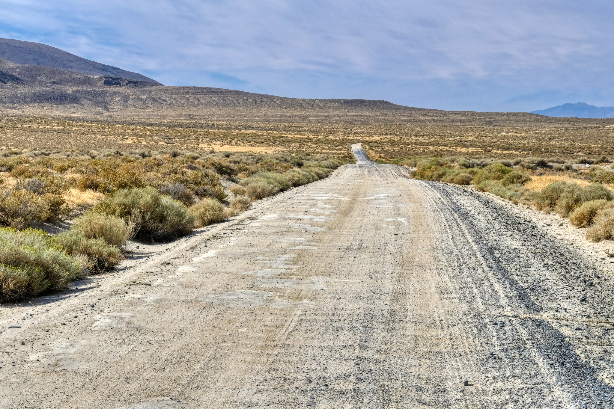
 After Benton (and Benton Hot Springs), the GPS took me down 120 miles of gravel road to my destination. I was very happy about it too!
 100 miles of this! I took my time.
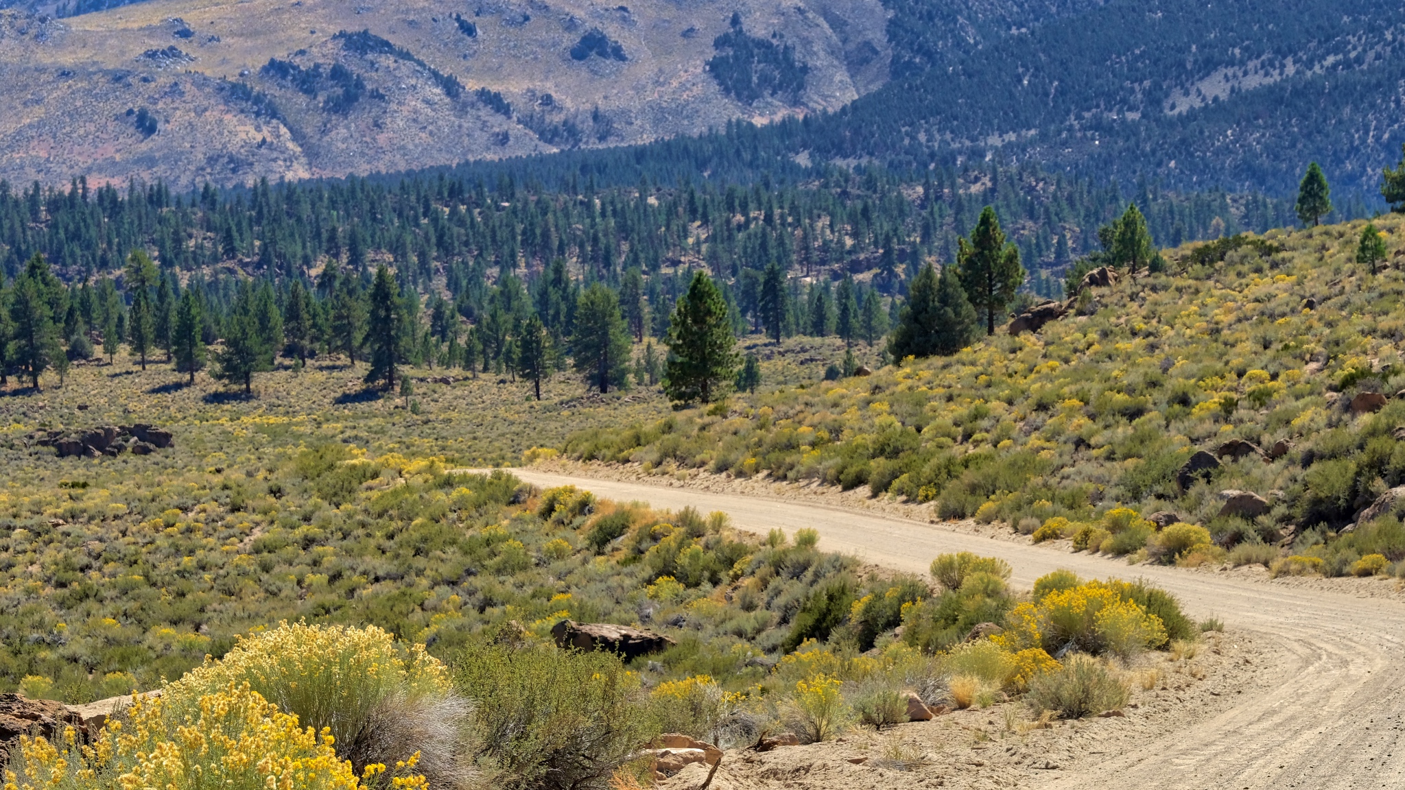 I drove for two hours on this gravel road and did not encounter a single other vehicle.
 The trees became larger the more altitude I gained.
 Up and over and up and over many steep passes . . . .
 And on such a beautiful day . . . .
 After two hours on Owens George Road I crested a hill to see Crowley Lake, just 15 miles from my final destination.
 Civilization At Last!!!!!
 The view approaching Swall Meadows; looking toward Bishop, California in a recent burn.
 Near Swall Meadows where I would base myself for my next adventure: camping up in The Buttermilk Country.
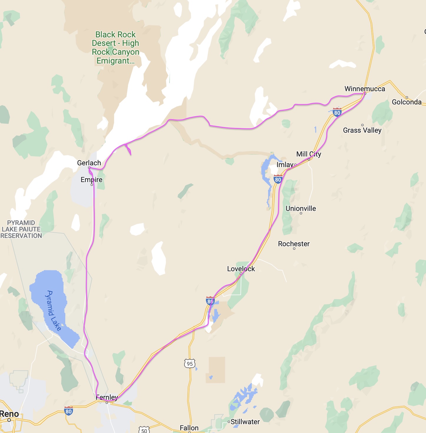
Road Trip USA: In and Out of Winnemucca, Nevada
September 2018
 After camping up on Steens Mountain in Oregon, I drove south on Oregon Highway 205. My destination was Winnemucca, Nevada, where I would stage for my planned camping out on Nevada's Black Rock Desert. I was dirty, my camper was dirty, and my clothes were dirty. I needed a few nights in an RV park . . . and I had a hankering for Mexican food.
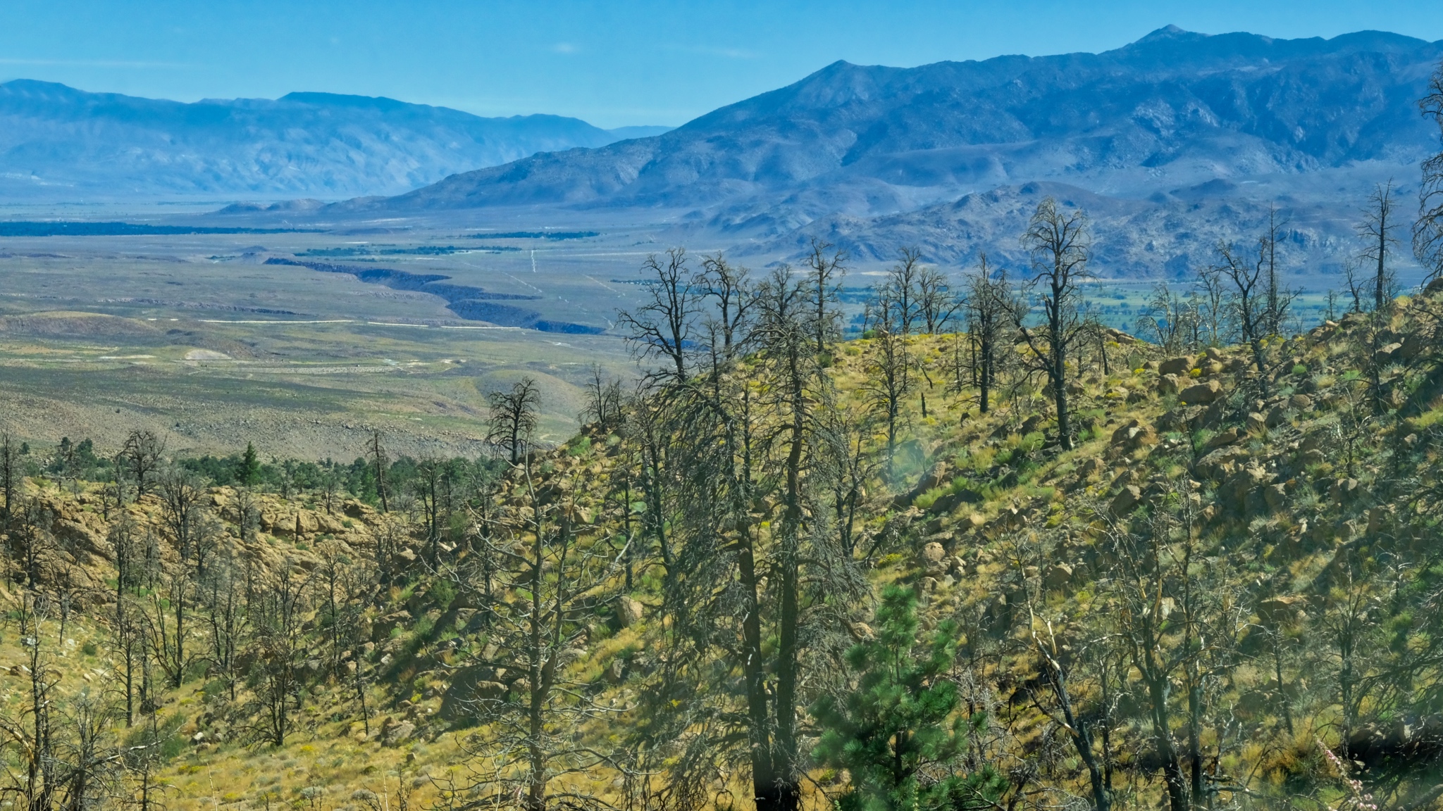
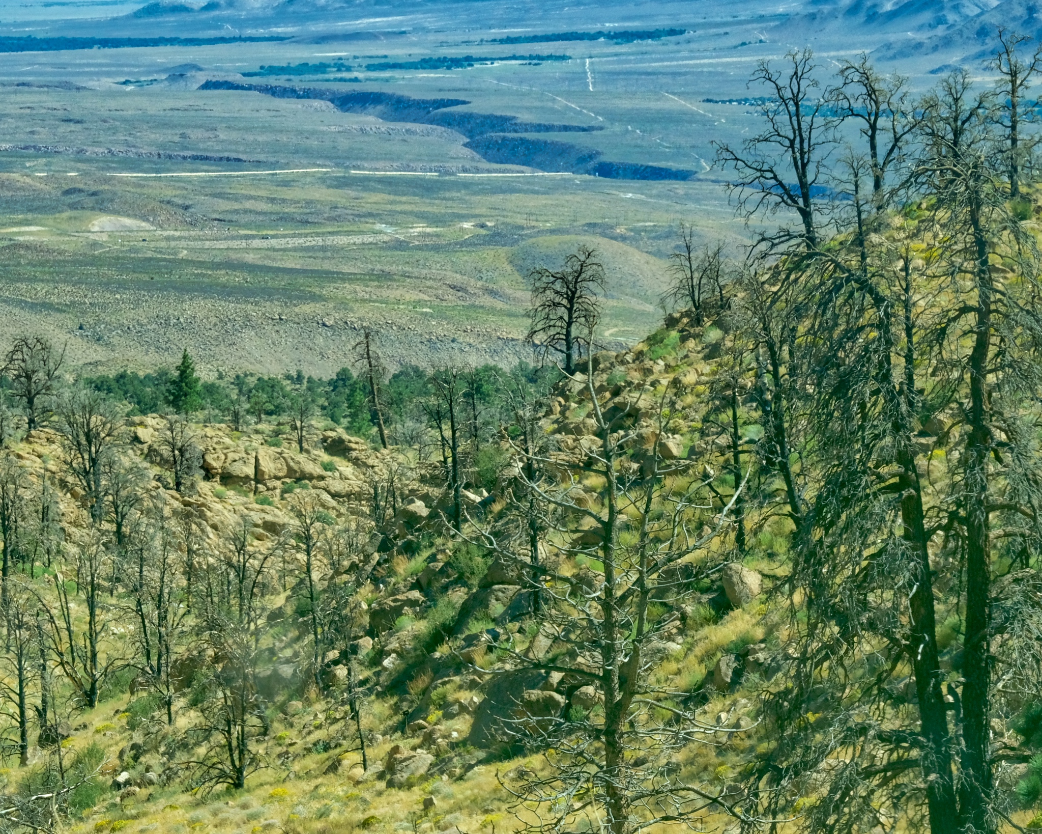
 It was roughly 200 miles from my campsite in The Steens to Winnemucca through some of the most uninhabited countryside in the USA. The major wildfires that had swept through much of the western states left behind smoke and haze that obscured the landscape . . . and in some cases made it more interesting.
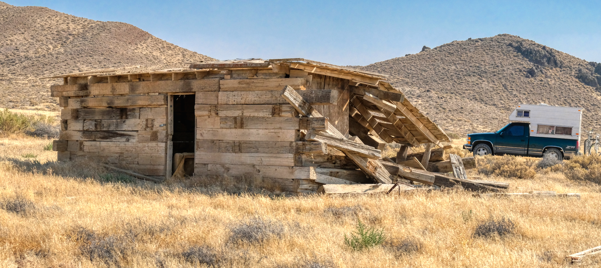
 This unforgiving high arid country left behind many abandoned homesteaders and miners' shacks, sheds, and farms buildings in the giant western landscapes.
 If these walls could talk . . . certainly applies here.
 I had fun stopping, getting out of the truck, taking a photo, driving on a few feet and getting out again . . . . These scenes are so photogenic, I didn't want to miss a shot!
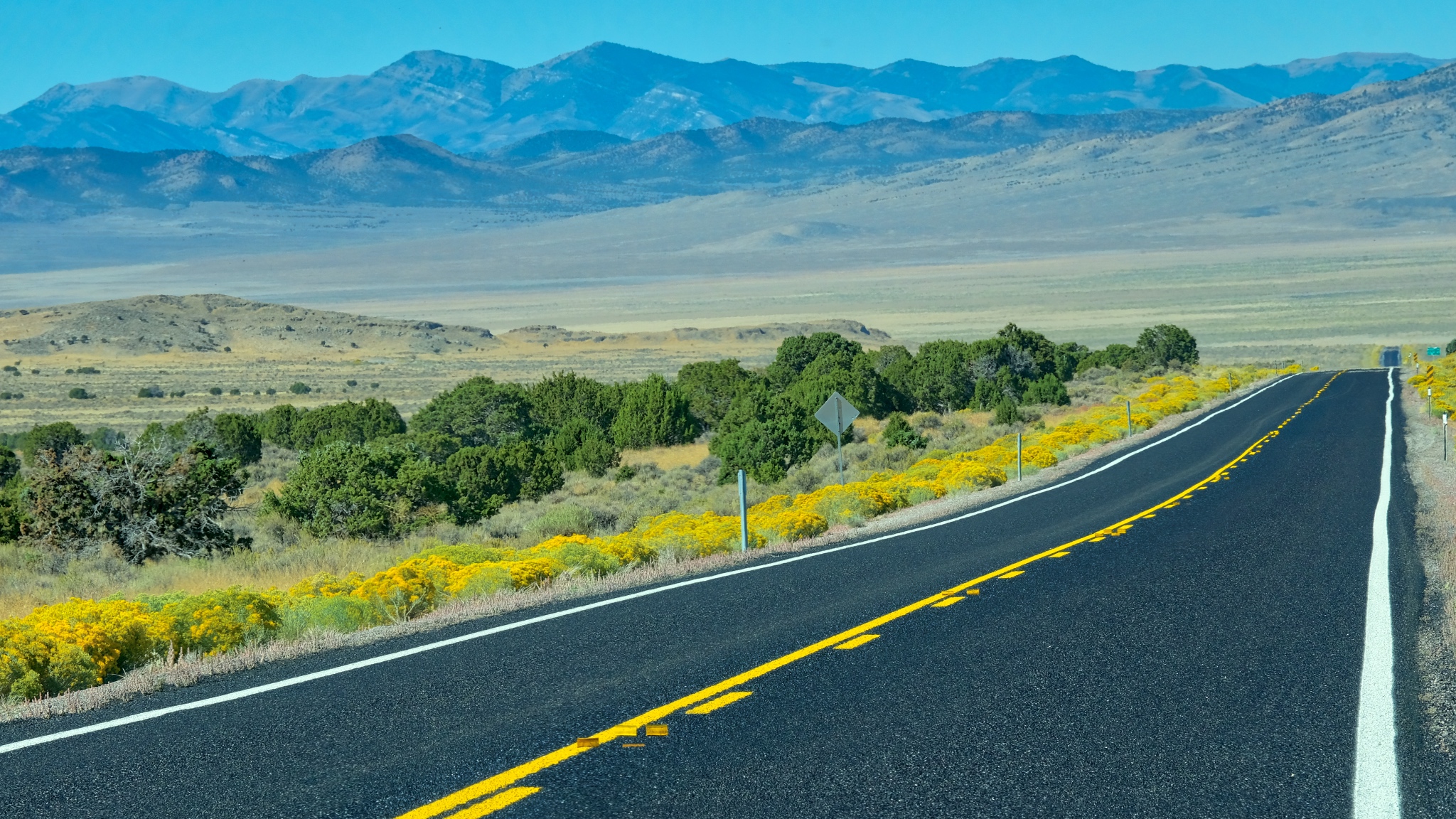
 The road went on and on through the dry, smoky landscape. Oregon Highway 205 became Nevada Highways 292 and 140 before joining US Highway 95 into Winnemucca.
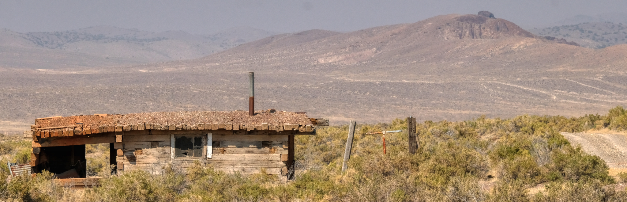
 An old abandoned farmstead. This one looks like it wasn't abandoned all that long ago. What was the story of this house? Its history?
 There were a few wide spot in the road towns along the road to Winnemucca.
 My camper ECU was acting up . . . the engine developed a radical rich condition . . . lots of black smoke. I diagnosed the problem as a temperature sender. I stopped to let the engine cool down and reset the ECU. It was an opportunity to take a walk around in the parched land.
 It was quiet and still. Cars would come by on the highway only every 10-15 minutes.
 It had been dry here for a long time. Other travellers along this highway had driven off the road into the desert too.
 Yes, the desert is not a welcoming place.
 Bone identification is not my academic field of study . . . sheep or cow?
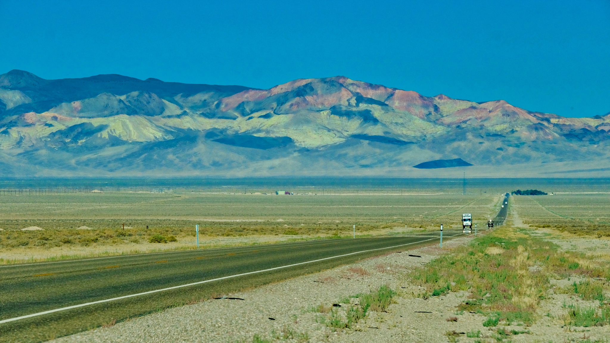
 Back out on the highway and toward distant mountains. I thoroughly enjoy these long desert drives . . . and have missed them in my tropical, equatorial life.
 Such lovely layered mountain ridge silhouettes in the wildfire haze.
 I pulled over to the side of the road whenever I would see these old decaying sheds.
 One of the joys of long desert drives is having the scenery suddenly change as you drive up and over a mountain pass.
 Another abandoned homestead. This old ranch house was literally 60 miles from the nearest store and gas station.
 Such rough construction. The summer temperatures out here are blistering . . . and the winter sees deep snow for months at a time.
 My camper was running well now . . .
 Dry desert just north of Winnemucca, Nevada.
 And on I went . . . down the highway of mirages.
 I eventually arrived in Winnemucca (pop.7,600), bought gas, went to a self-wash car wash, found a Mexican restaurant (and had a GREAT meal), checked into the Model T Casino RV Park (I bought the t-shirt!) I stayed there two nights while I resupplied the camper with food and water, ice, washed the clothes, cleaned out the camper (bought a small vacuum), took a shower, bought a new temperature sender for the truck, and watched a few NFL games on the big screen TV in the casino bar. A very nice stop.
 There was a great sunset both nights in Winnemucca.
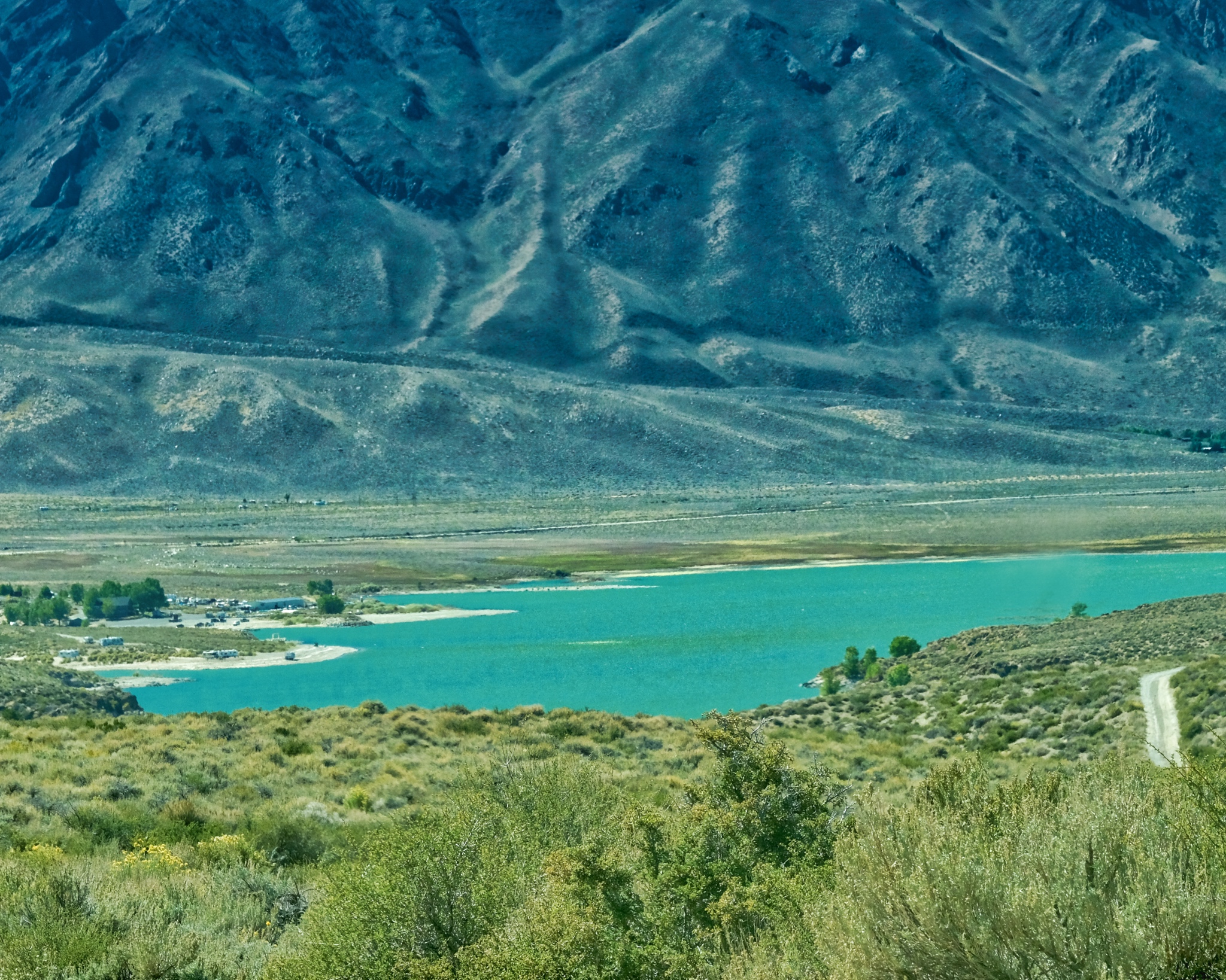
 The view from my RV park.
 I would come back to this same RV park when I returned from my extended camping in the Black Rock Desert.
 Steens Mountain (Frenchglen Hotel) to Winnemucca, Nevada.
_________________________________________________
Golconda, Nevada
 US Interstate Highway 80 heading East toward the Bonneville Salt Flats.
 While driving east I was having some trouble with my old Chevy pick-up . . . the ECU was acting up and I knew I needed to replace the temp sender and fitting. I had a new one in the truck, but had been too lazy to change it. I pulled off at Golconda, Nevada and waited for the engine to cool off . . . and in the meantime I walked around this little old mining town with my camera. It was worth the stop.
 I pulled up under a tree in front of the old Golconda School (circa, 1888), opened the hood, and headed down the street, camera in hand.
 Golcanda, population 216, is an old mining town with very little activity left in the mining sector. Corrugation!
 One of my favorite photographic subjects is corrugation and dilapidation . . . Golconda had both.
 There were lots of old farm implements sitting around in the brush.
 It seemed like about half of the houses and businesses were closed, abandoned.
 Some beautiful ensembles of junk, old cars, weathered surfaces, and light . . .
 A failed scooter business . . . .
 Like a movie set . . .
 A closed store out on Old Texas Highway 40 heading out of town.
 Closed, vacant, the people and stories gone.
 I couldn't resist these marvelous shapes, surfaces, and shadows.
 Gone from use.
 A fire burned the rear of the old store . . . but at sometime after it had been abandoned.
 WOW! These surface textures are amazing . . . and beautiful in a strange way.
 Sad and forlorn, still and silent . . .
 A straw rake imbedded in a tumbleweed . . . with white picket fence.
 Lots of old, abandoned automobiles about . . . and a surprising number of panel trucks.
 I'm surprised the hot rodders haven't been by and 'picked' this nice Chevy panel. I'd love to have it . . .
 I know these towns . . . the hot, quiet, lonely days . . .
 I do not fully understand why I find great beauty in these old places . . .
 I walked back across the mainline rails to the school and my camper. Such a beautiful location for a town.
 The pride of the town, the restored, and nationally listed, Golconda School.
 Winnemucca to the Bonneville Salt Flats.
Road Trip USA: Cherry Creek, Nevada
 After a wonderful four days at the World of Speed event at the Bonneville Salt Flats in Utah, I headed off on US Highway 93 (via Alt 93) to the Eastern Sierras in California. I was in no hurry . . . and planned to stay at a campground somewhere along the way.
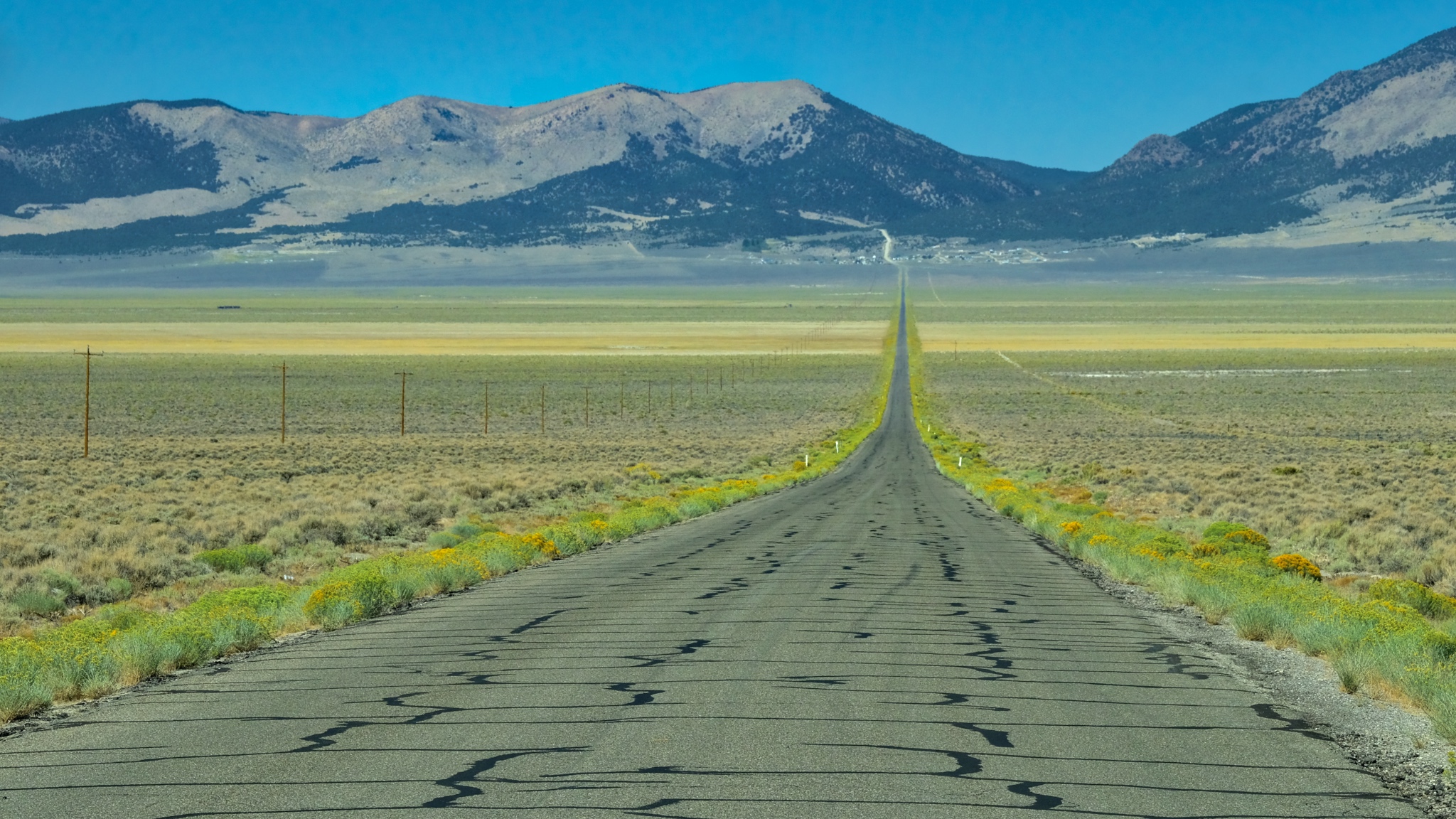 I came across this road leading up to some hills with a sign that said "Cherry Creek Museum 8 Miles" that looked interesting to me. Why not? Maybe it is an old photogenic mining town.
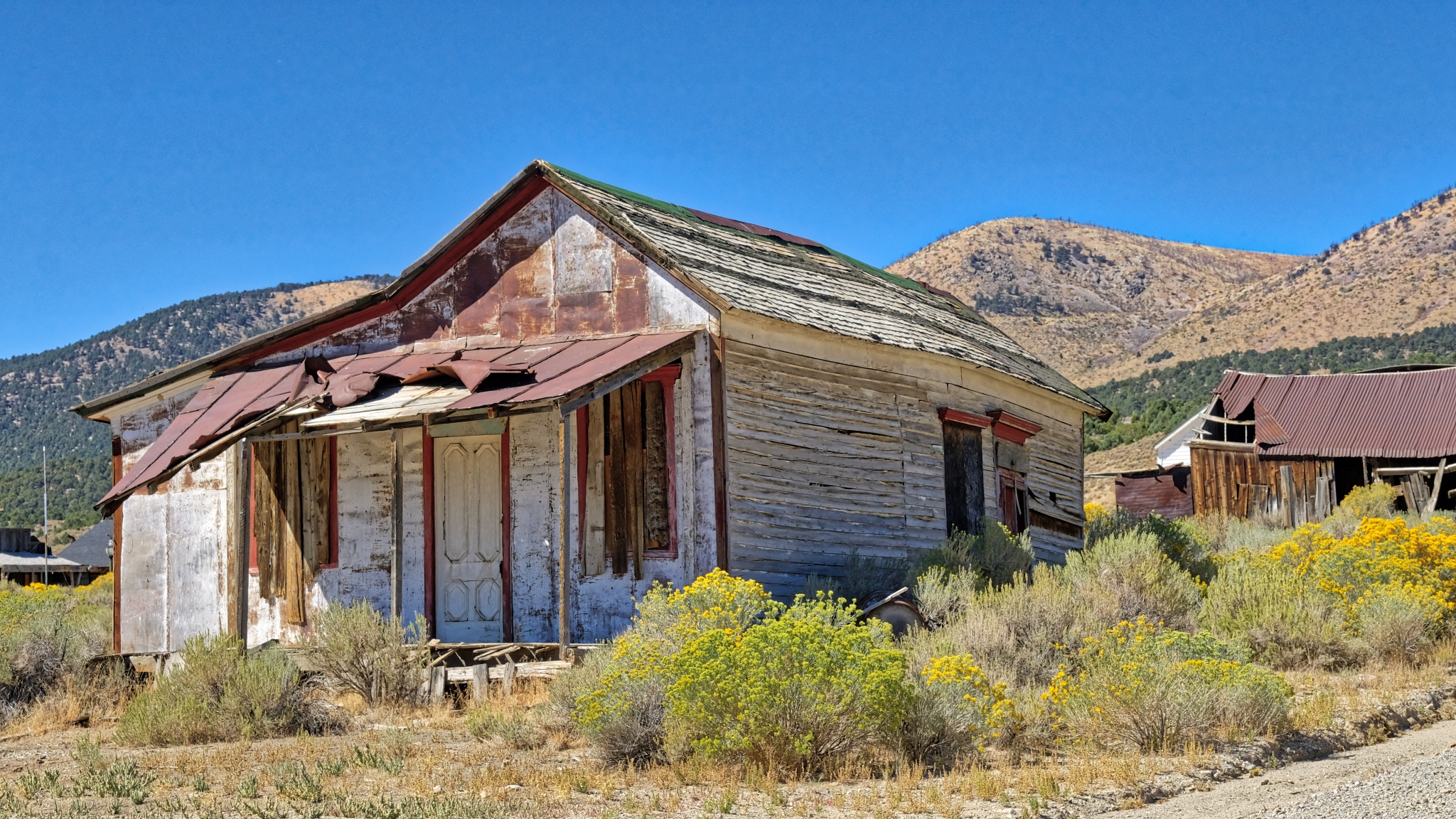 Yep, sure enough: Cherry Creek was an old mining town that had seen its glory days in the 1880-1890s. Just what I had hoped!
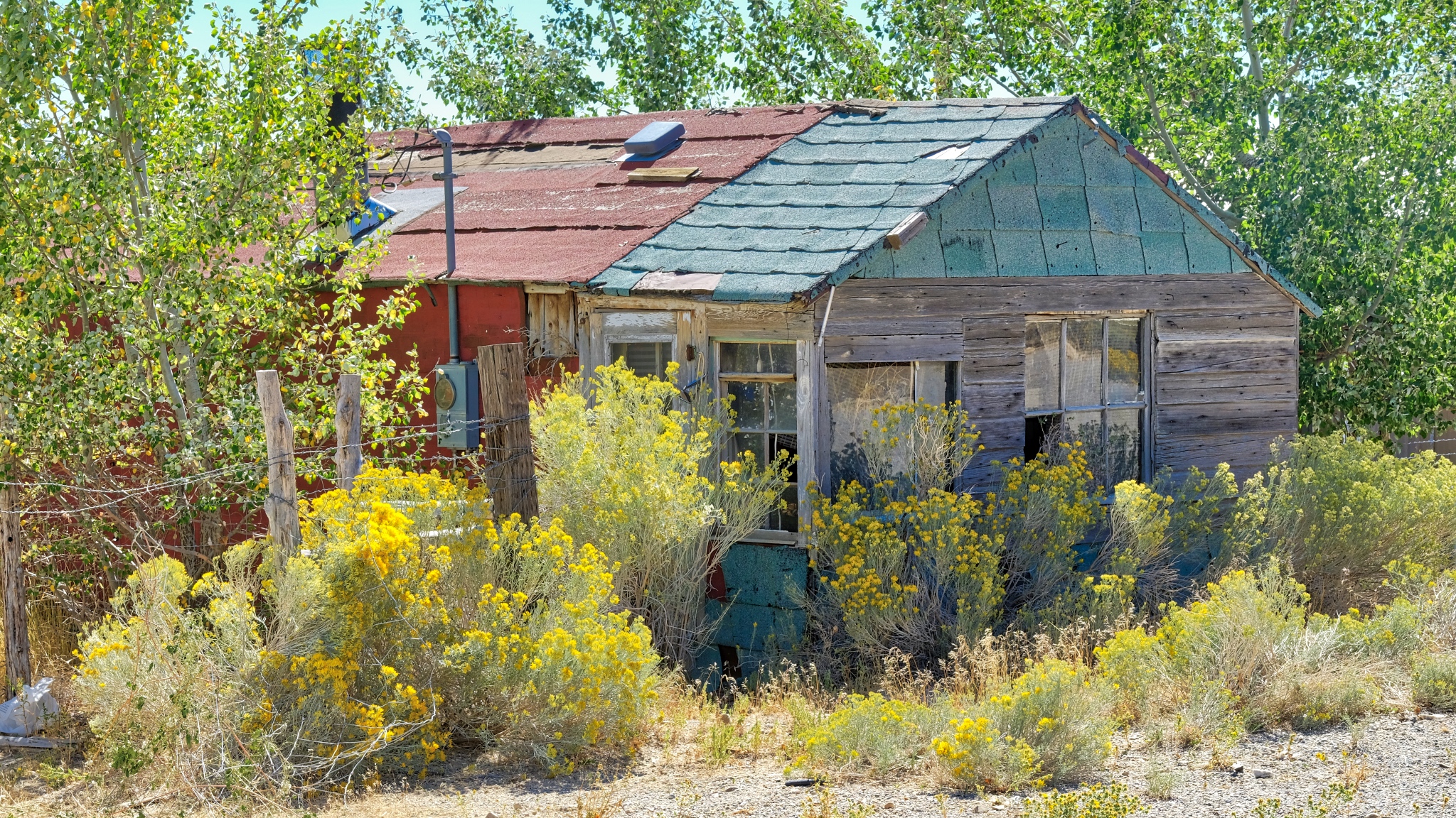 The blooming sage and the old weathered houses made for perfect compositions.
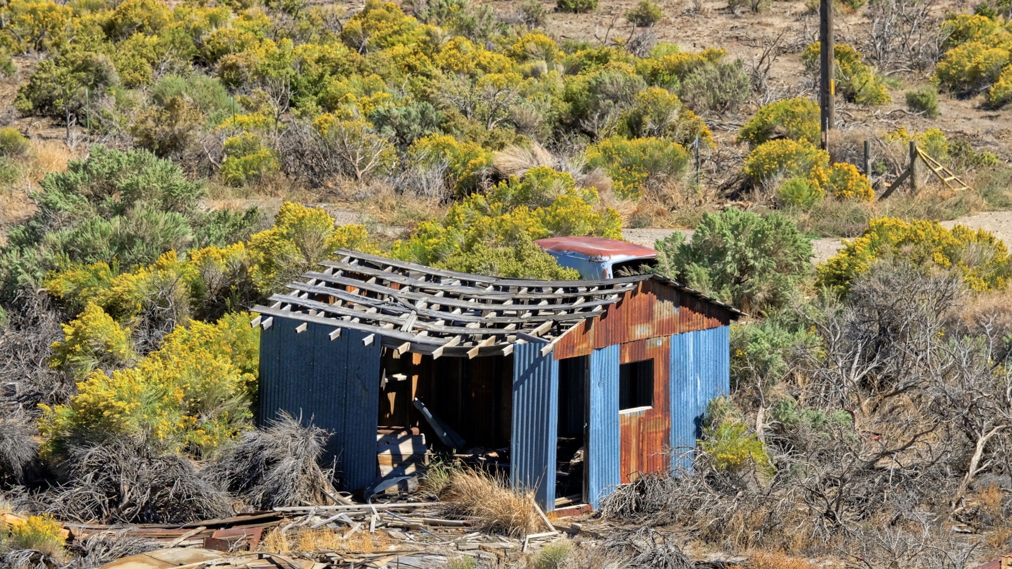
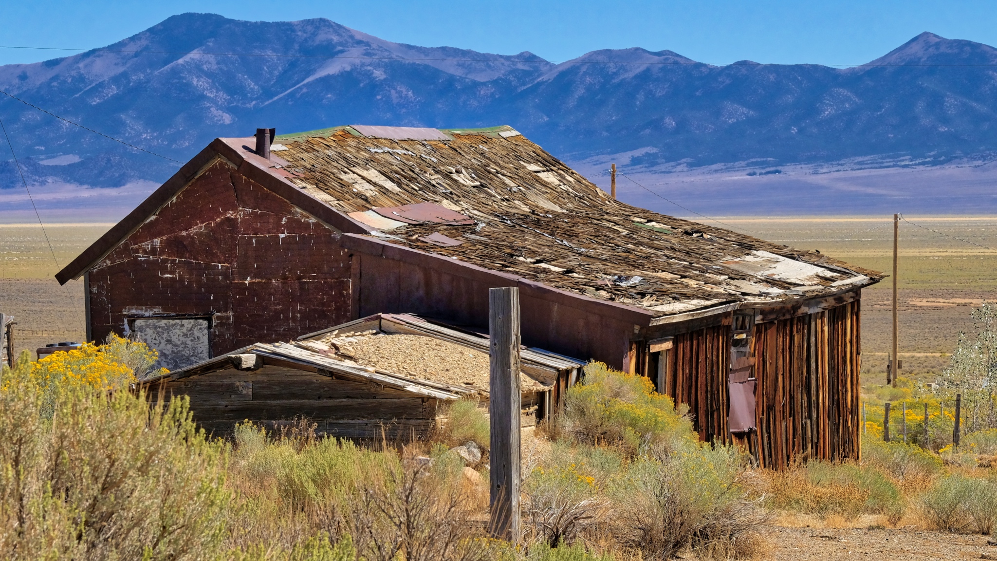 Some of the shacks seemed much older than others . . . perhaps dating to the beginning of the last century.
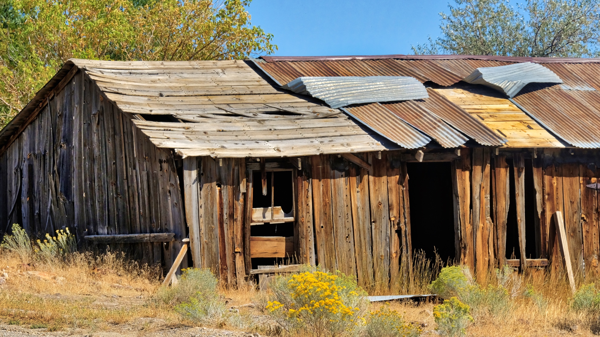 Much repairing and patching was done before these old houses were abandoned.
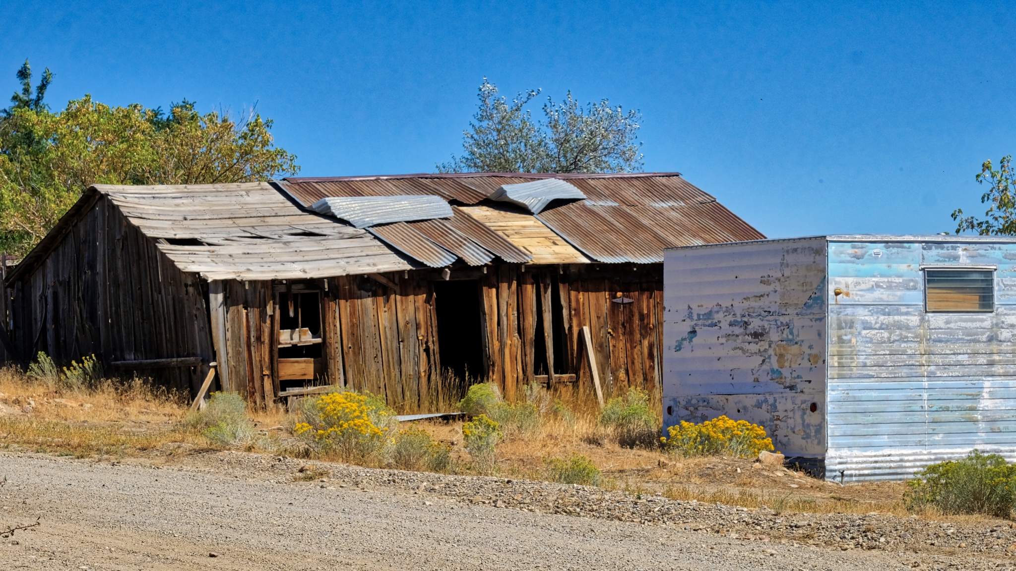 The old and the new(er).
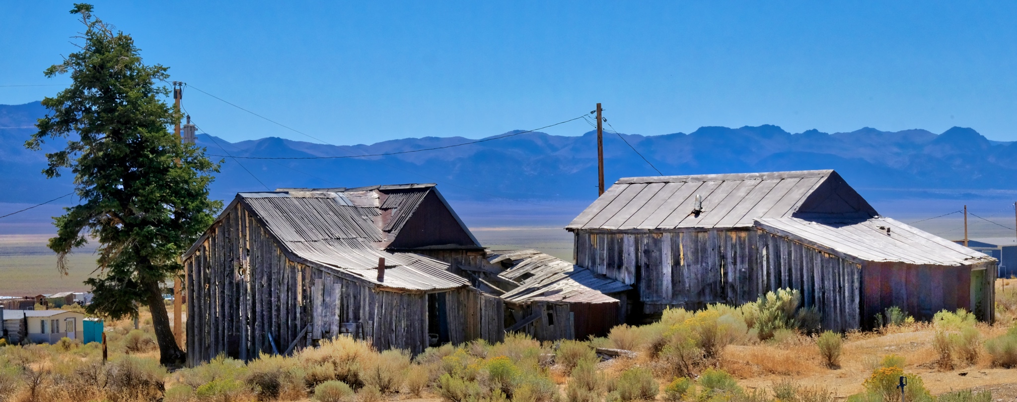 In 1882, Cherry Creek was estimated to have had a population of 7800, but by the census of 1890, it had fallen to just 350. In 2007 the population was 93 (61 male and 32 female). I did not see a single solitary person during my one hour walk-about.
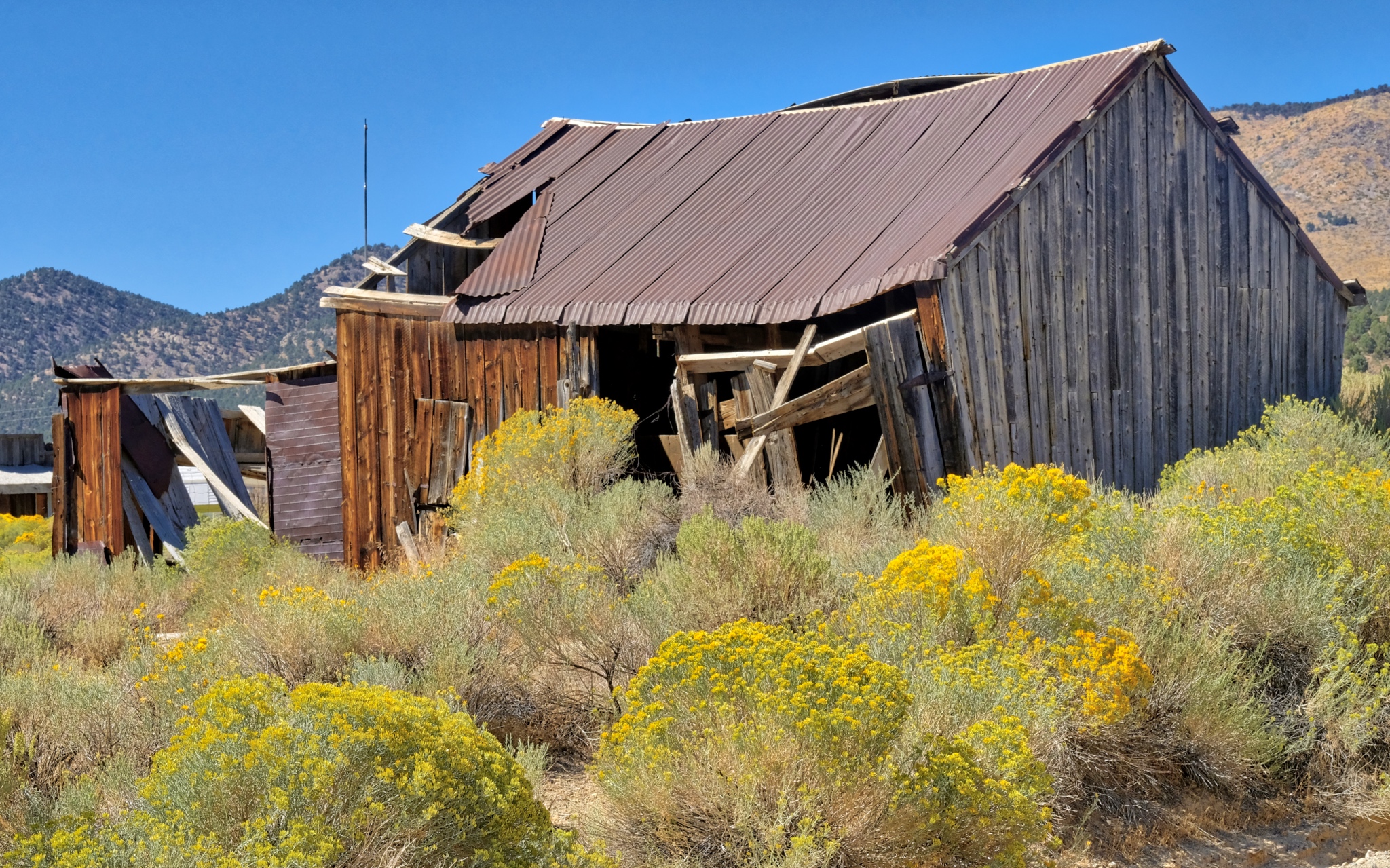 Corrugation and dilapidation . . . my favorite photographic subjects.
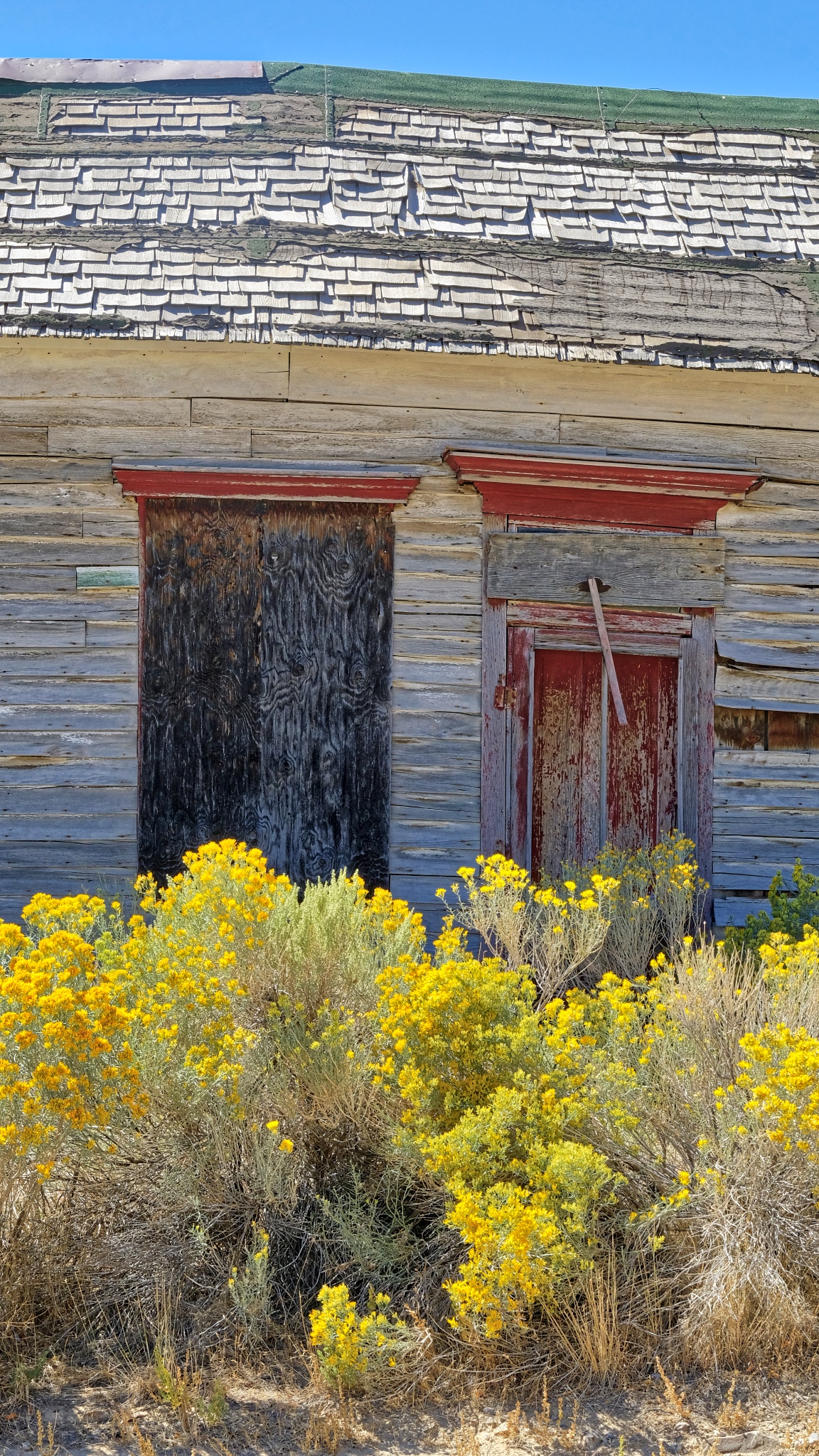 There were some lovely photos to be had.
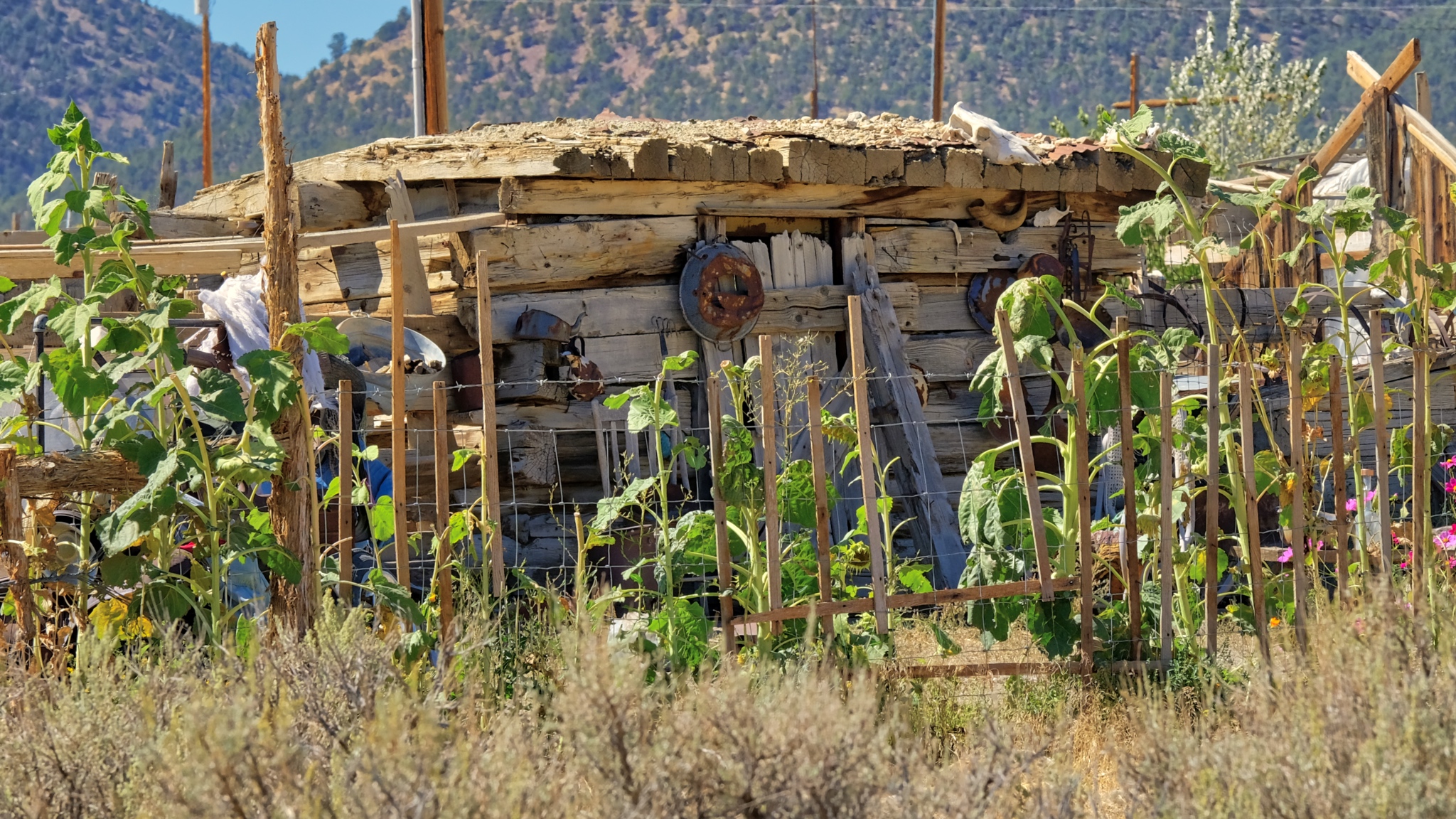 Although I didn't see any of the 93 inhabitants, I did see a nice rustic garden.
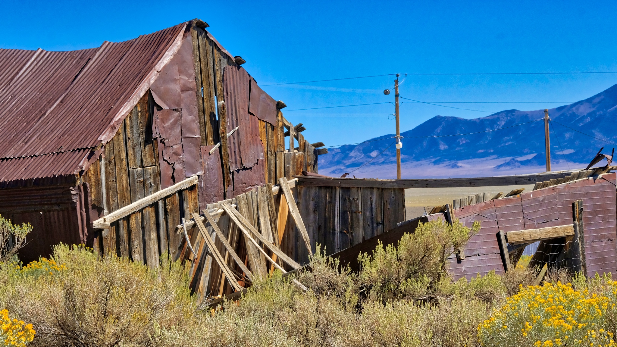 Patching, propping, and repairing right up to the end.
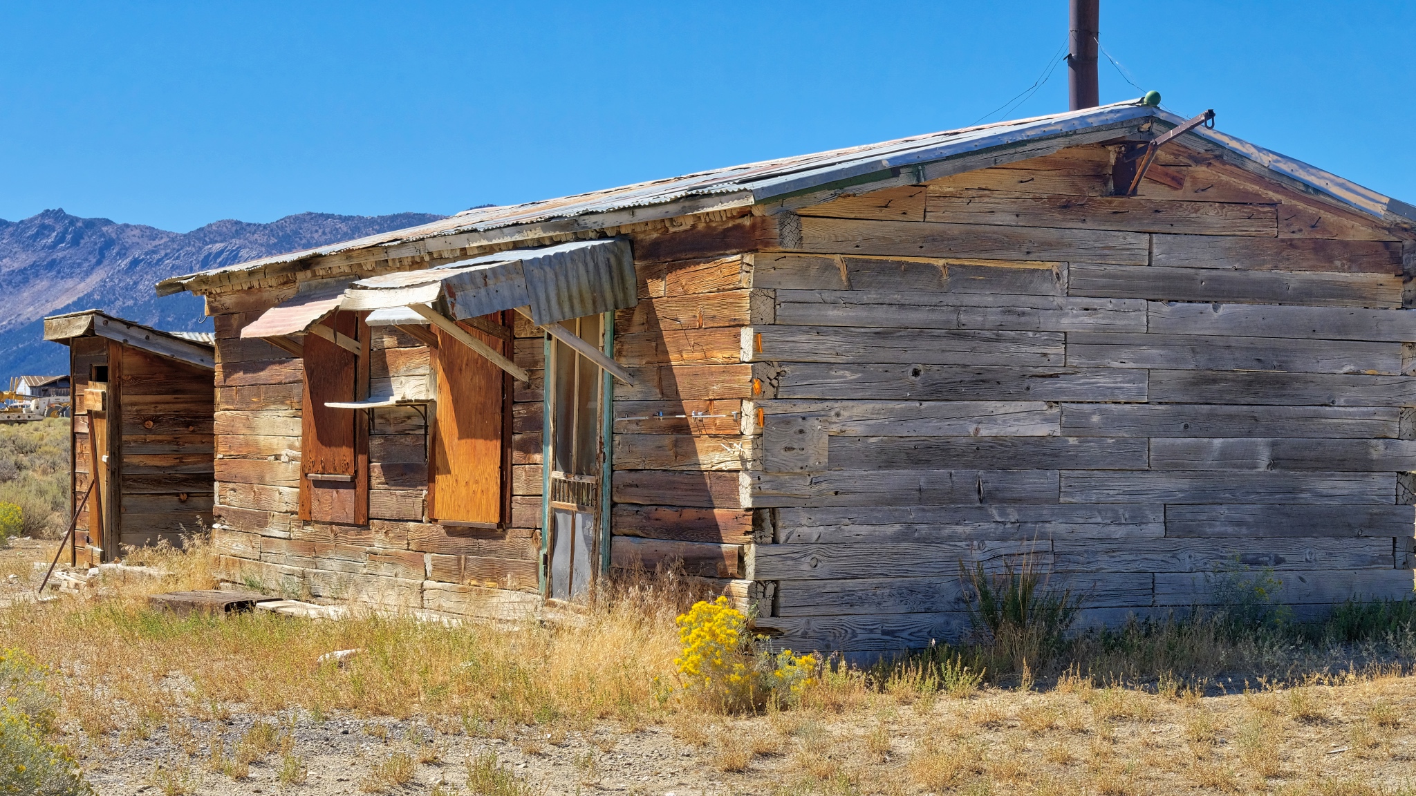 I saw several of these houses in the region that seemed to be made of large timbers like railroad ties.
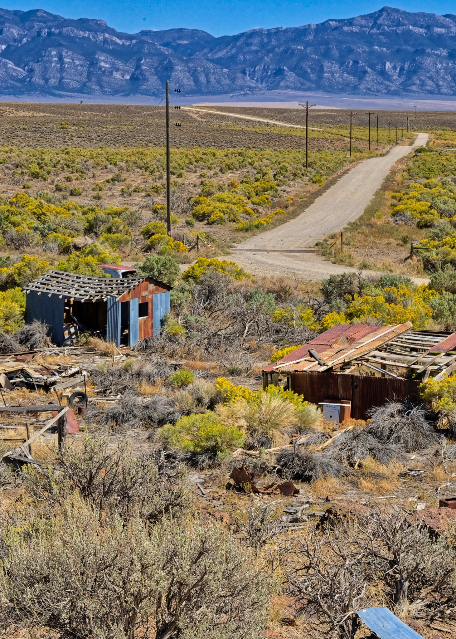
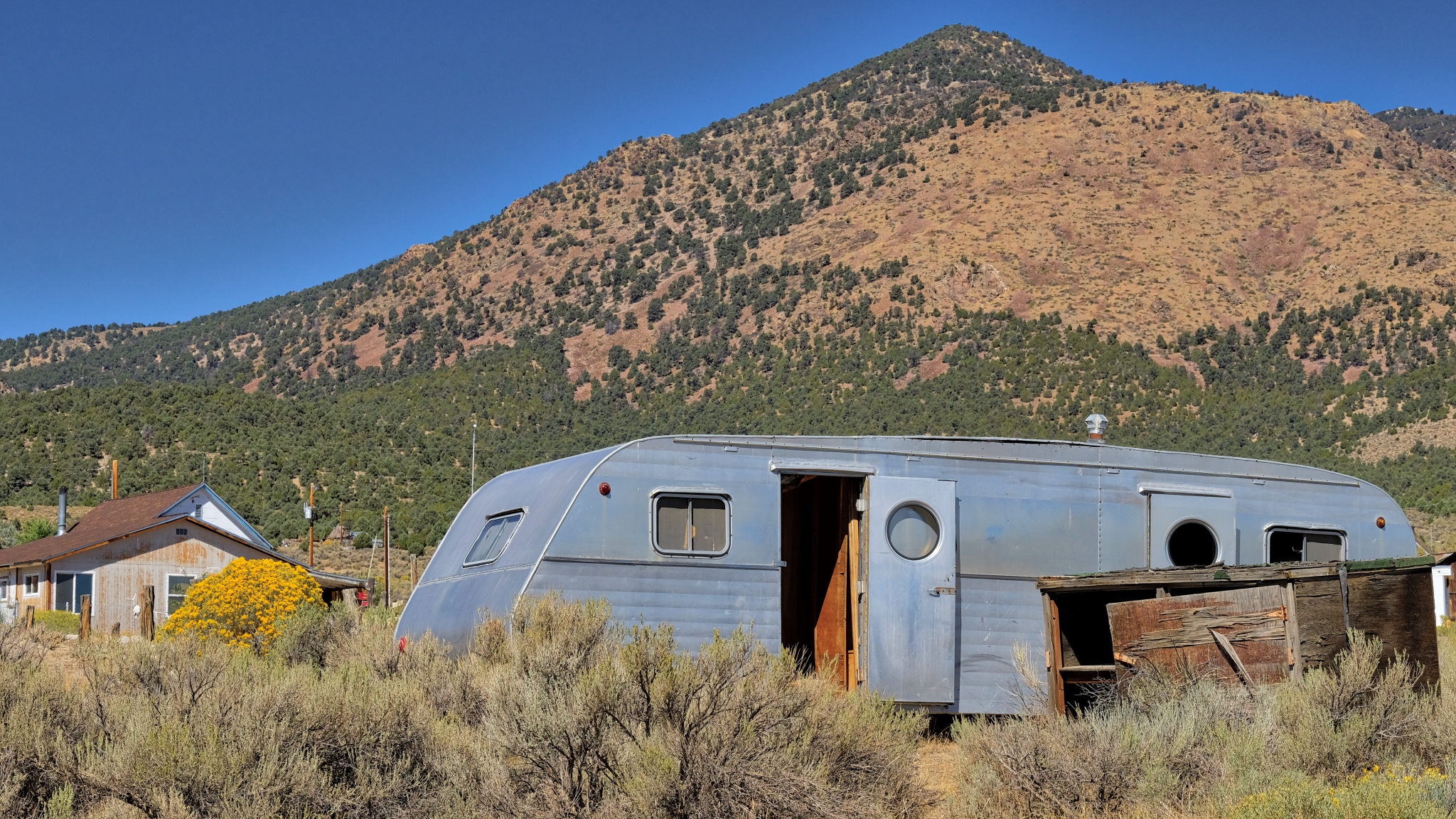 The 'townsite' was literally littered with old antique trailers . . .
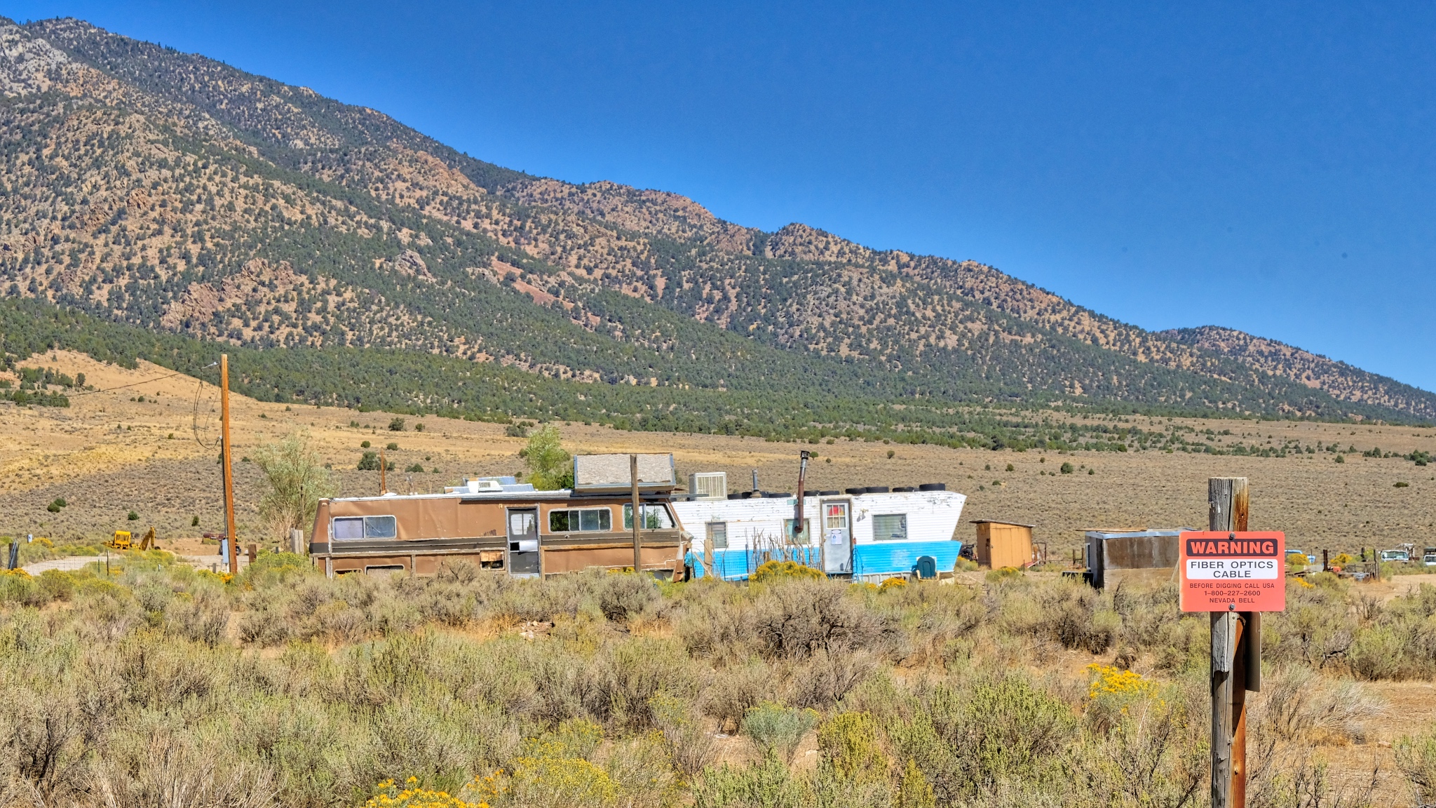 . . . and old motor homes. These residents may live out "in the middle of nowhere" . . . but they are by no means remote: there is fiber optic cable!!!
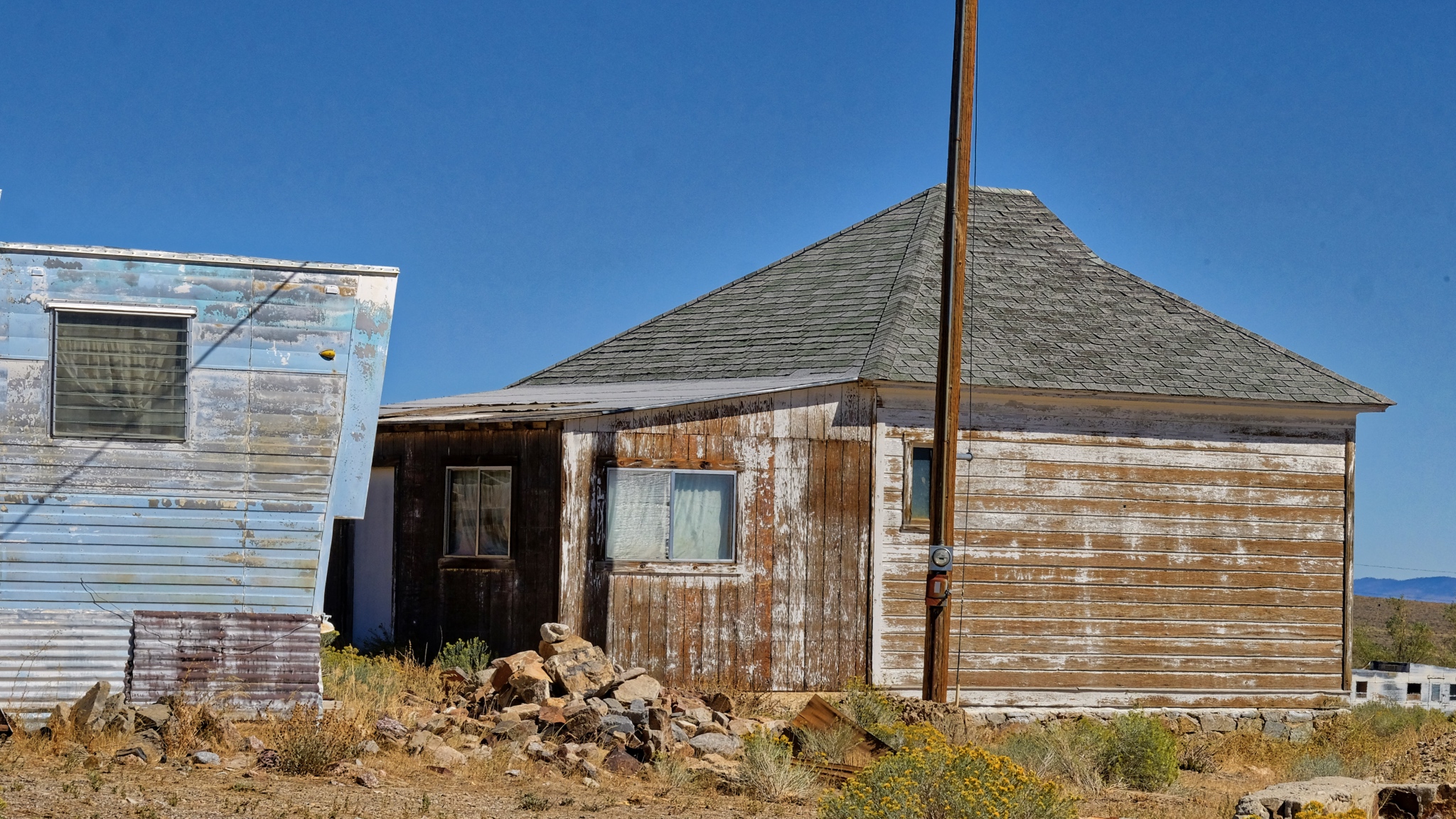 A very cool juxtaposition of old and new . . . .
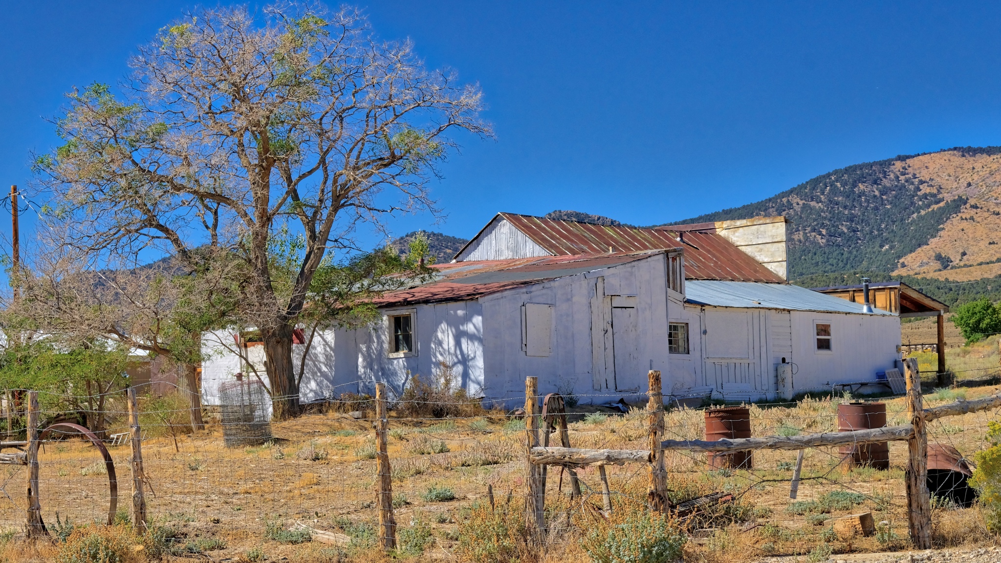 At some point in the recent past there was commerce here . . . this old store was for sale.
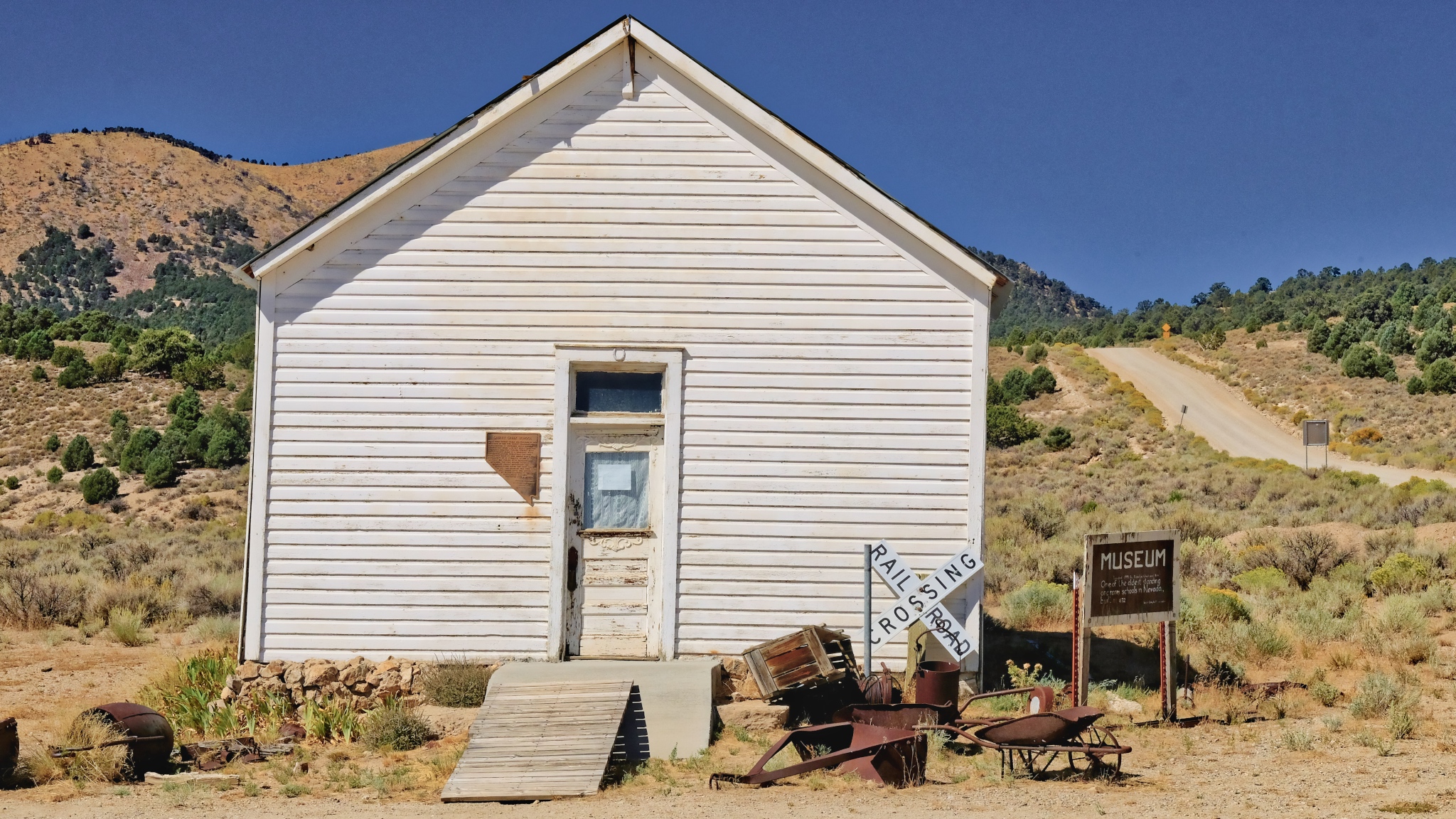 The Cherry Creek Museum was the old school house. It was closed, but a map on the door told you which trailer door to knock on to get a tour.
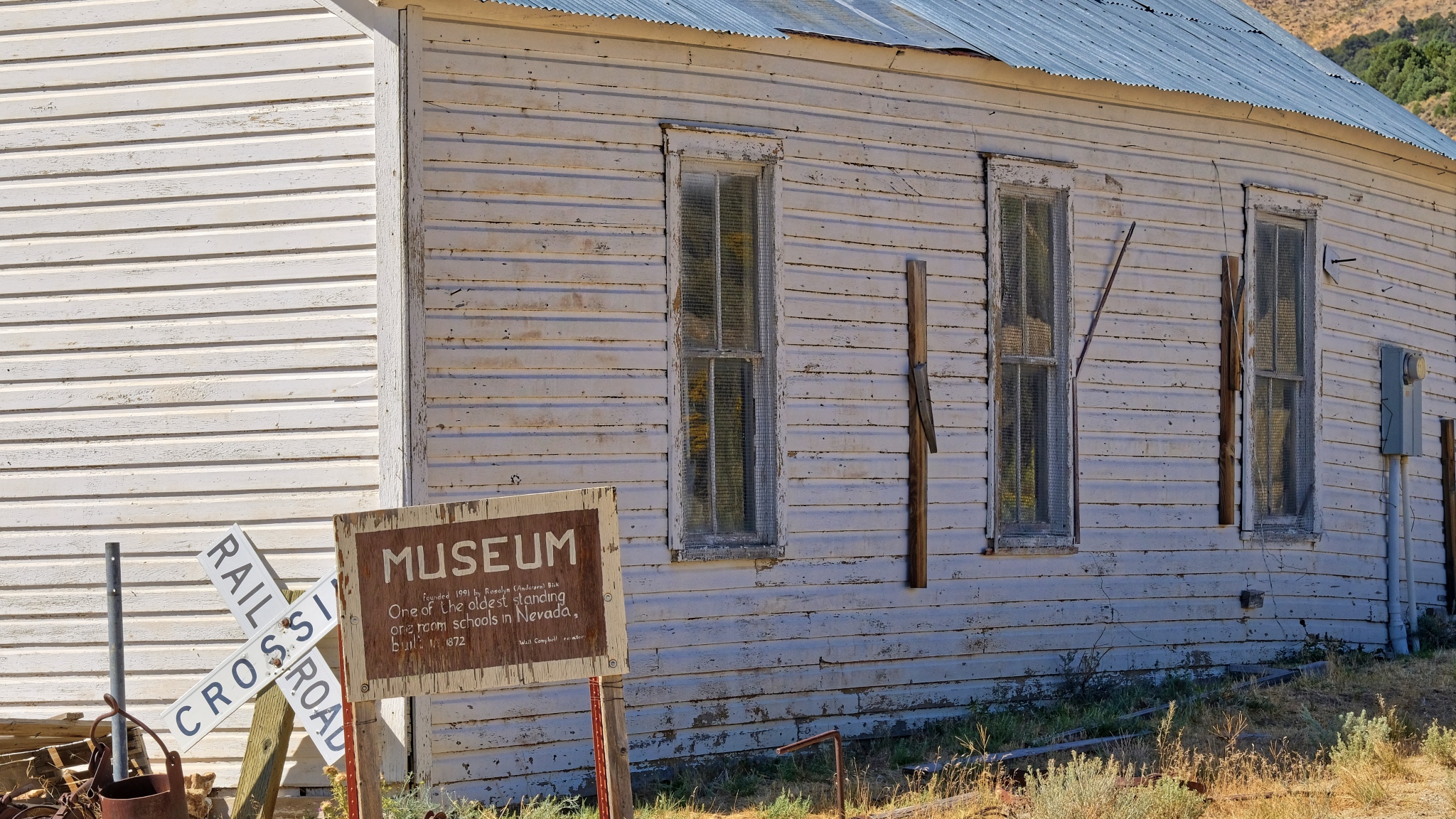 "One of the oldest standing one room schools in Nevada. Built in 1872."
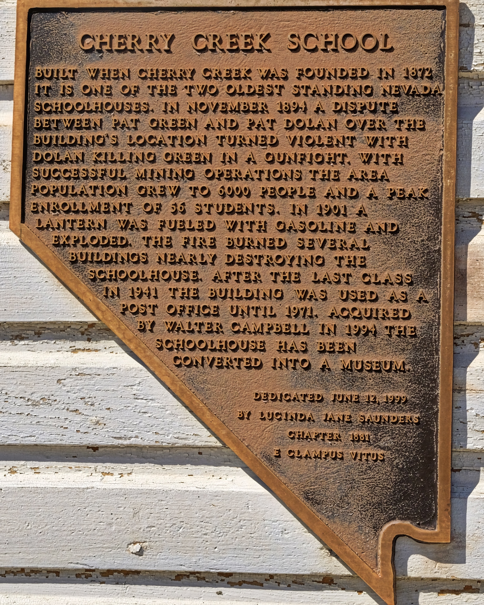 There was this wonderful commemorative plaque attached to the old school.
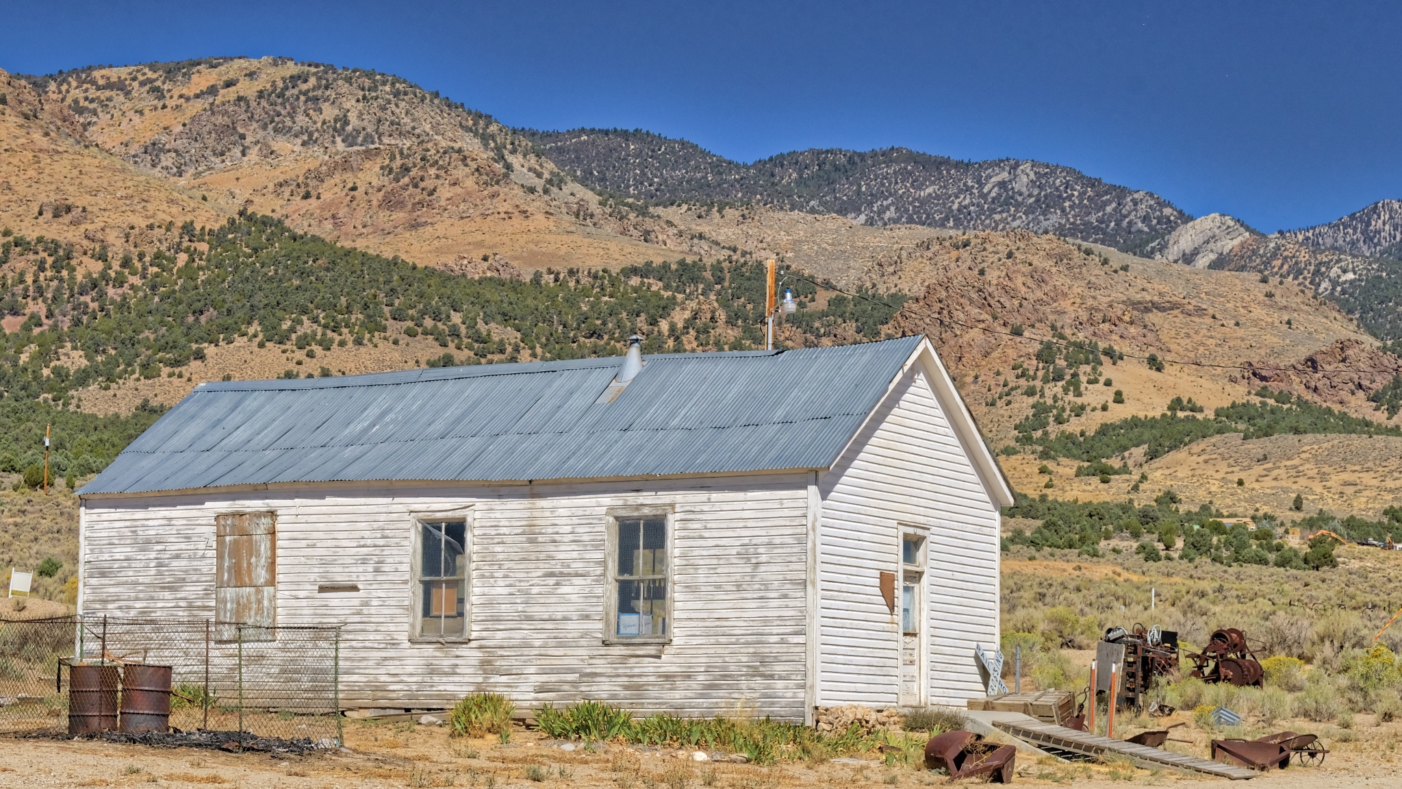 Oh the memories these children made! At it's peak there were 66 students. Where are all those 'children' now?
 Outhouses.
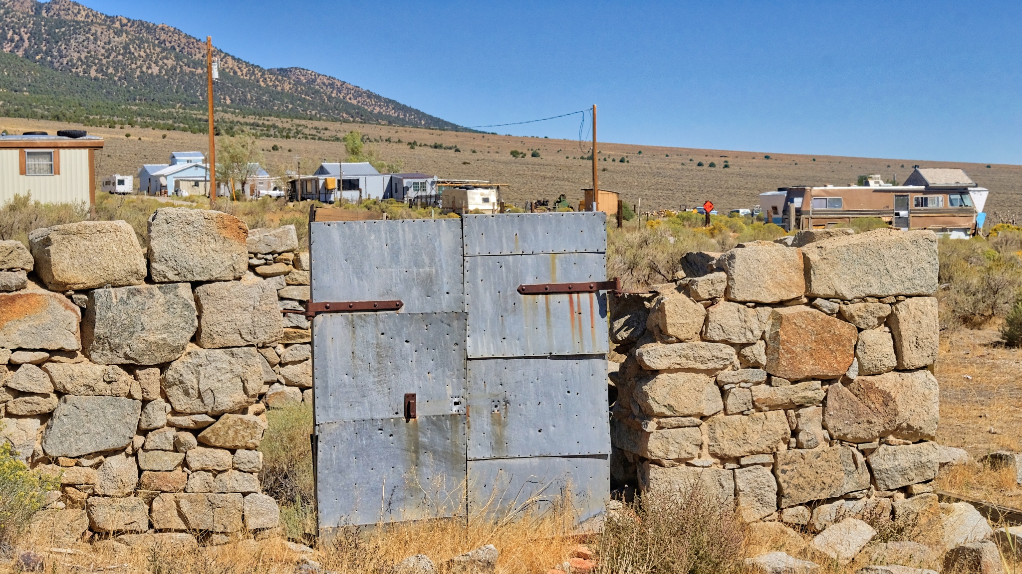 A strong wall and a steel gate to protect what is not there from what is no longer there . . . .
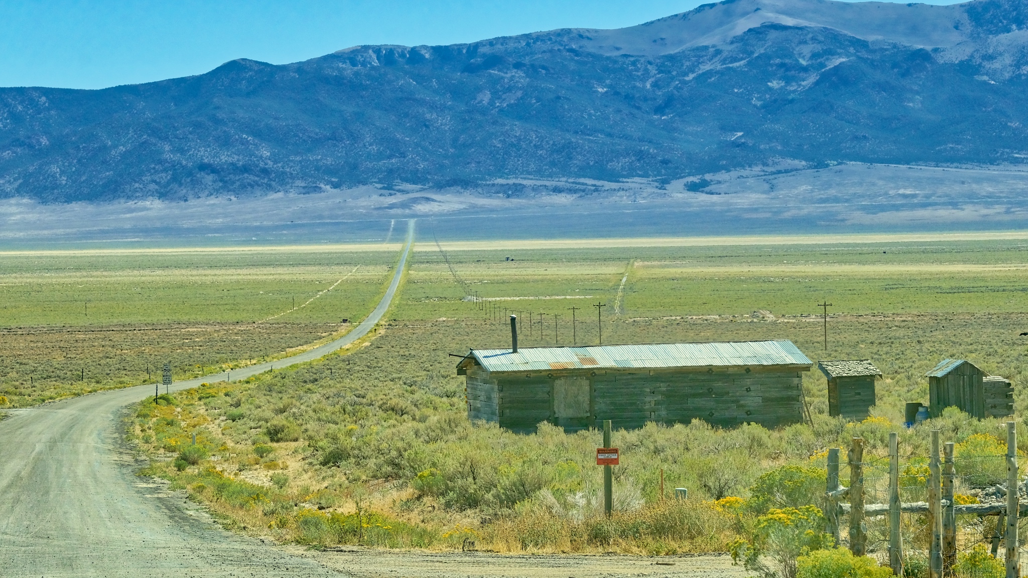 And so I left Cherry Creek, Nevada and headed up the 8 miles of road back to US 93.
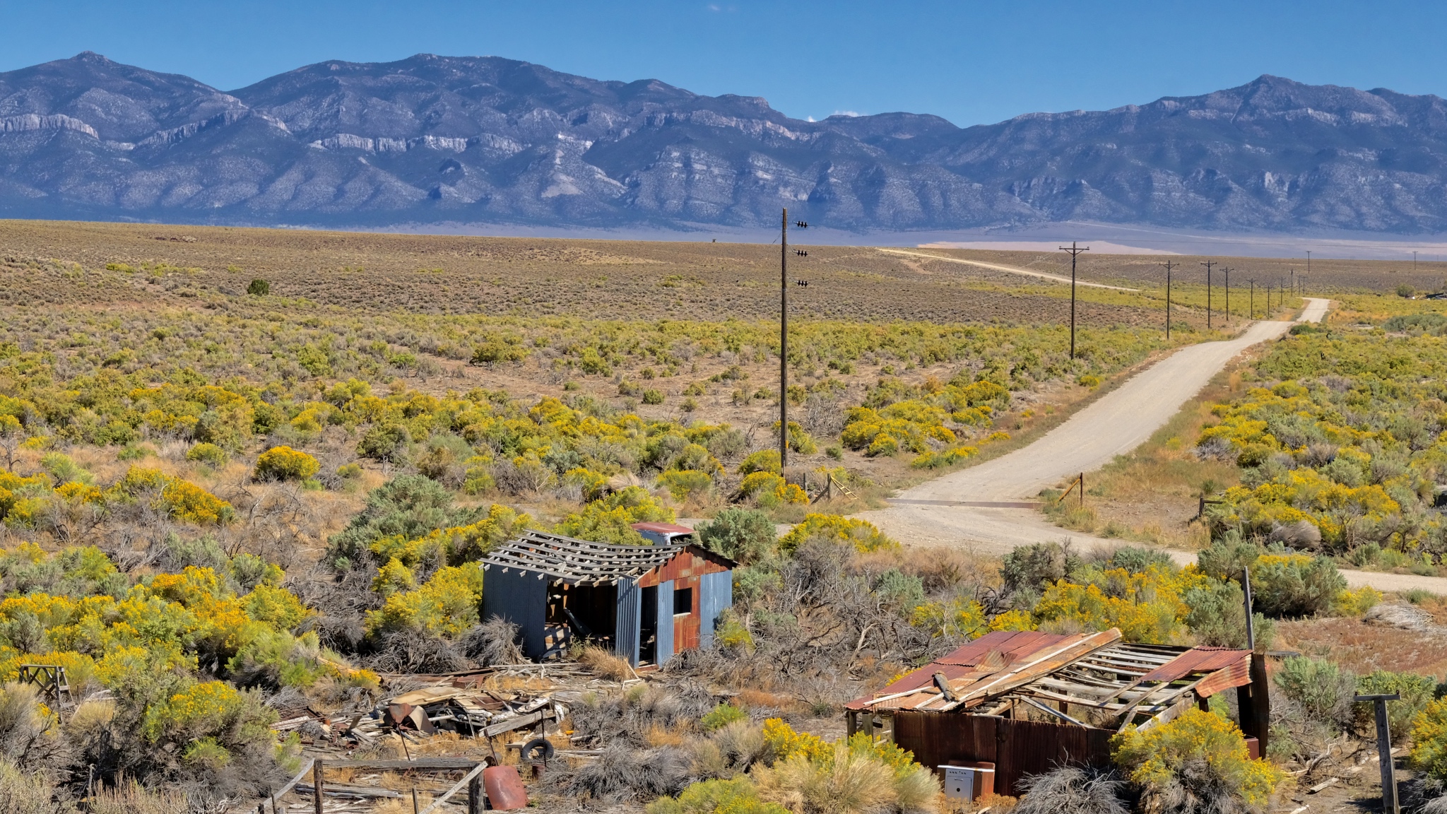 Further up the highway . . . more wonder: corrugation and dilapidation.
 Cherry Creek is in the northeast corner of Nevada.Dr. Jeff Harper
 Some of the photos seem to lend themselves to black & white . . . and perhaps printning.