My most current blog entry:
Entries in Waterfall (3)
Images from a Japanese Sojourn, May 2024
In May of 2024 my wife and I joined a group of her friends on a golf junket to Japan. A van/bus was rented and we drove, over several days and several overnight stop-overs, from Tokyo to near Nagoya - and back to Tokyo. We had lots of fun and saw a lot of amazing things . . . and ate a lot of great Japanese food . . . lots of it! While the group played golf I set off to explore the surrounding area with my camera. This entry, unlike others here, is not a chronological account of the whole trip, but "only" a collection of favorite images.
 At a tourist trap bathroom stop I took this amazing photo of Mt. Fuji with late spring colors in the foreground. Magical.
 I spent one morning with a Japanese man, another "golf widow," exploring the temples we found on GoogleMaps. Fantastic beauty. . .
 Fantastical Japanese artistic expression.
 A trip highlight was a frightening ride up a steep mountain on a cable-car. The view was astounding!
 Transportation options around an ancient royal Japanese temple complex.
 Japanese use of color and aesthetics are impressive.
 Japanese sense of humor . . . or? "Marriage Rocks."
 I was a bit embarrassed when out tour leader booked a dockside viewing of traditional woman pearl divers. They seemed like they were just awakened from their naps and driven down to the port to perform for us. It was interesting.
 We stopped to marvel at a 19th century Japanese businessman's house. Beautiful.
 Astoundingly beautiful temples at every turn.
 Japanese woodworking skill on display . . . love this.
 We visited many, many shrines . . . each different in special ways.
 A seaside shrine with monks.
 Japanese traditional temple aesthetic.
 The Japanese love of Nature is evident everywhere.
 Springtime in Japan means . . . FLOWERS!
 We visited a famous Begonia garden. Fantastic!
 Springtime in Japan . . . many different flowers everywhere.
 A field of bluebells.
 Seen in a museum waiting room.
 Gorgeous natural views . . .
 We stayed in hotels with great views throughout the week.
 Another great hotel room window view.
 Fantastic beauty . . . and craftsmanship.
 Big straw knot.
 Inner room of a Japanese temple.

Pagoda viewpoint . . . er . . . coastal city view.
 Too many steps for me! I didn't go up.
 Small Japanese town urban environment.
 Sweet waterfall at a temple.
 Small temple shrine.
 We stopped at a small town along the way and discovered a covered walking street.
 Small town sweet shop.
 The Japanese lead the world in amazing, and beautiful packaging.
 Busking with your monkey at the pagoda view point.
 Japan is known for its beautiful gardens . . .
 . . . so many beautiful Japanese gardens!
 I just love these contrasting textures and shapes. Japan!
 A sacred temple.
 An ancient village restored for tourist enjoyment and appreciation.
 Japanese tourists enjoying a tour through their cultural heritage.
 Packaged and ready to ship.
 My lunch, carefully selected from the corn dog family of fine and delicious deep fried foods. Japan!
 I left Japan with wonderful memories and a ton of images . . . many more than I could post here. I know I will go back to Japan. It is a fascinating country try.
 Dr. Jeff Harper
USA Road Trip: Moab & Dead Horse Point, Utah
My year-long USA camper road trip/sabbatical continued on from Winslow, Arizona to Moab, Utah. Early October 2018.
 Rain. Yes, it rains in the desert.
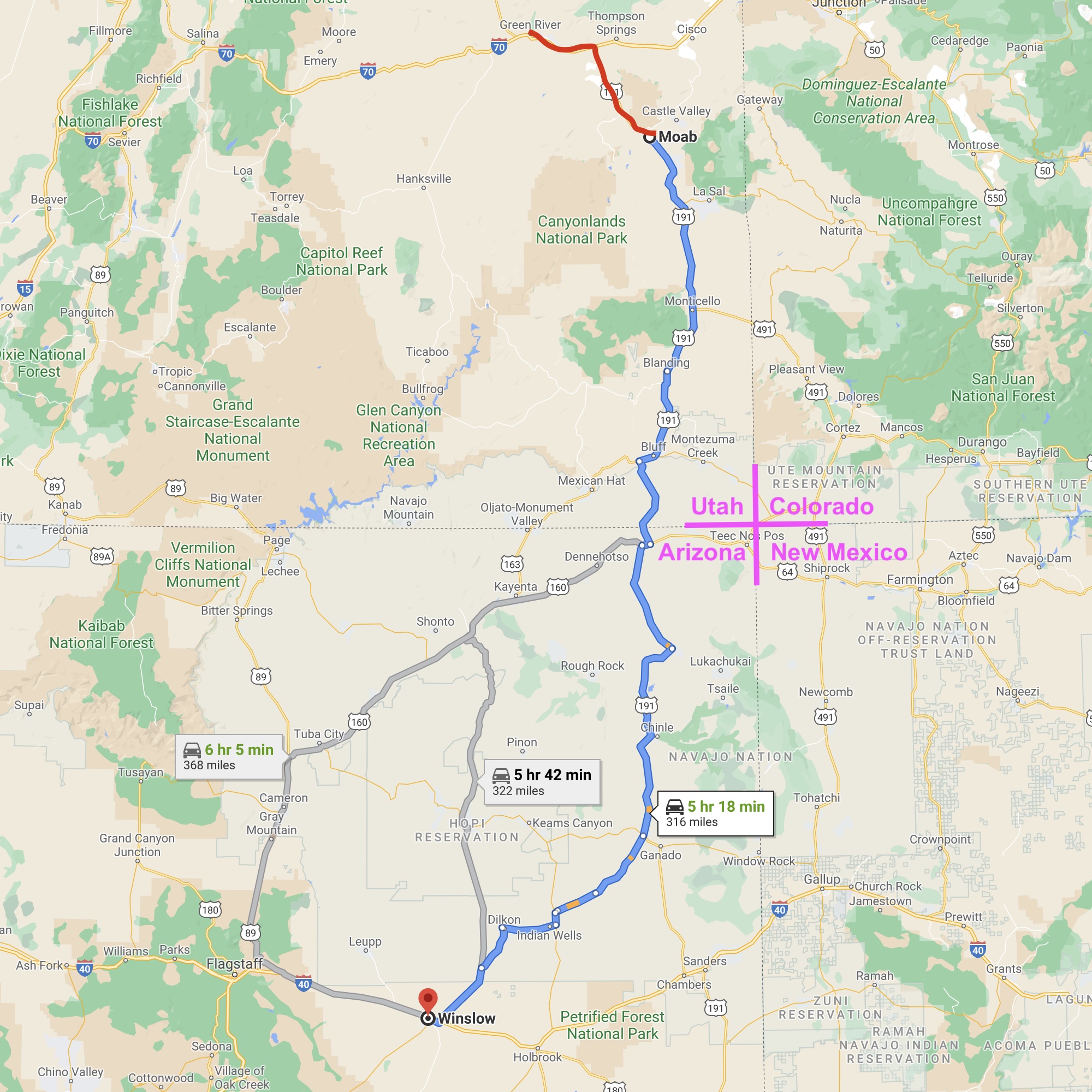
After an all day drive from Winslow, Arizona - through beautiful desert country in the Four Corners area of the American Southwest, I arrived in Moab, Utah in the middle of a major rain storm . . . record rain and a danger of flash flooding. I wanted to stay a night in a motel rather than in my camper . . . dry and warm. I Googled motels in Moab, looked up quite a few: all expensive and showing FULL . . . but one . . .
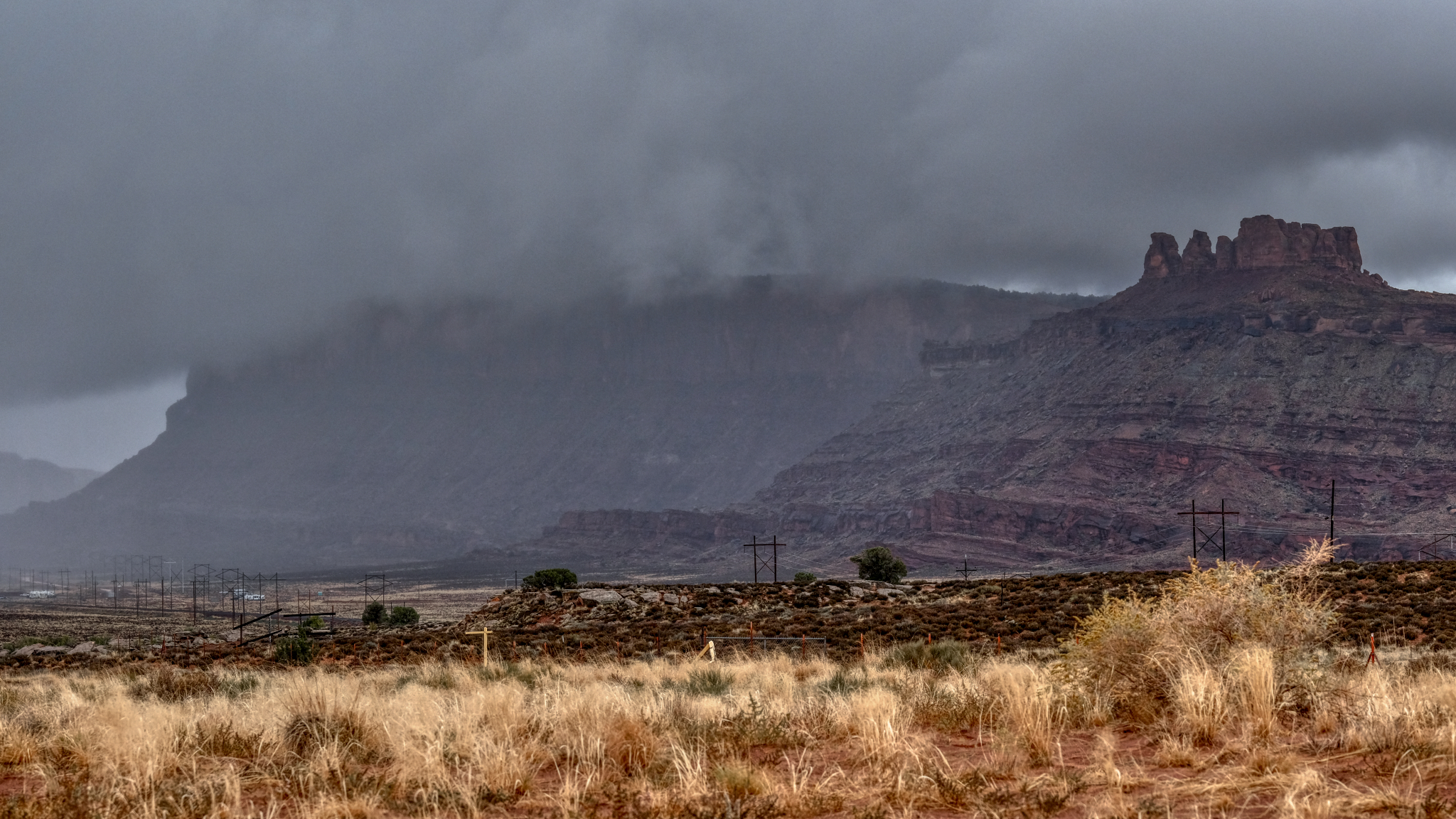
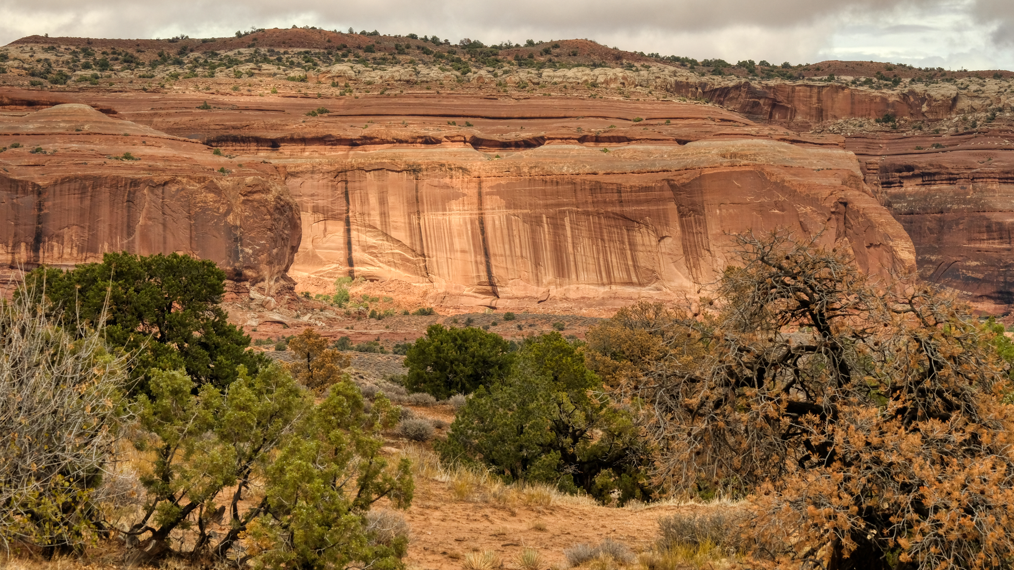 As I neared the town of Moab the rain increased, streaking the red cliffs.
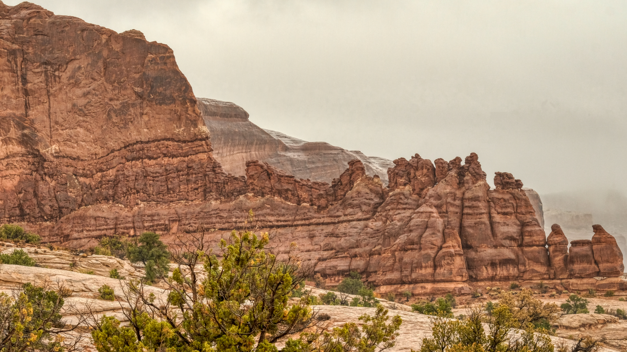 The red rock formations got wetter and wetter as I approached Moab.
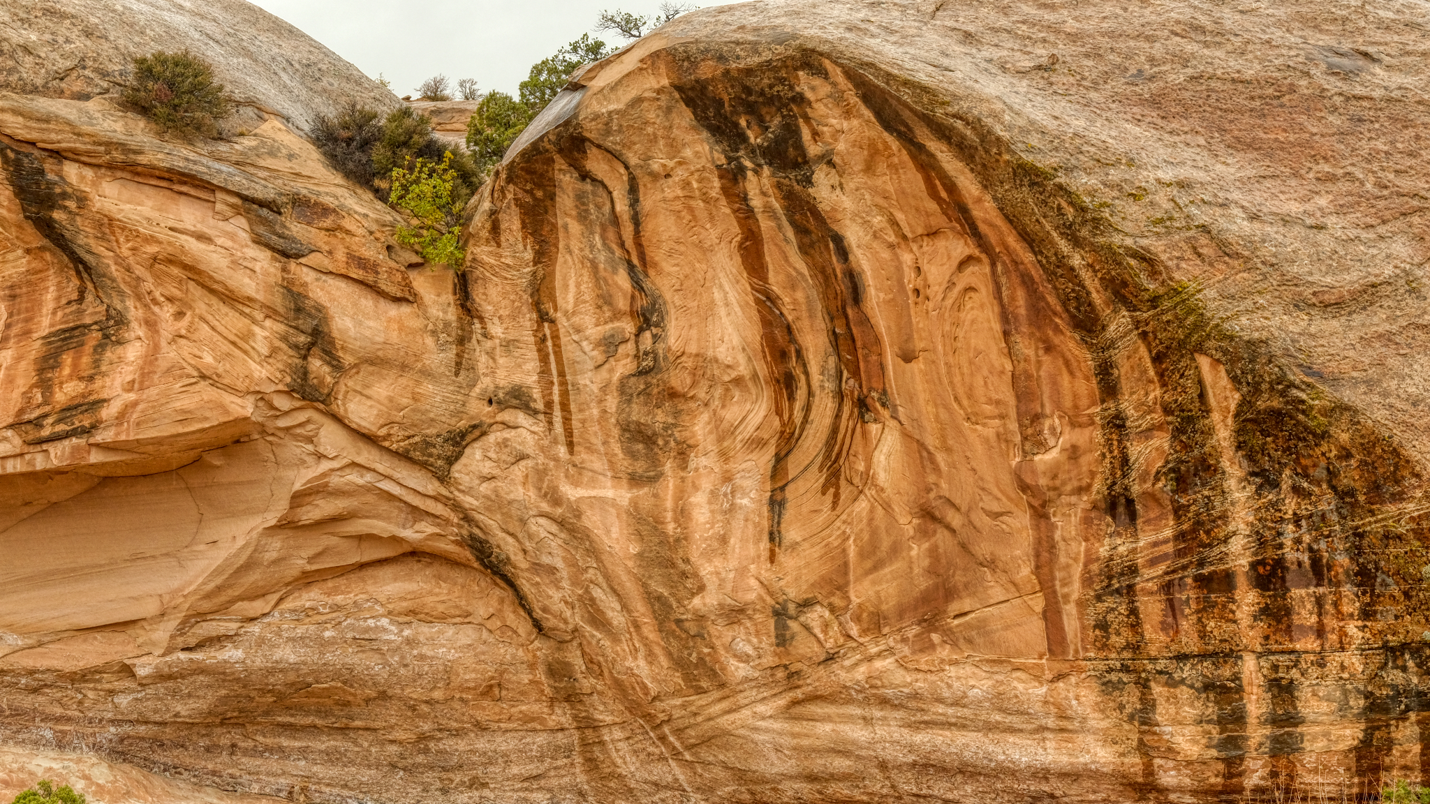 I discovered desert rock formations become even more fascinating when they are wet.
 And the rain continued to come down harder and harder. When I arrived at the only motel showing vacancies in Moab, I found out that the last room had just been taken, but I could come back the next day and stay for two nights. I booked it and went up the highway for 51 miles to Green River, Utah, on Interstate 70 where I found a room for the night.
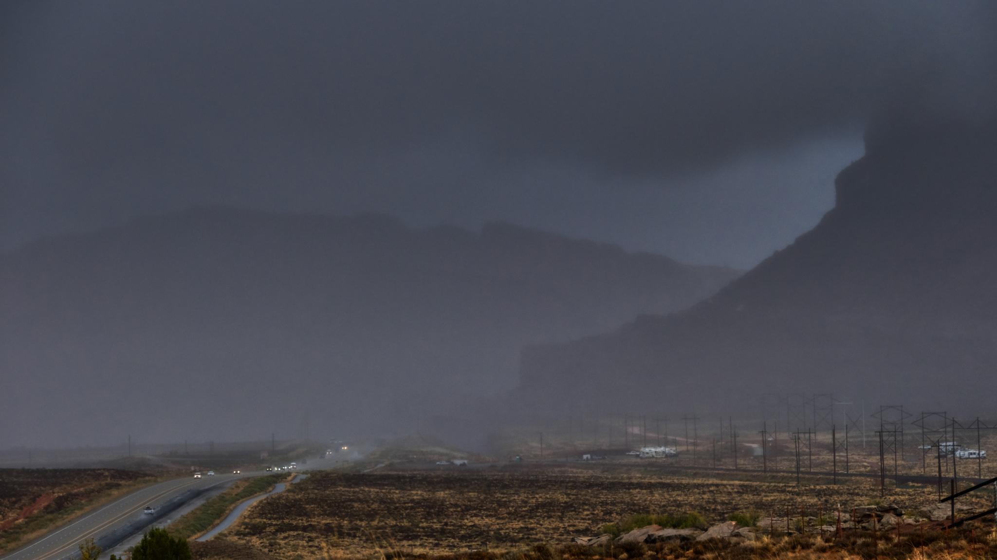 Driving north on Highway 191 out of Moab in a driving rain storm.
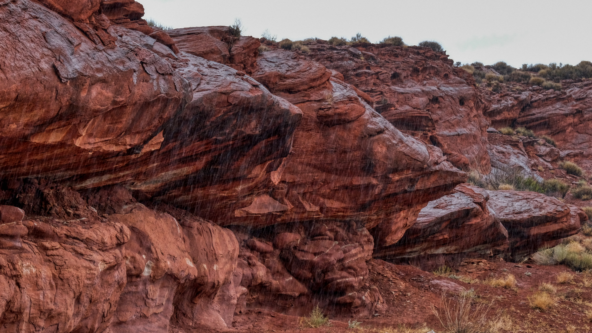
 Water poured off of the mesas and buttes.
 After a Sunday night in a Green River, Utah roadside motel (where I was able to watch an NFL game), I drove back to Moab to check for motels there . . . still in a light rain. I found one and sat out the day on the internet and watching Monday Night Football, as the rain became heavy all day. The next morning it was cloudy, with clear spots, so I headed to an RV park and bought a slot for camper next to a German couple who had been on a one year camper road trip in the USA.
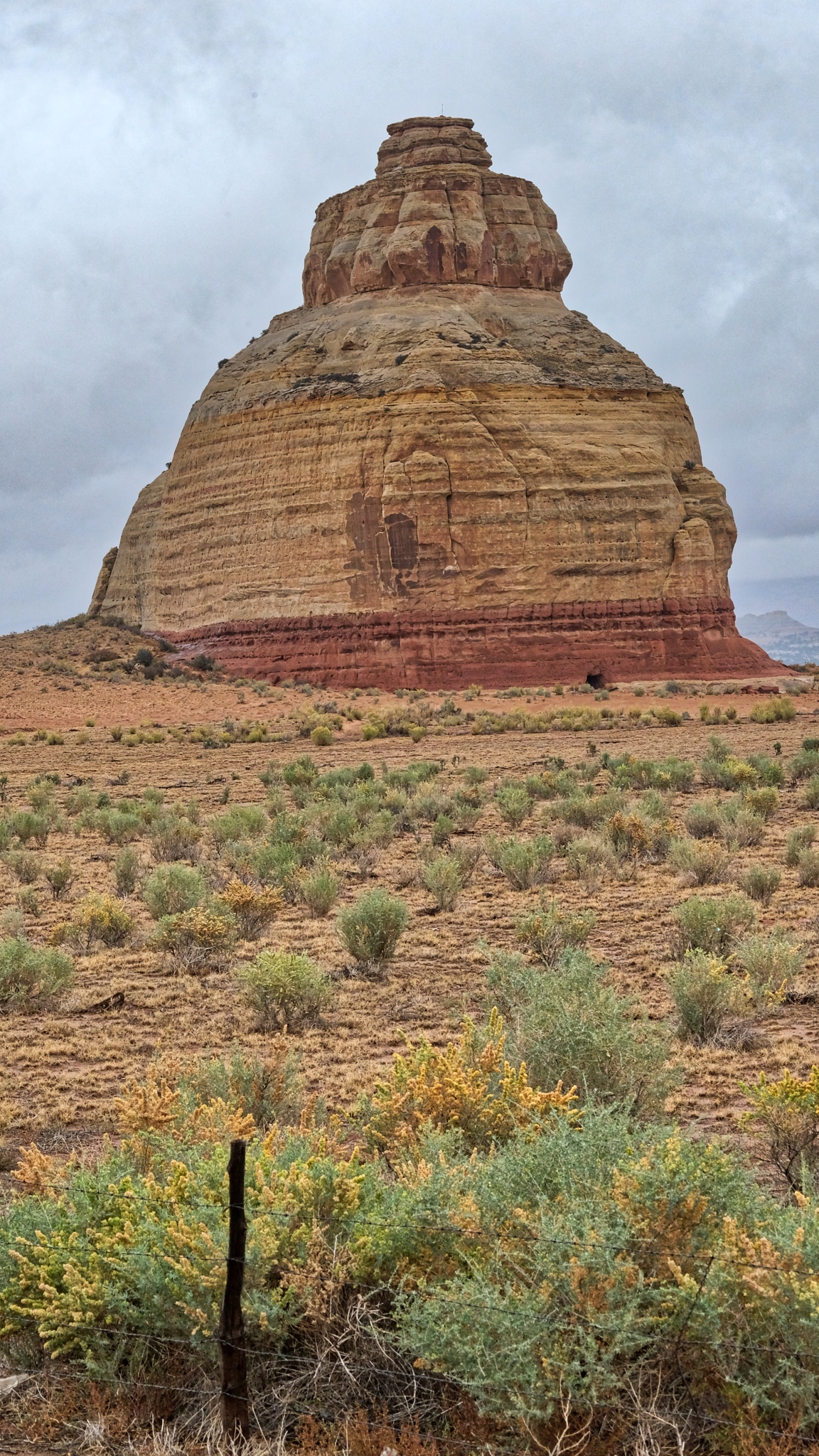
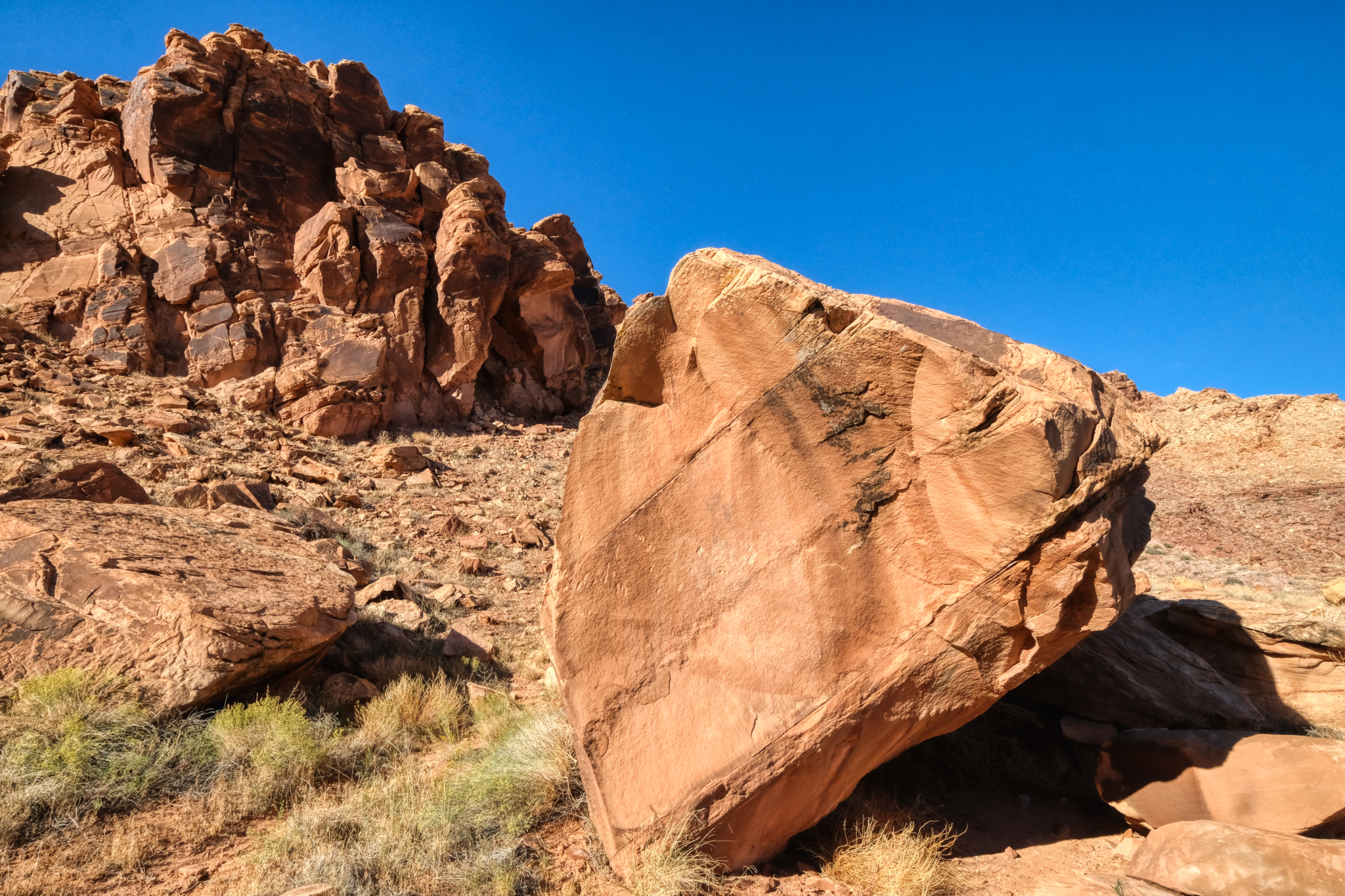
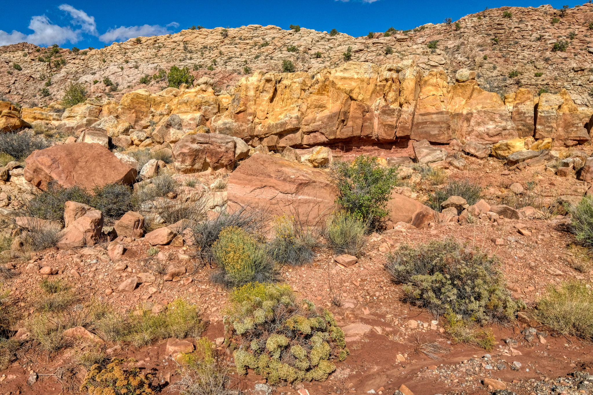
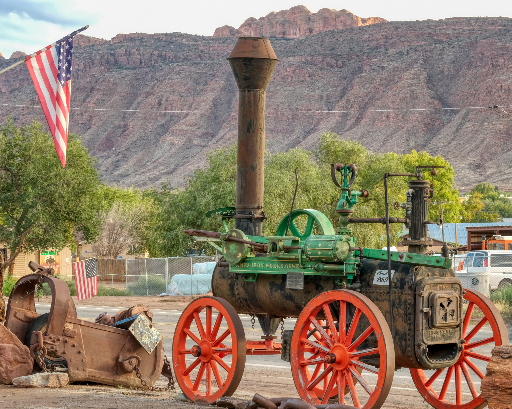 Moab is the "Outdoor Adventure Capitol of the USA" . . . and also a very interesting old mining town. I stopped in a gems and fossil shop to look for dinosaur fossils for my grandson at a place that had lots of antique mining equipment laying about . . .
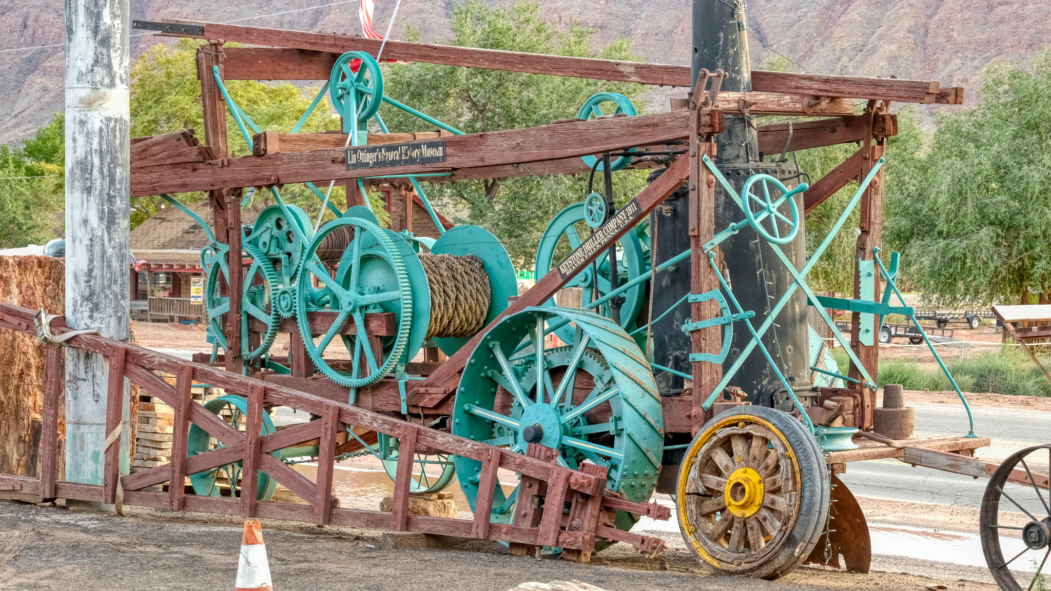 . . . an old mine winch . . .
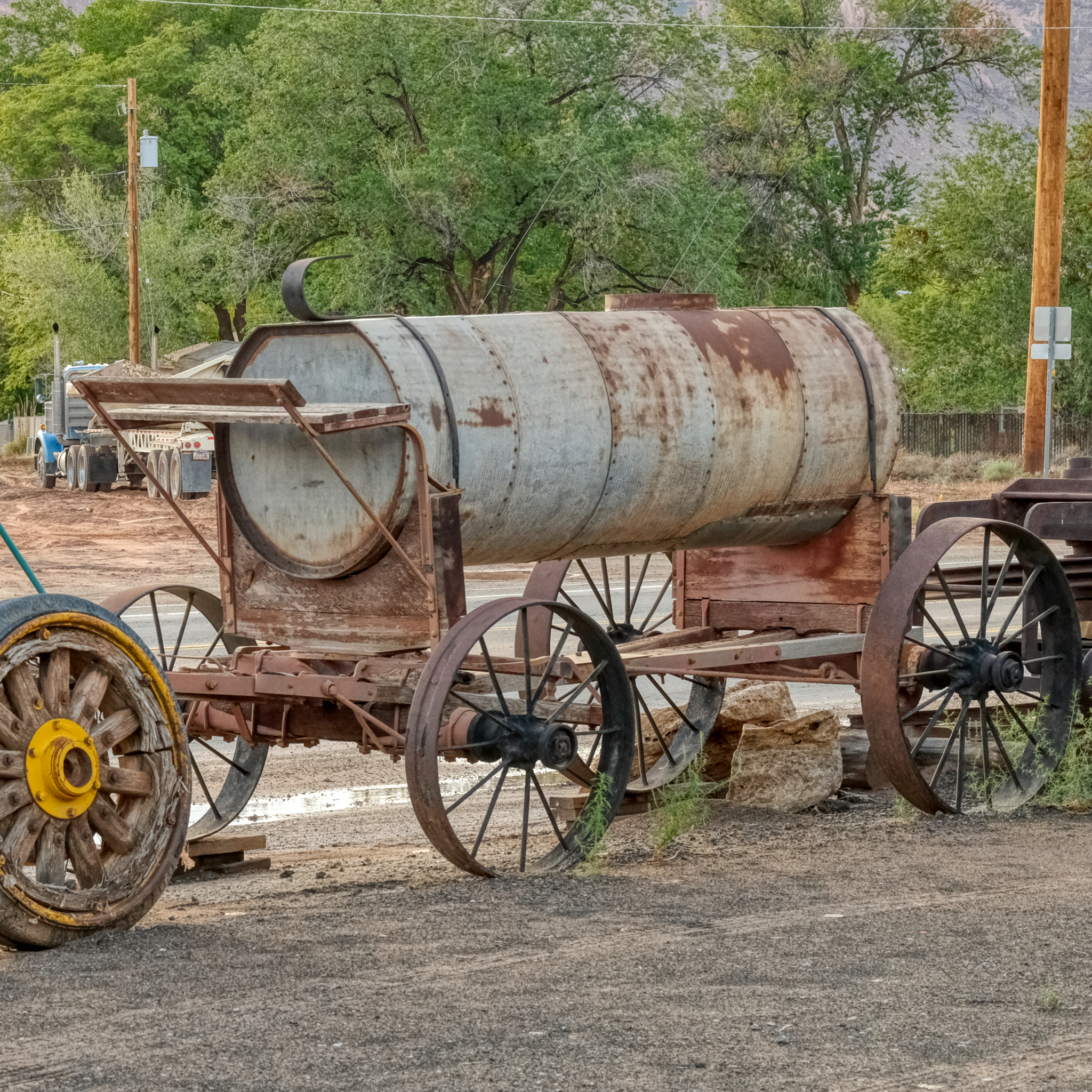 . . . a water wagon that once services a long forgotten mining operation.
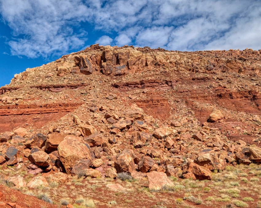
 The good people in the rock shop advised that I go and see Dead Horse Overlook State Park, about 20 miles out of town . . . and through fantastic high desert chaparral country.
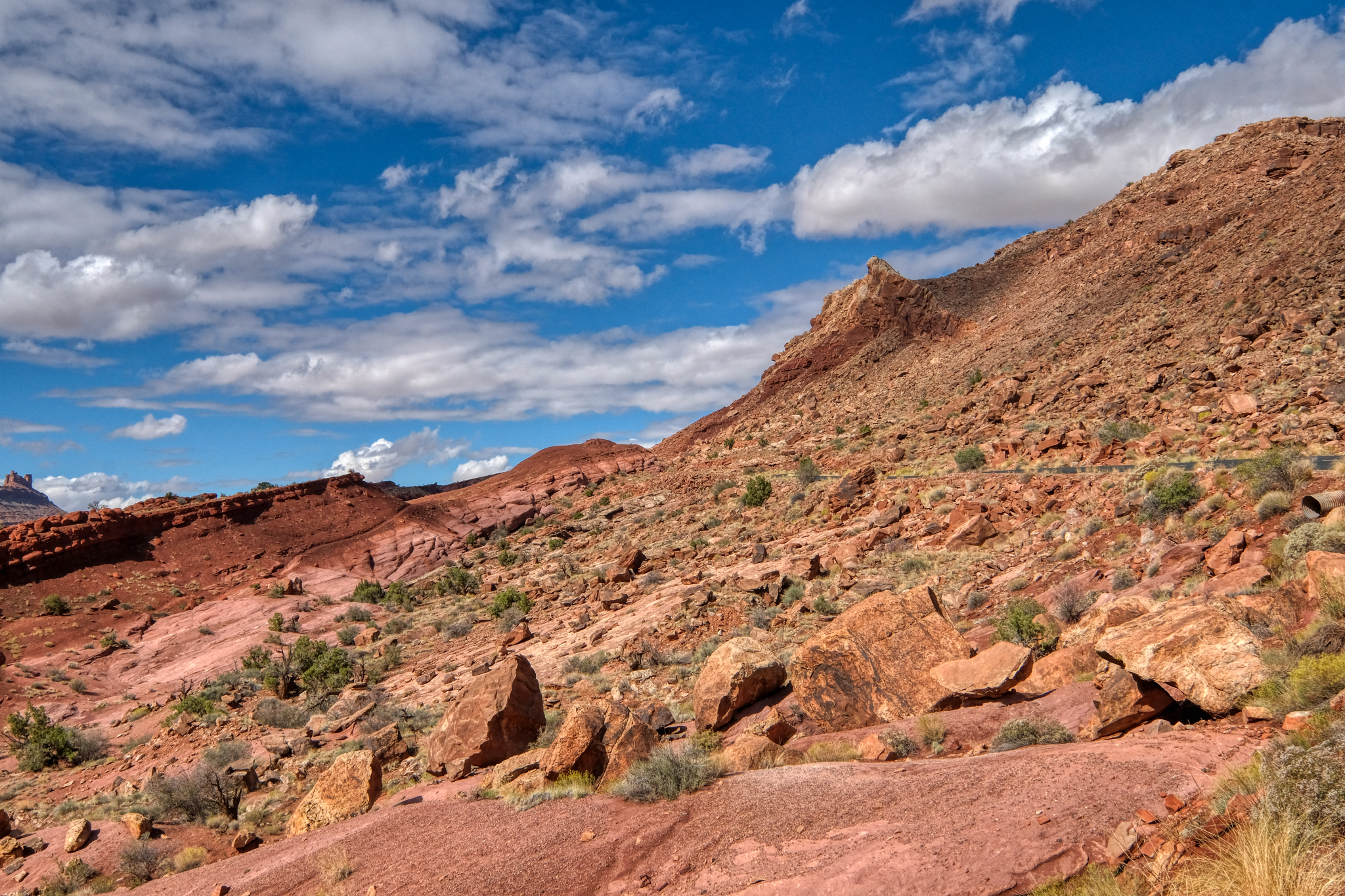
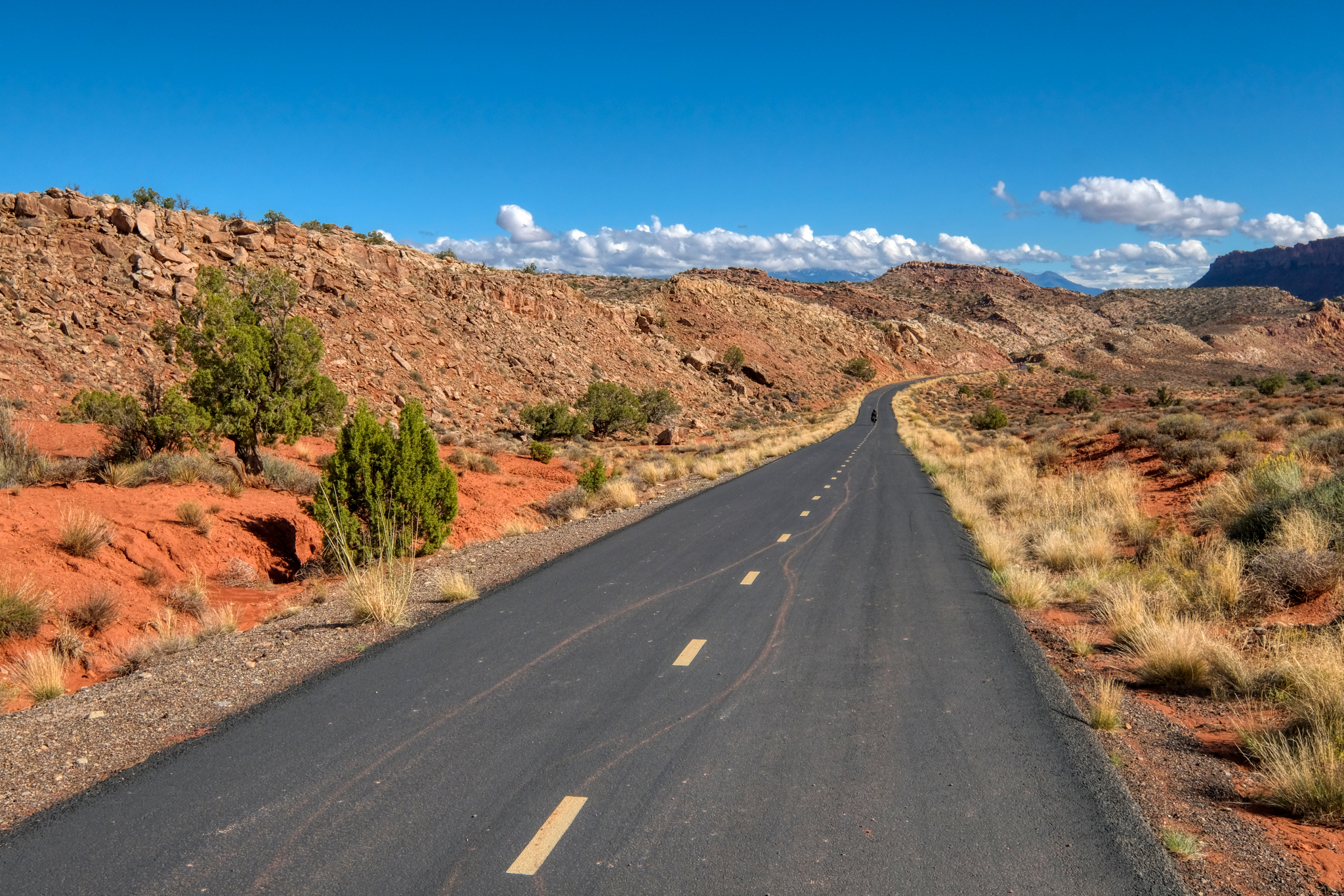
 The small paved road out to Dead Horse Overlook was GRAND!
 The sky became very dark and I was worried that I would lose another day in bad weather . . . I pushed on to Dead Horse Overlook.
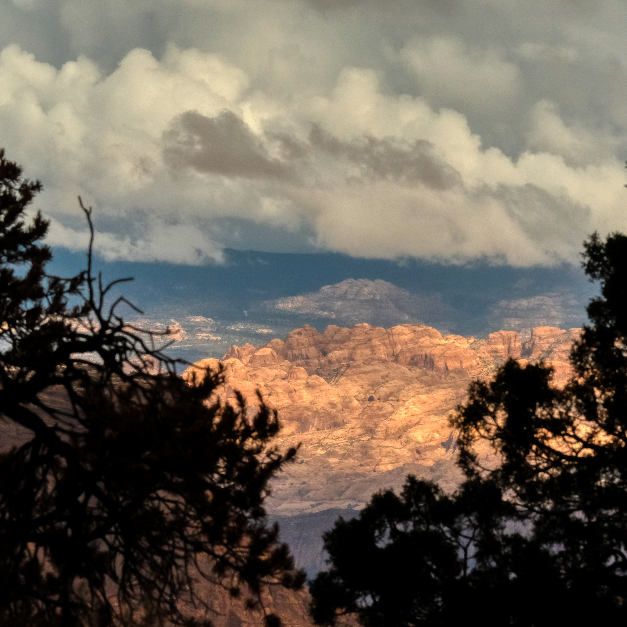
 As I neared the overlook I knew I was in for something truly wonderful.
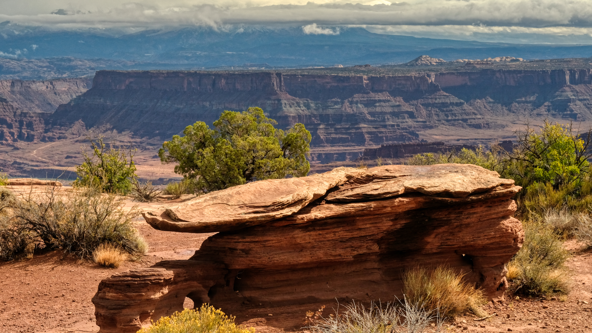
 Now and again I would get a glimpse through the roadside shrubbery of a grand landscape . . . .
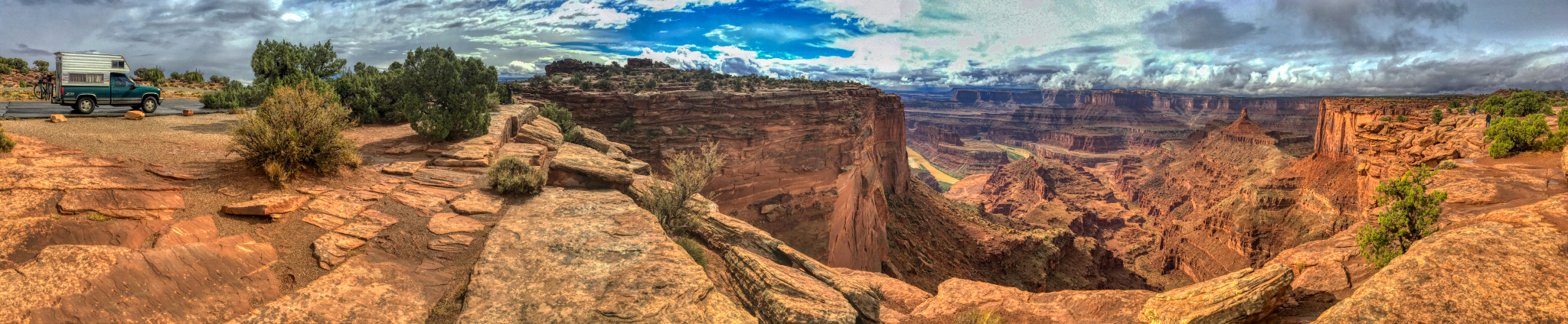
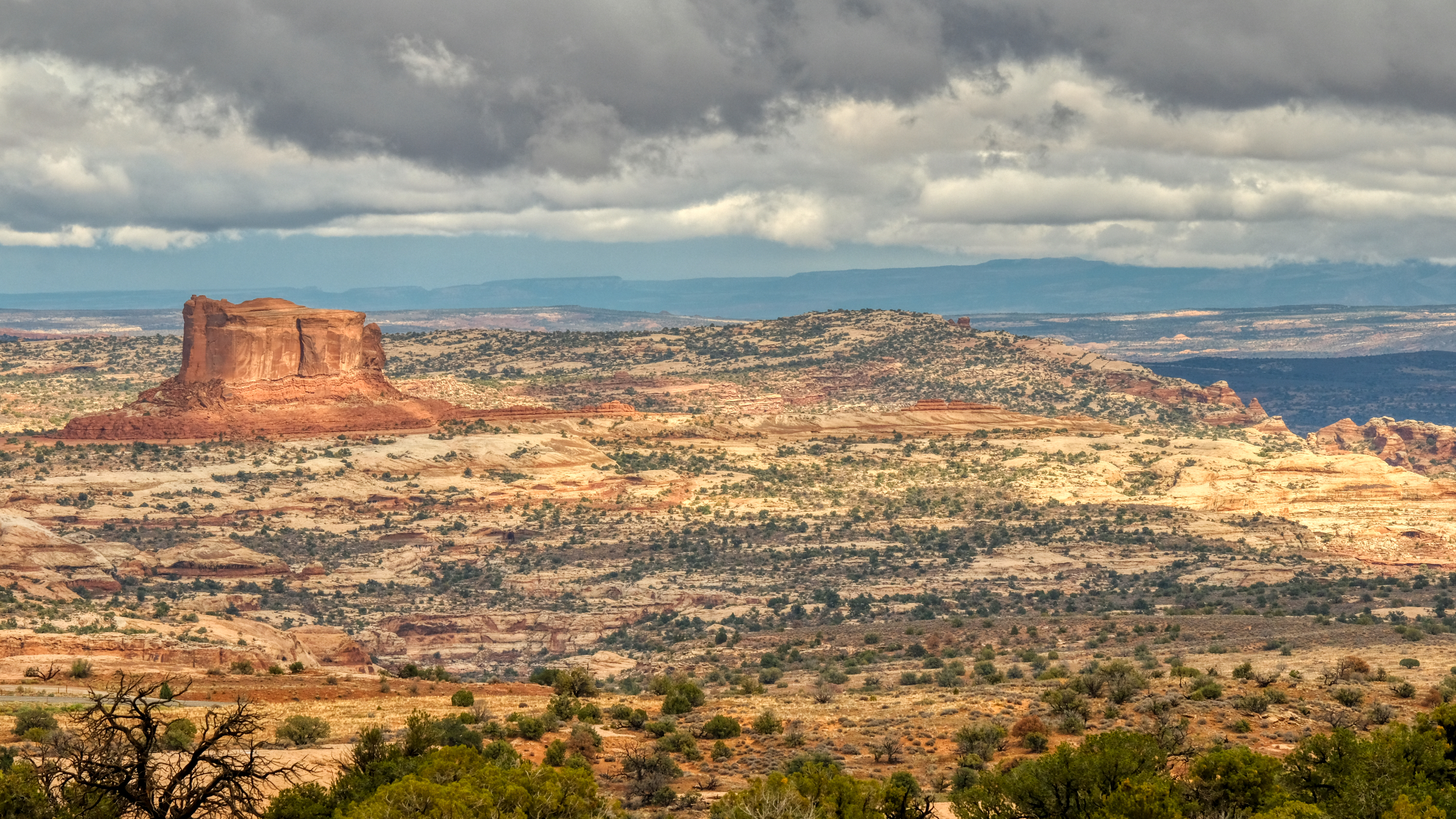
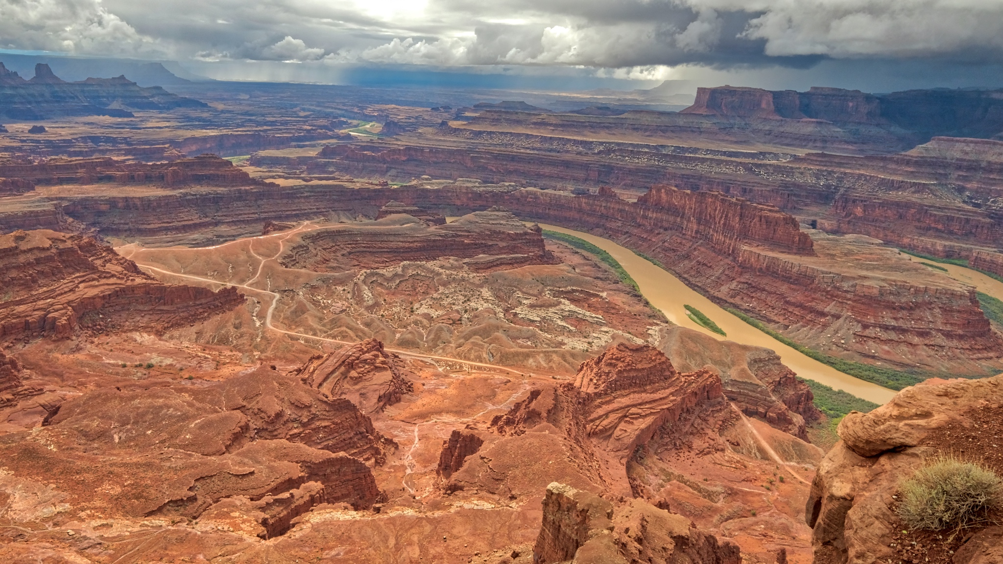
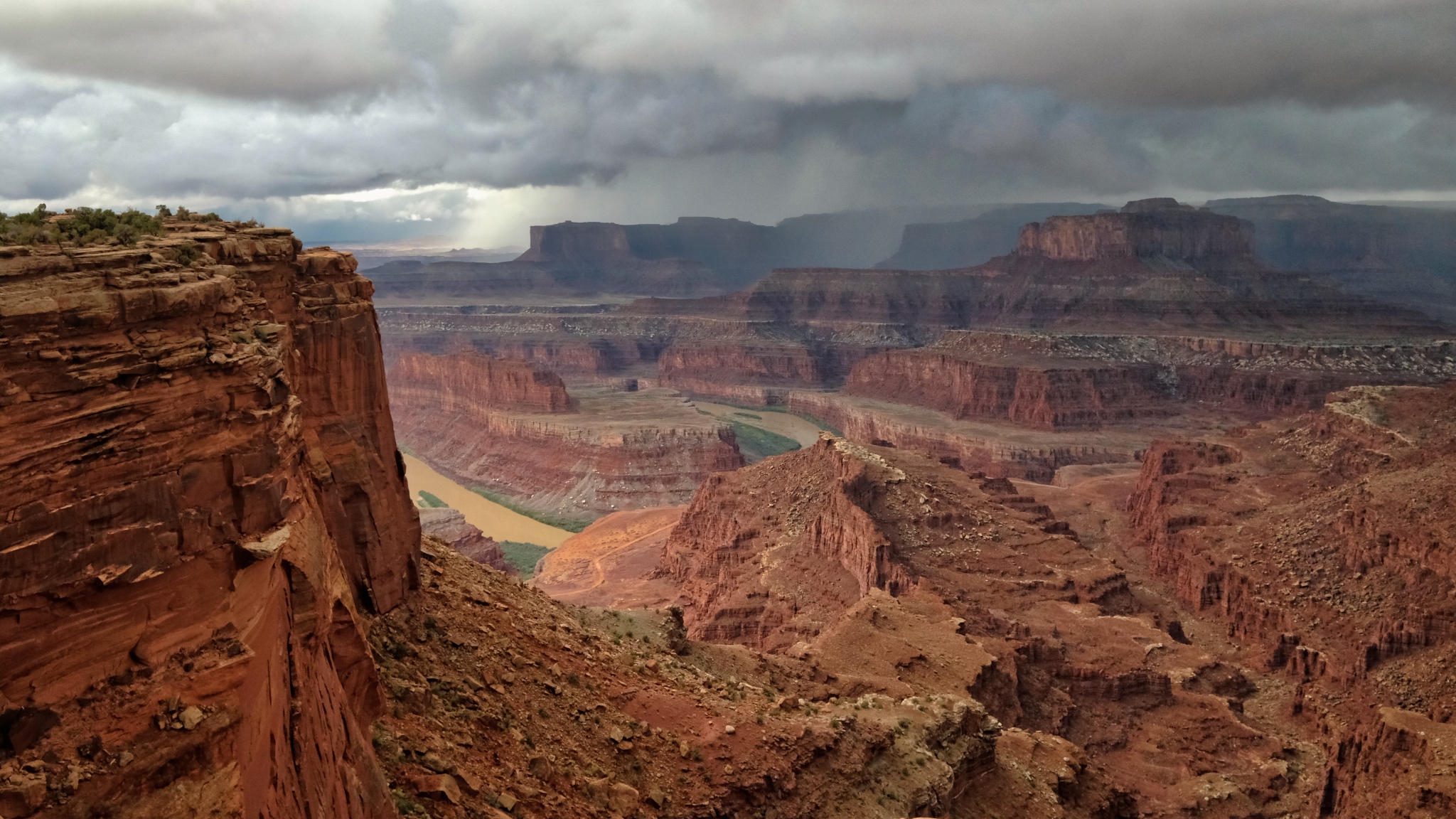
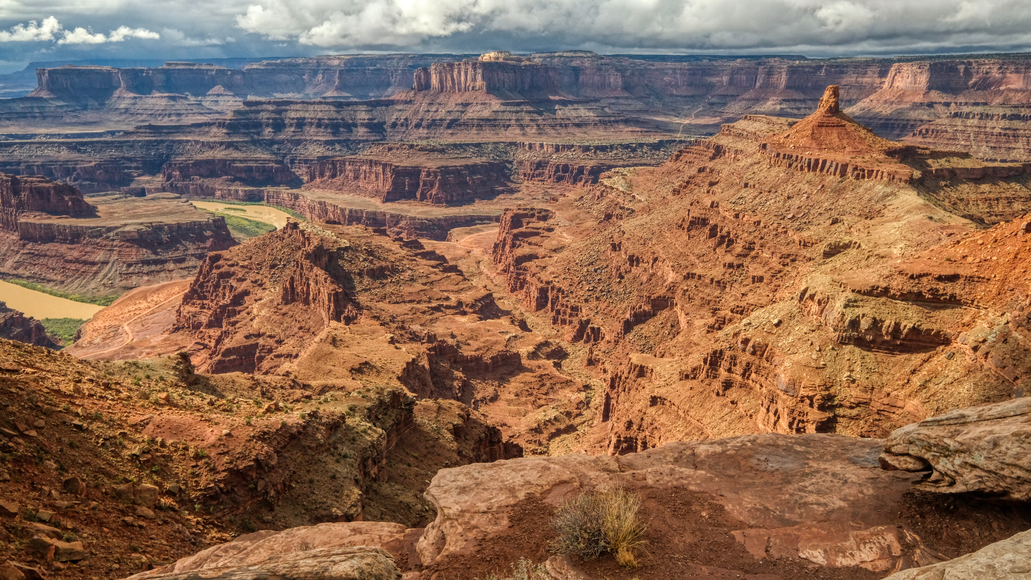 When I finally arrived at Dead Horse Overlook I parked right next to the precipice of this amazing sight! The grandest view I have ever seen! I was parked out on a ridge that jutted out into this spectacular canyon! There was a 300 degree view from where I stood. This view is looking north.
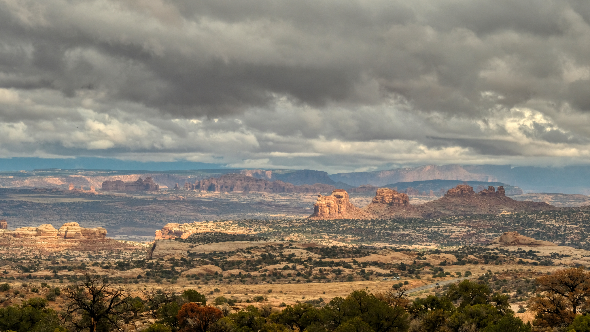
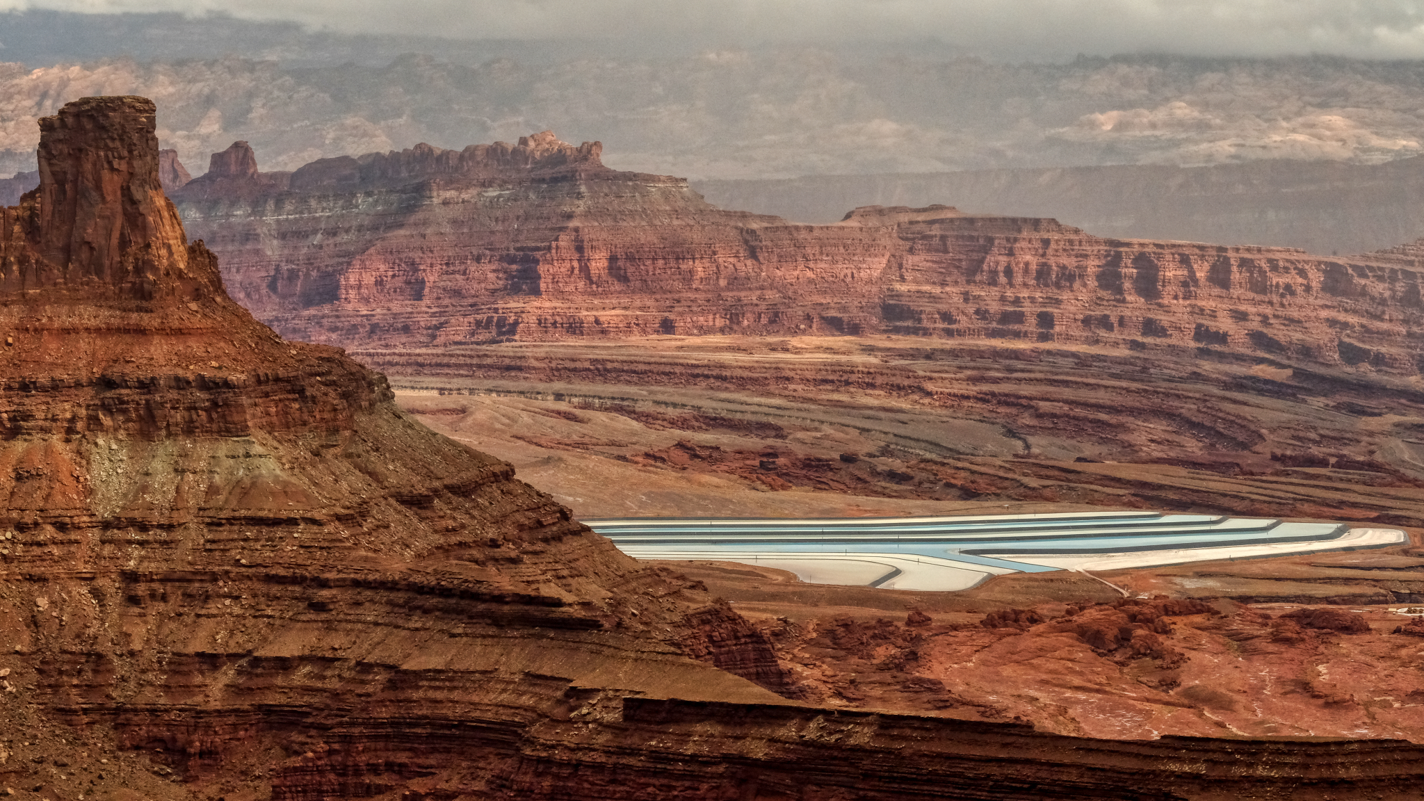
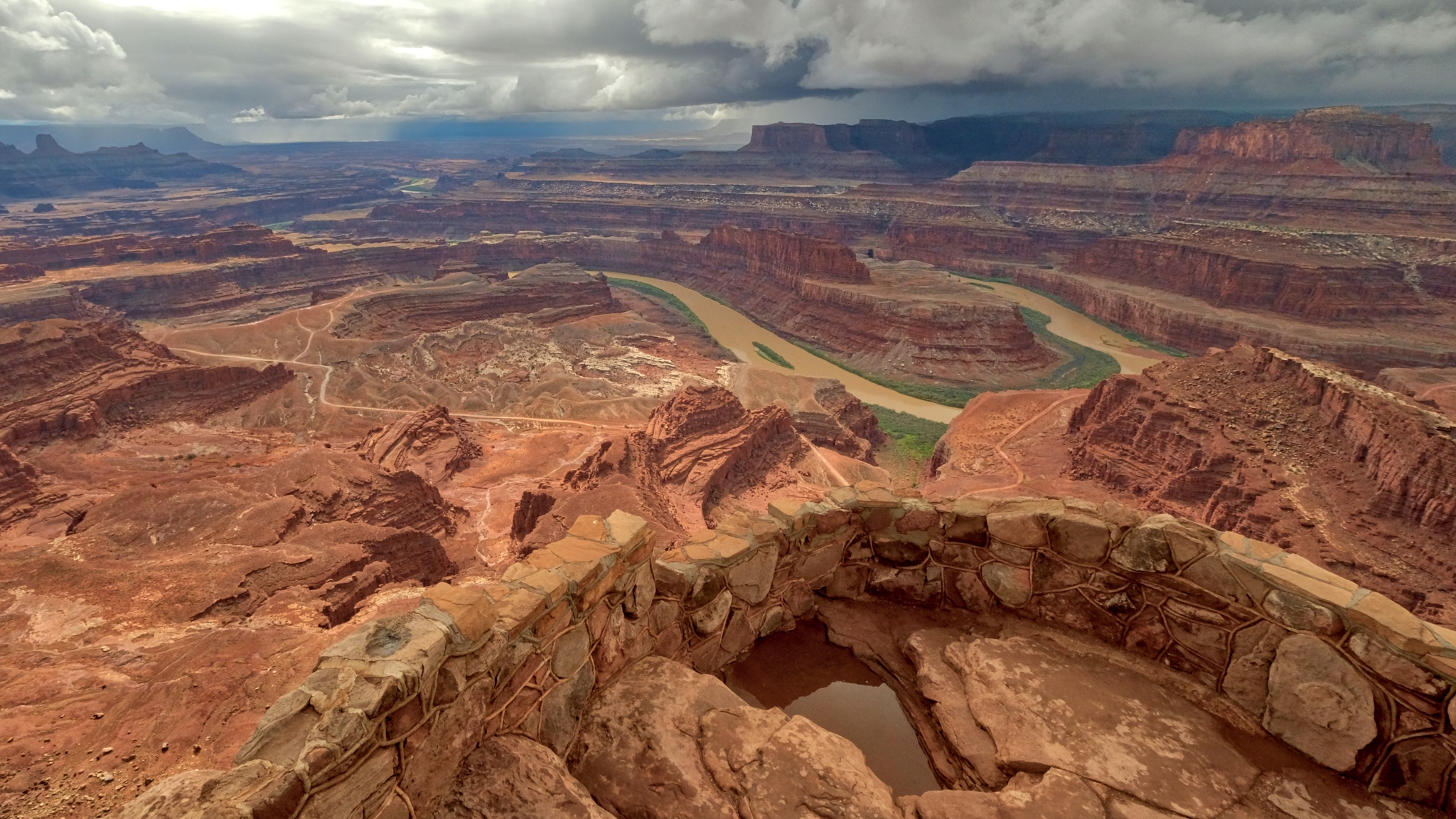
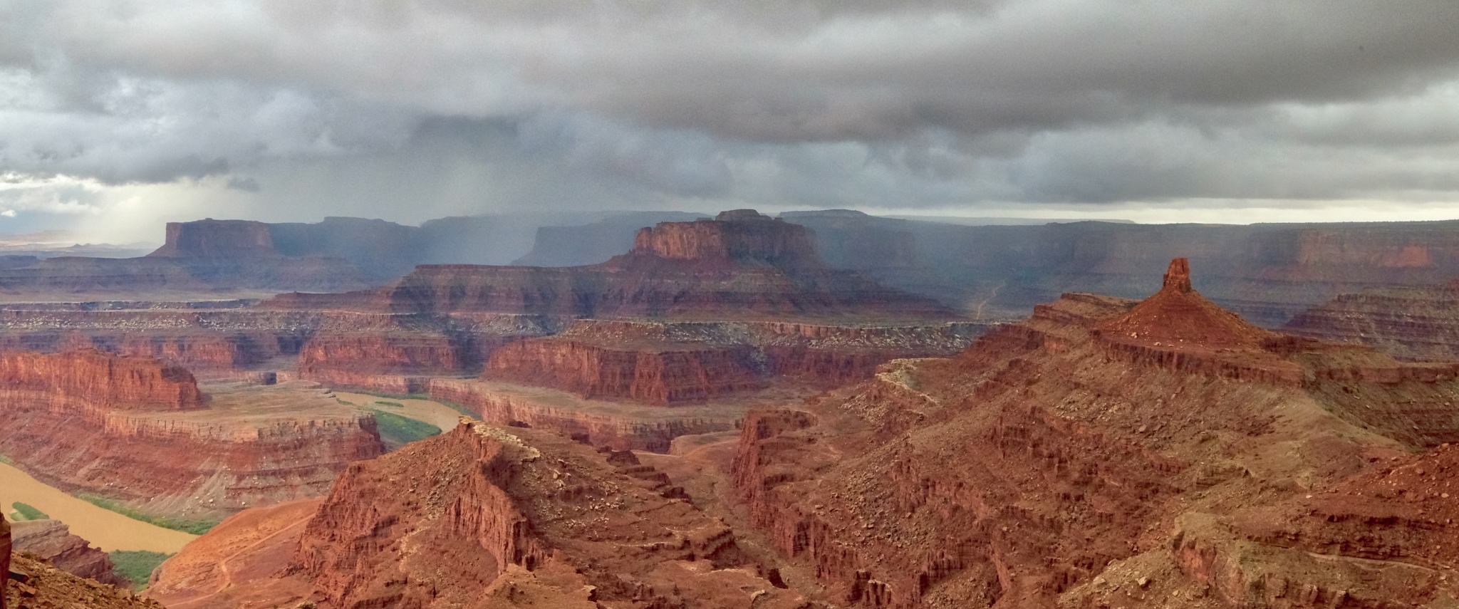
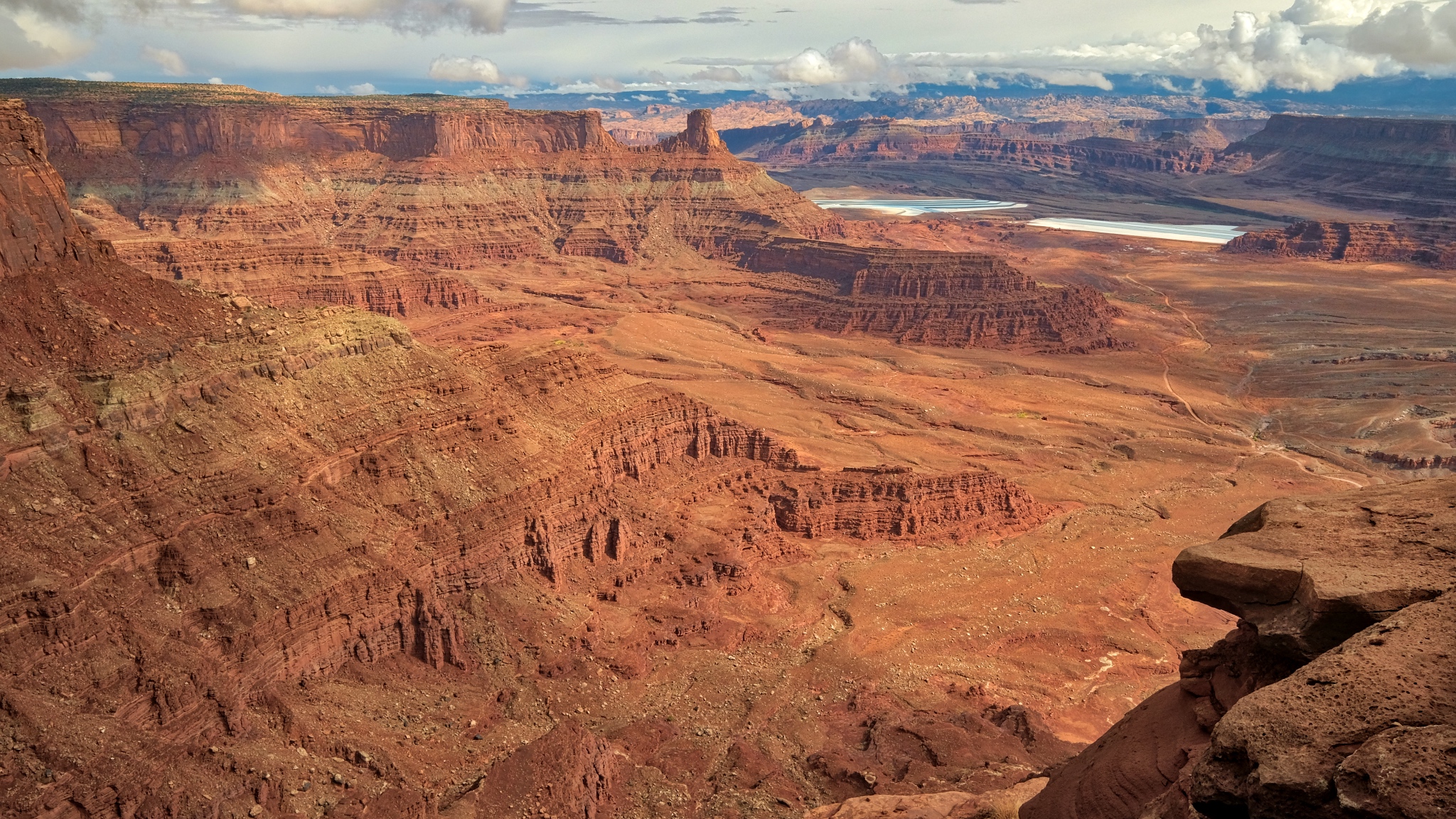 I walked across the road to this south facing view of the mammoth canyon!
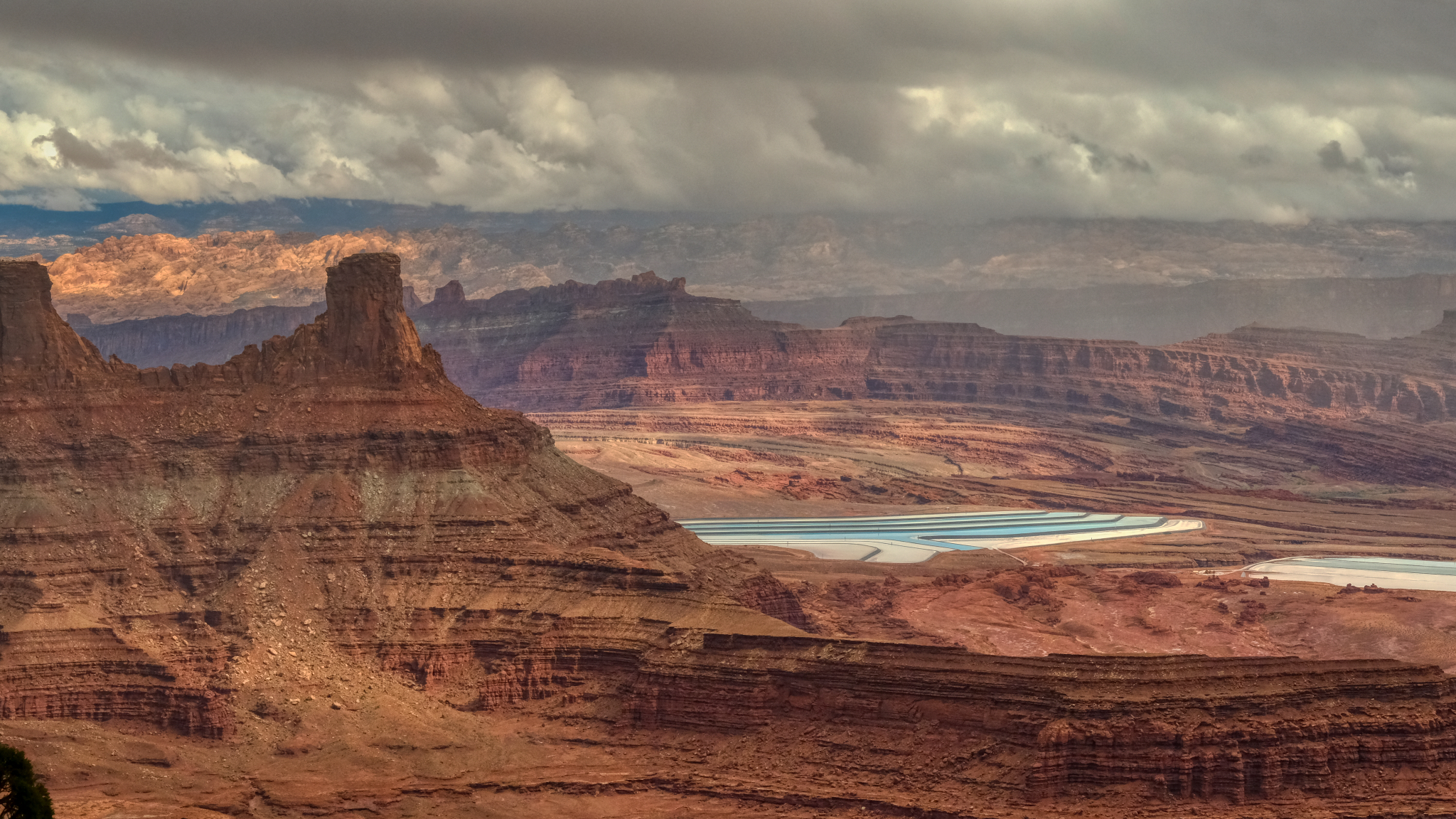 Potash evaporation ponds could be seen in the distance in the south side view.
 I was left speechless by the grandeur of this place . . . and so were the 15-20 other tourists there . . . walking around very slowly with their mouths open . . . in complete silence.
 Astonishing beauty.
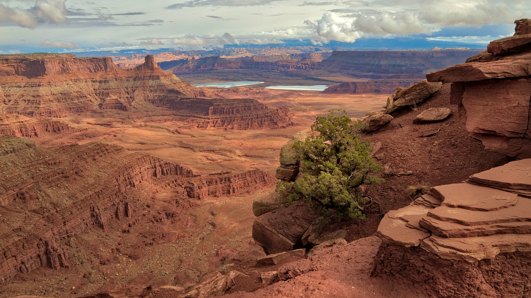
 I walked along the south edge toward the outermost point of the ridge . . .
 A meandering Colorado River cuts its way through the red rock.
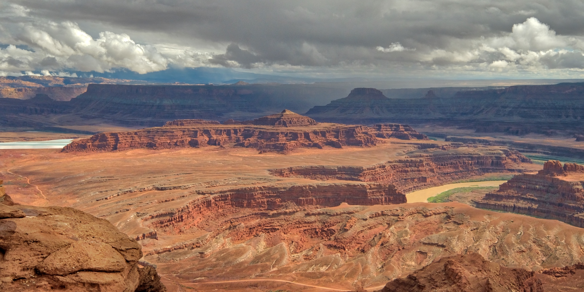
At last I stood out at the end of the ridge . . . with the entire canyon below . . .
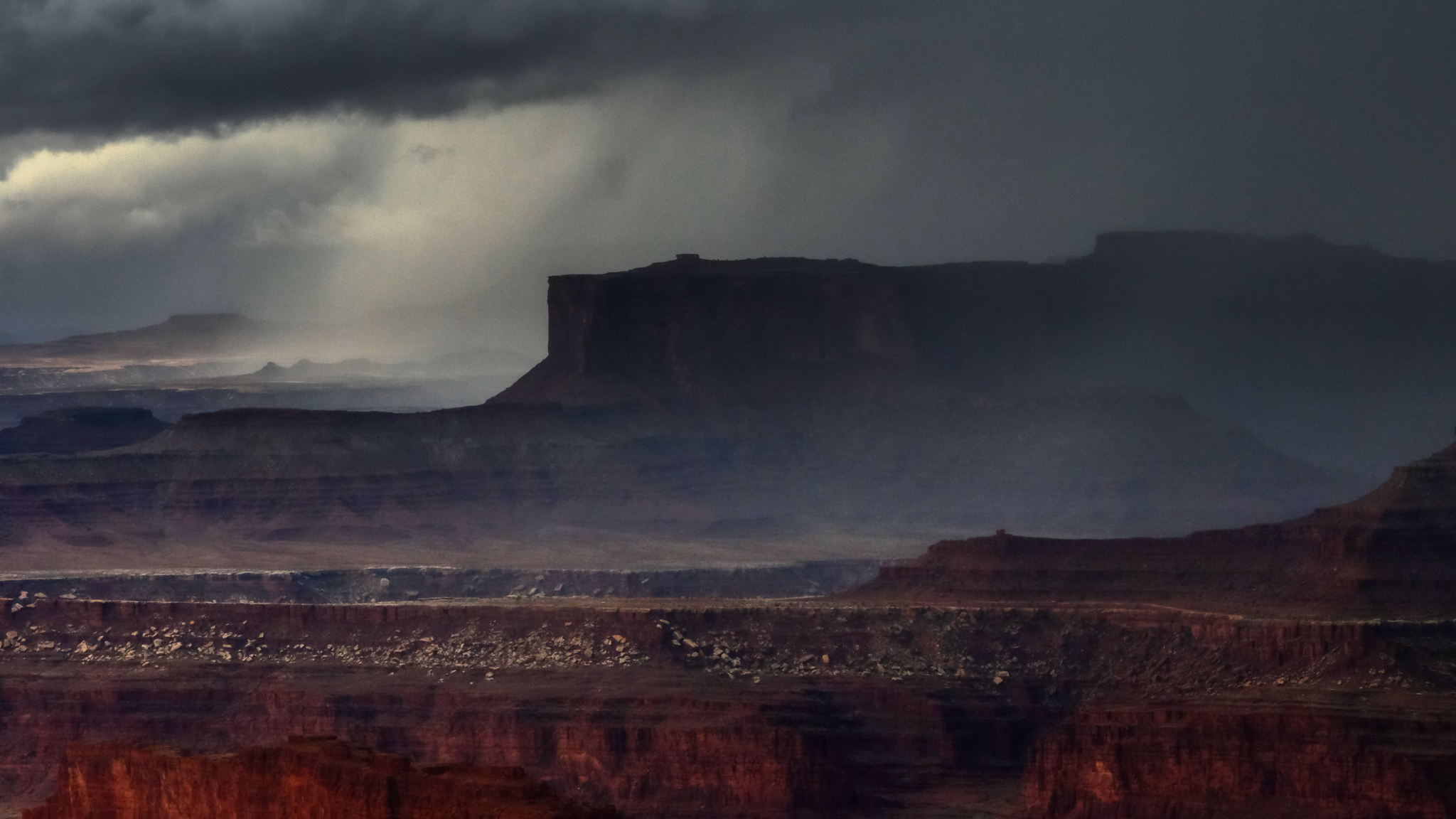
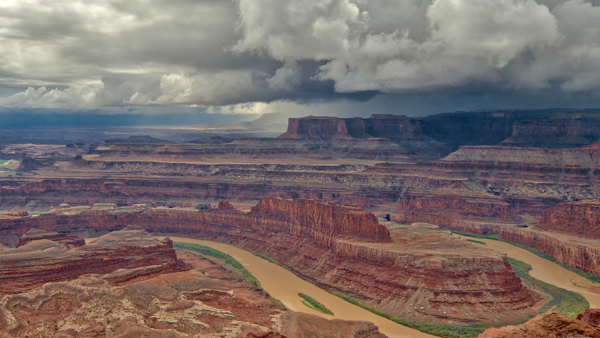 Looking north from the ridge point I could see the storm clouds gathering on the far canyon rim.
 Indescribable beauty.
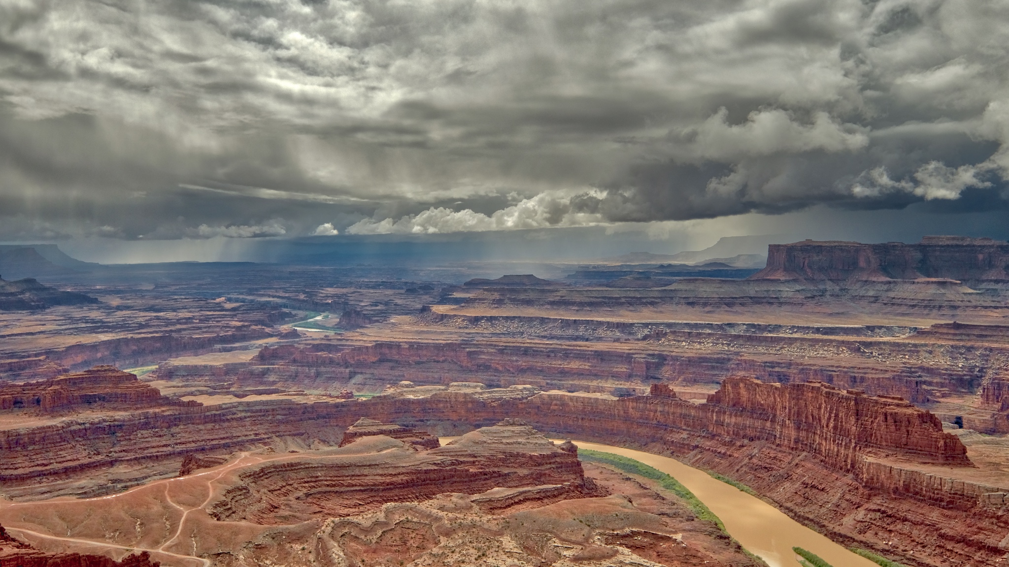
 The rain moved rapidly across the canyon.
 The rain came swiftly . . . I ran to my camper.
 I hated to have to leave this incredible place . . . I slowly drove away from Dead Horse Point State Park, Utah.
 Back down the road through the rain toward my motel room in Moab . . . too cold and wet for a campground . . .
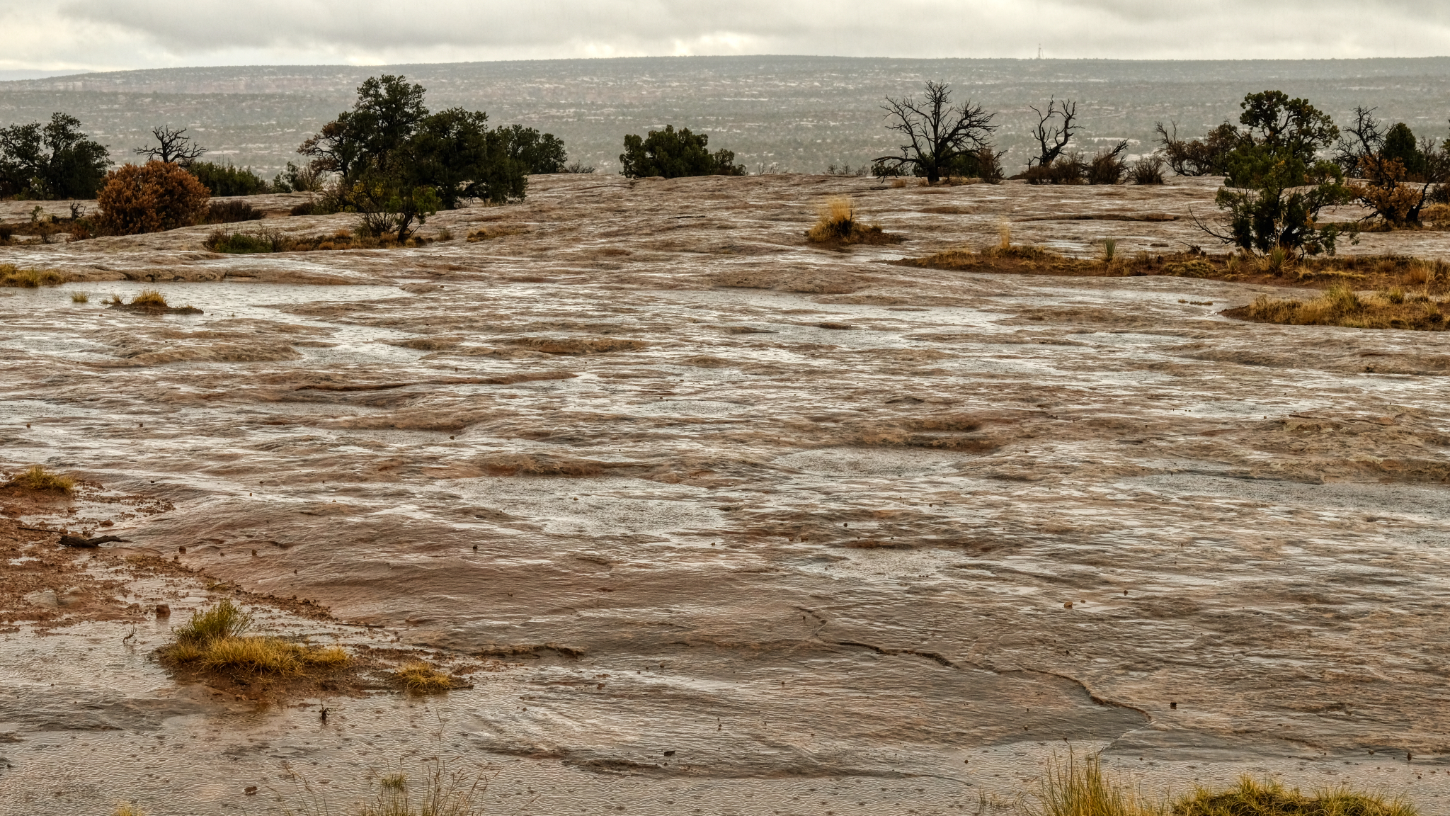 Hard rain on hard flat rock.
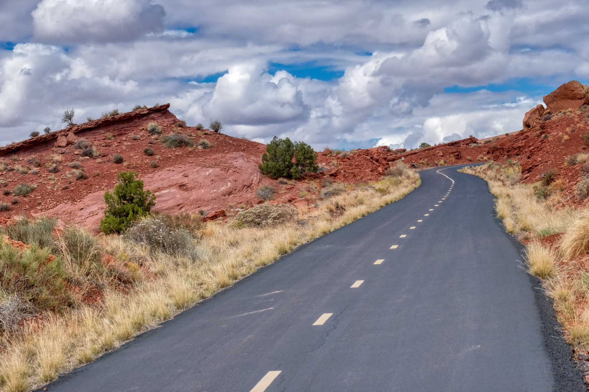
 The next morning broke bright and sunny. I left my motel and found a nice RV park at the edge of town, got a space, set up, and set off on my bicycle. As it turned out, my RV park was at the beginning of a long and paved bike trail that led out of town and up into the red rock canyons.
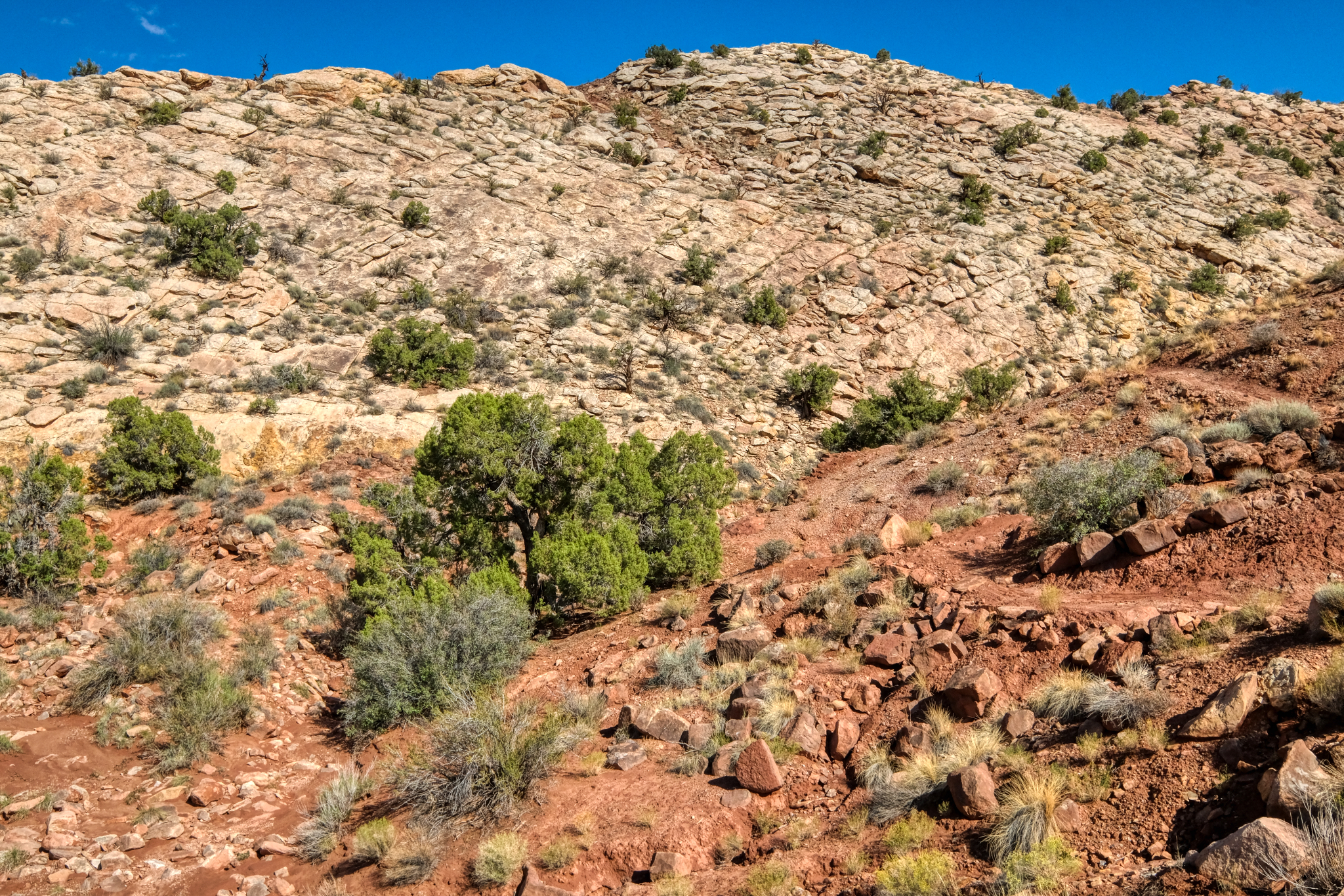
 The trail was beautifully paved and at a not too steep grade. Perfect.
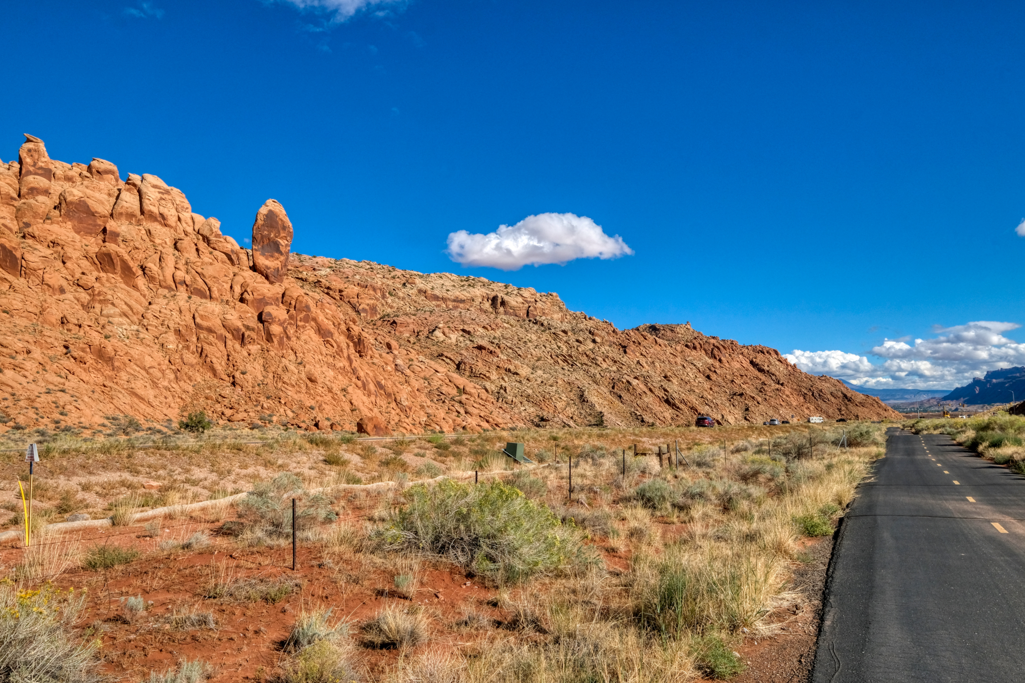
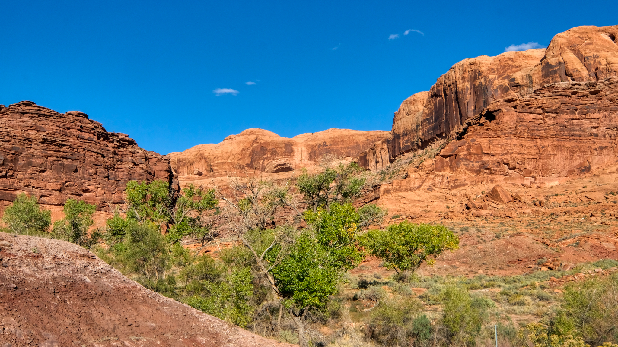
 The views coming up the bike trail out of Moab were spectacular!
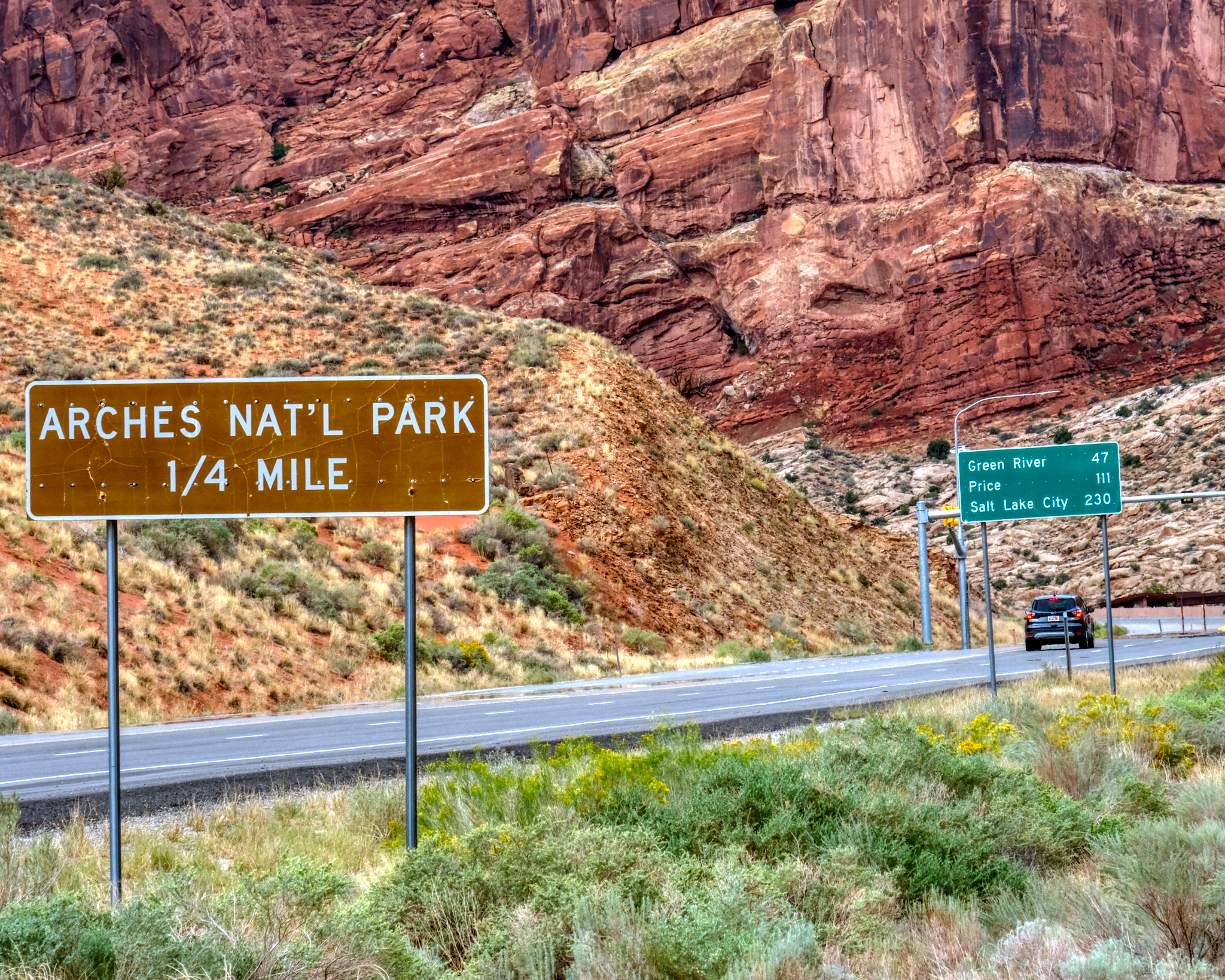 The cut-off road to the Arches National Park was just outside of town . . . .
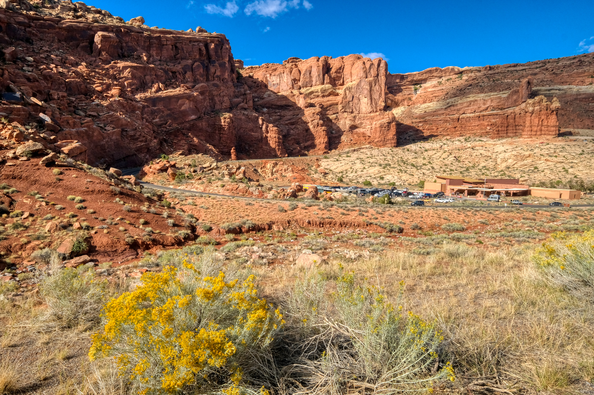 I thought about going into the Arches National Park, but the road was always busy . . . and so was the Visitors Center. I couldn't imagine seeing anything more impressive than Dead Horse Point overlook.
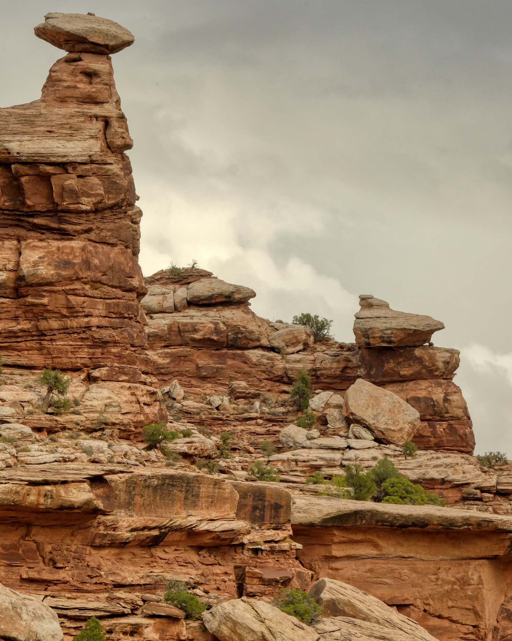
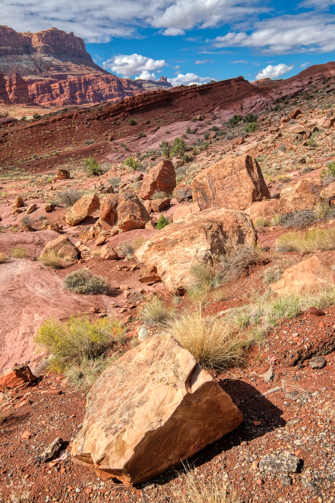
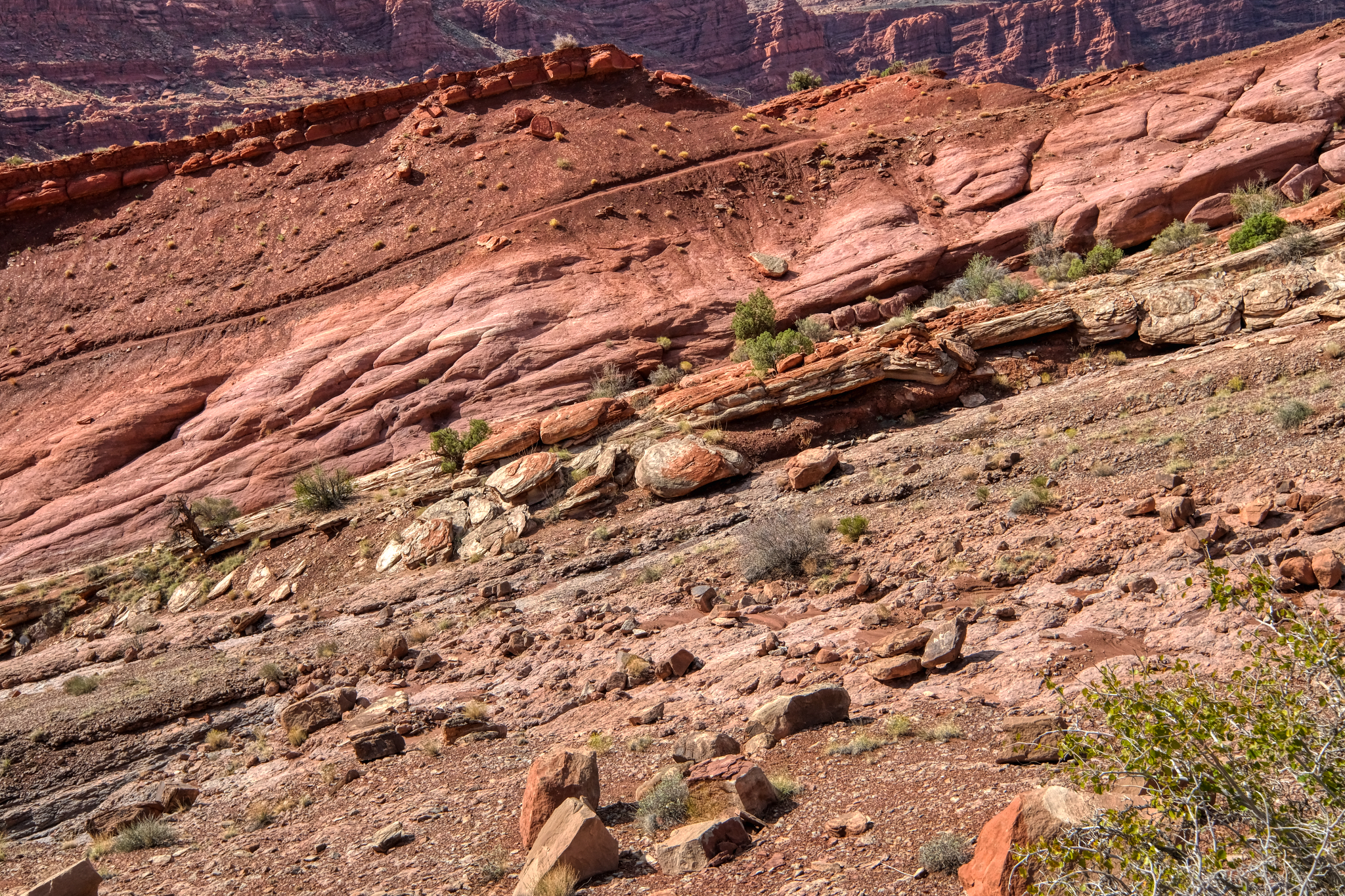
 I must have been a geologist in a previous life. My college roommate was a 'geomorphologist' and I guess I got the geology interest from him. This scenery fascinates me no end.
 Layered rock outcrops lined the bike trail.
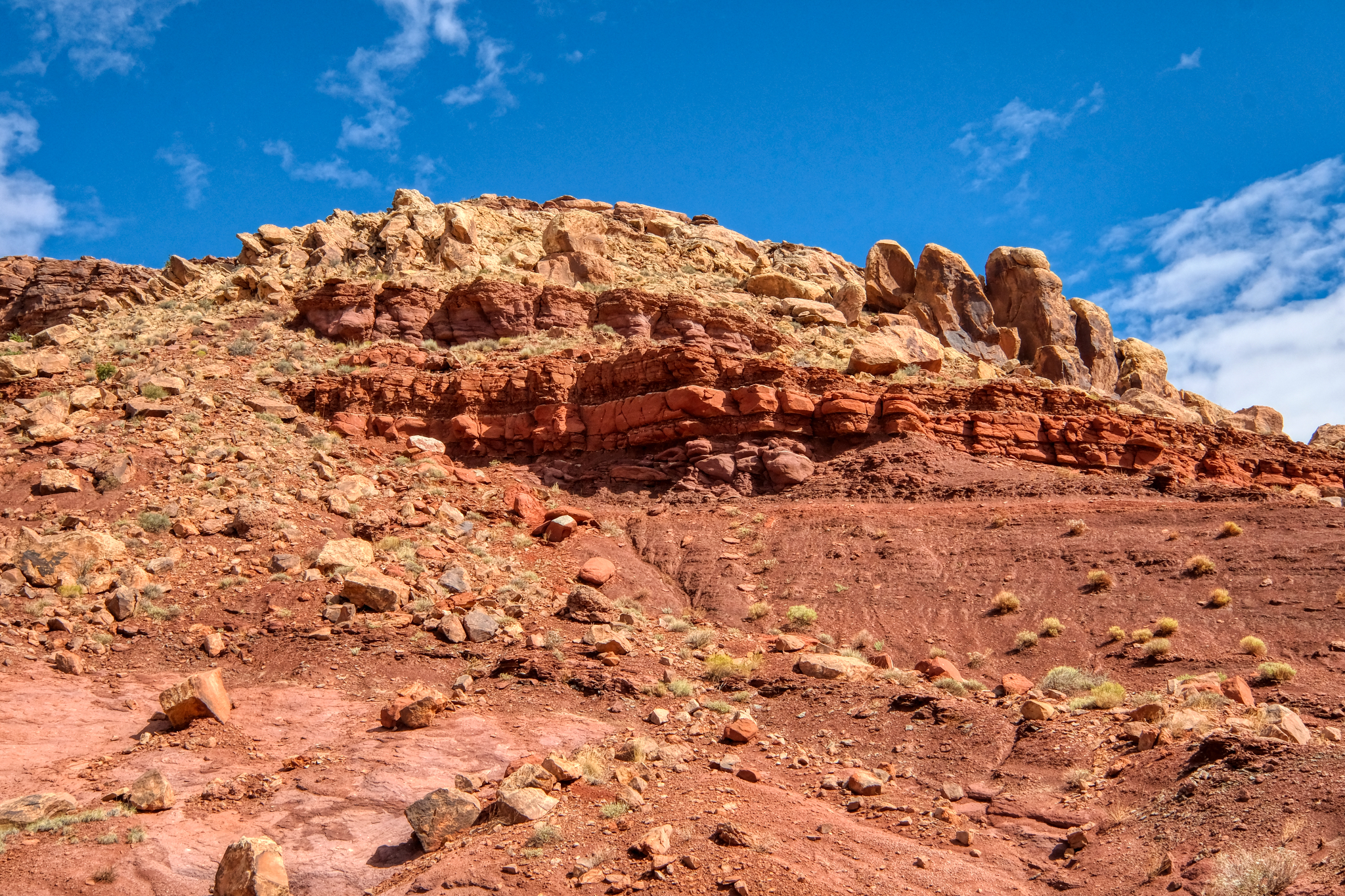
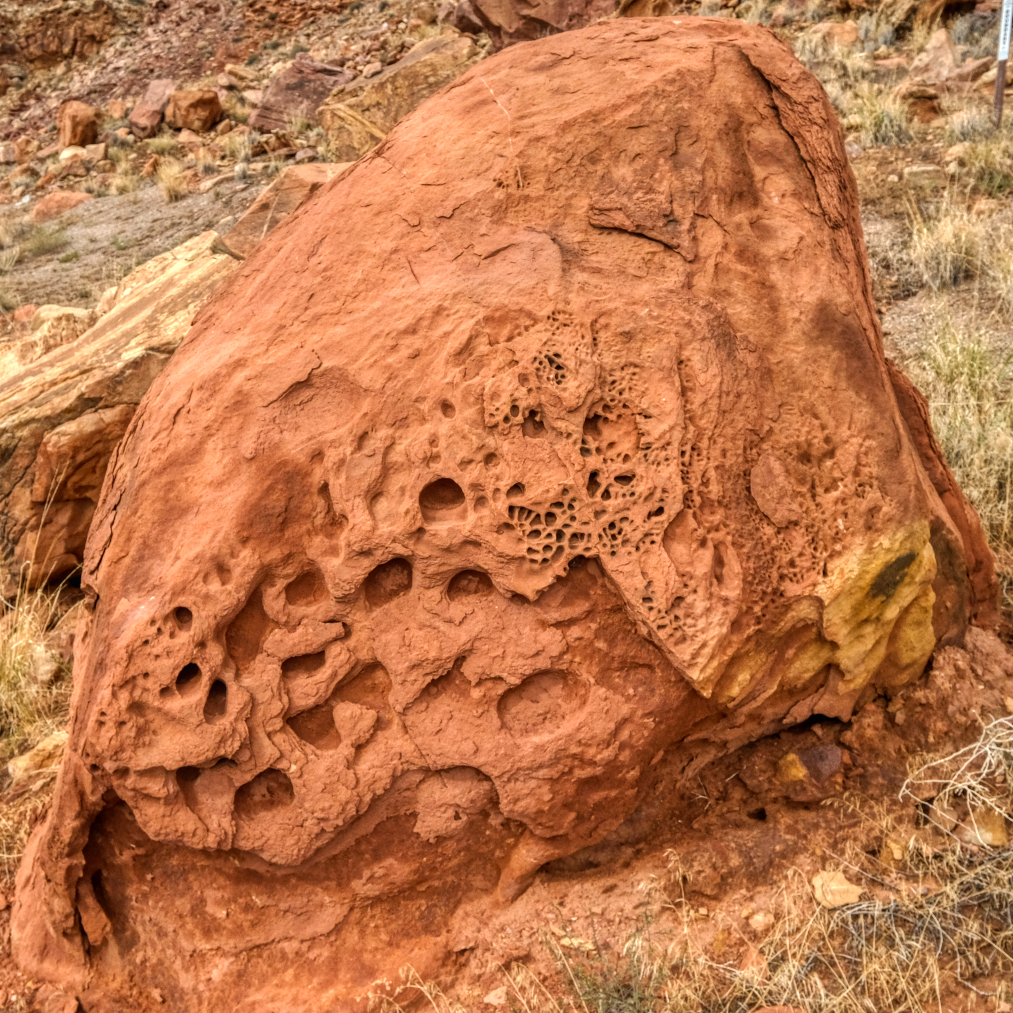
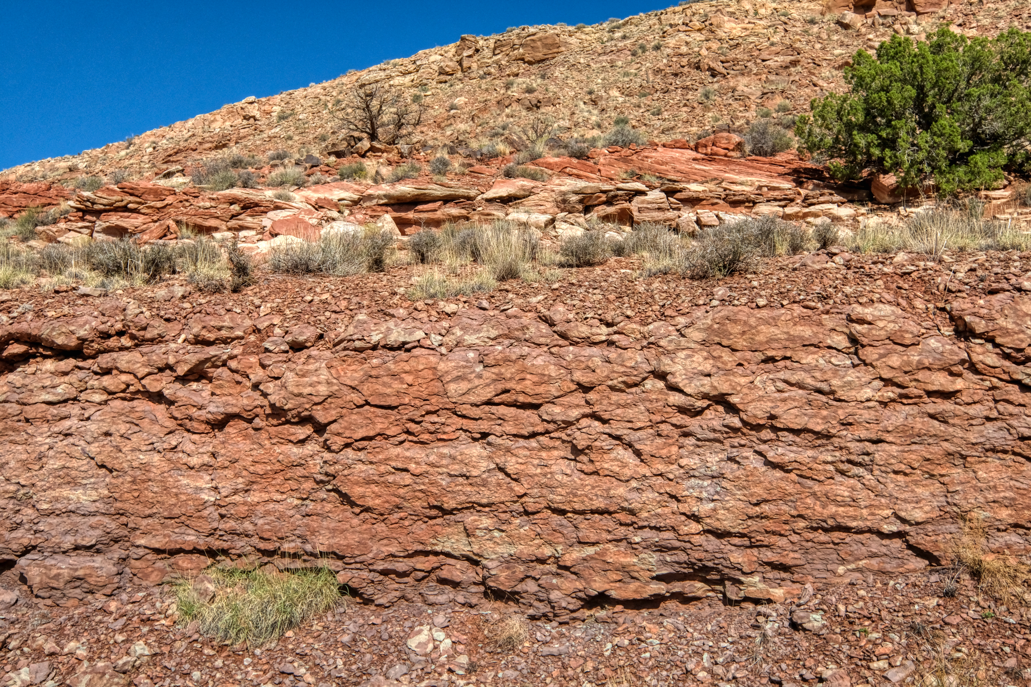 Layers of ancient, solidified mud (?) along the way.
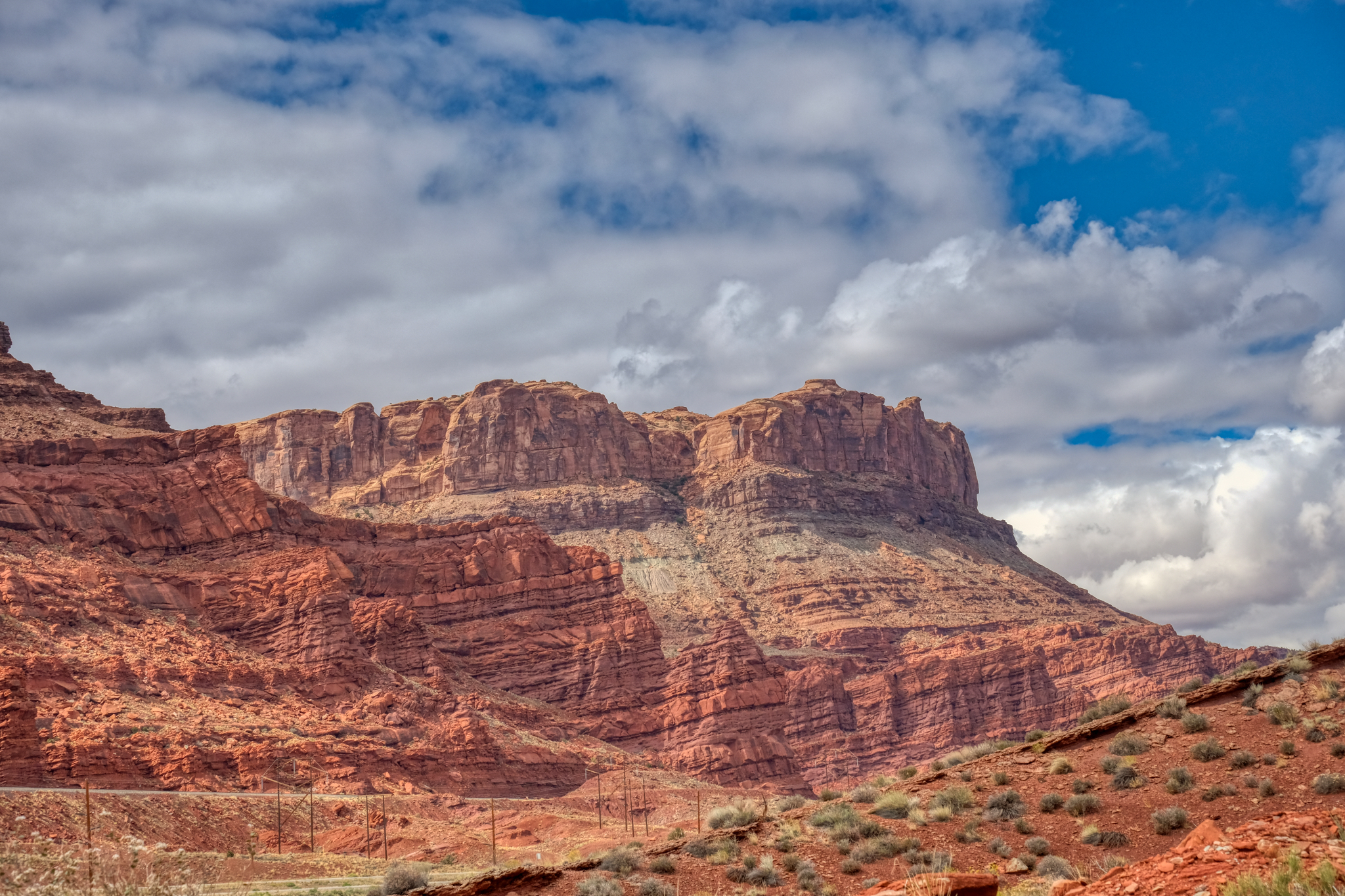
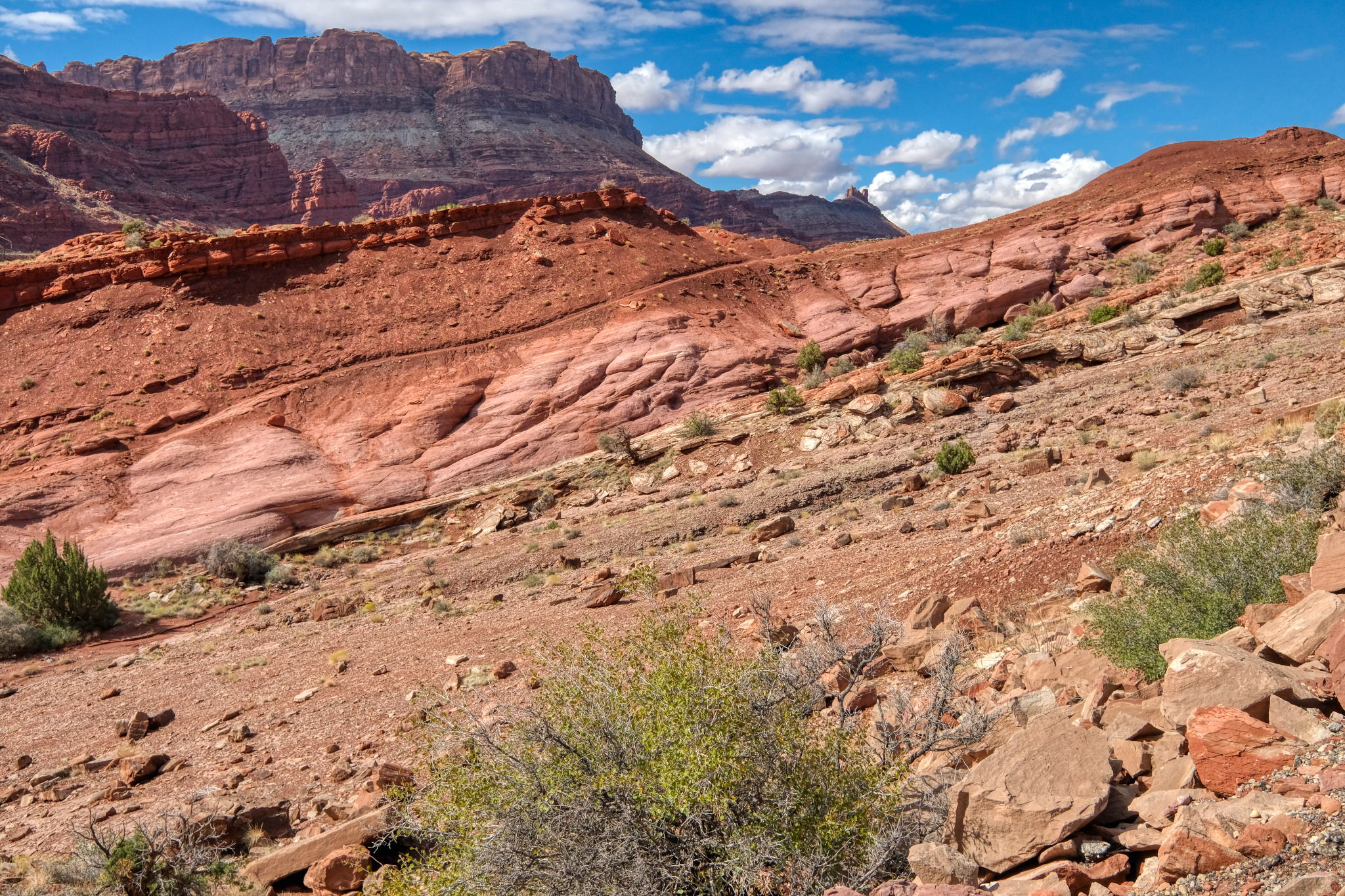
 The geological formations seemed to completely change every 200-300 meters.
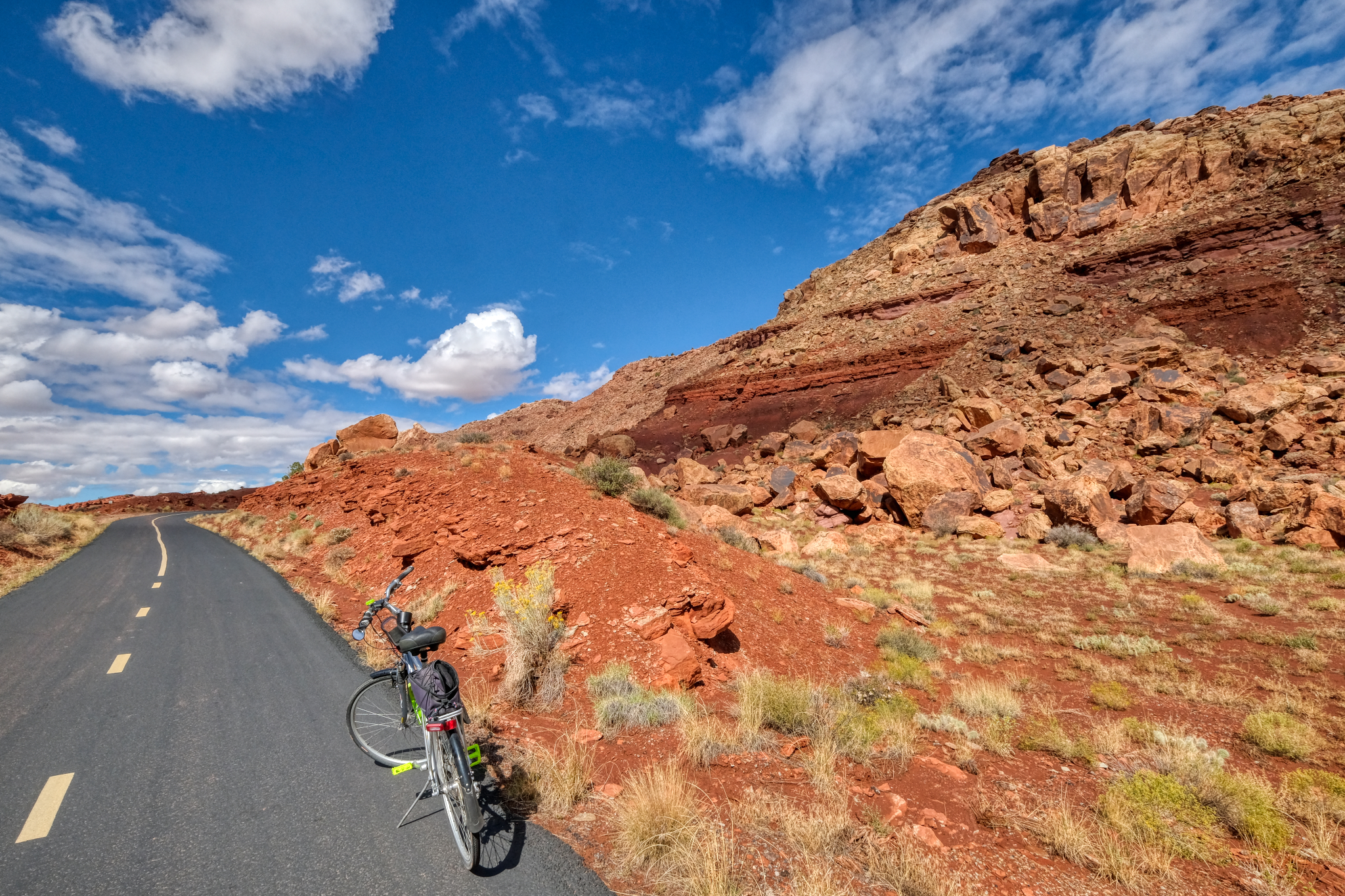 I stopped often (especially when the bike trail got steep) to snap photos and drink water. I packed a nice lunch too.
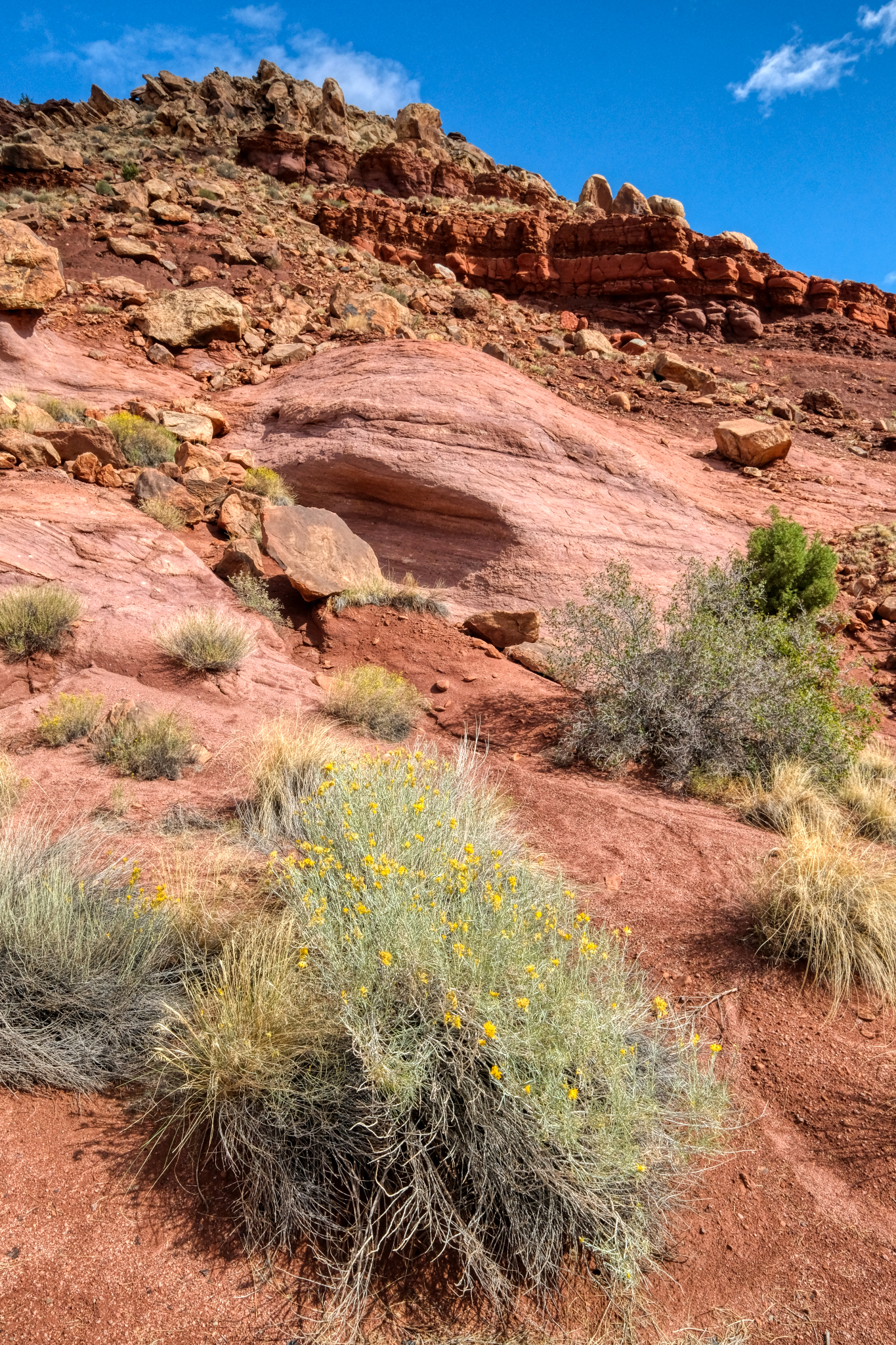
 A lovely spot to stop and be amazed by the geology of this fabulous place.
 The opportunities for dramatic nature photos were endless.
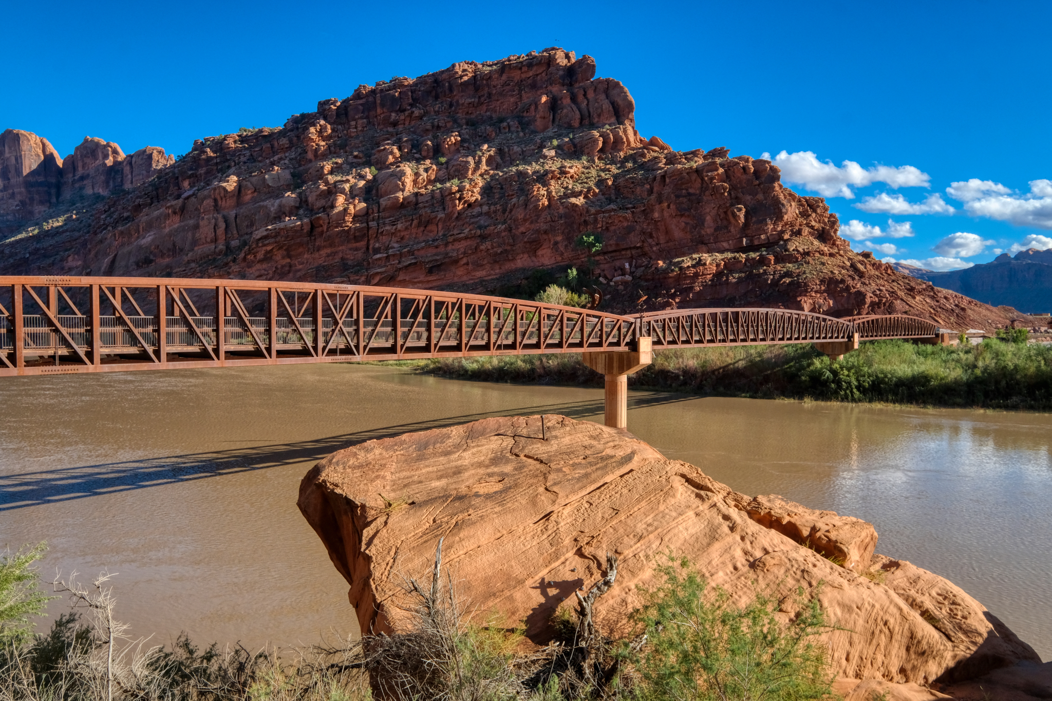
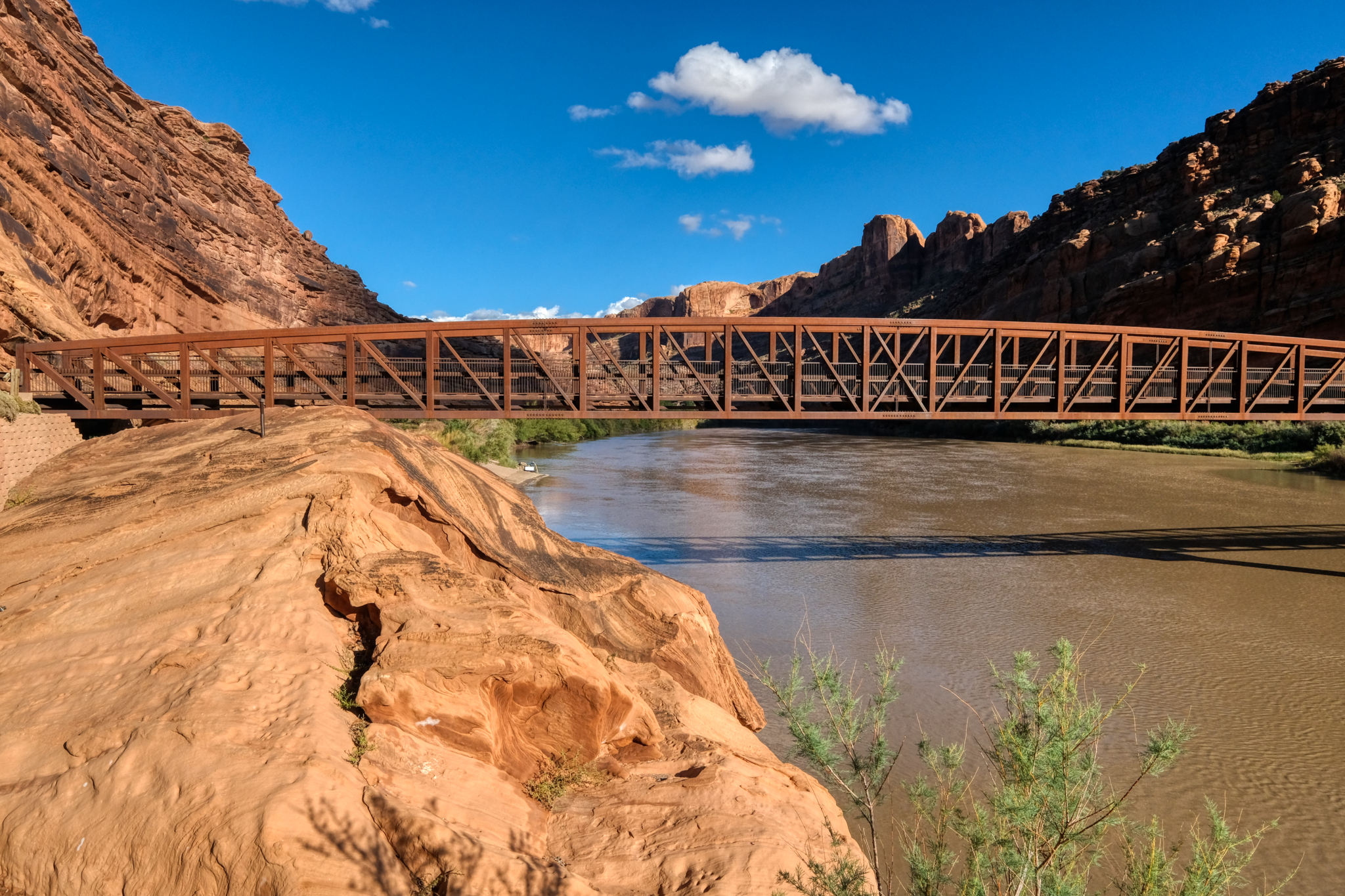
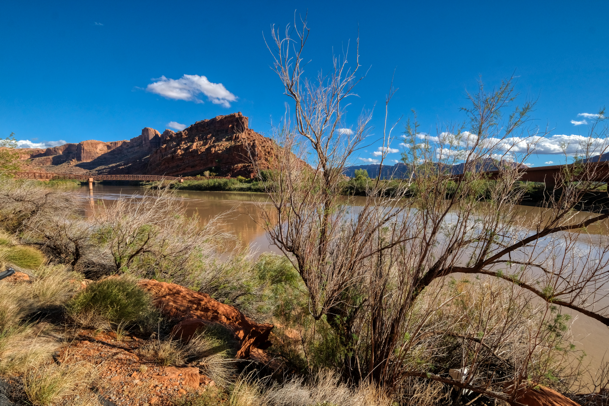 At one point just out of Moab, the canyon widened out as the Colorado River crossed under the bike path. It was the best bicycle bridge I had ever seen.
 Such a wondrous place for a long bike ride.
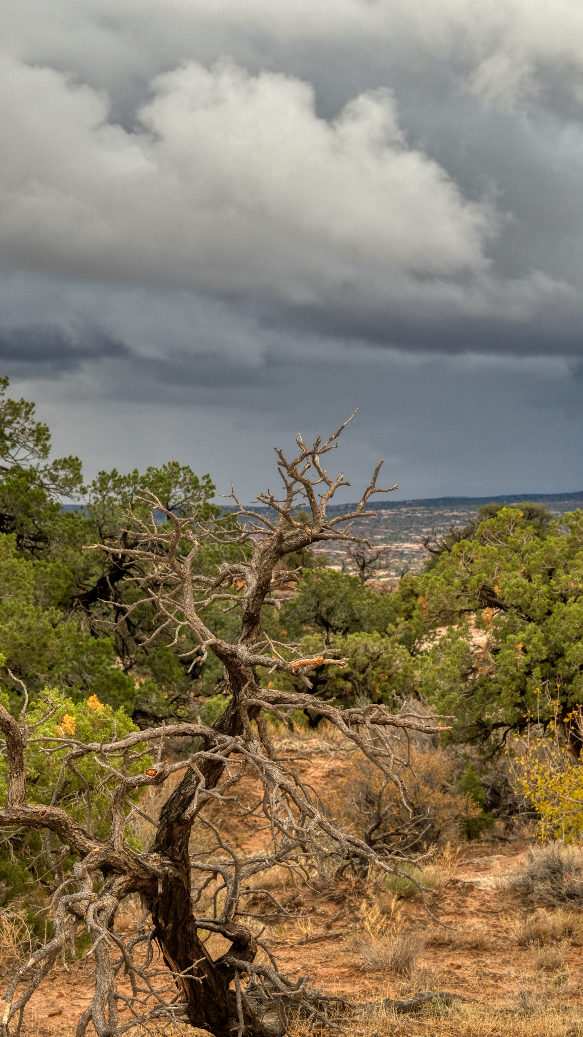
 There were only occasionally patches of large plant life . . .
 I rode my bike on up the very long steep uphill trail . . . noticing more "cactus" type plants the higher I went.
 More and more geological changes.
 Rocky desert portrait.
 Rocky desert flora portrait.
 After riding uphill all day I was getting ready to turn back in the late afternoon . . . after I climbed this last steep hill.
 My last steep climb.
 At last I reach my 'this is far enough for the day' point . . . and it was beautiful. I consoled myself with the knowledge that it would be all downhill to my RV camp site in Moab.
 I felt that it must get pretty windy and dusty up here . . . and turned around right here . . .
 And downhill I went . . . and saw the very first bike rider all day . . . a woman from South Africa. She stopped and we asked each other where we were from. I said Bangkok, Thailand . . . and she laughed. On we rode, she uphill, and I coasting back to my camper.
 The bike trail ran next to Highway 191 for a short while on my way back.
 And back across the Colorado River bike bridge . . .
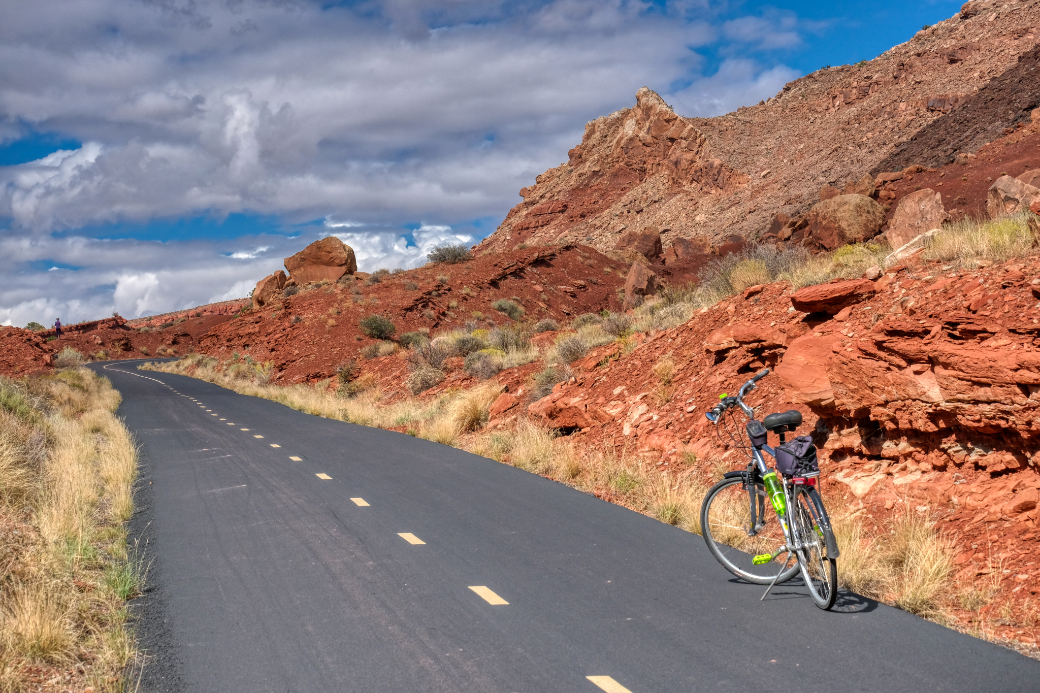
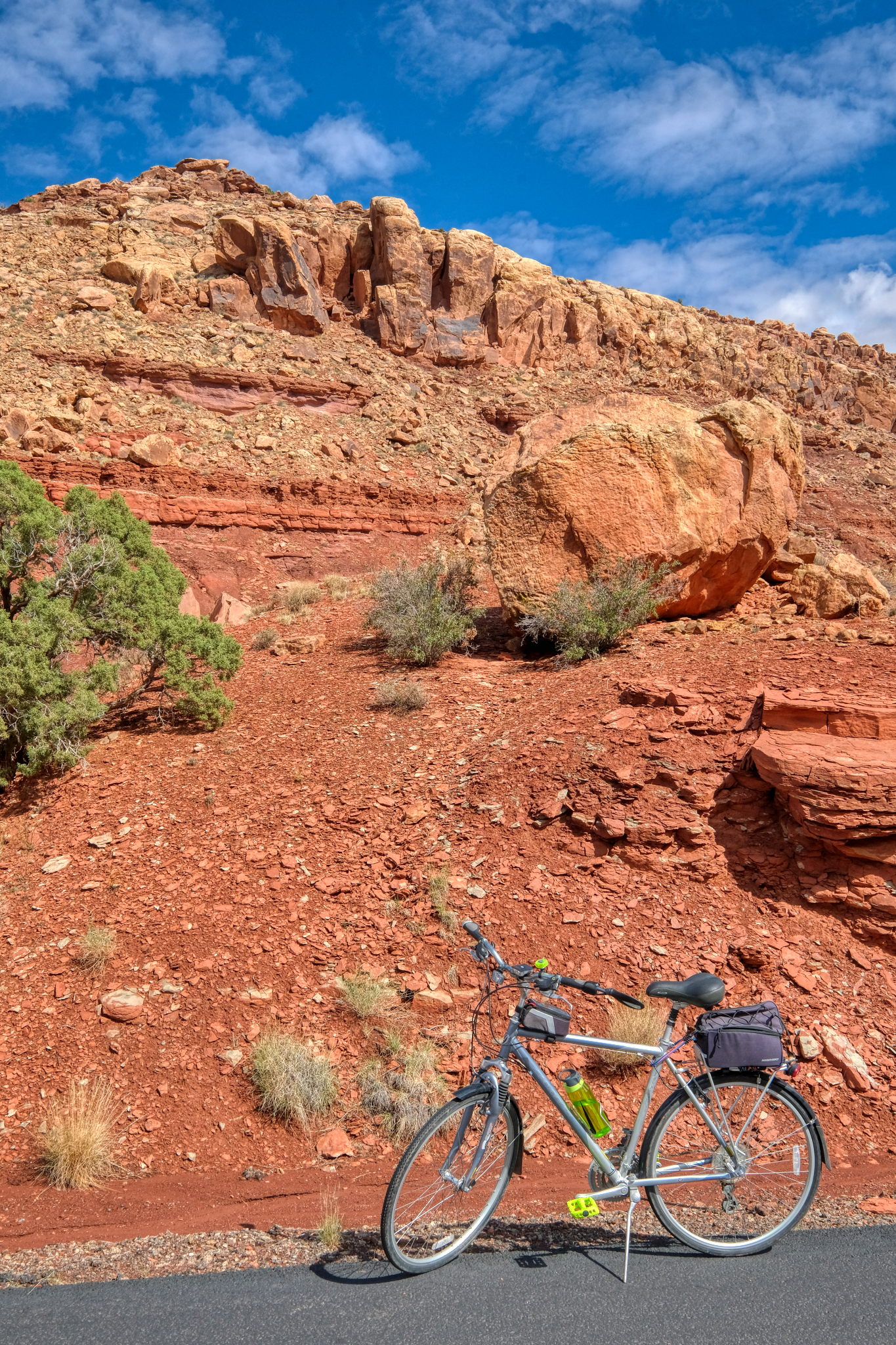
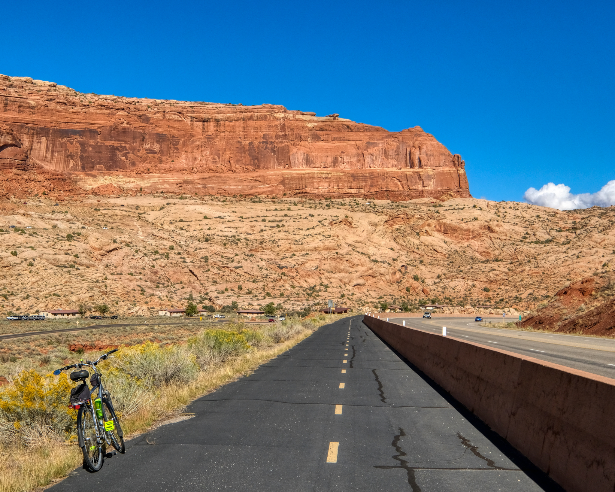
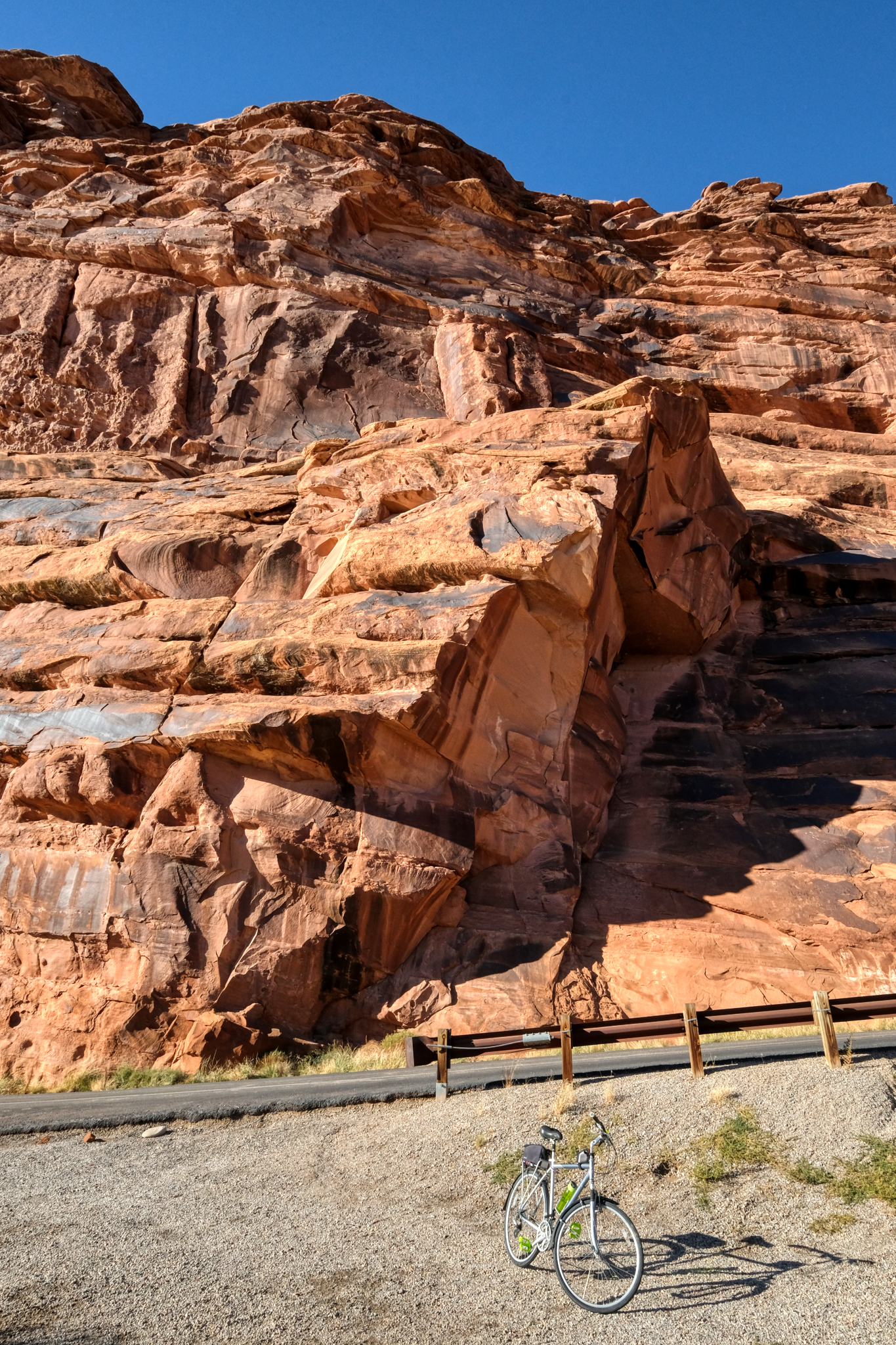 My last stop for a photo of my bike and a stone cliff . . . not far from my Slick Rock RV Campground (very nice place with very nice people working there). The next morning I would wake before dawn . . . and before coffee . . . for the long drive over the Rocky Mountains to my next destination: visiting an old high school friend in Colorado Springs, Colorado.
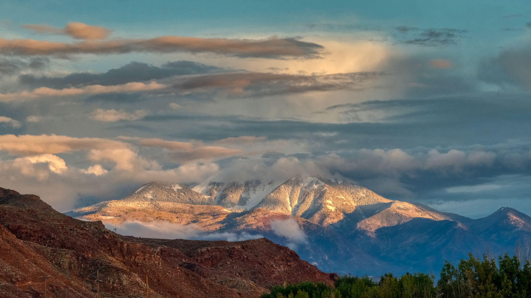 I headed out of Moab on my birthday on highway I-70 heading east to Colorado . . . this was the last view of Utah . . . snow on the mountains . . . little did I know that I would drive across the high Rocky Mountain passes during the very first snow storm of the season . . . but that is another story.
Road Trip USA: Oregon Camping - Silver Creek Falls
 Magnificent South Falls at Oregon's Silver Falls State Park.
 Out and about on the back roads and state parks of Oregon in my little camping rig. Life is great.
 Only 40 miles from where I have been staying near Keizer, Oregon is Silver Falls State Park.
 The western slopes of the Cascades Mountains are extremely damp and lush.
 It rains so much here there is moss hanging from the trees.
 I arrived on a cool, but dry, afternoon in early June. After setting up camp I went out on my bicycle to explore the well maintained trails.
 I have been all over the world . . . and this part of Oregon is by far the GREENEST! Ireland and Scotland are not even close.
 There are many miles of bike paths throughout the park, which I rode on day two of my stay. This is the Ridge Trial. I love the look of the orange pine needles covering the trail.
  The Ridge Trail passed through some marvelous old growth forest.
 A steep climb brought many views of this old forest.
 In many places the forest floor was a carpet of ferns!
 A new wonderment at every turn of the bike path.
 Trees felled by storms lay about here and there . . . and will decompose to supply nutrients to the next generations of tall trees.
 I found myself stopping often just to take in all the beauty. What a bike trail!
 A damp stand . . . .
 Layers and layers of greenery . . .
  After a long bike ride in the forest, the overcast sky began to clear, so I packed up my camp site and drove to the South Falls trailhead. Here, the view of the South Falls from above. I met a nice family from Thailand here. It's a small world.
 The path down and behind South Falls offers many fine spots for photography.
 A very beautiful waterfall.
 The trail goes behind the cascading falls . . . a very impressive sight.
 There were a fair number of tourists on this day . . . and we all stood kin silence under the falls listening to the powerful 'song' of the water falling from above.
 The bright sun suddenly appeared along the path to the Lower South Falls. . . making the already green environment explode with luminosity. Incredible green!
 The picture post card view.
 Silver Creek.
 A nice bridge view . . . there were many other photographers, most with big tripods, wanting to use the bridge as a vantage point . . . but they were all complaining that people walking on it caused it to shake.
 The two-mile path to Lower South Falls followed Silver Creek most of the way.
 A magical place.
 The path rose for quite while before a view of the creek was visible again.
 A steep zig-zag of stairs down to the fall's base.
 After the winding and steep stairs down, I was rewarded with my first view of Lower South Falls.
 The Lower South Falls through the trees.
 A beautiful view.
 Oregon!
 The path here also continued behind the falls.
 The roar of the falls became very loud as you neared it.
 Another fabulous forest waterfall view.
 I got a little wet behind the falls.
 Through the mists . . .
 Directly behind the falls.
 My last glimpse of the Lower South Falls as the sun began to shine again.
 Up the steep steps and onto the ridge for a view of the creek in bright sunlight.
 I walked back up the path to my camper and left the park. I spent a wonderful three days in a beautiful place. The camping sites and facilities were first rate.
 Hops for your beer: Oregon is a major world producer of hops . . . a very labour-intensive crop.
 Oregon fields of grain.
 This cooperative farmer stopped so I could take this photograph. Thank you.
 A small road sign indicated 'Gallon House Bridge' . . . it must be very special, I thought.
 And very special it was too. Gallon House Bridge is the oldest continuously used covered bridge in Oregon.
 A perfect country road 'find.'
 A very well-maintained old bridge.
 To walk an Oregon country road in June . . . .
 Oregon . . . good people, beautiful countryside.