My most current blog entry:
Road Trip USA: Bodie Ghost Town, California
In June of 2018, as a part of my bigger year-long road trip, my wife and I took a trip from Oregon to the Grand Canyon. Along the way we stopped at whatever seemed interesting along the way.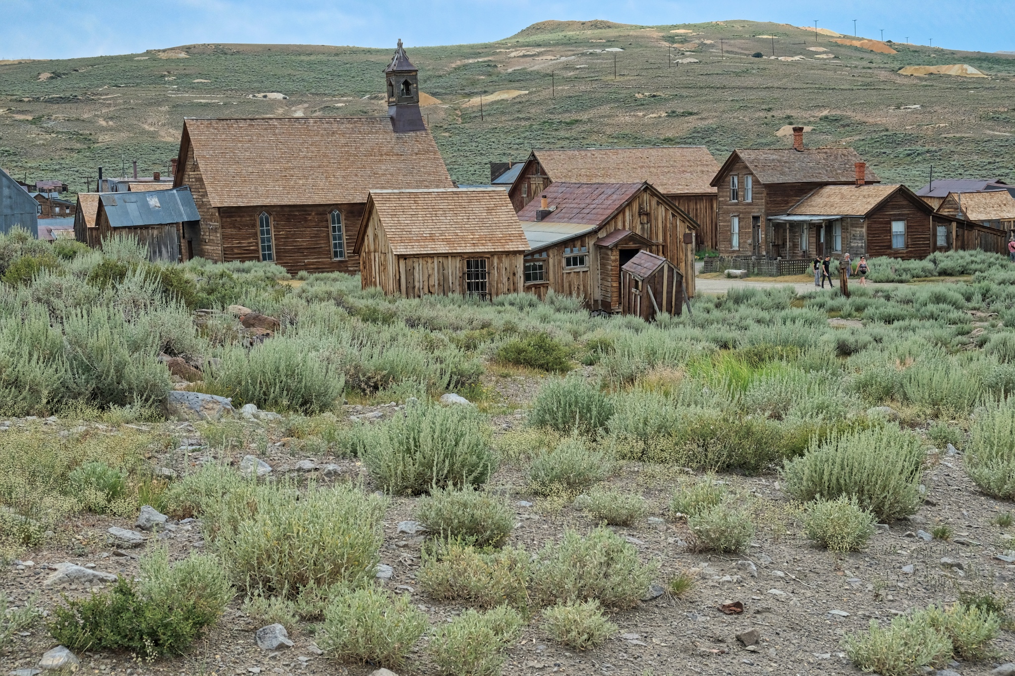 In east-central California, off of US Highway 395, is the old ghost town of Bodie, now a popular and much visited National Monument. It is one of the largest and most complete ghost towns in the USA (Jerome, Arizona is another).
 We arrived a the broad site of Bodie in a light drizzle under threatening skies.
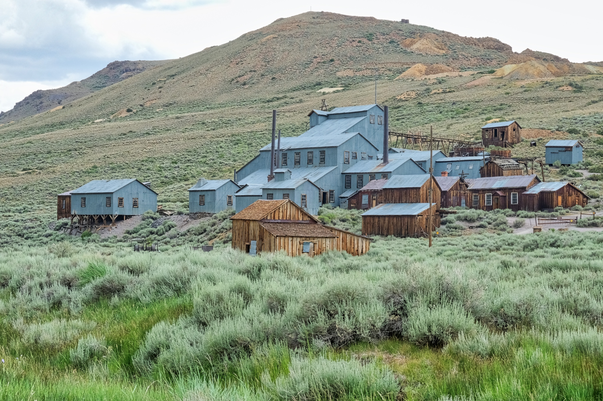
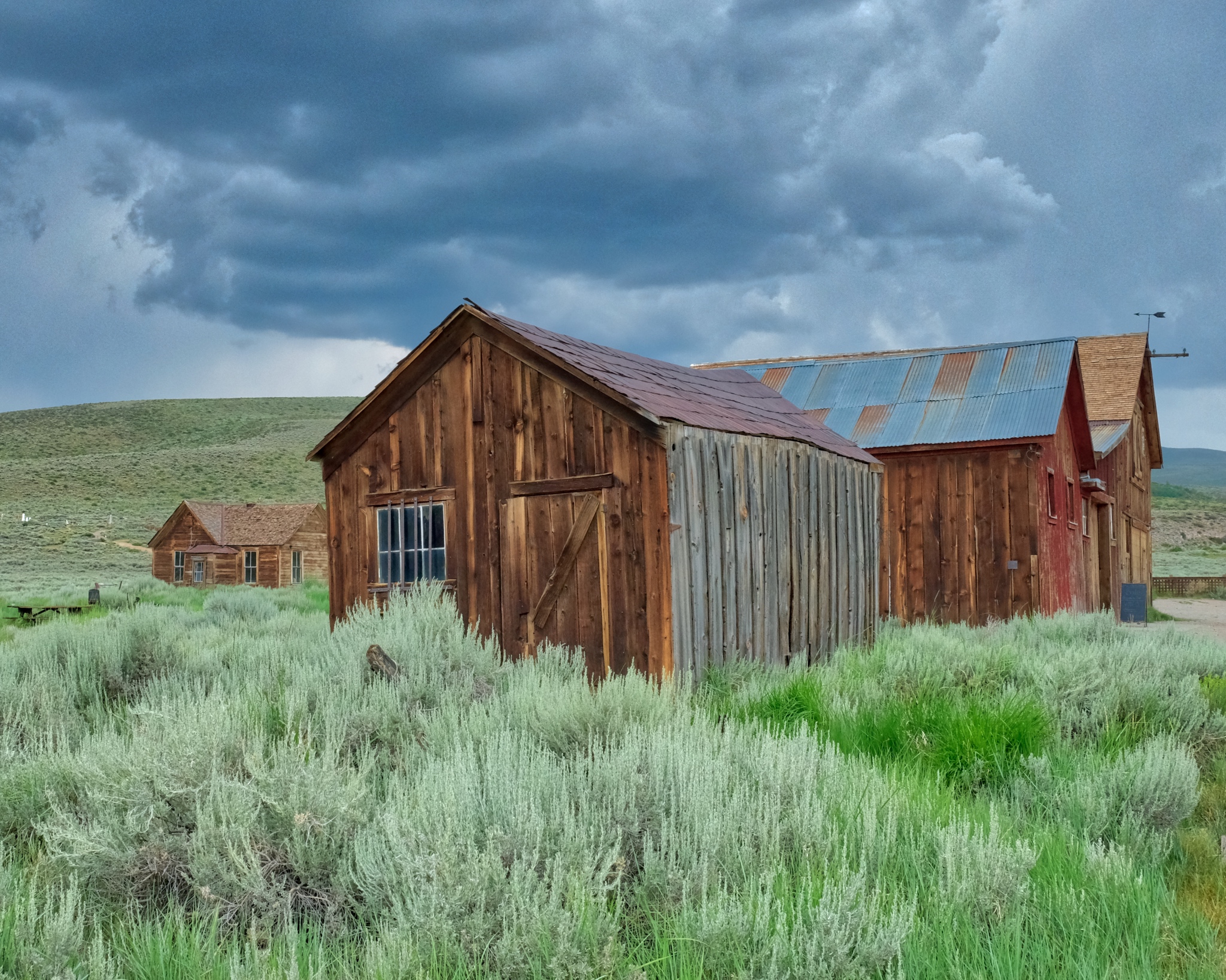
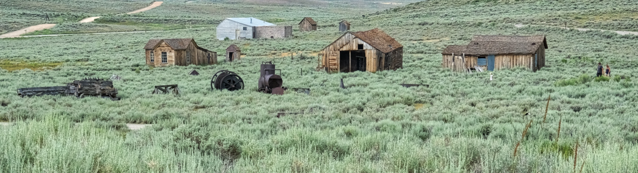
 Our first view of Bodie was of scattered shacks and abandoned mine tailings.
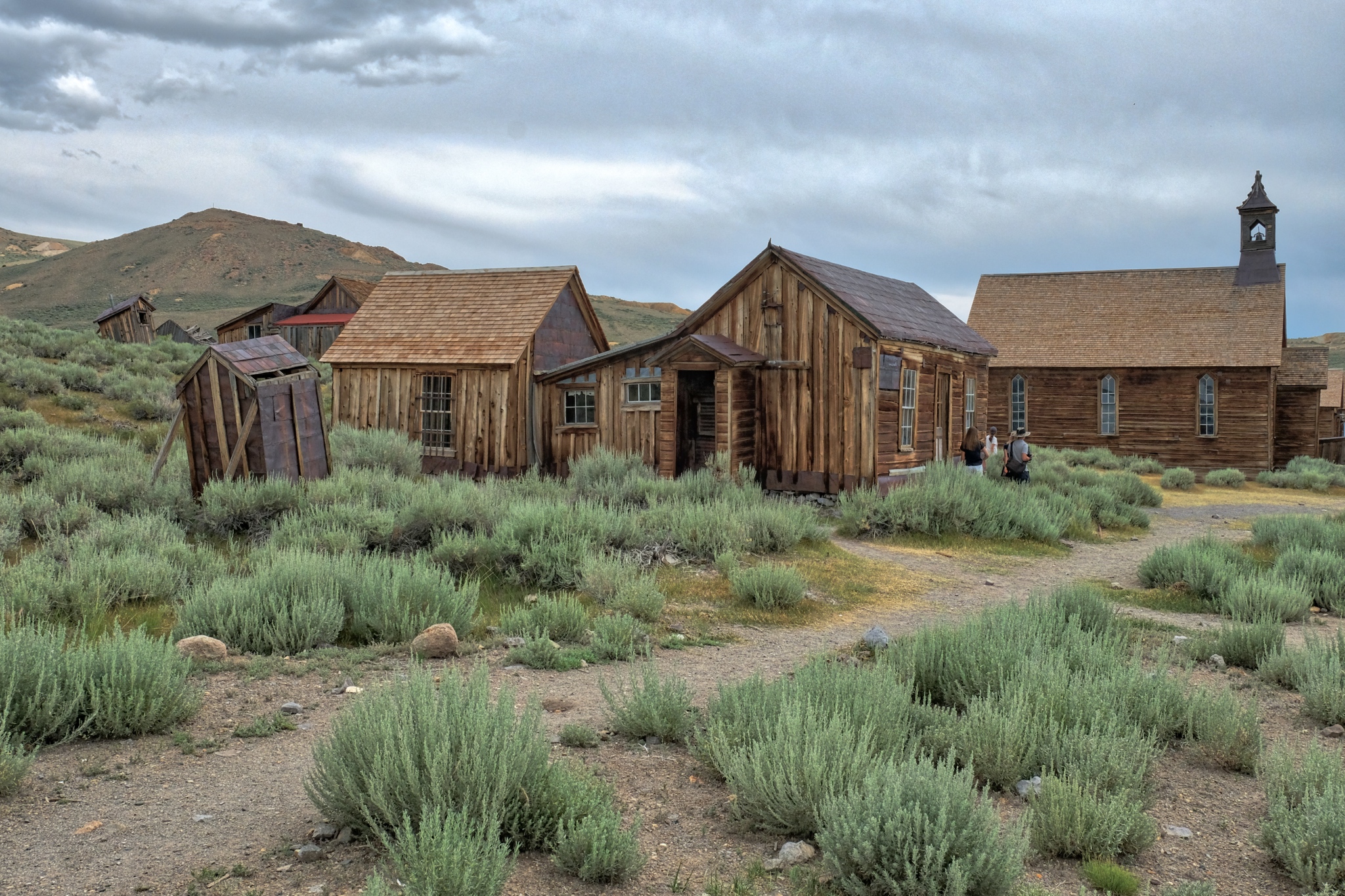
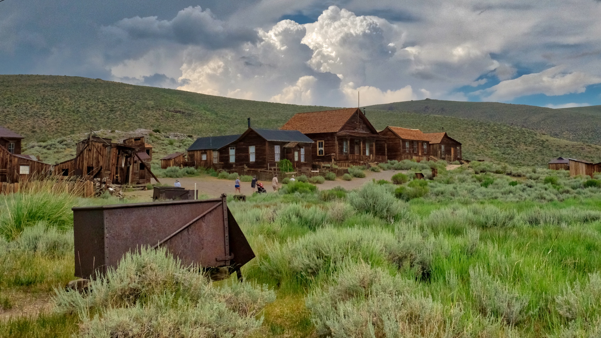
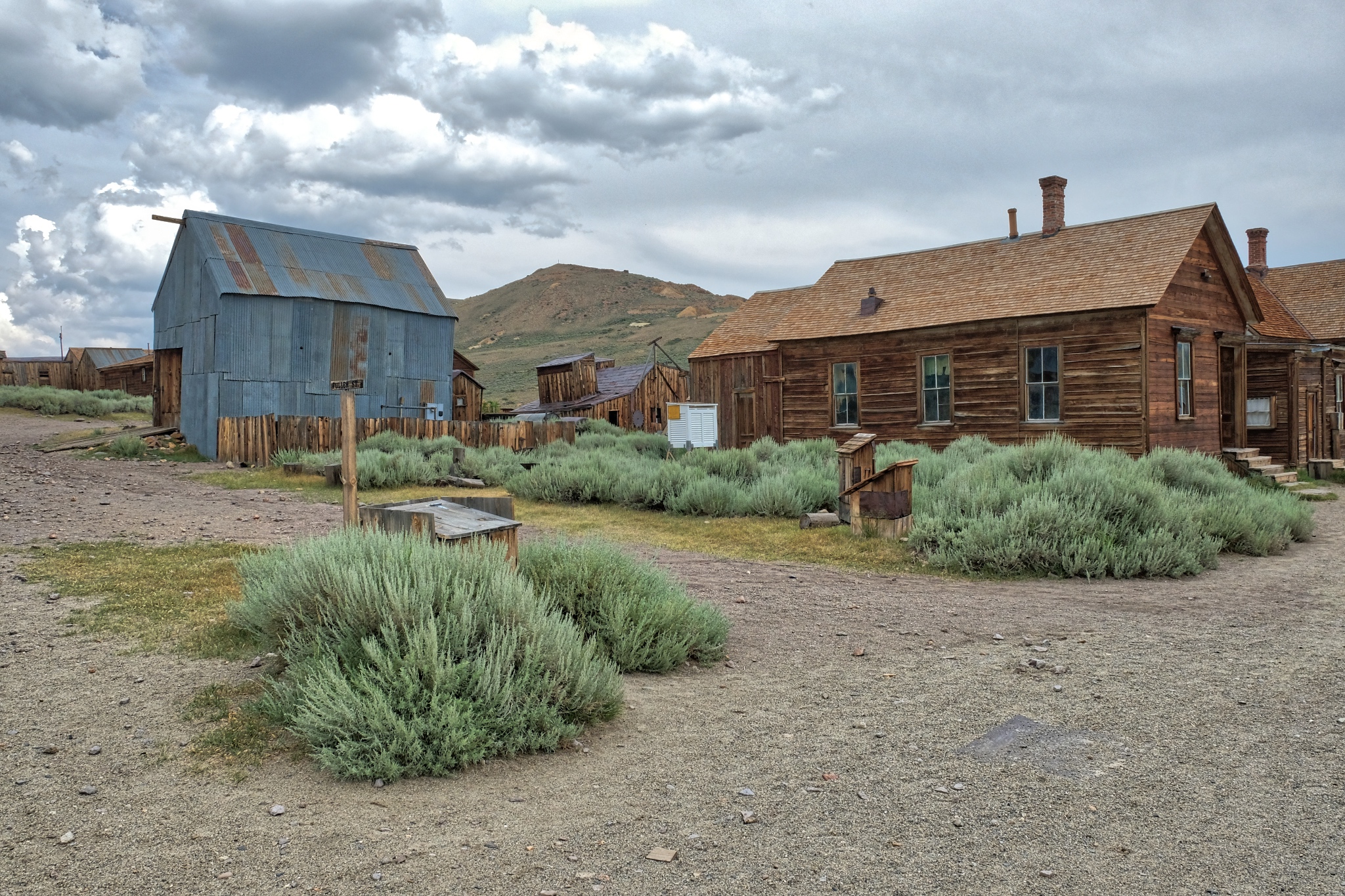
 And after parking and walking into the cluster of old weathered buildings, the layout of a town started to appear.
 Bodie became a town in 1876 when a productive vein of gold was discovered there.
 Even though it was mid June, the elevation of 8379 feet (2554 m) combined with the wind and mist, made the surfaces wet, revealing the colors and textures perfectly.
Bodie had a population of 7000 before the gold was all mined . . . and was connected to the world by a small gauge rail line.
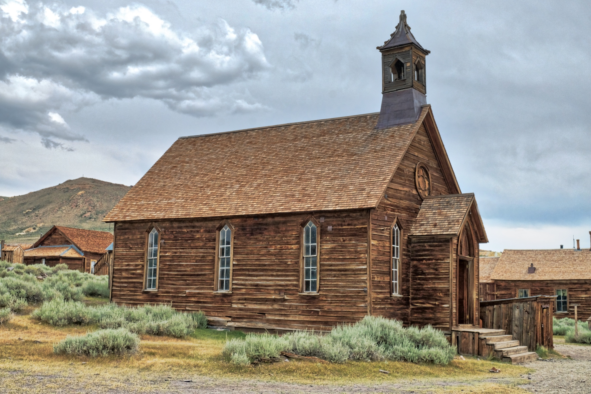 At it's height, Bodie had two churches, a Wells Fargo Bank, a myriad of shops and services, as well as its own hydroelectric generating station 13 miles away.
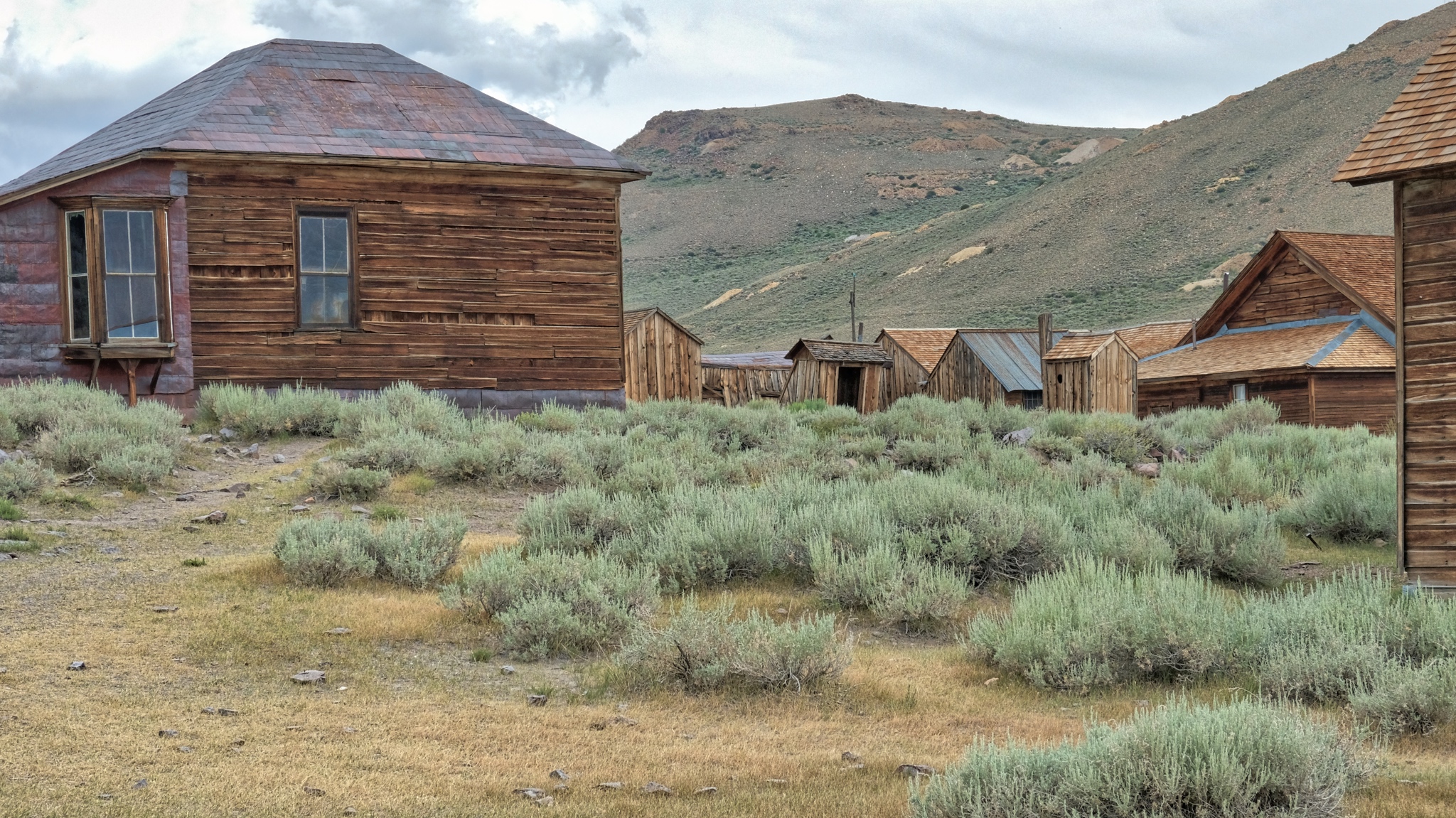
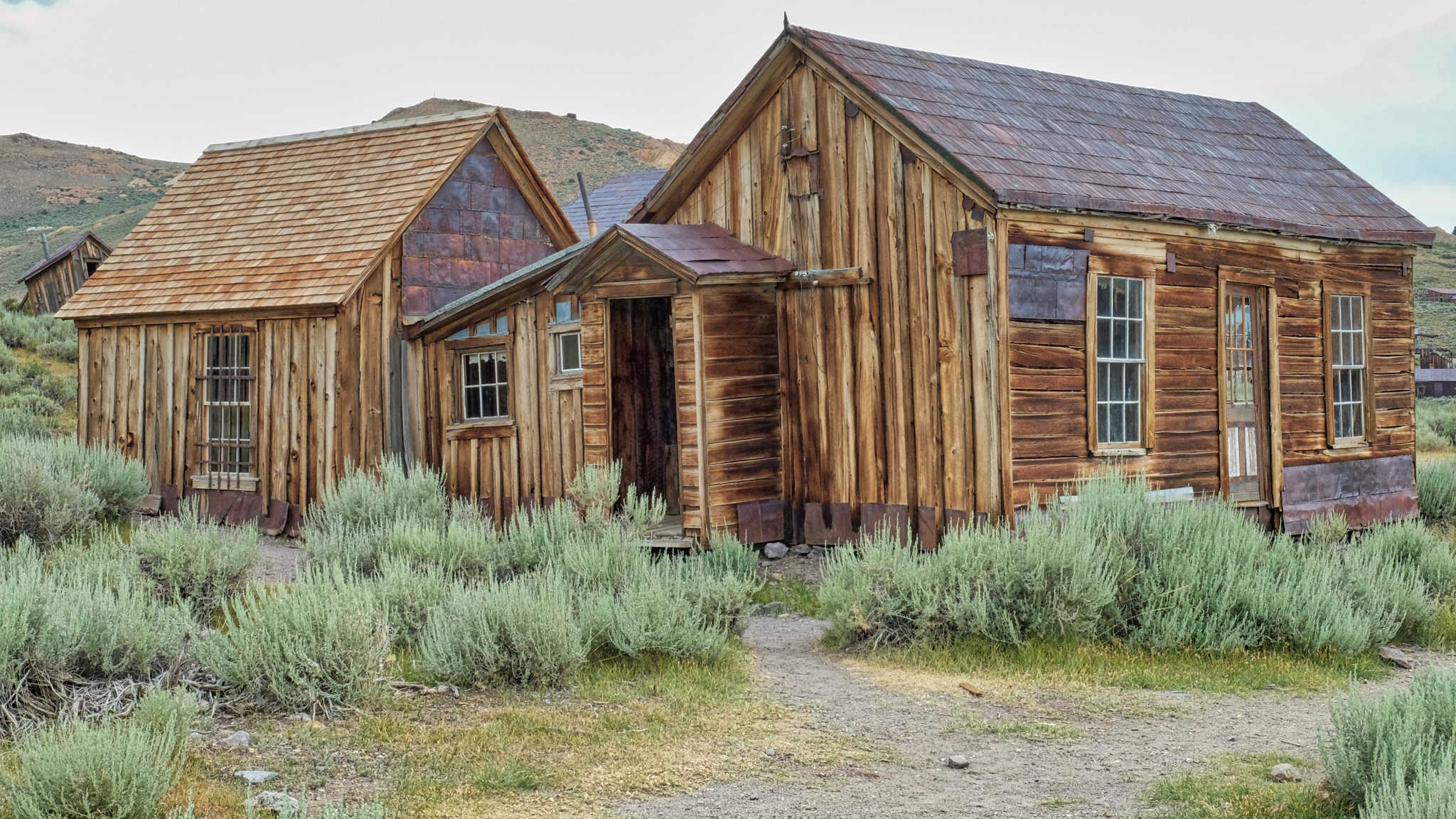
 There were 2000 buildings in Bodie at one time. There are nowhere near that many left today . . . but it is still an impressive sight to see.
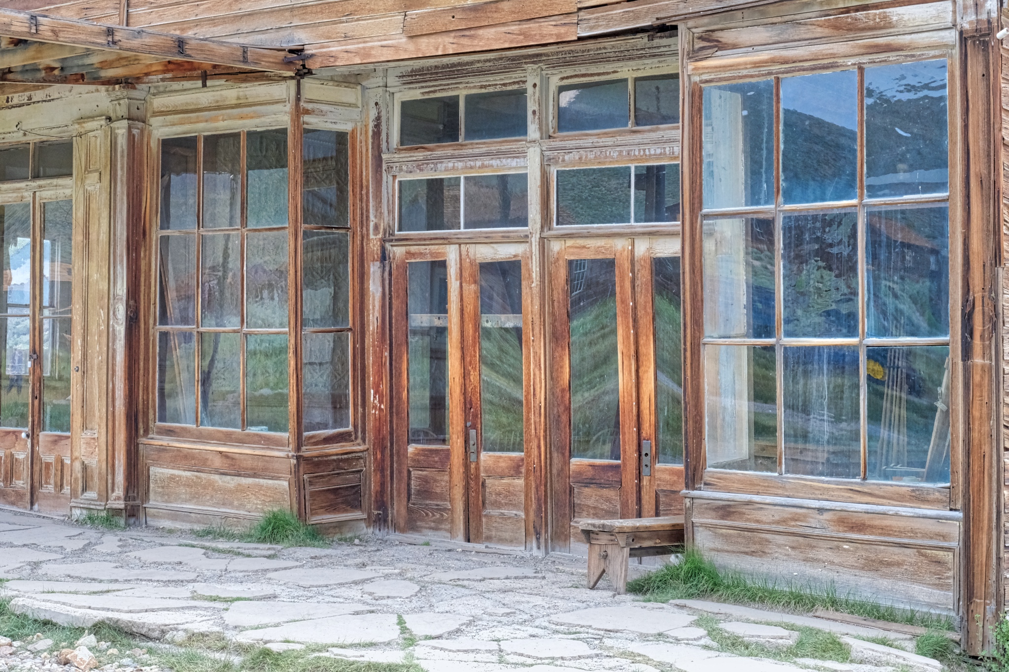
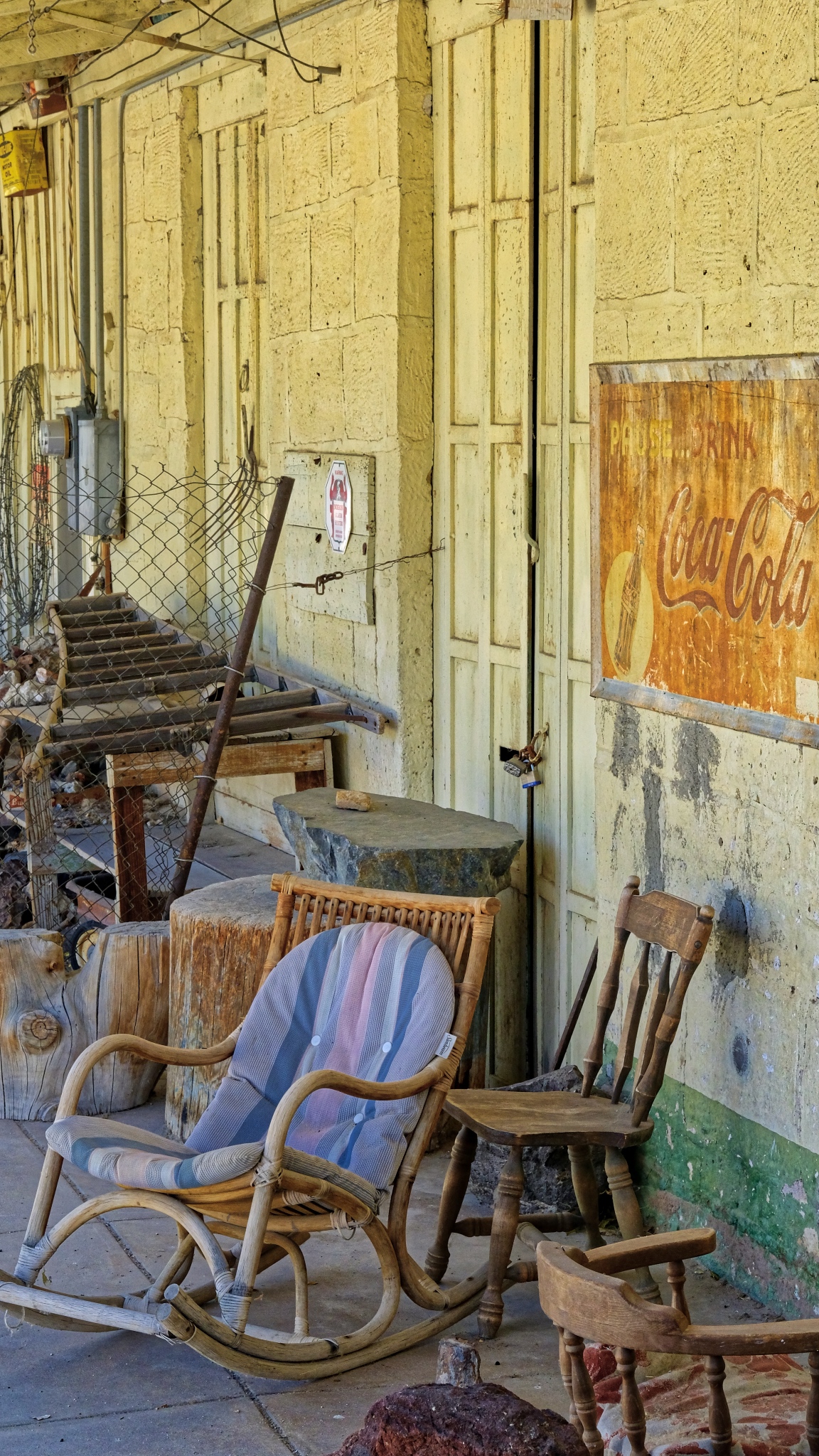
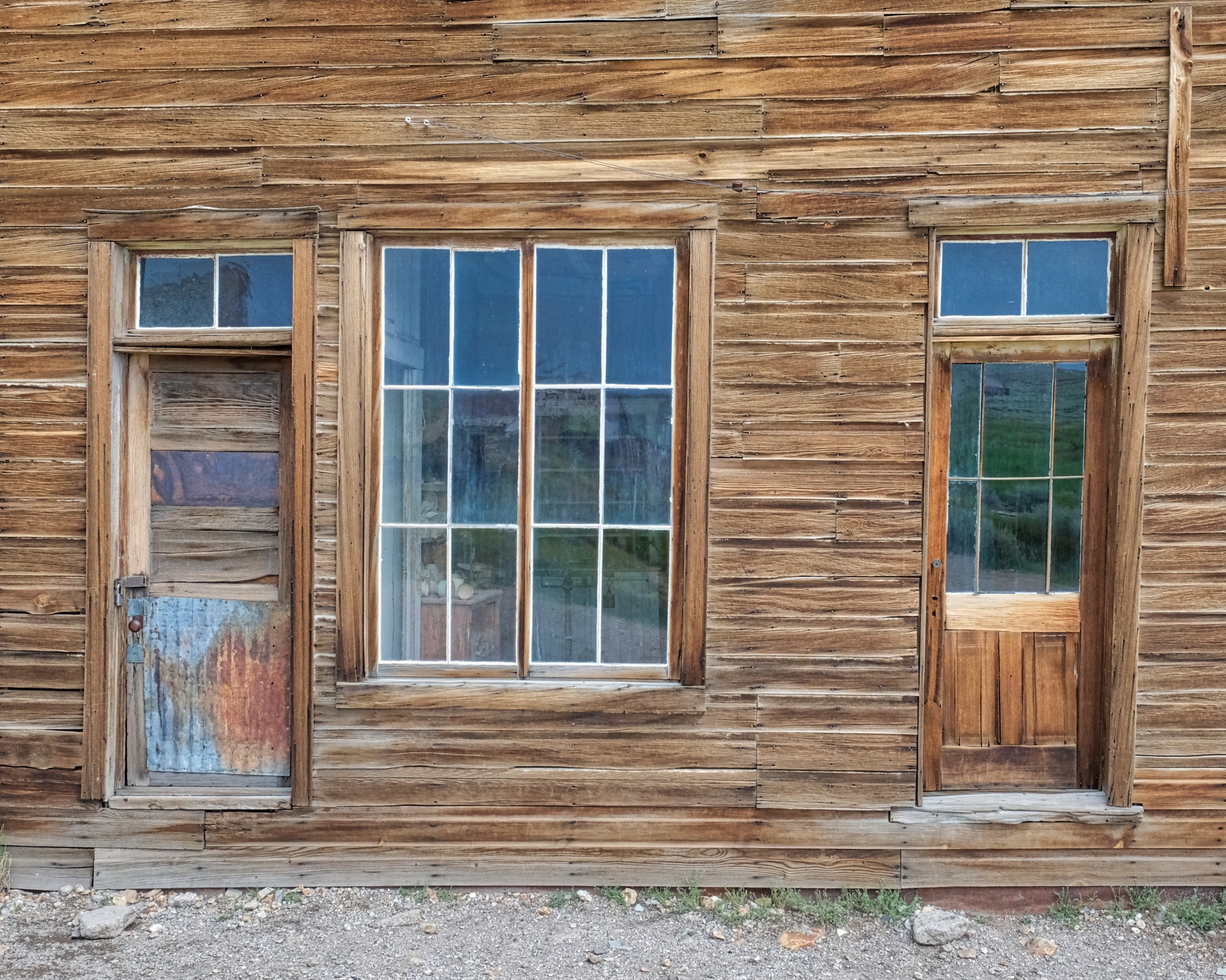 I am a fan of old doors and windows . . . especially weathered old doors and windows. I was in photographers' heaven in Bodie.
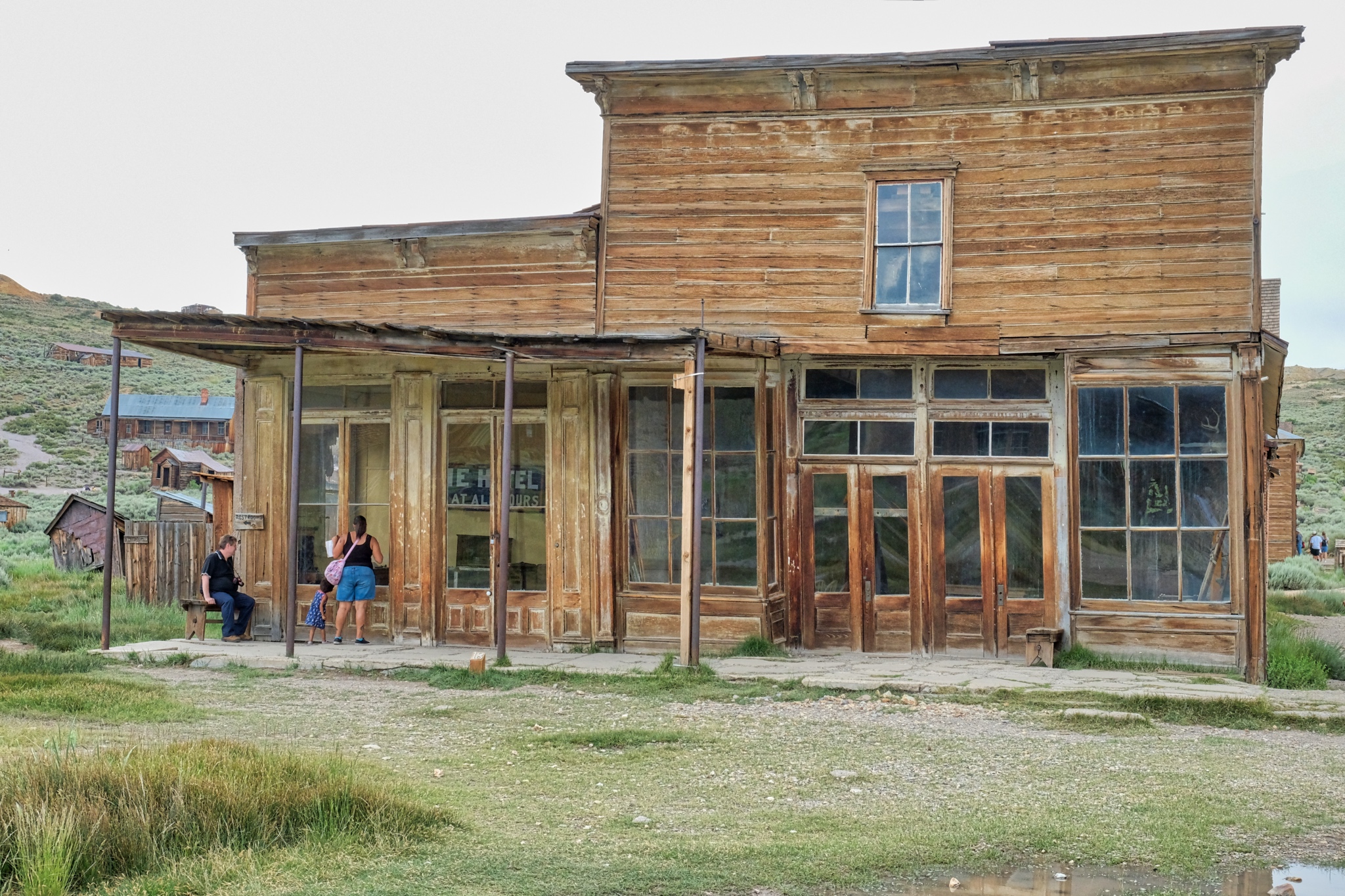
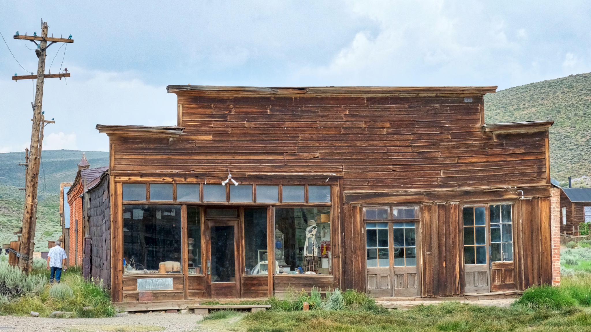 Several of the old general stores still had period merchandise in them. I am not sure if the items inside were left behind or carefully placed there years ago by over-eager National Parks staff, but the interiors are a marvel.
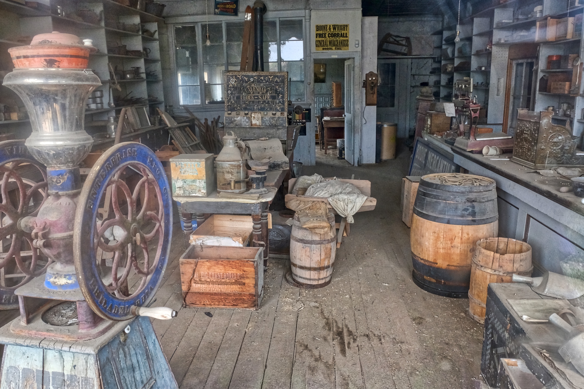 A photo of a general store interior, taken through the window since visitors could not go in. Fascinating.
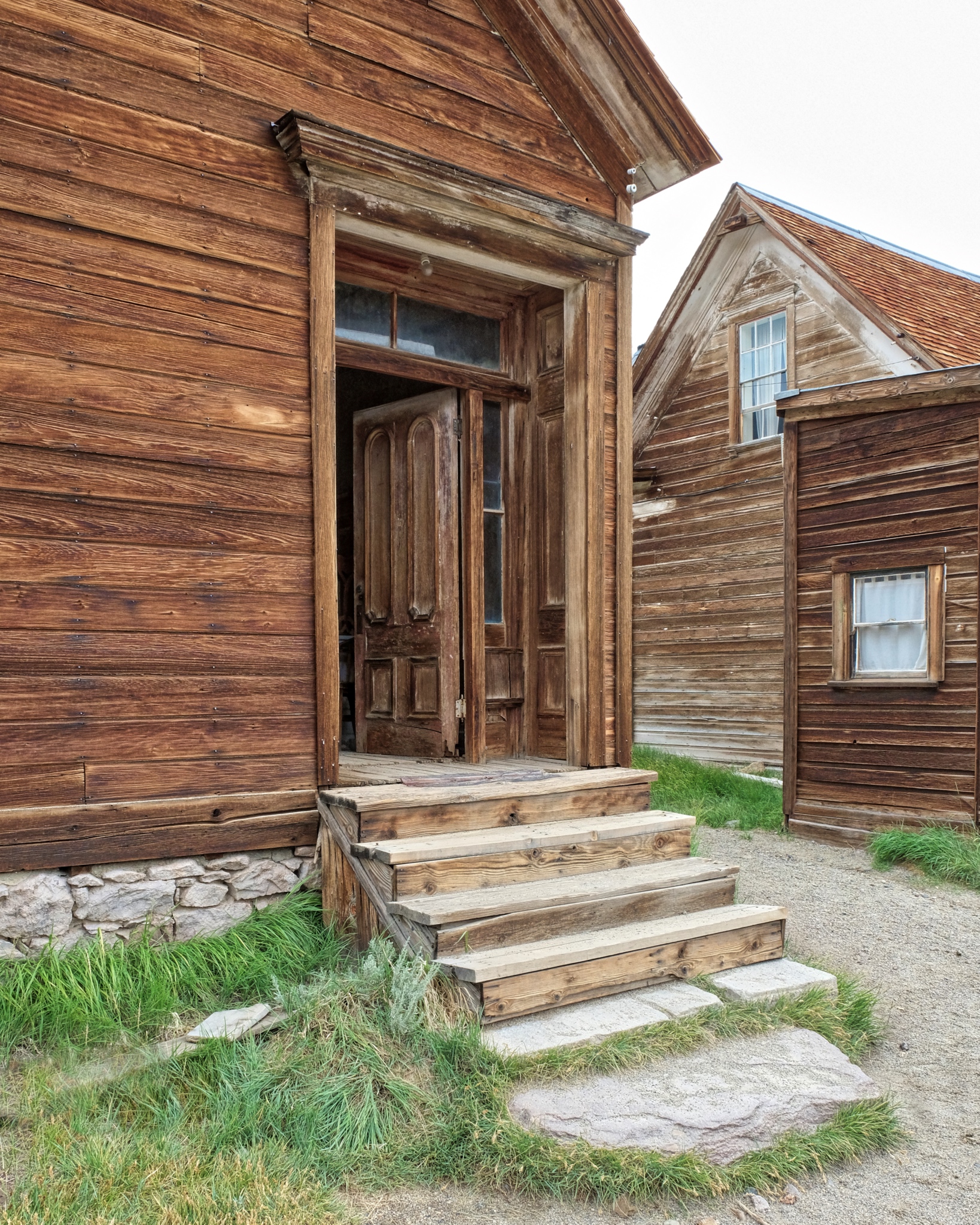
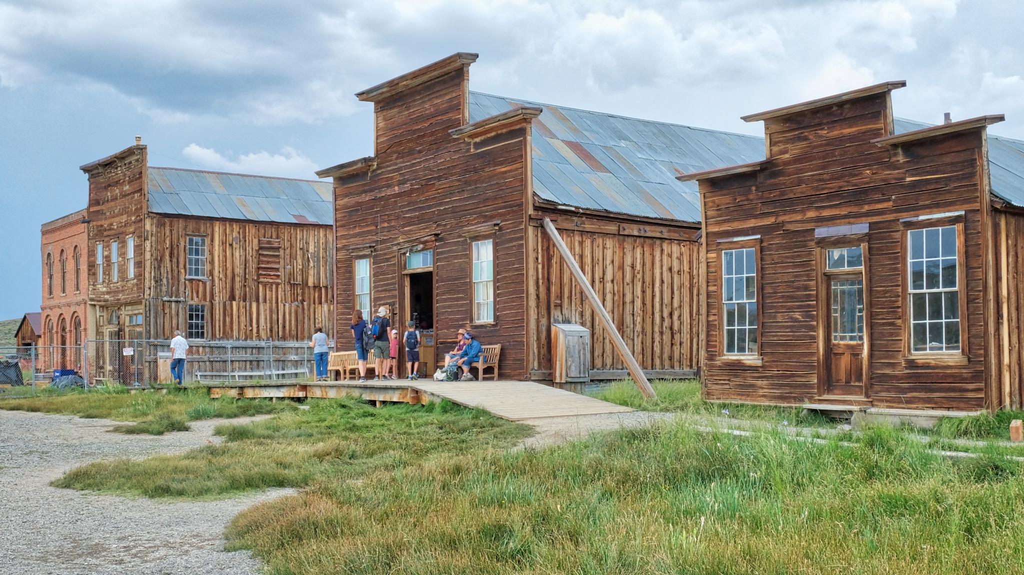 Bodie sees nearly 200,000 tourists yearly. The day we were there, we saw two large tour busses and four smaller vans full of tourists from France. They loved the place too. The building with the open door is the tourist information center, gift shop, and historical display.
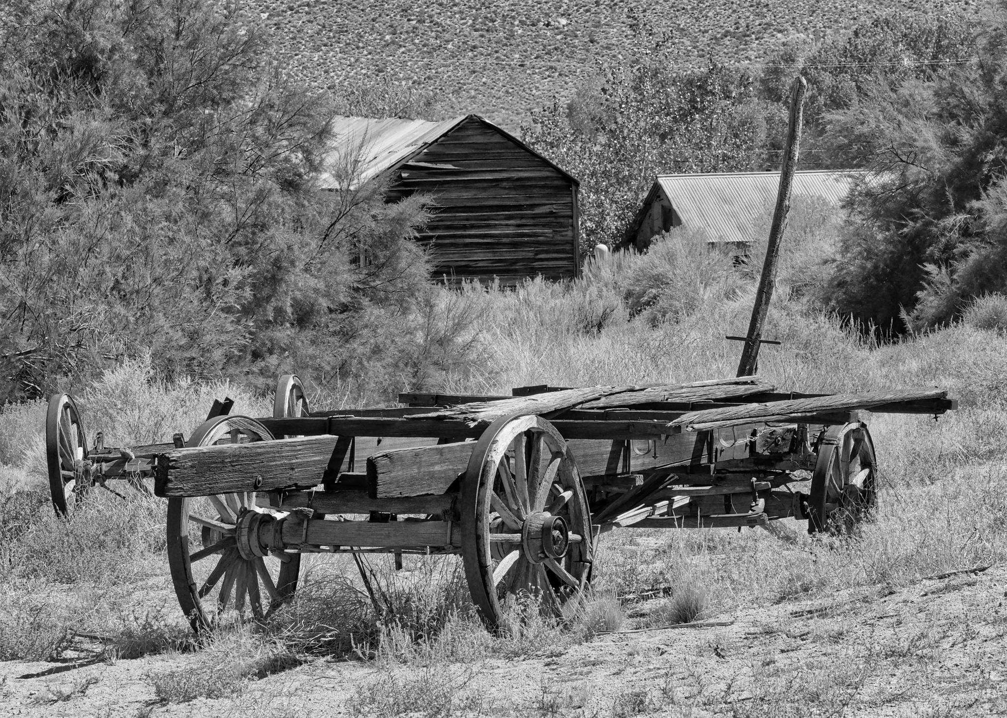
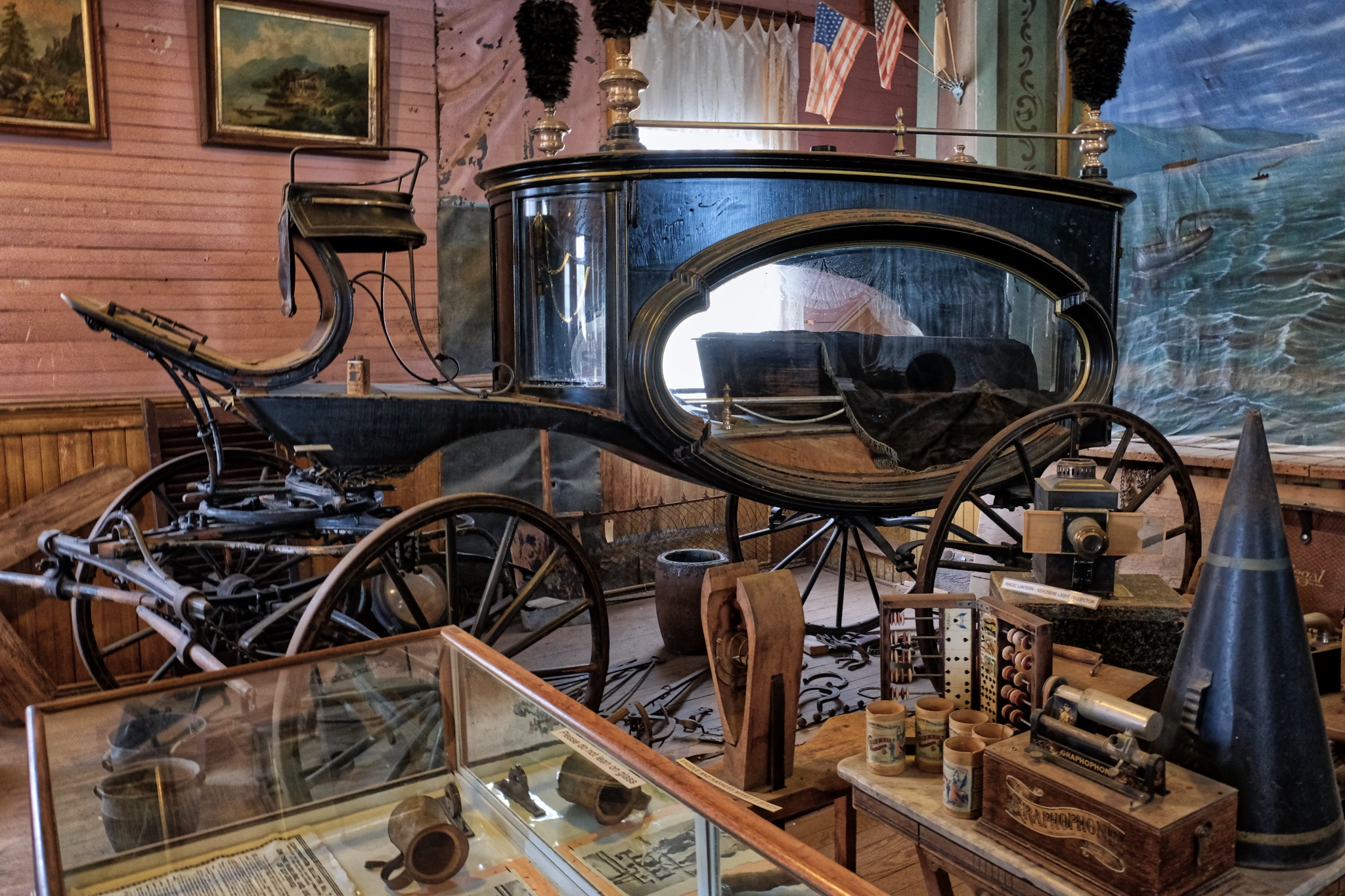 The museum had this wonderful horse drawn hearse, as well as many other finds from the site.
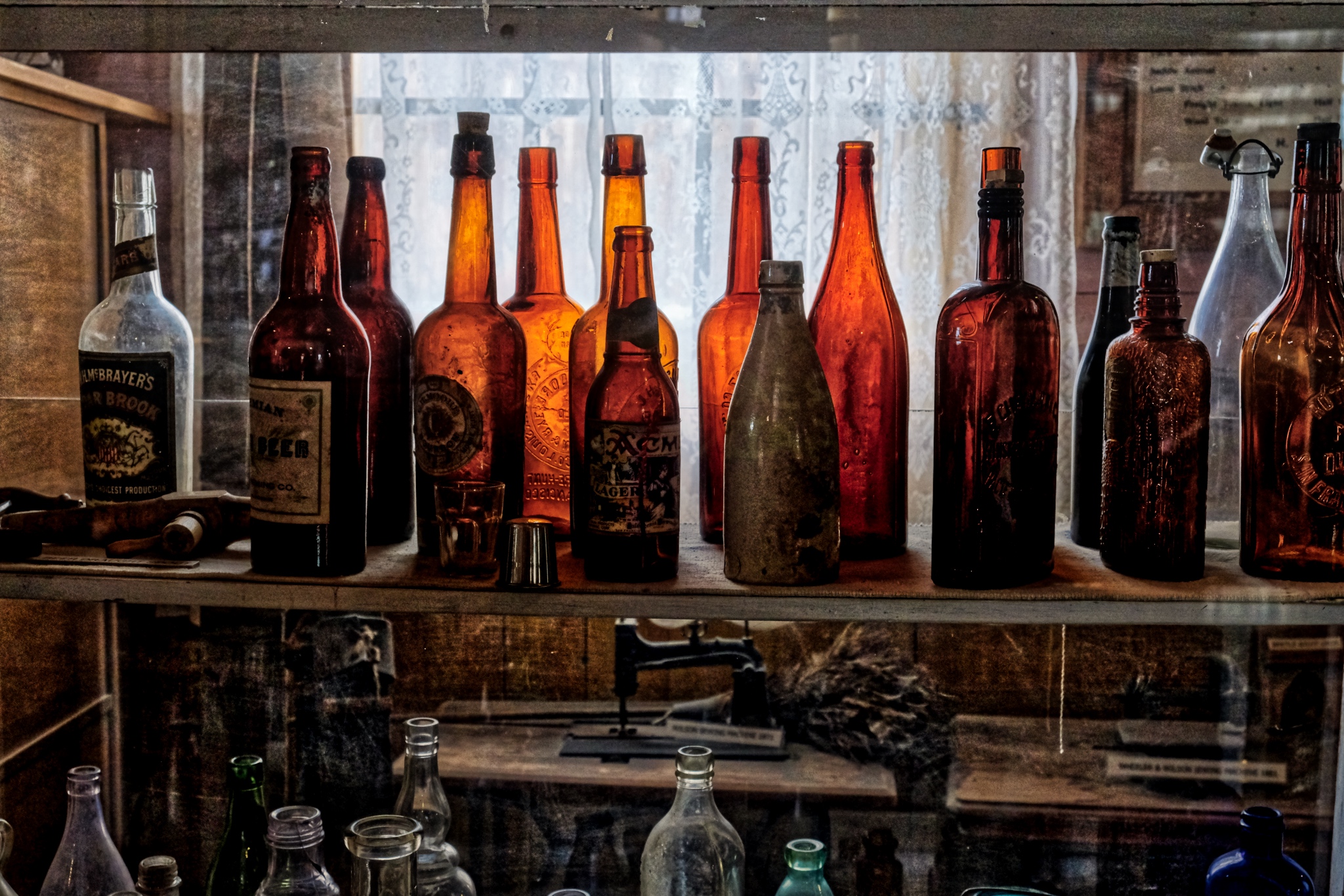 A lovely collection of amber bottles in the museum.
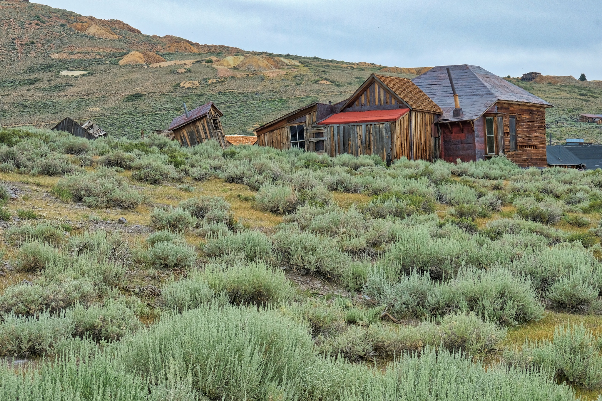
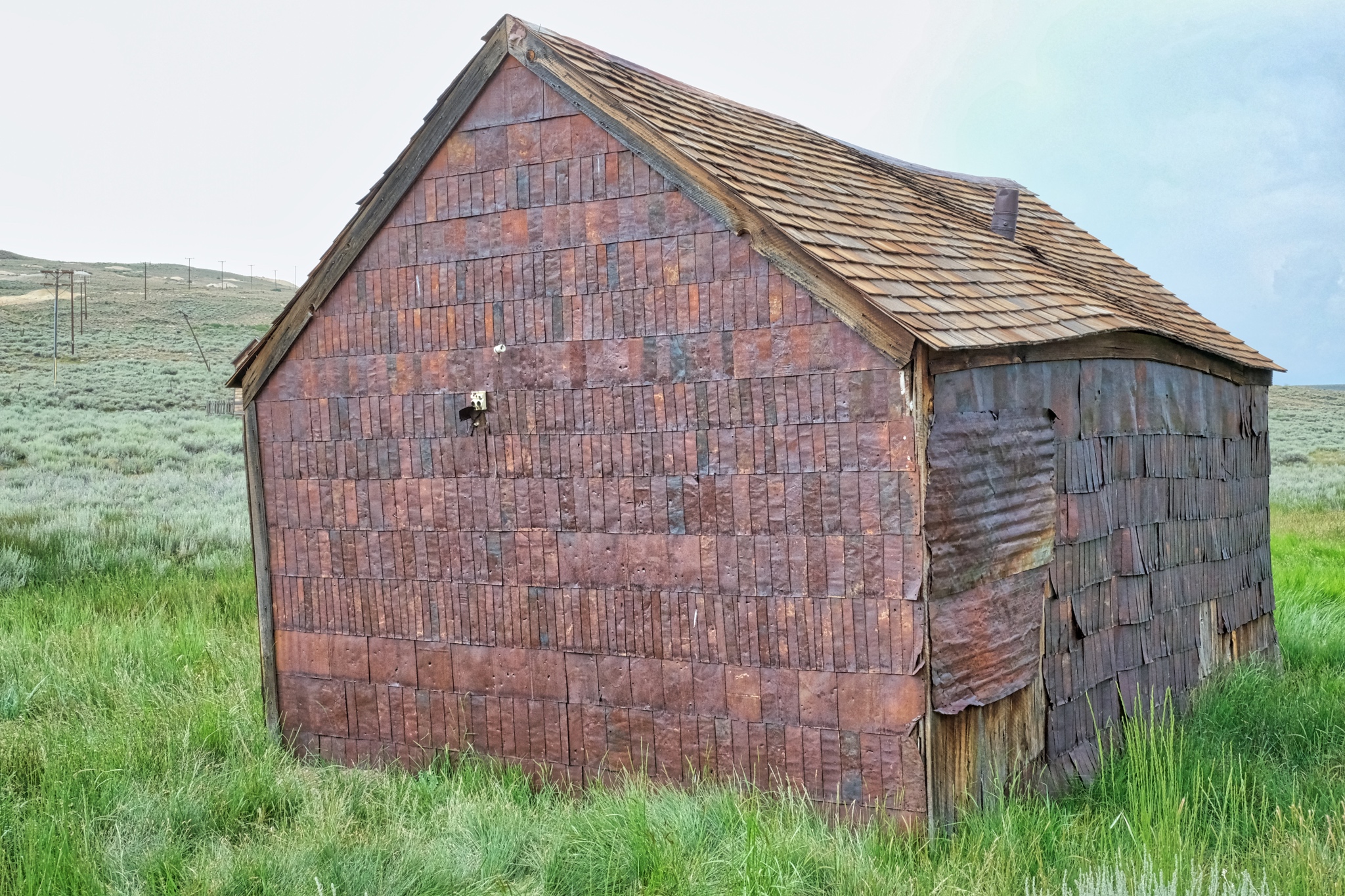 A number of the buildings used some kind of metal siding . . . as well as metal shingles on the roofs.
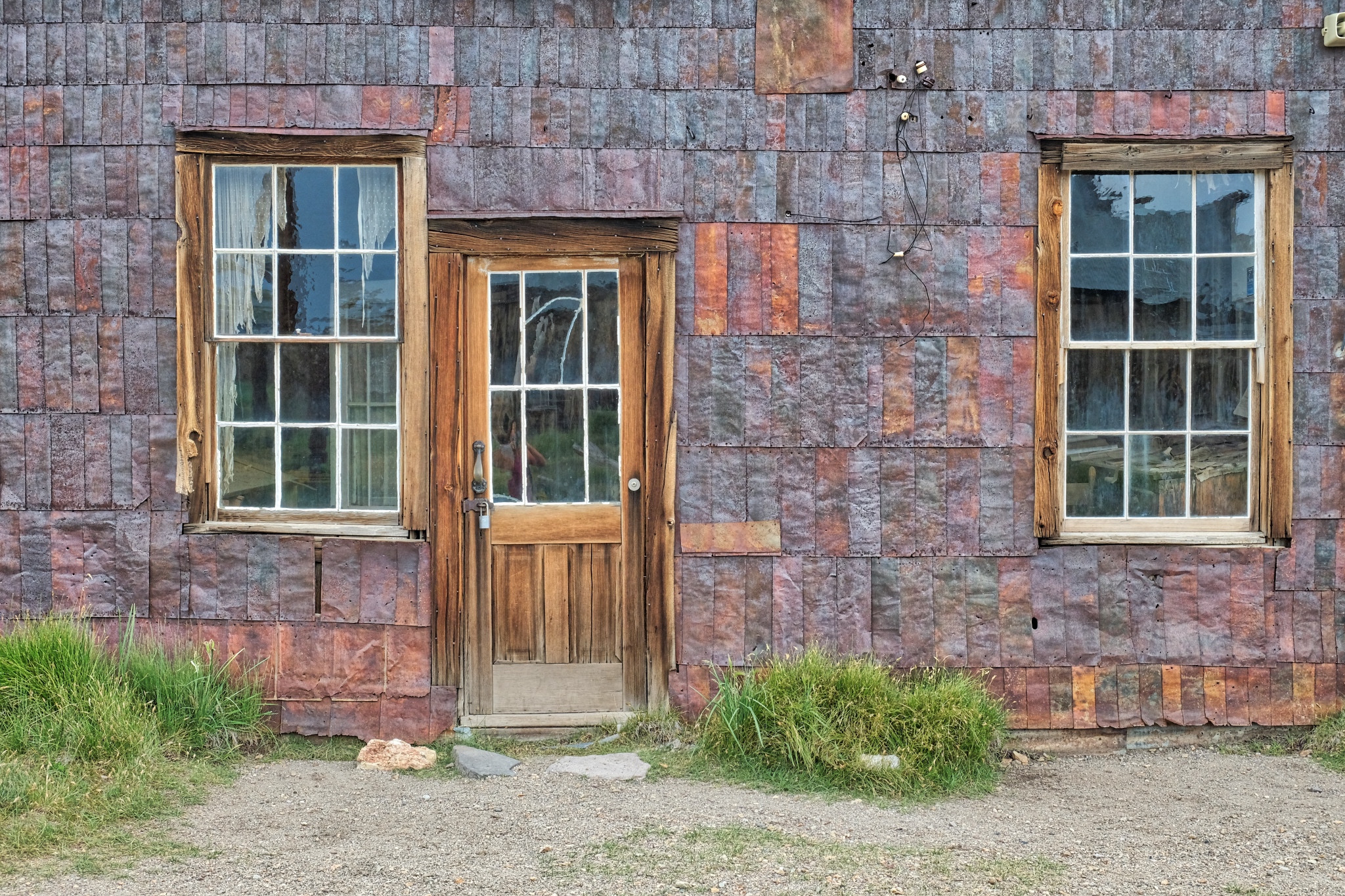 I was fascinated by this metal siding.
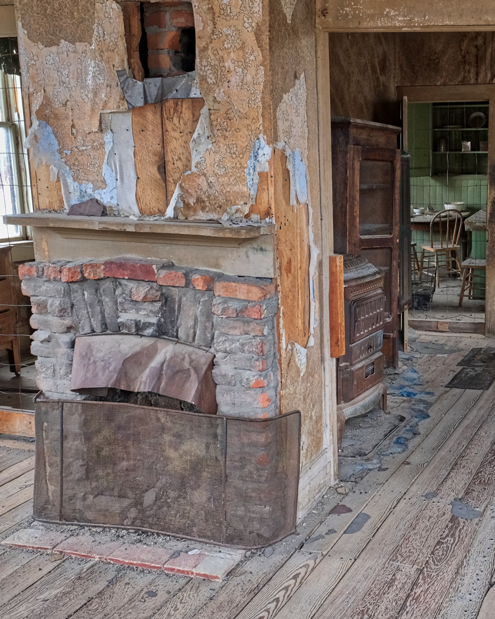
 The small metal sheets were used all around Bodie. This house used metal for the roof, as a siding, and for various patching.
 Upon closer inspection, I came to the conclusion that the metal strips were, in fact, opened up 'tin cans' . . . which were made from iron and steel in those days. Because of the altitude and cold weather (303 nights a year with below freezing temperature), and deep snow (average 10 feet or more of snow per year) in the winter meant they must have had to import a lot of food . . . which at that time was packed into cans. You can see the can ridges on some of the large metal strips.
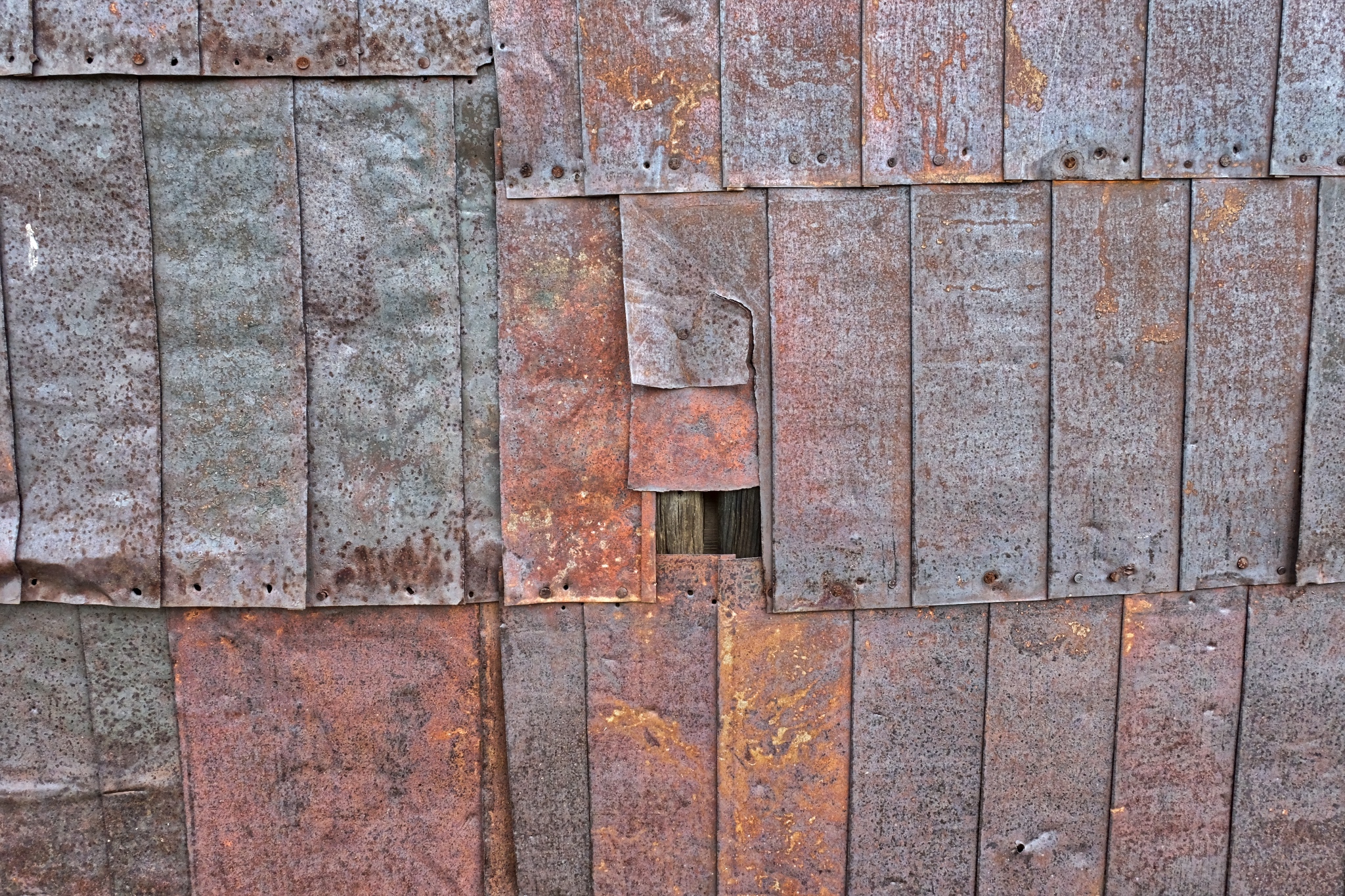 A kind of early recycling. In addition, these walls are visually very interesting in their own right.
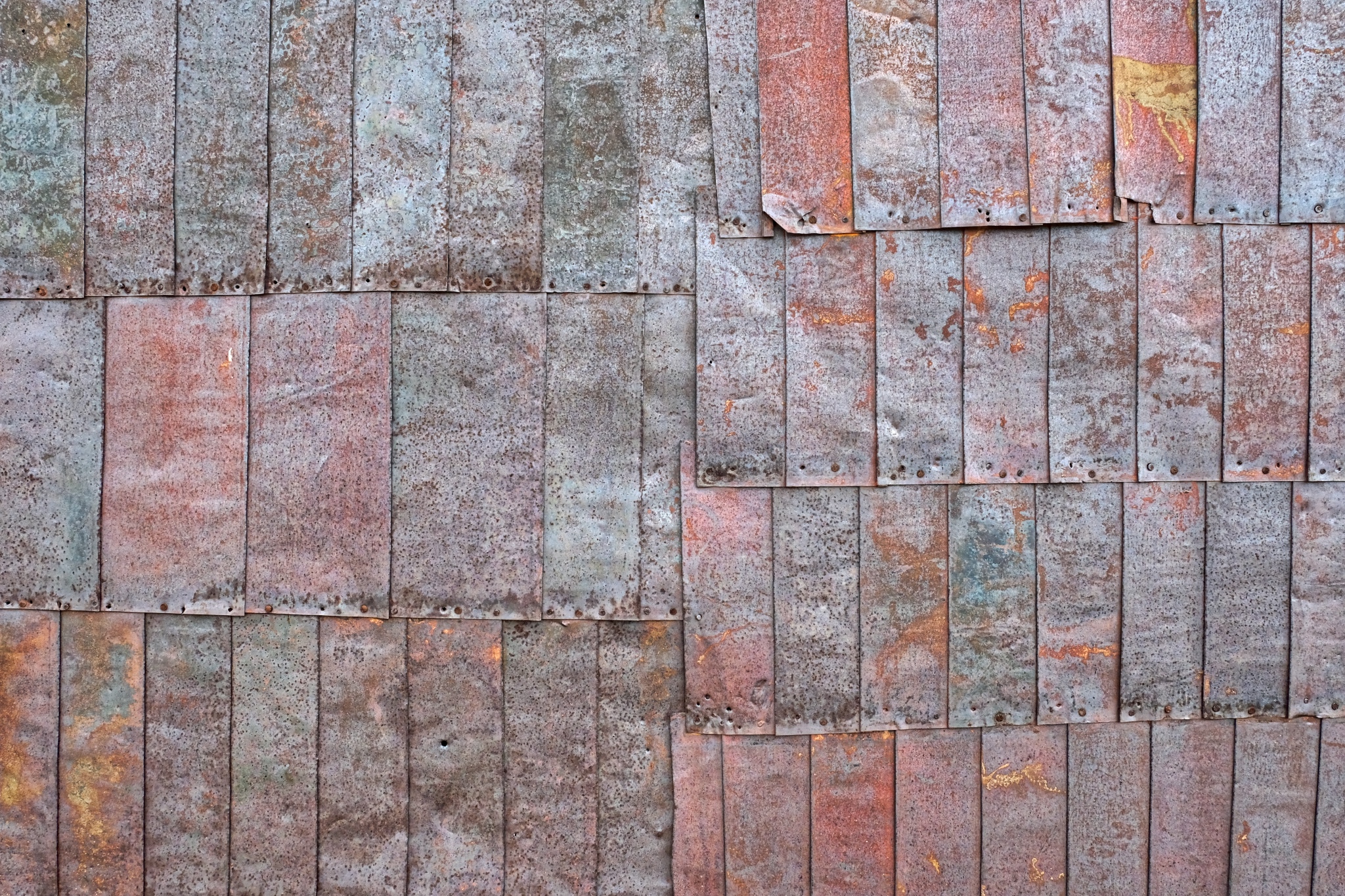 One more . . . just for the artistic effect.
 1881 was the highest production from the Bodie mines: $3.1 million US dollars. The total value of all the gold pulled from the ground here was $34 million US dollars . . . a lot of money at that time!
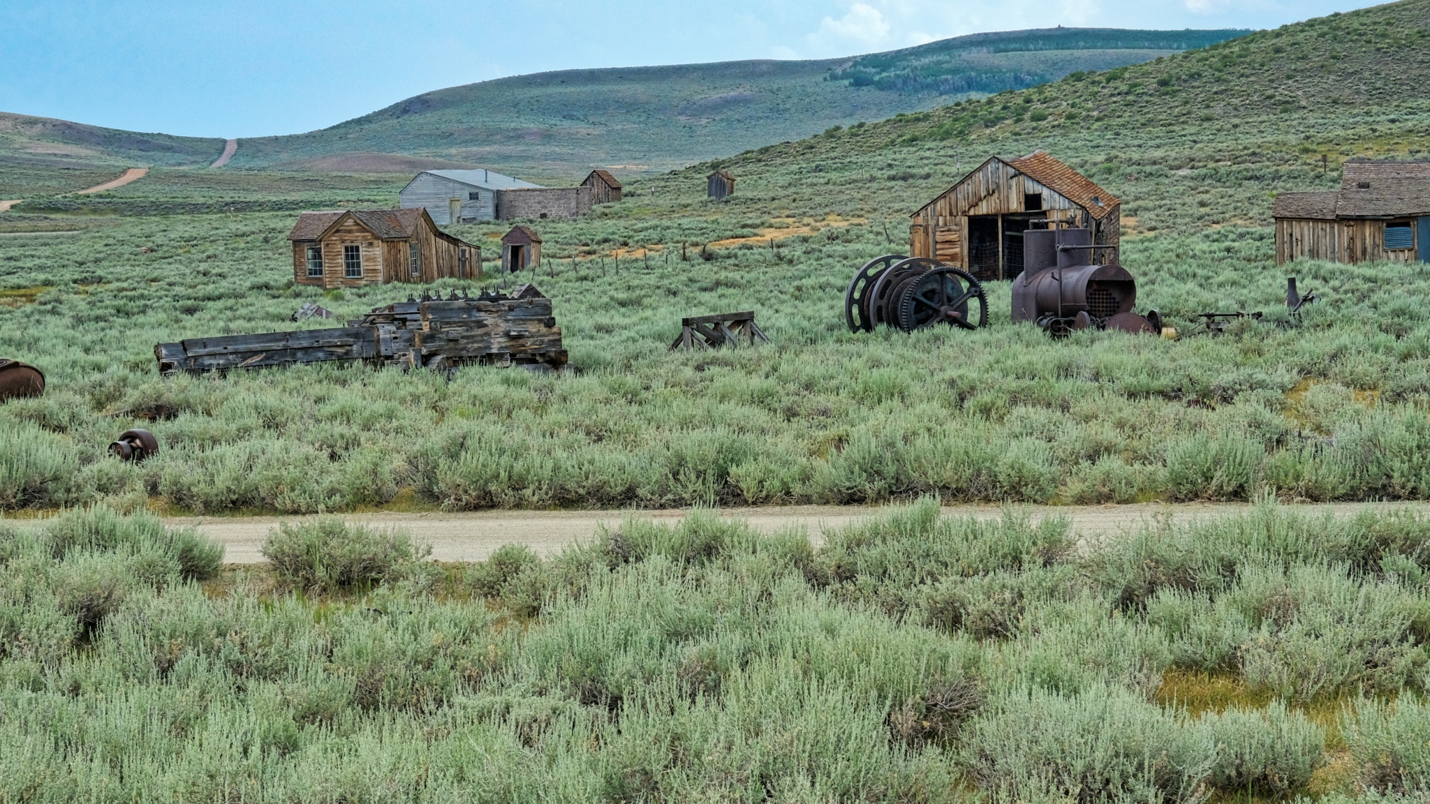
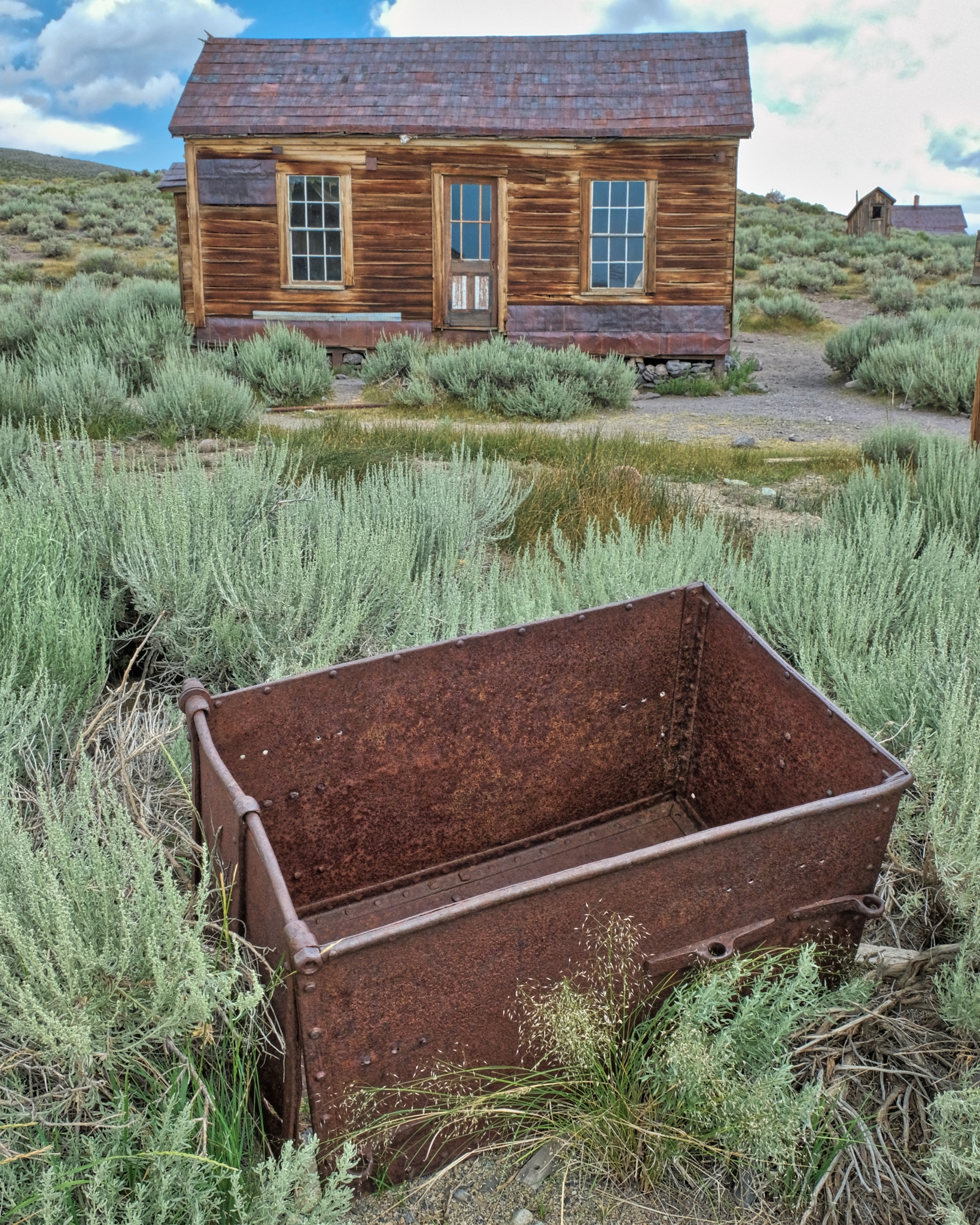
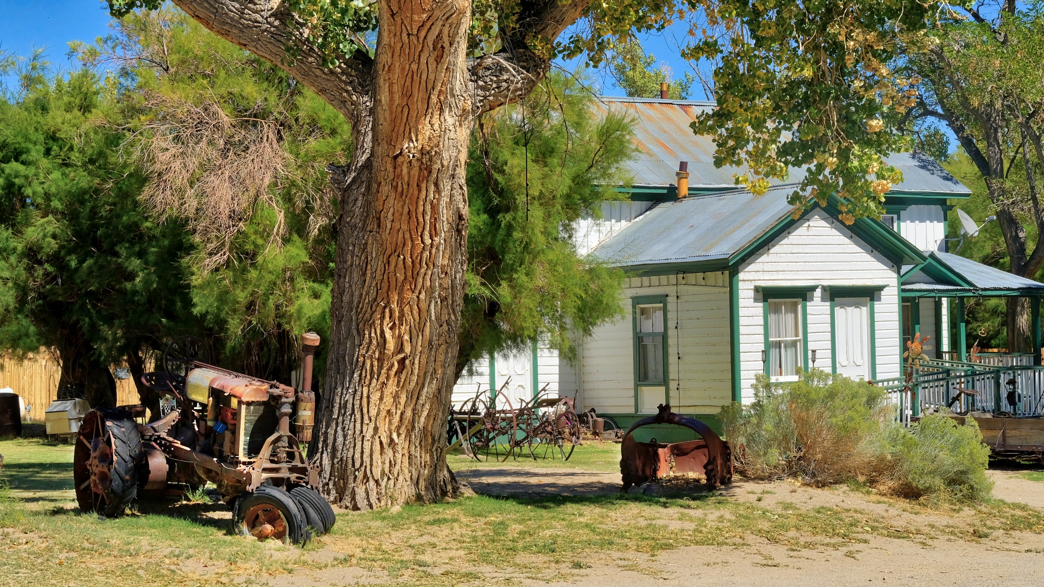
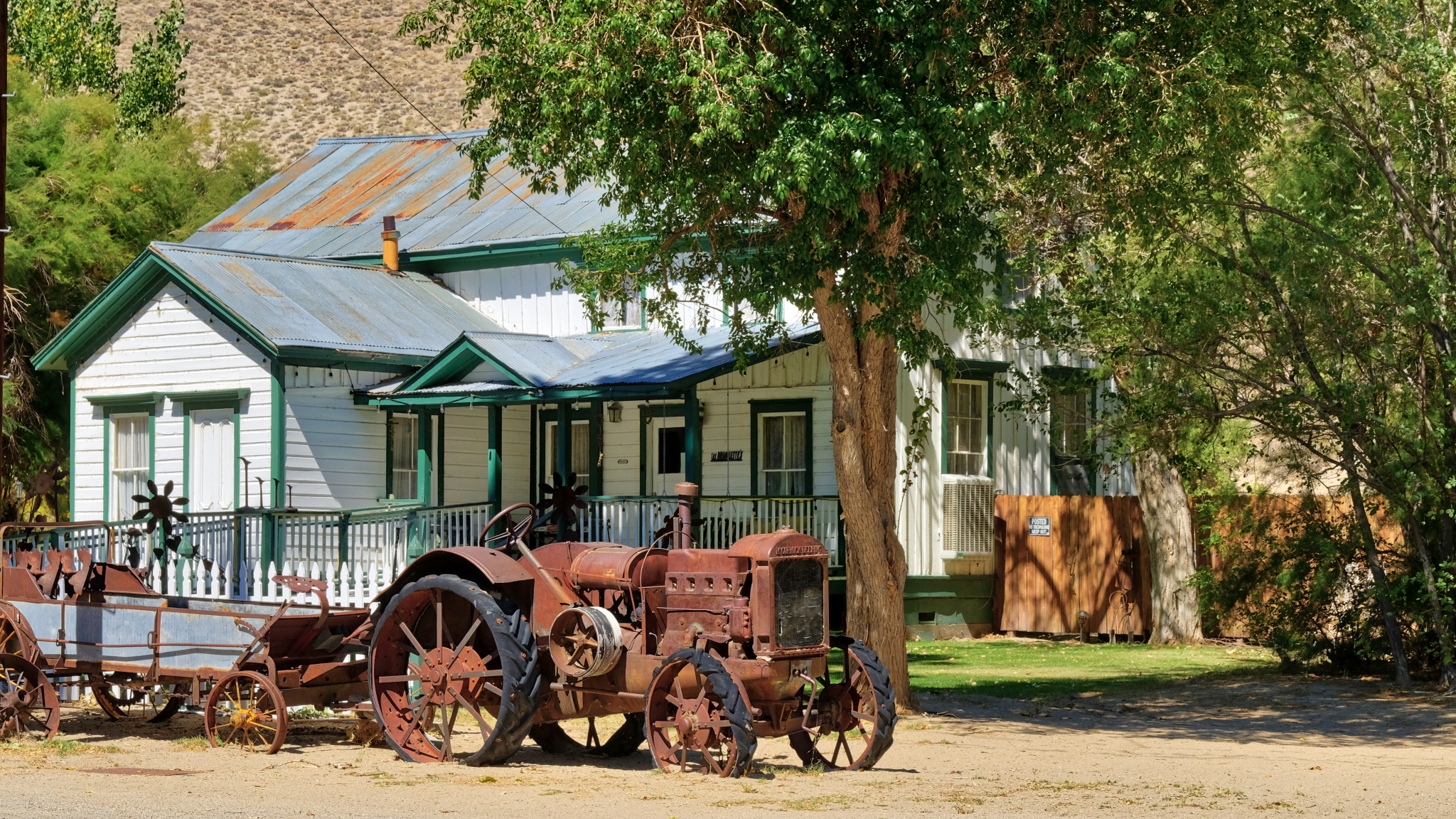
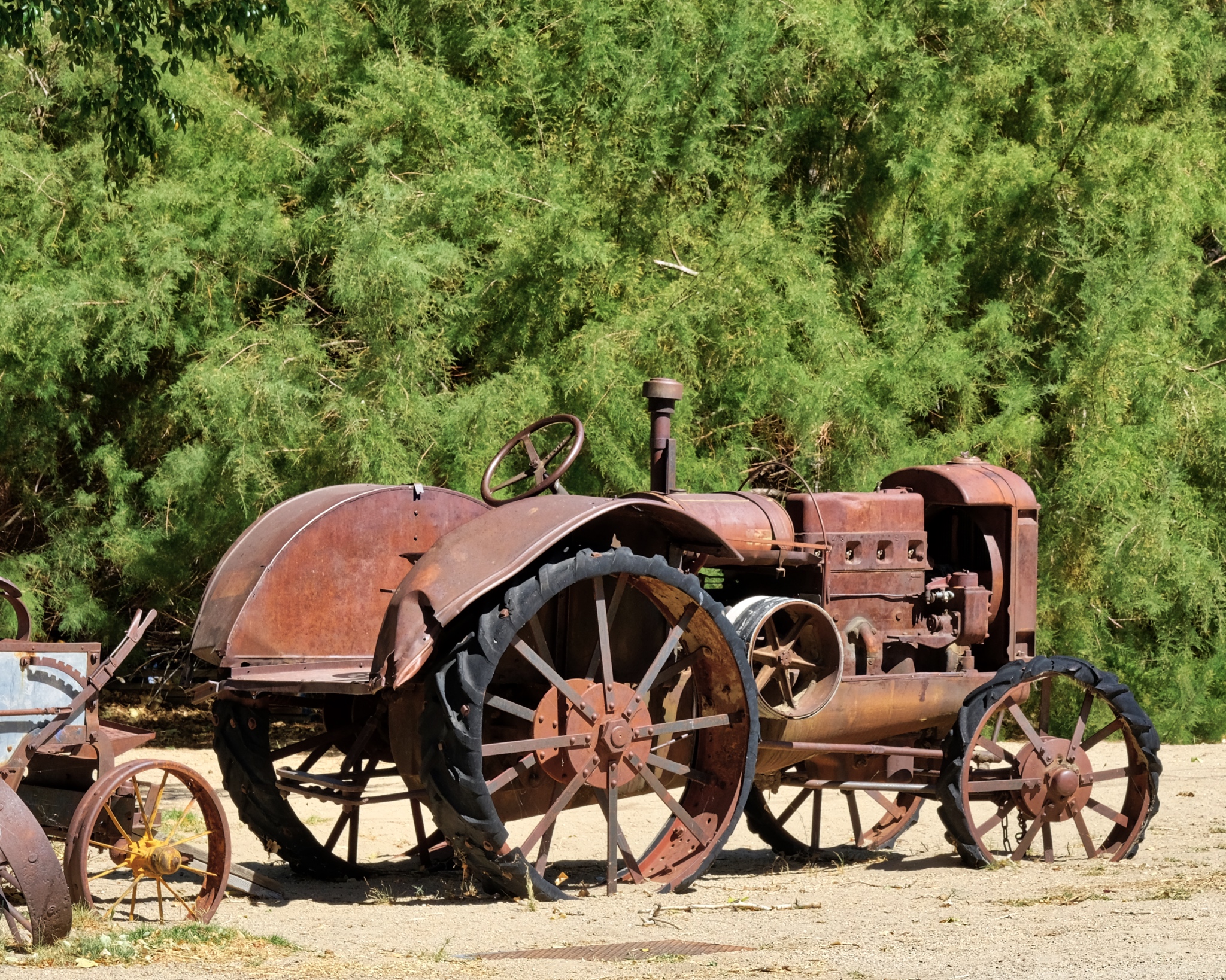
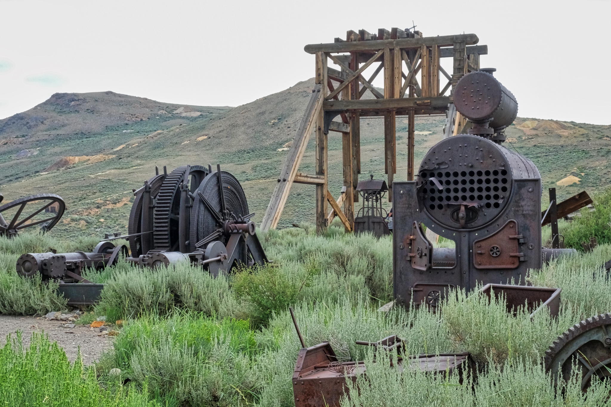 There is still a lot of mechanical debris left over from the age of industrial mining.
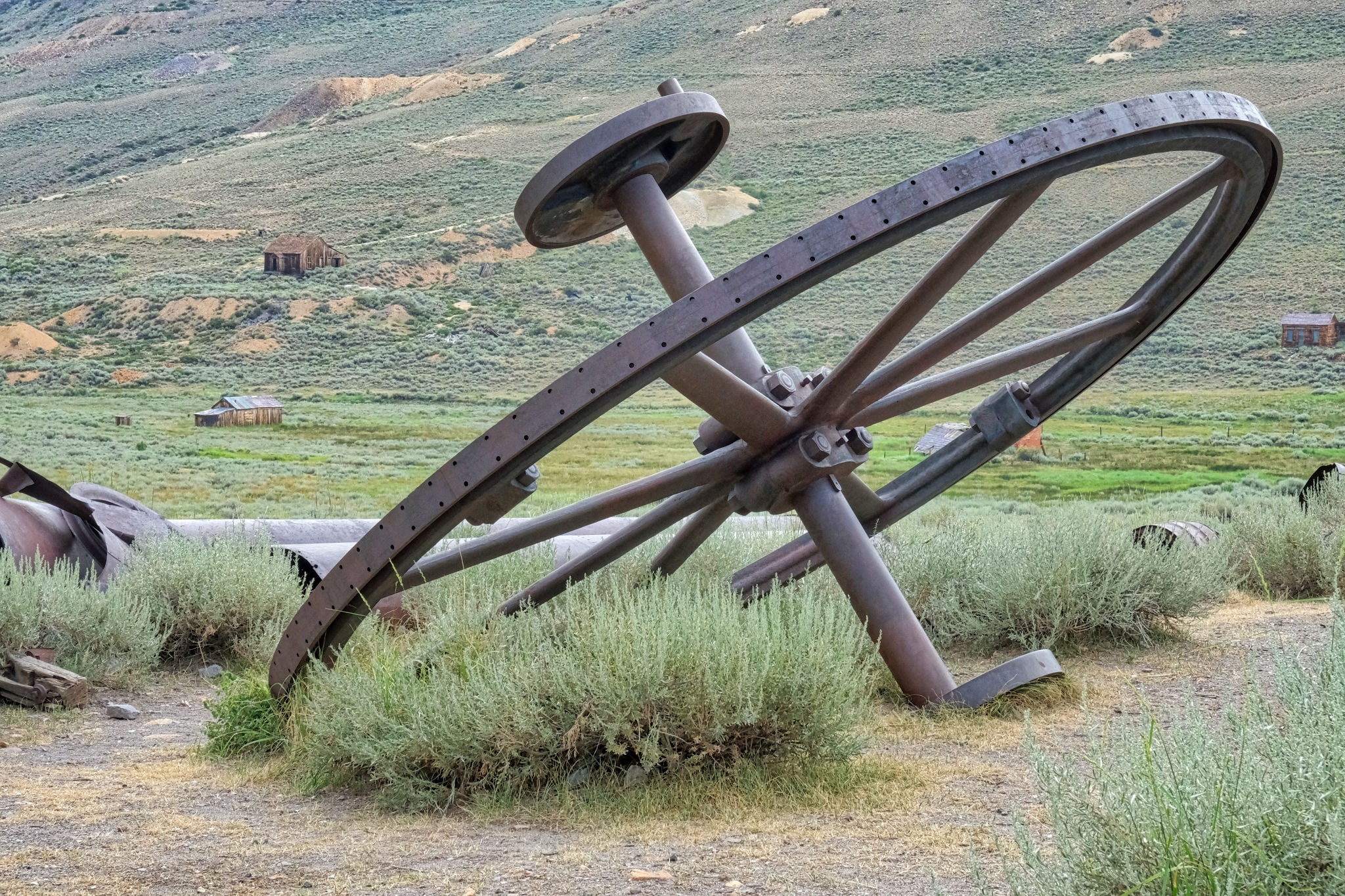 It is interesting to try and imagine where these parts went and what their purposes might have been.
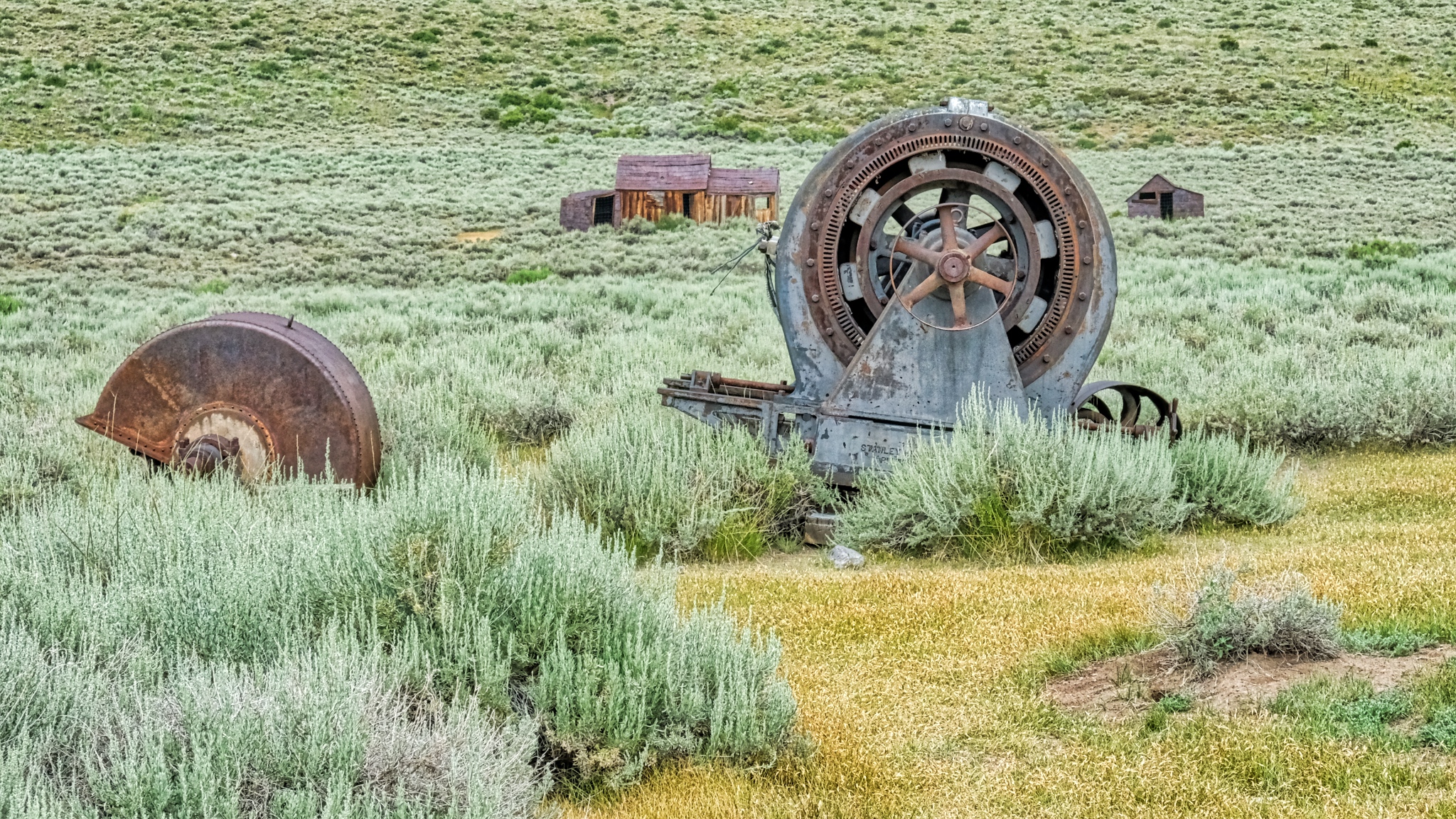 Your guess is as good as mine . . . .
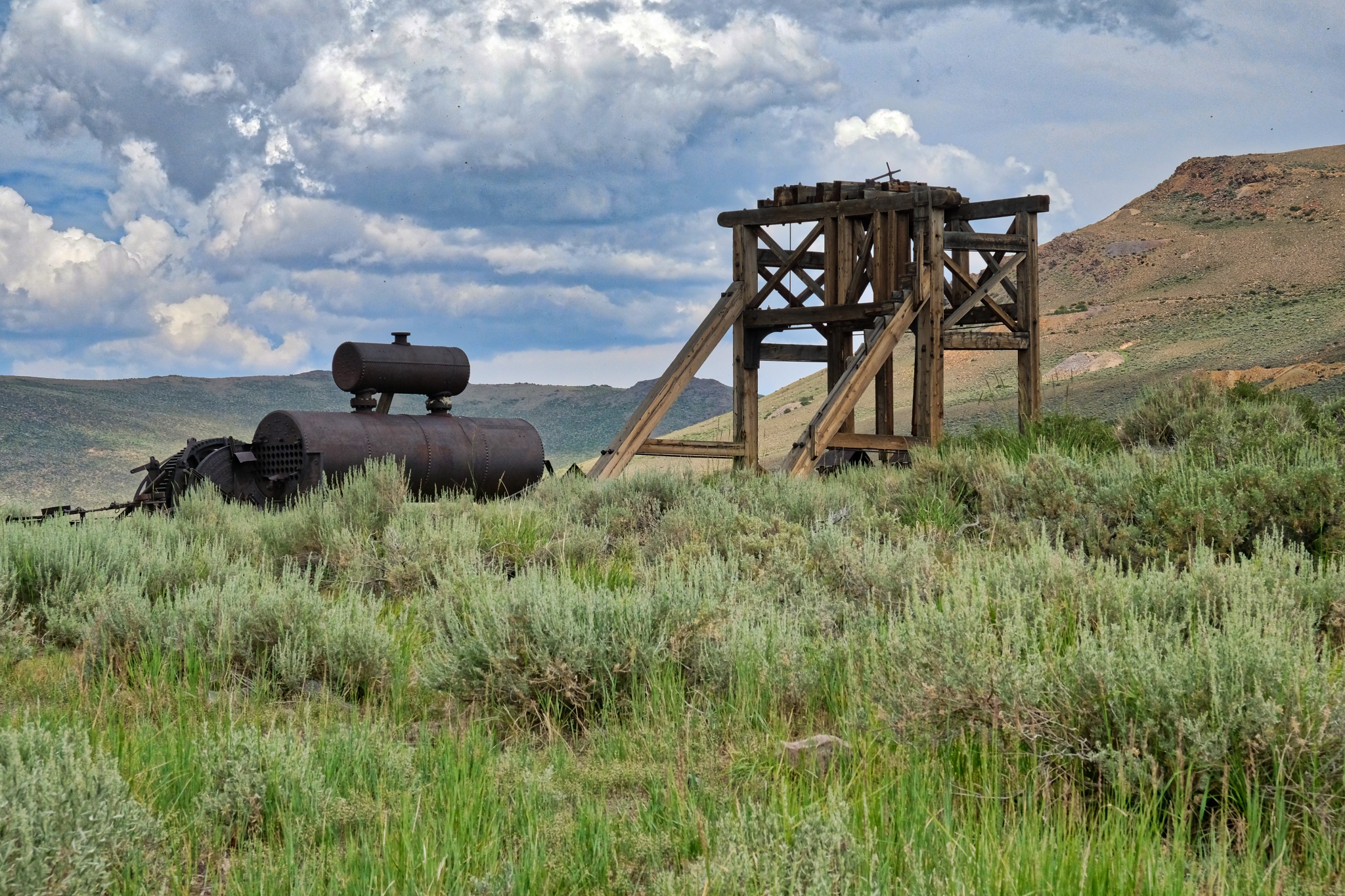 There were many mine head rigs and tanks across the area.
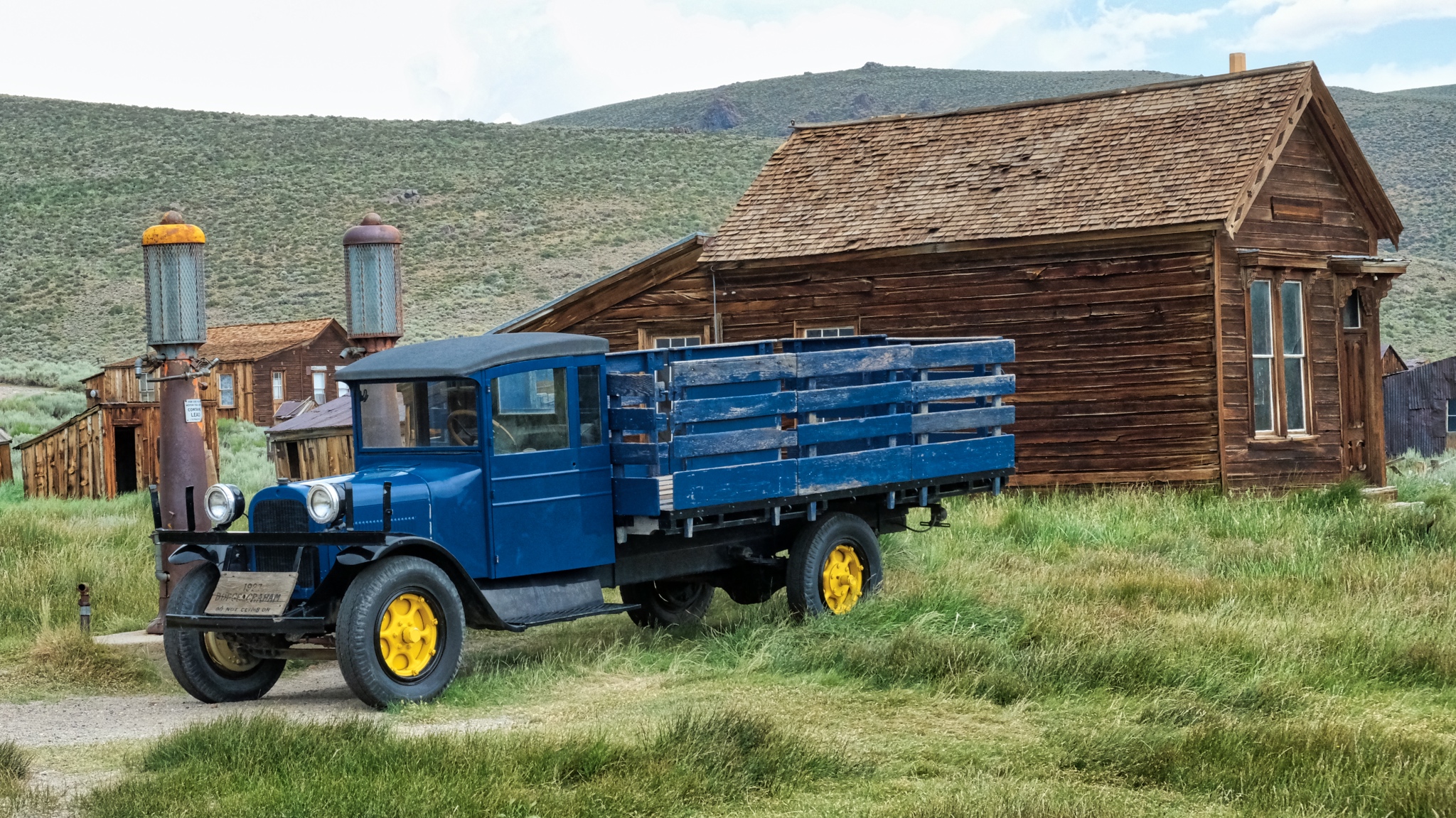 Although the rail line was torn up, trucks continued to supply the town with food, supplies, and machinery.
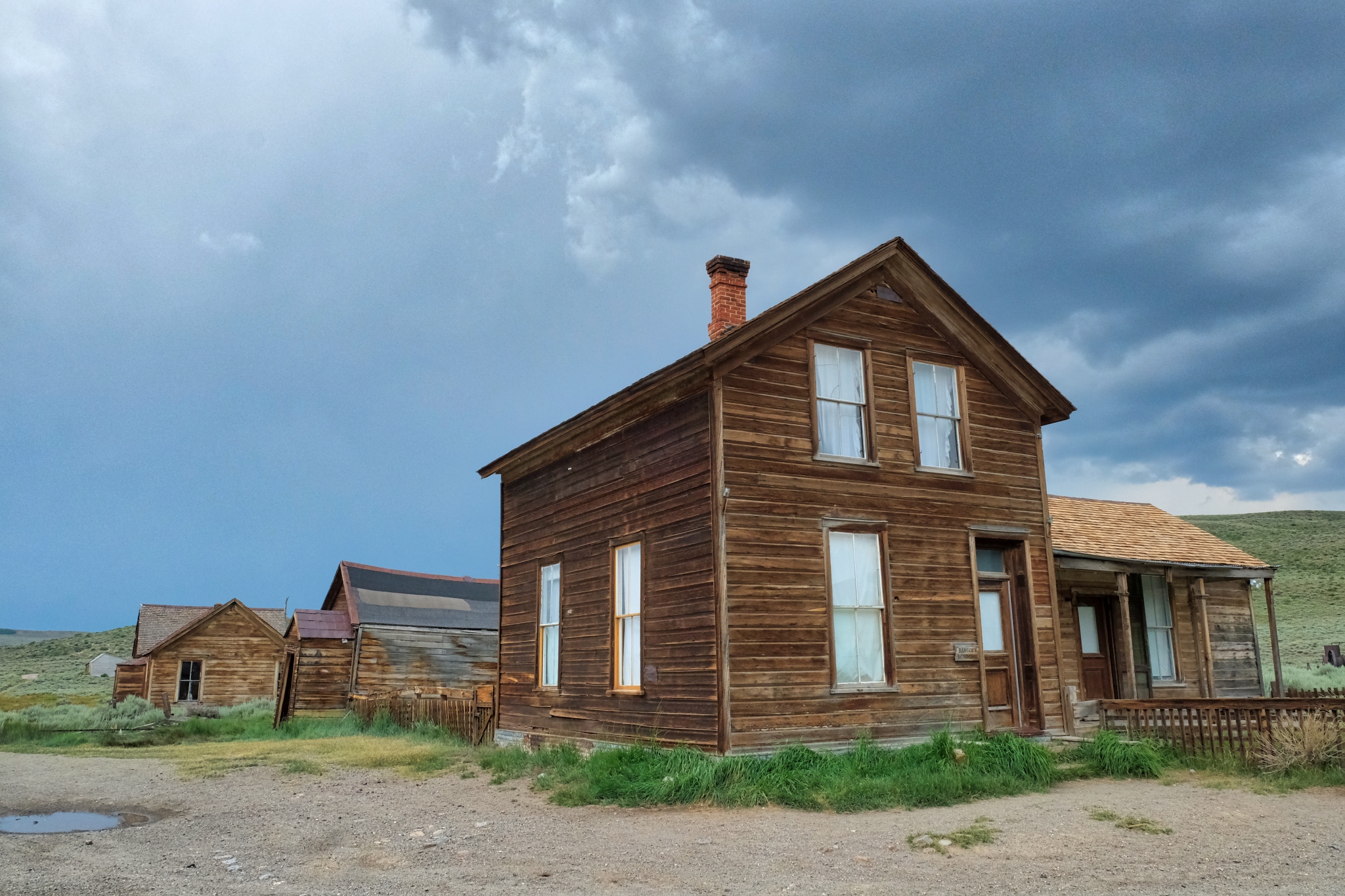
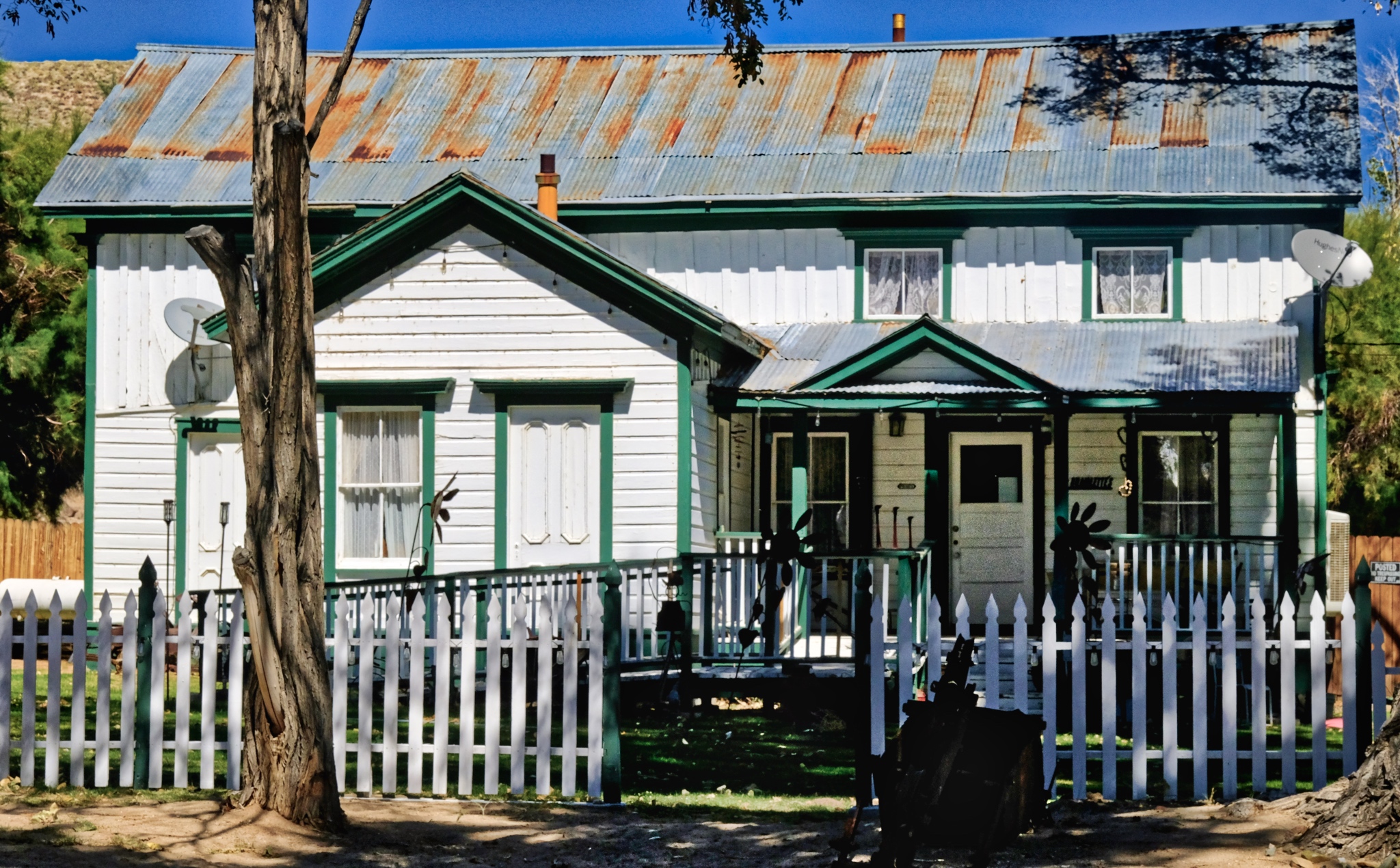
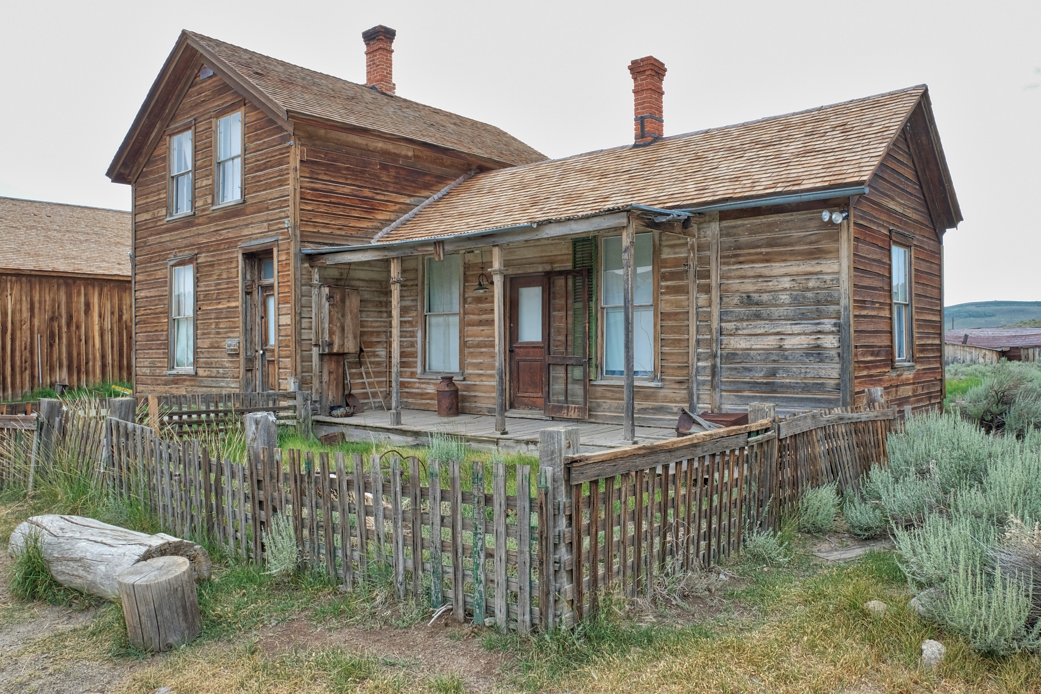 There were some very nice old homes here. Although it was designated a ghost town as early as 1915, there were still a few hardy souls who lived in Bodie up into the 1950s.
 This view back in the day would have had many more houses in it.
 One house had an open door . . . so I went in for a look.
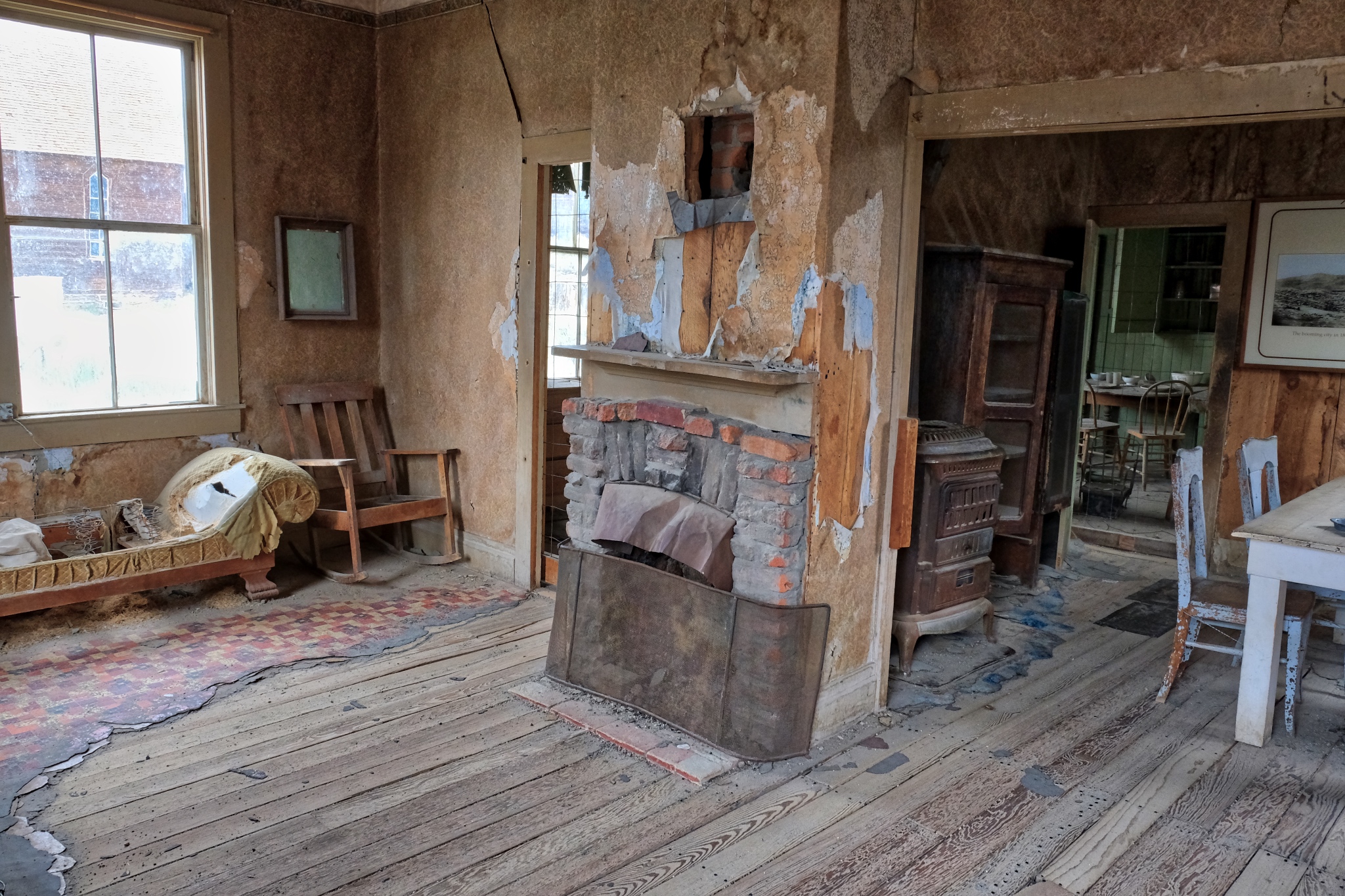 Fantastic!
 Although tens of thousands of visitors come to Bodie every year, it still feels like a discovery to find these old abandoned rooms.
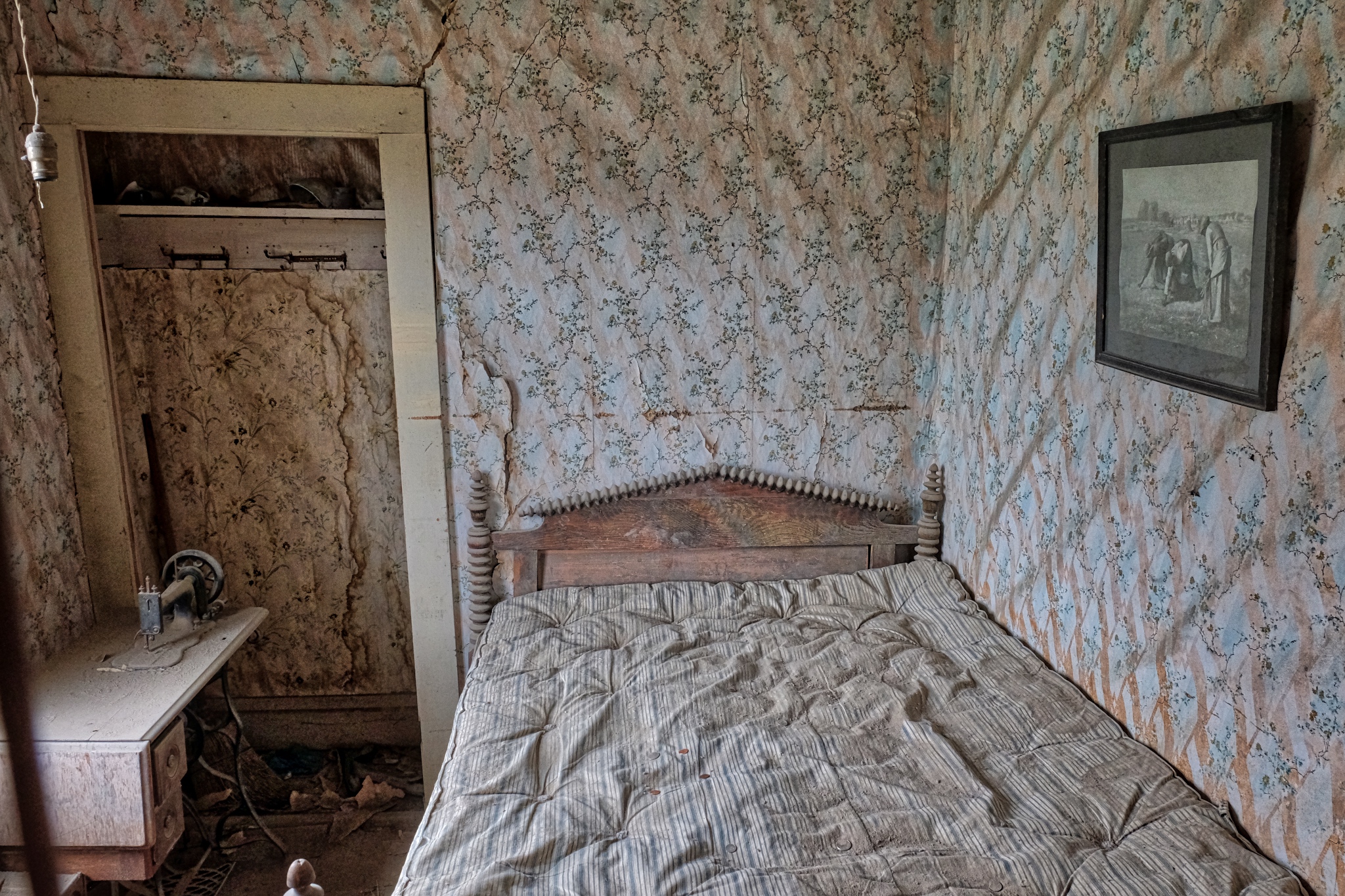
 I cannot tell if the furniture is original, but those layers of linoleum sure are!
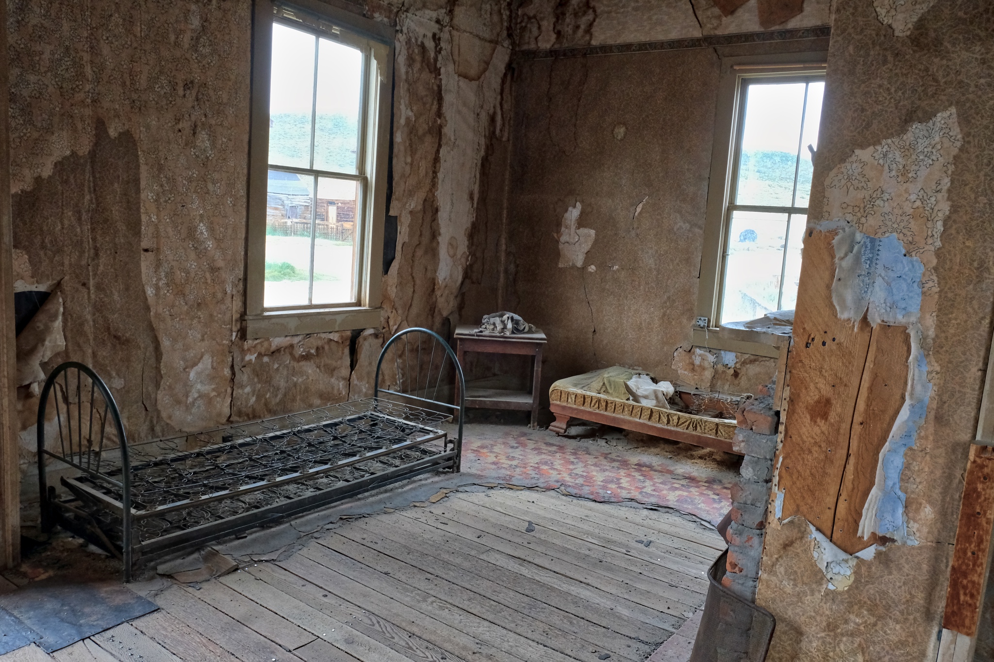
 Again, some of these old homes were lived in up to the 1950s, so I am not sure if this is one of those houses or it it dates to the end of mining around 1916.
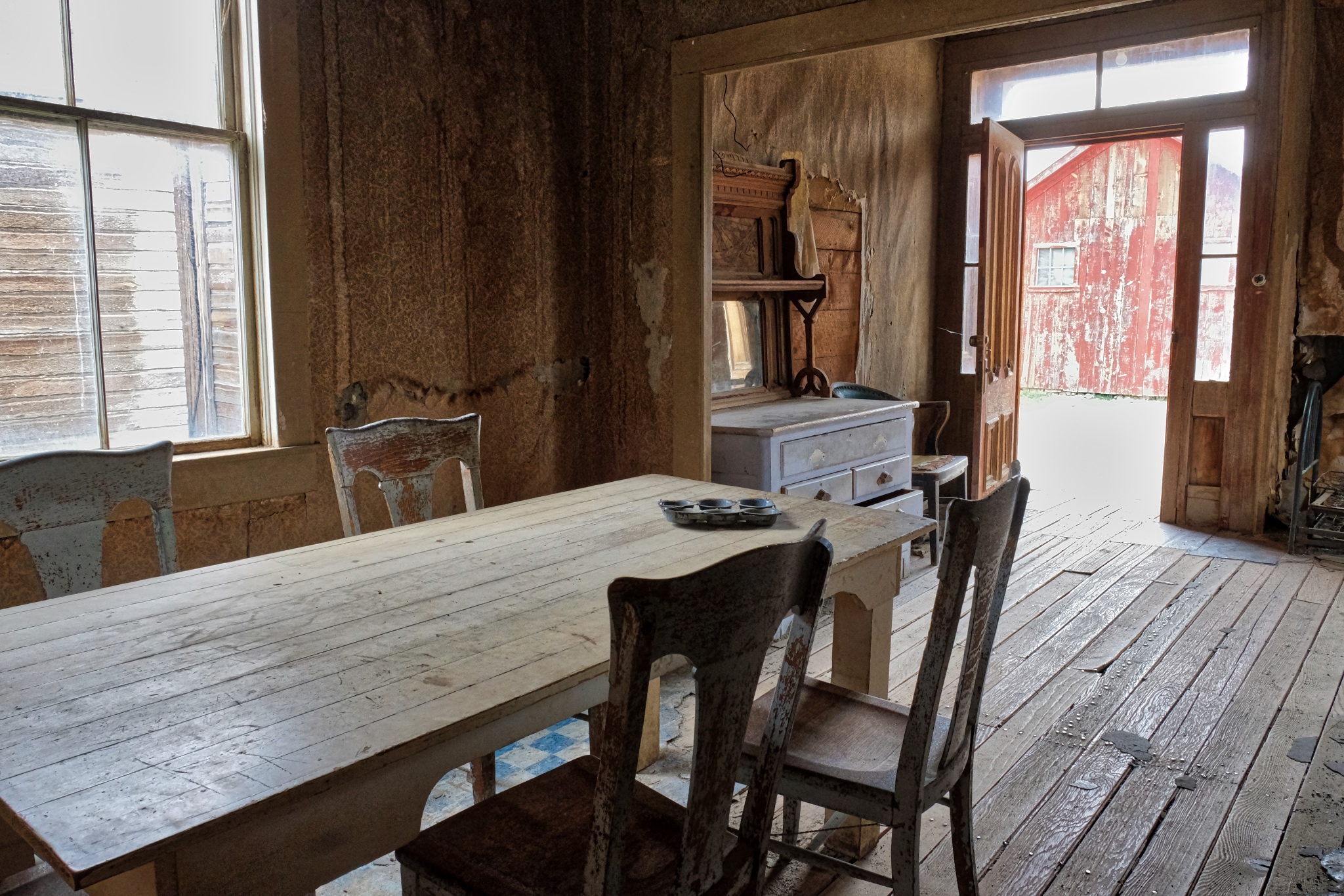
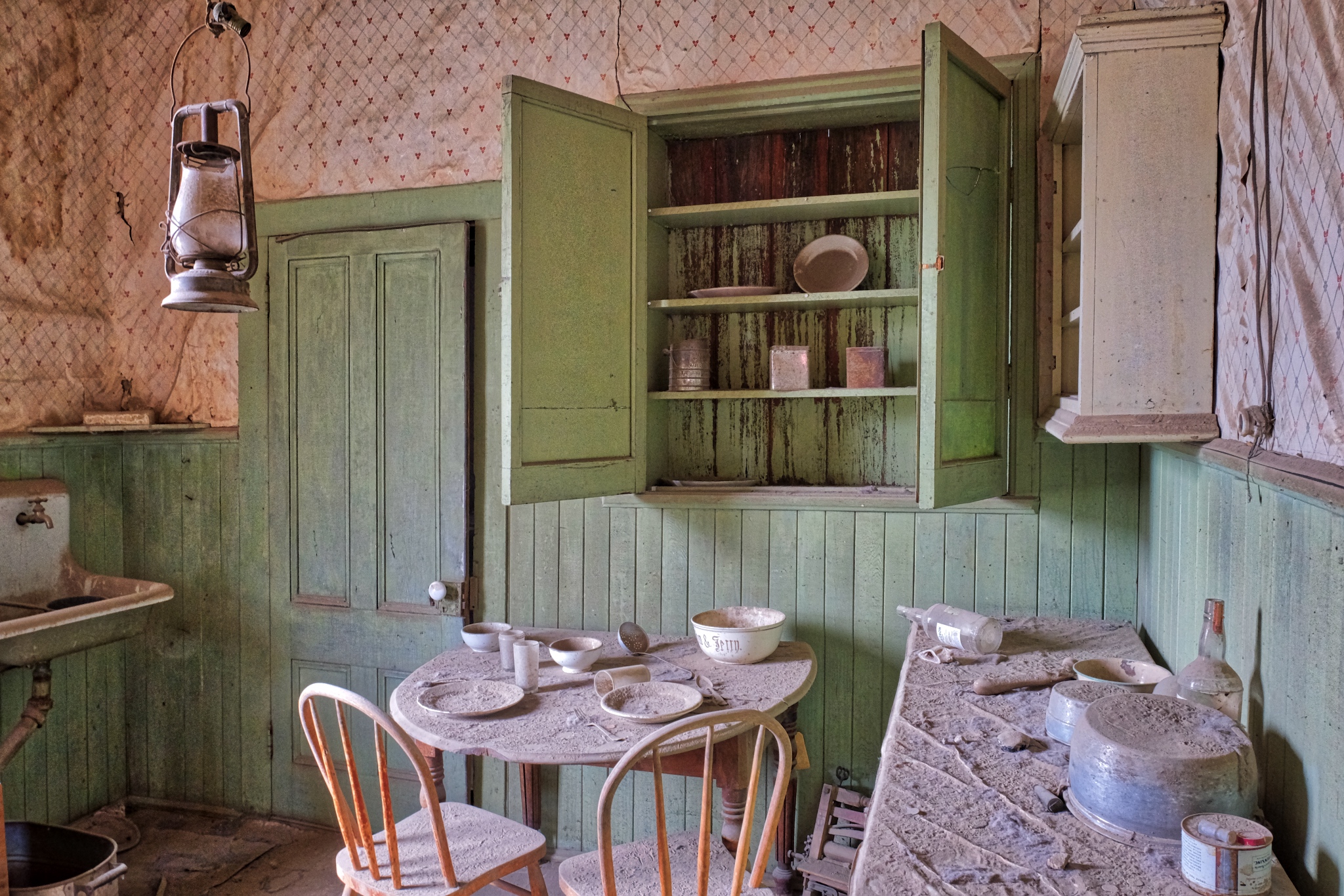 "The last breakfast" table still set. At least they didn't have to do the dishes on that last day . . .
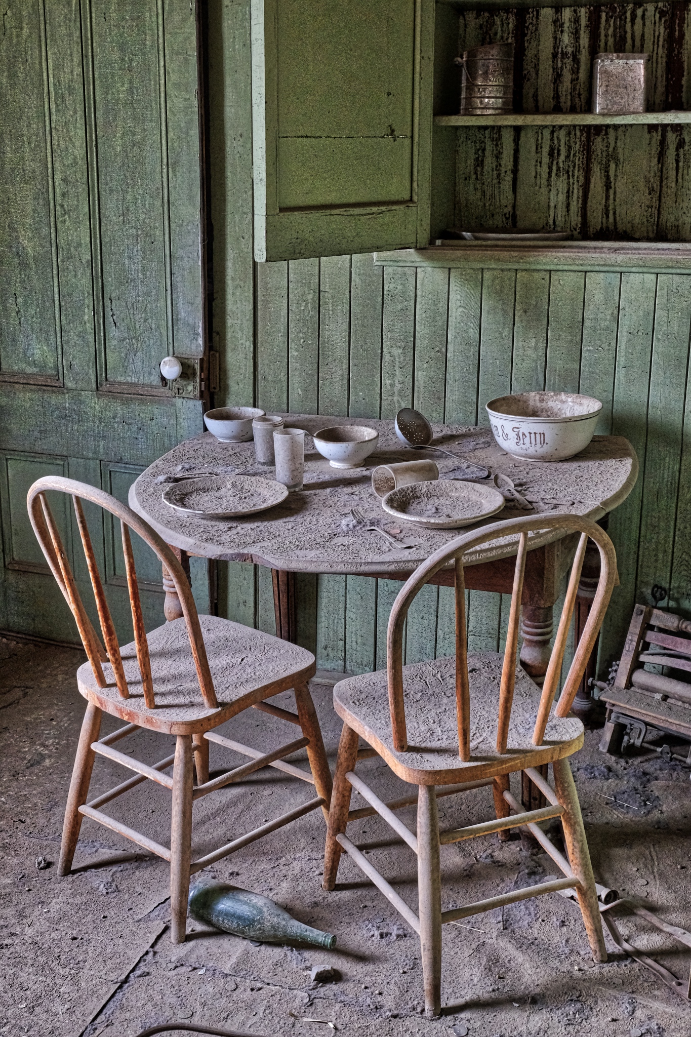 Wonderful patina of age.
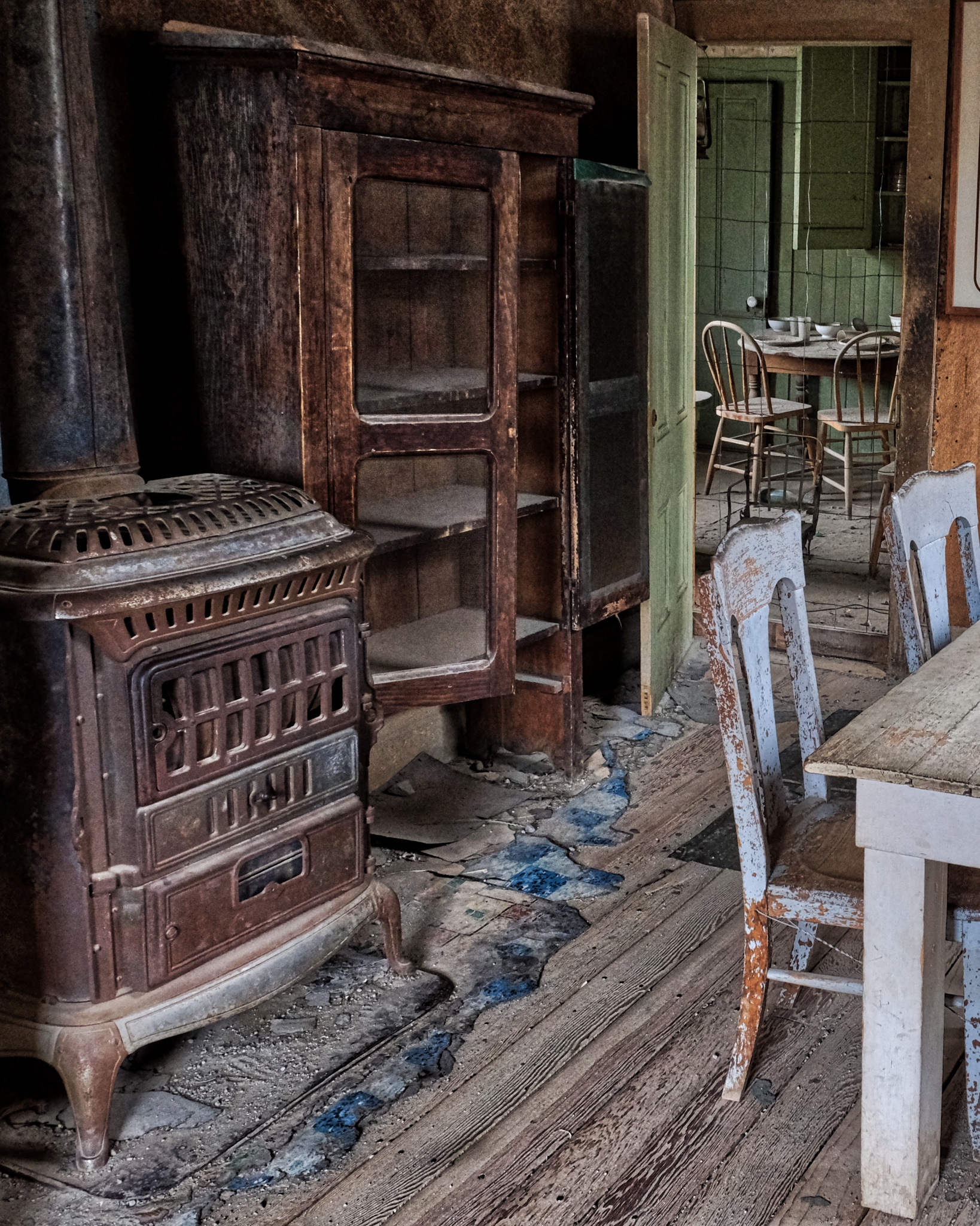 The old wood stove would have been the center of life in this very cold place.
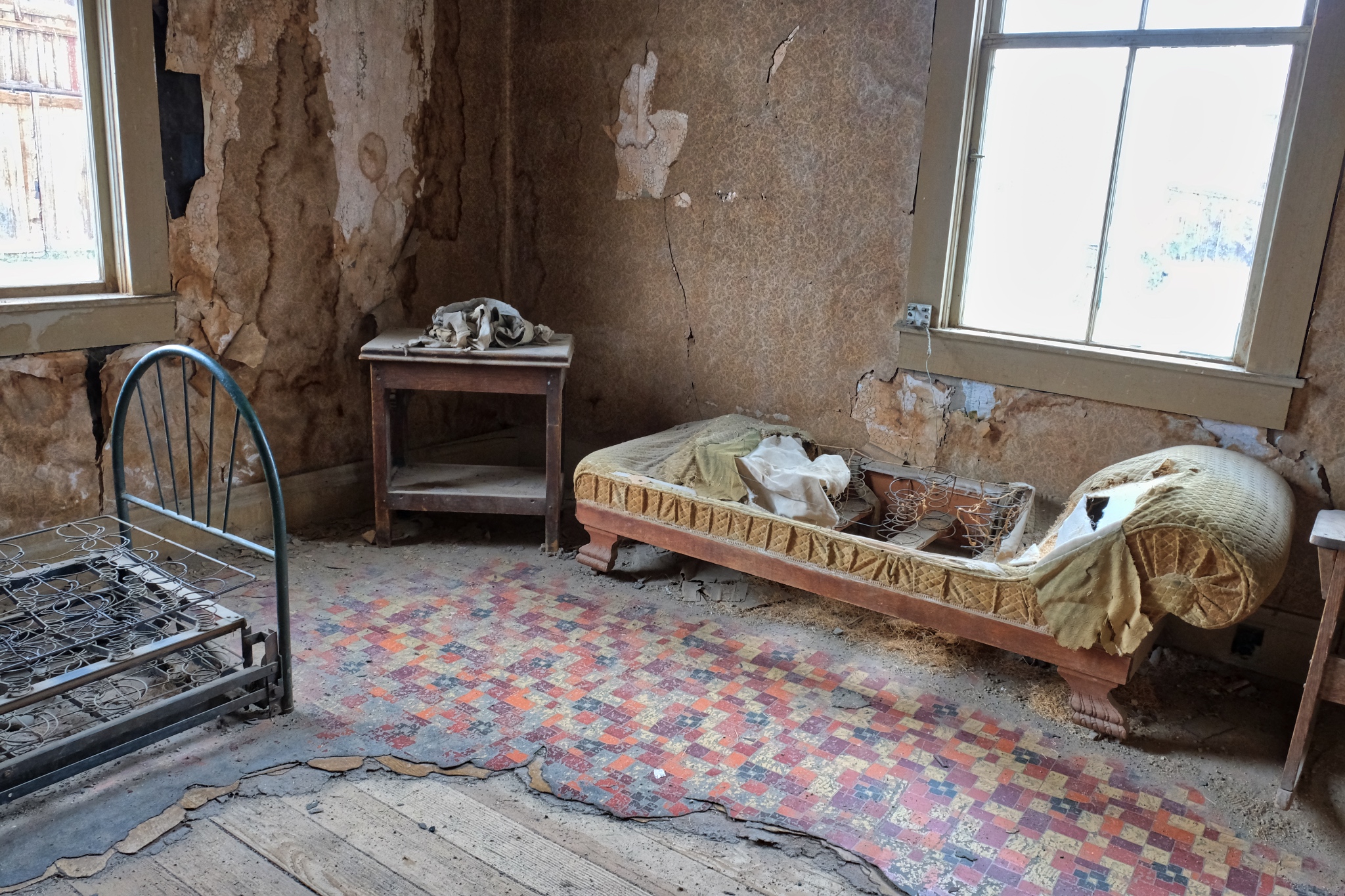
 Looks like a cozy room . . . at one time.
 I spent a long time in this old house . . . soaking up the silent beauty . . . and reflecting on the human lives that were lived out here . . . and my own life.
 Such beautiful visual compositions laying around everywhere. Another photographers' paradise!
 The longer we stayed, the darker the sky became . . . we started to move back to the camper at about this point. There was much more to see in Bodie, but the rain would drive us out.
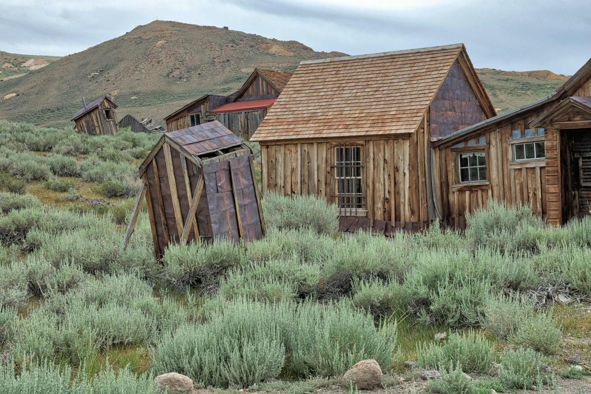
 This steel out-house looks like it has tipped over in the past . . . I wonder how this happened?
 Darker and darker . . .
 My fellow tourists were heading to cover from the approaching rain.
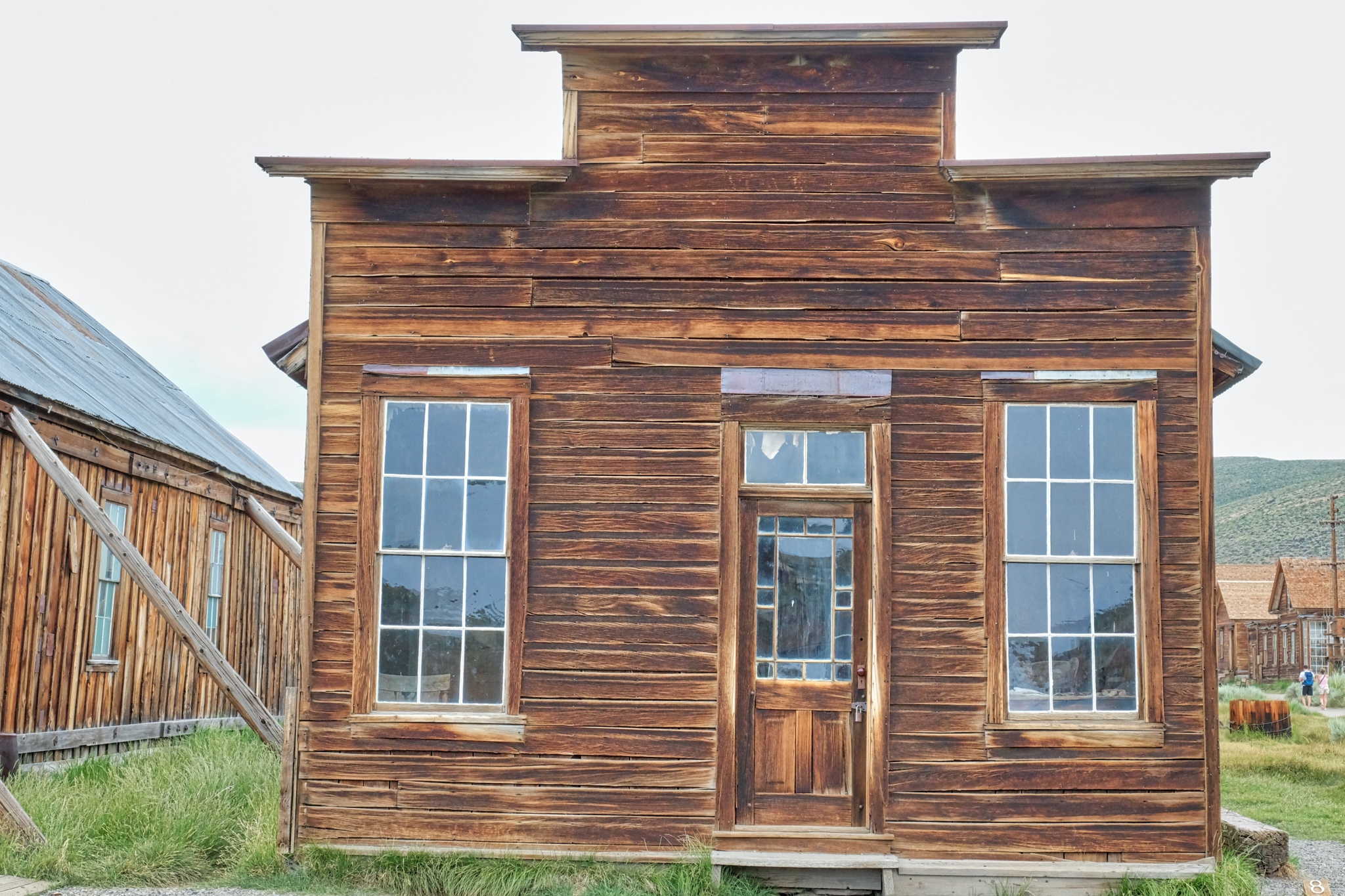
 This shop-front must have been beautiful back in the day.
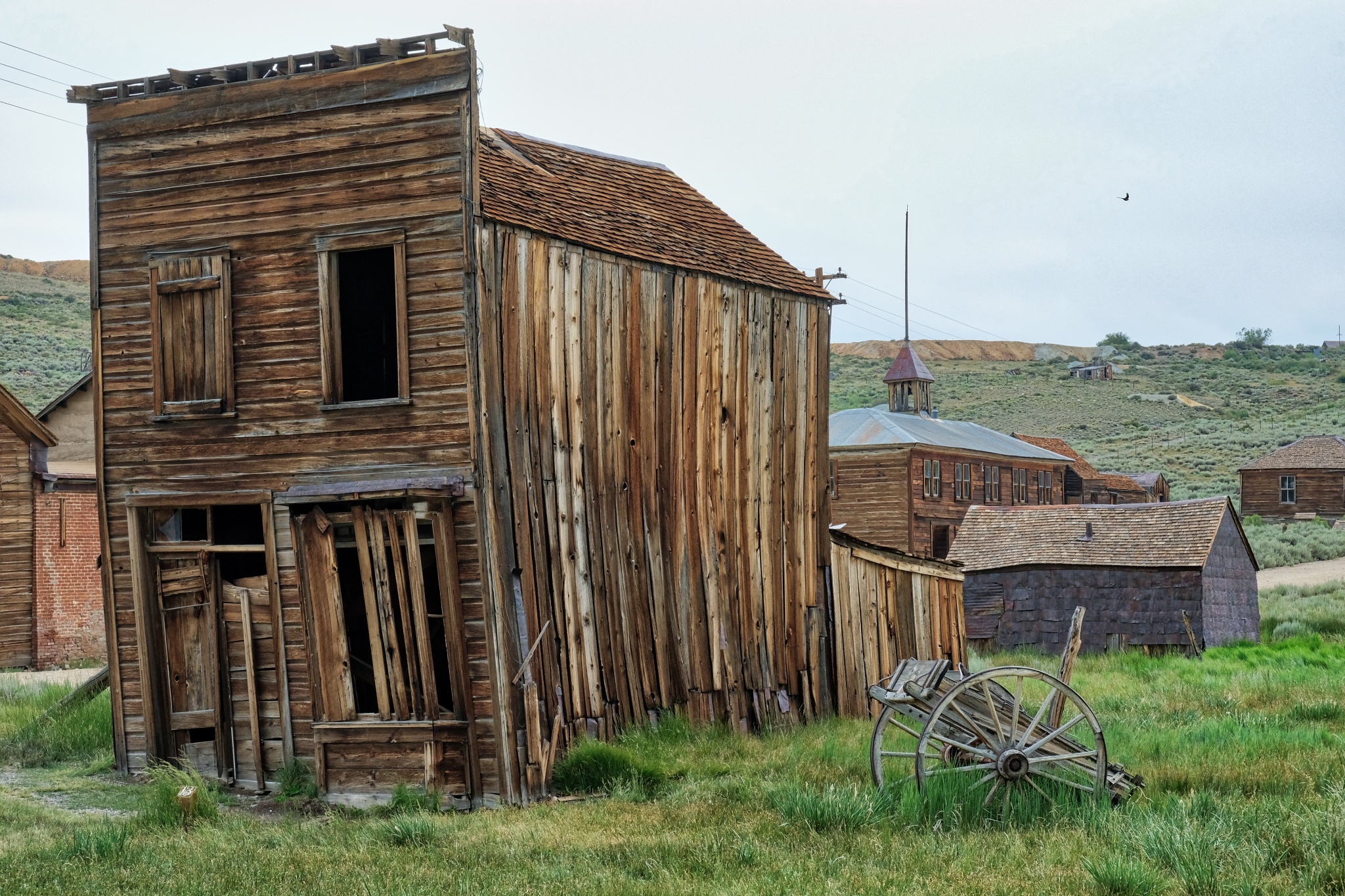
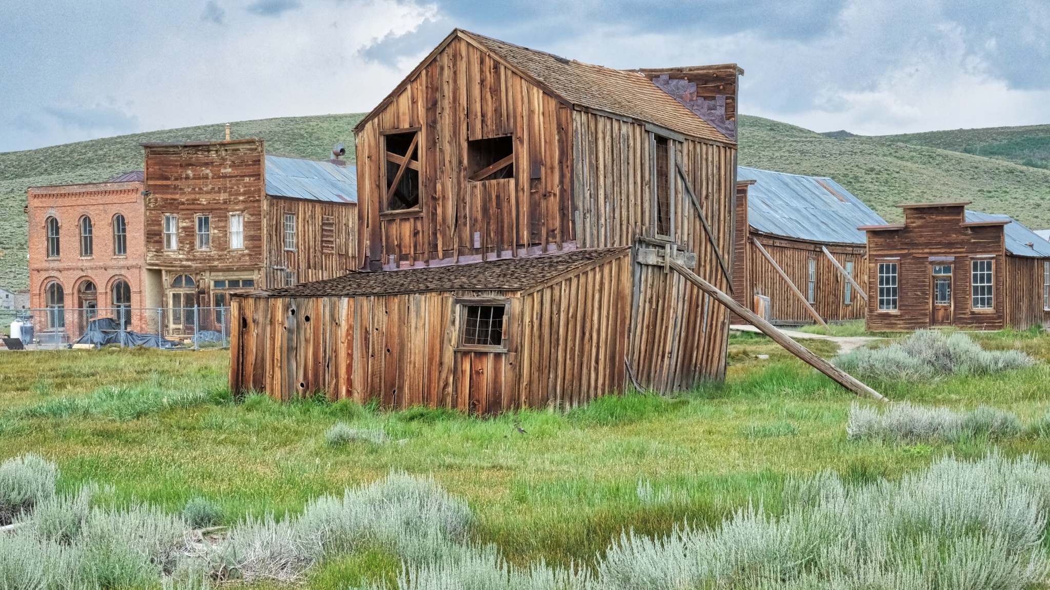
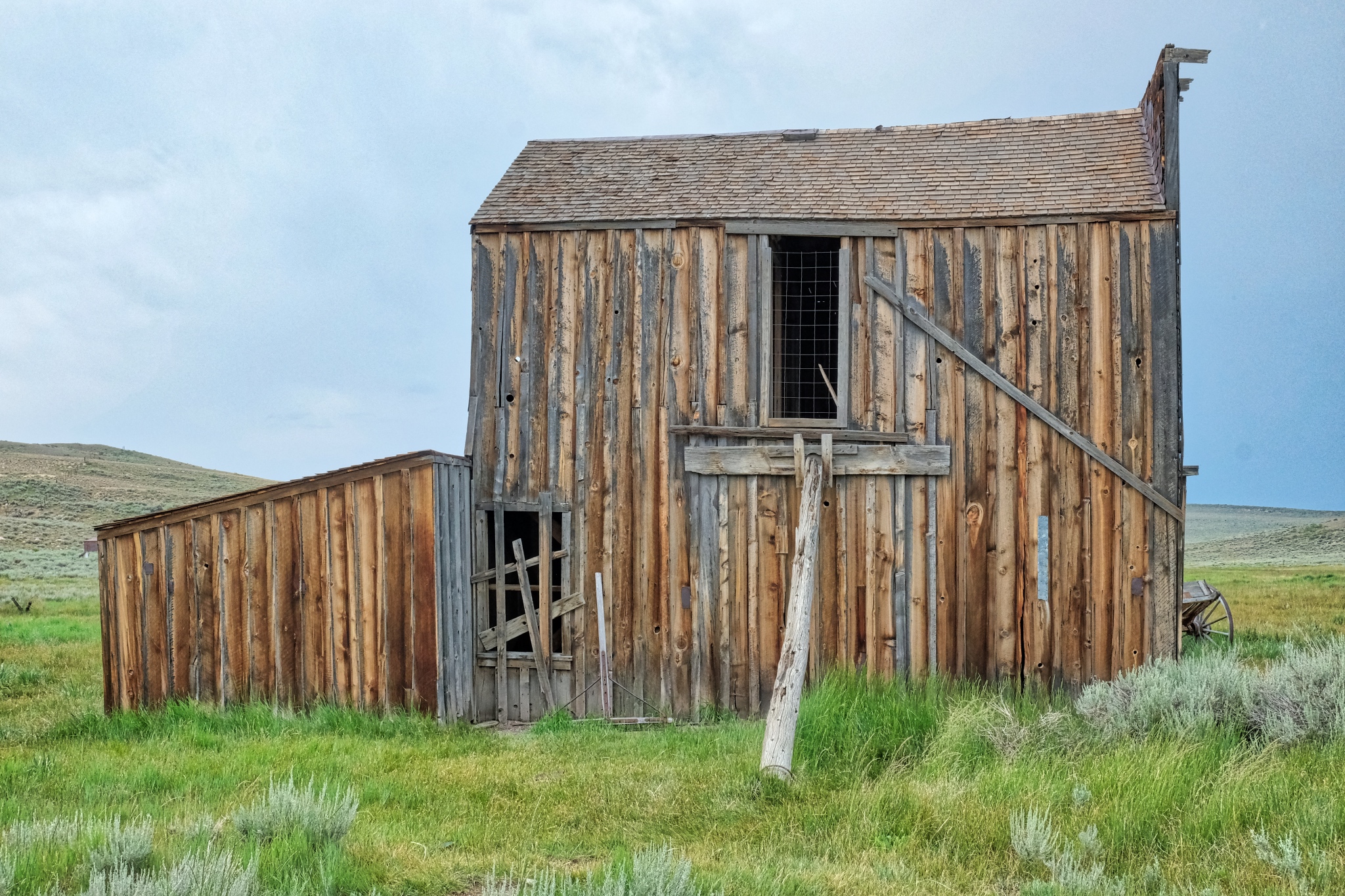
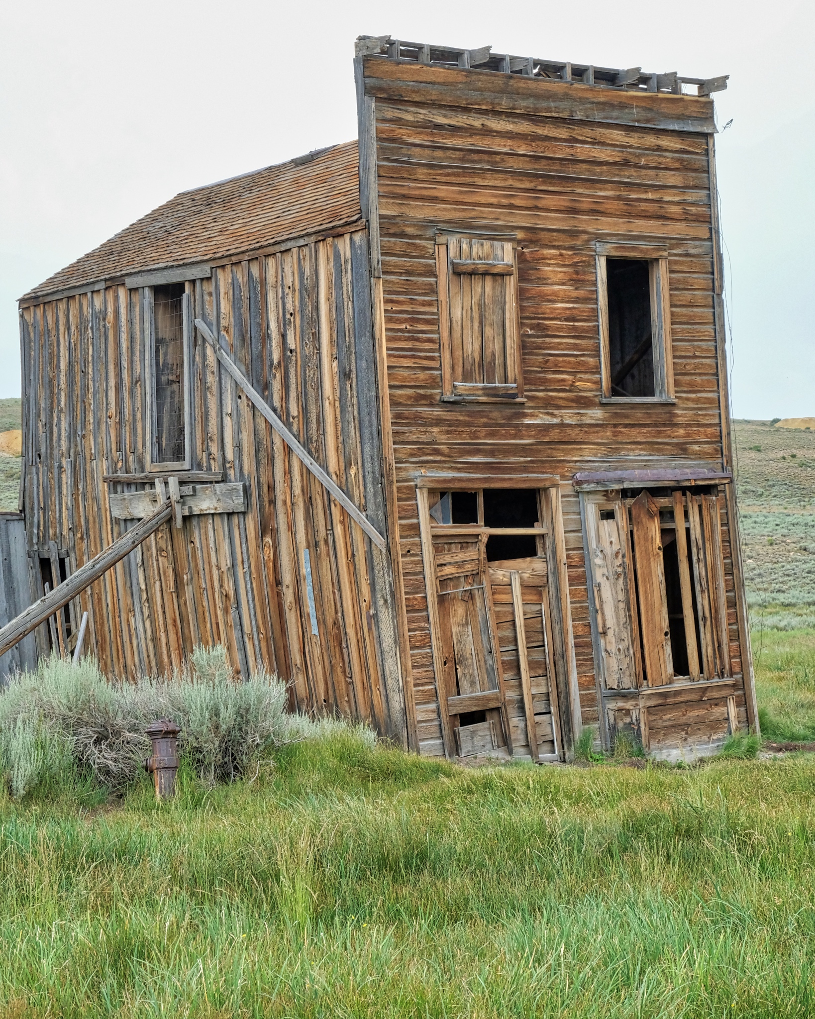 This intreguing and tilting little building was beautiful from the front and side (next photo).
 Such wonderfully defined textures and colors . . . highlighted by the fine mist that has settled on them.
 Sweet little place . . .
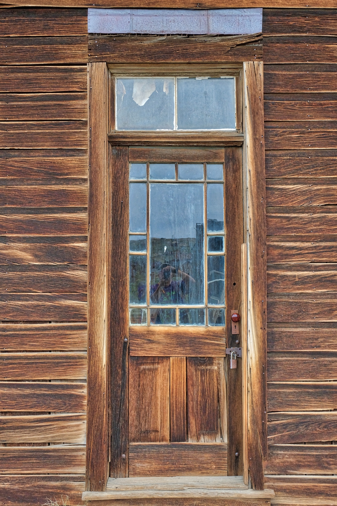 Fine, honest door (and self-portrait!).
 Time to go.
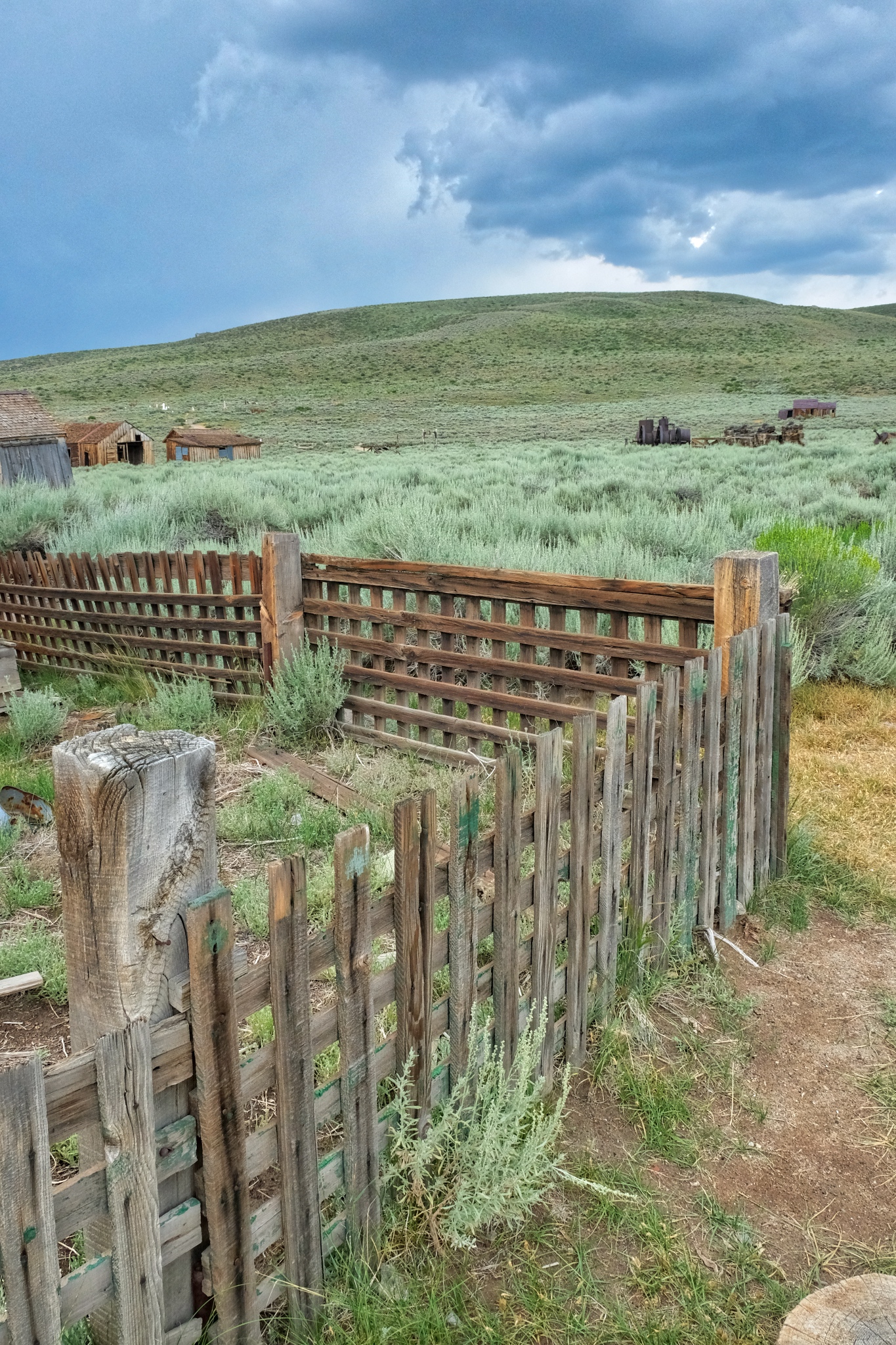
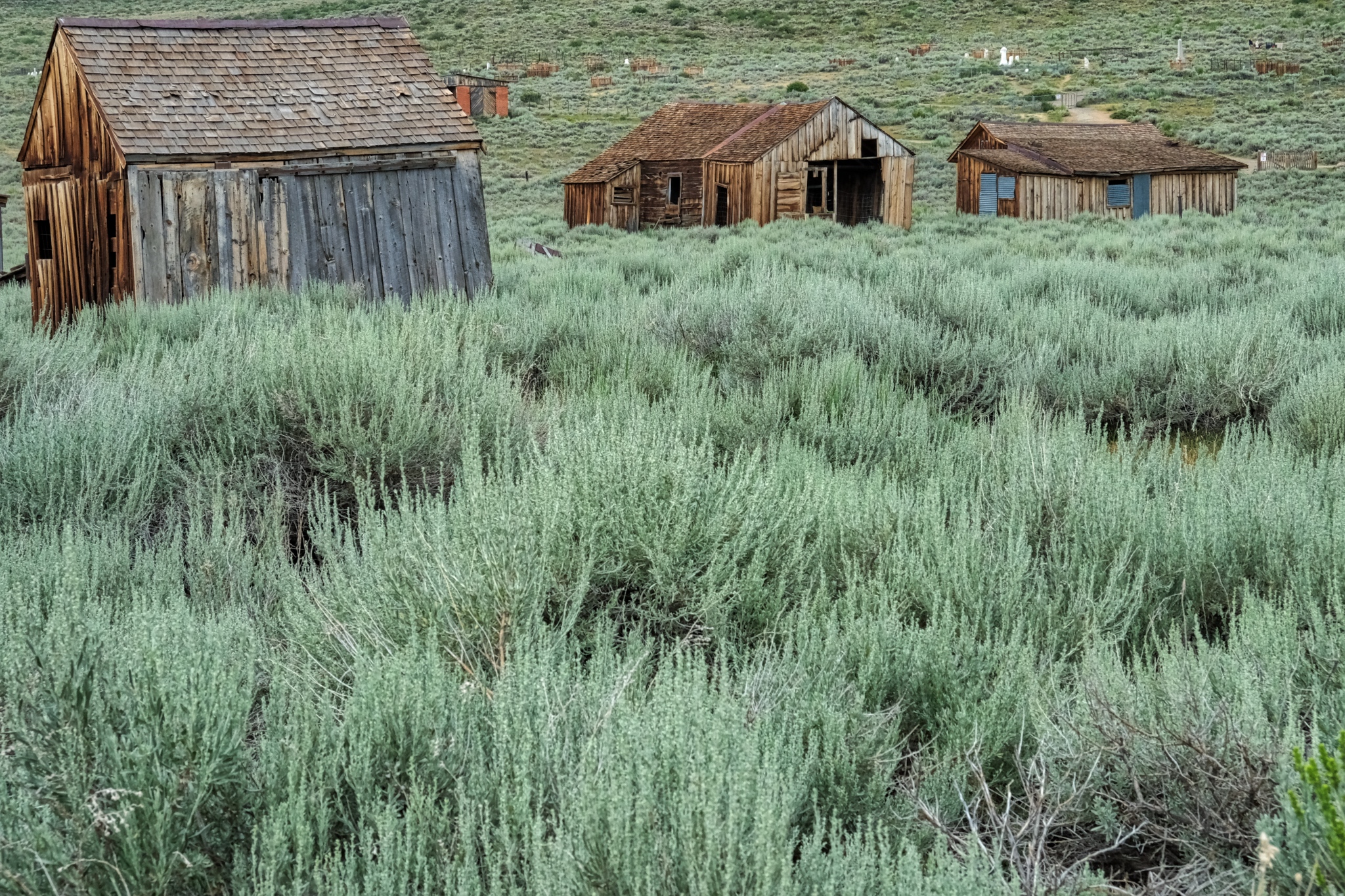 The sage brush has reclaimed most of the streets and paths.
 I would like to come back here . . . perhaps when there is some snow on the ground . . . and better light.
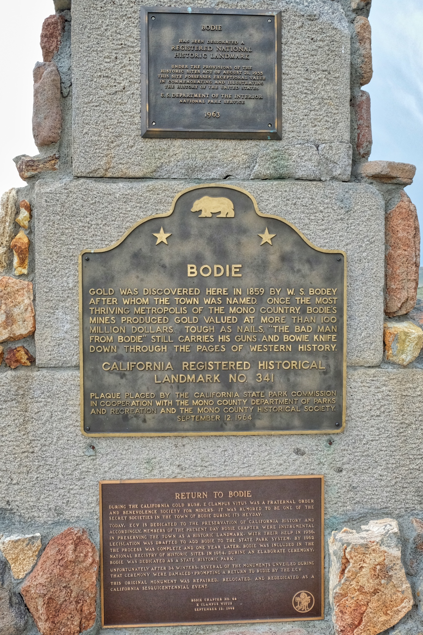 Commemorative plaques.
 And so, we drove off from Bodie.
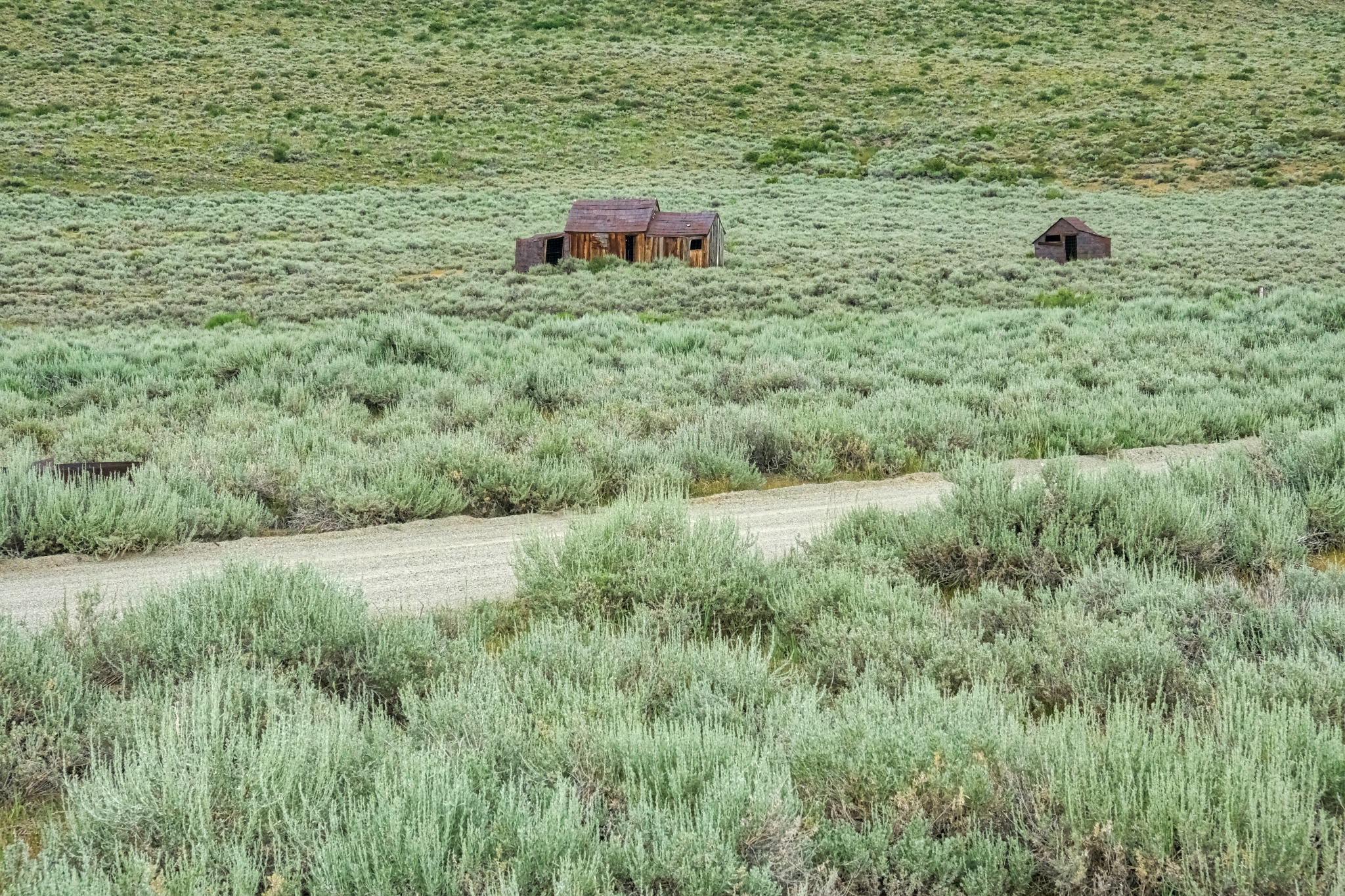
 One last look at the scattered shacks and sheds among the sage.
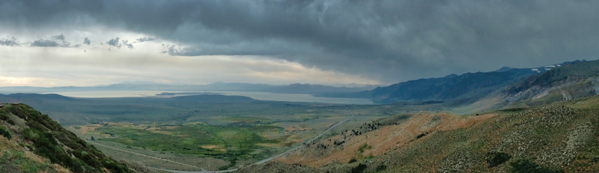 We drove back out the 20 miles to US Highway 395 and headed south toward Mono Lake.
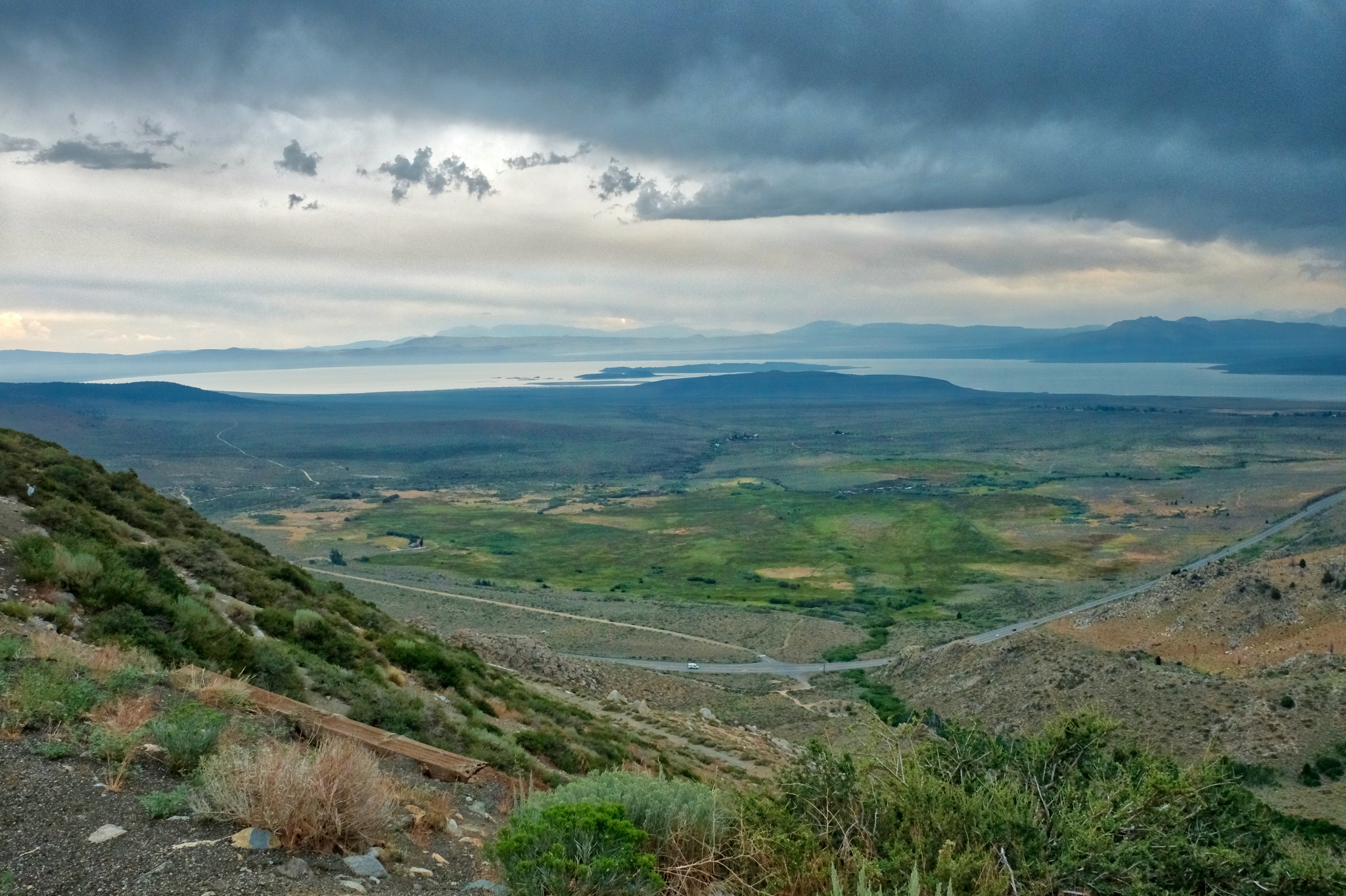 We pulled over on US 395 at this amazing viewpoint high above Mono Lake.
Road Trip USA: Benton Hot Springs, California . . . Almost A Ghost Town
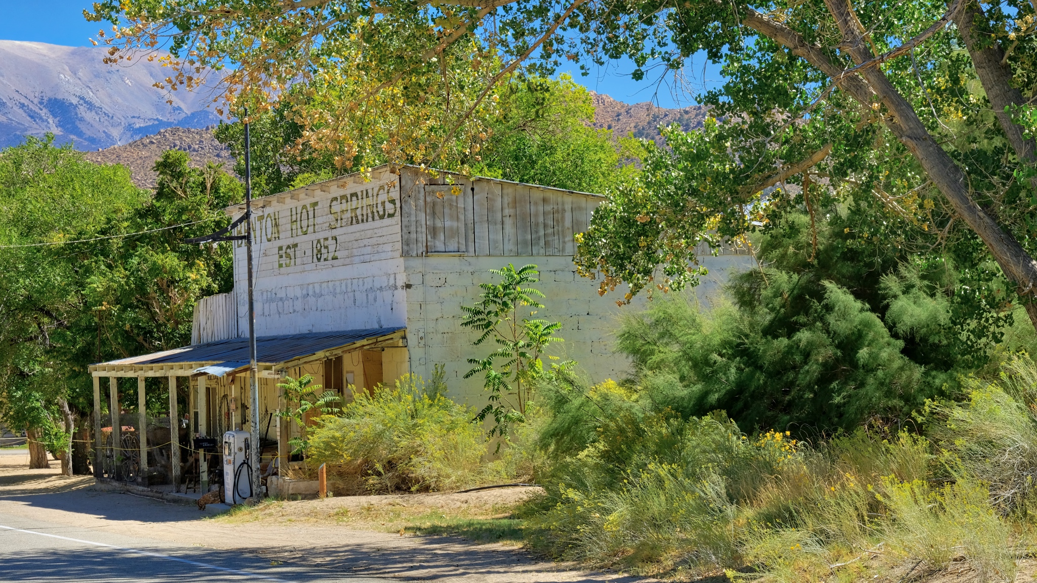 On my drive from the Bonneville Salt Flats in Utah back to my friend's house in the High Eastern Sierras, I took a 'short cut' down some very small, and often unpaved, roads. One of the joys of this type of travel is the discovery of amazingly photogenic little wide spots in the road. One such gem was Benton Hot Springs, just off of US Highway 6, just across the state line . . . on California State Road 120.
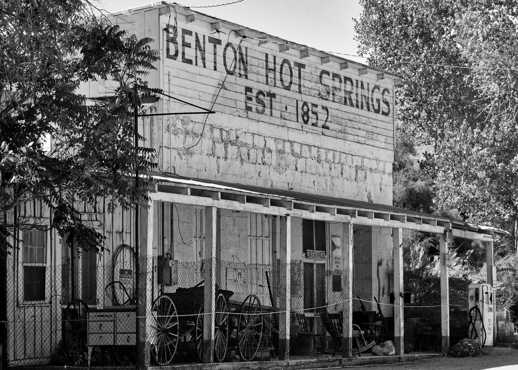
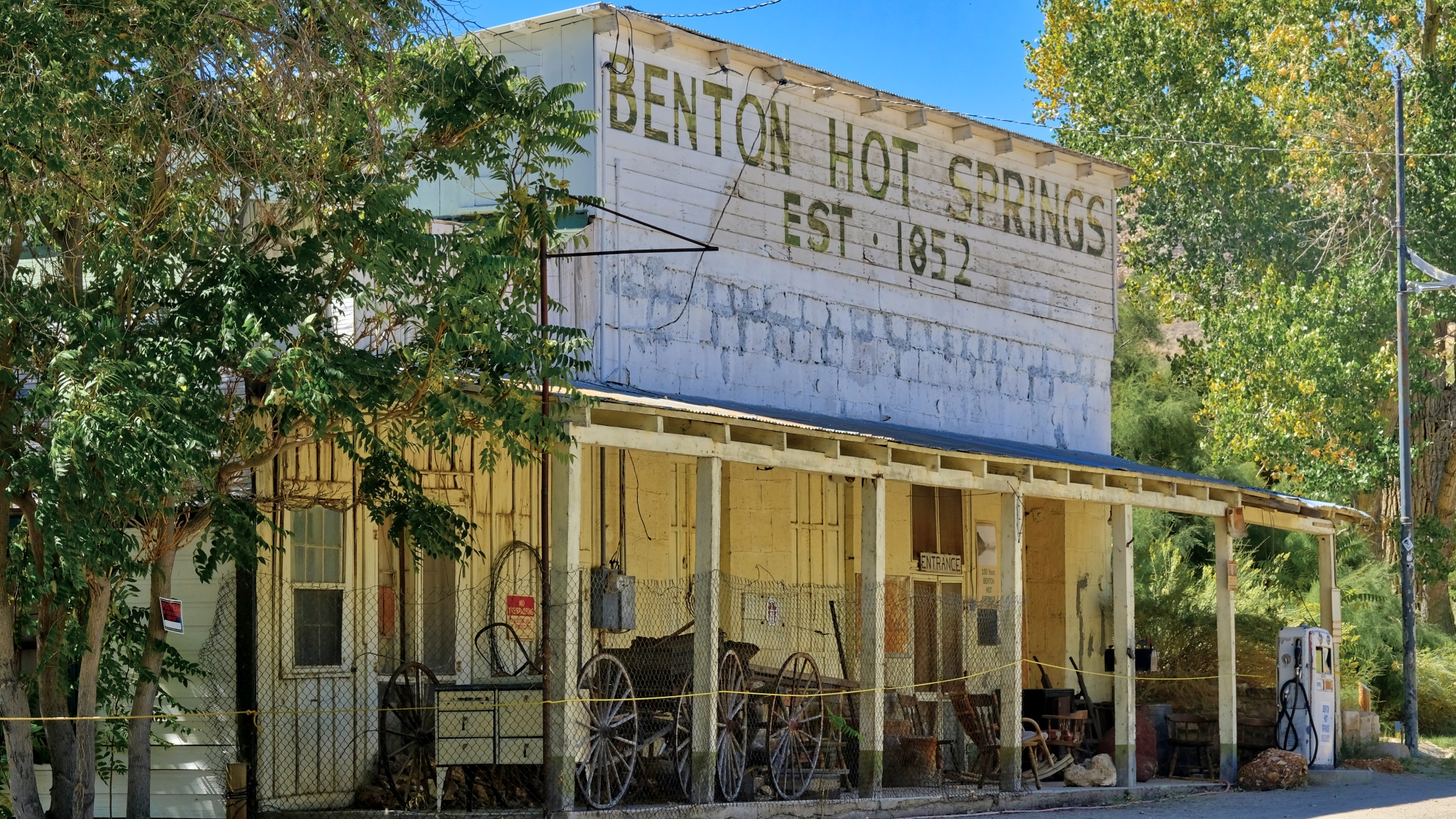 The Benton Hot Springs Hotel is the pride of the nearly dead town. The hotel (now closed) was founded as a general store and Wells Fargo Station in 1868.
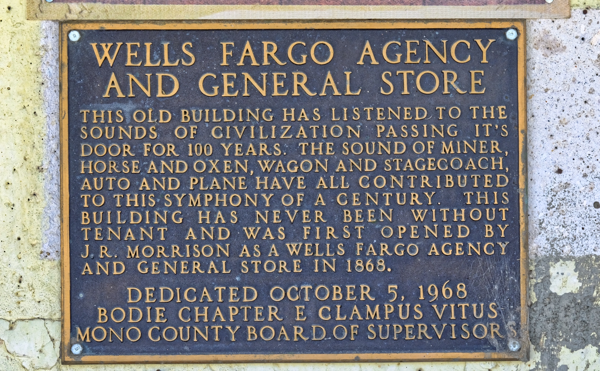 This lovely, and poetical plaque was placed on the old hotel in 1968.
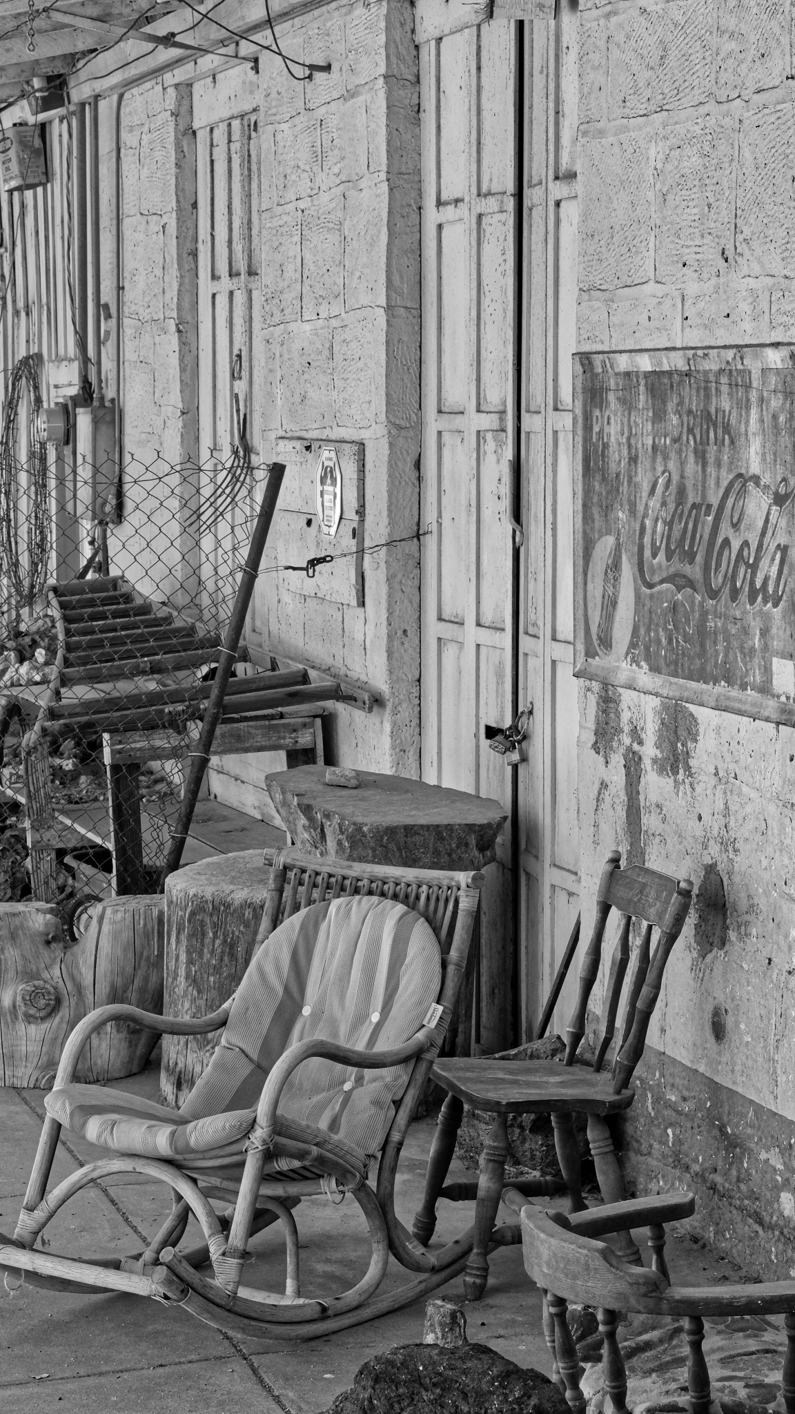
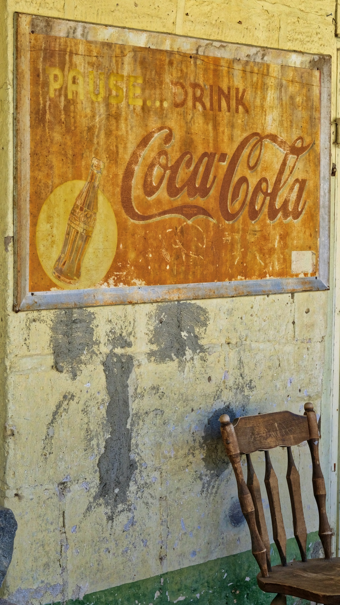 A nice place to lean a chair and pop open an ice cold Nehi on a hot summer day.
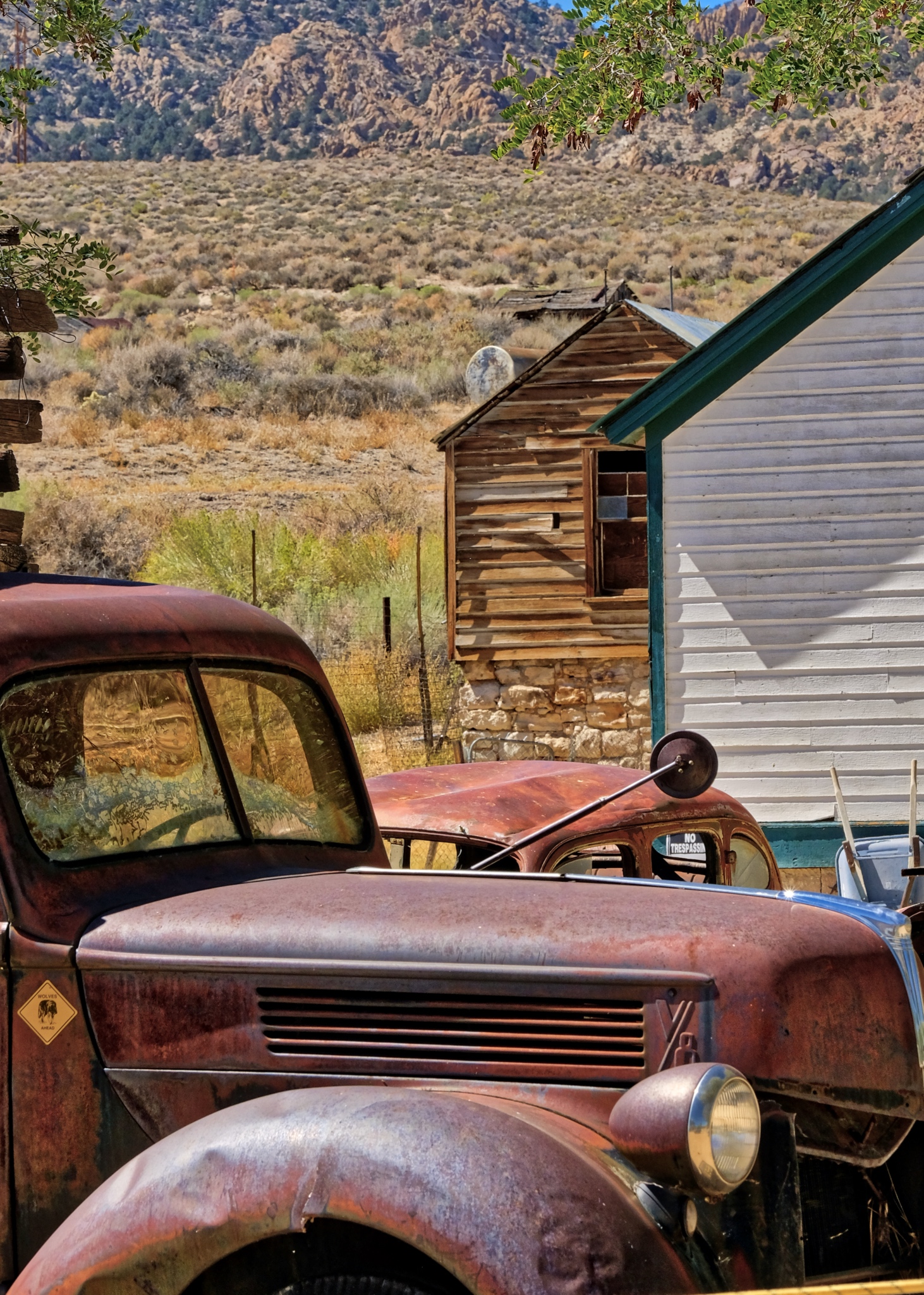
 The old hotel/store still had its old gas pump outside.
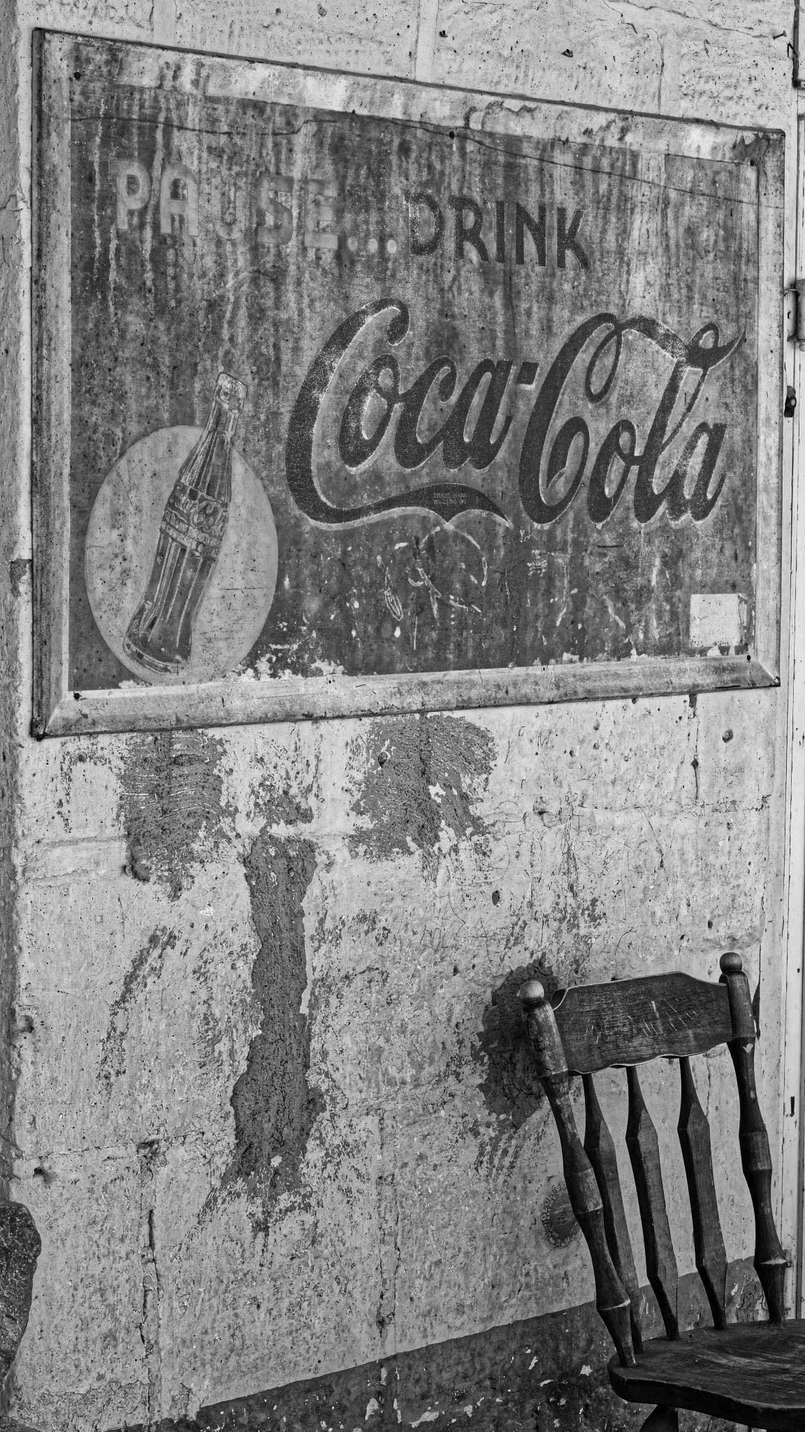
 A lazy place lost in the dust of time.
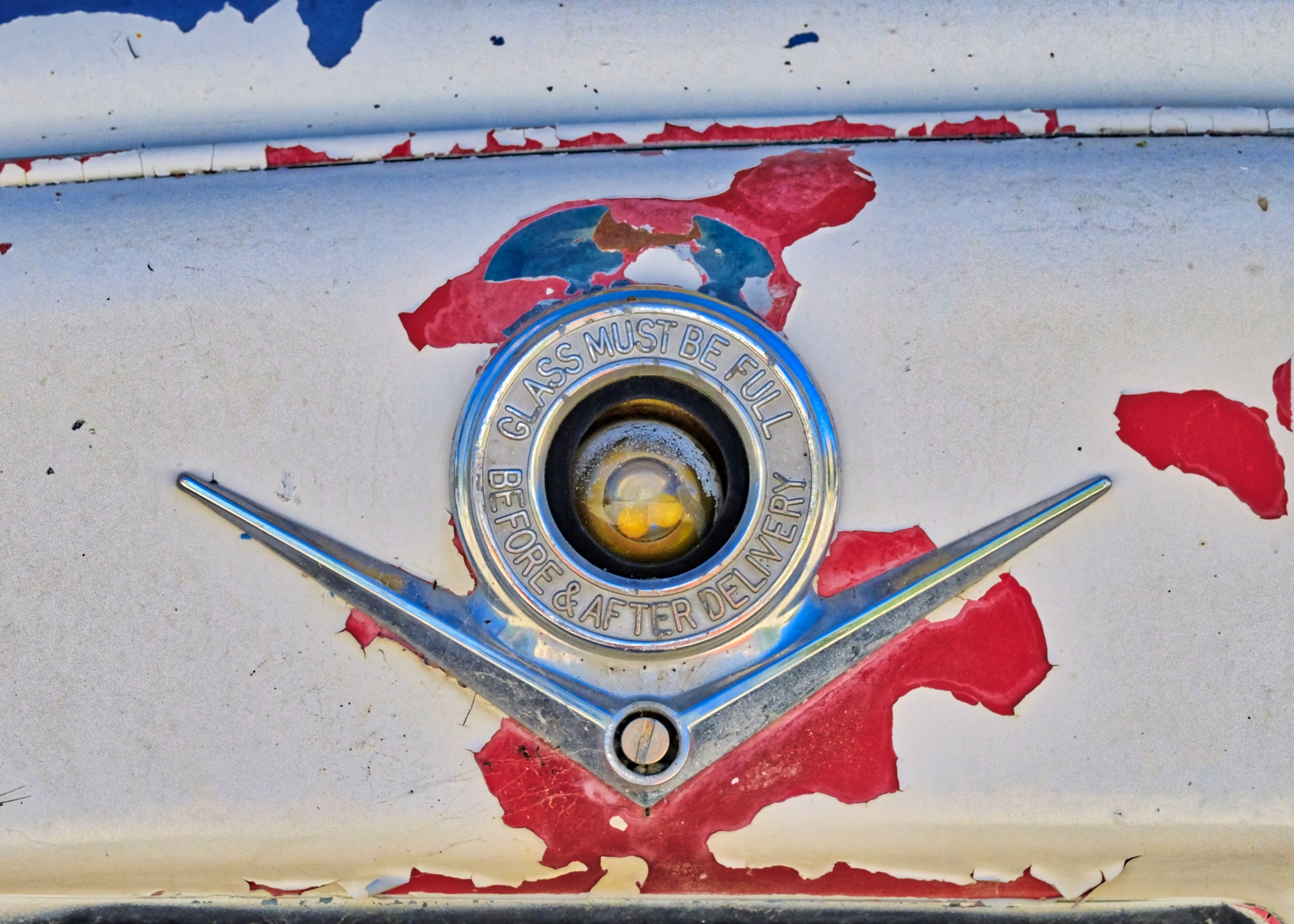
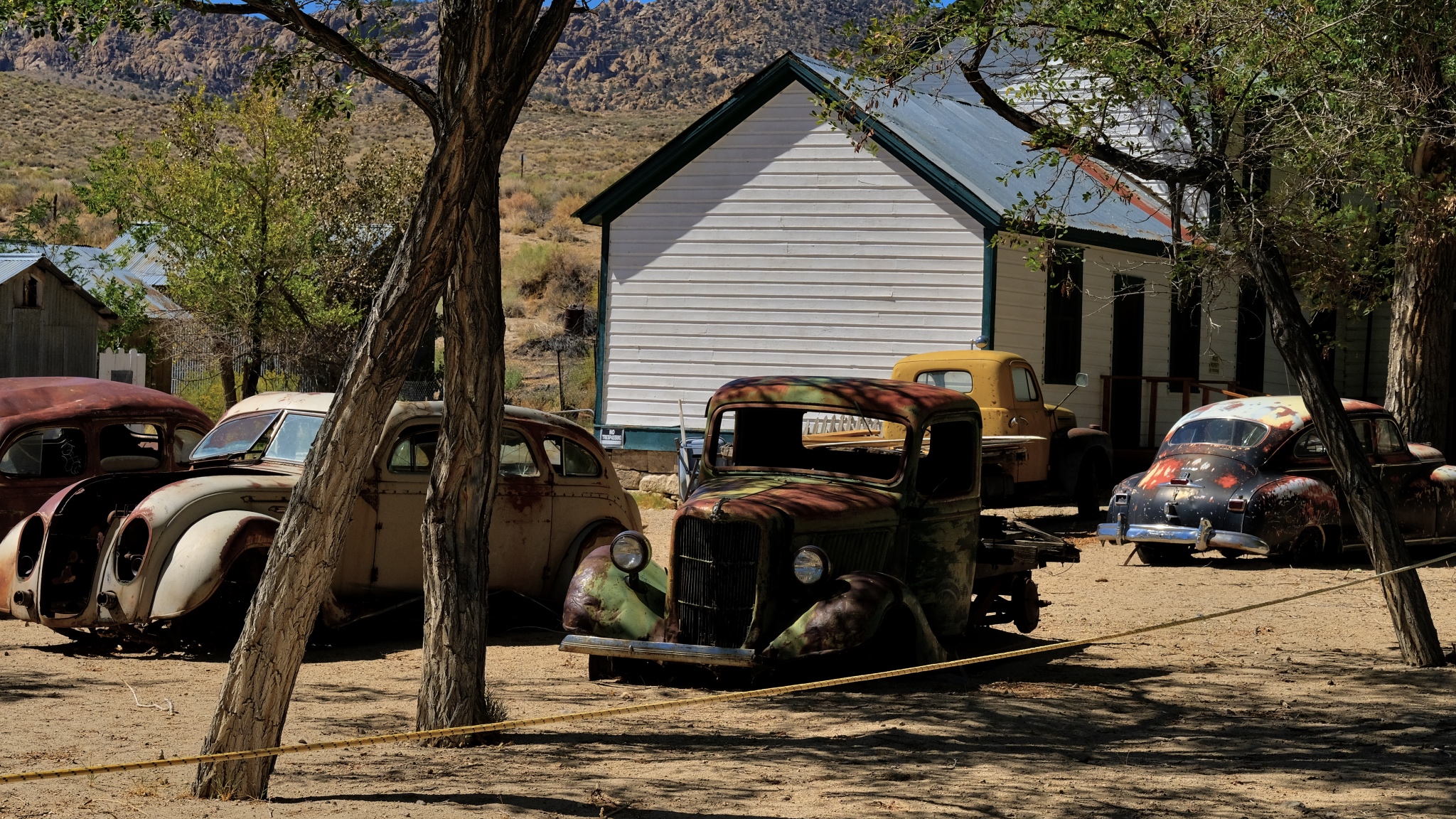
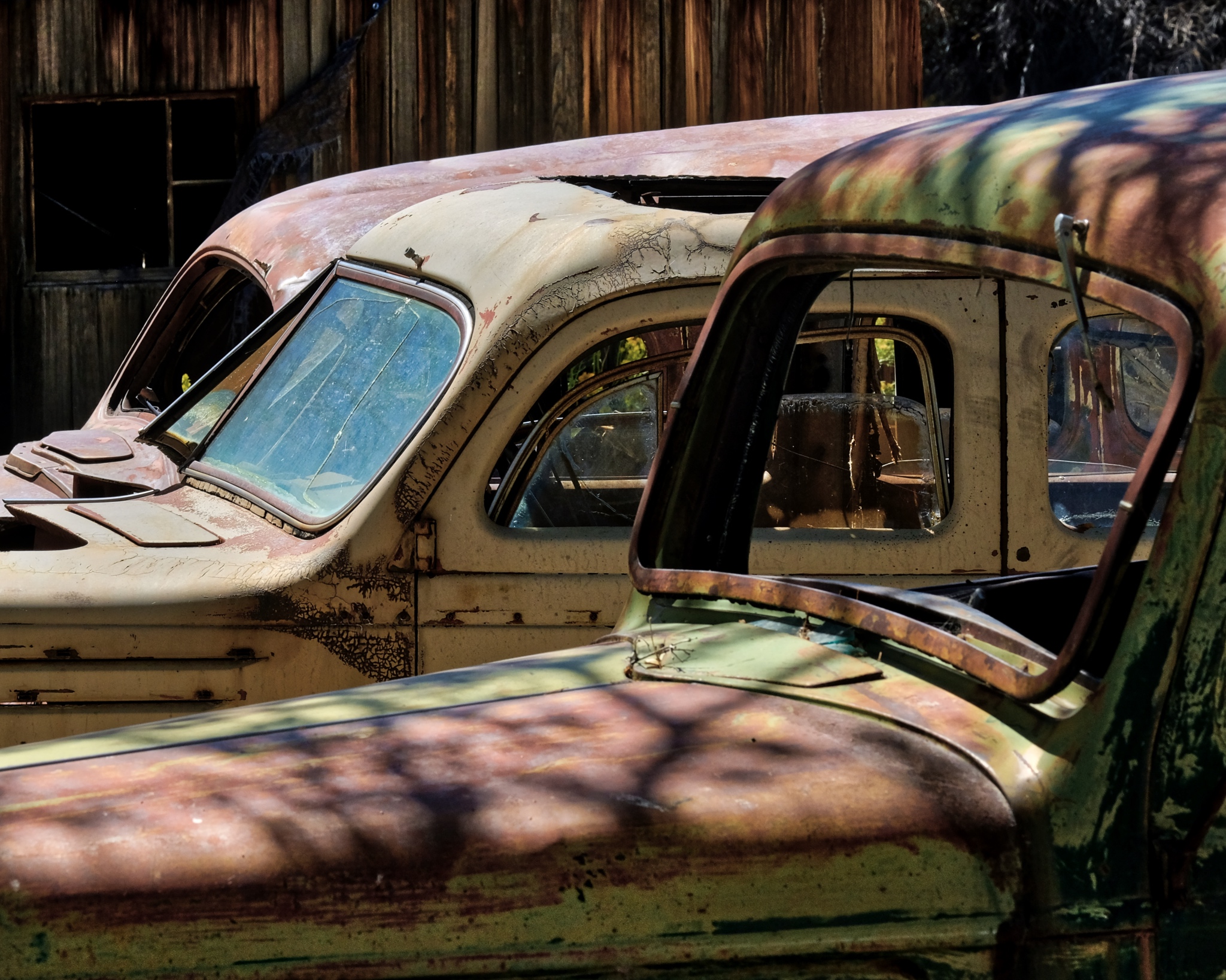
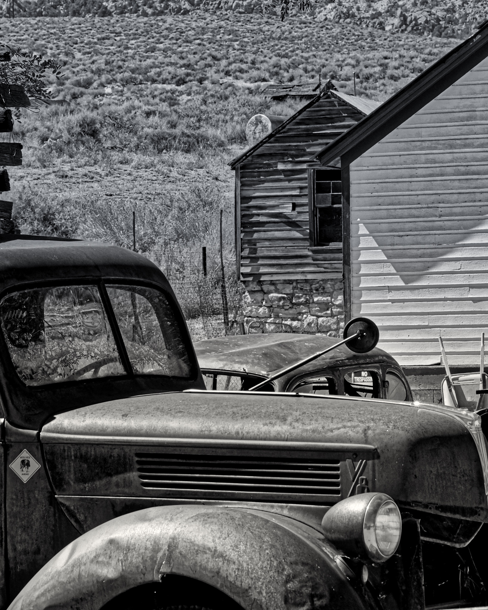
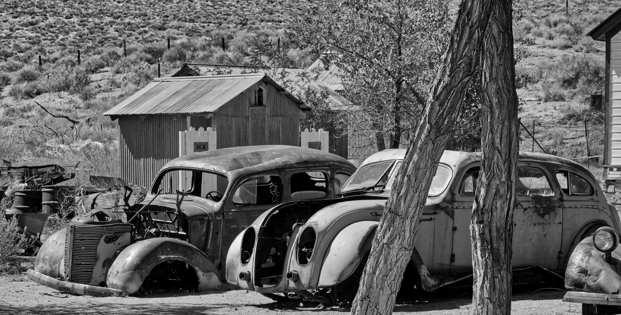
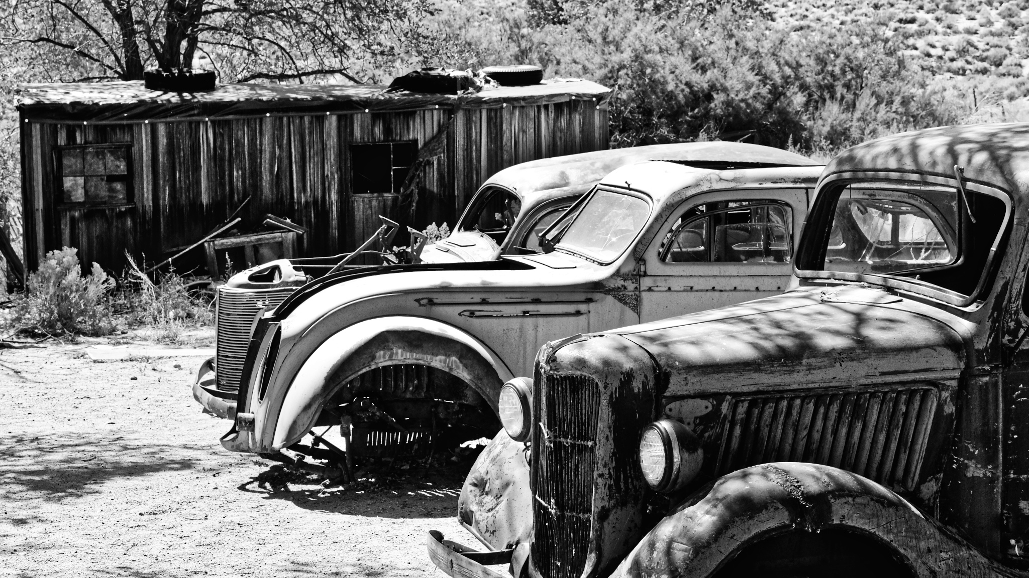
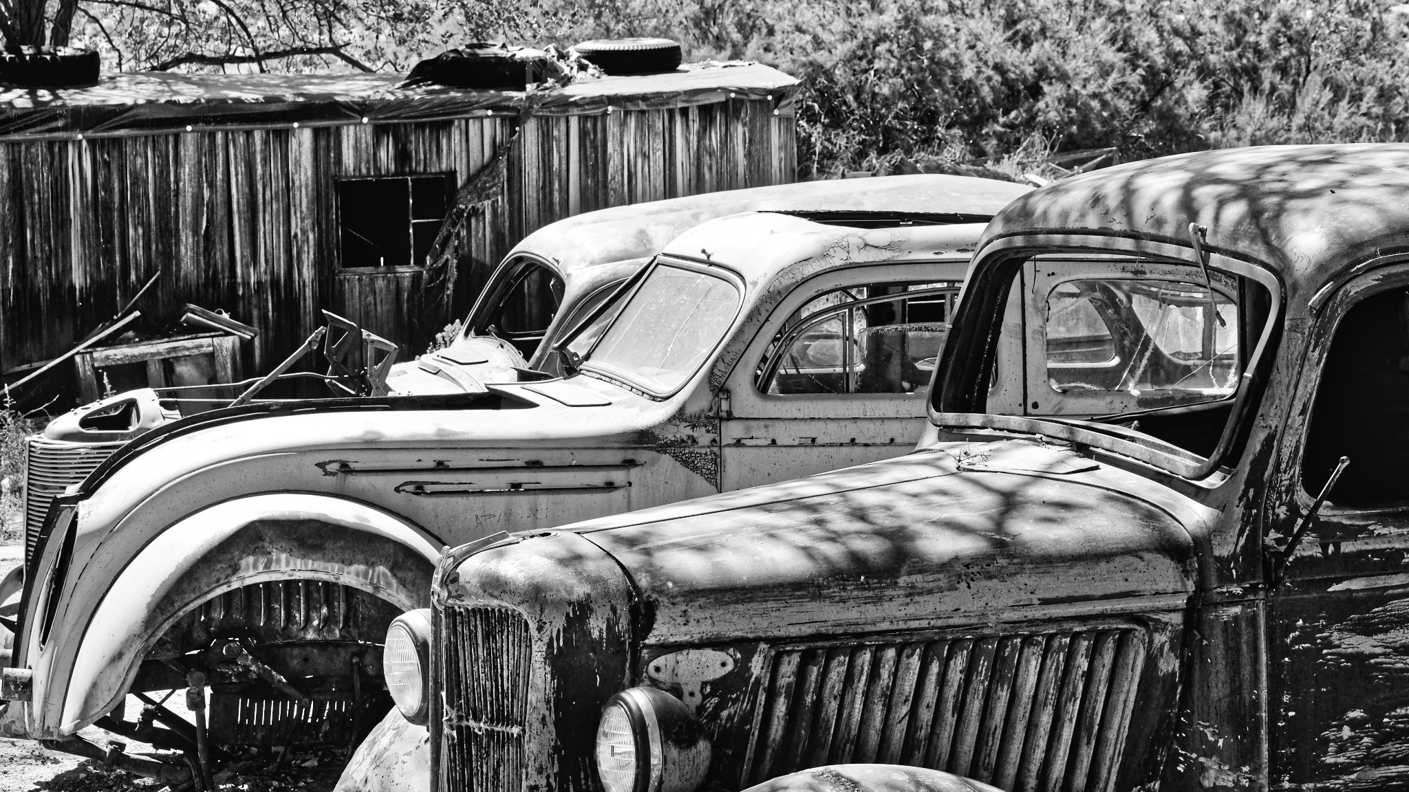
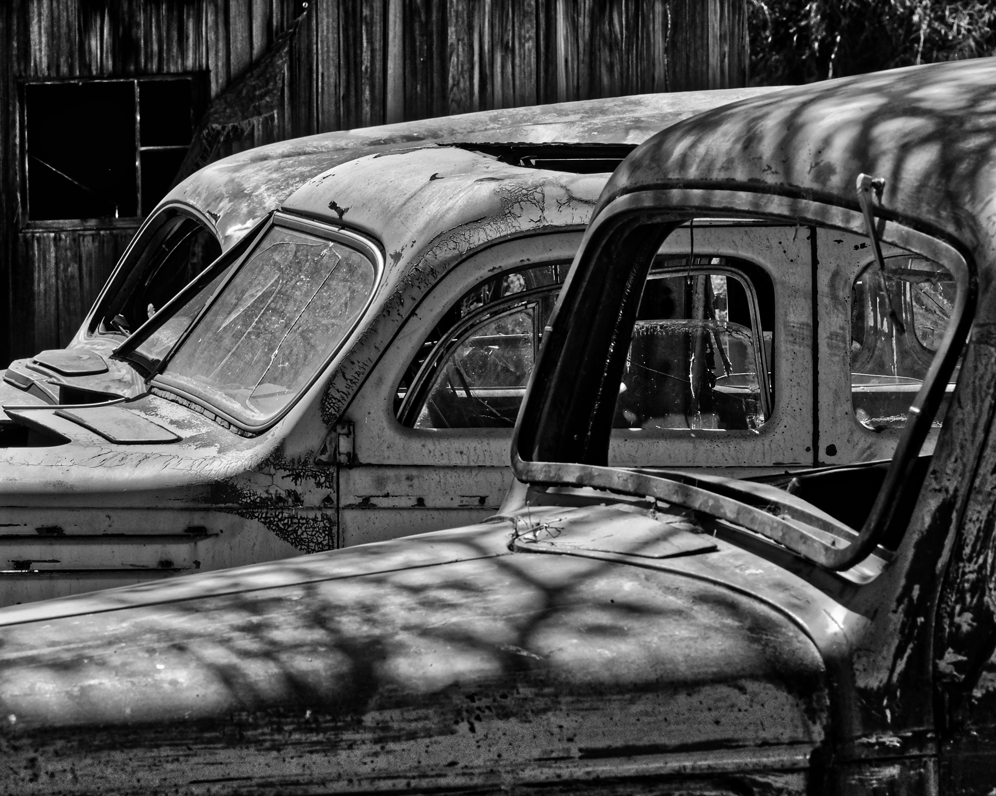
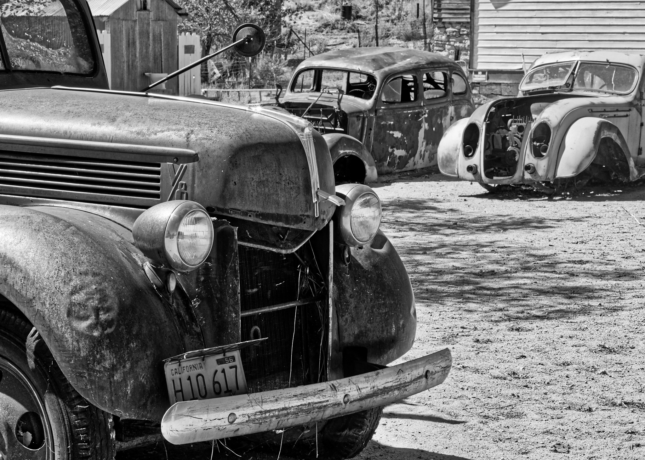
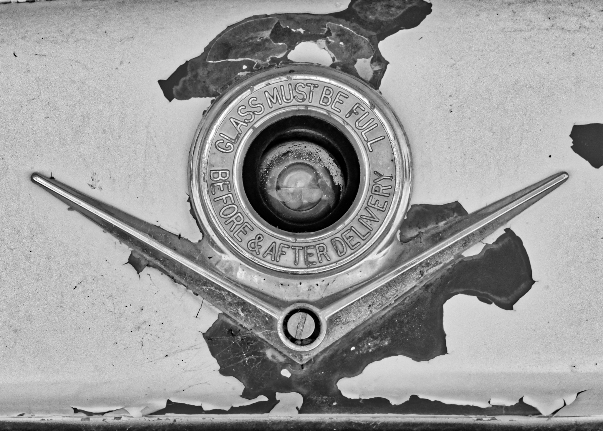
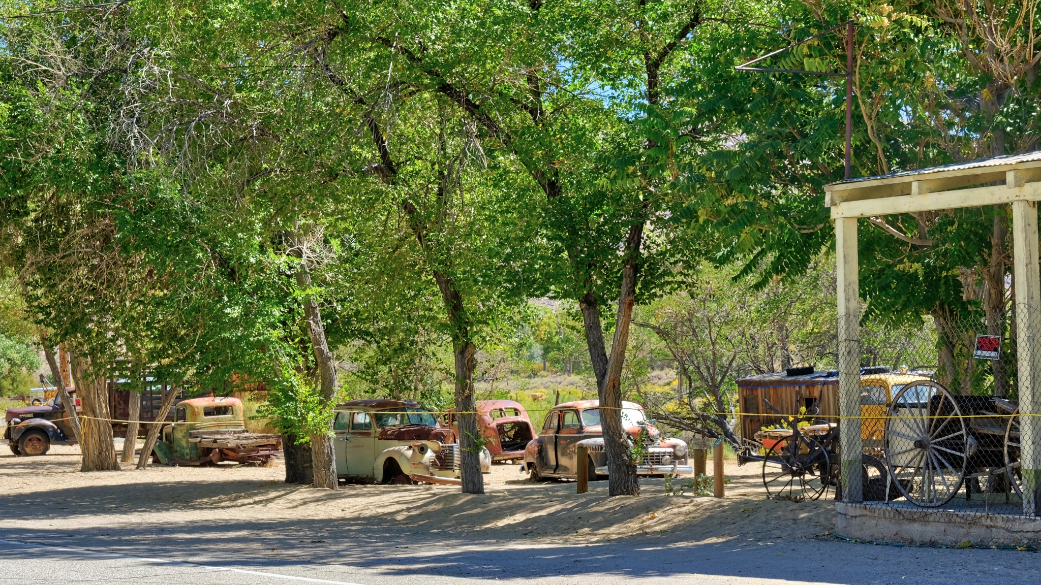 But what caught my eye in the first place as I drove along State Highway 120 were the old abandoned cars just beyond the hotel.
 Although these cars were not necessarily abandoned where they sat (they had obviously been towed to their present locations for photographic effect, one suspects), they made for a wonderful atmosphere of age and neglect . . . my favorite subject!
 When I crisscrossed the USA with my family in the '50s and '60s, these kinds of scenes were common. Now, not so much.
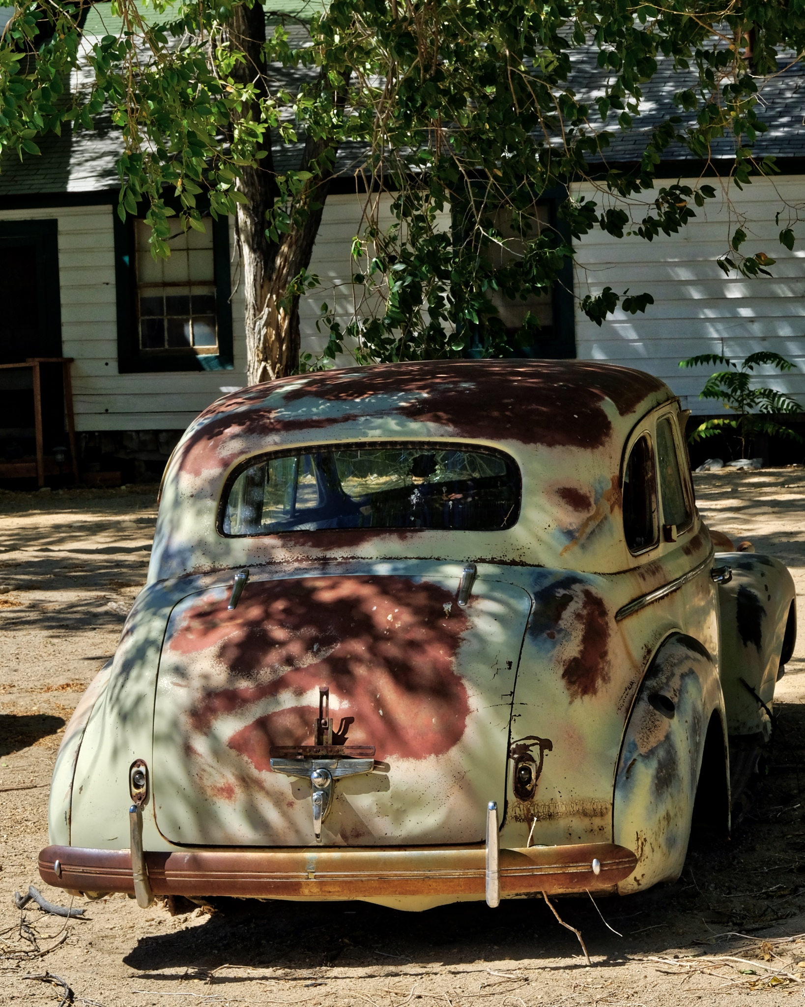
 I spotted a few very interesting cars here, like the 1934-1937 Chrysler Airflow (middle) - the first production car that attempted aerodynamic streamlining to increase economy.
 I had fun being an "art photographer" with all the shapes and patterns around me.
 These scenes lend themselves to black and white photography, so I have added a number of B&W photos to the end of this blog entry.
 There weren't very many buildings in Benton Hot Springs, but this one had nice arched windows.
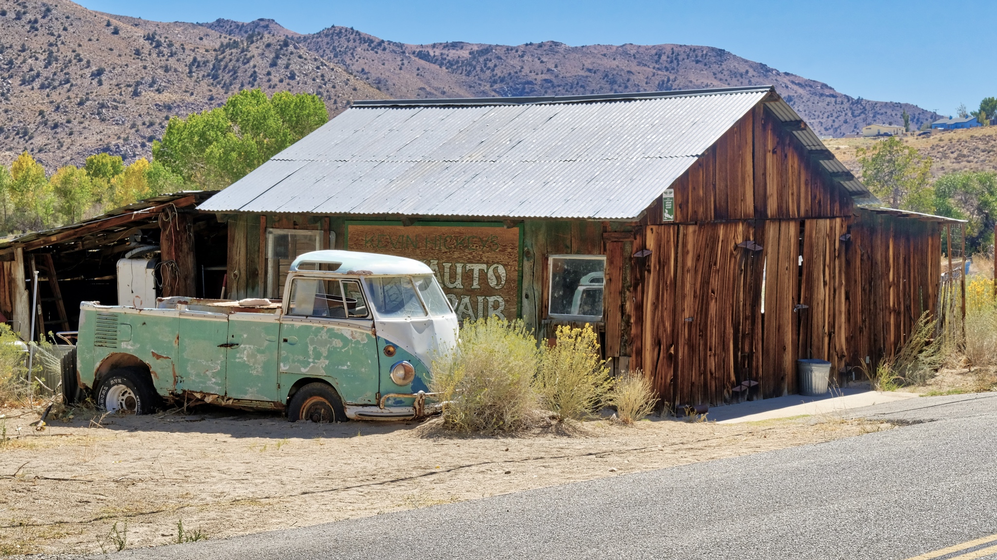 A chopped up old VW bus.
 There was a nice old farmhouse across the road from the hotel.
 Very pretty little place . . . and only 30 miles to Bishop, California . . . the nearest mall.
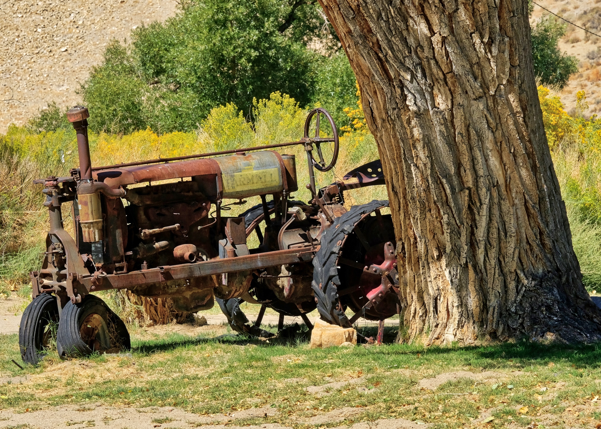
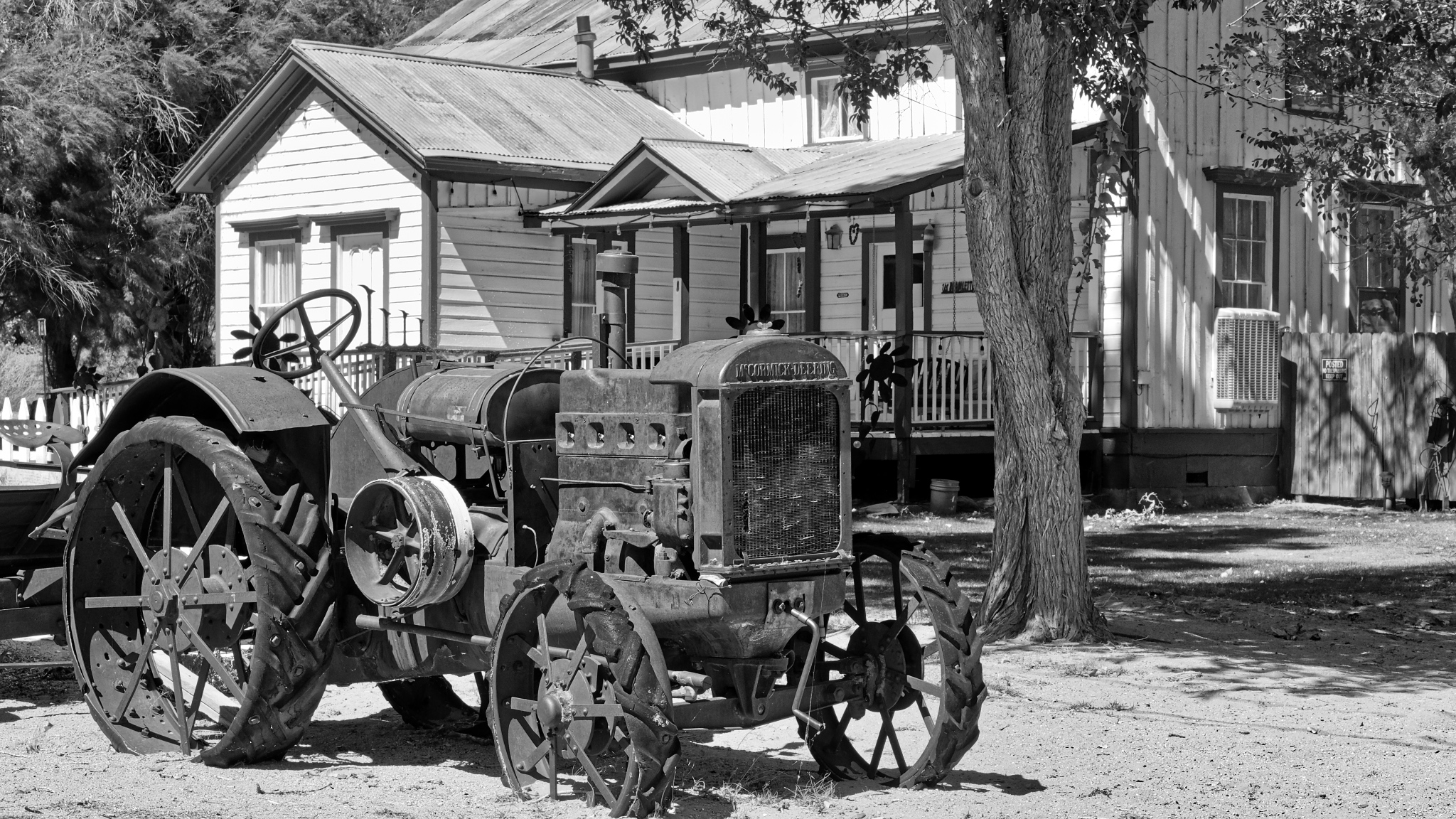
 Although very fascinating to look at, it is a shame to see these old farm implements rusting away in the harsh weather. The average low temperature in January is 16(f) and the average high temperature in July is 92(f).
 An antique tractor.
 Another antique tractor.
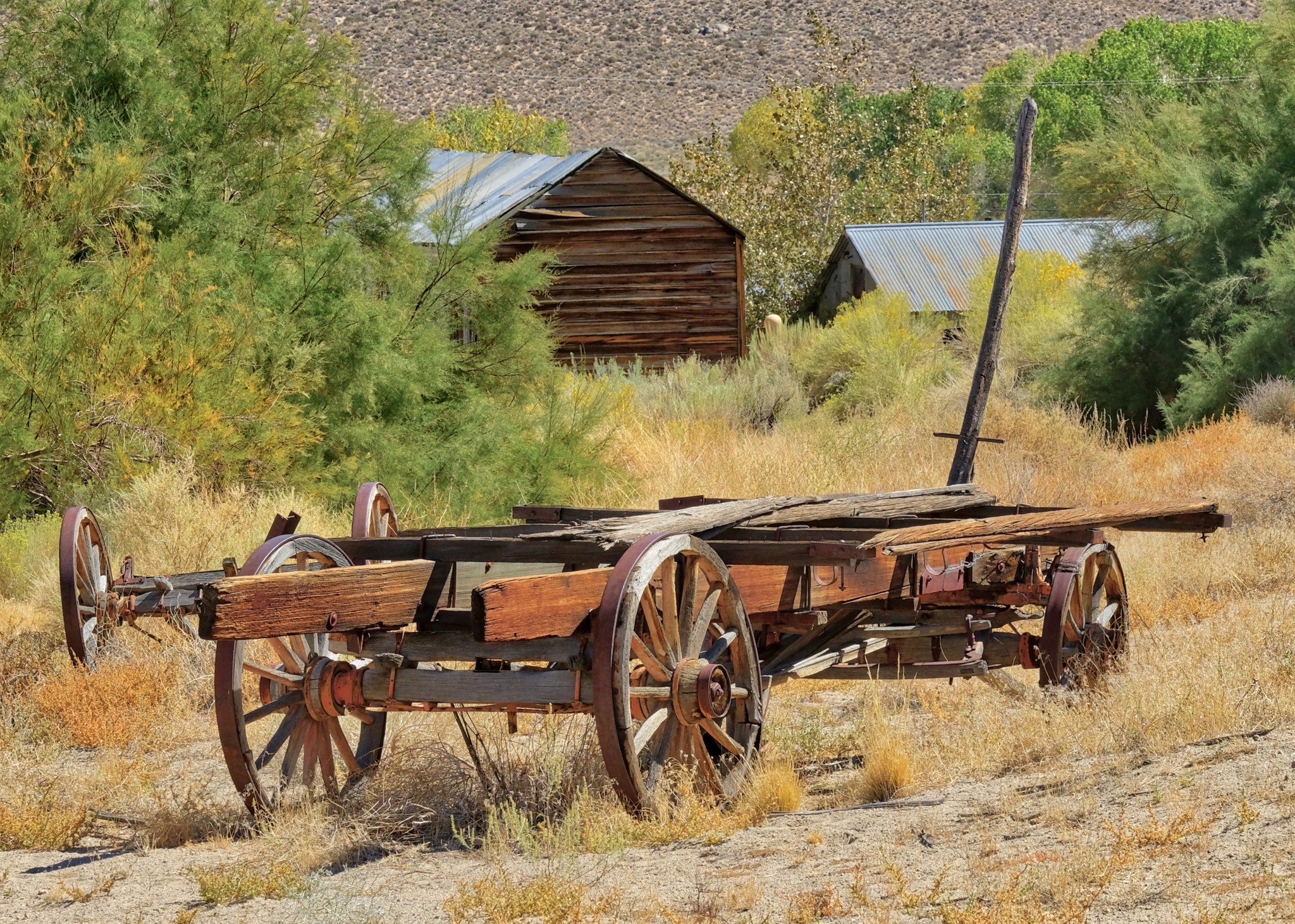 People who live out in the deserted parts seem to like to drag old stuff out of the hills and old mines and display it around their houses as yard decor. In Benton Hot Springs someone had gathered many old wagons and wagon wheels just outside of town. These should be preserved too.
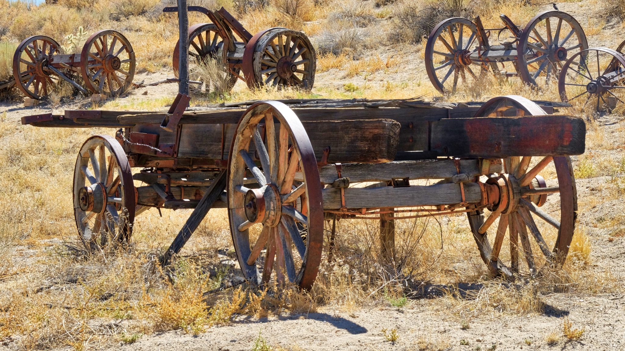 There was a hillside covered with these old wagons from the horse and buggy days.
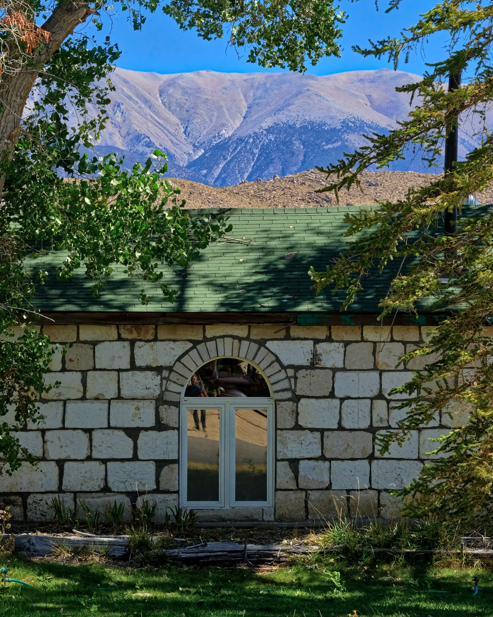
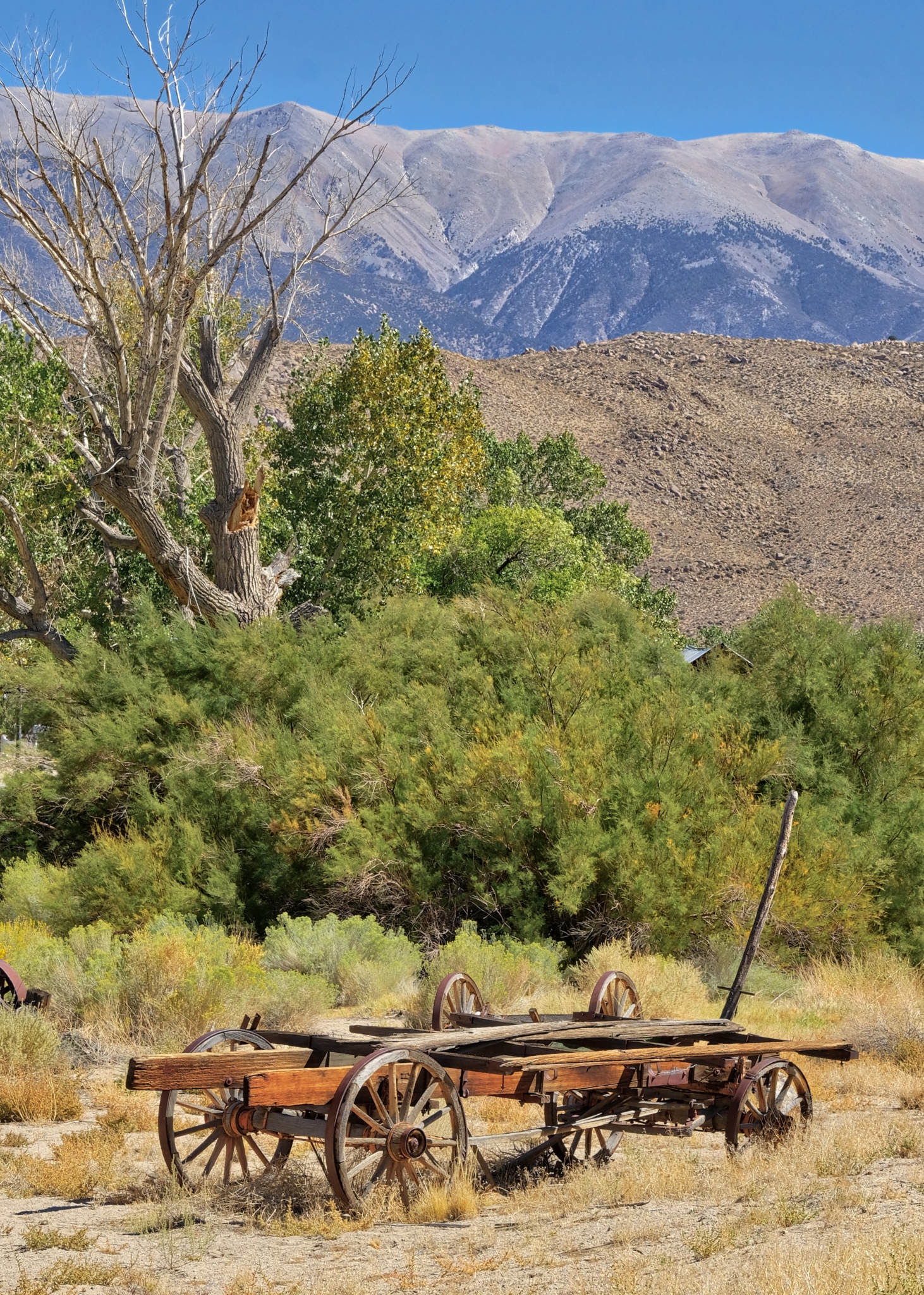 Benton Hot Springs sits in a green valley below Boundary Peak.
 I walked out of town and up a hill to get a view of Benton Hot Springs.
 "If these walls could talk." Indeed.
 As I travel the world I often ask myself, could I live here, in this place? I mean actually live here . . . to actually move to the place and make a life there. I am capable and free enough to live wherever in the world I want. I can say YES, I could live here. I may look into it more closely.
 I left Benton Hot Springs behind and headed into the rocky landscape along California State Highway 120 toward Swall Meadows.
 Dr. Jeff Harper
BONUS: Black & white photos of Benton Hot Springs, California!

Road Trip USA: The New Jersey Shore
 I have good friends who are semi-retired and live year round in Ocean City, New Jersey. I spent a wonderful five days visiting them.
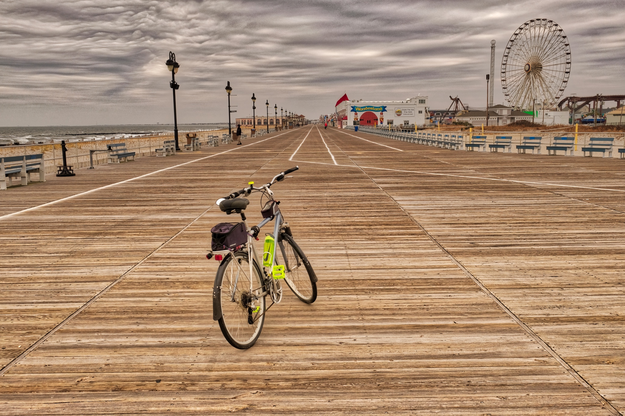 I brought my bicycle with me so that I could ride the many miles of Ocean City boardwalk.
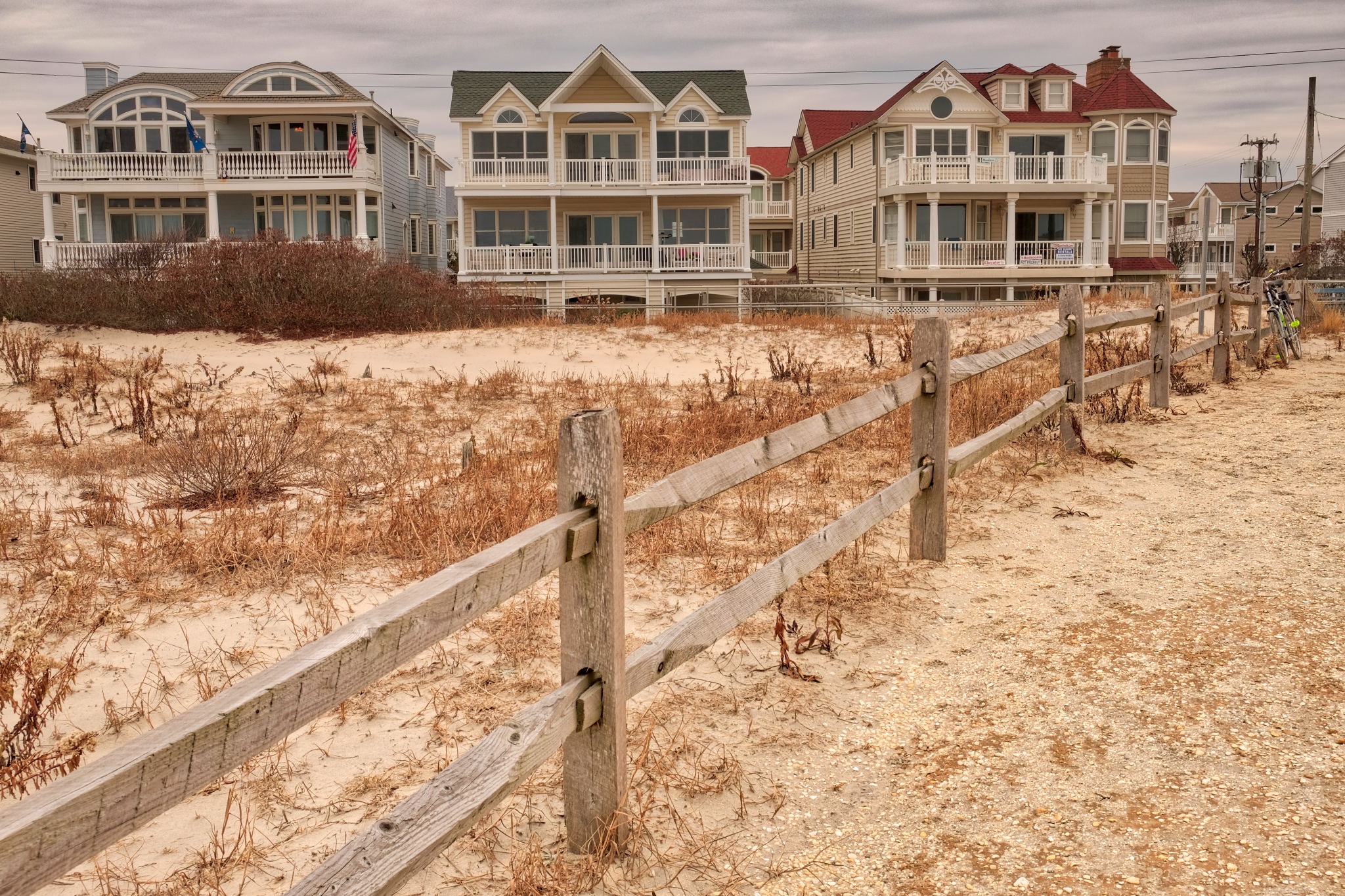 Although Ocean City is a very old beach resort (for mostly rich folks from Philadelphia), many of the old beach houses were torn down and replaced with these fanciful 'kit' beach houses. About 80% of these are vacant during the off-season.
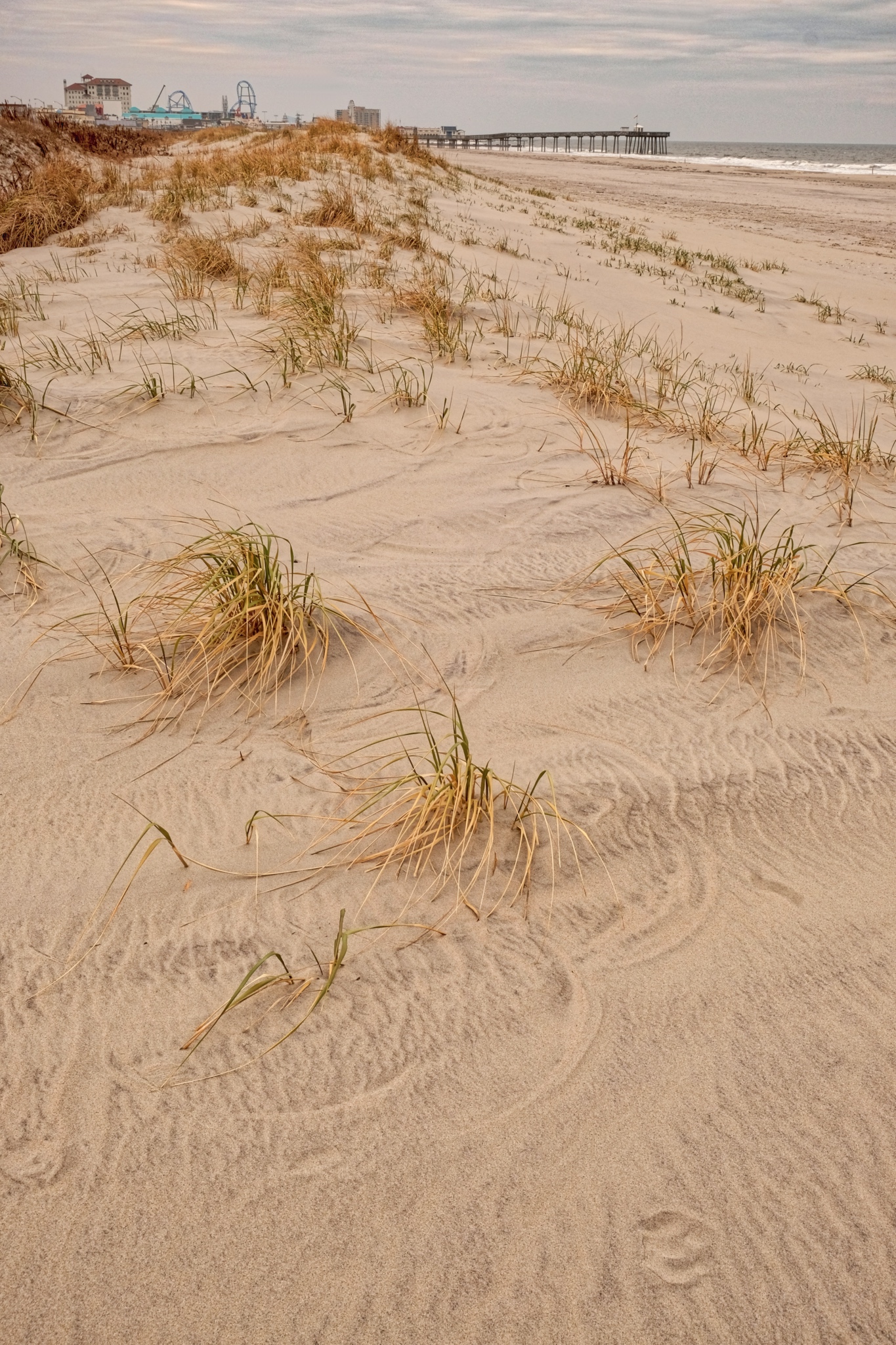 Ocean City has a nice beach. There used to be a major pier, but it was washed away during Hurricane Sandy . . . which also inundated Ocean City streets. The pier in the background is the private pier of the Ocean City Fishing Club.
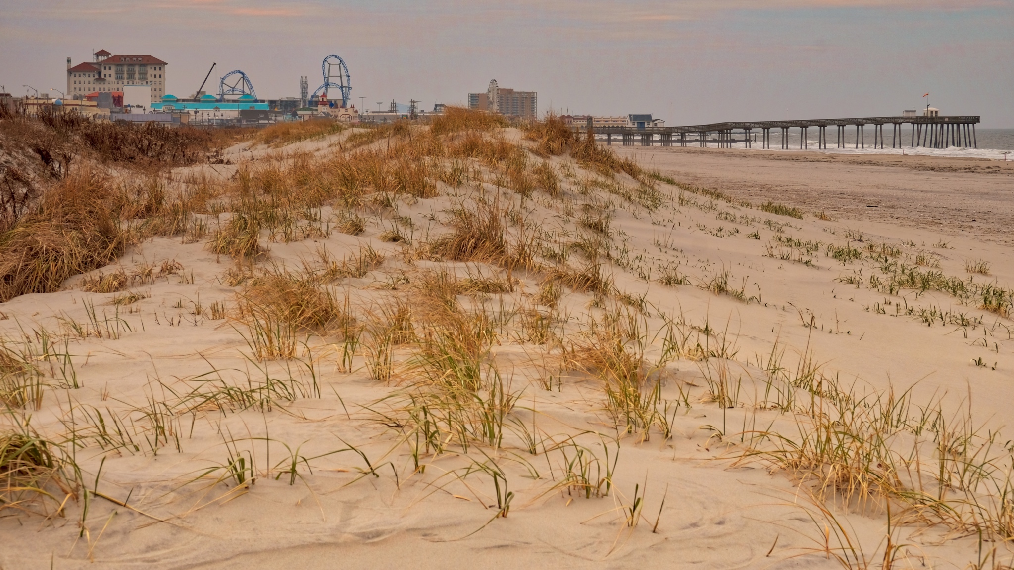 Ocean City has a few attractions, including a very fine boardwalk. The town is 'dry' - alcohol is not sold in stores, so it has gained a reputation as a family beach.
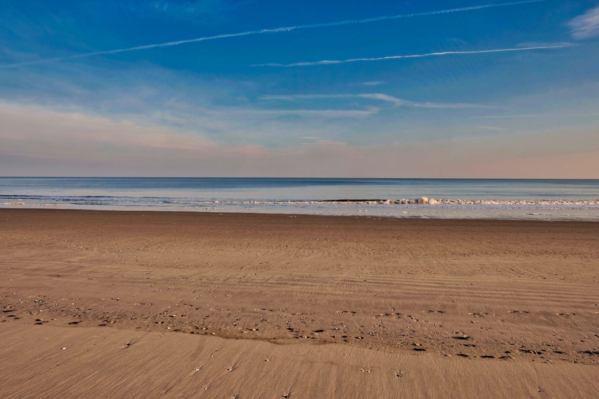
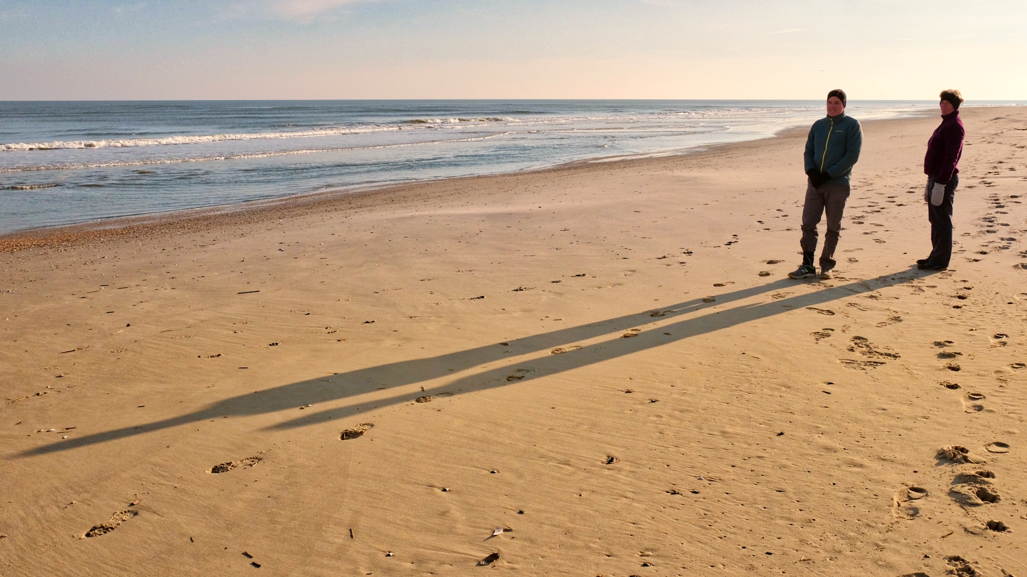 We had the beach to ourselves every day.
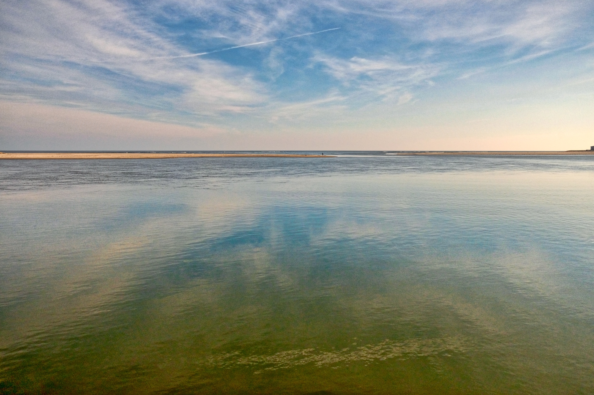 I had the good luck to be here between storms . . . and wind. Quite mild and calm days for December. We took a nice bike ride to a nearby island and saw this inlet along the way.
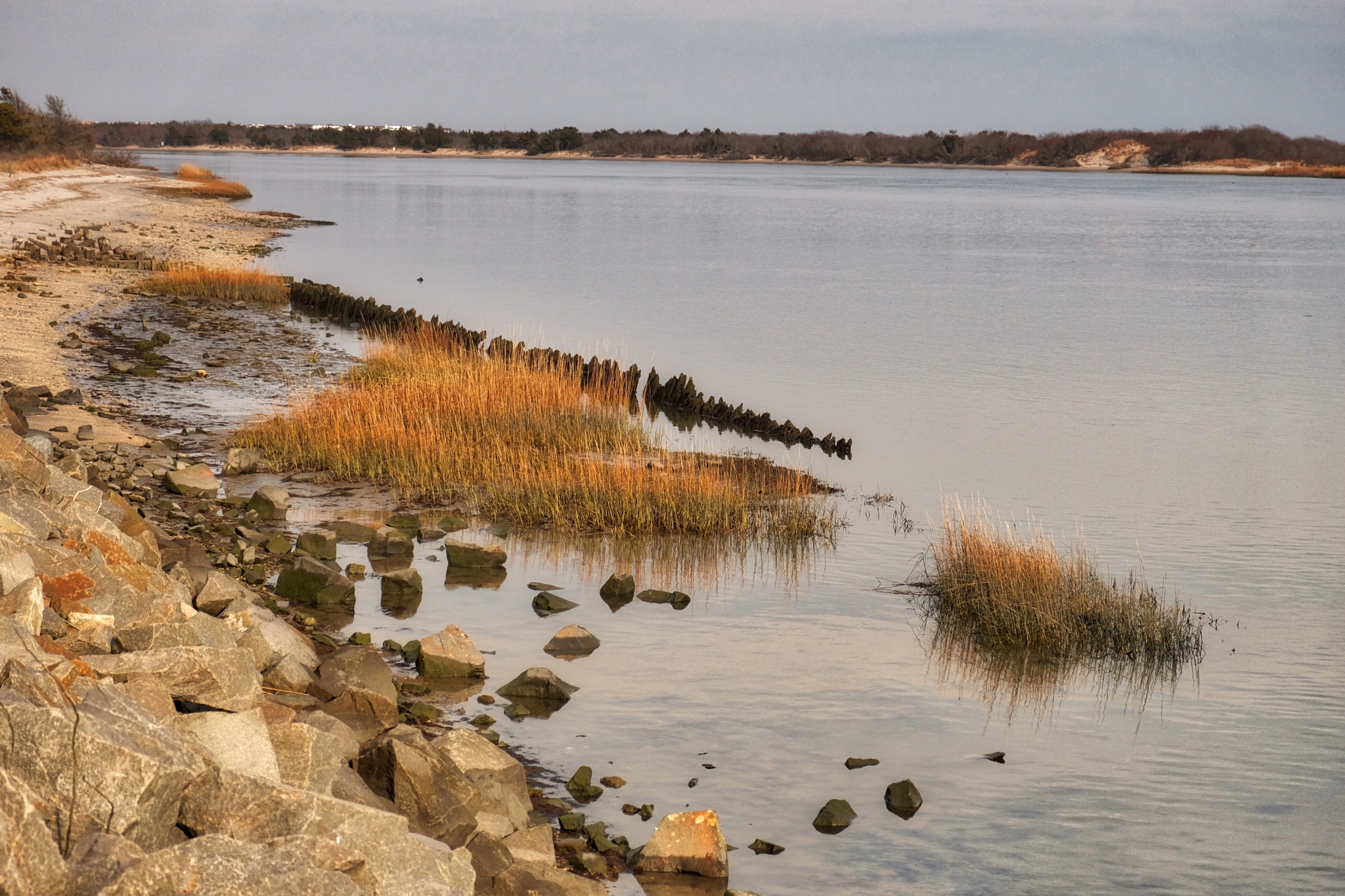 Much of the area to the west of Ocean City is designated as a wildlife reserve.
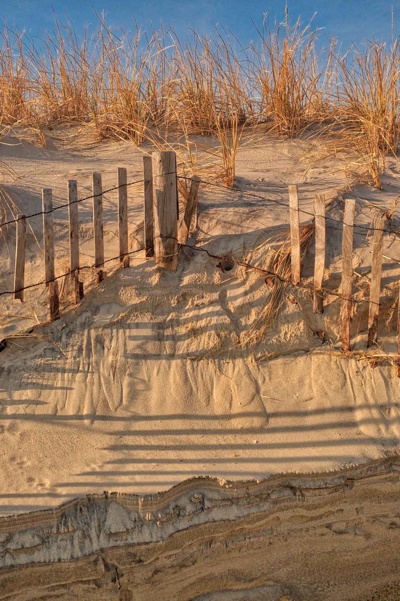 Beach erosion is still an issue. Successive hurricanes and 'noreasters' severely depleted the sands. The local government dredged the seabed and sprayed sand back to make a new beach. It will have to find it's new 'natural' levels.
 Wonderful patterns, shapes, and shadows in the beach dunes.
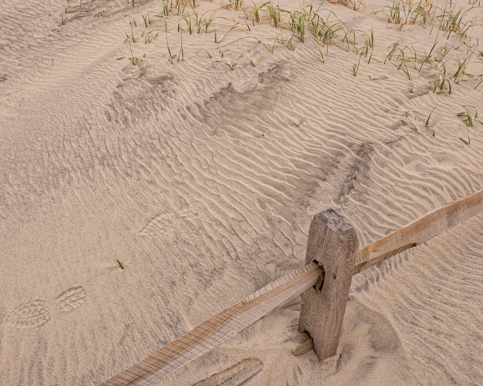 Wind patterns in the sand.
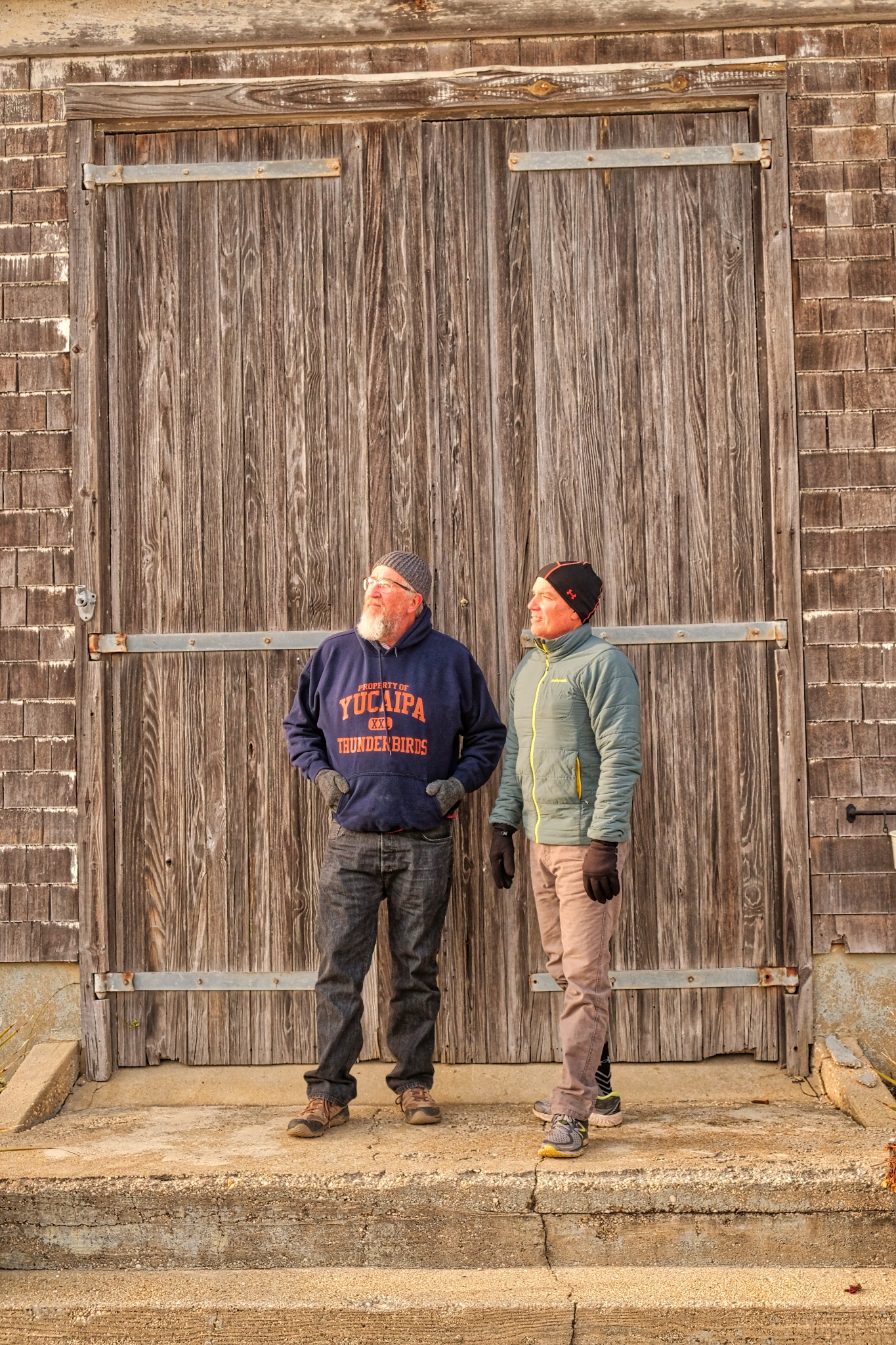 With my good buddy, Bud.
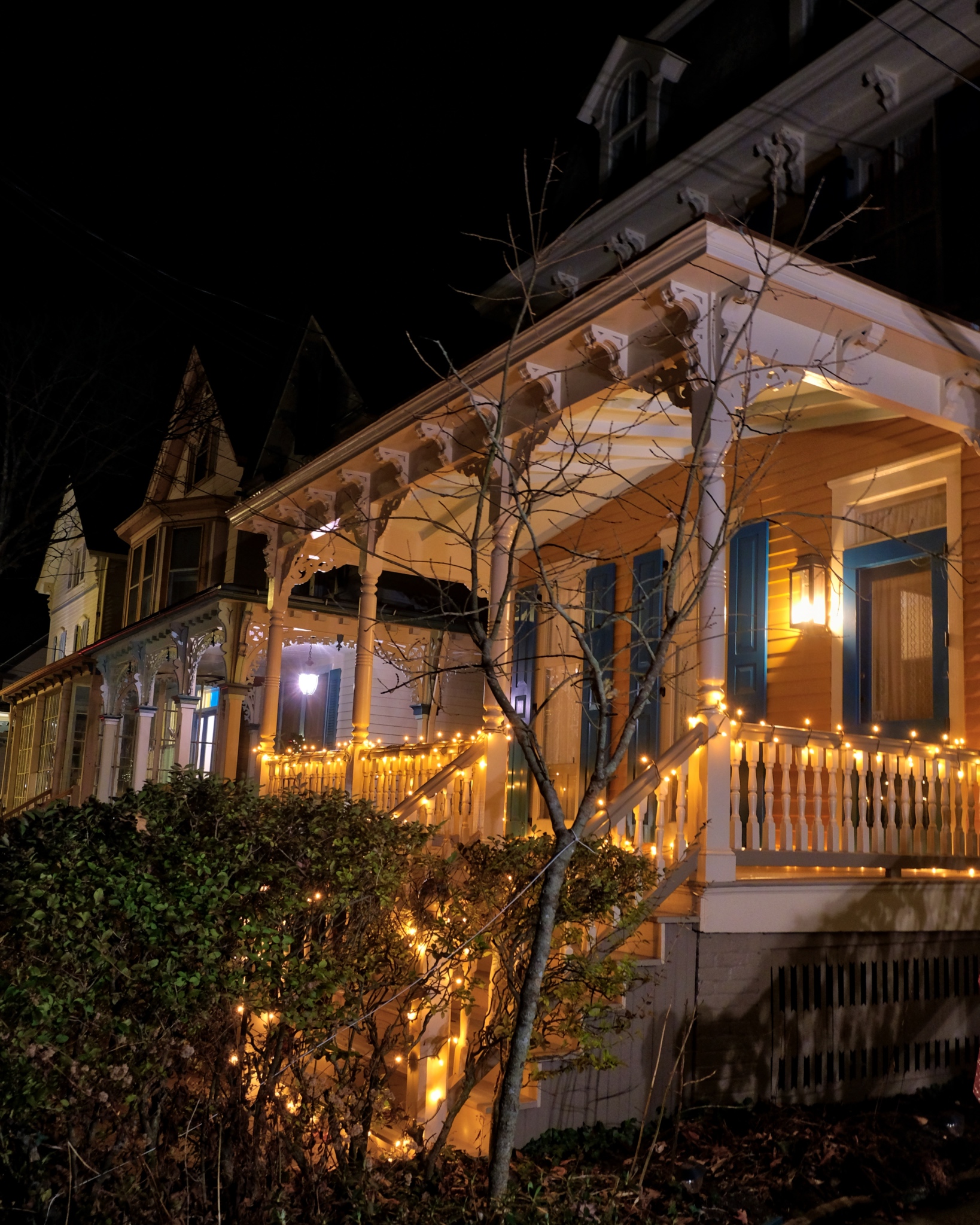
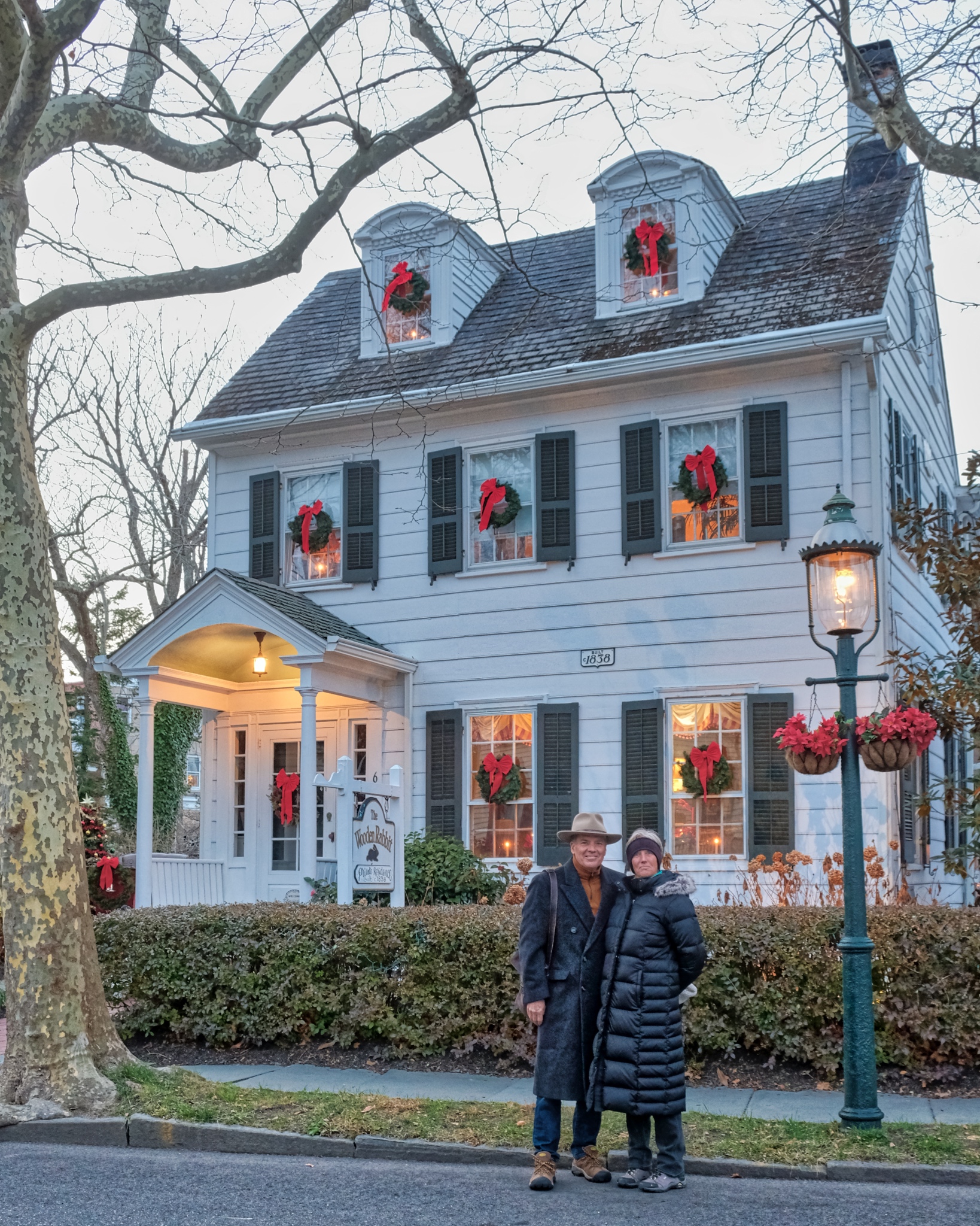 My friends and I drove 20 minutes south to the lovely colonial seaside village of Cape May in the late afternoon to see the decorated old Victorian and Colonial houses.
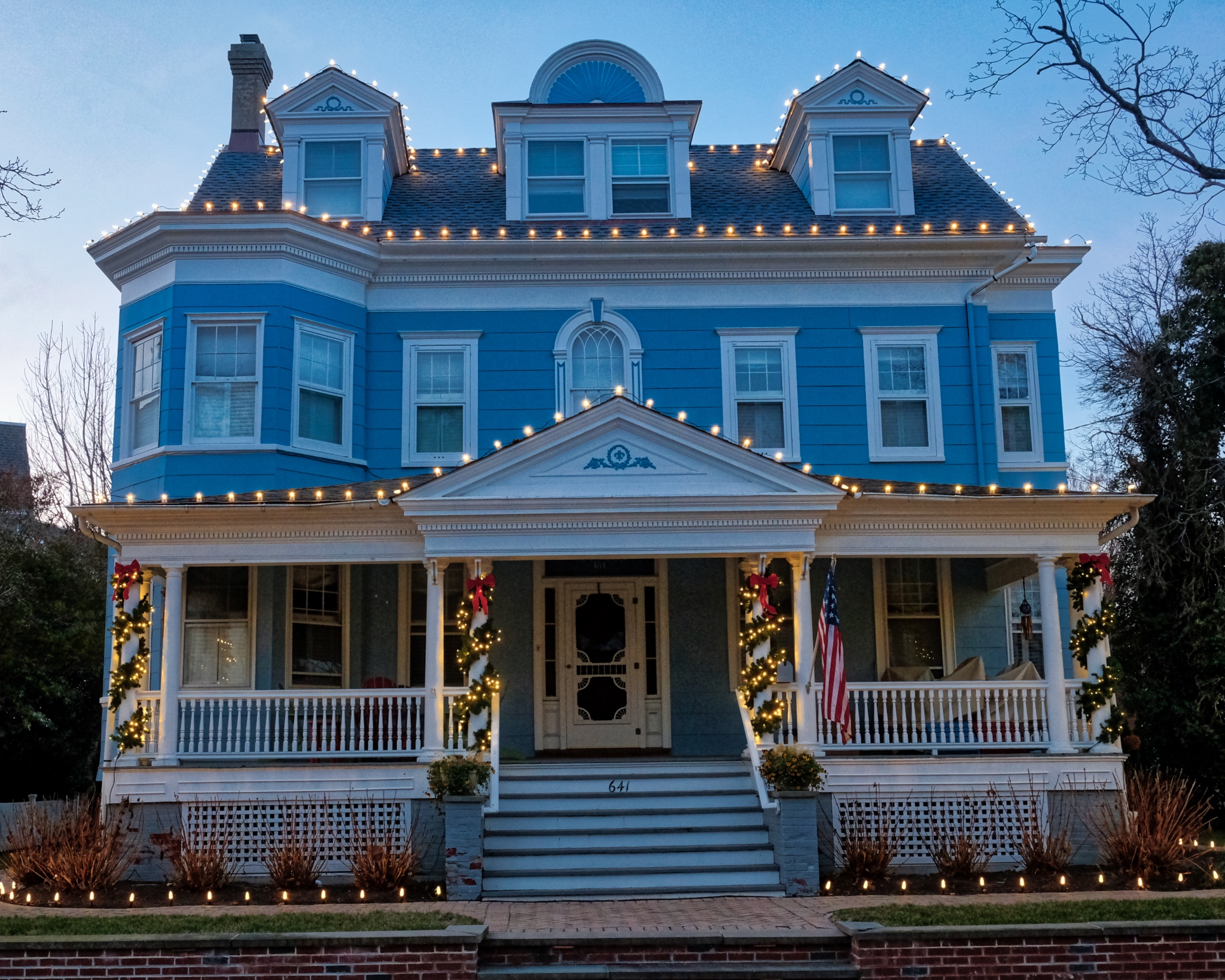 The sun had just gone down . . . and the houses were beginning to take on their night identity.
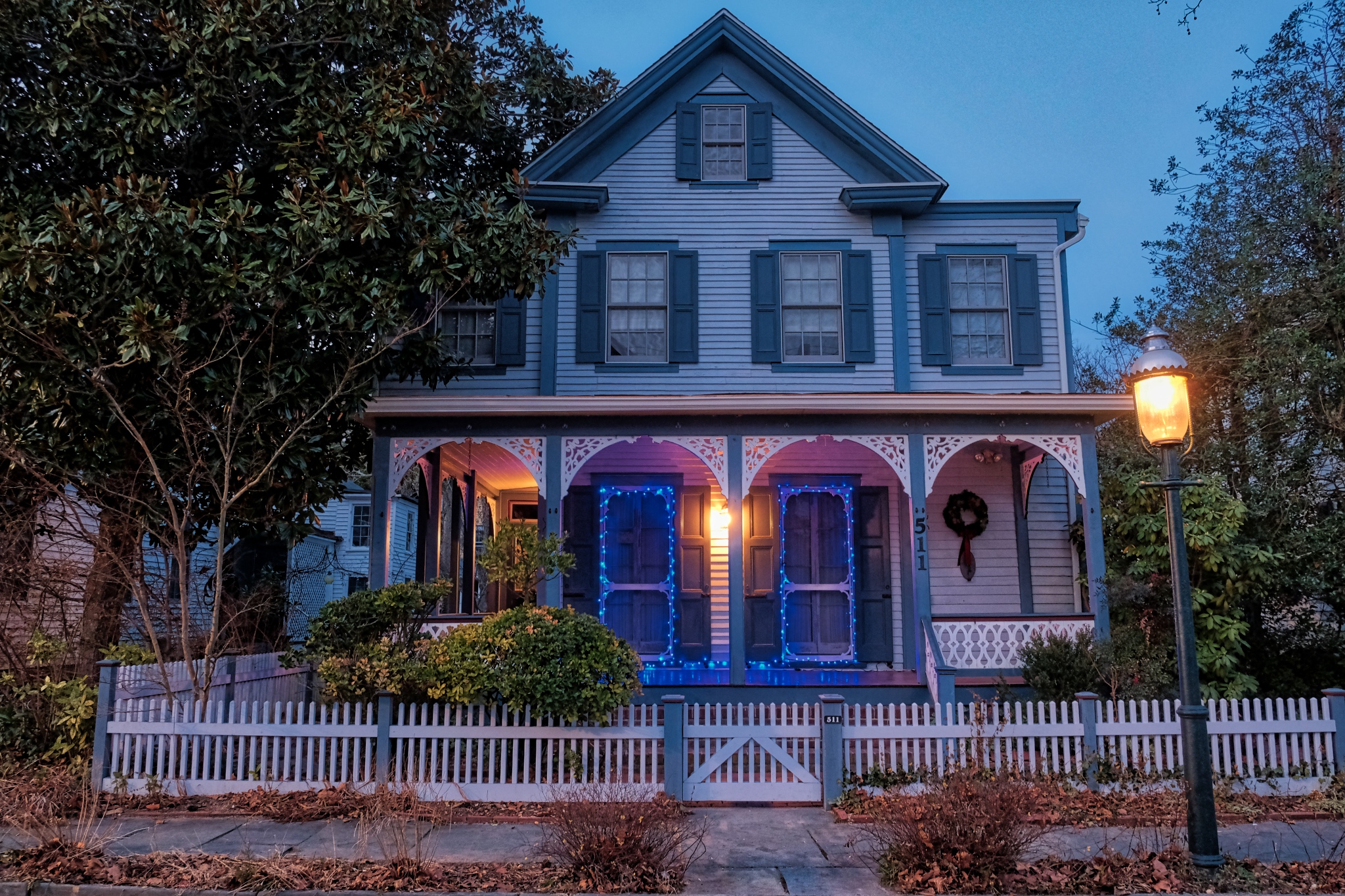 There are so many cute houses in Cape May. The Cape May Historic District has over 600 listed homes. Fantastic!
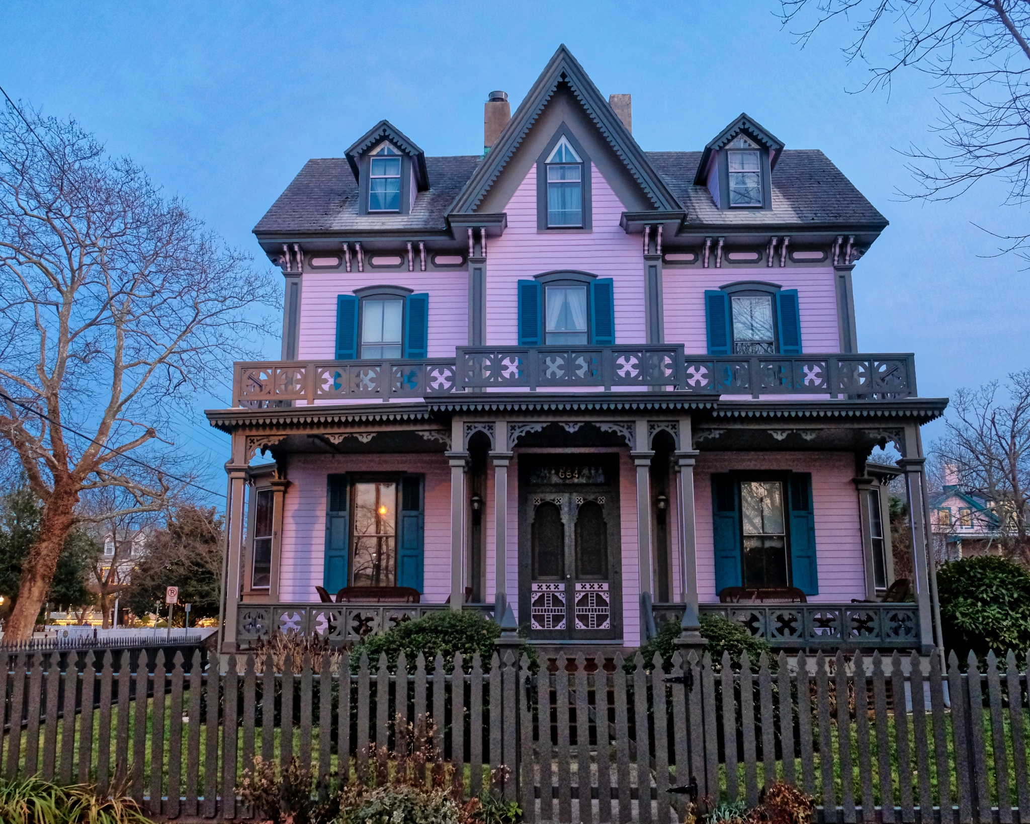 Cape May was first established as a village in 1632, on of the earliest settlements along the Atlantic coast. Most of the homes in the Historic District are of the Late Victorian Era Style.
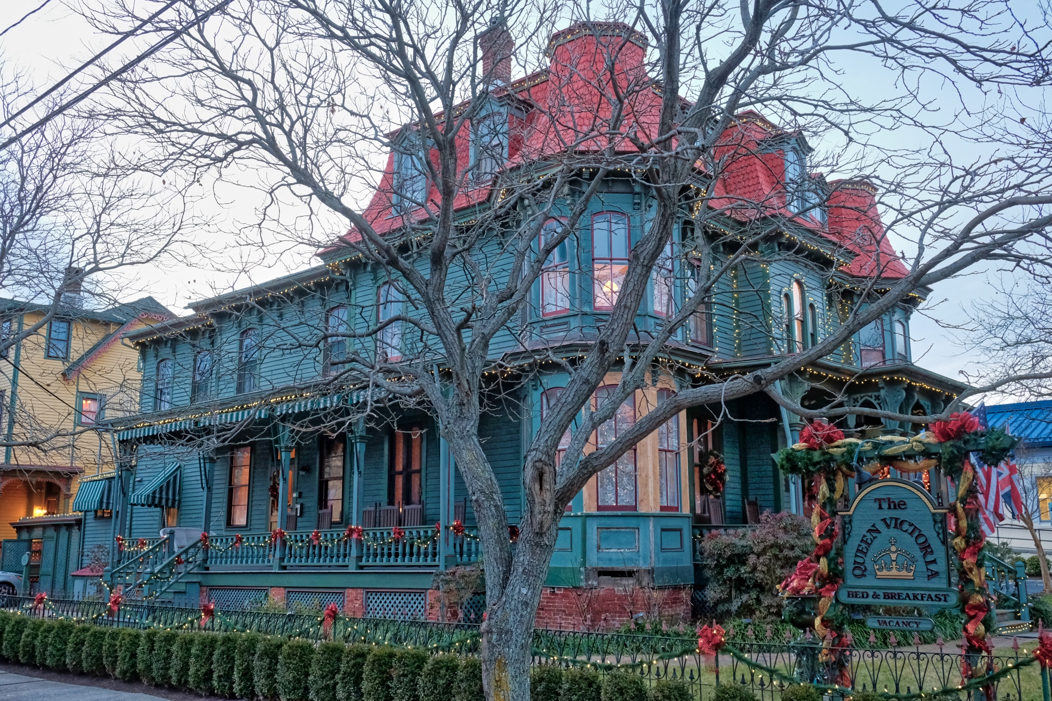 The beautiful Victoria B&B . . . .
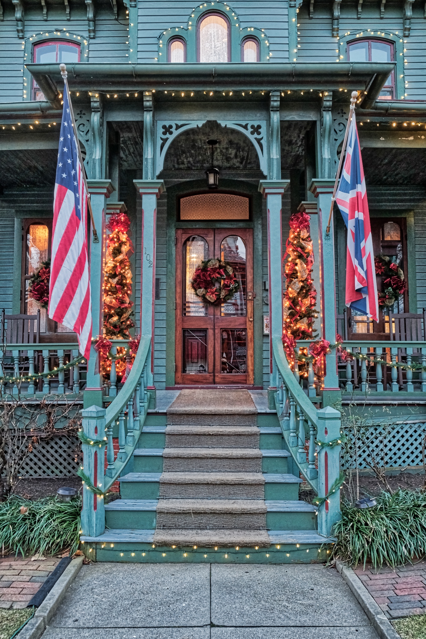 The Queen Victoria B&B front door.
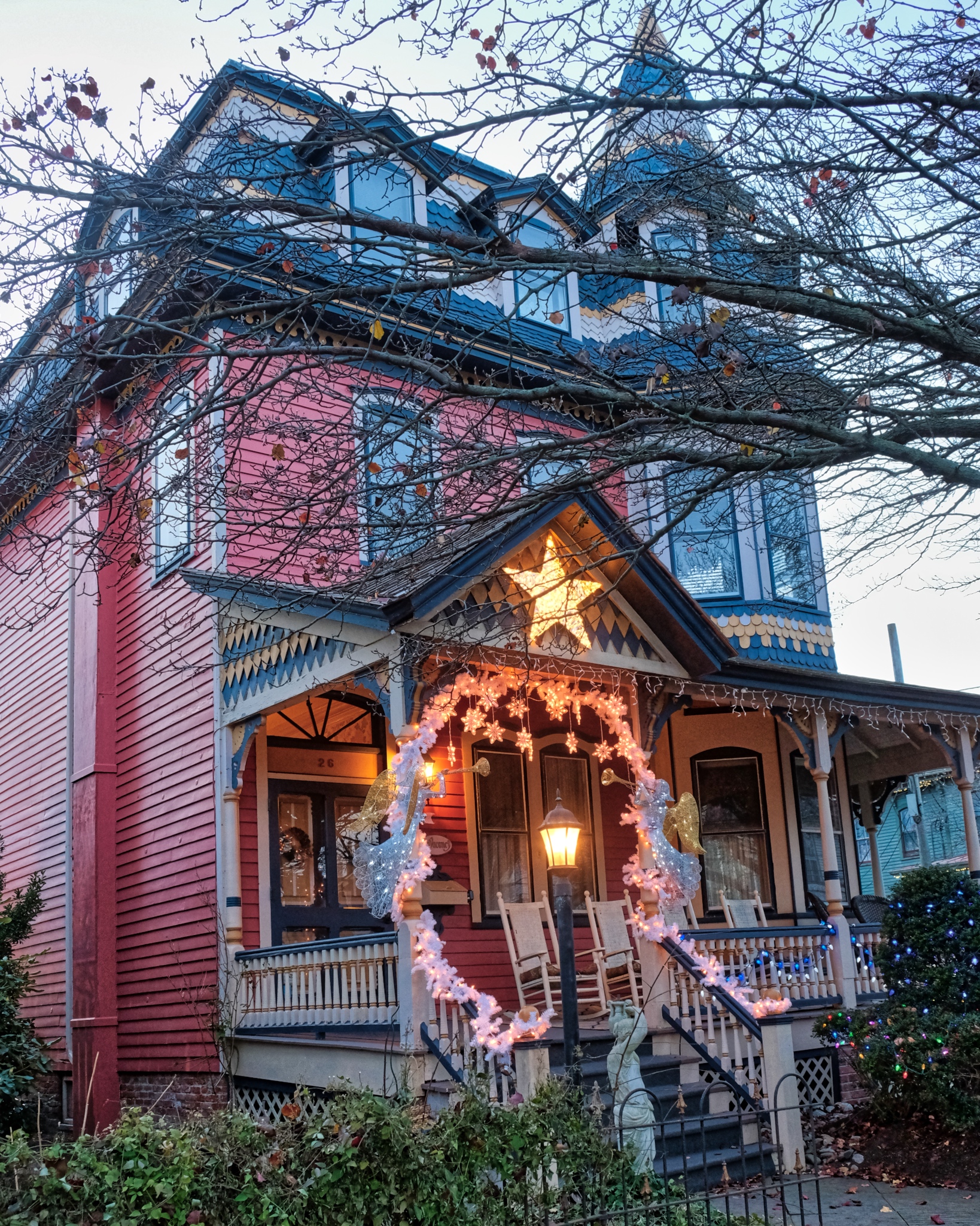 Lovely turreted Victorian mansion.
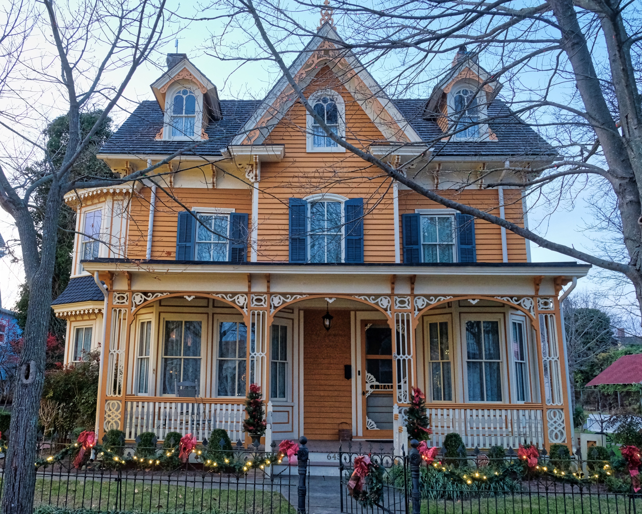 The pastel colors of the perfectly restored (maintained?) Victorians were so sweet.
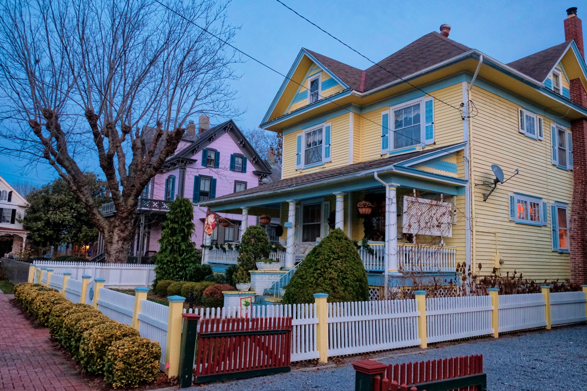 As the darkness continued to fall, the old houses began to light up in their Christmas charm.
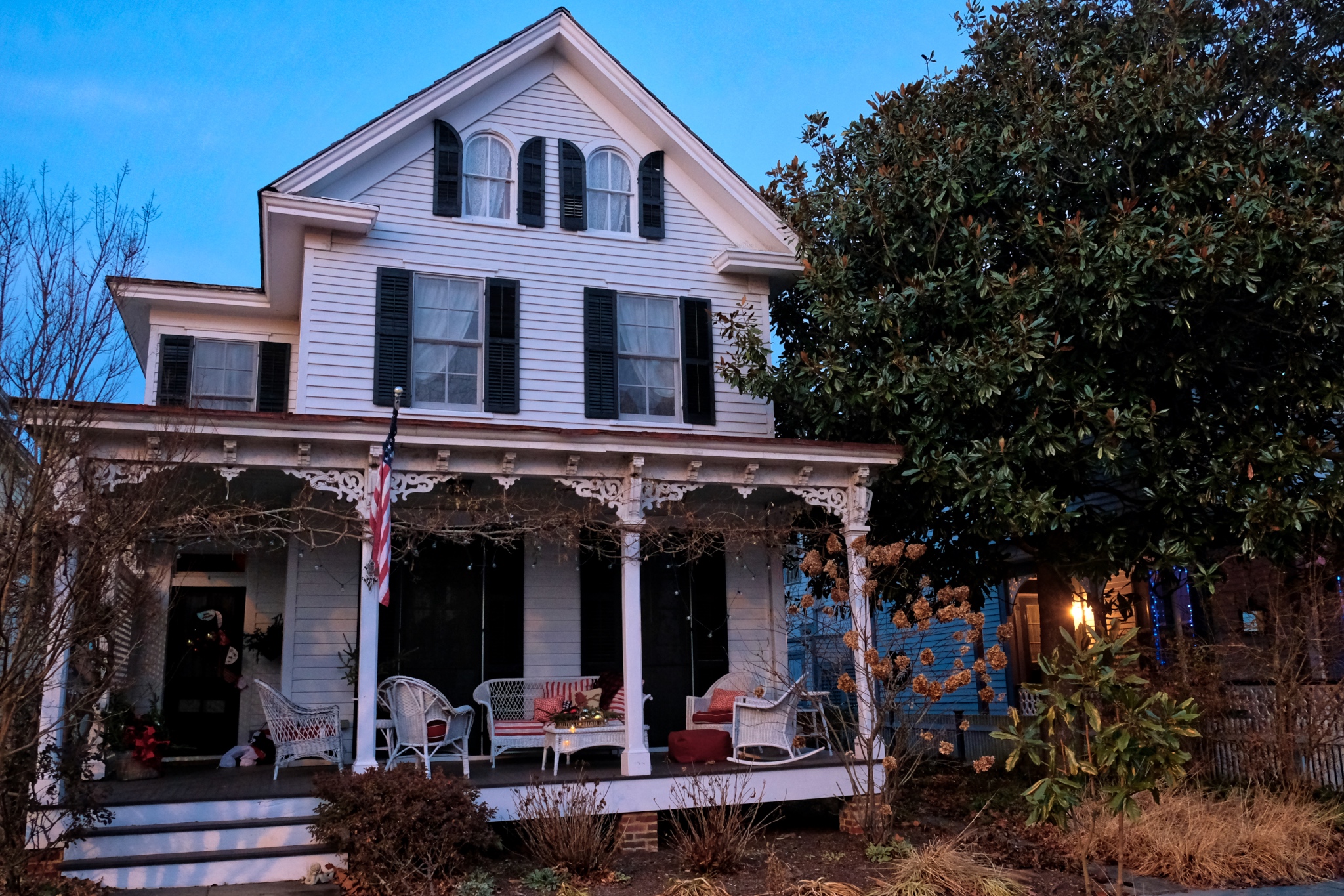 Although not as grand or ornate as some others in Cape May, I like this modest white house the most: it seems so inviting.
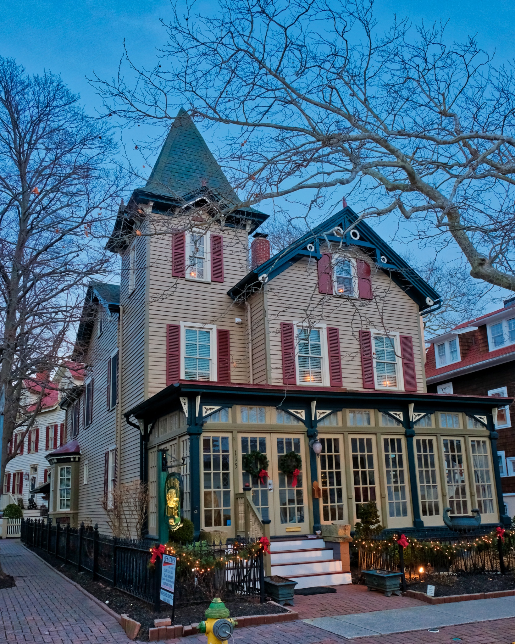 Another one of my favorites . . . that enclosed porch is just perfect!
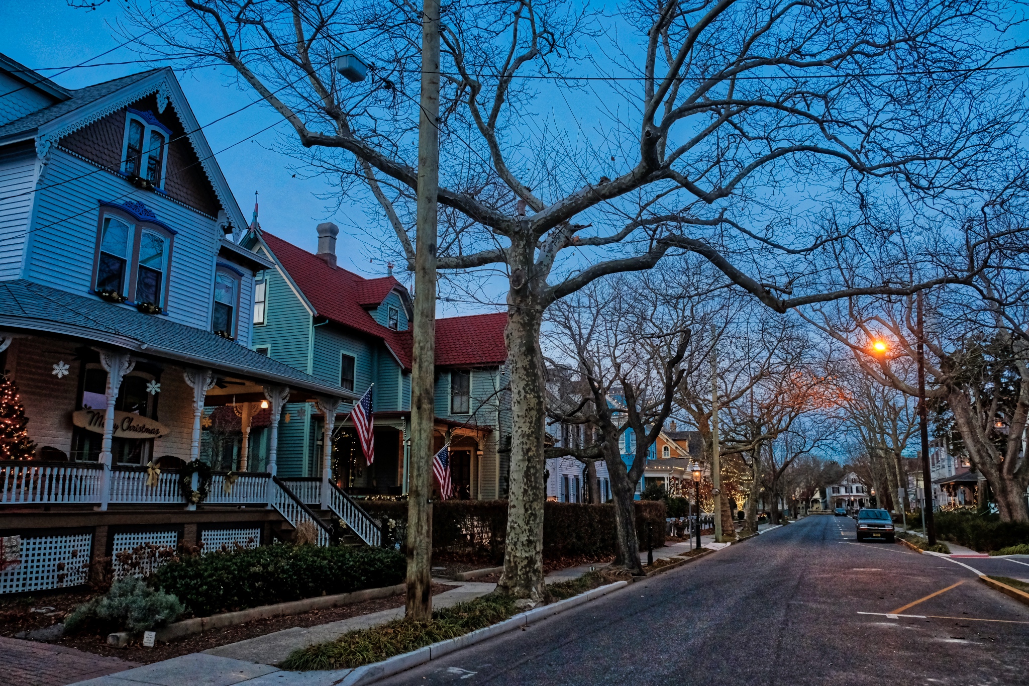 A typical Cape May street in the Historical District.
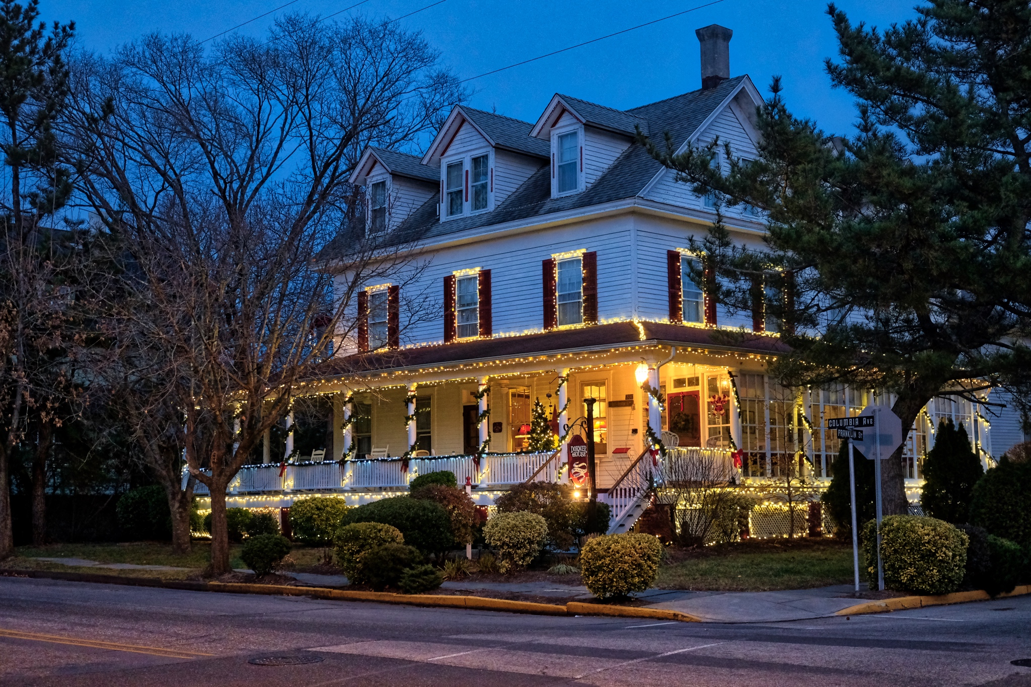 Photographers love the 'magic hour' - the first and last hour of sunlight, but we also love the 'Blue Hour' - the time just before dark when the sky is a deep blue.
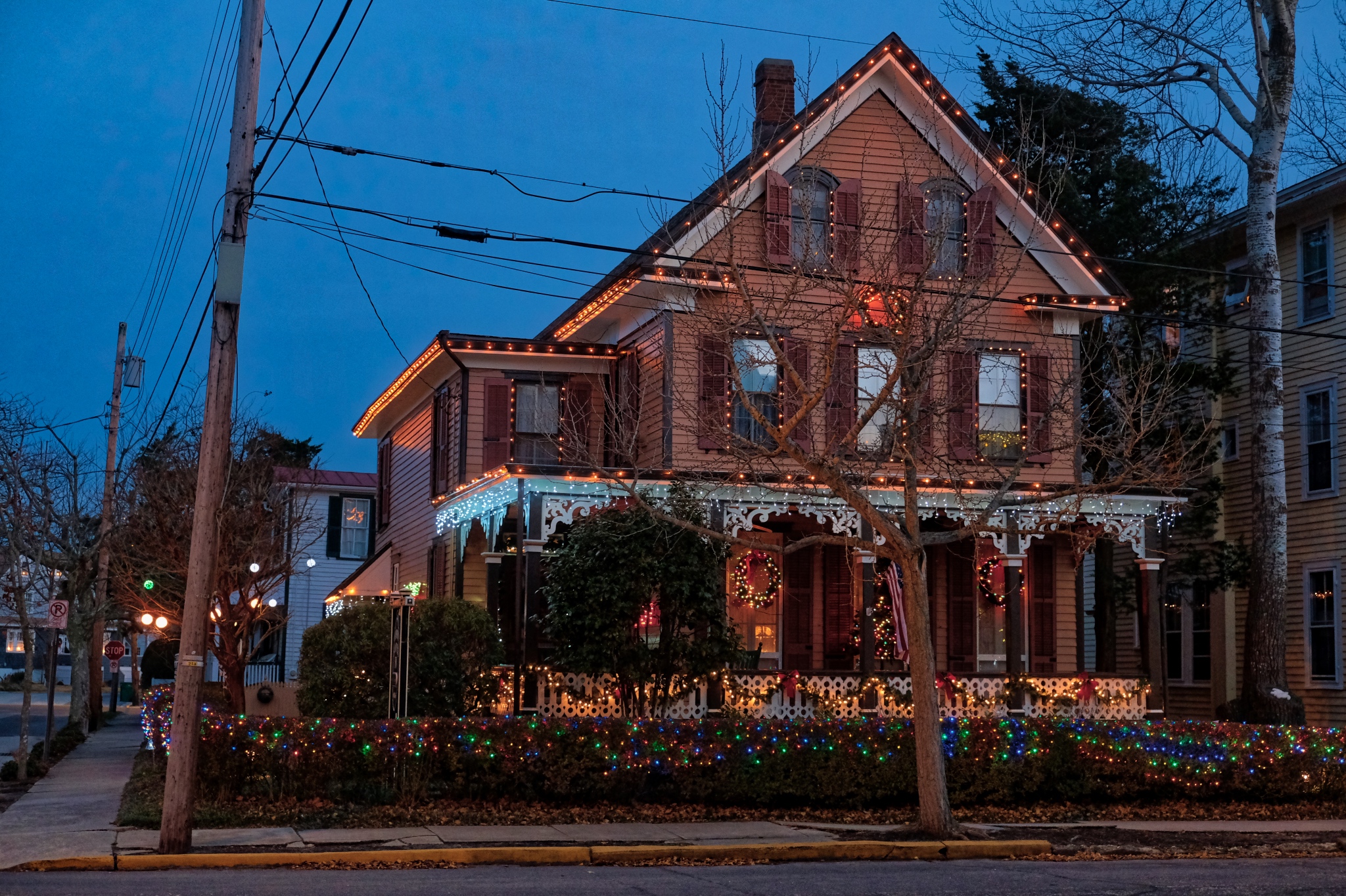 The holiday decorations were very nicely done . . . and NONE of those horrible inflatables!
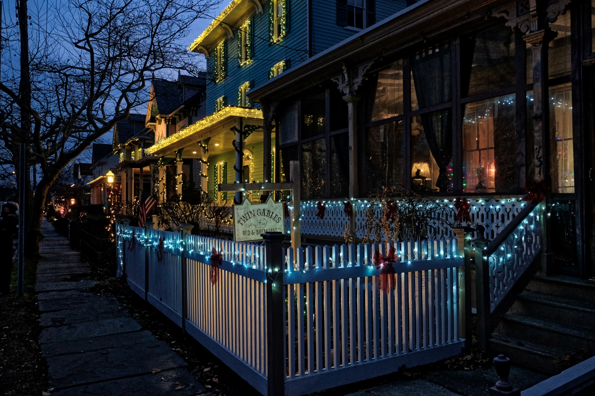 Such a lovely little town . . . "The way it used it be" . . . at least for the few who could afford it, even back then. My friends said this is "Philadelphia money."
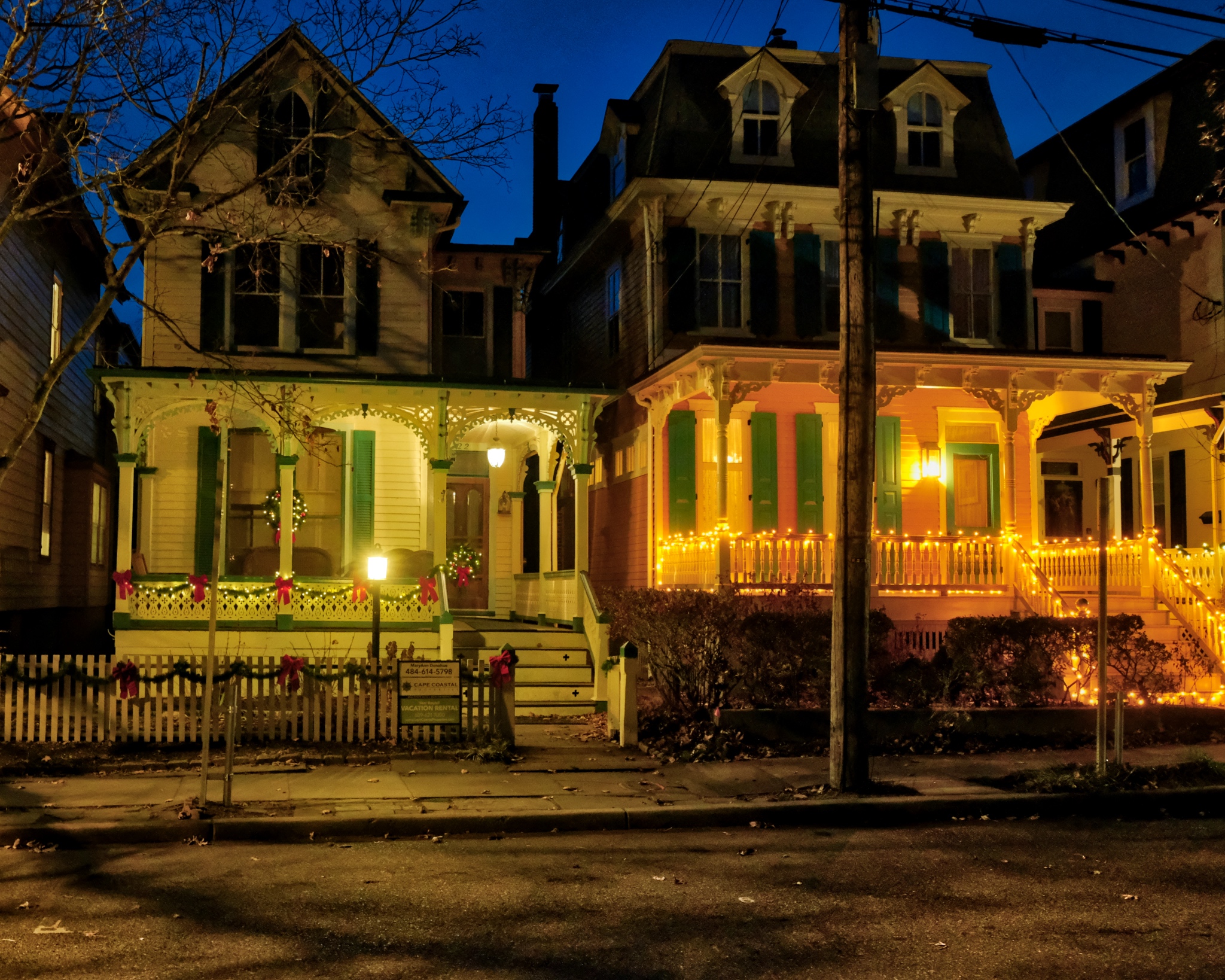 At times it seemed we were walking through a movie set . . . so perfect was the restoration . . .
  These two were gems: big porches on both floors!
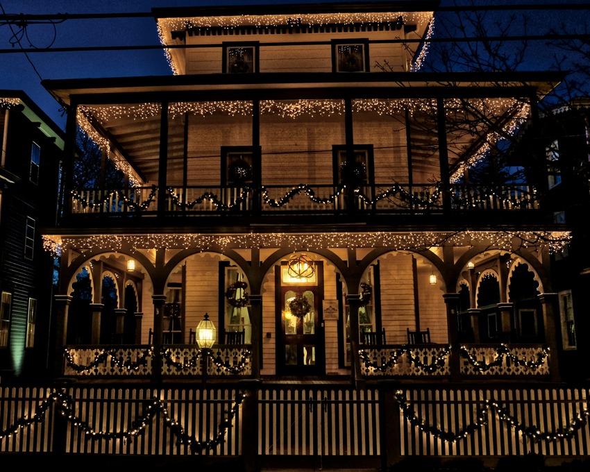 Such a fantasy house!
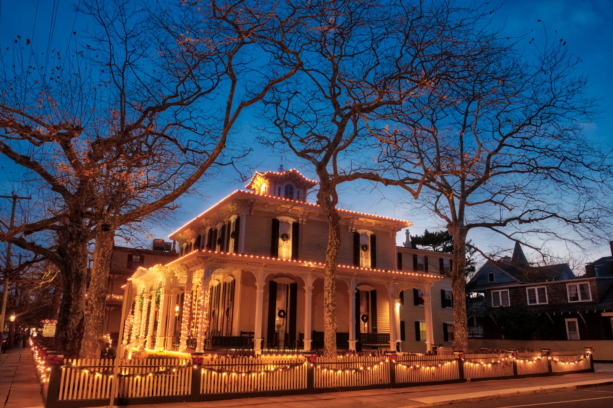 Cape May!
 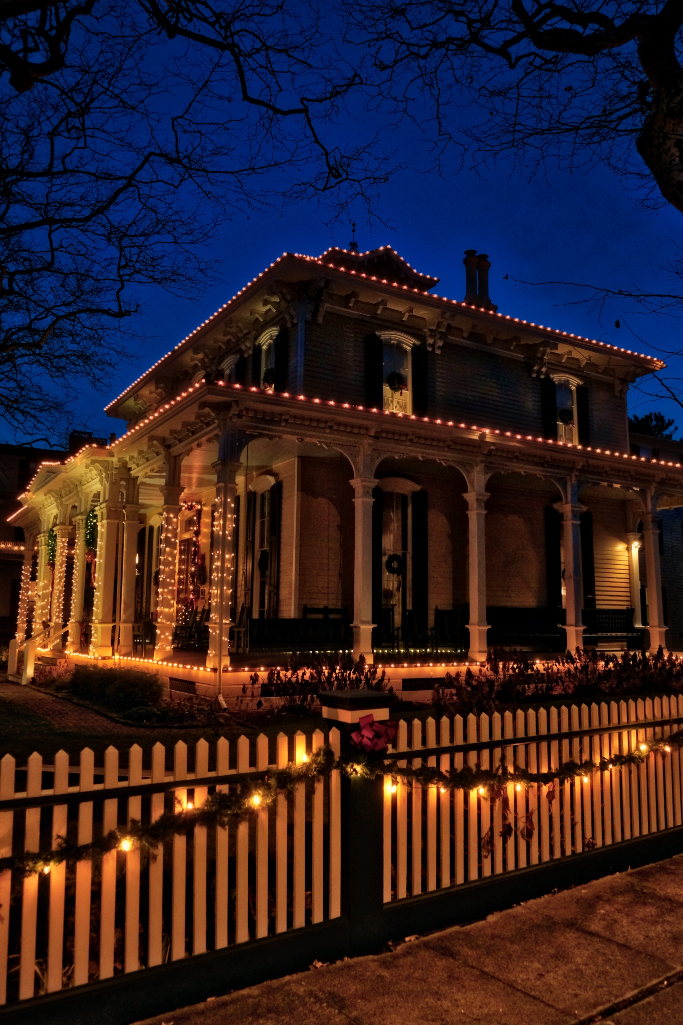 A beautiful gem in the blue hour.
 I could live here!
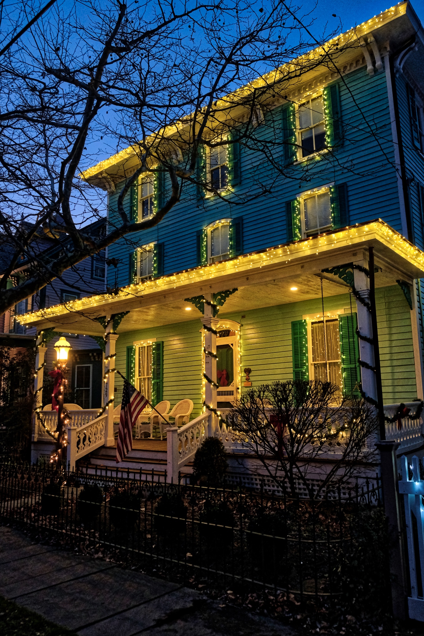 The old houses come in many colors.
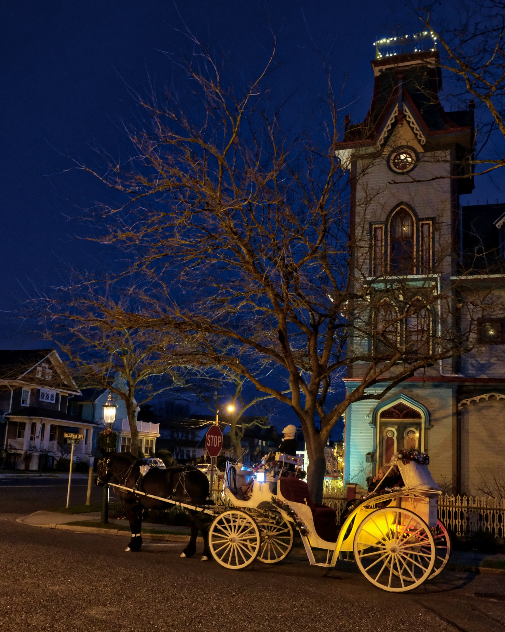 Tourists come to Cape May all year.
 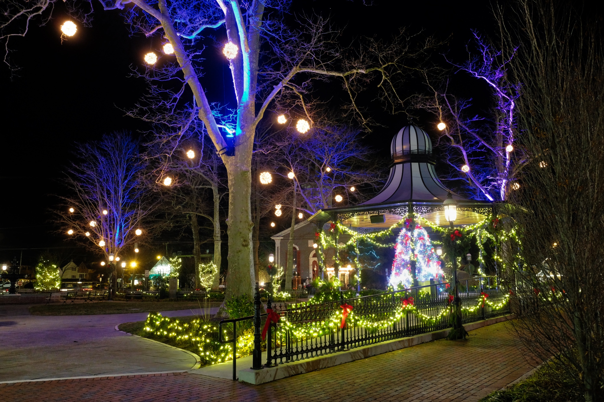 There is an old timey park in Cape May with a lovely gazebo.
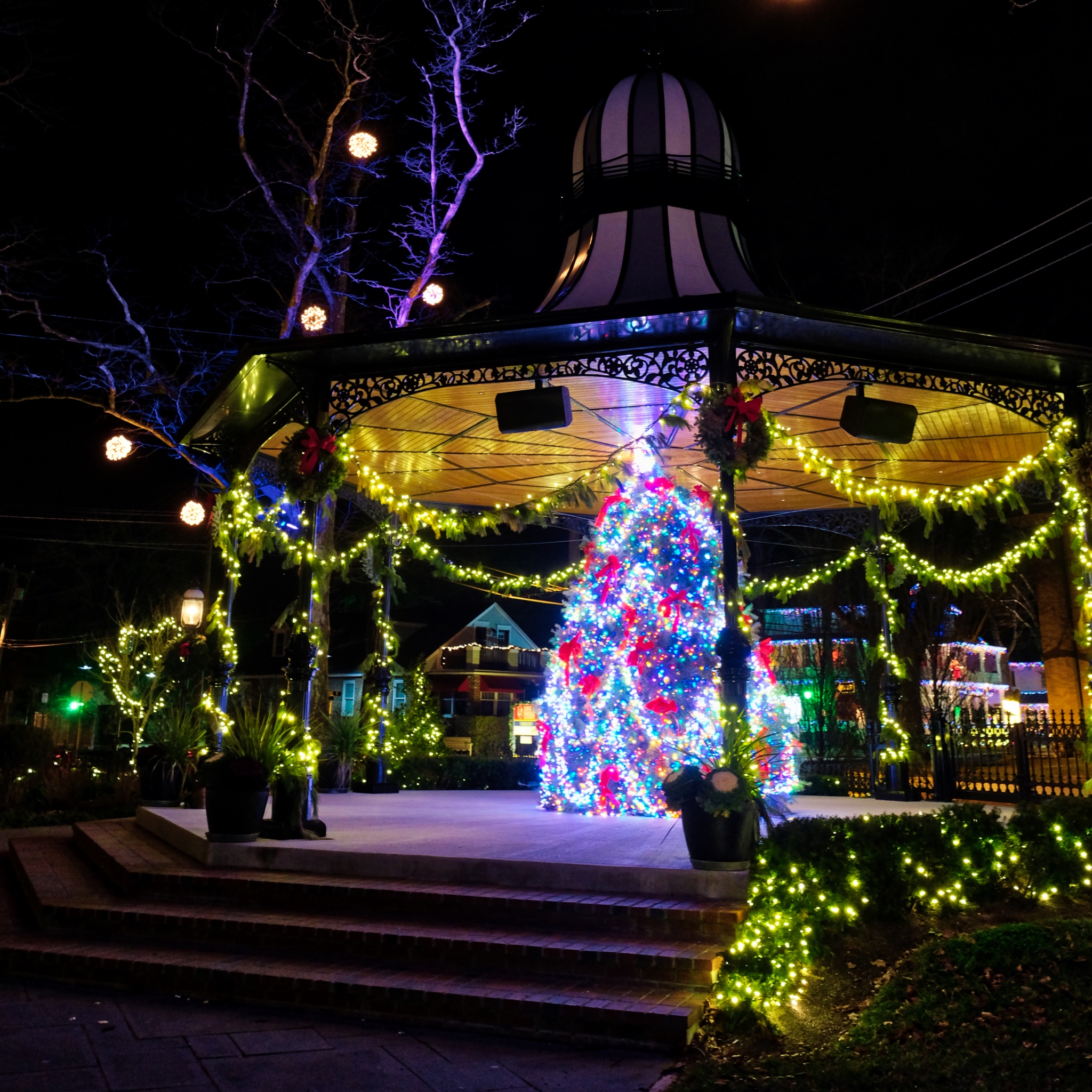 Such a festive feeling.
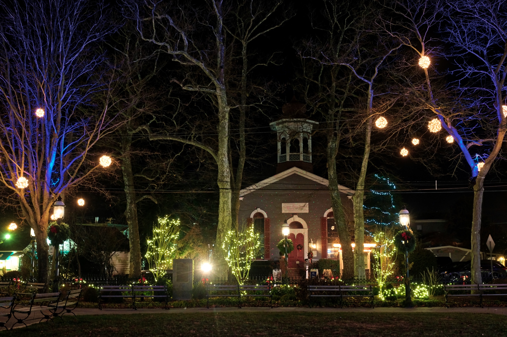 The buildings around the old town square.
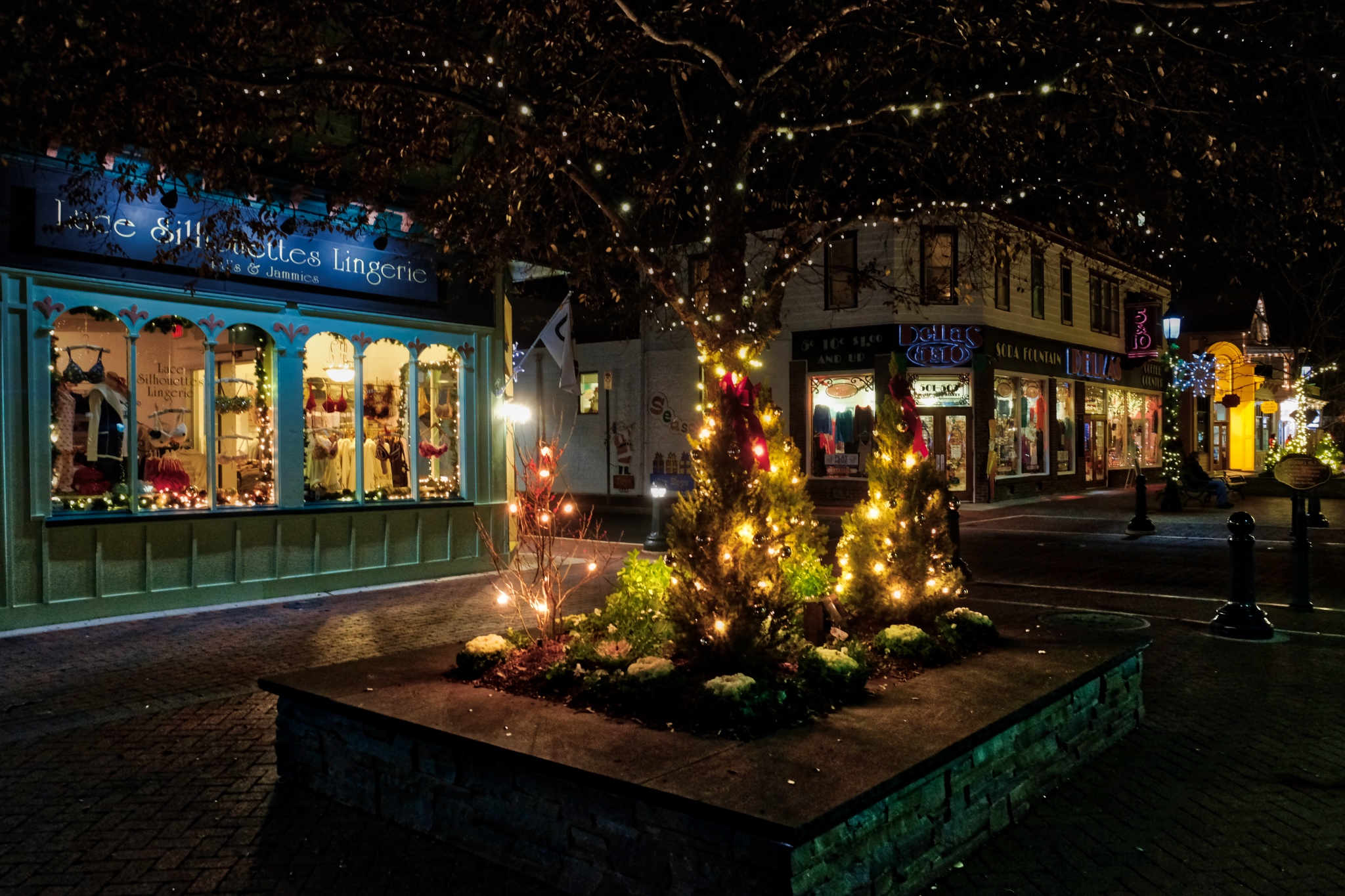 There is a nice walking street of old shops in Cape May proper.
 The shop windows were dressed for the season.
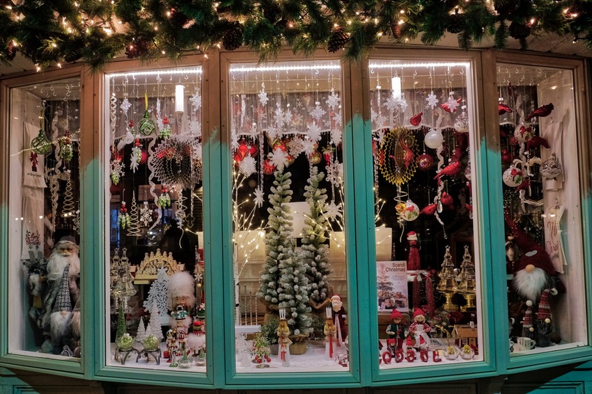 So pretty.
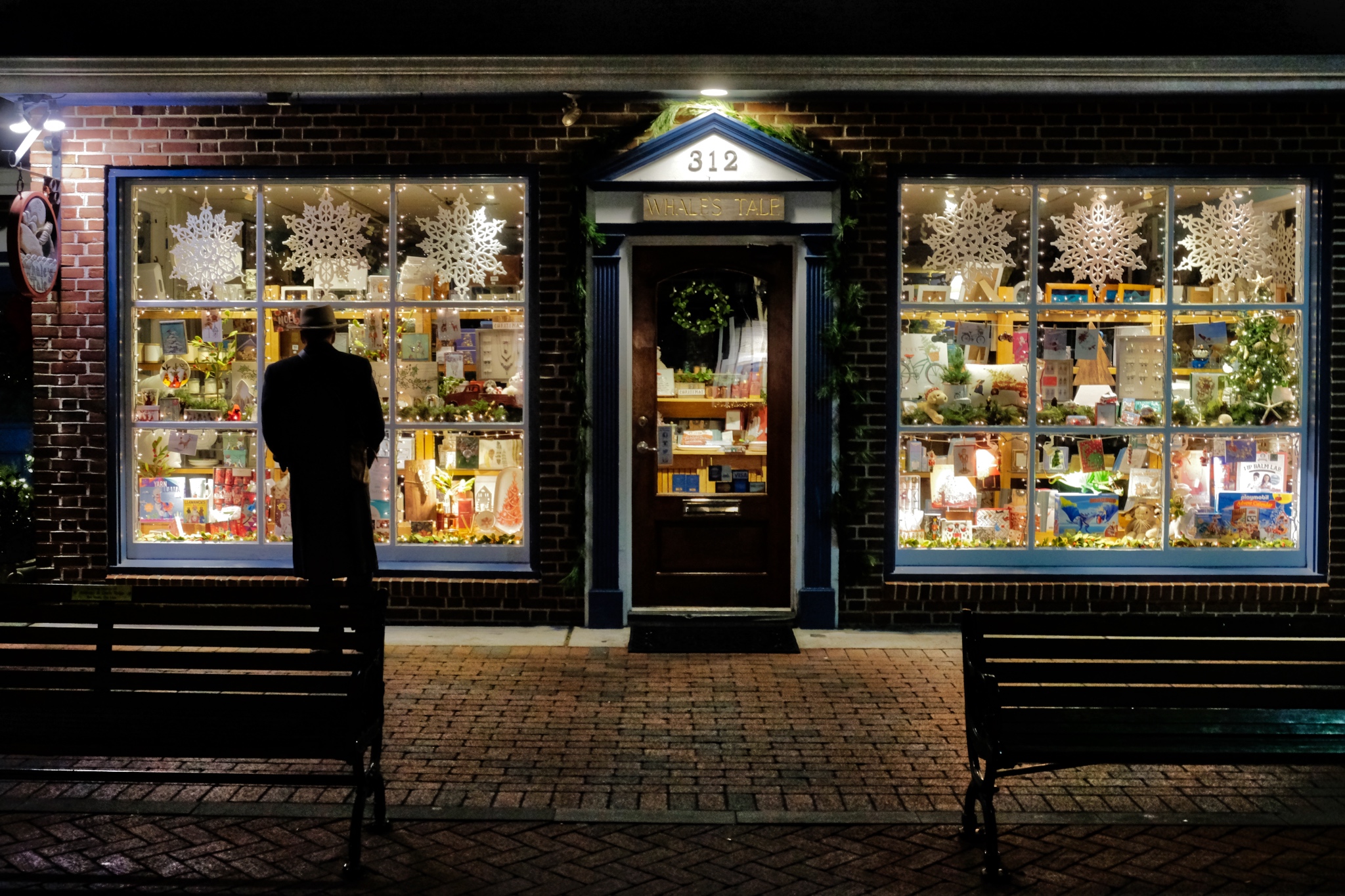 My friend, Bud, doing some last minute shopping.
 Christmas trees seemingly in every window!
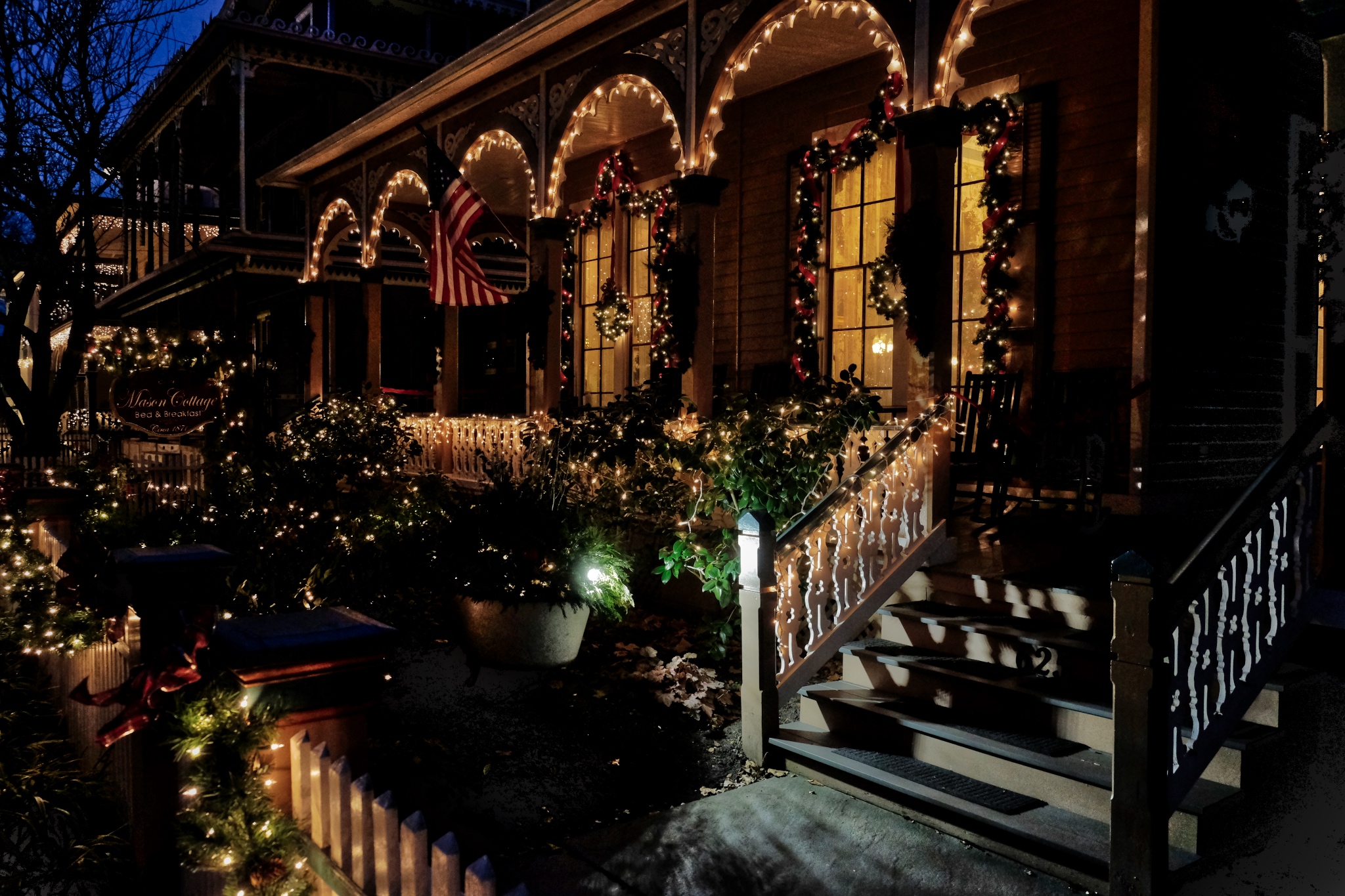
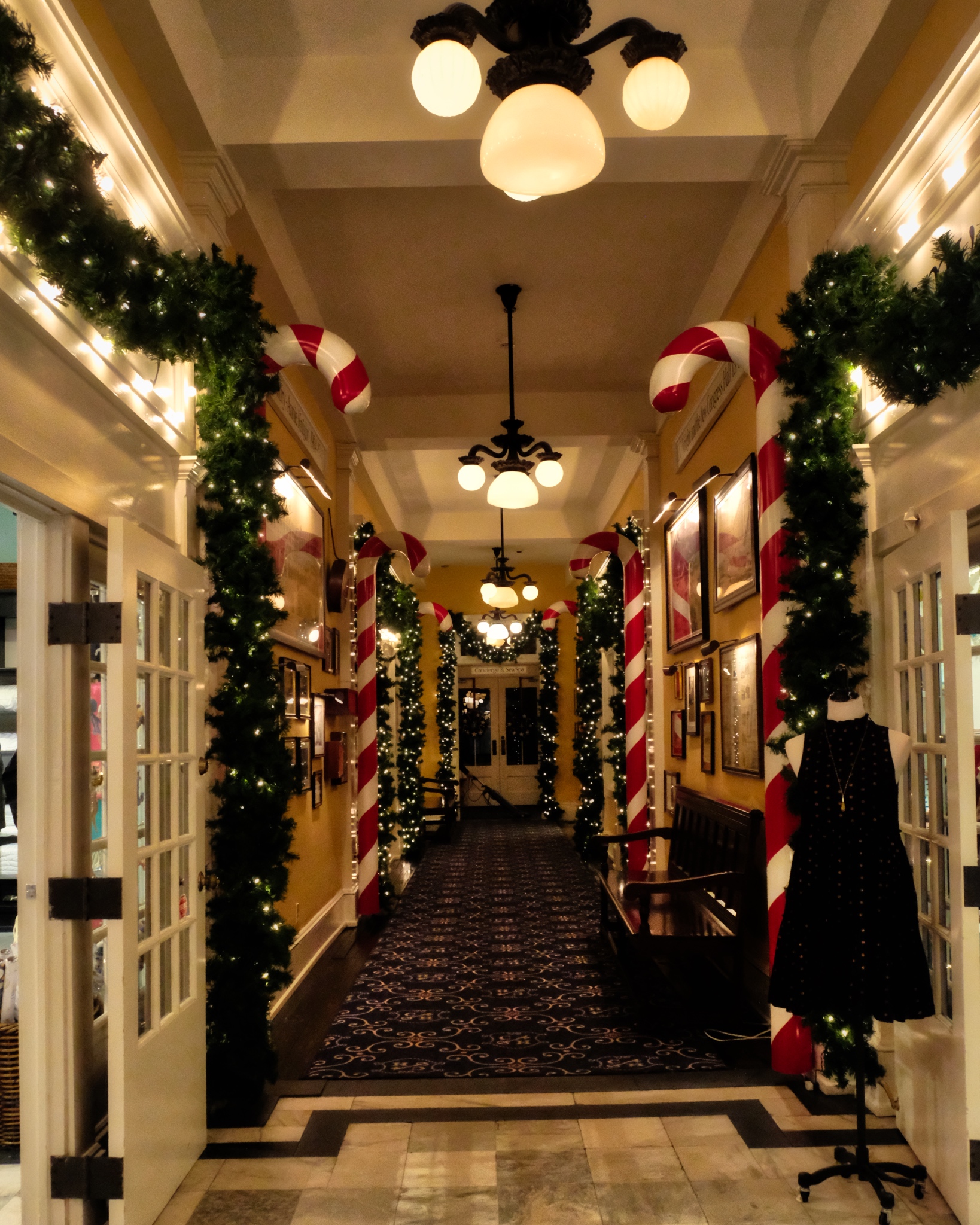 The interior of this hotel was nicely festooned with Christmas regalia.
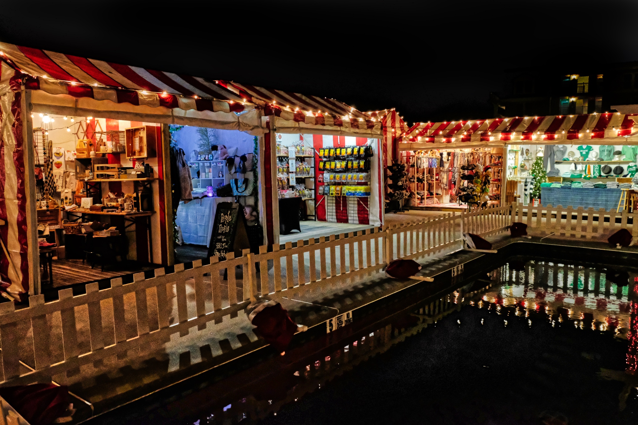 There was even a small Christmas Market in the garden of the old Heritage Hall Hotel. Yes, we had glüwine.
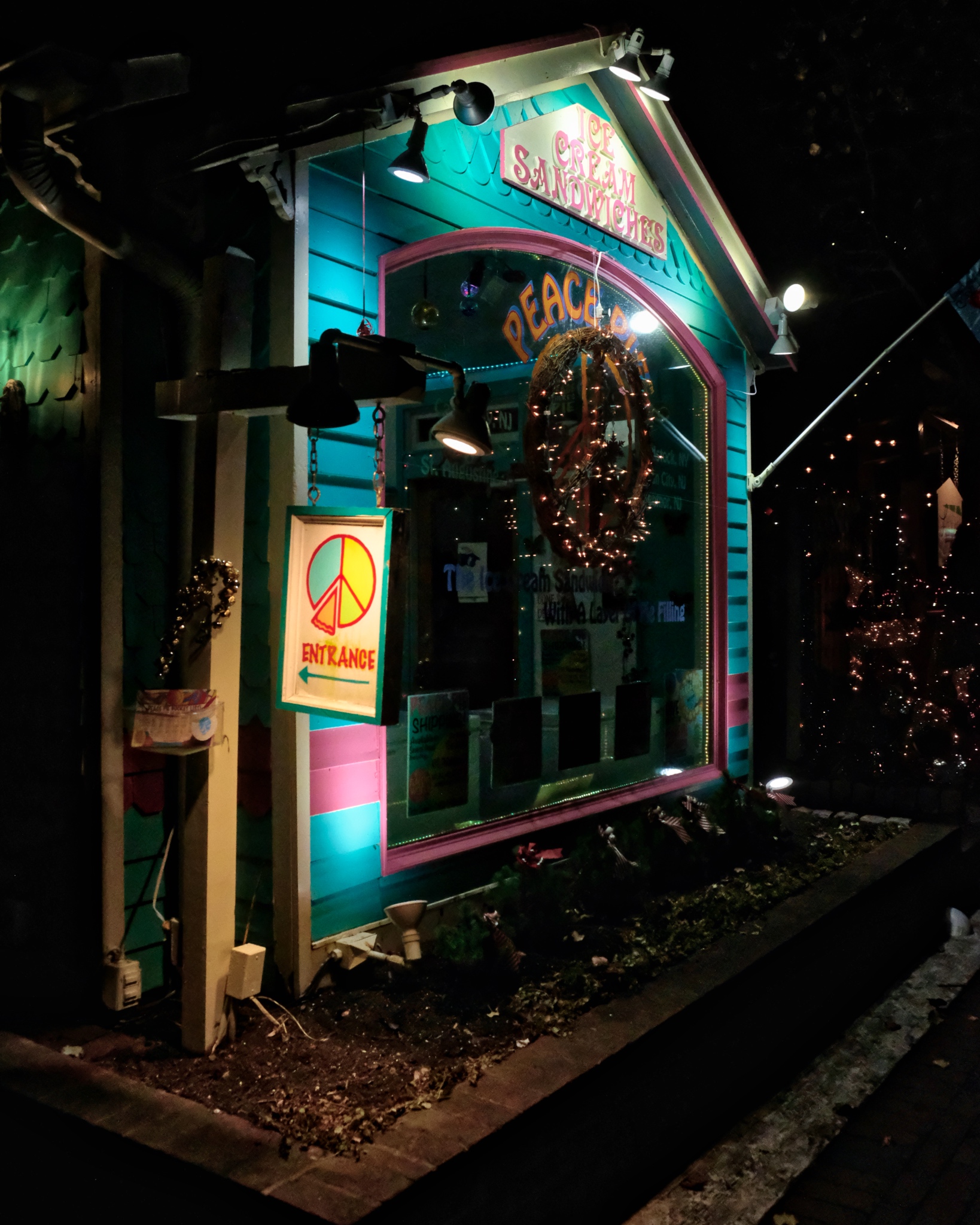 There were many cute little shops around the town center.
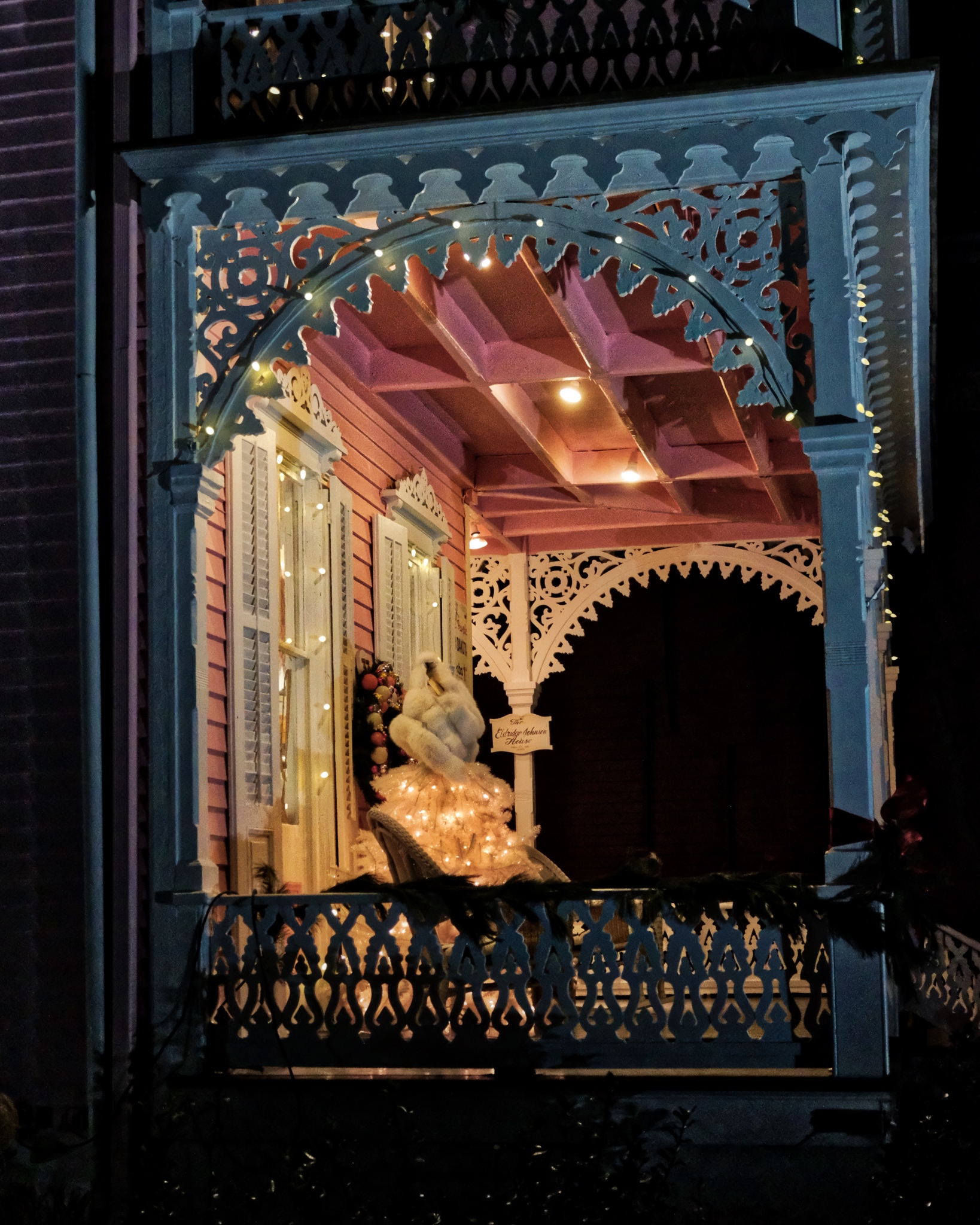
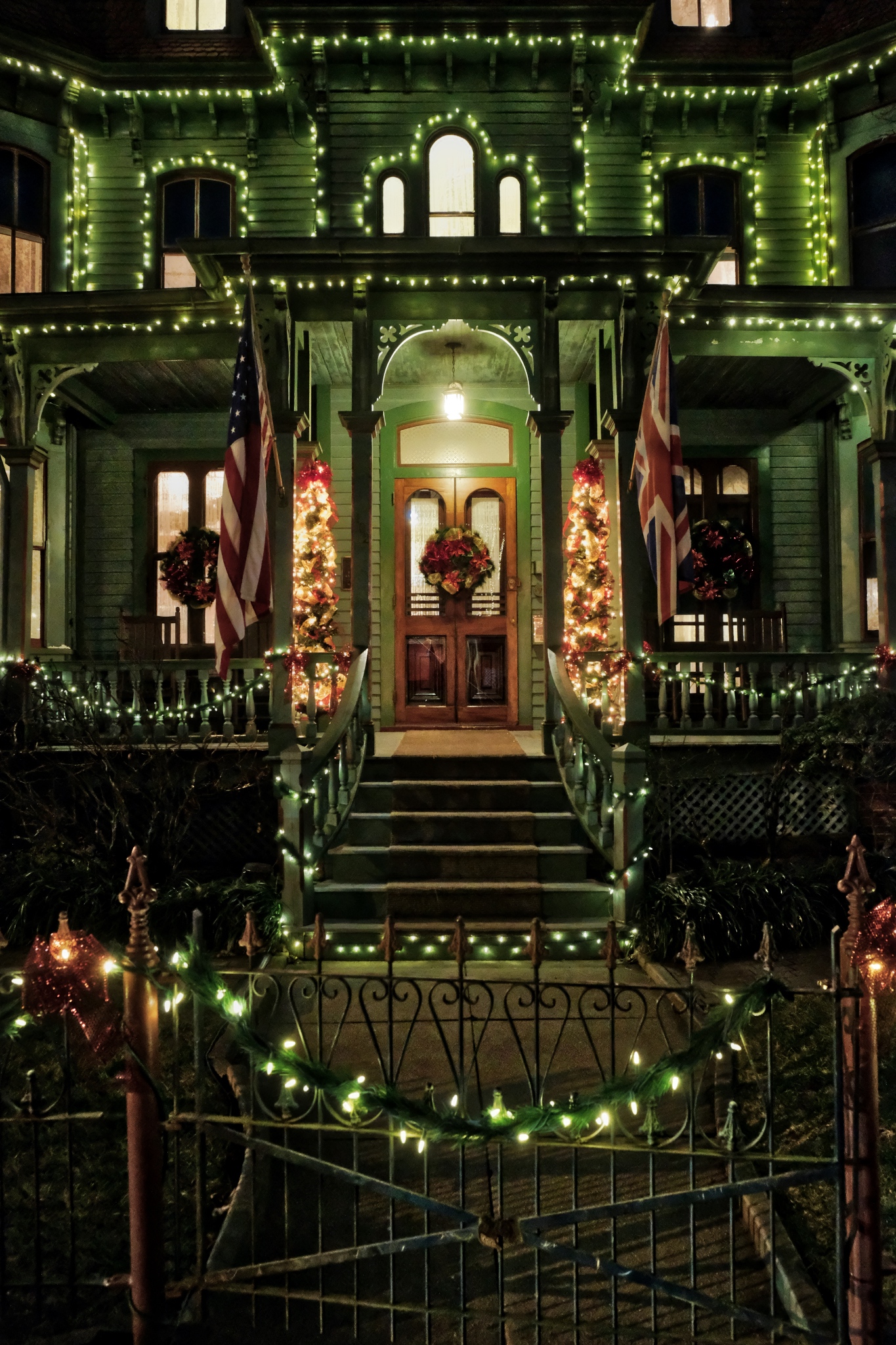
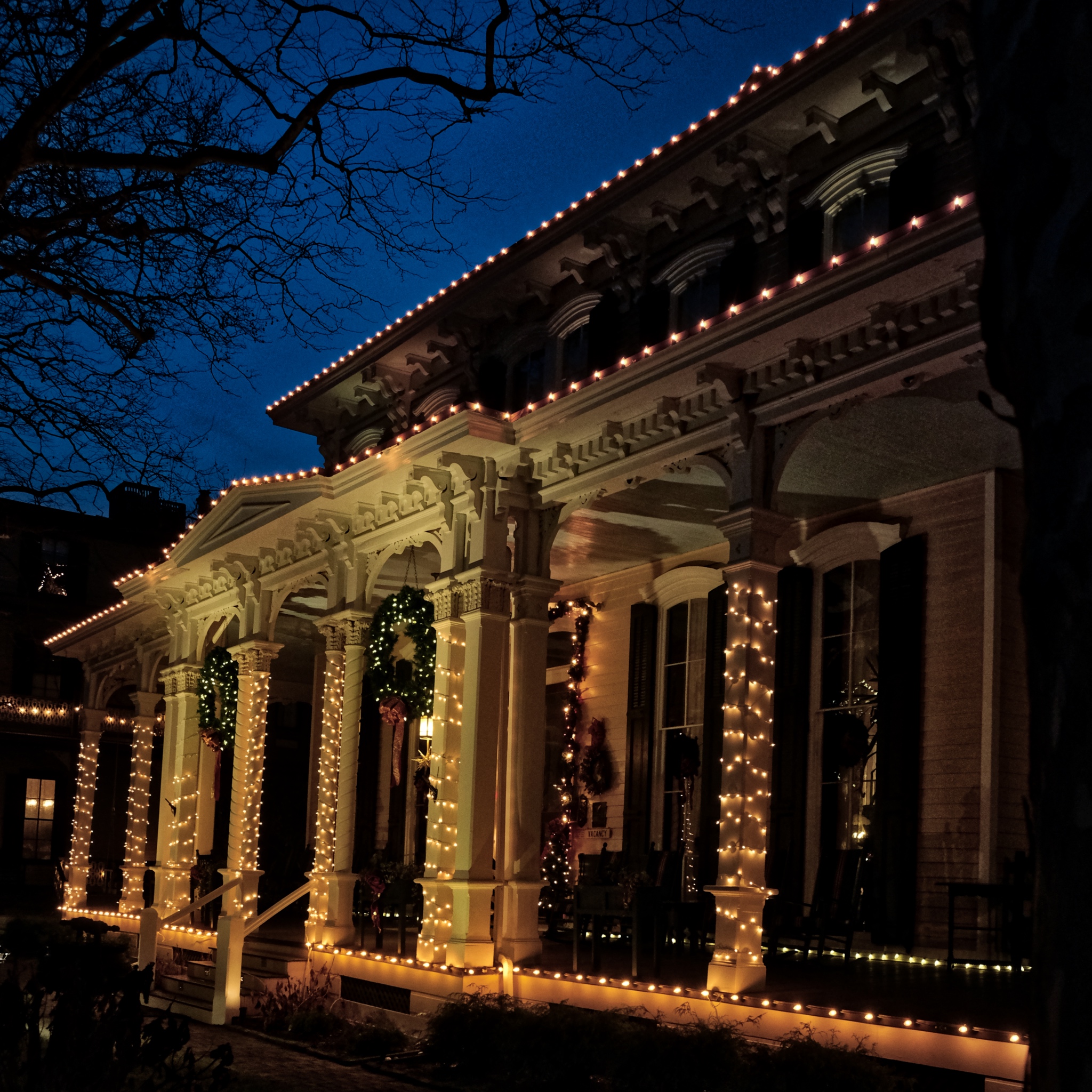 As sweet as the commercial area of Cape May was, the star of the city is the vast numbers of Victorian houses lit in Christmas decorations.
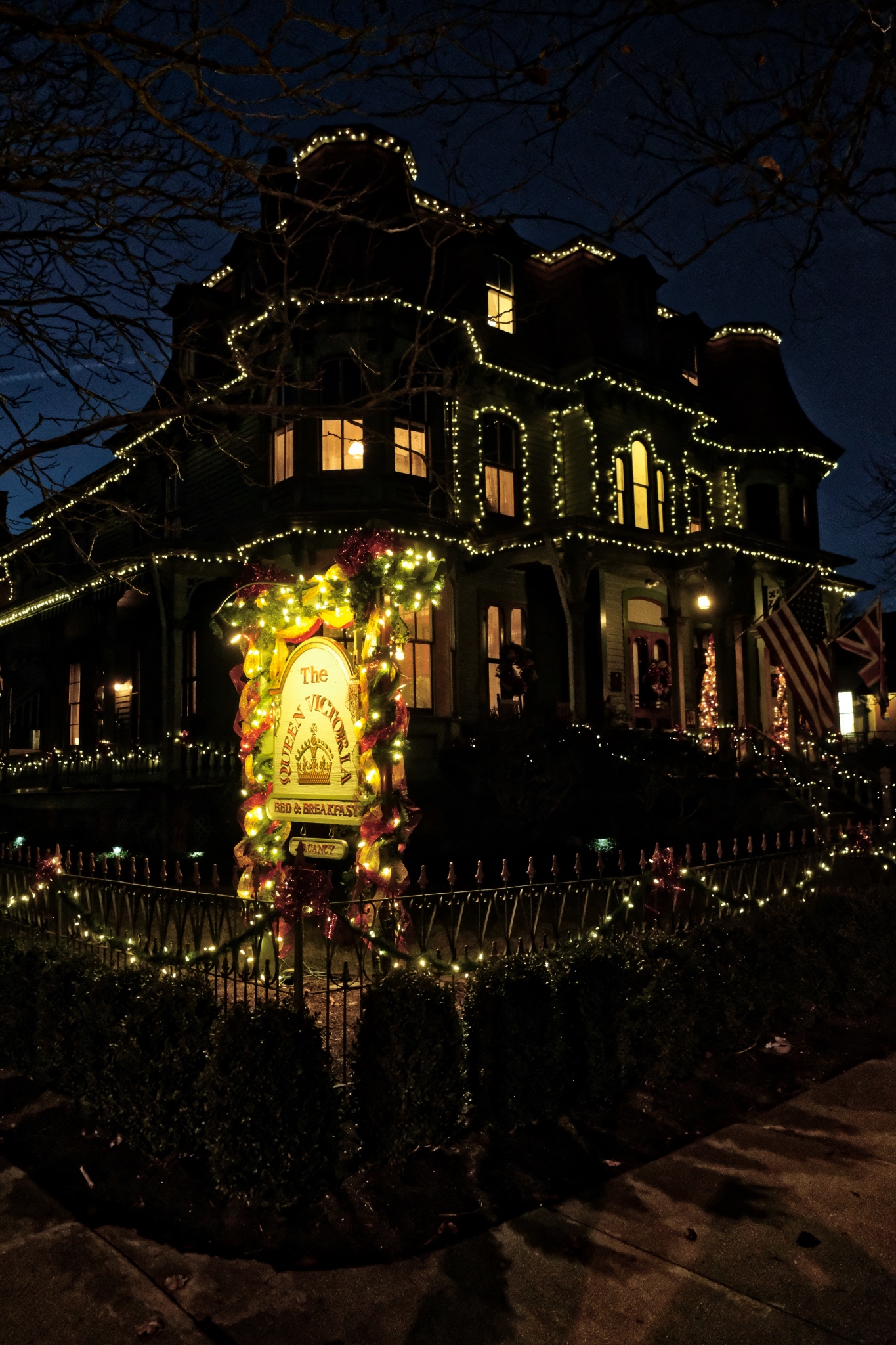 Gems in the night.
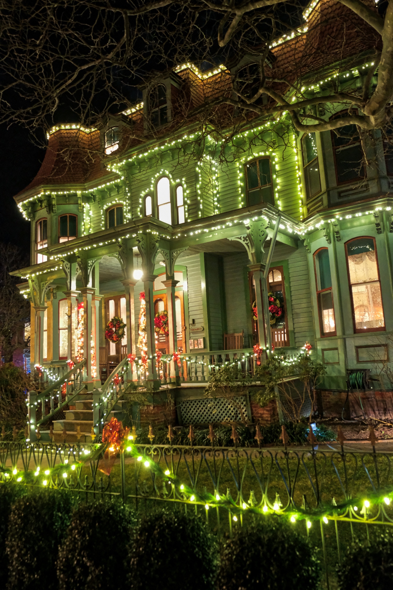 Lit up like Christmas, as they say.
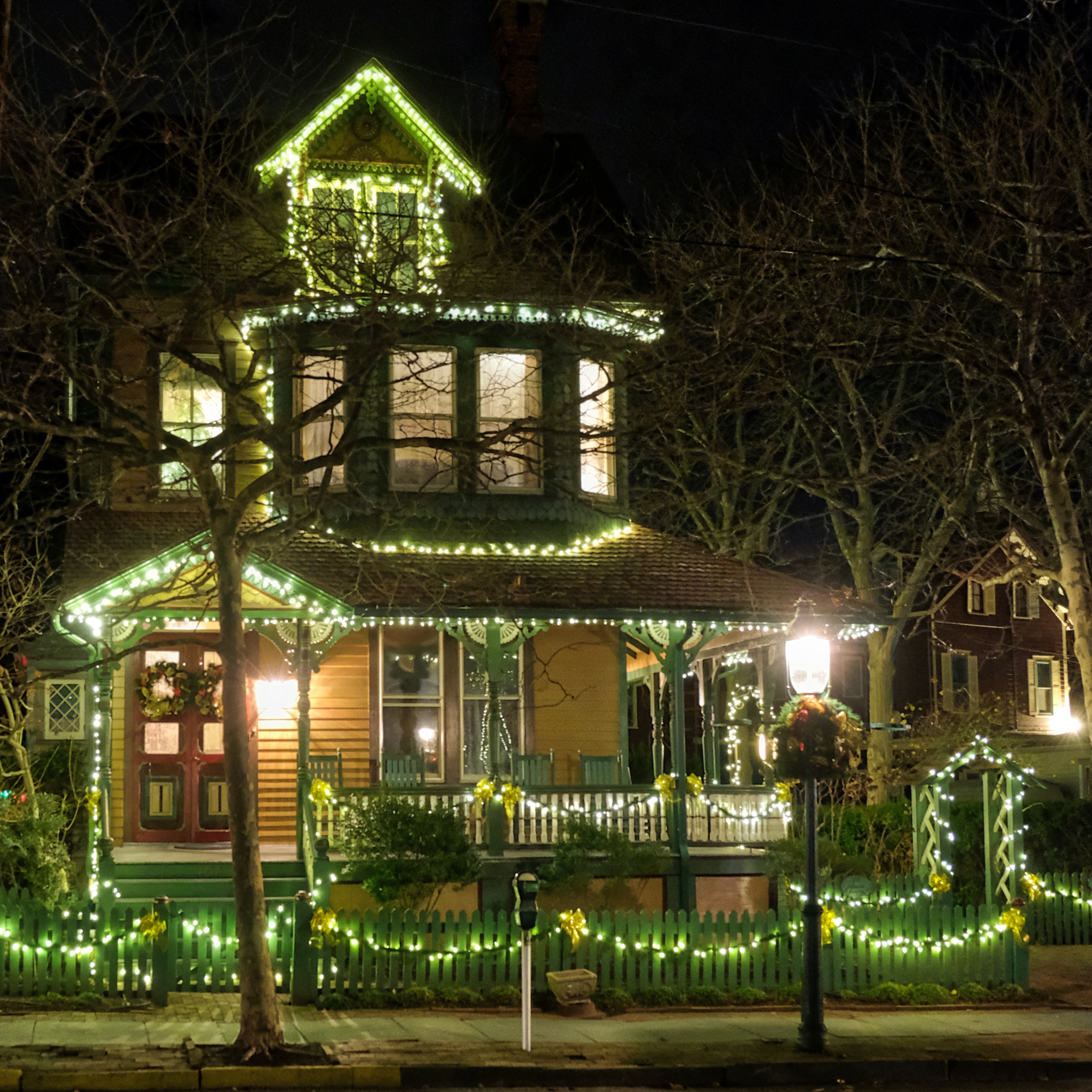 A dream house . . .
 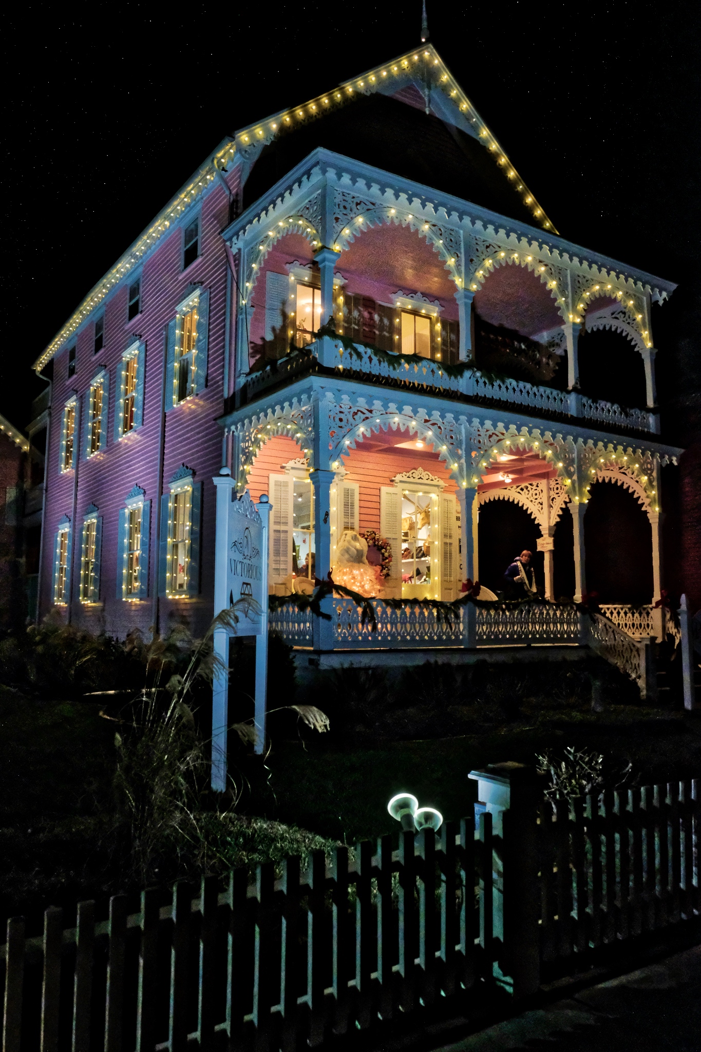 Another favorite of mine . . . this pink grand dame in all its glory!
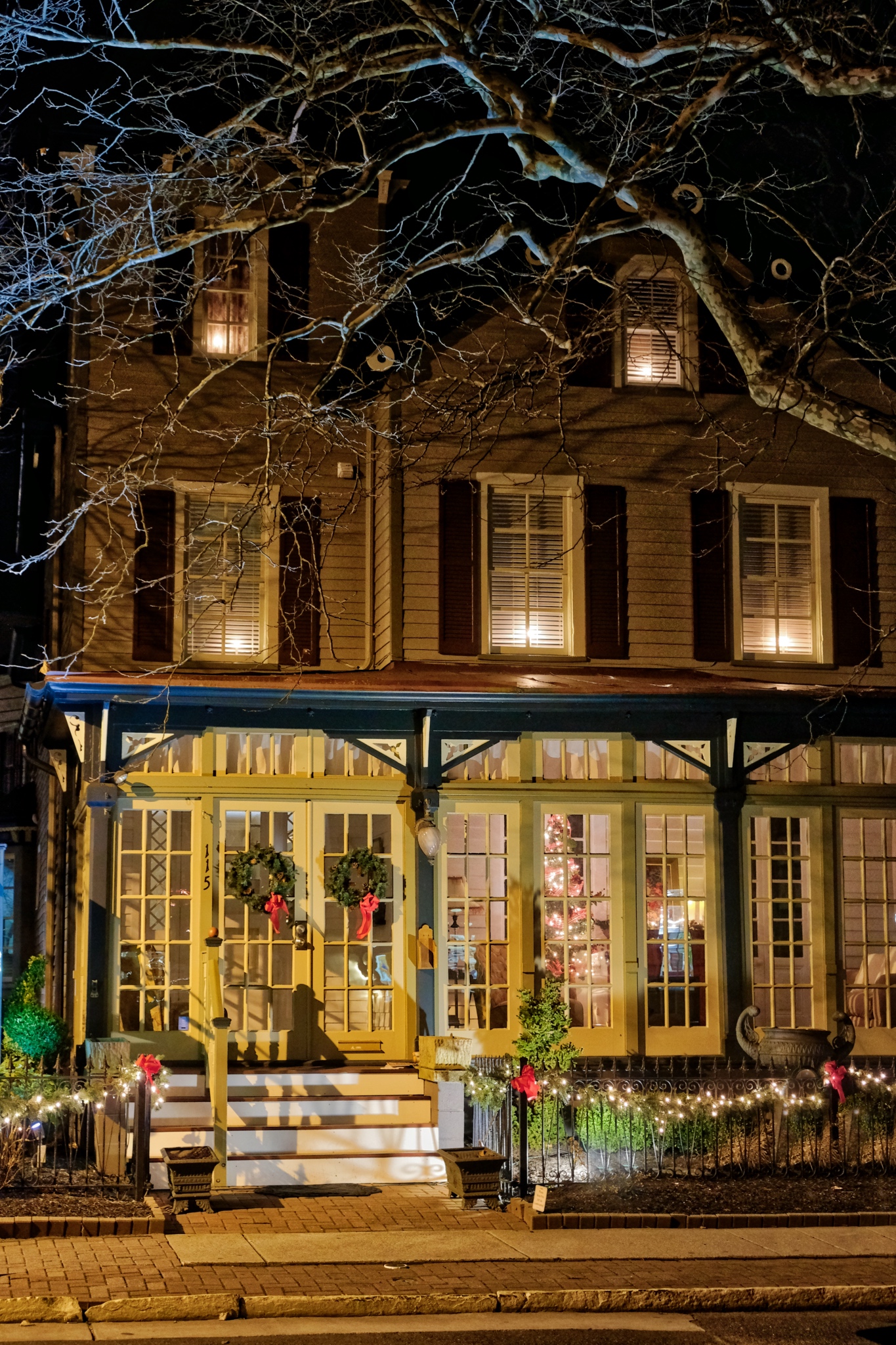 Seen earlier in the daylight, now a gem box of amazing color and form.
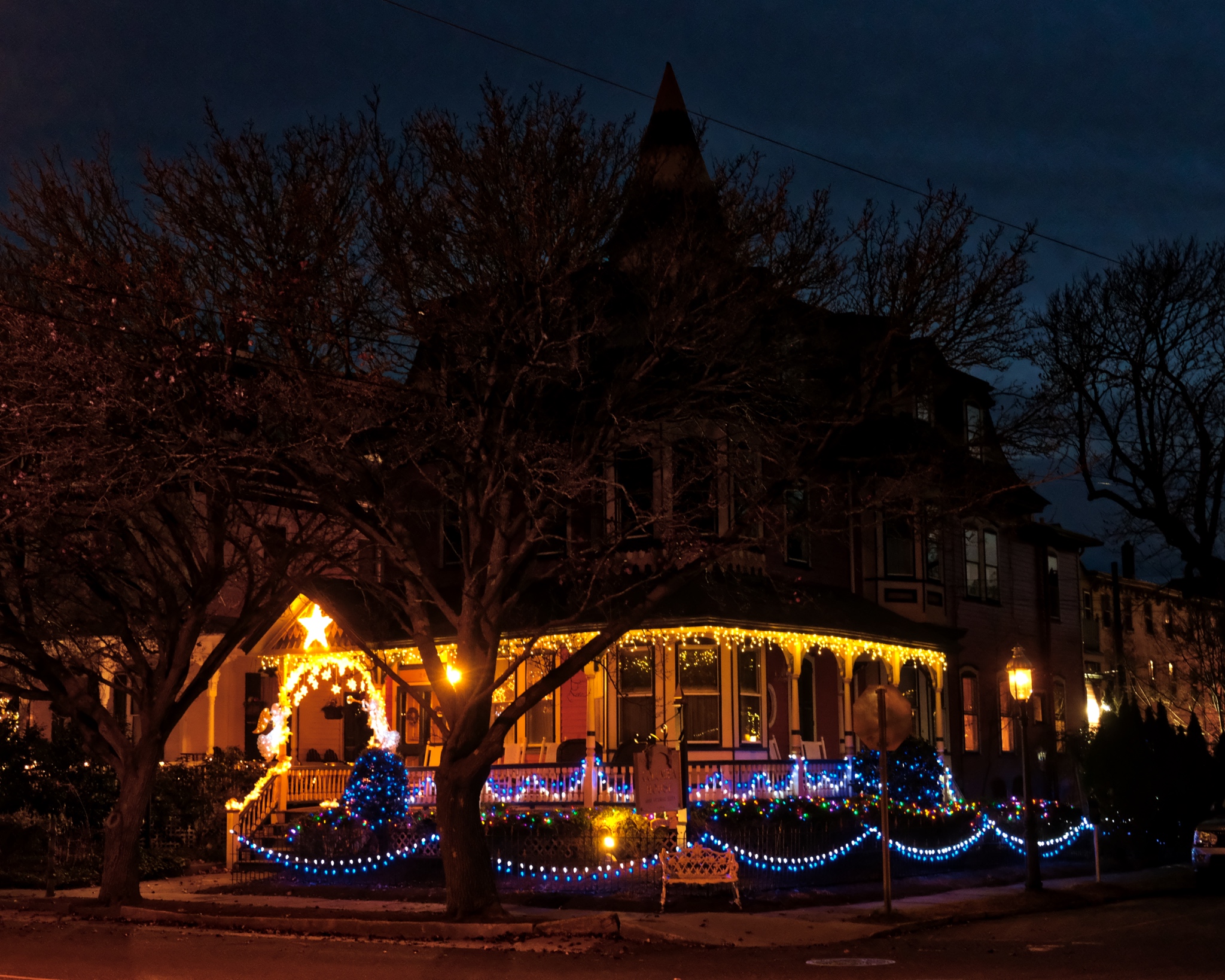 It was late (and cold!) when we finally left Cape May. I want to come back and stay in one of these old beauties. I have added an additional entry at the end of this blog focusing on just the front porches of these old Victorians (Bottom).
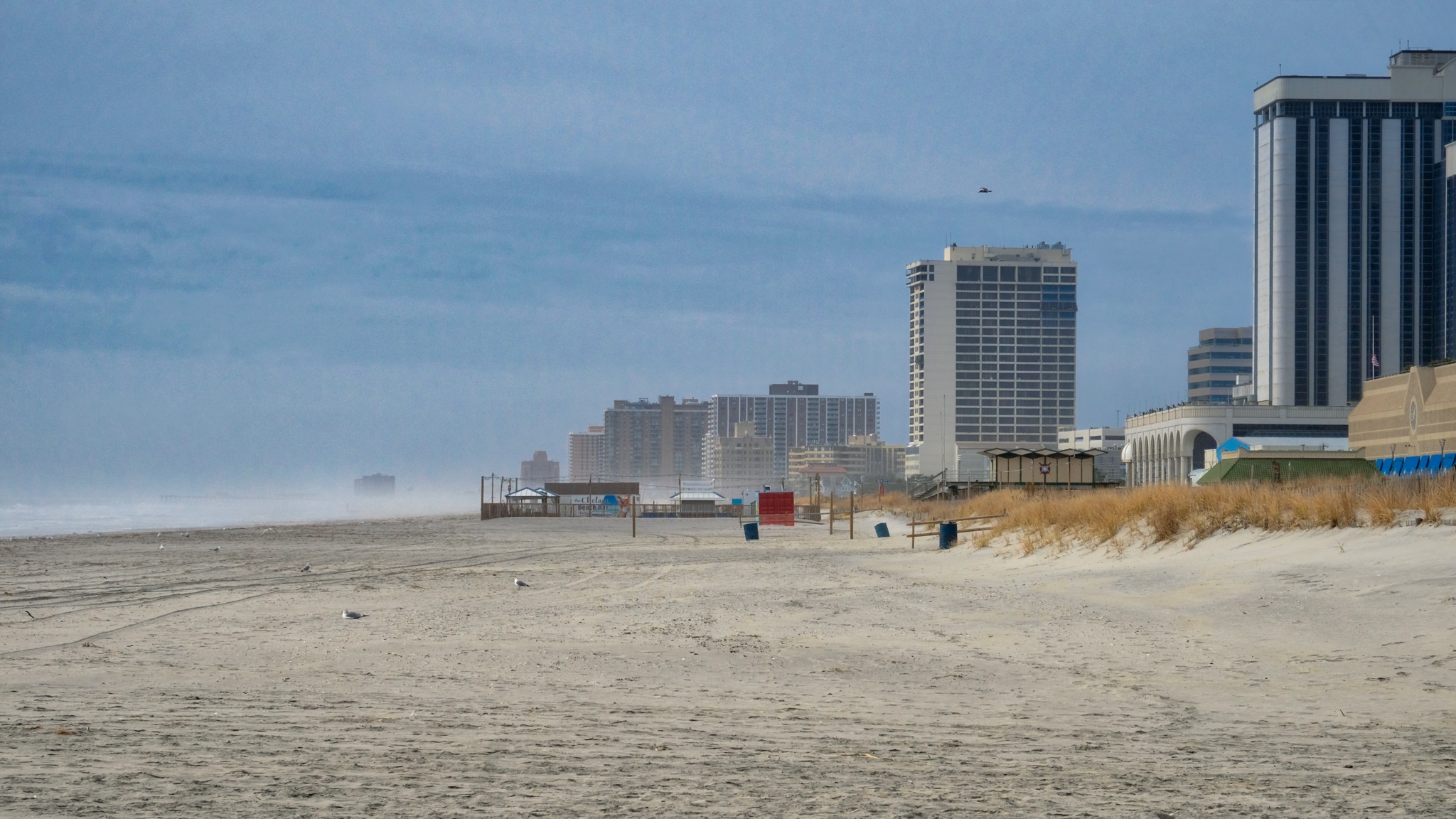 I drove north 30minutes from Ocean City one nice winter day. I brought my bicycle with me and had a nice 10 mile ride along he famous Atlantic City boardwalk.
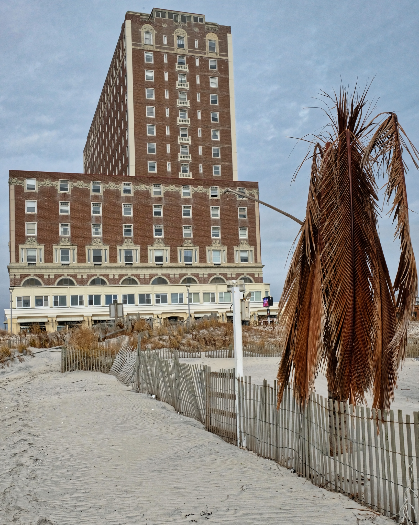 Atlantic City has been the dream retirement spot for eastcoasters for generations. . .
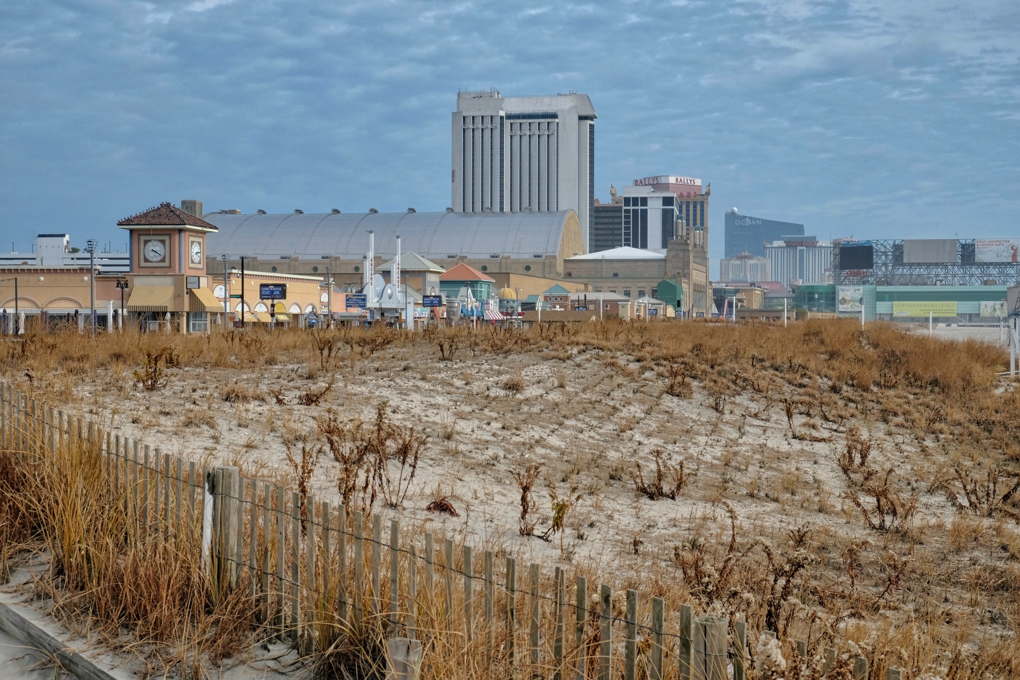 Hurricane Sandy and other major storms have played havoc with the Jersey Shore. After dredged sand was blown in, an attempt to stabilize the new beach.
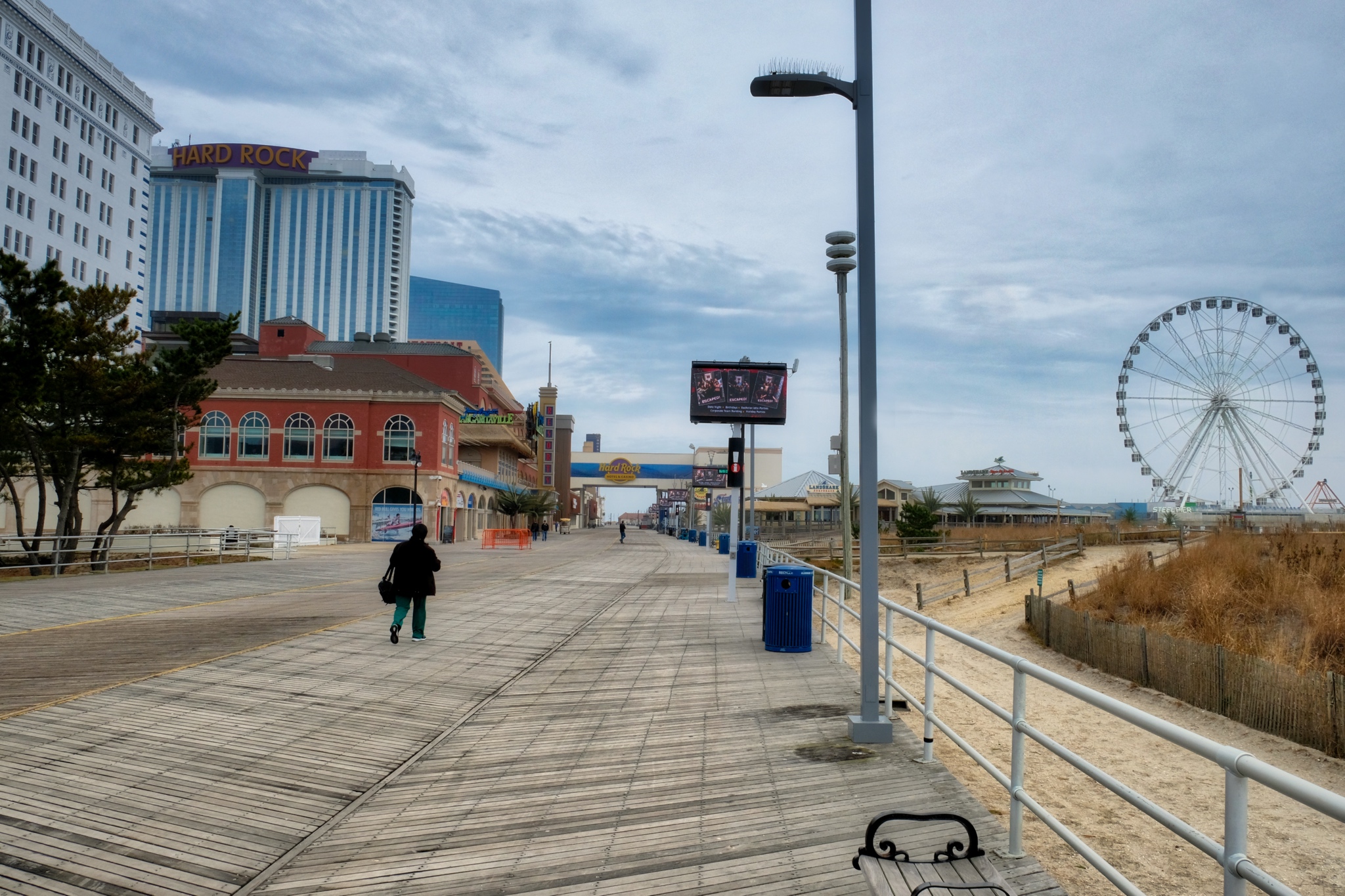 The boardwalk and most of the buildings seemed to be in a good state of repair.
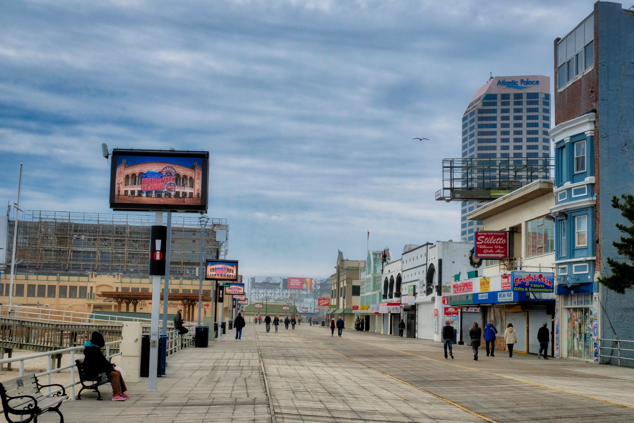 But, of curse, it is the Atlantic City boardwalk that attracts people, even on this cold and clear December day. I really enjoyed my 10 mile bike ride along this wooden bike path.
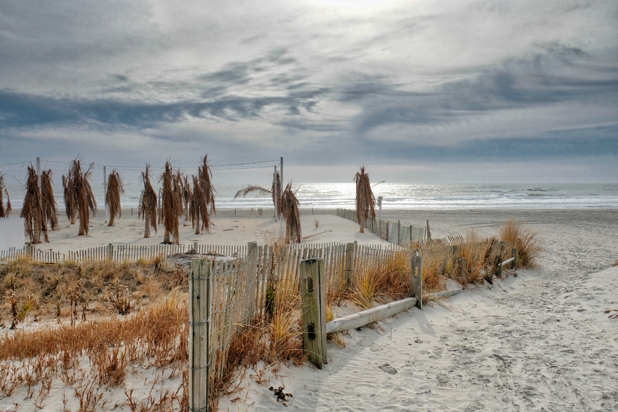 The weathered remains of a hotel beach party set-up . . . the last trace of the summer season. I rode my bike back five miles, loaded it into my camper, and drove back to Ocean City . . . good exercise for the day.Dr. Jeff Harper
The Victorian Porches of Cape May, New Jersey
 One of the most beautiful architectural features of Cape May, New Jersey are the front porches of the old Victorian houses.
 These houses date form a period in cultural history when the front door mattered as the face of the family that lived inside.
 In summer the porch serves as a place to sit and greet your neighbors as they pass by. In winter, it serves as a stage to light the Holiday Season.
 Closed or open porches . . . they are such a beautiful feature one wonders why they ever fell out of fashion.
 Please, step on in . . .
 The many B&Bs in Cape May must be packed during the summer season . . . and the rocking chairs on the porches fully occupied.
 Festive, to say the least.
 The Carpenter Victorian porch is just pure fantasy!
 Charming and bold colors.
 An old Victorian in all its Yuletide glory.
 Soooo inviting!
 Porch Life has not vanished from the Earth . . . it lives on in Cape May, New Jersey!
Road Trip USA: In and Out of Winnemucca, Nevada
September 2018
 After camping up on Steens Mountain in Oregon, I drove south on Oregon Highway 205. My destination was Winnemucca, Nevada, where I would stage for my planned camping out on Nevada's Black Rock Desert. I was dirty, my camper was dirty, and my clothes were dirty. I needed a few nights in an RV park . . . and I had a hankering for Mexican food.
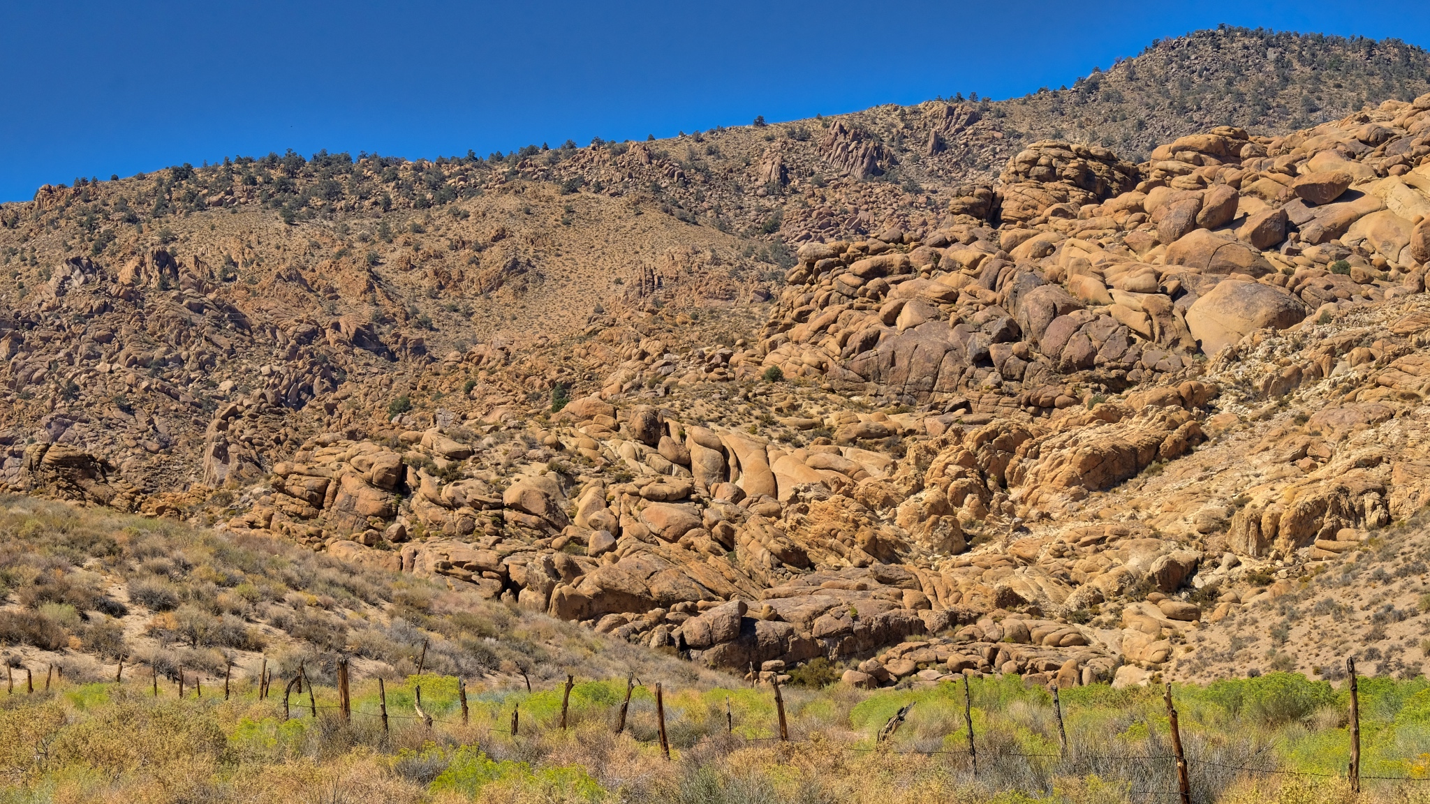
 It was roughly 200 miles from my campsite in The Steens to Winnemucca through some of the most uninhabited countryside in the USA. The major wildfires that had swept through much of the western states left behind smoke and haze that obscured the landscape . . . and in some cases made it more interesting.
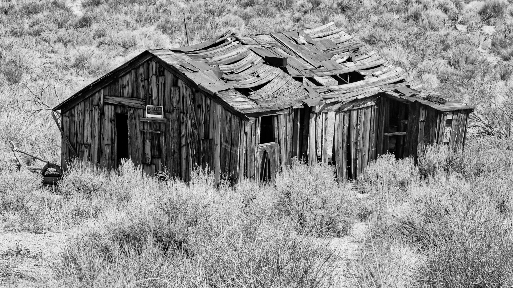
 This unforgiving high arid country left behind many abandoned homesteaders and miners' shacks, sheds, and farms buildings in the giant western landscapes.
 If these walls could talk . . . certainly applies here.
 I had fun stopping, getting out of the truck, taking a photo, driving on a few feet and getting out again . . . . These scenes are so photogenic, I didn't want to miss a shot!
 The road went on and on through the dry, smoky landscape. Oregon Highway 205 became Nevada Highways 292 and 140 before joining US Highway 95 into Winnemucca.
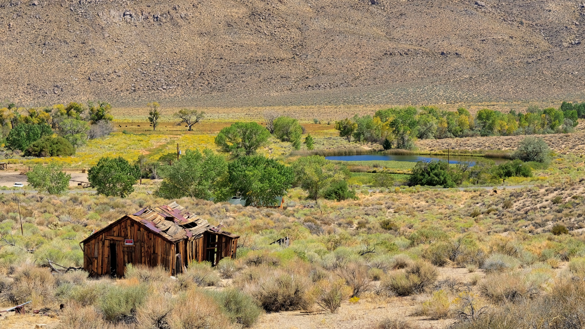
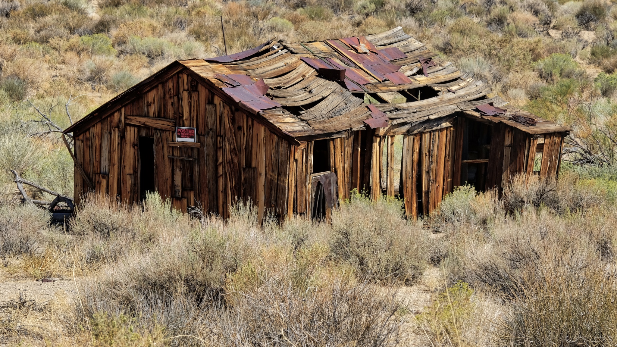
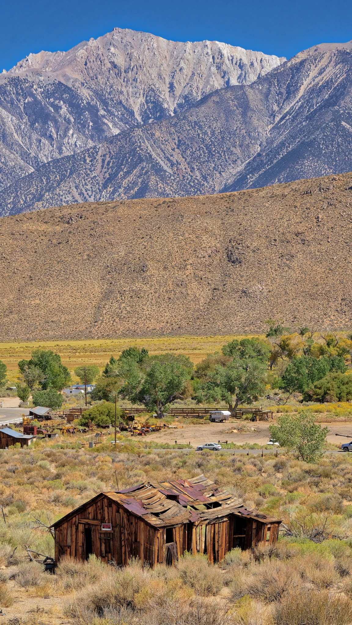
 An old abandoned farmstead. This one looks like it wasn't abandoned all that long ago. What was the story of this house? Its history?
 There were a few wide spot in the road towns along the road to Winnemucca.
 My camper ECU was acting up . . . the engine developed a radical rich condition . . . lots of black smoke. I diagnosed the problem as a temperature sender. I stopped to let the engine cool down and reset the ECU. It was an opportunity to take a walk around in the parched land.
 It was quiet and still. Cars would come by on the highway only every 10-15 minutes.
 It had been dry here for a long time. Other travellers along this highway had driven off the road into the desert too.
 Yes, the desert is not a welcoming place.
 Bone identification is not my academic field of study . . . sheep or cow?
 Back out on the highway and toward distant mountains. I thoroughly enjoy these long desert drives . . . and have missed them in my tropical, equatorial life.
 Such lovely layered mountain ridge silhouettes in the wildfire haze.
 I pulled over to the side of the road whenever I would see these old decaying sheds.
 One of the joys of long desert drives is having the scenery suddenly change as you drive up and over a mountain pass.
 Another abandoned homestead. This old ranch house was literally 60 miles from the nearest store and gas station.
 Such rough construction. The summer temperatures out here are blistering . . . and the winter sees deep snow for months at a time.
 My camper was running well now . . .
 Dry desert just north of Winnemucca, Nevada.
 And on I went . . . down the highway of mirages.
 I eventually arrived in Winnemucca (pop.7,600), bought gas, went to a self-wash car wash, found a Mexican restaurant (and had a GREAT meal), checked into the Model T Casino RV Park (I bought the t-shirt!) I stayed there two nights while I resupplied the camper with food and water, ice, washed the clothes, cleaned out the camper (bought a small vacuum), took a shower, bought a new temperature sender for the truck, and watched a few NFL games on the big screen TV in the casino bar. A very nice stop.
 There was a great sunset both nights in Winnemucca.
 The view from my RV park.
 I would come back to this same RV park when I returned from my extended camping in the Black Rock Desert.
 Steens Mountain (Frenchglen Hotel) to Winnemucca, Nevada.
_________________________________________________
Golconda, Nevada
 US Interstate Highway 80 heading East toward the Bonneville Salt Flats.
 While driving east I was having some trouble with my old Chevy pick-up . . . the ECU was acting up and I knew I needed to replace the temp sender and fitting. I had a new one in the truck, but had been too lazy to change it. I pulled off at Golconda, Nevada and waited for the engine to cool off . . . and in the meantime I walked around this little old mining town with my camera. It was worth the stop.
 I pulled up under a tree in front of the old Golconda School (circa, 1888), opened the hood, and headed down the street, camera in hand.
 Golcanda, population 216, is an old mining town with very little activity left in the mining sector. Corrugation!
 One of my favorite photographic subjects is corrugation and dilapidation . . . Golconda had both.
 There were lots of old farm implements sitting around in the brush.
 It seemed like about half of the houses and businesses were closed, abandoned.
 Some beautiful ensembles of junk, old cars, weathered surfaces, and light . . .
 A failed scooter business . . . .
 Like a movie set . . .
 A closed store out on Old Texas Highway 40 heading out of town.
 Closed, vacant, the people and stories gone.
 I couldn't resist these marvelous shapes, surfaces, and shadows.
 Gone from use.
 A fire burned the rear of the old store . . . but at sometime after it had been abandoned.
 WOW! These surface textures are amazing . . . and beautiful in a strange way.
 Sad and forlorn, still and silent . . .
 A straw rake imbedded in a tumbleweed . . . with white picket fence.
 Lots of old, abandoned automobiles about . . . and a surprising number of panel trucks.
 I'm surprised the hot rodders haven't been by and 'picked' this nice Chevy panel. I'd love to have it . . .
 I know these towns . . . the hot, quiet, lonely days . . .
 I do not fully understand why I find great beauty in these old places . . .
 I walked back across the mainline rails to the school and my camper. Such a beautiful location for a town.
 The pride of the town, the restored, and nationally listed, Golconda School.
 Winnemucca to the Bonneville Salt Flats.
Road Trip USA: Bonneville Salt Flats, Utah
World of Speed, September 14-17, 2018
 Out on the great Bonneville Salt Flats in Utah in mid-September to attend the World of Speed land speed record event. It was a great experience.
 This is what I came all this way to see . . . pure speed . . . and enough room to run flat out! Bonneville land speed racing is a very special and rarified form of mortorsport.
 American 'Hot Rods' have their roots on the dry desert lake beds of California and the salt flats of Utah. Early hot rodders would strip their cars down so they were as light as possible and modify their engines for maximum power and then take them out to the salt flats to "see what she'll do."
_______________________________
 The Bonneville Salt Flats have been used to set land speed records since 1896. I always wanted to go to the salt flats and my road trip offered me the chance to attend.
 I arrived at the race track in the late afternoon after having driven from Winnemucca, Nevada, just as they were closing the salt for the night. Only racers with race entered race cars are allowed to camp on the salt.
 The Bonneville Salt Flats are famous all over the world. A steady stream of cars would show up and people would get out and wander around on the salt.
 There was still quite a lot of action on the salt. Race cars were being towed to and from the starting line for some reason.
 The first actual race car I saw from behind the entry gate was this nice early 50s Chevrolet.
 I was getting excited. There are many, many different classes of land speed race cars . . . all the way from 100cc sidecar motorcycle to wheel-driven and jet powered 500++ mile per hour streamliners.
 There is a 'long course' and a 'short course.' The long course pits were about three miles from the starting line. A row of cars leaving the salt as it began to get dark.
 A strong wind came up out of nowhere as the sun set.
 I love desert sunsets, but this one was among the best I have seen.
 I stayed the night in my camper just outside of the entrance.
 I was awakened early by the sound of unmuffled race engines as racers were driving to the starting line in preparation for a day of speed. I loved this car: my very first car was a 1957 Chevrolet station wagon like this, but in all white.
 I drove across the salt to the pit area and set up camp for the day, offloaded my bicycle and rode it around the pits for a look see. I camped next to this big 4X4 truck owned by a Belgian family who were driving from Alaska to Patagonia!
 The pits were full of every kind of race car imaginable. From these 'antique' street roadsters to . . .
 . . . to futuristic, sophisticated land speed streamliners.
 Working on a B/Competition Coupe in the pits. Basic tools and a simple trailer. They could only muster a troubled 174mph run on a 265mph class record.
 This V4F/Competition Coupe did much better, setting a new record in their class of 159.5mph (bettering the old record of 156.5mph). The 'V4F' class designates a "Pre-1935 American made four cylinder flathead" engine. Fantastic performance for such an old engine technology.
 This race car would look right at home on a drag strip. But look closely and you can see that the chassis is much more sturdy than your typical 1/4 mile dragster. These cars have to run at top speed for three miles . . . and then another mile or two to shut down . . . and not always on a smooth salt flat (although this year it was 'perfect' according to the racers). However, this team experienced true heartbreak: Utilizing a 430 cubic inch HEMI on nitromethane, they ran a 359.11mph against a class record of 360.07mph!! They missed the record by less than 1 mile per hour!!!
 A streamliner team all the way from New Zealand with an F/Gas Streamliner (N/A 183ci, or 2.5L). They set a new class record at 304mph (the old record was 298mph). Congratulations Kiwis!
 Like drag racing, you can roam the pit area at a salt flats race and get up close to the race cars.
 I like to follow a few cars and teams across an event. These 'geezers' (like me!) were here with a brand new race car that looked like a very old 'belly tank' lakester. I can tell you from my own racing experience, having a race car and being on a race team is a HUGE and consuming drama . . . and a fantastic life experience.
 Being towed to the starting line staging area . . . hoping everything is just right for the perfect pass down the Long Course.
 Time to buckle in for the big event. This is an exciting moment for the whole crew. This is what you have lived for.
 After being pushed up to a speed that the first gear can handle, he is off down the track . . . WOW!
 After the thrill-of-a-lifetime run (a test pass) . . . towed back to the team pit for refinement, adjustment, maintenance, and readying for the next pass. The test pass netted them a troubled 116mph on a 279mph class record.
 The rules allow some pretty radical modification: look closely and you can see that this is a Ford Model T roadster . . . with a really, really long nose (and a supercharged engine). They ran 190.99 on Sunday.
 Special tires with low rolling resistance and capable of very high speeds.
 Some of these land speed race cars are really impressive. This one has an engine of just 1.65L (100 cubic inches) . . . supercharged on nitromethane fuel, and classified as a motorcycle with a side car (it has three wheels).
 The rear end final drive gearing is so 'steep' that the cars cannot move from a standing start; they require a push up to about 60 miles an hour to begin their timed run.
 Off on a timed run . . . through three timing intervals . . . at one, two and three miles! I am so impressed with this car . . to go 304 miles an hour (489.2 kph) on 100 cubic inches!!!!
 Raising your children the right way!!!
 Not something I expected to see out on the salt flats: a bicycle with unbelievably tall gearing.
 Yep, that's right, this woman will pedal her bicycle behind this land speed dragster to try and set the assisted bicycle land speed record.
 She will be pulled up to about 160mph while pedaling and then be cut loose to see if she can stay within the faring.
 It takes a very big fuel injected Chevy engine on methanol to get up to the speeds they will need to set the record.
 This is what she saw . . . . at 186 miles an hour . . . the record she set!
 A classic salt flats roadster. I loved this car.
 In the staging lanes. A V8? No, a 4 cylinder. Some of these land speed cars have been raced for many years, with many different engine combinations, and hold multiple records in multiple classes.
 The purple roadster had this 4 cylinder engine.
 Running in the G/FMR class (G= 93-122 cubic inches, FMR = Fuel Modified Roadster) it ran 181.8mph for a new class record (the previous record was 181.2mph).
 I would love to make a high speed pass down the salt . . . but NOT in this race vehicle!
 Yes, a human being squeezes into this contraption HEAD FIRST, only inches from the hard salt surface.
 The driver, in fact, becomes part of his car: he is wearing a carbon fiber 'turtle shell' on his back which he will use to slide on in case the car tips upside down. Insane.
 Getting in involves first sticking your legs back into a pair of padded tubes on either side of the engine. No kidding.
 The next step is for you to duck your head into the front of the race car as your crew members push down on your back, forcing your head forward in the process. No kidding!
 Next, your crewman tightly straps you in so you cannot move an inch. You are now part of the car itself.
 You are now ready to go 130 miles an hour while peeking out of the front window, your chin almost resting on the salt. No thank you.
 Can you imagine this guy's excitement as his crew member guides him to the starting line! They snapped the top panel on and he was off. He set the 100cc sidecar record at 130 miles an hour. Impressive, to say the least.
 This healthy, turbo-charged, injected big block Corvette was trying for 300mph . . . . he went an impressive 294mph on a 264mph record on Saturday.
 A 'run-whatcha-brung' Buick V-6 powered Jaguar 4-door sedan. I was surprised when they joined the 200 Mile Per Hour Club with a run of 209mph (eclipsing the old record of 194mph). Class XX0/BGCC = "Speciality Cylinder Head", Blown Gas Competition Coupe. Congratulations to these guys!!!
 A vintage 'Lakester' class racer.
 They ran a 155mph on a tough to beat 221mph record. Some racers are not really going for the Land Speed Record, but for personal bests. A class I/Fuel Lakester can only have an engine up to 61 cubic inches.
 Readying for a record setting run?
 There were four 400mph-capable streamliners on the salt for the week-end. Unfortunately this AA/Blown Fuel Streamliner could not find the combination - it ran a respectable 303mph on a 417mph record.
 Off it went . . . .
 And away it went . . . faster and faster. This photo shows the mile marker orange cones (1, 2, and 3). It is very difficult to estimate distance on such a flat and white surface, but those orange mile markers are exactly one mile apart. I love this photo.
 Here is another streamliner, but at speed just past the finish line. This AA/Fuel Streamliner went 417 on this run against a 448mph record (which would be lowered soon after his run). One of the other 400mph-capable streamliner went 451mph, but I do not have a photo . . . I was wandering in the pits at the time.
 For me, and many others at the event, this Ford Galaxy was the star of the event. Owned and built by an 84 year old body shop owner from La Pine, Oregon (pop. 1,653), they won the hearts and minds of everyone there.
 The driver/builder's 84 year old wife buckled him in before the run.
 And his wife wished him luck.
 And off he went in his 472 cubic inch big block Ford . . . .
 A 147.9mph on a 226.3mph was not close, but I am sure he had a great time. I talked to him afterward and he said he could not find any traction on the salt . . . he lacked the technique . . . it was his very first time at the salt flats with a race car!!!
 Although there is a separate Bike Week for motorcycles, there were a few on hand . . . and I guess they let anybody run. This yellow BSA just missed the record with a 149.4mph against a 150.1mph record . . . just 1/2 mile per hour short of the record.
 A great variety of machines ran: this scratch-build turbo Harley had trouble and aborted his run early.
 This very professional streamlined motorcycle ran 169mph before mechanical problems set in.
 But the undisputed headliner of the meet was the Vesco Turbinator II streamliner.
 The press was everywhere around this car. There was great expectation that they were going to set the wheel-driven land speed record that day!
 Pre-staged . . . last minute instructions from the crew before starting the engine.
 The Turbinator II is powered by a turbojet helicopter engine driving a shaft through a rear end and, ultimately, through the pnumatic tires. It was loud and it gave off a lot of heat.
 And off it went in a great hurry . . . it vanished into a dot on the horizon in no time at all! They did it! 486mph average for a new wheel-driven land speed record . . . and I was there to see it.
 Two weeks at the same place the TeamVesco Turbinator II set the record again at 503mph. Amazing.
 There were so many cool race cars at Bonneville . . . and I took a million photos. I will leave a few more of my favorites:
 Competition Coupe.
 Yes, another modified T-bucket, but with rear engine and streamlining.
 With only 91 cubic inches, it ran 180 miles per hour against a very tough 201mph record!
 I will treasure my memories of this race forever . . . a 'Bucket List' checked off!
 This photo epitomises the essence of land speed record racing at the Bonneville Salt Flats.
